Greg O’s Garage: New Discovery- The actual 1906 location of the Spinney Hill grandstands
In debate for many years, the location of the Spinney Hill grandstands has largely been unconfirmed, but some new, recent clues have been uncovered that finally confirm the location.
Greg O.
Location of the Grandstands
In the recent recreation of the 1906 course, the Spinney Hill grandstands were a particular location that posed a bit of doubt as to its believed location at the top of the Northern Boulevard turn.
Al Velocci: "I recall [historians] Bob Miller and Sam Berliner believing the grandstands were where the Macy's parking lot is located on the Manhasset Hill"
The intersection of what we know today as Northern Boulevard and Community Drive was the very center of the Manhasset business community in 1906. So it made sense that the paid, reserved seats could have been on the edge of town just before the turn.
Adding to the confusion has been villages that weren’t always accurately defined on some maps. The 1906 Belcher Hyde atlas has the Thomaston Great Neck boundaries labeled as ‘Manhasset’.
The Manhasset Dip of Death
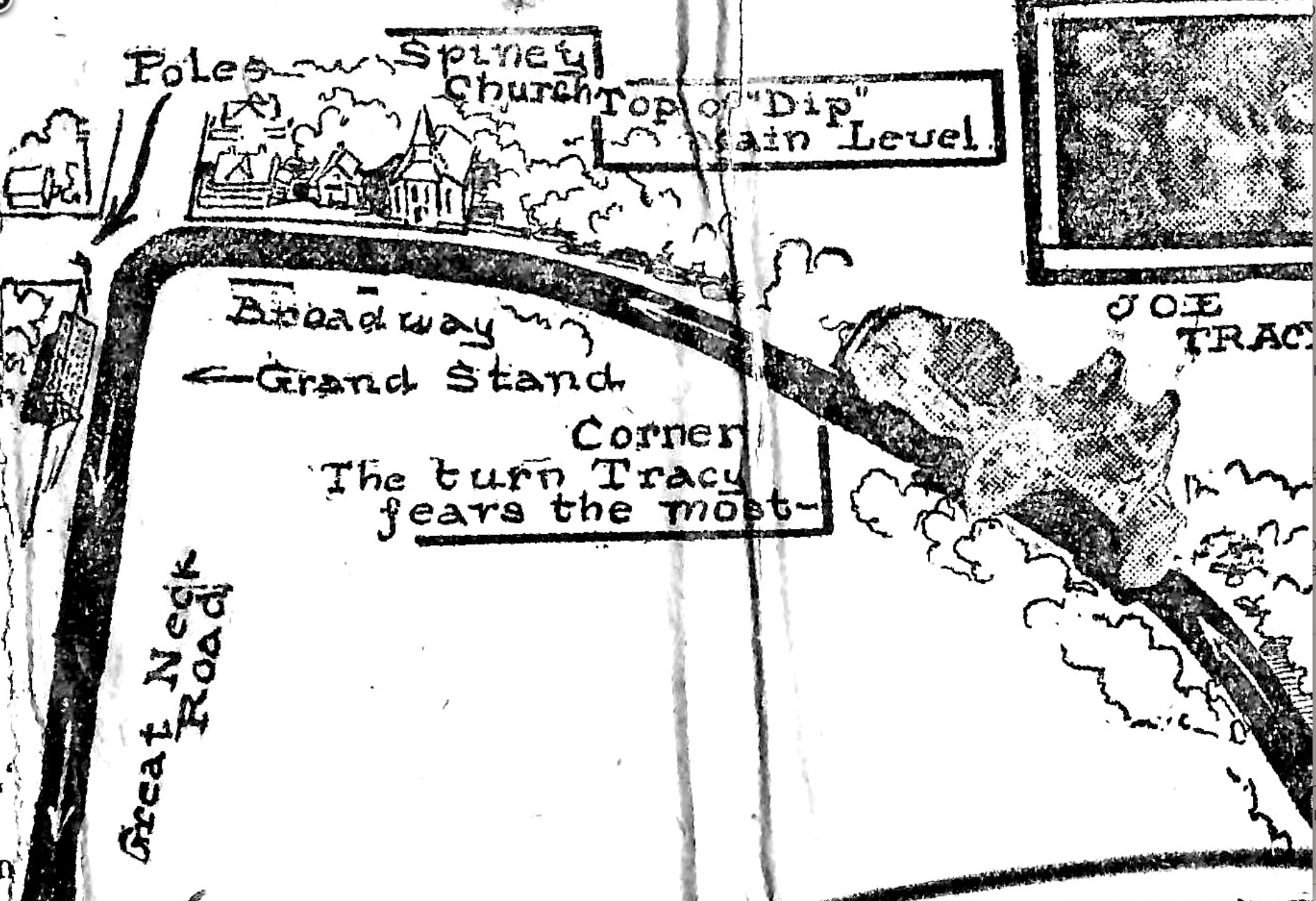
In Art’s recent ‘Dip of Death’ post, a clue as to the grandstand’s location was found in the cartoonish, hand-drawn map of Joe Tracy’s most feared turn.
On the map, the Spinney Hill church is represented just before a turn on to Great Neck Road with the grandstands depicted on the far end of the turn. At the time, Lakeville Road was not named as such and often known as 'Great neck Rd', or simply, 'the road to Great Neck'. So were the grandstands located at the Lakeville and Northern Boulevard turn?
Spinney Hill Church
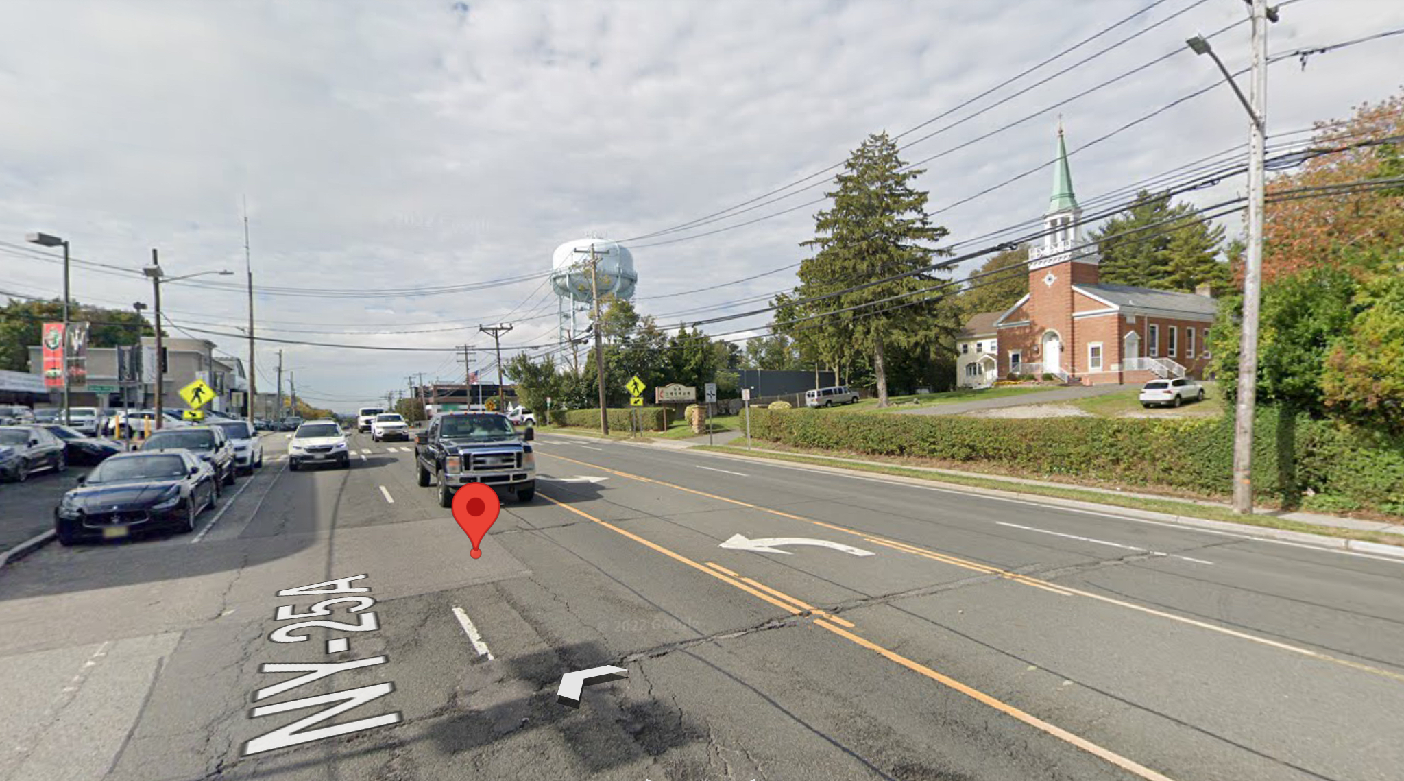
There is indeed a church on Northern Boulevard's north side just before Lakeville Rd's left-hand trun.
Today, the Korean United Methodists Church of NY maintains the church to its original appearance, an appearance that matches the hand-drawn map's depiction of the church.
Grandstand Crowd
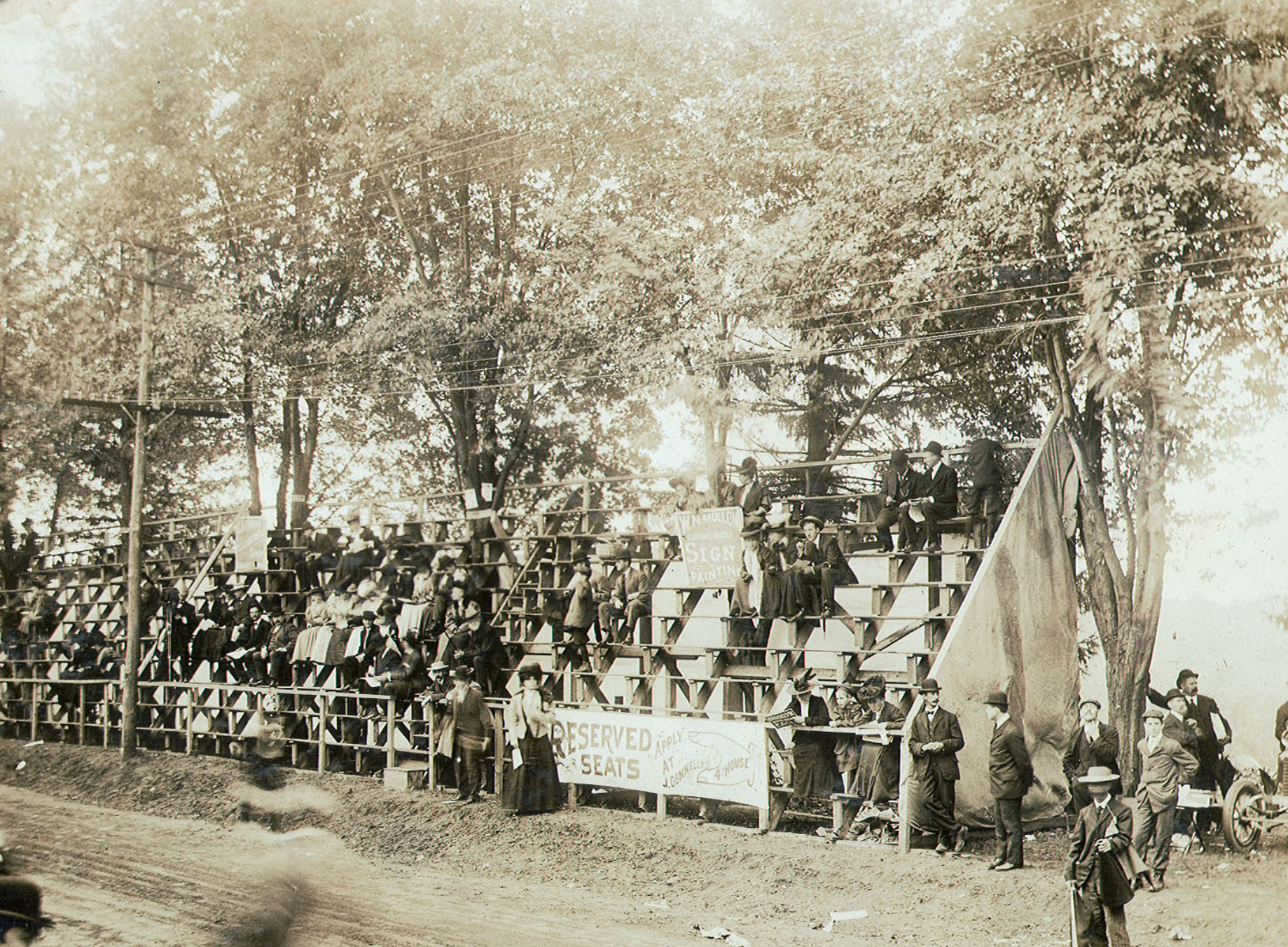
The smaller than usual crowd at the grandstand is most likely attributed to the fact that these seats needed to be purchased rather than the countless free vantage points in the area, namely the crowded turn down the road in front of Schneider's Hotel.
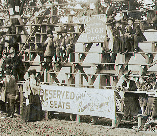
The closeup reveals the sign on the front of the grandstand that reads; 'Reserved seats Apply at J. Dennelly's' with a hand pointing down the road saying '4th house'.
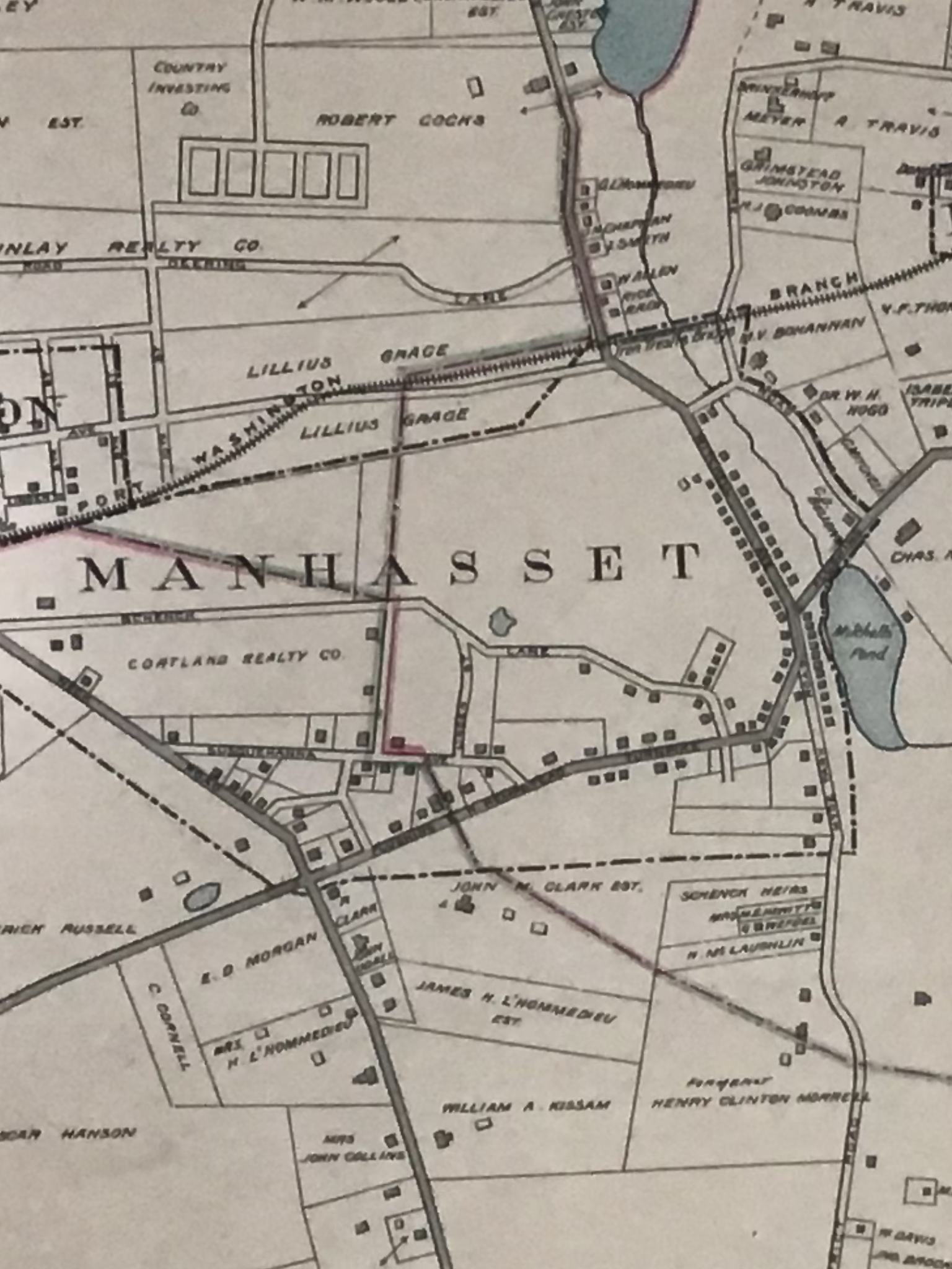
1906 Belcher-Hyde Atlas
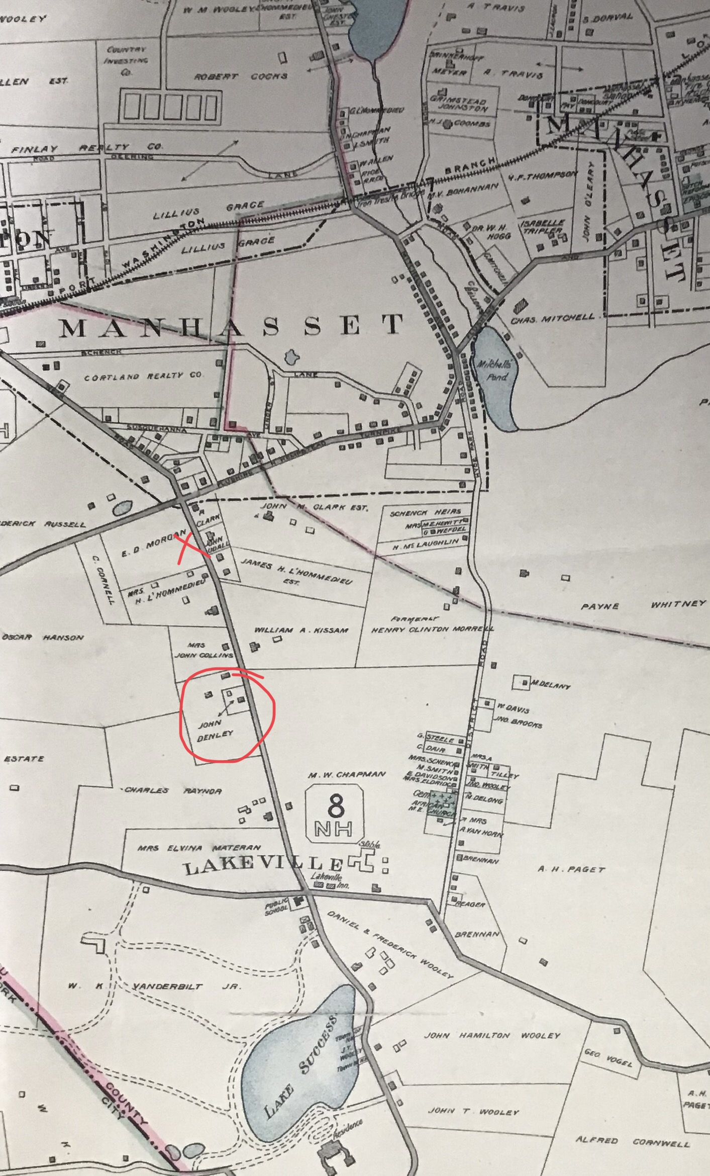
Looking at the 1906 atlas shows if we placed an 'X' representing the hand-drawn map's location of the grandstand on E.D. Morgan's property, counted 4 structures south, we arrive at the property labeled 'John Denley'. No doubt a misspelling of 'Dennelly'.
John Dennelly’s Maple Lodge
John Dennelly's The Maple Lodge was not only the home to purchase your grandstand seats, but he also profited by being the headquarters for Joe Tracy's Locomobile team.
With these new clues, it's reasonable to conclude that the grandstands were indeed at the corner of Lakeville Road and Northern Boulevard.
Other Grandstand Photos

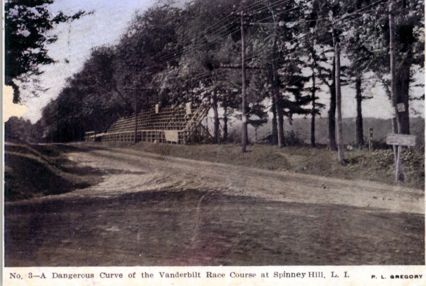
Just completed, the grandstands await the crowds
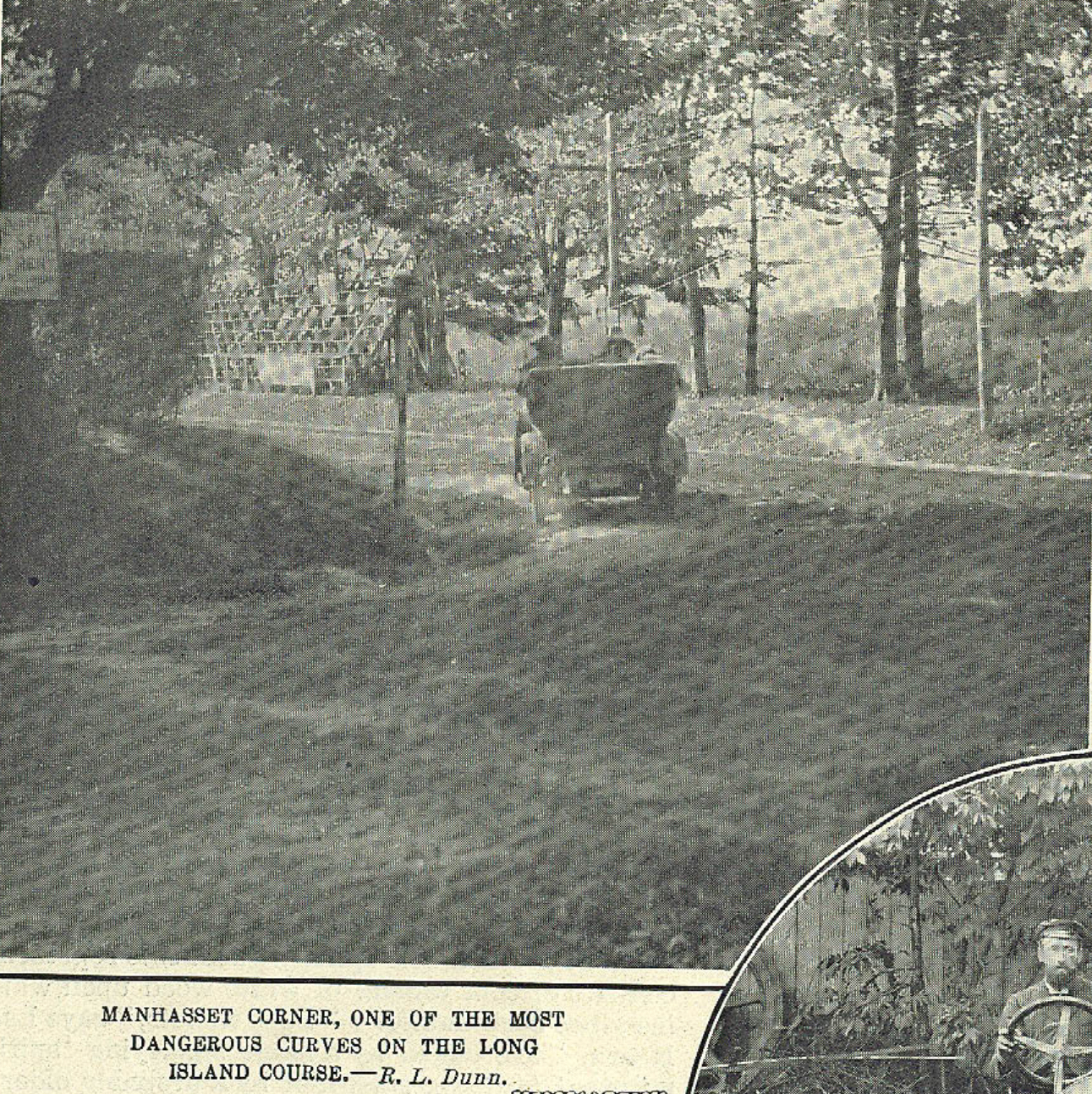
A touring car making the left from Northern Boulevard on to Lakeville Road just like the race cars will do during the races. Note: The grandstand in the background.


Comments
Great Job. Loved this post.
Telephone station Manhasset Hill 1906
Fantastic job, Greg!
Thanks Art! Wouldn’t have figured it out without you!
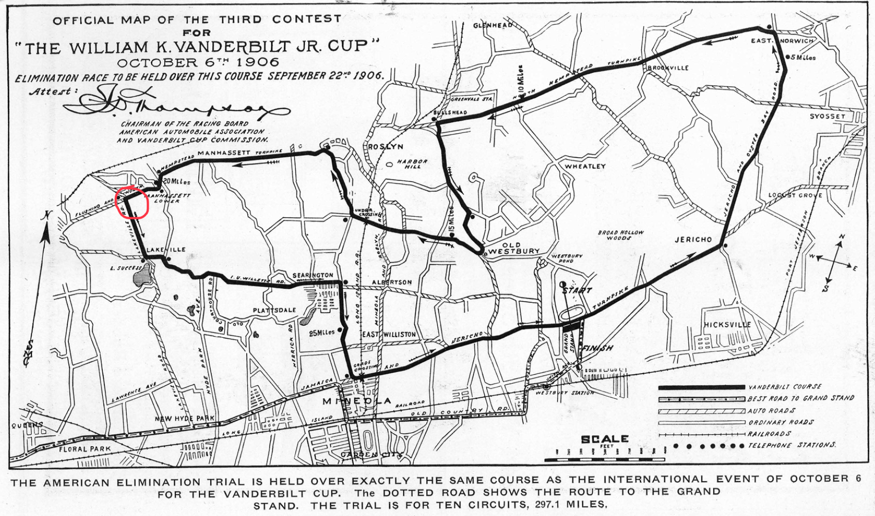
Great find Greg, everything seems to match! I’m puzzled though how 25A appears to dead-end at a T intersection in both photos below. As we all know 25A was an original contiguous roadway in early Long Island. I wish the photographer had pointed just slightly more north to expose the continuous roadway. Nice work!
Frank-
I can completely understand what you see, but try to envision the darker part of the dirt road in the immediate foreground as 25A going left to right.
Agreed Greg. This intersection in 1906 through present-day remains at 90 degrees. I suspect the ‘dangerous curve’ was due to turning left onto a narrower roadway from a wider, higher speed 25A.
Frank-
If you notice on the hand drawn map, they make mention of the telephone/power poles which was a lot of the danger on the outside of a turn.
Good research once again. Interesting to know where these landmarks were.