Kleiner’s Kolumn: Documentation of the First 15 Long Island Motor Parkway Bridges in Nassau County

The Long Island Motor Parkway Bridge series continues with the first 15 bridges in Nassau County (#s 13-27) going from west to east.
Art Kleiner
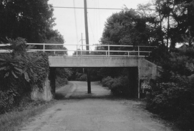
#16 New Hyde Park Road Motor Parkway Bridge in Manhasset Hills/North Hills
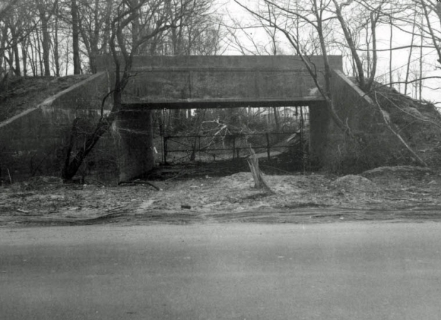
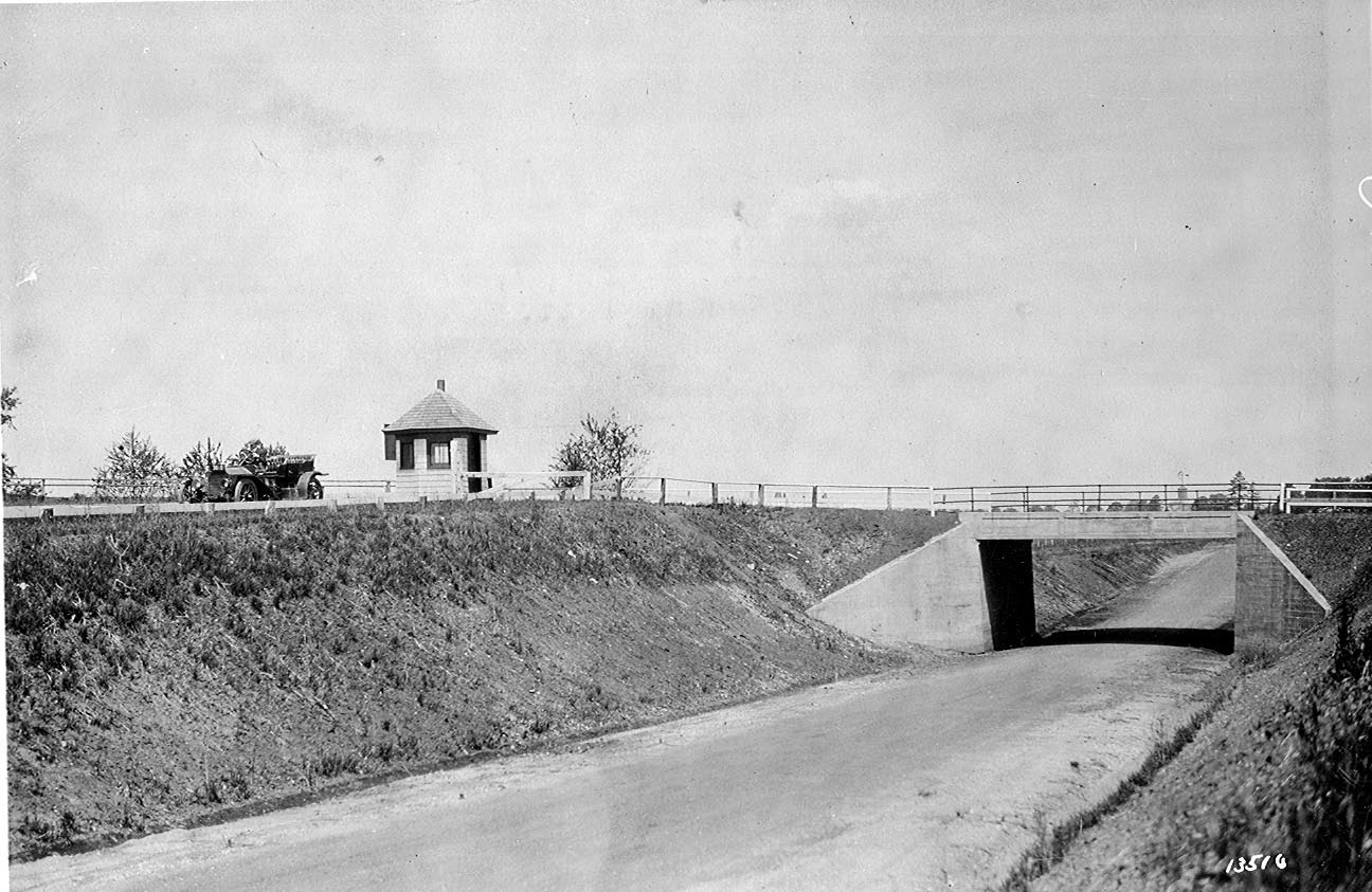
#20 Old Searingtown Road Motor Parkway Bridge in Searingtown


Comments
Thank you for this series on the LIMP bridges. Please note that the caption for bridge #16 should indicate the location as Manhasset Hills/North Hills rather than as Searingtown.
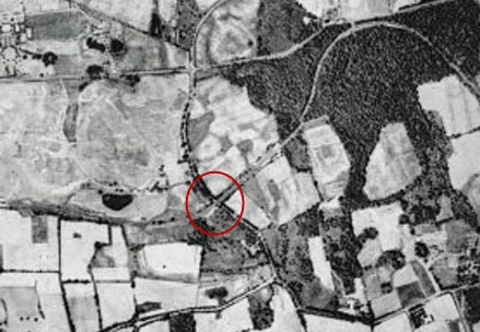
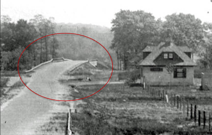
Whooie; what a trip down memory lane! Even found I’d missed myself (#17). Now, as to #19, I.U. Willets Road Motor Parkway Bridge in Searingtown, I thought I knew that area pretty well but go to the triangle between Old Searingtown Road and “new” Searingtown Road, opposite the VFW and library, and look NW at Old Homestead Road. I don’t remember any such (it may well not have been there back then) but it sure looks to be the LIMP RoW (see attached). Anyone know more about this location? Sam, III
Well that was a fun 2 hours reminiscing past archives of the bridges. Great work, as it always is.
Amazing work lately Art.
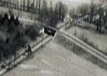
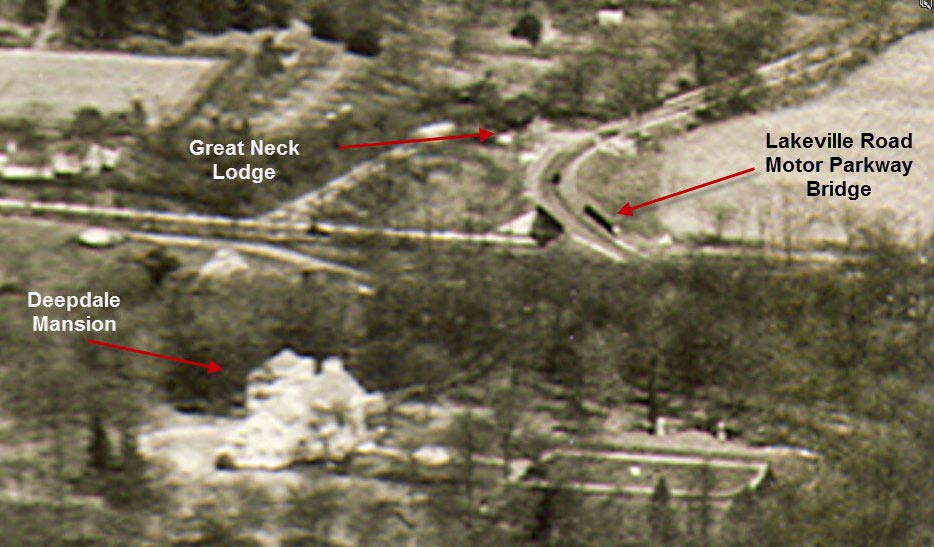
The thing that really sparked my interest here is #14, the Lakeville Road bridge. Great pic BTW with Deepdale mansion still standing with extended garden, the LIMP really went right by his house!
But what caught my attn was the tremendous ANGLE the LIMP takes over Lakeville Rd. The bridge really crosses over the road at a 45 degree angle and I was not aware of that at all. I thought the major curve was before/west of the bridge.
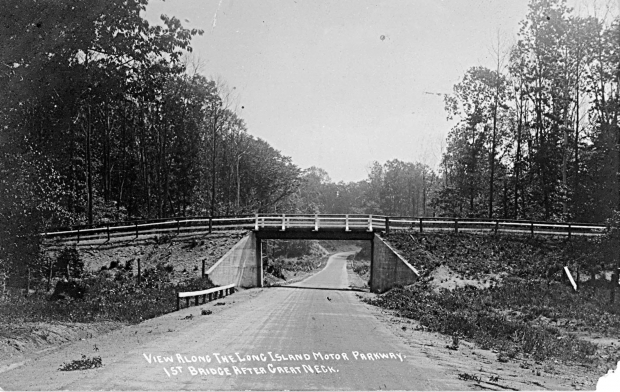
Clearly shown in the photo, the LIMP doesn’t “straighten out” until it reaches the Great Neck Lodge. But see these two pics I’ve attached, and this is original LIMP so you can’t argue with this. And that bridge pic is an actual LIMP pic so you can’t argue with that either! Maybe after the bridge came down Lakeville Road was widened a little for sure but it’s still strange! You can see from the second pic there is a long straightaway leading up to the Great Neck Lodge on the left which you can see in the pic. Then it turns after the lodge. It just contradicts the old photo. Very weird.
Dave. My guess is that the original section of LIMP pavement starting from the Great Neck Lodge leading to the Lakeville Road bridge was removed when they tore down the bridge. At that time,they lowered the grade to meet the grade of Lakeville Road and straightened it as well. The Great Neck school district wanted the entrance to the fields to be easy to traverse. The pavement in your pictures is an impostor and a good one at that.
Sam III - There are a few blogs here on the site that explains how Old Homestead Lane came to be. If you search - Old Homestead - it’ll lead you to the blog. This area was developed in the mid 1990’s, and I never thought to explore this location prior. The images here show what a hidden treasure it was.
Matt, thanks for feedback, and can anyone confirm what Matt is suggesting? I always thought this stretch from Lakeville Rd east past the fields was original LIMP. Am I wrong?? The school rebuilt a road that close to the original LIMP with concrete extensions on each side? Really??
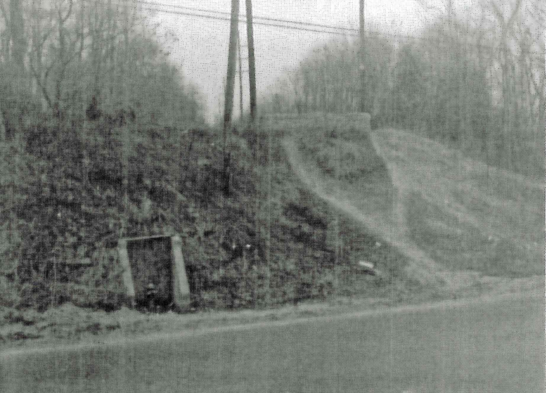
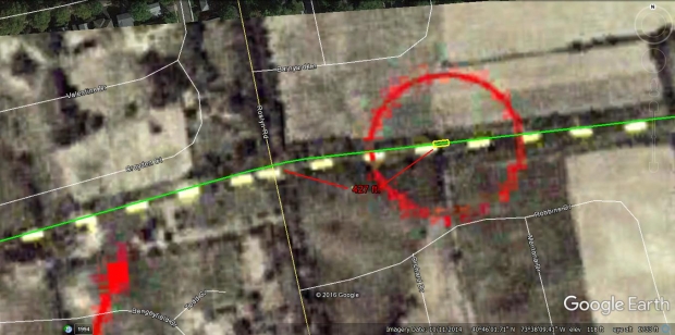
Brian - re #19 and Old Homestead road, I amended that after reading #20 but it never made it to the blog. As to Dave’s puzzlement re the 3’ extensions on the Lakeville-to-NSP stretch above, add me to the list of the puzzled. Could it be that this was the entry ramp, *NOT* the RoW? Consider how far south it is from the old lodge-cum-kitchen. Someone get out the old plats/maps and the GPS, please. Sam, III
I just walked the LIMP at great neck South campus. I believe that my theory that the grade was lowered is correct. It is clear that starting approximately 75 feet east of the lodge that the concrete extensions west bound are different than what continues east of that point. The concrete is of a different age. As well different materials were used in the aggregate. The newer concrete has crushed bluestone mixed in the aggregate which I doubt was available when the original extensions were added on the LIMP. There is currently a 6 to 7 foot elevation difference between the road and the foundation of the lodge/current house. It’s more likely that the elevation of the original LIMP was close to even with the lodge. The original LIMP most likely continued to rise as it curved south towards the Lakeville Road bridge.
Correction - Old concrete is in front of new concrete in picture.
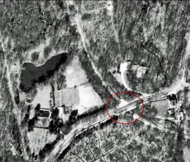
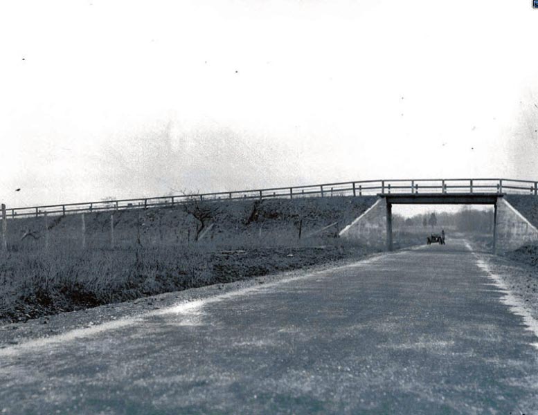
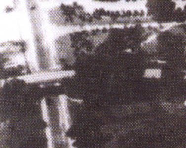
Frank F and I also have witnessed the newer/less curved roadway leading to Lakeville Rd. Like Mark observed, the original concrete road extensions are pebbled. The 1910 image below shows the steady uprise of the pkwy to the then western end, Great Neck. The 1960 image shows the modified roadway. Great Neck High South est. in 1958, the school must have wanted the road to look uniform, not like a bandaid.