Long Island Motor Parkway Bridge Series:#20 Old Searingtown Road Motor Parkway Bridge in Searingtown
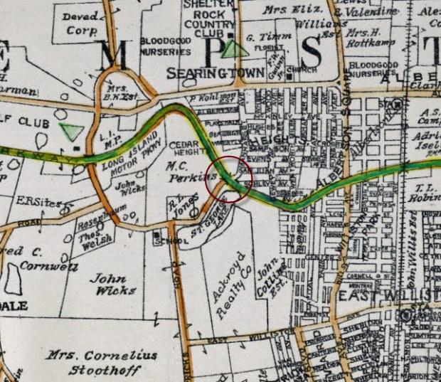
One of the important pioneering features of the Long Island Motor Parkway was the first construction of bridges associated with an automobile road to eliminate grade crossings. A total of at least 65 bridges were built for the Motor Parkway from 1908 to 1926 over crossroads (designated a parkway bridge), under crossroads (designated a highway bridge), and, as part of right-of-way agreements, to connect farmlands (designated a farmway bridge).
Continuing the west to east documentation, the 20th bridge in this series focuses on the Old Searingtown Road Motor Parkway Bridge in Searingtown.
Although well-documented in surveys and maps, there are unfortunately no known ground photos of the bridge.
Enjoy,
Howard Kroplick
1906 Belcher-Hyde Map
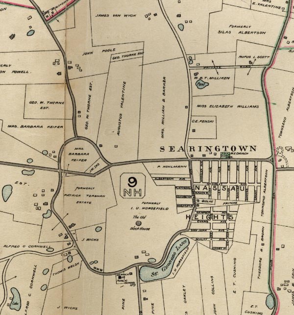
Around 1900, this area was part of the I.U. Horsefield property which was sold to a real estate developer Cedar Heights Associates.
1909 Surveys
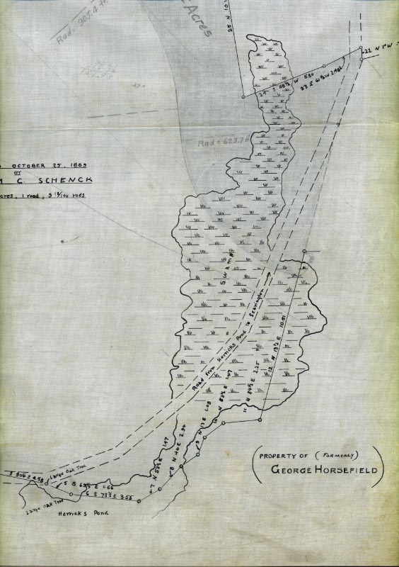
This survey showed the proposed route of the Motor Parkway at the "Road from Herricks to Searingtown". The path was place over an 1863 survey of the William Schenck property. Note the extensive "swamp" area.
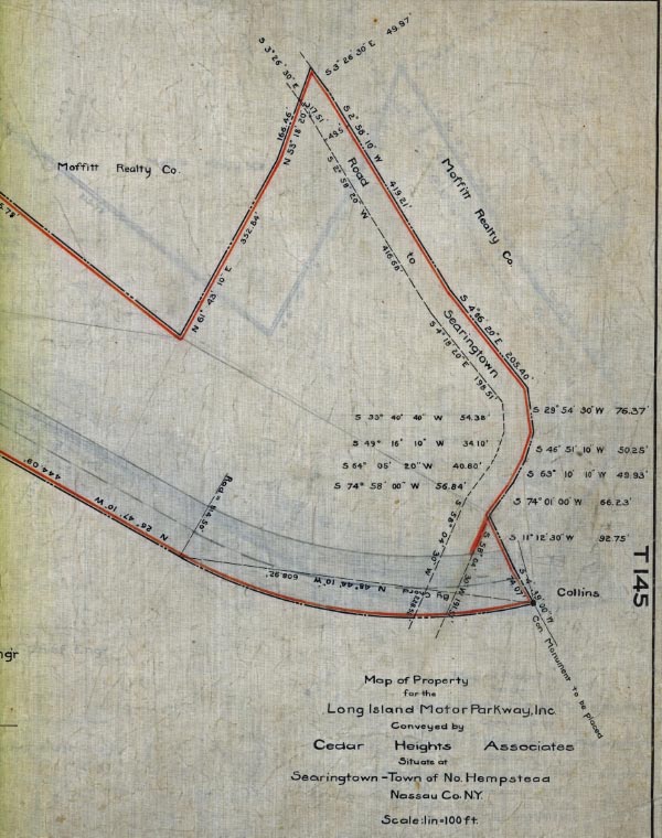
The Long Island Motor Parkway Inc. purchased 23.8 acres from Cedar Heights Associates in this area. Only 1.2 acres was used for the road.
1914 Belcher-Hyde Map
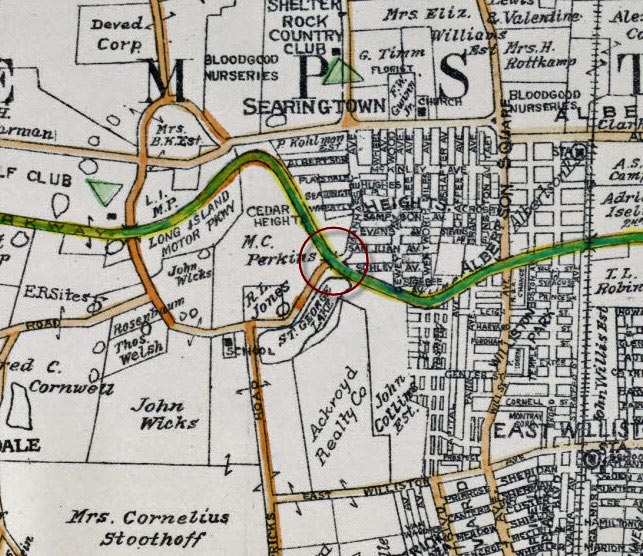
The bridge over "Manhasset Avenue" was marked in early Long Island maps.
1926 Aerial
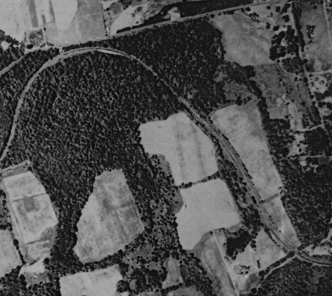
The upside-down "U" shape of the Motor Parkway in Searingtown.
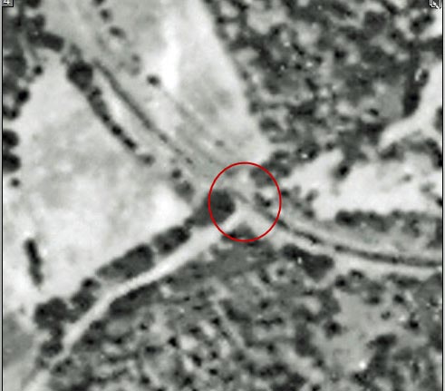
This blurry aerial close-up is the current best view of the bridge. Does anyone have a better photo?
1928 Motor Parkway Atlas
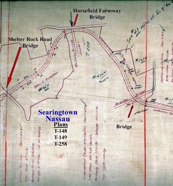
The "parkway bridge" was designated at Station 613.
1937 Survey
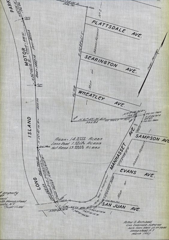
This survey was likely prepared with the anticipated closing of the Motor Parkway. A total of 15 acres were surveyed.
1950 Aerial
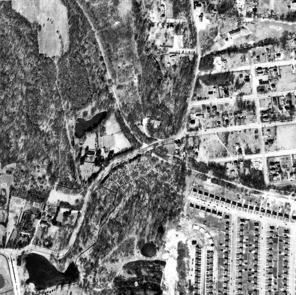
Twelve years after the last car drove on it in 1938, the Motor Parkway was still clearly visible.
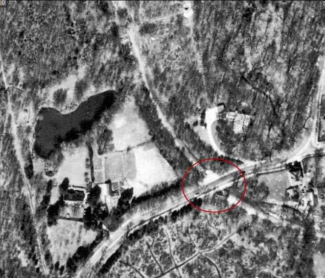
The remnants of the bridge can be seen within the red circle.
1970s Map
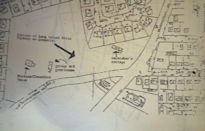
This map showed how the bridge went over Old Searingtown Road and its relation to the extension of Searingtown Road. The property in the 1970s and 1980s was owned by Dr. Arthur Sackler, a research psychiatrist and entrepreneur who became one of the country's leading art collectors and patrons.
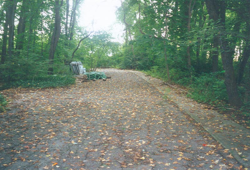
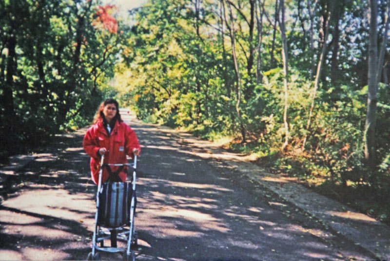
1990s Photos
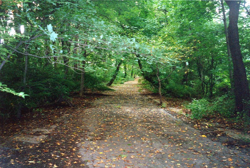
Although ground photos of the bridge have been elusive, these rare images show the Motor Parkway just west of our target. Photos courtesy of the Magid Family.
2012 Photos
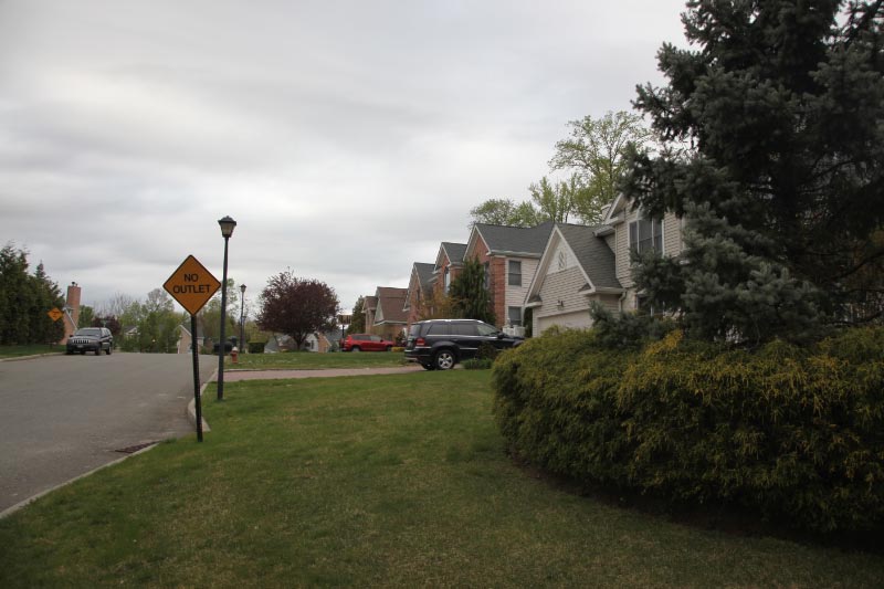
In the 1990s, a row of new houses on Old Homestead Road were built directly on the path of the Motor Parkway.
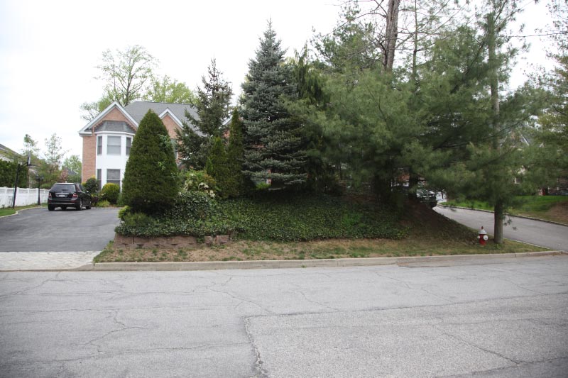
The remains of the west embankment of the "Old Searingtown Road" Motor Parkway Bridge?
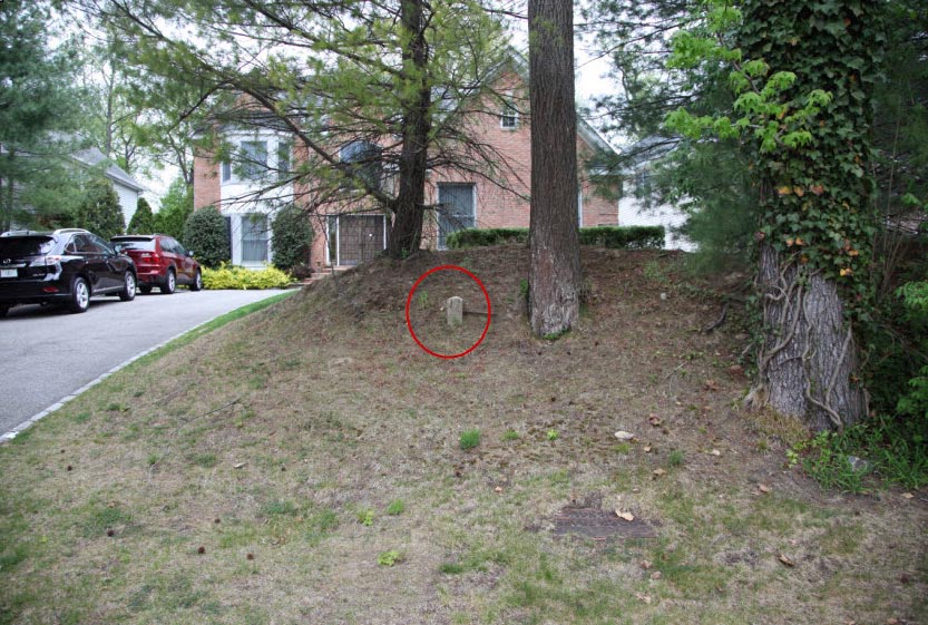
North of the bridge location, a lonely Motor Parkway concrete post still remains.
2012 Bing Map
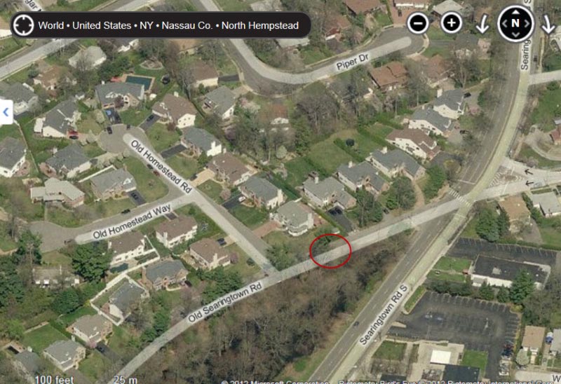
A Bing "bird's eye" view of the bridge location.


Comments
I see now that the Horsefield bridge was basically for farmway access to IU Willets Rd. Looks like there was quite a bit of woods before getting to the farmland.
1950 was 12 years after 1938.
________________________________
From Howard Kroplick
John, good catch! Thanks.