Updated 12/7/2022: Then & Now: The Very Elusive Clody Farmway Bridge in the Melville Sand Pits
The sole remaining standing Motor Parkway bridge in Suffolk County is the elusive Clody Farmway Bridge in Melville.
This farmway bridge was built in 1910 connecting the northern and southern sections of the Clody farm. The bridge is located on private property (the Meville sandpits) and inaccessible to the public. Moreover, the current owners even deny its existence.
Update 12/7/2022: An anonymous contributor has forwarded three recent images of the Clody Farmway Bridge,
Update: 1/17/217: These "Then & Now" images document that this historic bridge is very much still standing including recent images from a father/son team of Motor Parkway explorers.
Enjoy,
Howard Kroplick
Update: December 7, 2022
1907 Survey
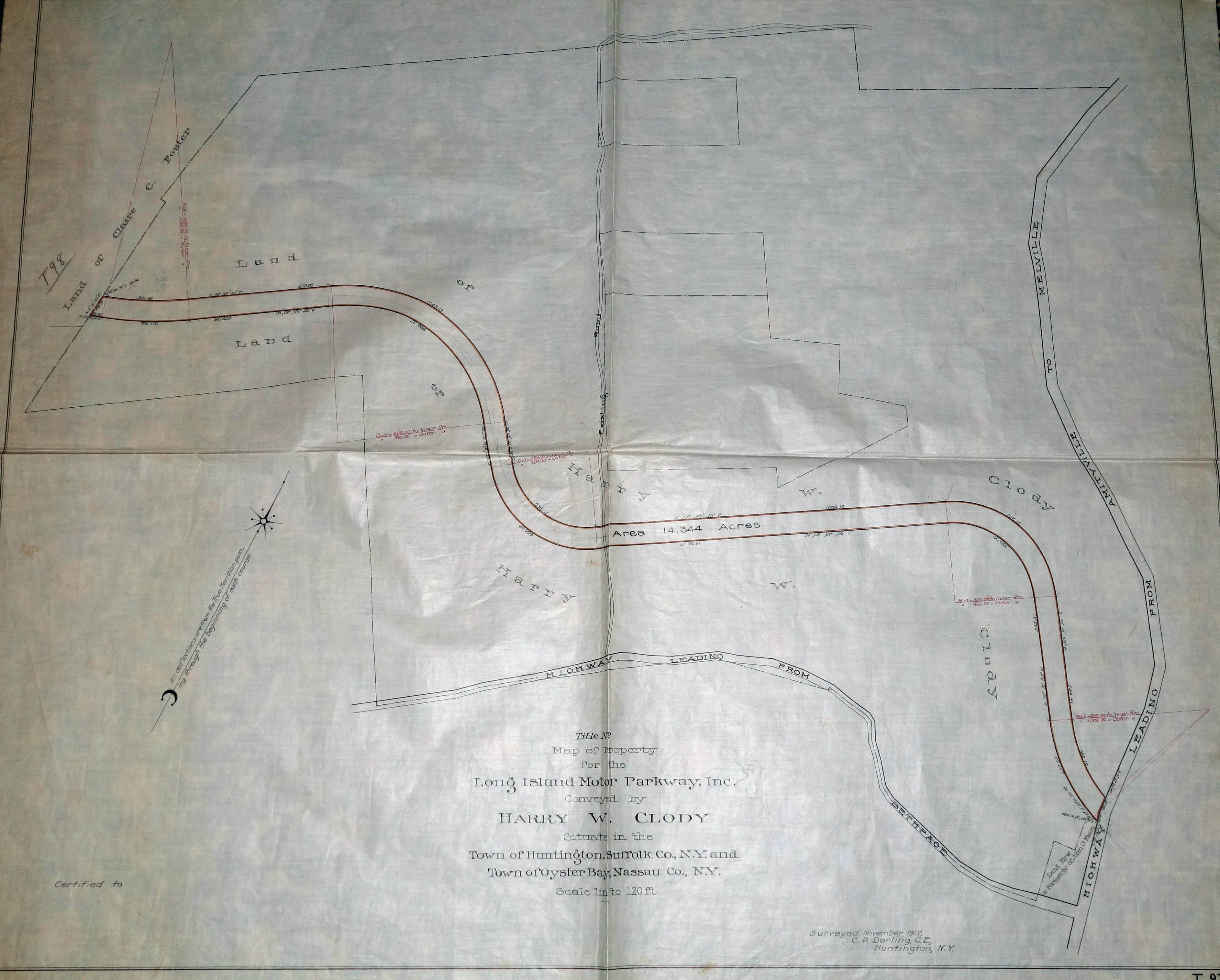
This survey of the Clody property was taken in November 1907 by C.P. Darling of Huntington
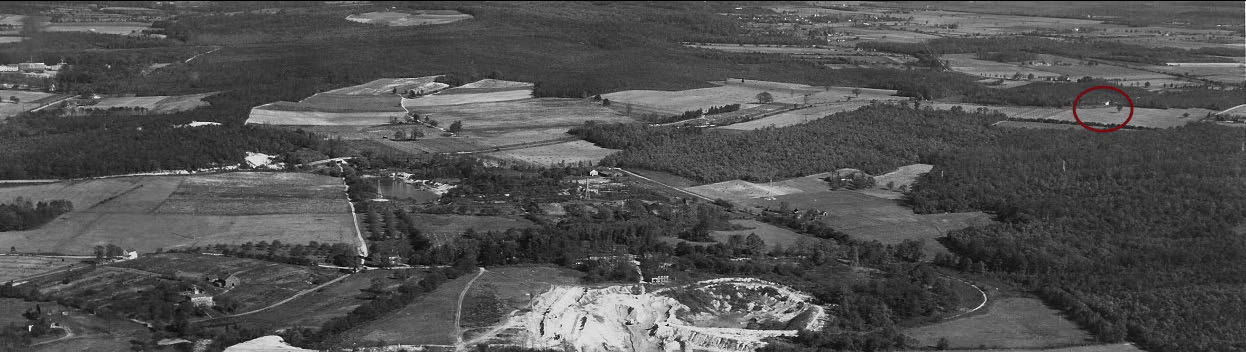
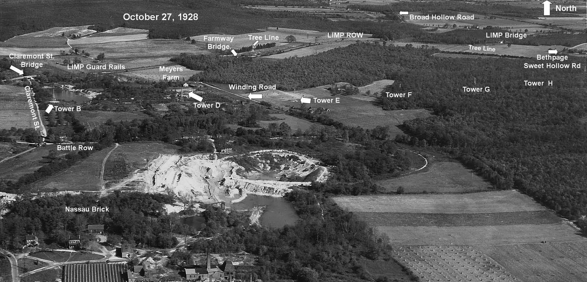
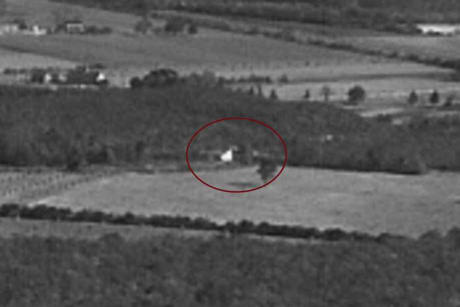
1928 Aerial
1930 Aerial
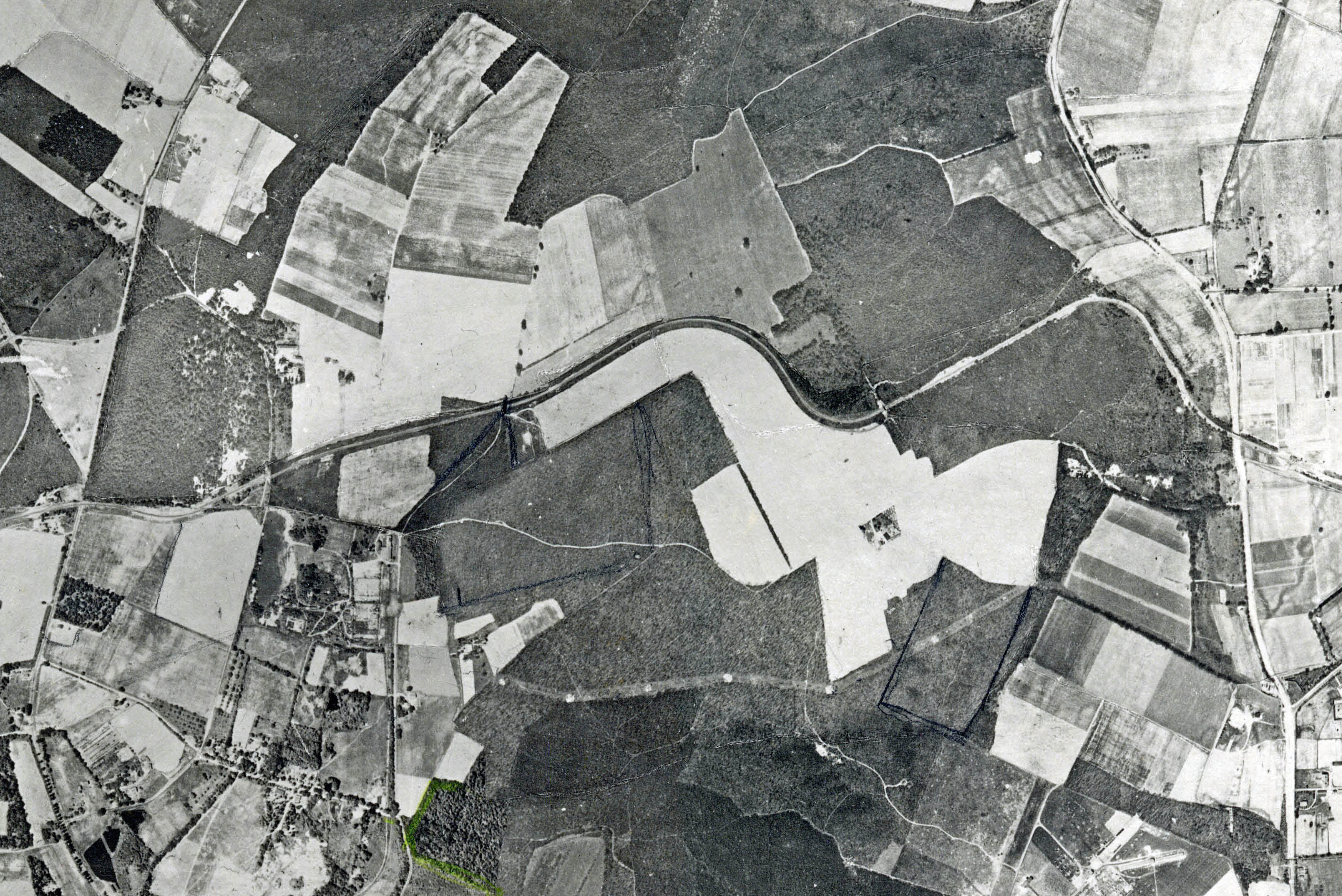
Melville Sand Pits
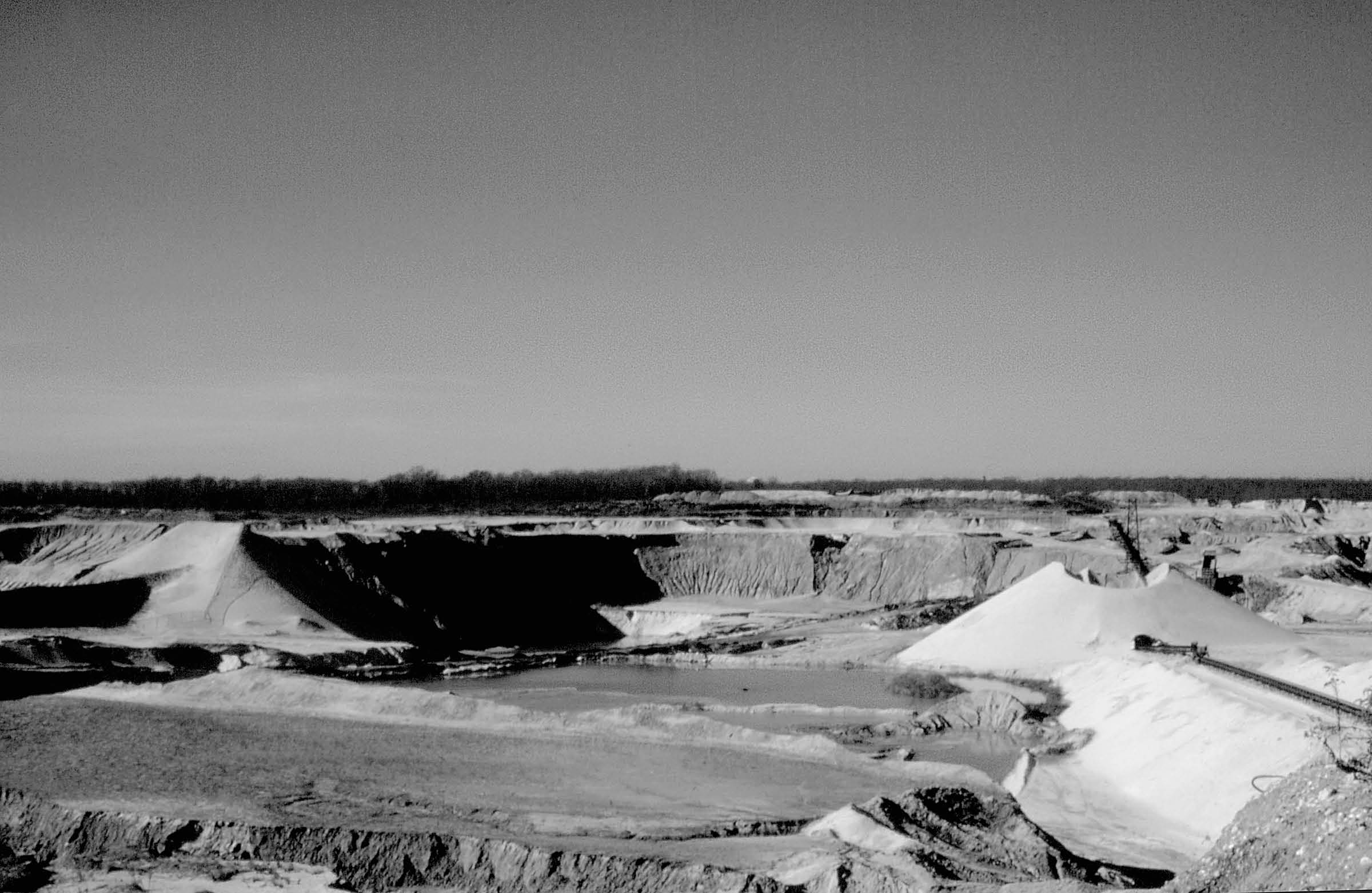
1972
Courtesy of Margaret & George Vitale from the slides of Ledter Cutting
1981
Courtesy of Ron Ridolph
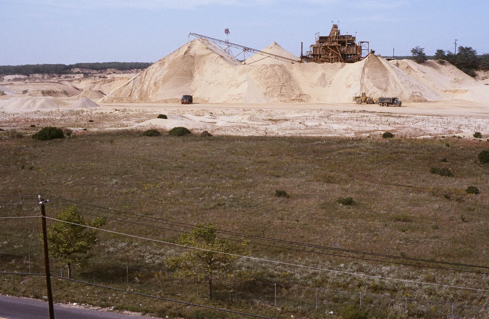
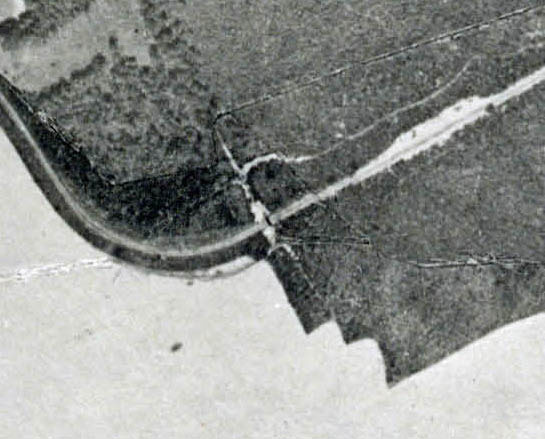
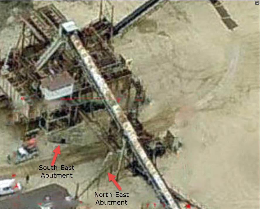
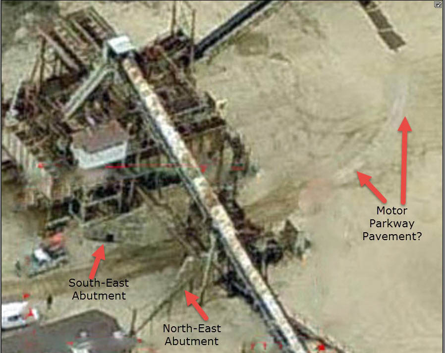
Image Key
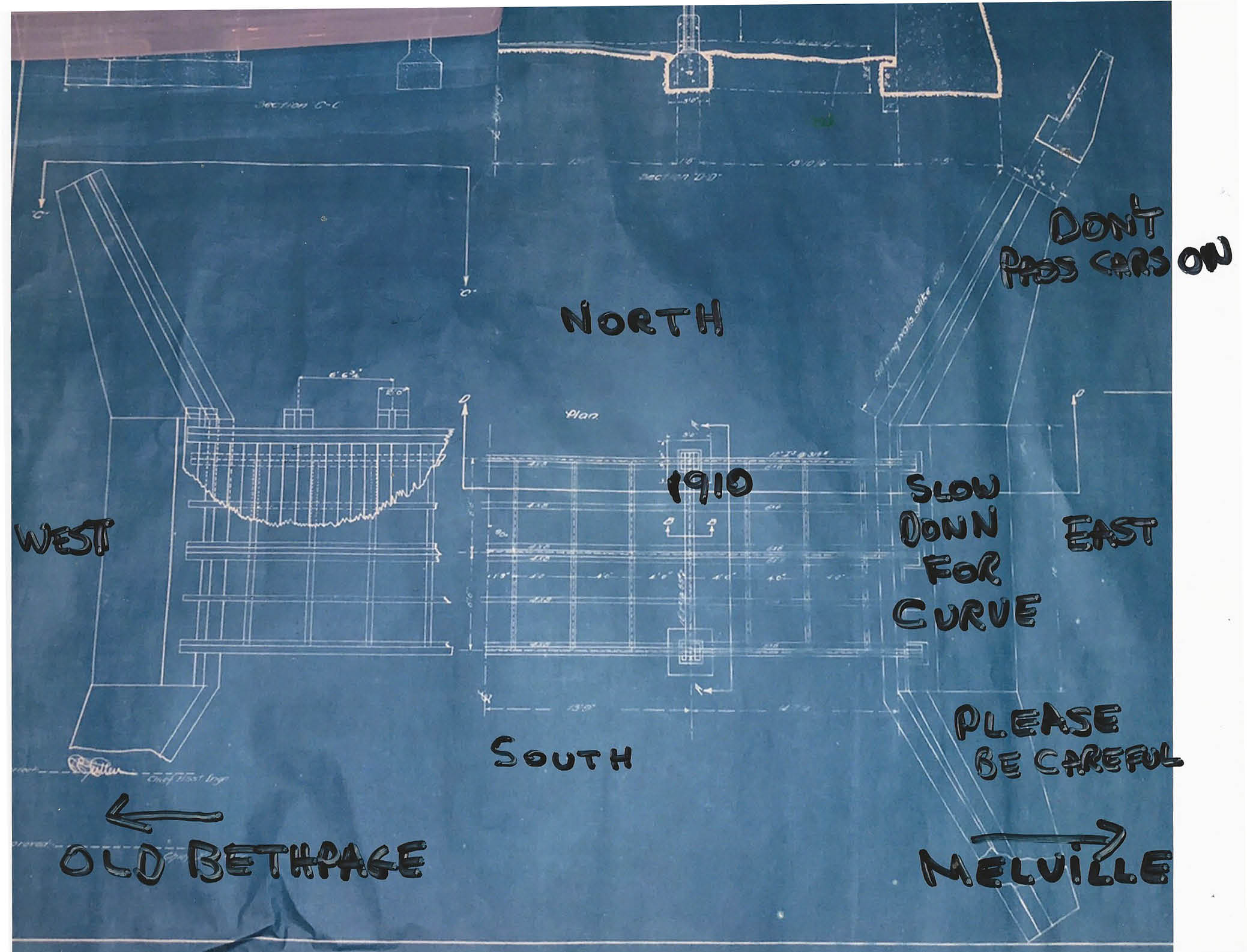
Farmway bridge diagram (Courtesy of the Malverne Survey Collection-Roy Knoernschild)
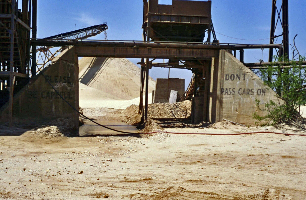
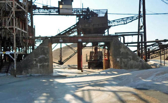
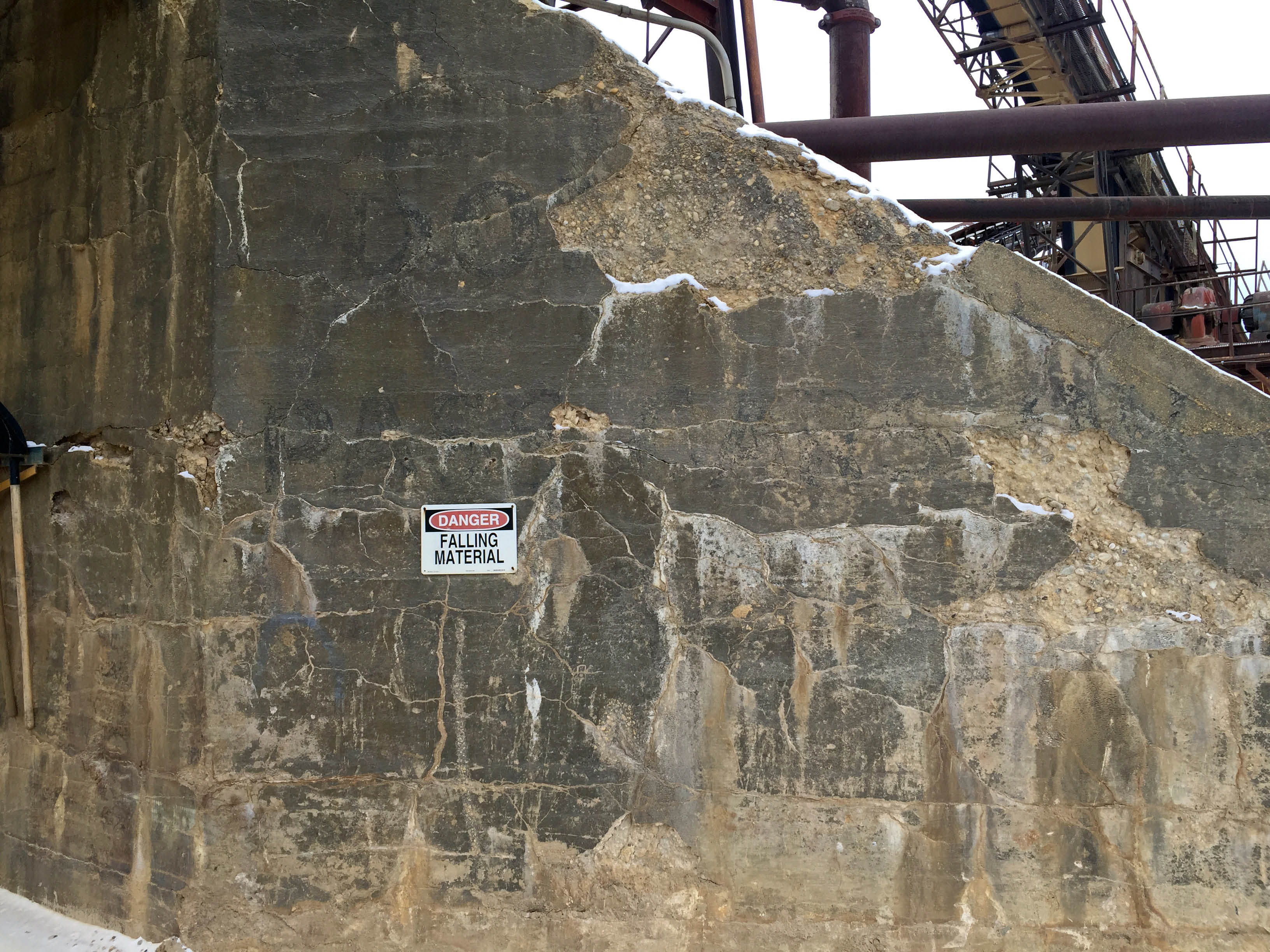
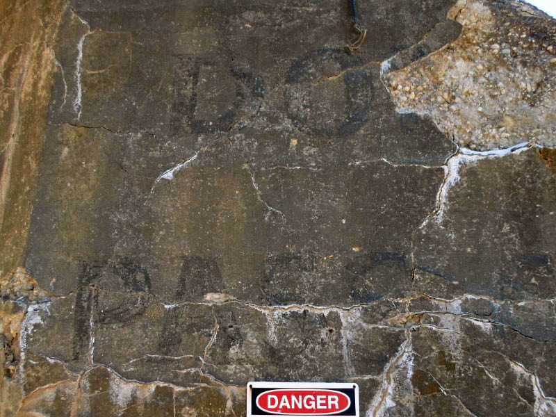
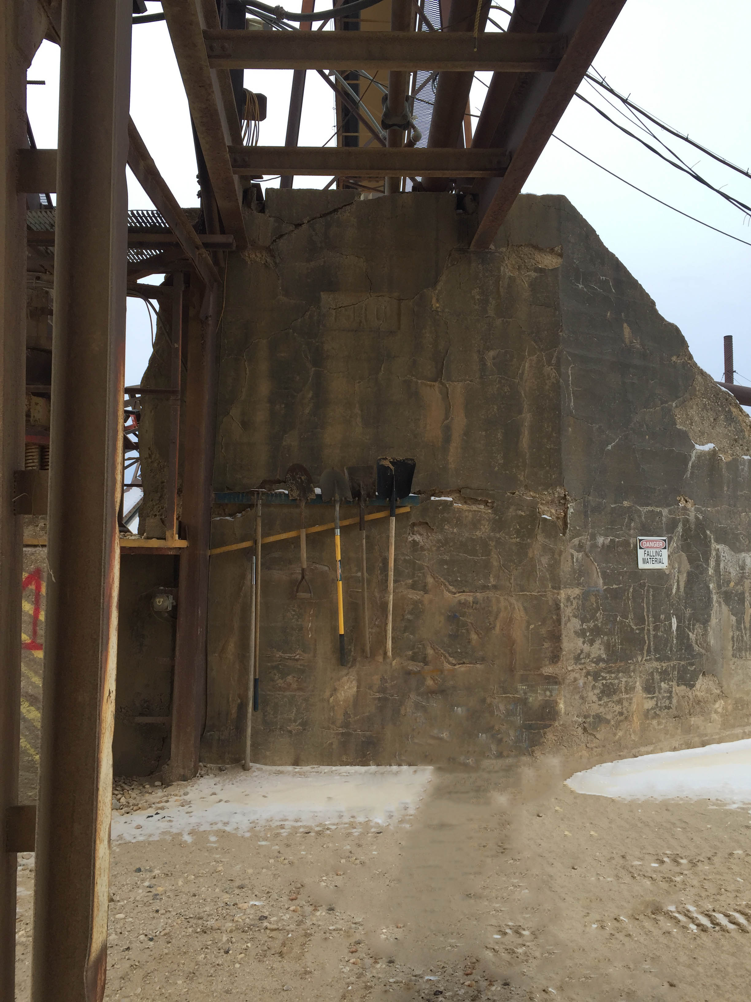
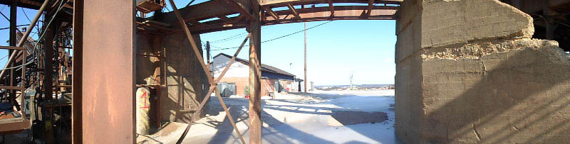
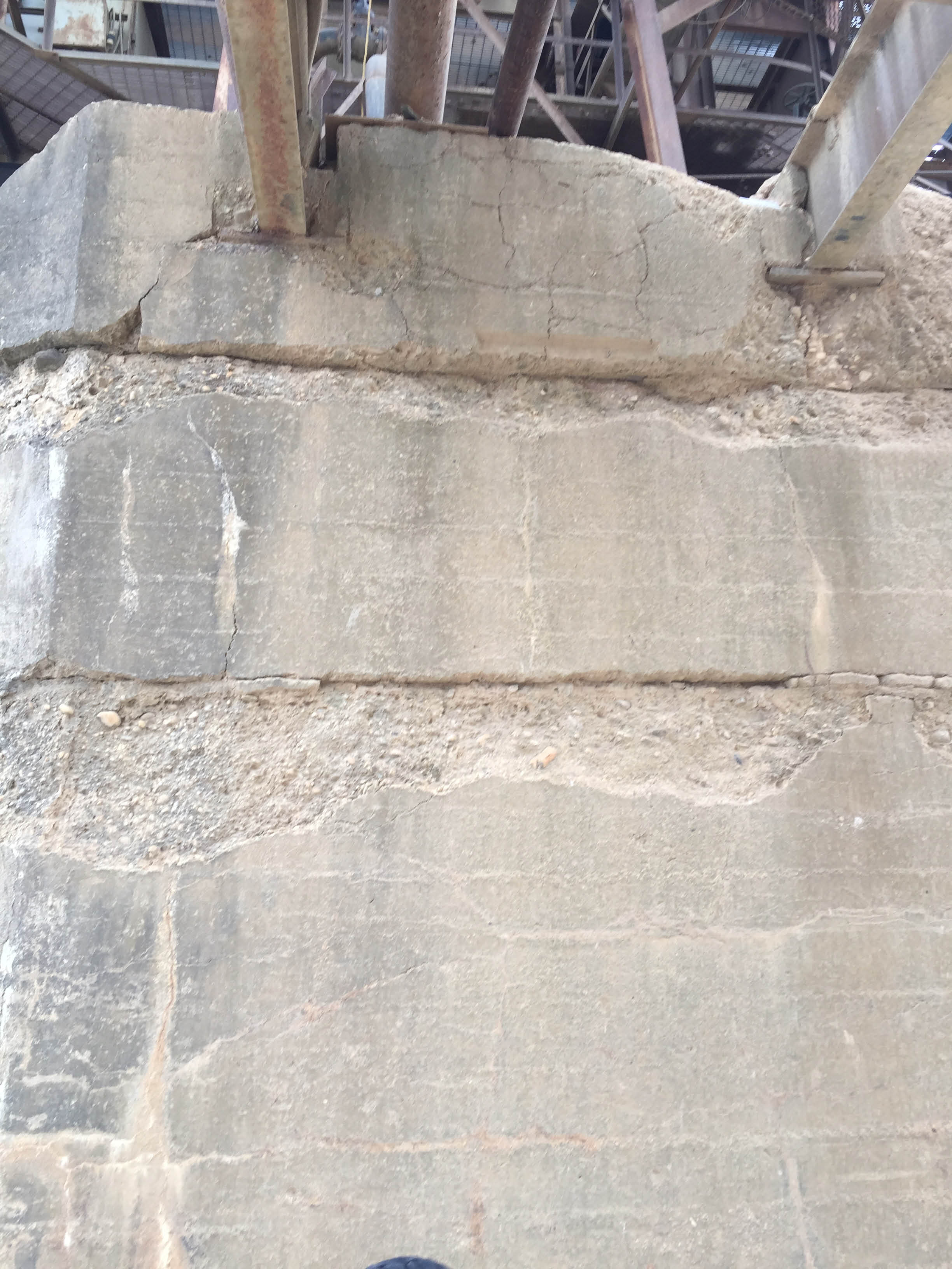
East Abutments-Looking west to Old Bethpage
Then: 1972
Copy on north-east abutment:
DONT
PASS CARS ON
BR(IDGES & CURVE)
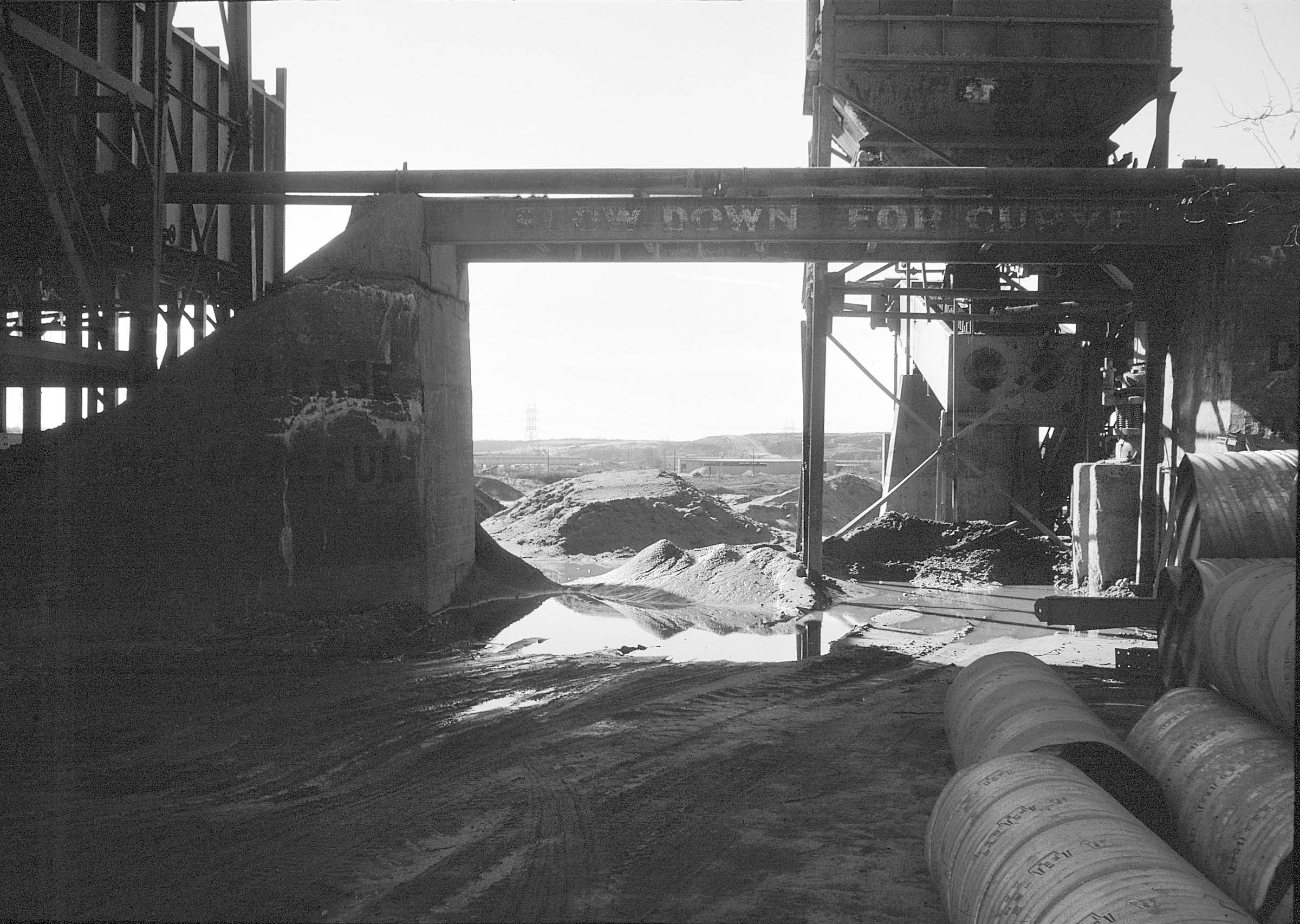
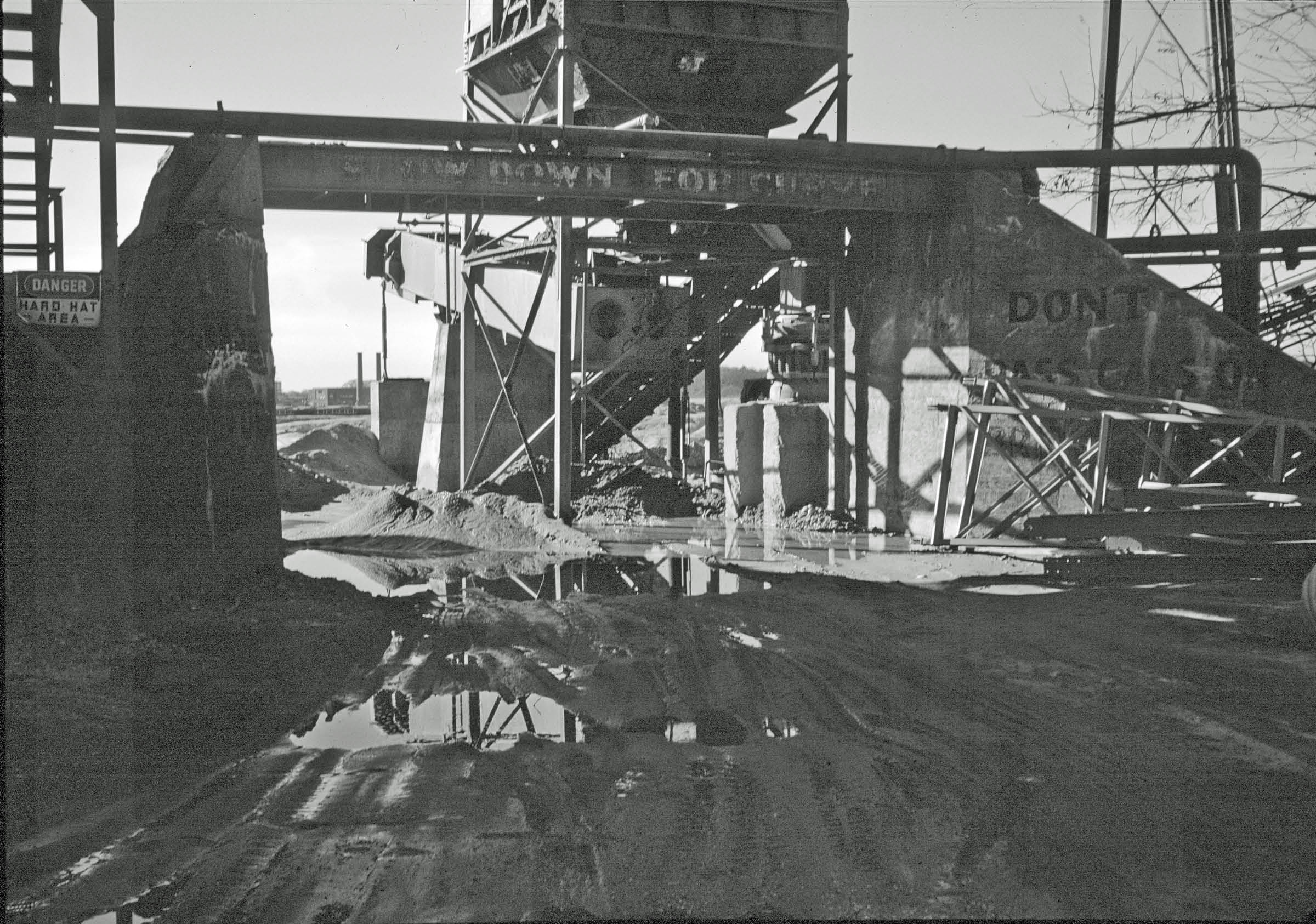
Copy on girder: SLOW DOWN OR CURVE
Copy on south-east abutment:
PLEASE
BE CAREFUL
Courtesy of Margaret & George Vitale from the slides of Lester Cutting
Then: 1981
Courtesy of Ron Ridolph
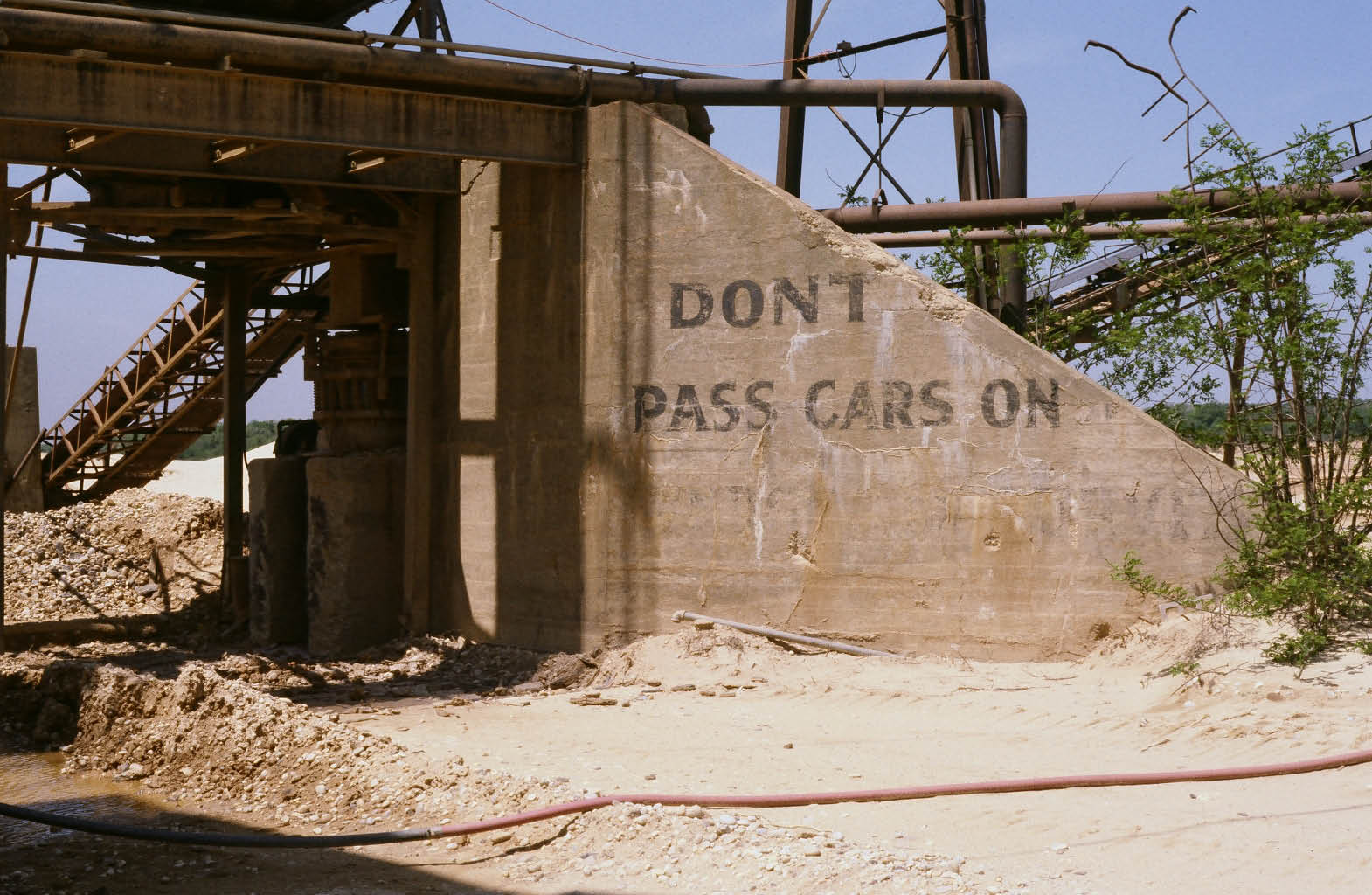
North-east abutment
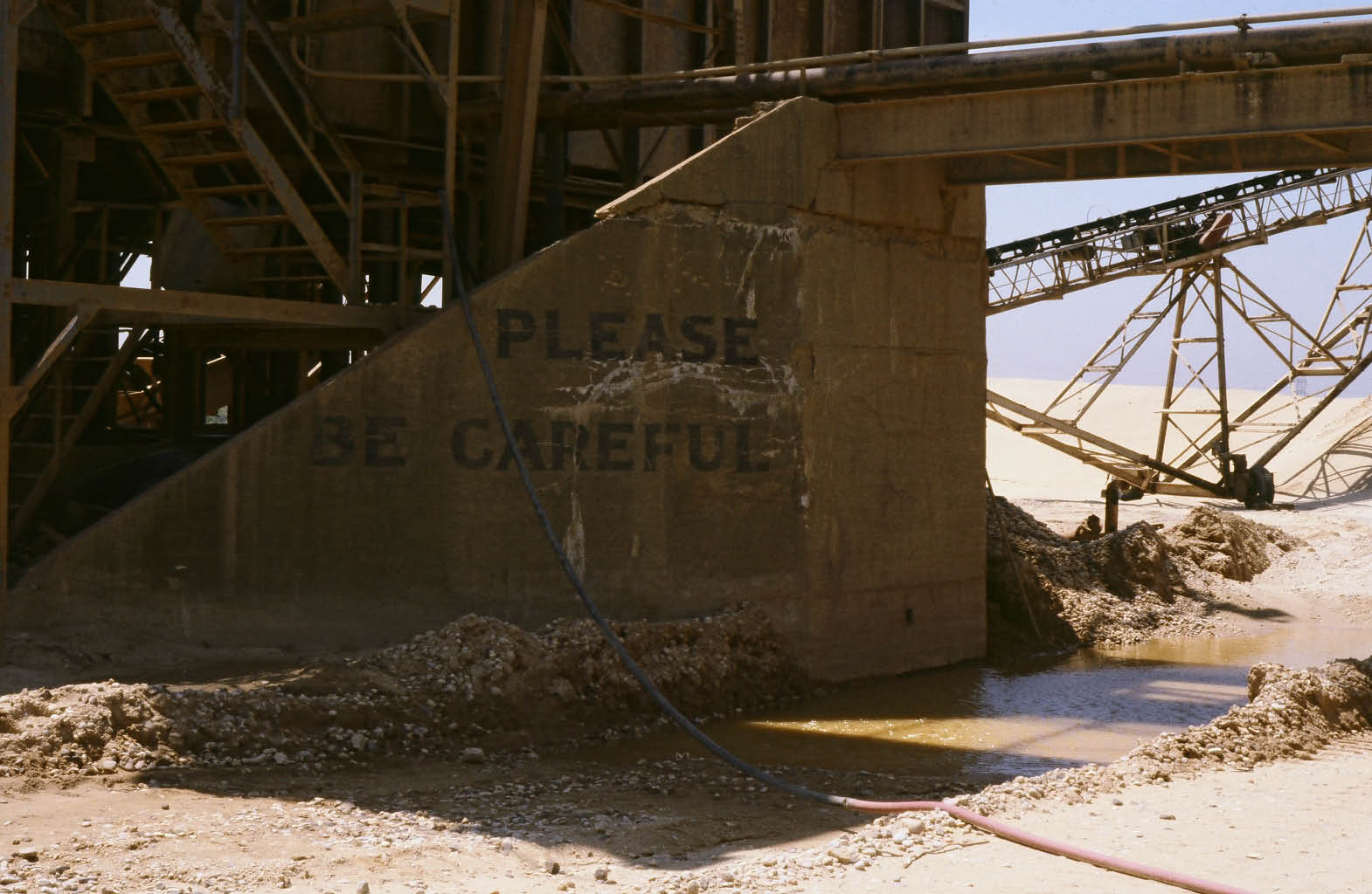
South-east abutment
Then: 2013
Courtesy of Joe Scotto
Then: 2014
Courtesy of Eric
Looking at south-east abutment
View looking south-west
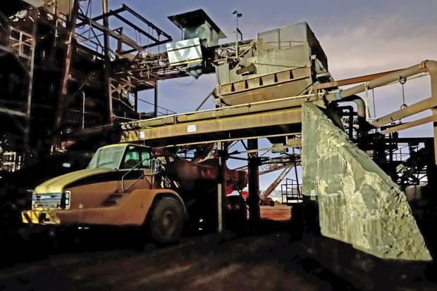
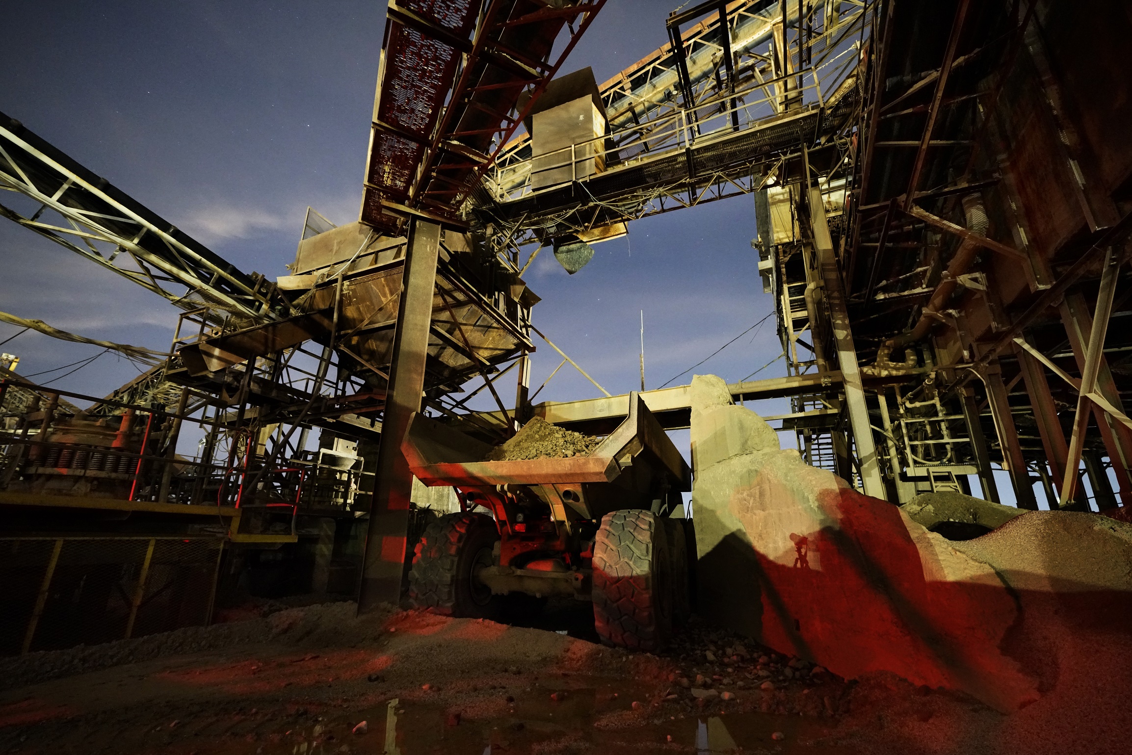
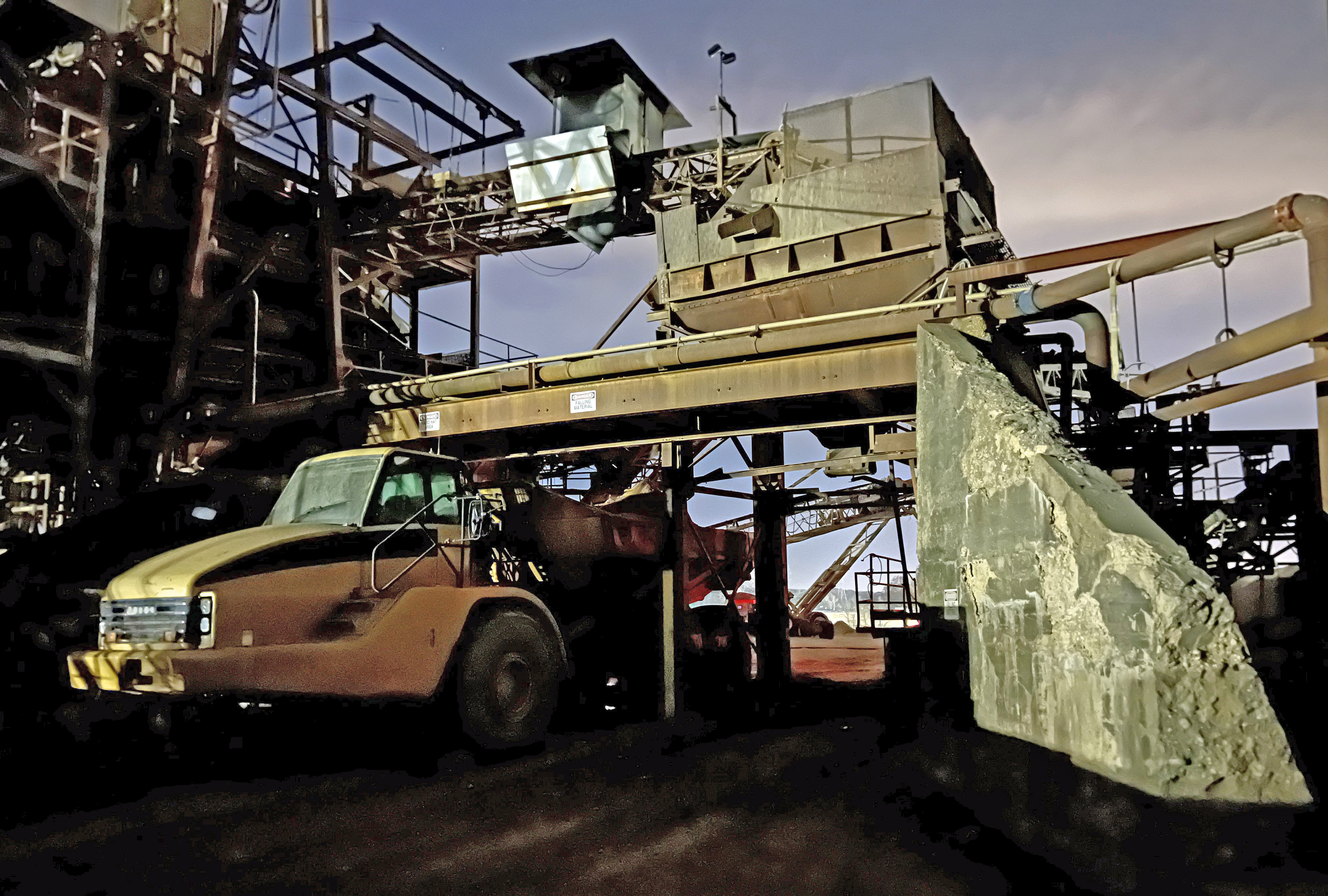
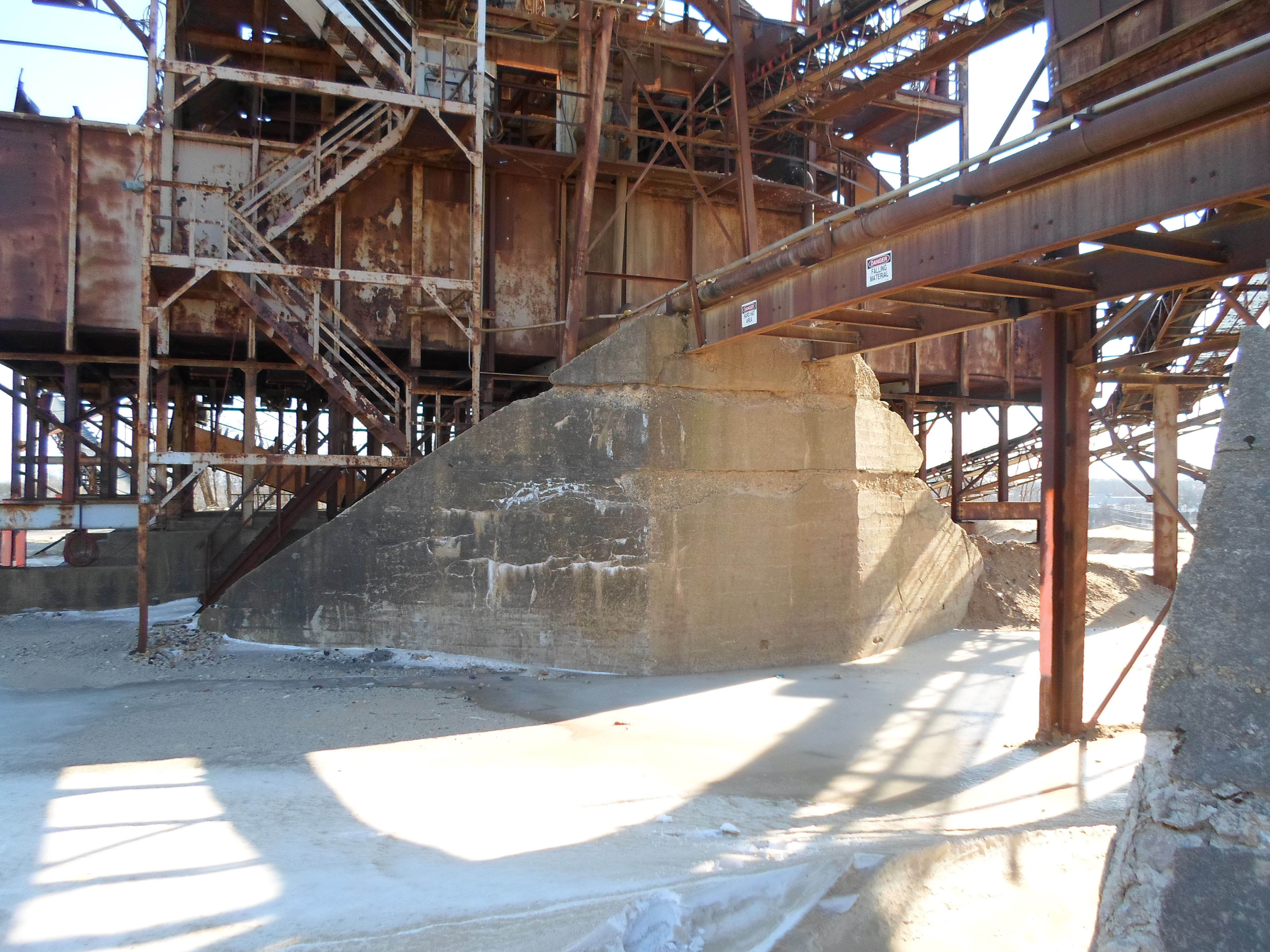
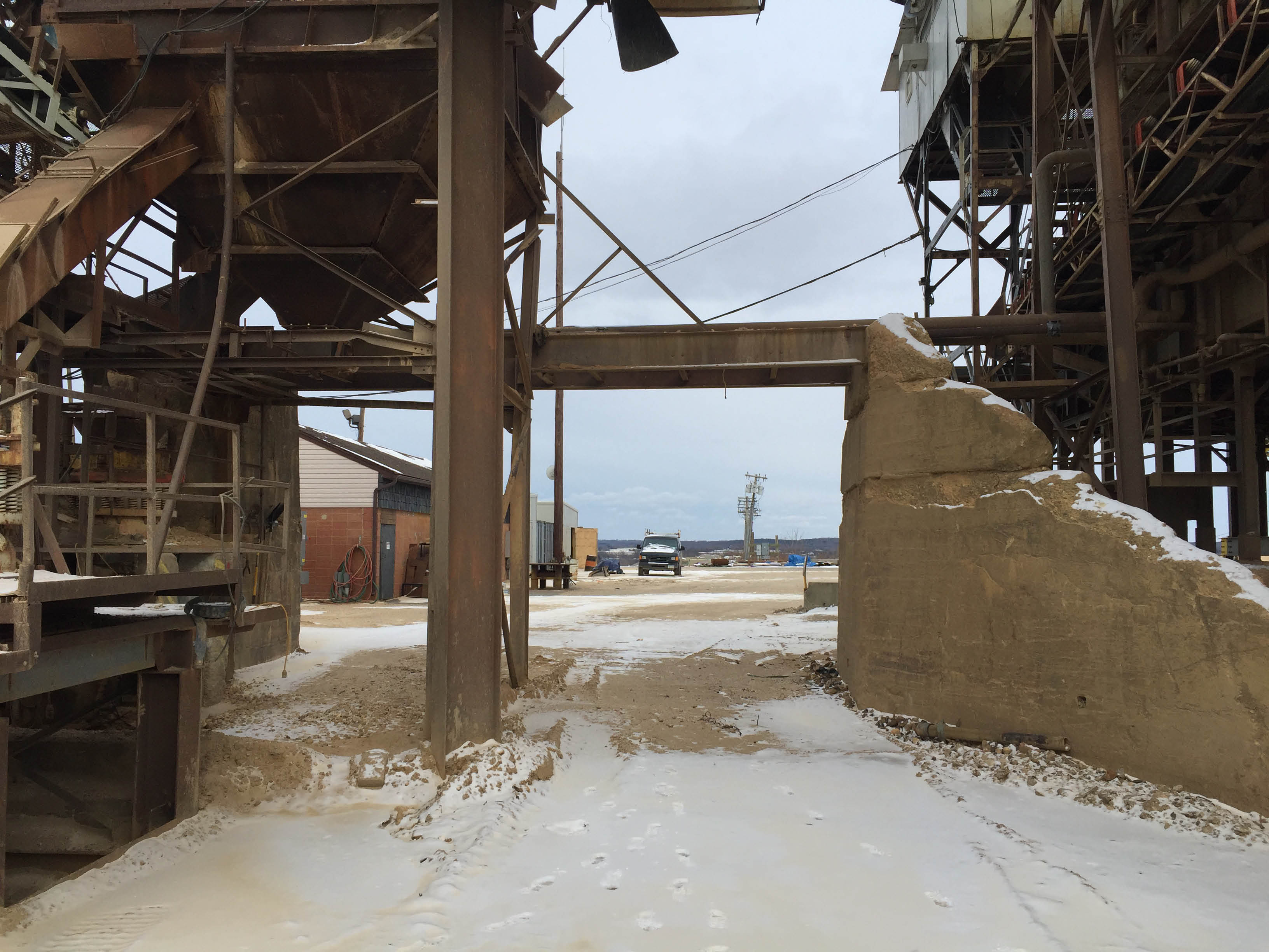
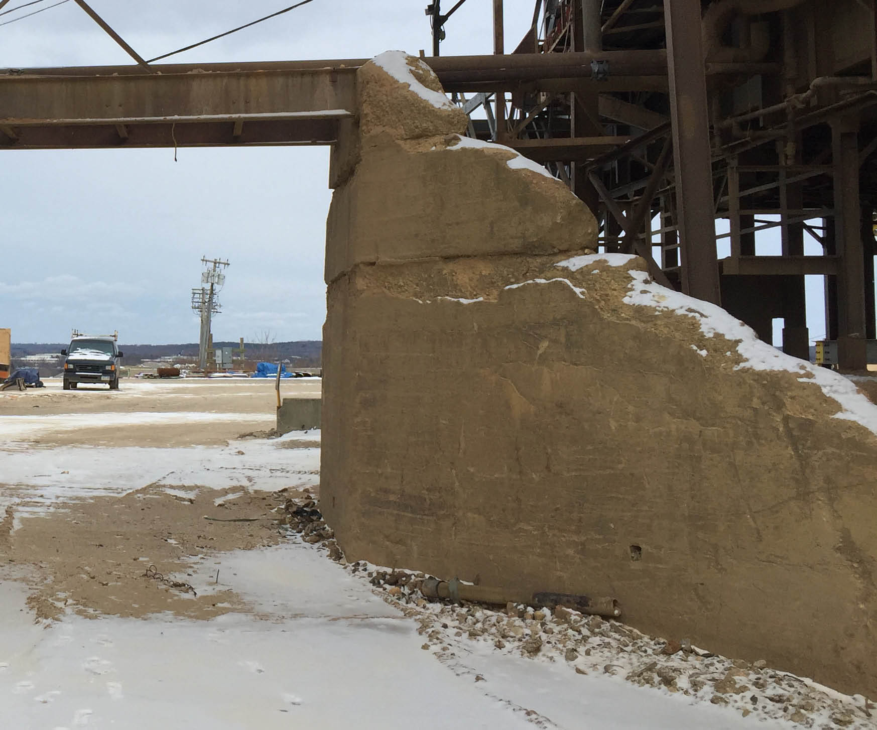
Now: 2017
Courtesy of a father/son Motor Parkway exploring team
North-east abutment

South-east abutment
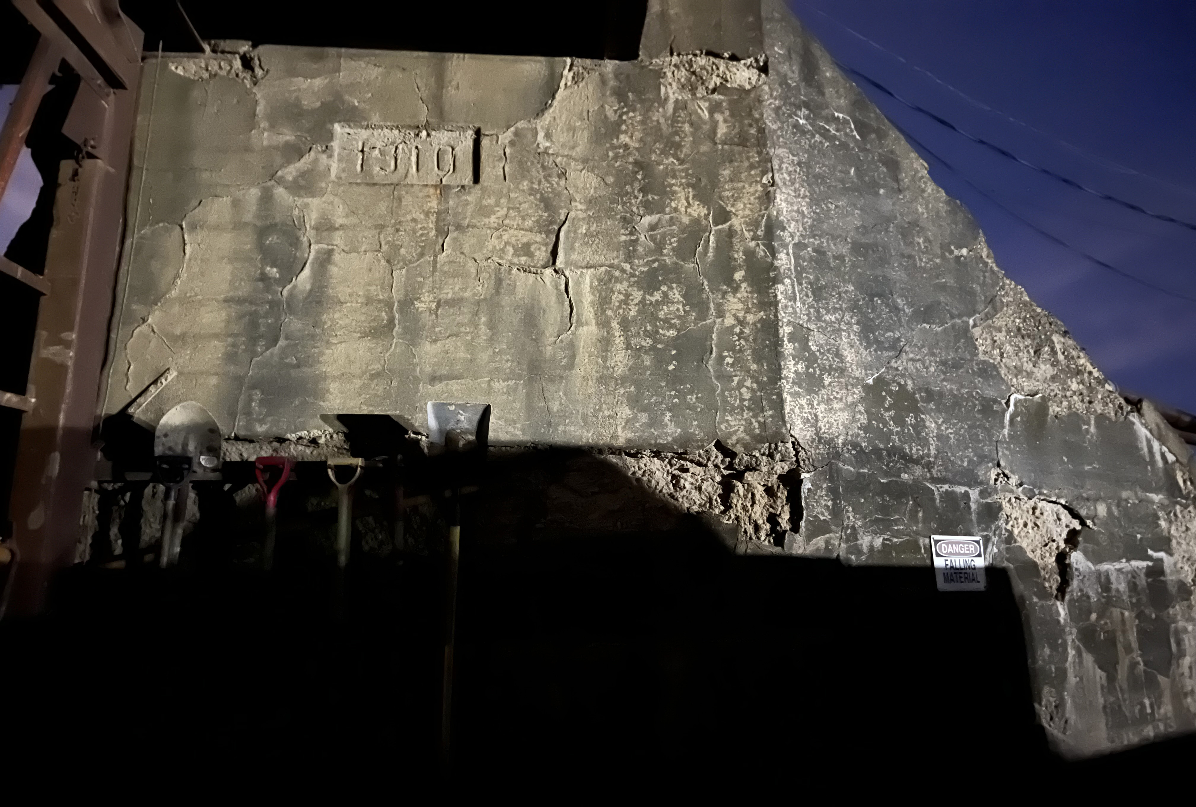
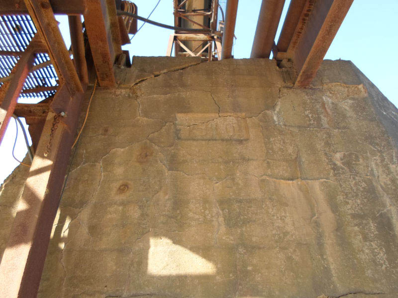
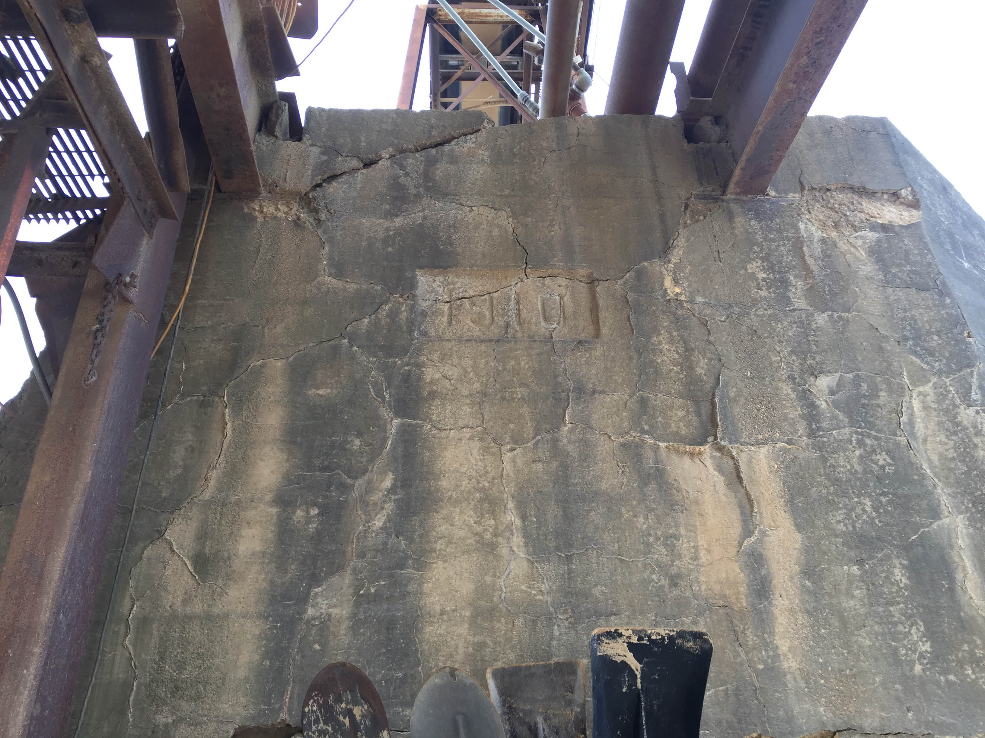
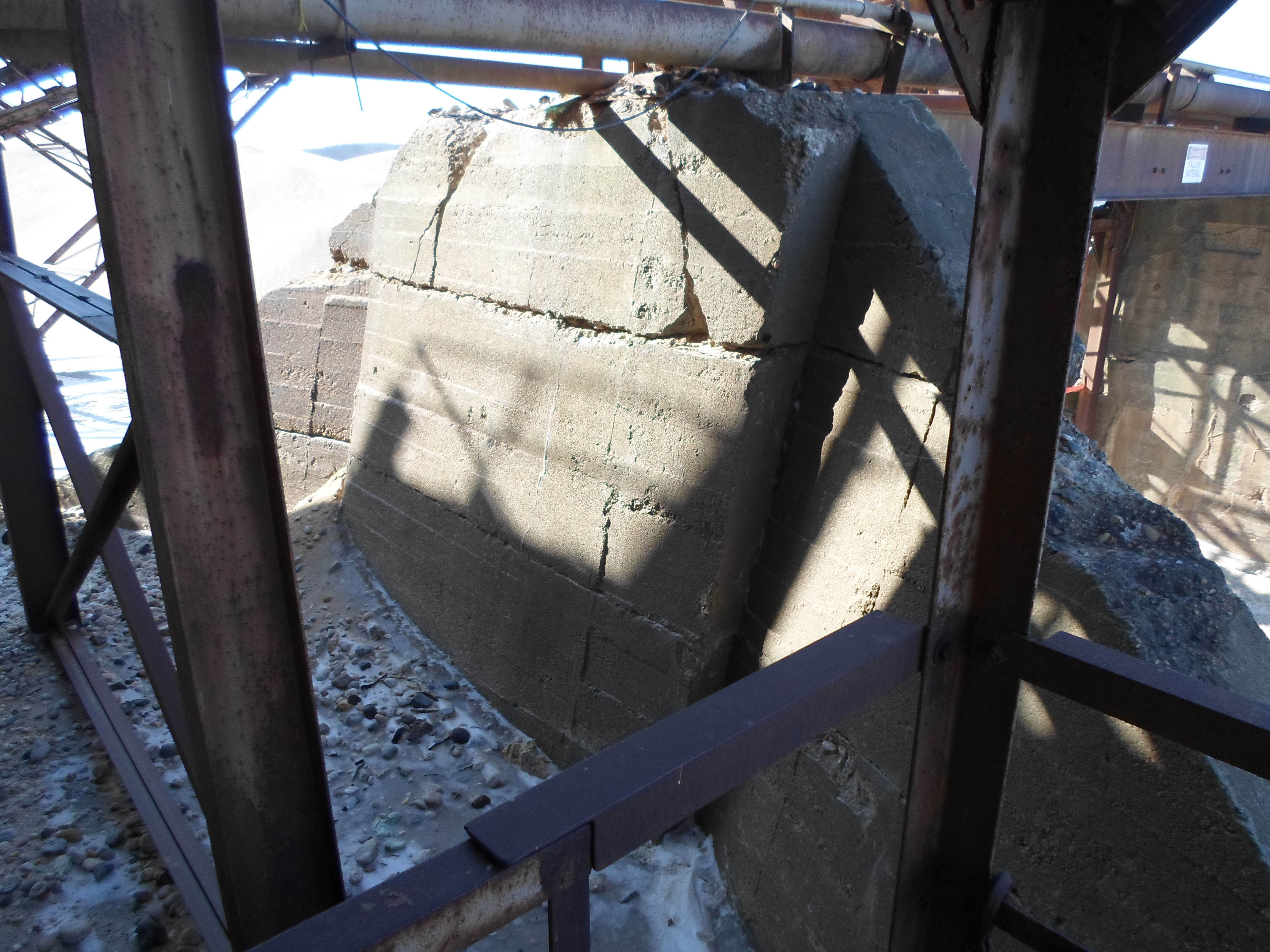
North Abutment with 1910 Date Stamp
Then: 2014
Now: 2017
West Abutments- Looking east to Route 110 in Melville
Then: 1981
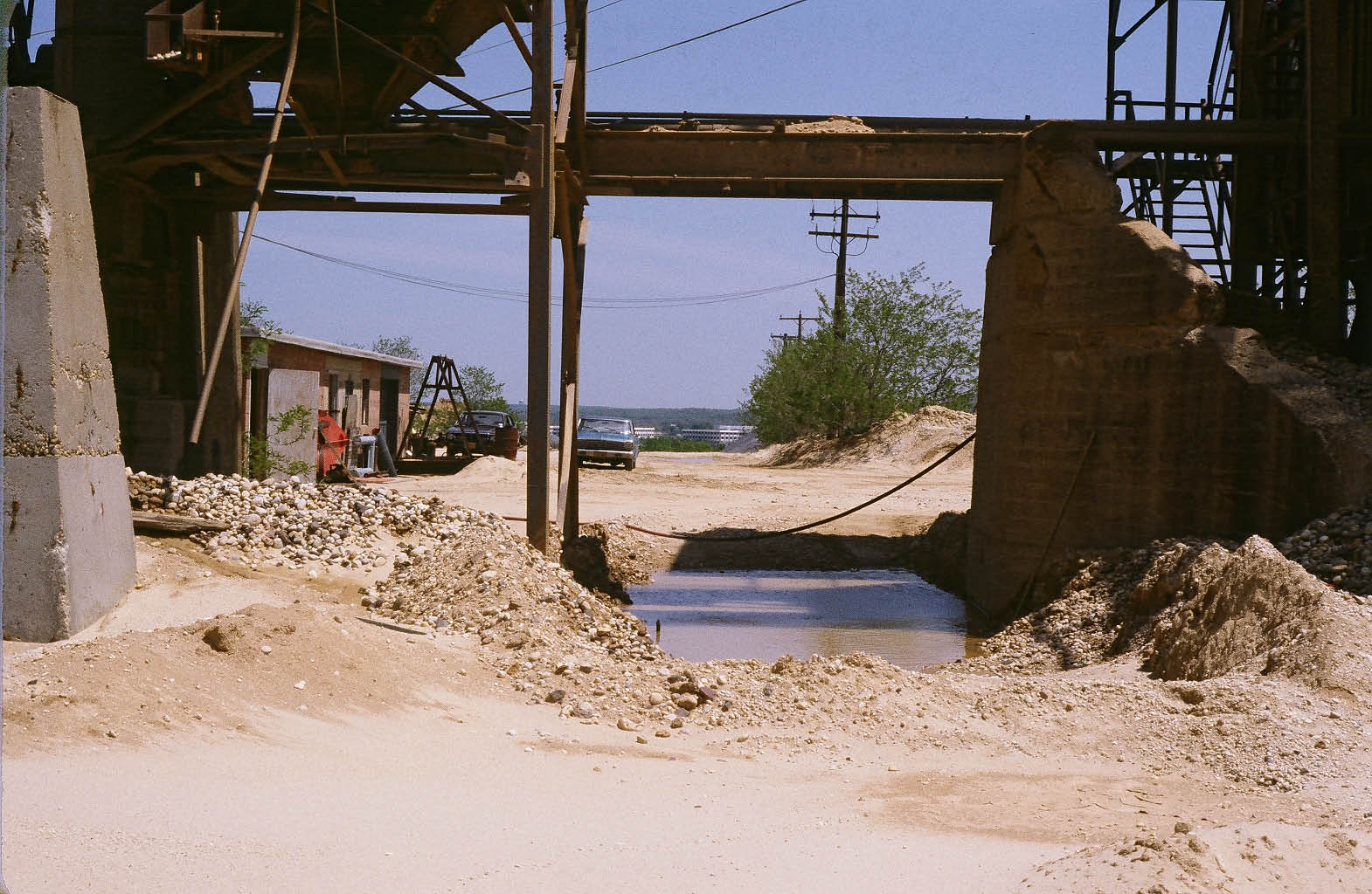
Then: 2012
Then: 2014
Now: 2017

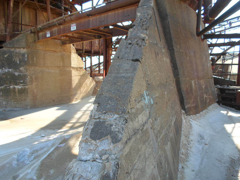
South Abutment
Then: 2014
View looking north. Note: North abutment with 1910 date stamp on the right.
Now: 2017
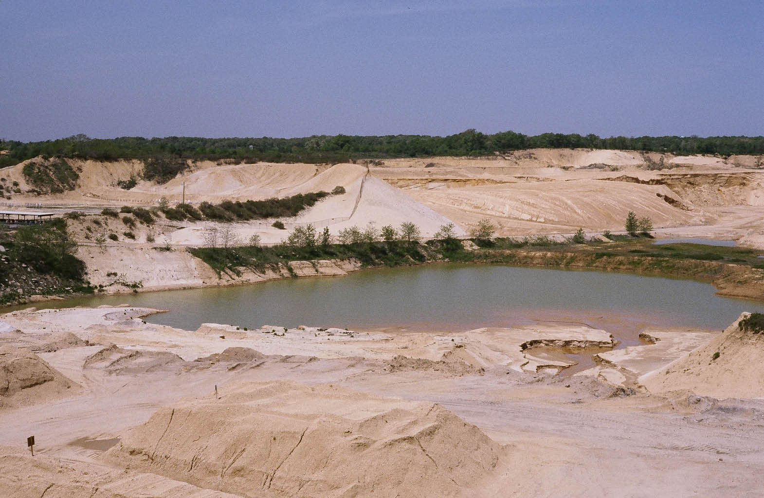
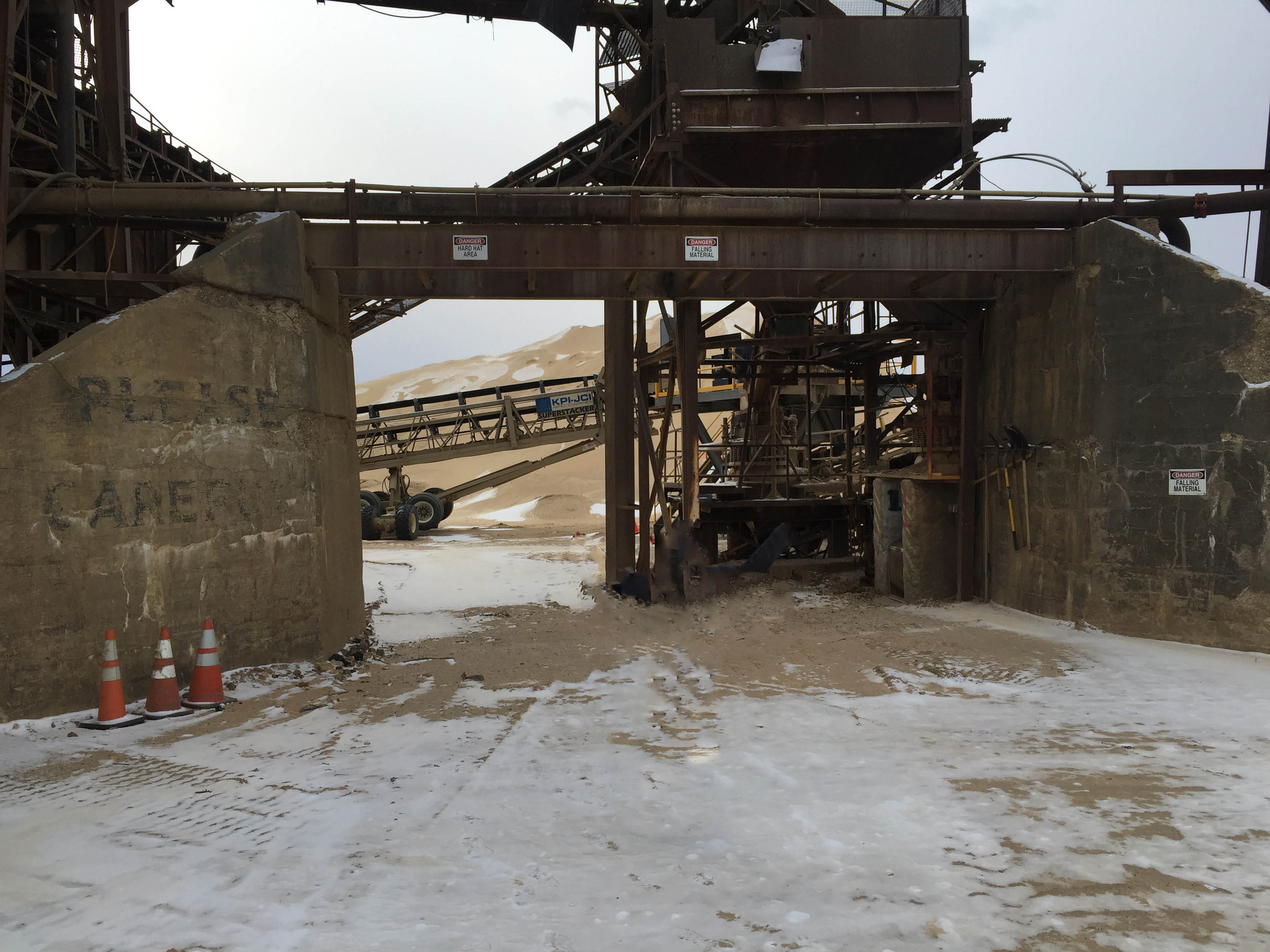
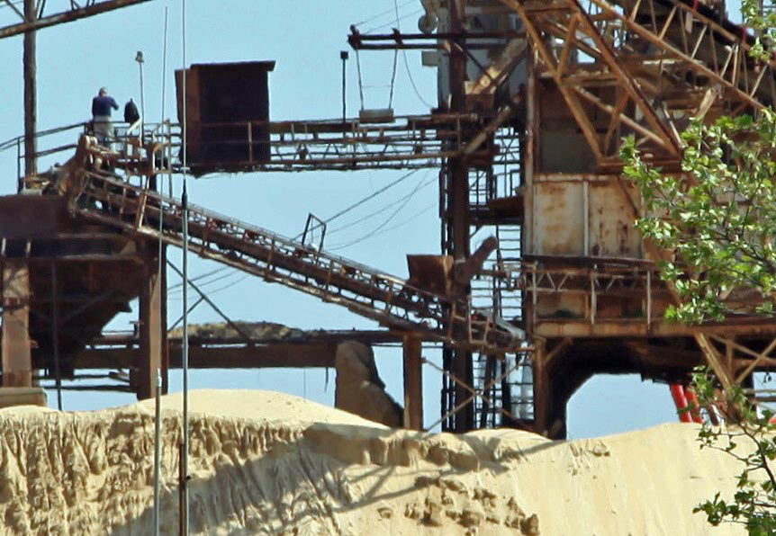
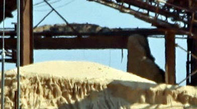
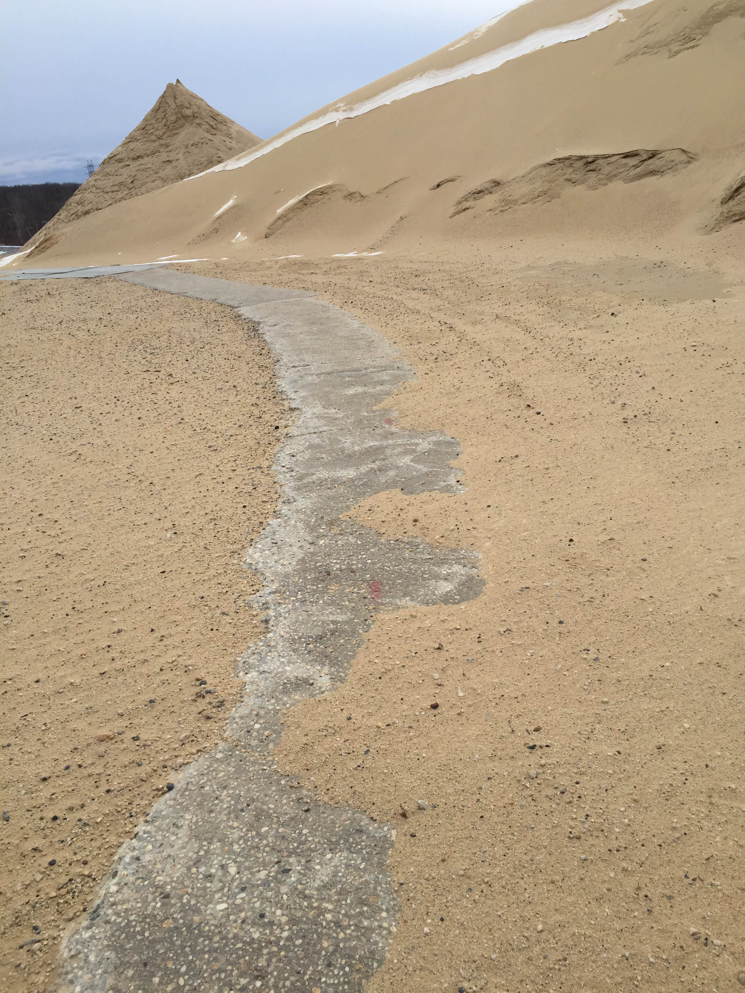
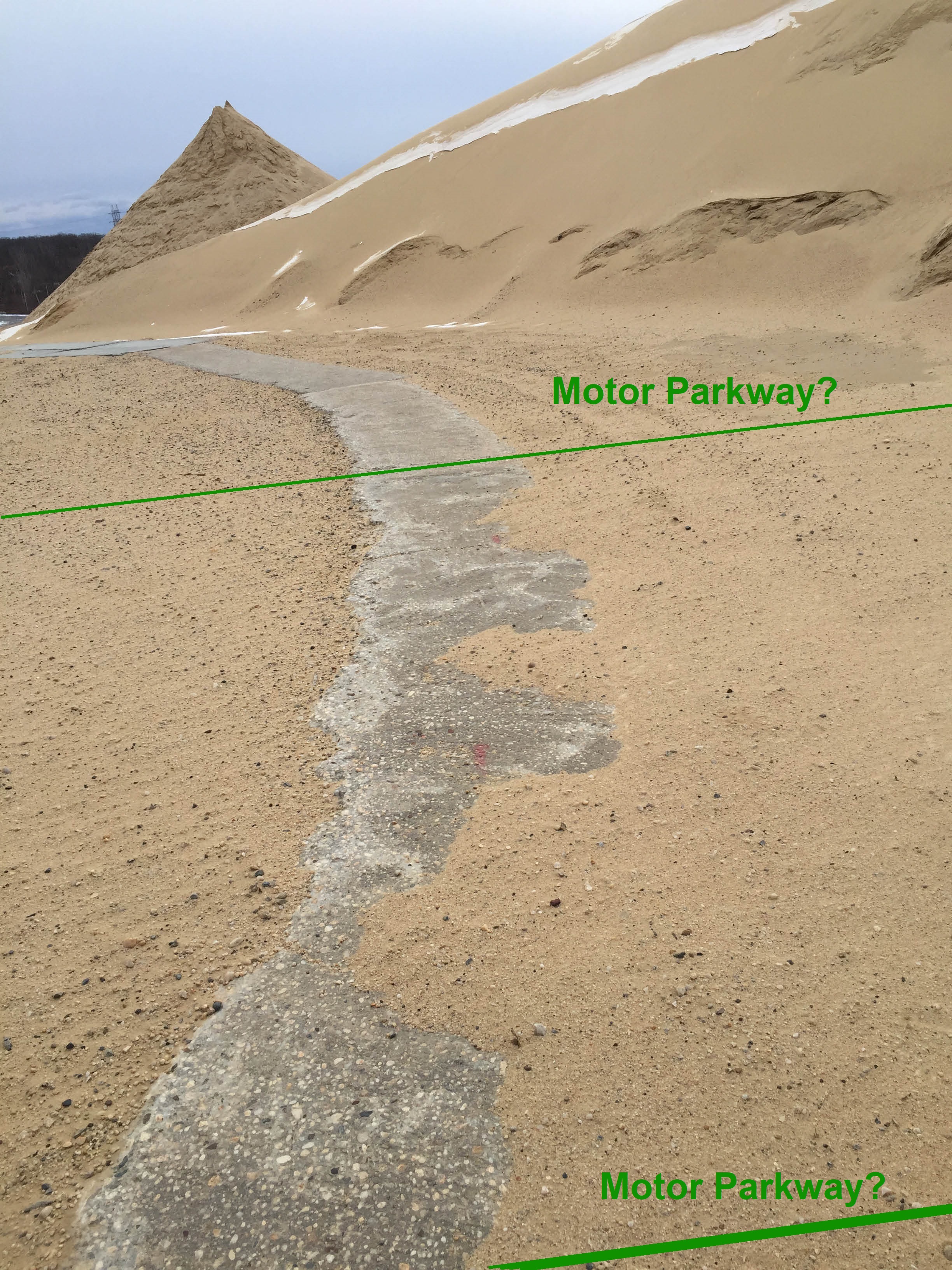
Possible Motor Parkway Pavement- West of the Bridge
Then: 1981
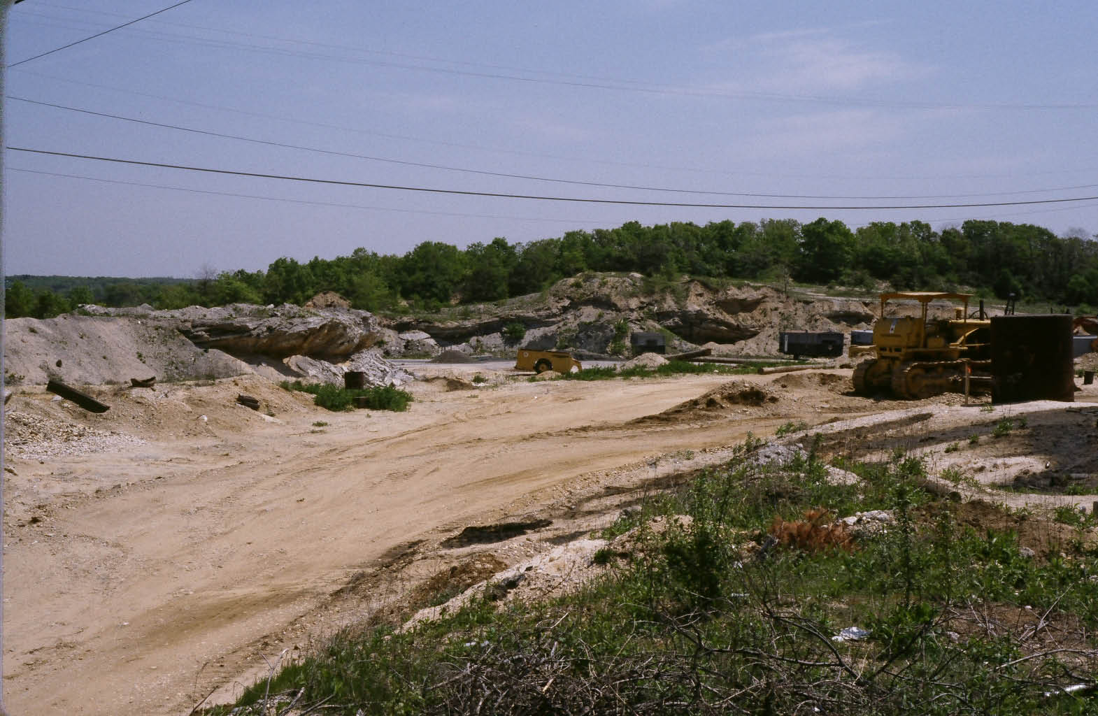
Then: 2013
Now: 2017
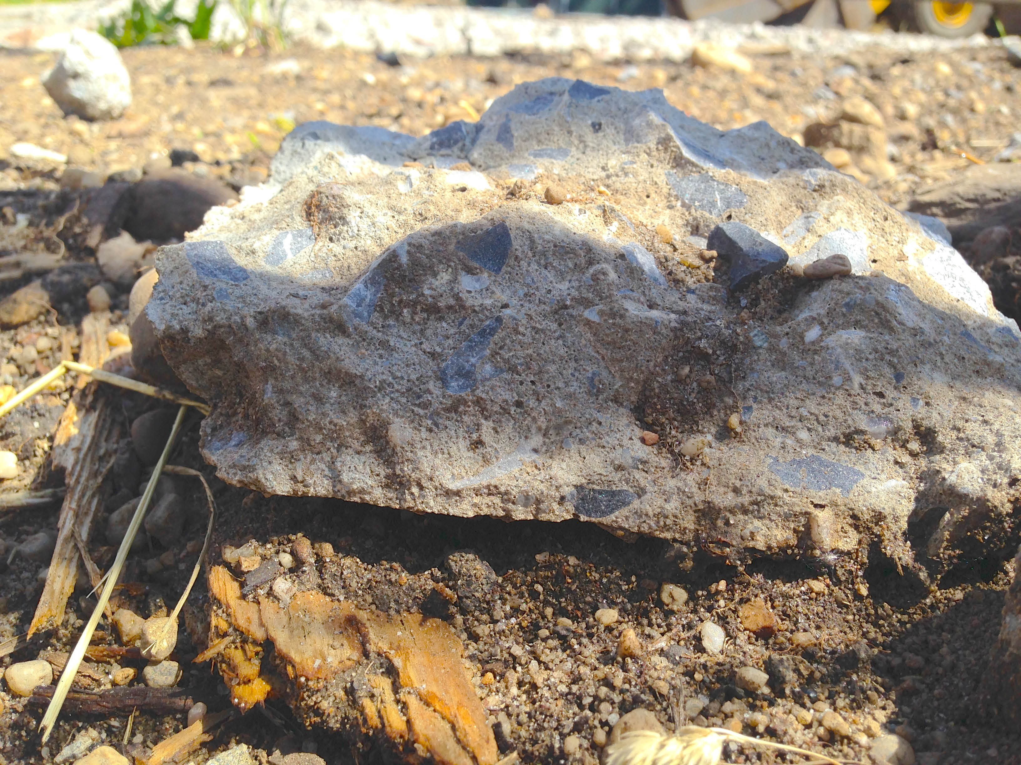
Femenias Findings (Submitted by Frank Femenias)
Frank: Possible Motor Parkway concrete with Right-Of-Way
Frank: Motor Parkway concrete between Wantagh Avenue and Hicksville Avenue discovered by Art Kleiner in 2017
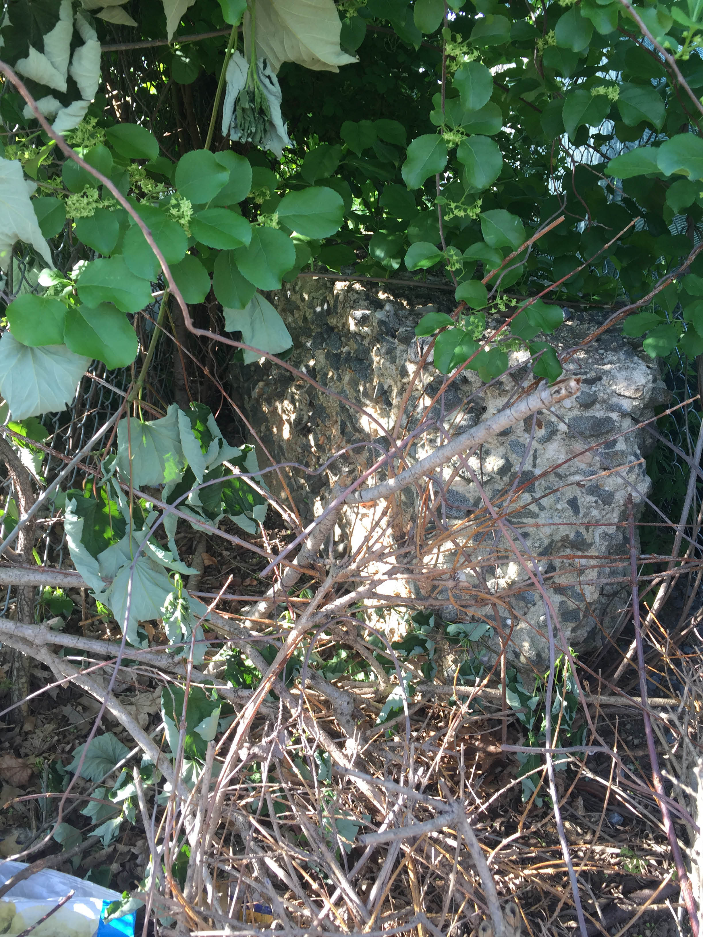
Frank: Motor Parkway concrete between Wantagh Avenue and Hicksville Avenue discovered by Dave and Sammy Russo in 2017.
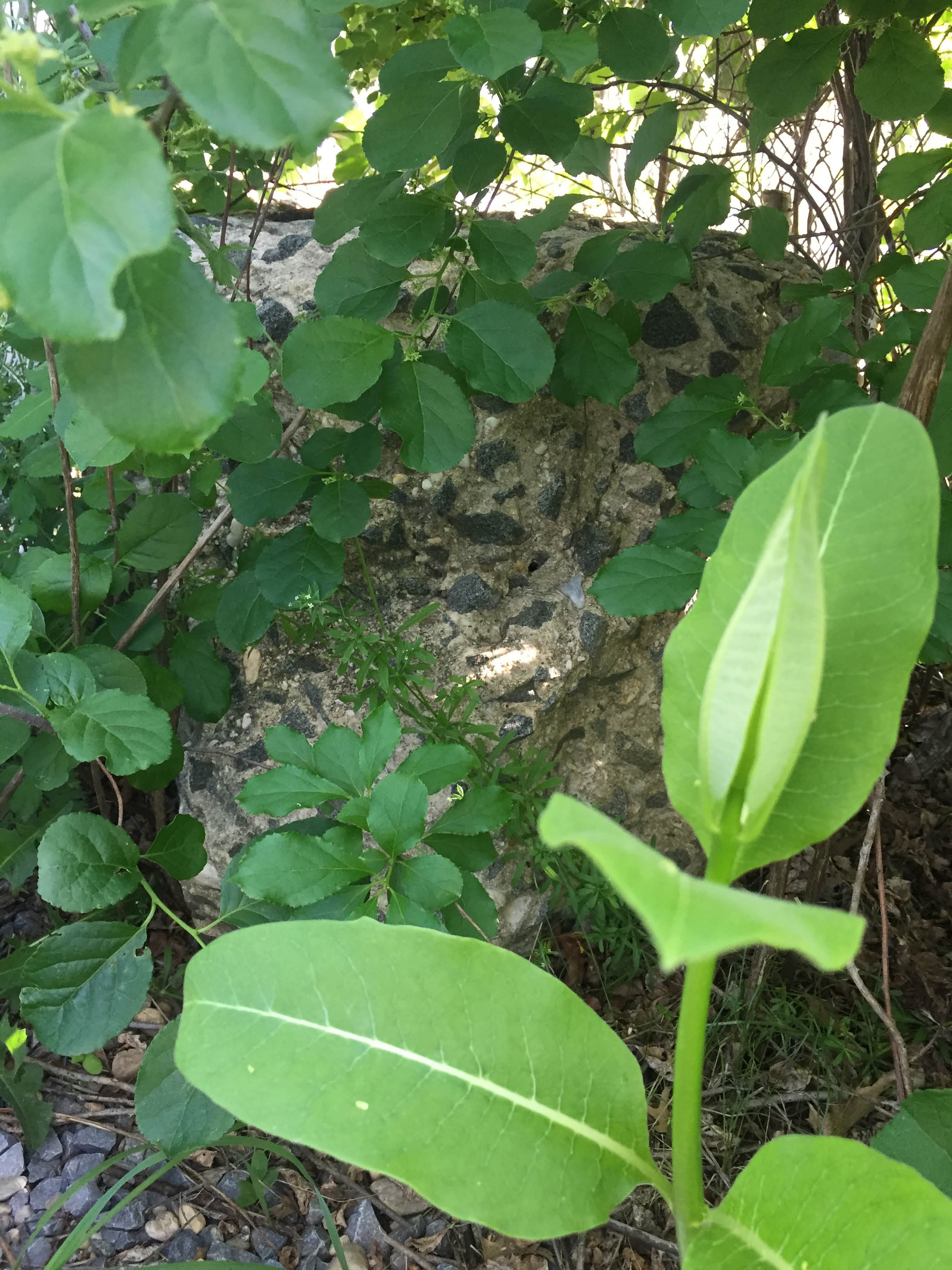
Frank: Motor Parkway concrete in Levittown discovered by Dave and Sammy Russo in 2017.


Comments
What a great job with this post. That last picture is as real as it gets. It looks like our parkway to me.
Great comparison photos. You can see that unfortunately the “Do not Pass” lettering has faded between 1981 and 2017 on the north abutment. It could be gone in another decade.
Great coverage, Dad & Son! I personally never been at this location, and heard how hard it is exploring around here. No problem for you trailblazers!
Bucket list item. Had to be done. What an amazing LIMP remnant.
Of the remaining bridges how is it possible that this writing on the abutments remains on this one? True it’s not exposed to vandals or graffiti but it is in a very busy construction location and as you can see the bridge is actually USED for STRUCTURAL purposes after 118 years - which is probably why they wont allow anyone in here to see this as I’m sure this is not the most “code compliant” situation, but it’s so cool this is still here.
Does anyone know what year that writing was done? When you compare the 1981 photos to 2017 the southeast abutment “PLEASE BE CAREFUL” has aged very well. The other side has worn out much worse but it’s awesome so see it still there.
Regarding the possible LIMP pavement on the west side of the bridge: According to Wayne’s map when going under the bridge heading west you have a straightaway that is followed by a relatively sharp turn to the NORTH. Our picture clearly shows this possible pavement curving to the SOUTH, and not at all far away from the bridge. I don’t know. Could be another example of “you can’t argue with physical, visible remnants!” But again, knowing what this site is used for now and the fact that 118 years later the original pavement exists? If it’s not the pavement what the heck could it be?? A possible path to take materials on a wheeled cart or something? But why does it look just like LIMP pavement? It’s not some new path these guys built that’s for sure.
Wish we took more pics. Camera was at 80% upon arrival, but after the trek in and the brutal cold the phone went down to literally 1% and I was sure I was going to lose the photos but thankfully they survived but it was a stressful ordeal for sure. You definitely have that “I better get the **** outta here” feeling the whole time you are there!
What a great remnant. Nothing else like it. Amazing to see it.
Clody still stands! Thanks to all the daredevil photographers over the decades for recording its existence and condition. Isn’t Suffolk’s Smith farmway bridge on Maxess Rd still standing as well, or was it totally removed? I remember builders were chipping away at it in 2016.
In Clody’s already abrasive environment, the signage on the NE abutment (Don’t Pass Cars on Bridges and Curves) always seems more faded (slightly) than its sister in the SE. This could be due to more sun exposure.
The curved pavement cannot be Motor Parkway. The westward roadway did curve to the right towards the north, not left. I super zoomed into the pavement using ‘Paint’ and determined it was crudely laid out in small sections, but the lower end of the strip does resemble LIMP pavement. Could’ve been laid out for sandpit vehicles avoiding muddy areas. Time for a debate!
How the heck does anyone get into this place without being seen/caught?! Truly daredevils!
_________________________________________________________________________
Howard Kroplick
Frank, the Maxess Road abutments are still standing. However, the top of the bridge and girders have been long gone.
Father/Son - nice work! What’s next?
Howard or Al: was the bridge writing original? I doubt it but If not do you know what year it was added? Do you think there was any writing on the western abutments? Or were they only writing on the eastern ones here because of the upcoming curve? Was there writing on most bridges?
Frank—yes let the discussion begin!——my initial thought was to agree with you. This can’t be LIMP pavement. This must be some sort of “path” they built to help them transport / wheel supplies from one spot to another, BUT look at this pavement. This is clearly not something new that was done. This is quite old. This is not a five and dime construction site. If they were going to need a path for their purposes, they would make one a lot better then this. They would have updated this if they needed to. It doesn’t cost that much to make a nice/new path like this.
And why do you say the lower end of the strip resembles LIMP?
Anonymous Father/Son….I’m just going to regard you as “The Dynamic Duo”.
If you or anyone hasn’t already, take a look back on the 1/21/2015 blog here ( LIMP Bridge Series #53 Clody Farmway Bridge ). This bridge and the LIMP is clearly seen on the 1930 & 1950 aerials. Yes, there is a short straightaway west of this bridge before the parkway curves north; and then eventually west. The short straightaway isn’t a true west direction, more like a SOUTHWEST. These aerials are the next best proof besides being on Terra Firma. Looking at the 2017 pavement image, I notice the transmission tower in the distance ( left of the “Sand Pyramid” ). That’s the tower line SOUTH of this photo’s location.
Batman & Robin were here with snow on the ground! That’s dedication with a capital D!
Is the bridge going over Commack Road now unused a bridge from the Motor Parkway?
_______________________________________________
Howard Kroplick:
Tom, not sure which bridge that you are referring to. There is no bridge at Commack Road and the Motor Parkway.
As I recall the Sandpit was (is) owned by Picone Family (cinder blocks) and was accessible from old 110 (Broad Hollow Rd). Back in the day, as is sometimes said, the sandpit was used as a gun range on weekends, circa 1954, or thereabouts.
Presently, as I also recall, they also now have a sandpit on the East side of 110 South of Ruland Road at the Huntington/Babylon Town line, (formerly part of St Rose Industrial Home for Girls) as easily seen from a Google satellite map.
As to other access points to LIMP in the general area, there is one behind a private residence on Colonial Springs Rd (in the mid 1940s the house was even then quite an old building)
Les’s and Ron’s old pix and more are on my old LIMP Bridges page at <http://sbiii.com/limpbrdg.html#sandpits>. Other than a certain un-named father-son team getting in there (no comments on how), don’t we have any intrepid chopper or drone pilots to overfly and document further to the team’s dying-camera work? I concur that the wrongly-curved paving is not LIMP. Now that Sears is dying or dead, that warehouse (now Summit Discount?) on Bethpage-Spagnoli may be accessible again; you can see the bridge clearly from the roof, as I did ca. 1995 with a scope - unfortunately, I did NOT have a telephoto lens with me at the time. Mayhap another of the buildings there might offer a view. With a REALLY big scope or telephoto you should also be able to see it from the LILCO/LIPA ridge south of B-S. Sam, III
It was the exploration of this exact area that caused myself and my son Gram to stop our own weekend walks on the Motorway back nearly seven years ago. The protection service of the sandpits were horrific in their guarded behavior when we asked if we could take an escorted walk on the grounds. Their usage of the abutment is likely in violation of safety regulations. Oh well. At least it assures it’s continued existence for now. Kudos to The intrepid new father/son duo for recoding this invaluable trace of the road we all love!
Keep up the great research!
Ken Harris
Anonymous Team - Zooming in further on the curved concrete path reveals two different textures of concrete, with the bottom half closely resembling LIMP pavement (the Right-of-Way?). I’ve attached photos of other LIMP pavement discoveries for comparison.
It’s possible a crude, narrow, and circular concrete walk path was added besides an already existing and partially exposed LIMP roadway, for office personnel to avoid mud traps.
One must be on location for better judgement. Did you guys notice any other exposed concrete nearby the curved path?
It’s absolutely incredible that those bridge abutments even still exist. The fact that there’s a business in operation around the abutments boggles the mind. I wonder how much longer they’ll continue to remain.
Rog
Frank, no there was no other visible concrete on the west side. But if you look at the “THEN 2013” aerial that Howard posted, this is the exact stretch that we saw. I haven’t looked for old aerials but it should be visible if the LIMP did in fact that a little southerly curve before heading northwest. Not enough people are chiming in on this one. I thought there would be more opinions on this. If this is original LIMP it has never been documented and it’s amazing that it’s still there. And if it’s not LIMP why does it look so much like LIMP pavement?
Actually, if one is to look up the history of Joseph Picone and Son, as I recall they have been occupying that site from as far back as when the bridge on Broad Hollow Road was still in existence—the next bridge East, remembering, that until the mid-fifties, Broad Hollow Rd and Route 110 were the same two lane winding road, with the 110 we know today taken from the route of the Cross-Island Trolley. Aerial wise, anything focusing on the Church in the Wildwood should also show the route of the LIMP, with the LIMP following the North side of Ruland Rd and Hi-tension LILCO lines until it crossed eventually following the Southern side of Colonial Springs Rd, again Googling the area will show the remnants of the LIMP.
Anon. - there probably was a heavy-duty truck road there; you couldn’t drive over the sand. As to the firing range, it never occurred to me that the range was in the Picone/110 Concrete property but the gunfire was still quite audible from the OBVR well into the MP Panel time, 1999-2011.
Incidentally, folks might have a look at the Panel’s projects list on my old Panel page, <http://sbiii.com/limpanel.html>.
Sam, III
I agree with Roger, fantastic discovery and photos!
I know one needs extra special permission or a license to be on that property, but really wish they would let a few of us in there ( with an escort of course ) to explore as much as possible.
Ditto Brian, a temporary pass to explore the sand-pits could produce hidden gems of the old Motor Parkway RoW. I believe Picone’s objection is due to liability, that he/she is not willing to risk health hazards from outside visitors, even though we can both easily knock this one out. Frustration continues throughout the community…
I’m pretty certain that the owner is Clifford Broman. I have been on that property 100 times over the past 25 years dumping construction debri. It is a very large landfill that is filling up fast. Not many people realize that there is a landfill there. I have purchased sand from them, but have not been on the side where the LIMP bridge abutments are. Liability is probably the concern for not allowing people to walk around. Big earth moving equipment always on the move. I wouldn’t be surprised if the owner is concerned that “someone” might start a campaign to preserve the remnant.
All couple reasons to deny that something historic exists still; to avoid attracting trespassers, to avoid historic or like designations that in some places prevent demolitions.
I grew up in Old Bethpage and was aware of LIMP sites in our area but never knew a bridge still existed let alone in the “gravel pits” as we called it. I’m sure that the reason they deny it’s existence is, as the previous comments stated, looky loos and possibility of historical site preservation. I totally enjoyed reading about this and LOVED the photos!