Mystery Friday Photo #1 Solved: The Bethpage State Park in Old Bethpage and Farmingdale
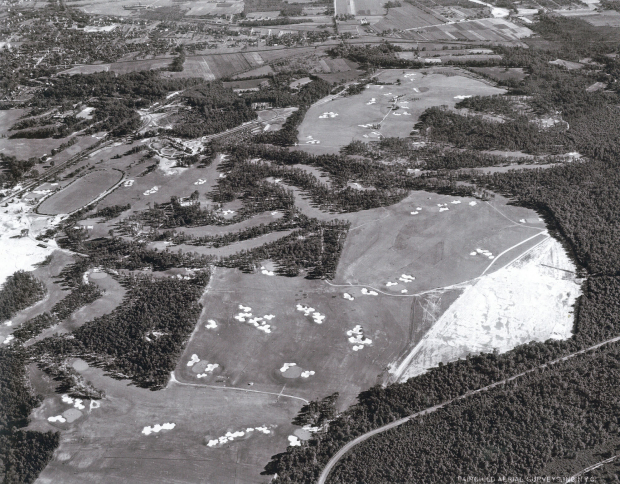
Congratulations to Brian McCarthy, Jim Waechtler, blh, Frank and Scott for correctly identifying last week's mystery 1940s aerial as the Long Island Motor Parkway on the border of Bethpage State Park in Old Bethpage.
Enjoy,
Howard Kroplick
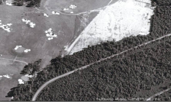
A close-up view of the Motor Parkway. The golf course behind it is now the "Yellow Course" of Bethpage State Park.
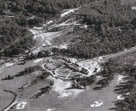
A close-up of the clubhouse.
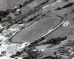
As noted by eagle-eye "blh", a sporting event was being held near the clubhouse, likely a polo match.
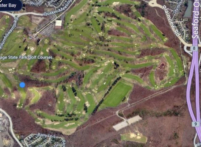
A matching Google map view of the mystery photo. A trace of the Motor Parkway curve can still be seen.
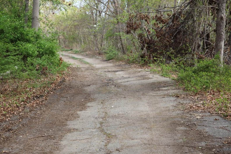
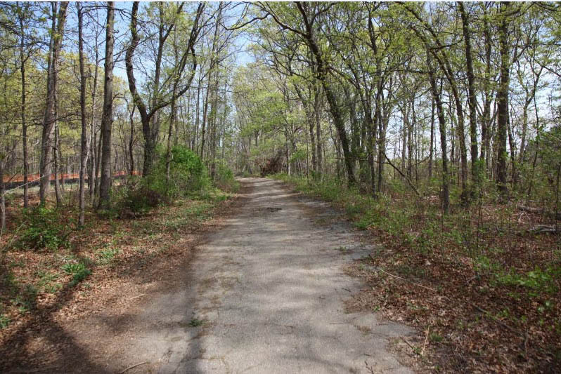
The curve in the mystery photo is in place today adjacent to the new section of the Bethpage Bikeway.


Comments
This was an easy one. 😊
Roosevelt Field
You got me on this one,no clue at all can’t even guess at it,it can be anywhere,it looks as though it’s surrounded by water and most of L:ong Island is surrounded by some kind of water. By the way I took that stroll from Cunningham Park to Alley Pond Park,I thought it was more than 2 miles,it was a pretty nice day yesterday.
Its the limp running through bethpage state park.
It could be the northern end of Salsbury Park in East Meadow where the 1908 course cut across from Elison Ave to Salsbury Park Drive?
North Shore, Calverton/Riverhead area
Bethpage State Park, looking SSE. You can see where the LIRR splits at (what used to be called) Bethpage Junction. One track goes southeast to Babylon (topmost), one goes east to Ronkonkama, one (no longer there) goes north to (Old) Bethpage beside Round Swamp Road. LIMP is longer road in foreground.
Wheatley Heights?
I’m way off on this one,are’nt I? I don’t even see what they’re seeimg. Are those lines the railroad tracks? I’m really lost on this one
All the sand traps make it look almost like a beach. That can be a bit misleading - but also informative, regarding the Bethpage State Park golf courses.
Clubhouse for the Bethpage State Park is at the top. Is that a racetrack/polo field near it?
Facing NE over the Deepdale Golf Club E of Lake Success. The LIE will cut through some day above the Parkway.
Too easy. Wheatley Hills Golf in East Williston. The angle of the shot made it difficult ;p
Correction: Not that easy! Definately Bethpage Park Golf looking south just east of the parking lot where the new bike path extension begins.
If you invert Bethpage park on Google earth you can clearly see the resemblance with the town of farmingdale on the south side of the park.
just match up the dog-legs for you golfers out there
Rumor has it winners get a free ride in “The Beast”
It is Bethpage Park, but before the polo field was at its’ present location at bottom of photo. Also before the construction of the Seaford-Oysterbay Expressway
Kinda thought it was Bethpage State Park,that’s what almost everybody was saying,shucks I should have said it,maybe I would be able to get another ride on the Black Beast
From Bob G.:
“Notwithstanding its Farmingdale address, Bethpage State Park is not located in Farmingdale; it is almost entirely within the boarders of Old Bethpage. When the park was constructed, Old Bethage was known as Bethpage and Bethpage was known as Central Park. When the villages successively changed their names, the State did not change the name of the park. “
Looking at https://www.bethpageproshop.com/red-course-page-13/chapter/2 - it’s the Red Course in the foreground