Mystery Foto #4 Solved: A 1940 aerial of the Bethpage, the Grumman Airport and the Motor Parkway
Art Kleiner challenged you to solve this weekend's Mystery Foto.
Answers to the Mystery Foto questions:
Identify:
- The general aerial location
Bethpage
- The location of the Motor Parkway
Upper and lower corners of the aerial
- Motor Parkway structures
Lower right corner: Jerusalem Road Bridge (now Stewart Avenue)
Upper right corner: Central Avenue/LIRR Motor Parkway Bridge
Nibbe Farmway Bridge
Powell Avenue Motor Parkway Bridge
- Major roads
See Brian McCarthy's captioned image in Comments
- Airfield
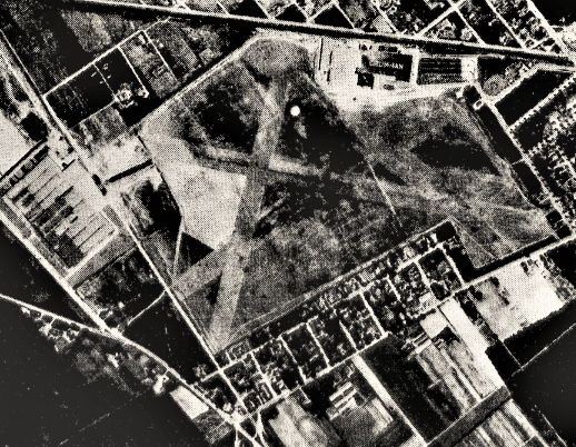
Grumman Airport in Bethpage.
Link the aerial to the Vanderbilt Cup Races.
This section of the Motor Parkway was used for the 1908 Vanderbilt Cup Race course.
Hicksville Road was used for the 1909 and 1910 courses.
Kudos question: When was the Foto taken? Provide a rationale.
July 20, 1940. Rationale: The number of Grumman Airfield buildings.
Comments (9)
Congrats to Greg O., John Cunningham, Brian McCarthy, Al Prete, Steve Lucas, Ernie and Frank Femenias for identifying Bethpage.
Kudos to Greg O., John Cunningham and Frank Femenias for getting close to the Mystery Foto date.
Enjoy,
Howard Kroplick
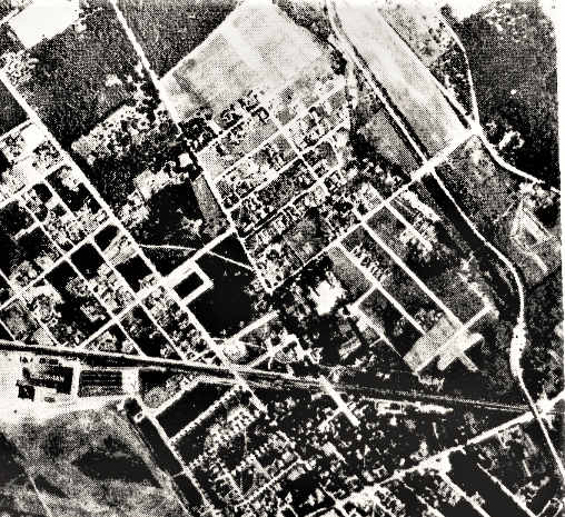
Close-Ups
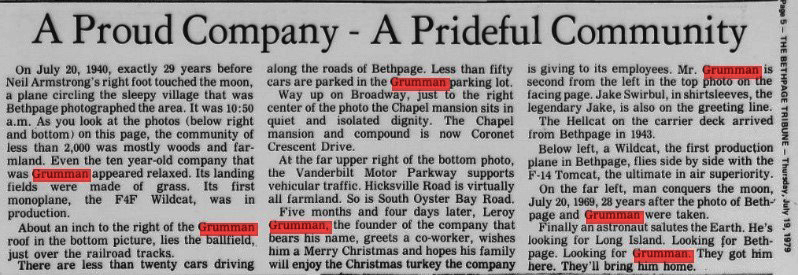
Source: The Bethpage Tribune, July 19, 1979
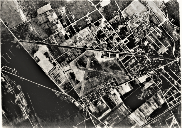
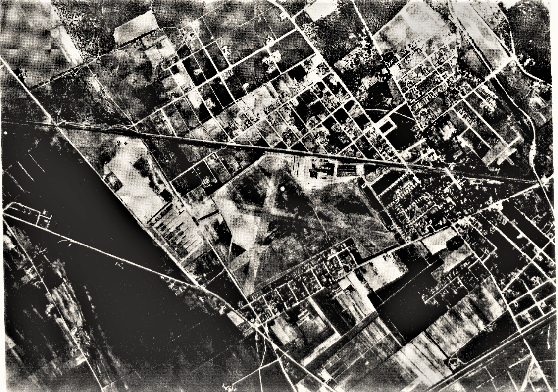
Aerial of Bethpage on July 20,1940.
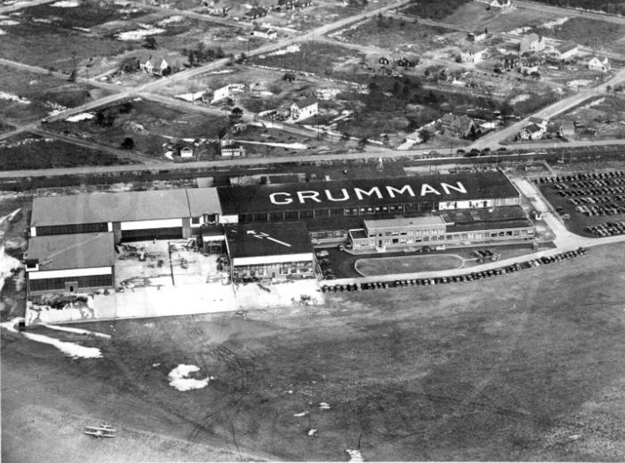
Grumman Airport-1938


Comments
Directly over Grumman airfield in Bethpage/Central Park. The LIMP is at the bottom right corner and along the right hand side of the photo. Deadman’s Curve is cutoff in the lower right. Central Ave, Hicksville Rd and Stewart Ave are all visible. Not the greatest resolution, but it looks like the Stewart Ave, Central Ave, and Powell Ave bridge all look like they’re in the photo. 1908, 09, 10 Cup Races used this area of the LIMP.
Judging by the presence of only the first Grumman building, I’d say this is sometime in 1938 just after it opened.
The pic is of Bethpage circa WWII. Motor Parkway is in the top right quadrant. Stewart Ave Bridge/Groundbreaking location just out of frame to the right. Central Ave/Train bridge is in the middle of pic on the right. Powell, Nibbe, and widened section by deadmans curve #2 all visible. LIRR cuts horizontally through the middle of photo. S.Oysterbay Rd, 107, Powell, Central, and Stewart aves all in photo. So are both versions of Plainview Rd. although the Plainview Rd bridge is just out of frame. Grumman Airfield can be seen easily in center of photo.
The Bethpage portion of the cup races is in the photo as well
Based on the development of the area( half of my street appears undeveloped) and the 135 not existing, I said around WWII
*Location - Bethpage NY
*LIMP - Seen at the upper and lower right corners. 4 bridges total - Pkwy Type - Jerusalem Rd & Central Ave/LIRR. Nibbe Farmway & Powell Ave HWY Type.
*Roads - noted on the aerial below. Airfield is Grumman.
*Year - I’m guessing 1947. More development seen than 1938. 1950 aerials show the bridges removed. The bridges appear to be intact here.
This one had me stumped for a while, then I looked carefully at the Foto and noticed that one of the buildings is labeled “GRUMMAN.” We’re over Bethpage, with northeast at the top. LIMP is upper right. The LIRR runs across the center of the Foto. LIMP bridge over the RR and Central Avenue can be seen right center, then the second Dead Man’s Curve, then the Powell Avenue bridge. Other roads: Broadway, Stewart Avenue, Hicksville Road. The airfield is the Grumman airfield.
VCR link: The visible part of the LIMP was part of the ‘08 race.
Date: Mid ‘40’s (1946?), because of the absence of Levitt houses on the west side of Hicksville Road.
We are over Bethpage with north at the top of the photo. The LIMP is near the upper right corner running north/south and the lower right corner running east/west. Structures include bridges over Powell Avenue, Central Avenue/LIRR, Jerusalem Road (Stewart Avenue), and possibly the Nibbe farmway bridge. Major roads include Central Ave. Powell Ave., Plainview Rd., Stewart Ave., Broadway, Massapequa-Hicksville Rd. and Wantagh Ave. The airfield is on the Grumman property. Small sections of the routes for the 1904, 1908, 1909 and 1910 V. C. Races can be seen in the photo. Since the Central Ave. bridge is clearly visible and it was demolished around 1950, I’ll guess the date to be 1948 - 1950.
The general aerial location: Bethpage, looking down at the Grumman plant and runways.
The location of the Motor Parkway: the LIMP appears at the extreme lower right corner snaking up to near the middle top. The three right of ways overlapping are the LIMP, Central Avenue, and the LIRR. This bridge of the LIMP spanned both a roadway and the railroad.
Motor Parkway structures: Additional bridges are Plainview Road and the Nibbe Farmway Bridge. A bit south out of frame is dead man’s curve.
Major roads: Broadway, Central Ave, South Oyster Bay Road (before the dogleg when the runway was extended)
Airfield: Grumman Field.
Bethpage looking NNE at top.
LIMP is diagonal at bottom right corner and curvy along the right edge.
LIMP Central Ave RR bridge, Powell Ave bridge, Nibbes farmway bridge, Deadman’s Curve #2, 1908 Ground Breaking Ceremony site at bottom, east of Stewart Ave and north of the LIMP.
LIMP, LIRR, Central Ave, Stewart Ave, Broadway.
Early Grumman Airfield ramps, about 1942
Only the 1908 VCR used this section of LIMP