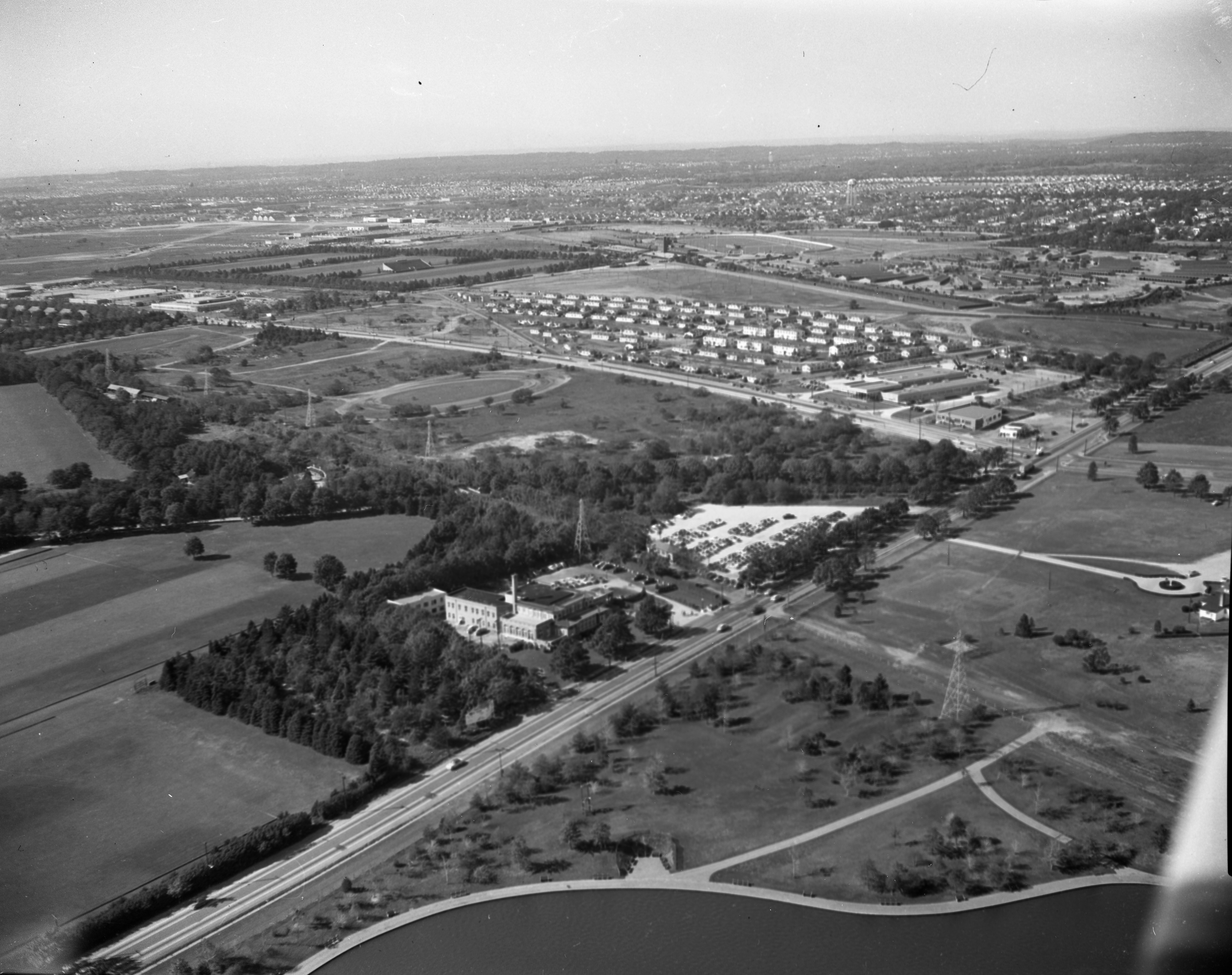
Mystery Foto #49 Solved: A 1953 View over Merrick Avenue and East Meadow and Westbury

The Cradle of Aviation Archives challenged you to solve this weekend's newly scanned aerial.
This aerial was scanned last week by Joel Friedman, volunteer archivist at the Cradle of Aviation.
Mystery Foto questions:
- Identify the following:
-Location of the Mystery Foto and orientation of the photographer
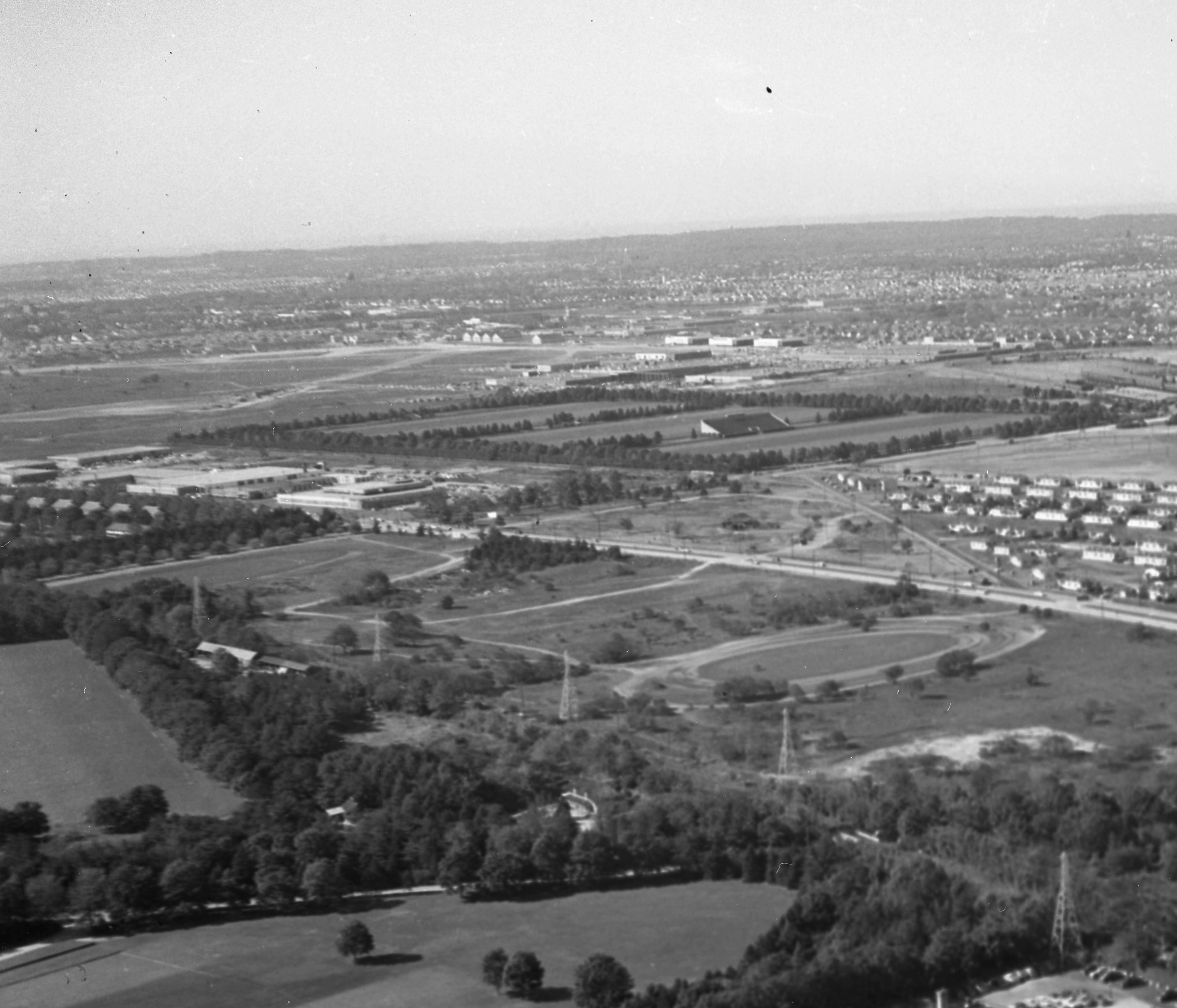
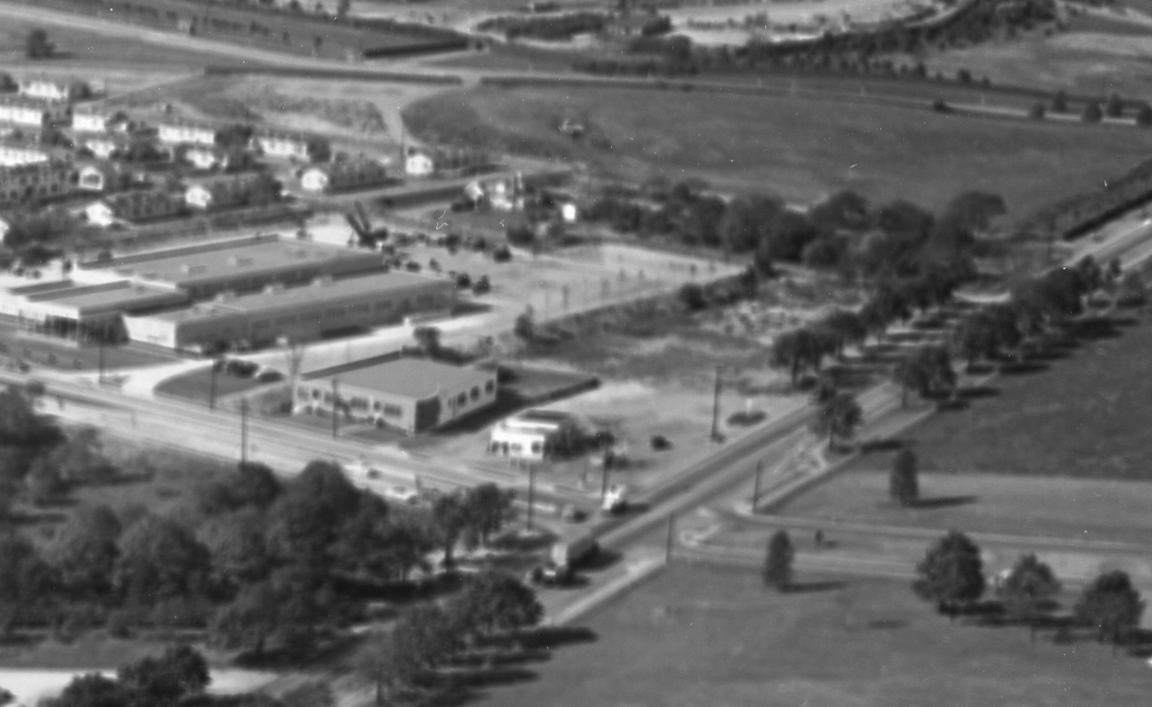
Airplane was over the Salisbury Park section of East Meadow looking northwest to Westbury/East Garden City.
-The major roads and buildings
Roads
-Merrick Avenue is on the diagonal from south to north.
-Stewart Avenue is seen in the middle from west to east.
-Old Country Road is near the top from west to east
-Remnants of the Long Island Motor Parkway north of the Mitchel Gardens community.
Buildings/Structures
-Mitchel Gardens community
-Roosevelt Field Hangars off Old Country Road
-The former Salisbury Links clubhouse off Merrick Avenue
-The abandoned Salisbury Plains Train Station and bridge trestle. The right-of-way for the Central Railroad was still visible.
-The Meadow Brook Lodge off Merrick Avenue.
-The Roosevelt Raceway being used for harness racing
-The grandstand for the Meadowbrook Polo Club
- Link the Mystery Foto to the Vanderbilt Cup Races
-The courses for 1908-1910 Vanderbilt Cup Races included the section of the Motor Parkway over the Merrick Avenue Bridge.
-The courses for 1909-1910 Vanderbilt Cup Races included Old Country Road
-The 1936 and 1937 Vanderbilt Cup Races were held at Roosevelt Raceway
- Link the Mystery Foto to the Long Island Motor Parkway
-The still standing Meadow Brook Lodge
-The Motor Parkway right-of-Way
- The date of the Mystery Foto. Provide a rationale.
-May 23, 1953: Absence of the construction for the Meadowbrook Parkway and Roosevelt Field Shopping Mall
Comments (10)
Congrats to Greg O., Al Prete, Casey De Nicola, Steve Lucas, Wayne Woodbury, Sam Berliner III, Art Kleiner and Frank Femenias for identifying the Mystery Foto.
Kudos to Frank Femenias and Art Kleiner for the additional jpeg documentation.
Enjoy,
Howard Kroplick
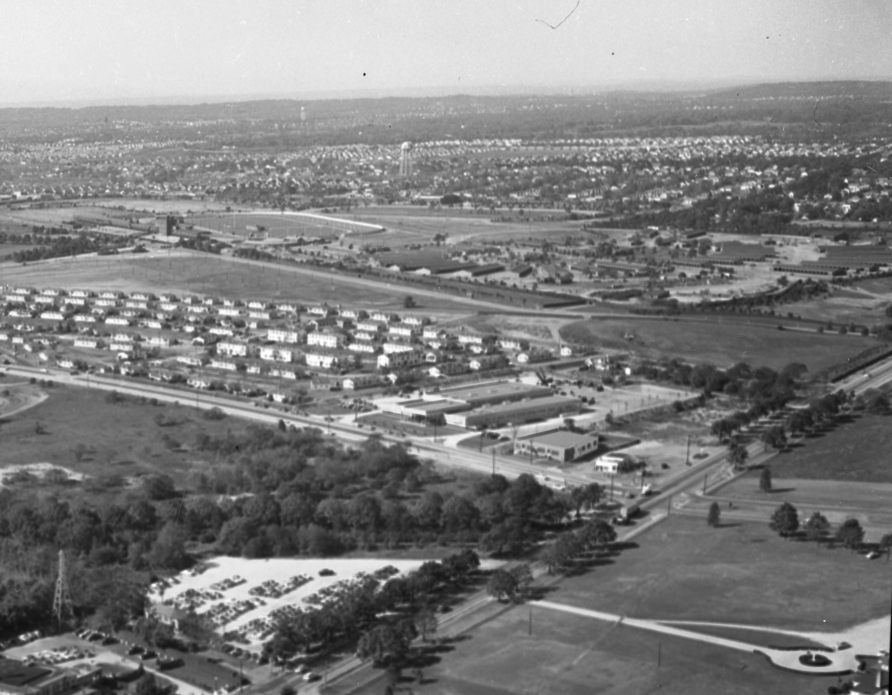
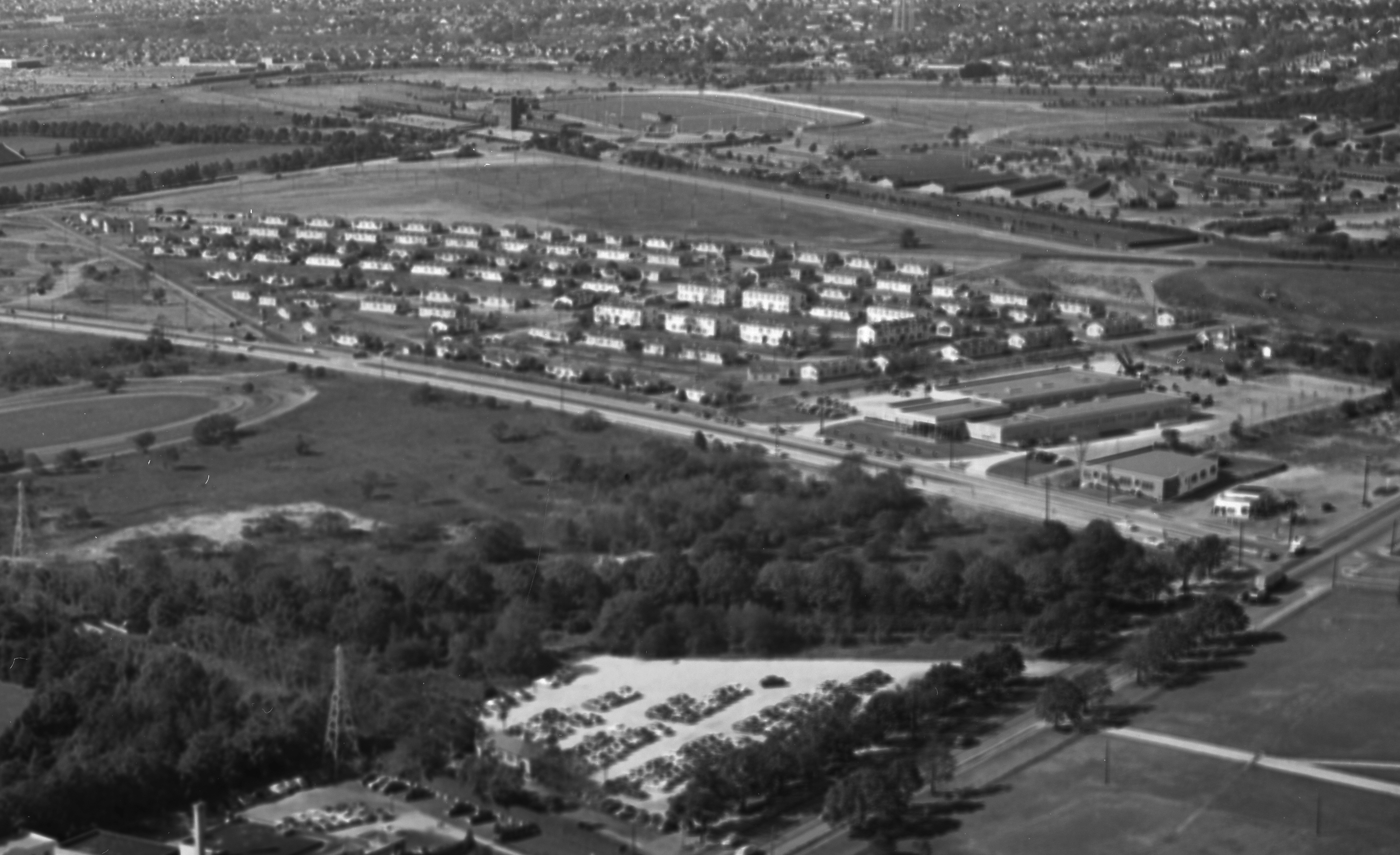
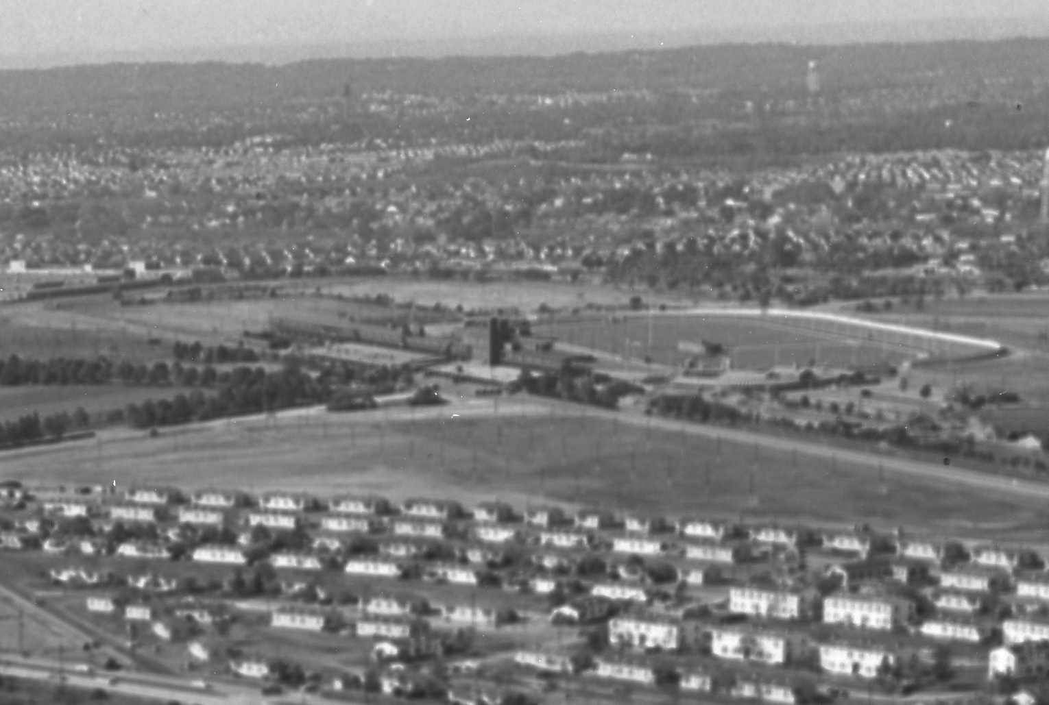
Close-Ups
Meadow Brook Lodge in the middle on the far right.
Mitchel Gardens and Roosevelt Raceway
The Meadowbrook Lodge is in the middle of this close-up.
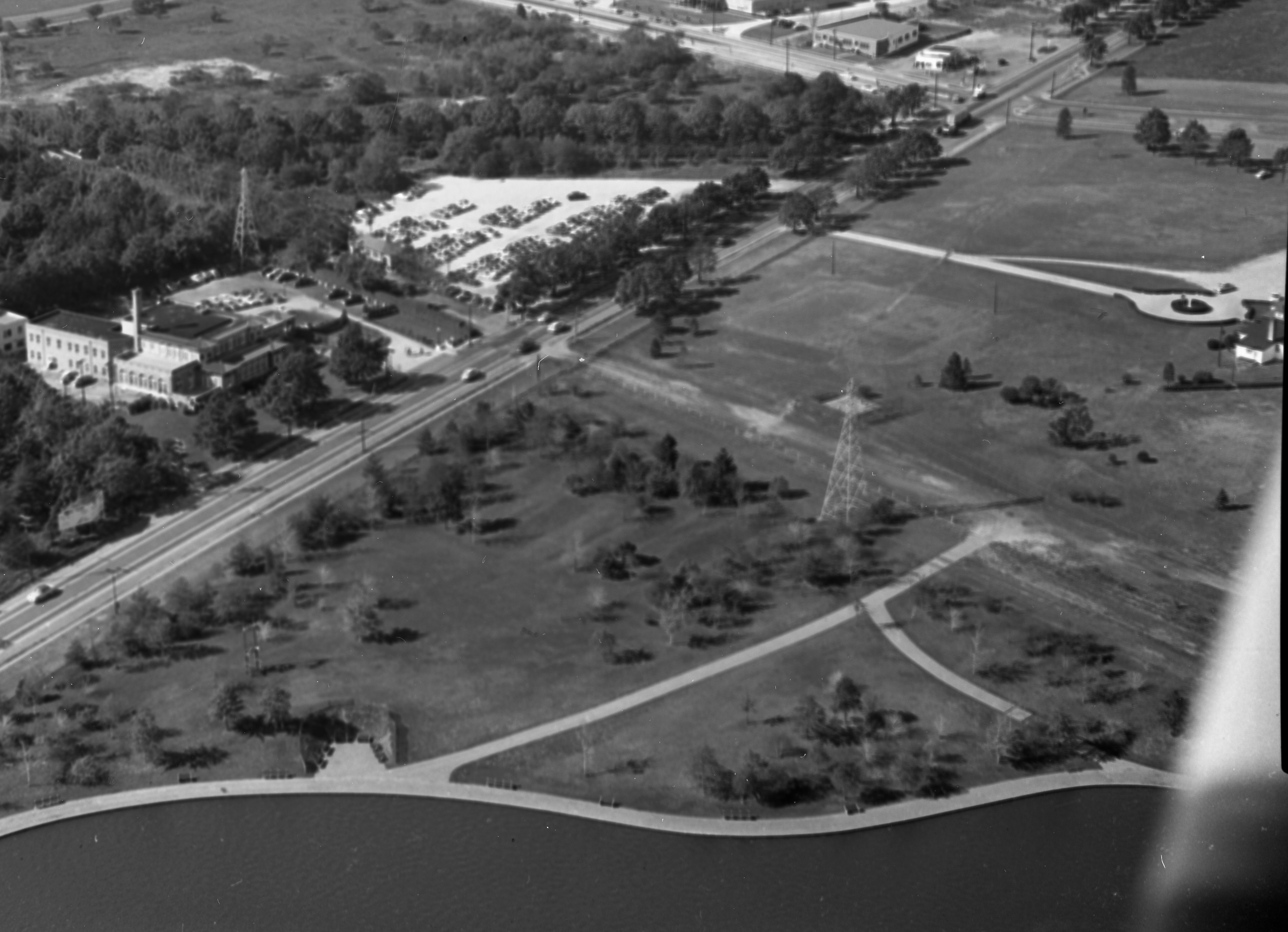
The Central Railroad right-of-way.
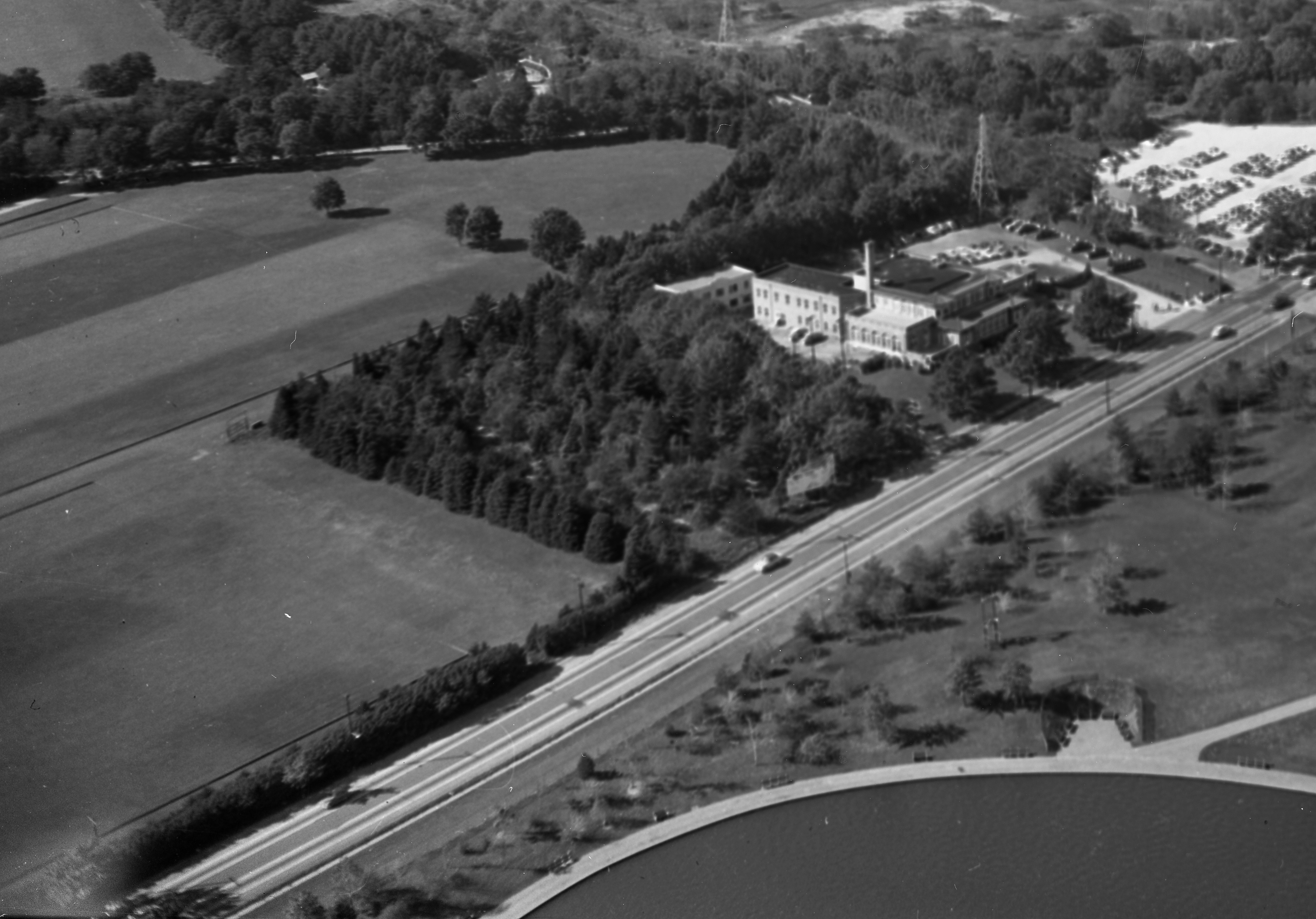
Salisbury Park Pond and the former Salisbury Club Clubhouse


Comments
-Location of the Mystery Foto and orientation of the photographer
Looking Northwest flying directly over the small lake on the West side of Eisenhower Park.
-The major roads and buildings
Merrick Ave diagonal on the bottom right corner, Stewart Ave running semi-horizontal in the center of the photo. Roosevelt Field hangars far off in the upper left. Salisbury Links Clubhouse. I also spot the railroad trestle that still stands in the cloverleaf entrance to the current Meadowbrook Parkway.
-Link the Mystery Foto to the Vanderbilt Cup Races
Parts of the 1908-1910 race courses were run through this area as well as the 1936/37 Cup Races towards the right side where Rossevel Raceway was located.
-Link the Mystery Foto to the Long Island Motor Parkway
The LIMP ROW ran ran horizontally across the center of the photo. Tough to see due to resolution, but I believe I see the Meadow Brook Lodge still standing with Otto McCamish waiving to the plane out front. OK, maybe I don’t see Otto….
-The date of the Mystery Foto. Provide a rationale.
No Meadowbrook Parkway or Rossevelt Field mall construction yet. My guess is 1951.
As I write my answers, on the TV in the background, is Howard explaining the Roslyn Grist Mill’s ‘message in the bottle’ to Danielle Campbell on News 12. Great find Howard!
Location: Over the Eisenhower (Salisbury) Park pond. The photographer is looking northwest. Merrick Avenue runs from the lower left to the upper right. In the picture can be seen, crossing Merrick Avenue from south to north, the remnants of the old Central Railroad, then Stewart Avenue, then the remnants of the Motor Parkway.
North of Stewart Avenue is the Mitchel Gardens housing development. West of that, the Meadow Brook Polo Club, and west of that, Hazelhurst Field. South of Stewart Avenue is the area that became Nassau Community College.
Is that Ellison Avenue between Mitchel Gardens and the polo club? That would be a connection to the VCR, since it was part of the ‘08 course.
I see no sign of the Meadowbrook Parkway, so I’m placing the Foto in the late ‘40s.
This is the intersection of Stewart ave. & Merrick ave. in Westbury. The photographer is looking Northwest. Merrick ave. runs diagonally from lower left to upper right of photo. The lake and open land to the right of Merrick are part of Salisbury park (now Eisenhower). Large tract of open land at upper left edge is Roosevelt field(the air field). I don’t know the date,but there is no Meadowbrook pkwy. I’m going to guess at the mid to late 1940’s.
addition: I recognized the large building in the closeup of the intersection as the former store of H.O.Penn machinery (Caterpillar dealer). They moved to Holtsville. The building then housed an International truck dealer, I don’t know if they are still there.
We are over East Meadow looking northwest toward Westbury (East Garden City). Major roads are Stewart Avenue, Merrick Avenue, and Old Country Road off in the distance. Some buildings include various structures for Roosevelt Fields (airfield and raceway), the old clubhouse for Salisbury Links and the Mitchel Gardens complex. The photo includes the site for the 1936 & 1937 V. C. Races and a portion of the course for the 1908, 1909, and 1910 V. C. Races. Remnants of the LIMP can be found just beyond the Mitchel Gardens along with the site of the Meadow Brook Lodge slightly to the right of that behind the trees. Since the Mitchel Gardens are completely intact and there’s no sign of the future Meadowbrook Parkway, I’ll guess the date to be around 1950.
Looking northwest over then Salisbury Park and it’s lake. Merrick Ave runs from bottom to top on a diagonal and Stewart Ave right to left. The date? Salisbury Park opened in 1949 so it’s after that. There is no hint of the Meadowbrook Parkway which was built from 1953-56. Also, there is no sign of railroad tracks, temporary (Levittown construction) or otherwise so it is after 1951 when the last Levitt houses were constructed and before 1953. The old Salisbury Plains LIRR station can be seen as can the (still extant?) LIRR bridge over the Meadowbrook Club entrance road. The Motor Parkway row would have run from left to right just north of the still visible LIRR row and Lilco towers.
Meadowbrook Club looking NW from over Salisbury/Eisenhower Park with Post/Merrick Avenue running from lower left to upper right and LIRR Central Branch running from upper left to lower right. Salisbury Plains station at near side of parking lot. LIMP in distance. Flying fields at far left. Sam, III
Garden City looking northwest from Salisbury Park
Merrick Avenue on the right (diagonal from lower left to upper right)
Stewart Avenue bordering Mitchel Gardens housing complex
Building off of Merrick Avenue is the Meadowbrook Train Station years before this picture was taken. The building became a test site for scientific experiments, including sonic booms (see picture). Smith property in the park just east of Merrick Avenue. Polo field grandstands.
VCR ran through the area as does the Motor Parkway north of Mitchel Gardens
Late 1940s - pre-Roosevelt Field and Meadowbrook Parkway. Mitchel Gardens still there.
Over Eisenhower Park in Salisbury looking NW, directly above future Nassau County 9/11 Memorial. Merrick Av, Stewart Av, Park Blvd, Meadow Brook Hunt Club access road and CRR bridge, and Meadow Brook Lodge access ramp to Motor Parkway hidden under the trees. The lodge and its porte cochere are visible. Salisbury Links clubhouse in the foreground and the Salisbury Plains RR Station just to its north. RR crossing at Merrick Av. Meadow Brook lodge was the starting point for the 1908-10 Vanderbilt Cup Races. Photo taken sometime before 1960’s, before the lodge was removed.
Photos below of the Salisbury Plains RR Station by Merrick Ave, and CRR bridge over the Meadow Brook Hunt Club access road, courtesy of NassauCountyNY.gov and Arrts-Arrchives.com
Like Frank above, courtesy of Arrt’s Arrchives below. A good number of the Transmission Towers, some seen in the mystery foto, have been removed. Probably around the same time of the construction of the Meadowbrook Pkwy. Electric is below ground now. There’s 7 towers west of Carmen Ave ( Blue Course ). Then the towers commence just west of the Meadowbrook Pkwy.
Must have missed this over the holidays.
This has got to be the clearest photo of the Mitchel Gardens development yet. Originally built as a WPA project to house civilian employees at Mitchel Field, it was taken over after the War by the Air Force and used to house low ranking personnel through the mid ‘60’s.
Kids living in those houses (more like shacks) went to Uniondale schools as the Uniondale School District extended as far North as Old Country Road. Growing up on Mitchel Field proper, I can remember our school bus stopping at Mitchel Gardens as late as 1966. The property was later used as drug rehab housing by the early ‘70’s and today is the site of the recycling plant on Stewart Ave.