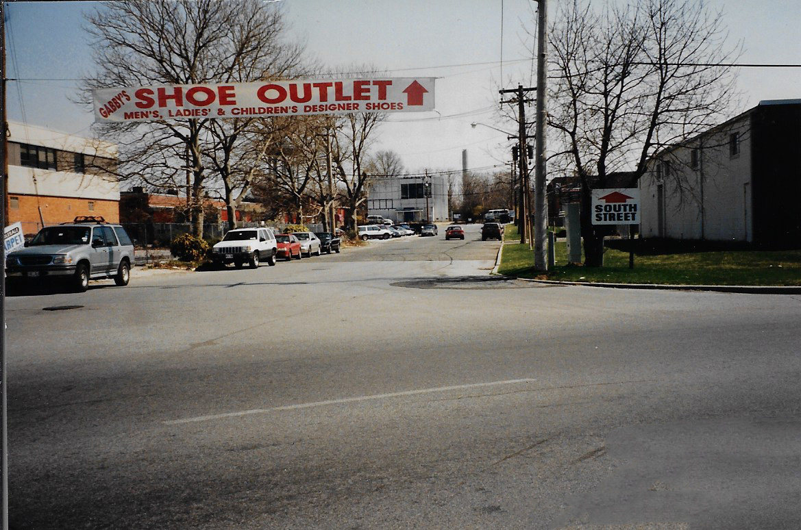
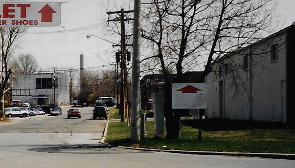
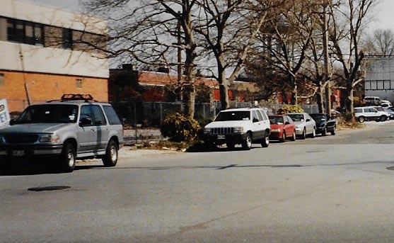
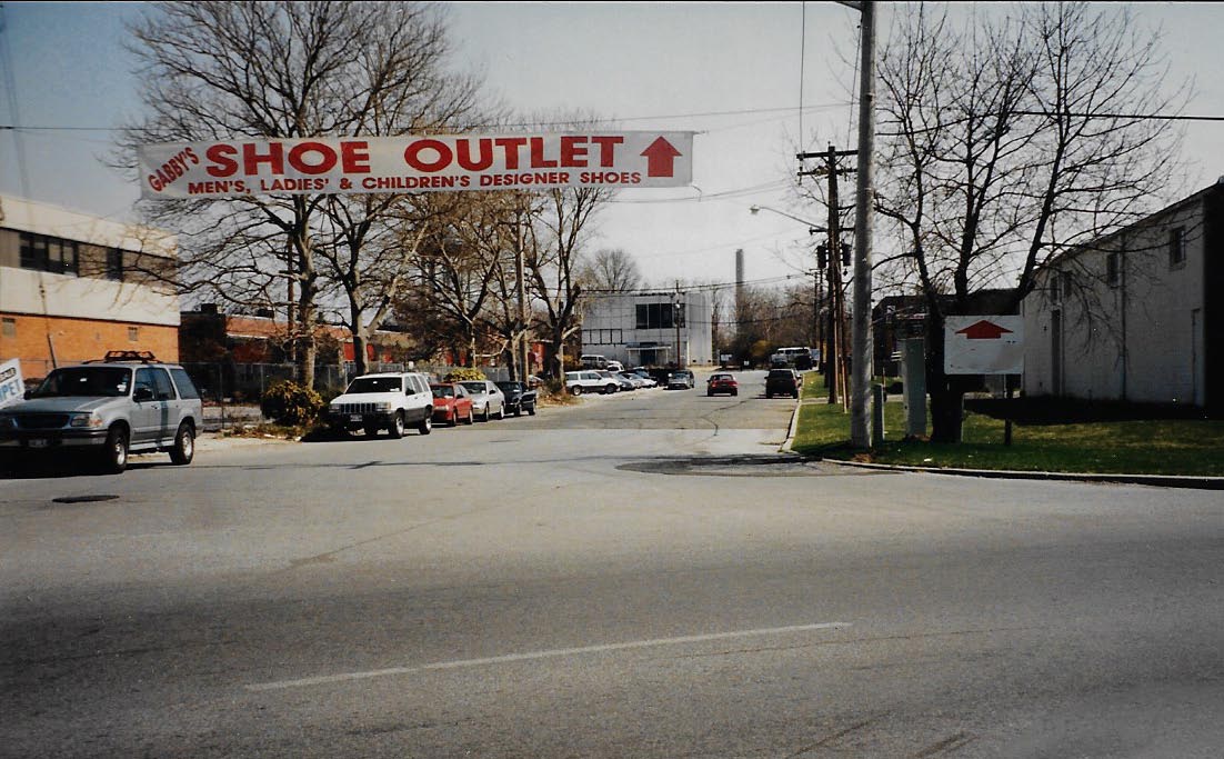
Mystery Foto #22 Solved: South Street On the Motor Parkway Right-Of-Way in East Garden City

My favorite co-author Al Velocci challenged you to solve this weekend's Mystery Foto.
Mystery Foto questions:
- Identify the location of the Mystery Foto and the orientation of the photographer Al Velocci. Provide a rationale.
Al was standing at the southeast corner of Roosevelt Field at the end of Ring Road looking east to an extension of South Street. Rationale: The Covanta smokestack in the background.
- What year was the Foto taken? Provide a rationale.
1998. The automobiles.
Comments (14)
Congrats to Greg O.,Dave Kilkenny, Wayne Woodbury, Joseph Oesterle, Dave Russo, Al Prete, Brian McCarthy,Lee Chambers, Art Kleiner, Mark Lanese, Steve Lucas, Chris Lindsley,and Michael LaBarbera for identifying the South Street location.
Kudos to Greg O., Wayne Woodbury,Al Prete, and Art Kleiner for getting close to the 1998 date of the photo.
Be Safe, Stay Healthy, Save Lives,
Howard Kroplick
Original Photo from Al Velocci
Close-Ups
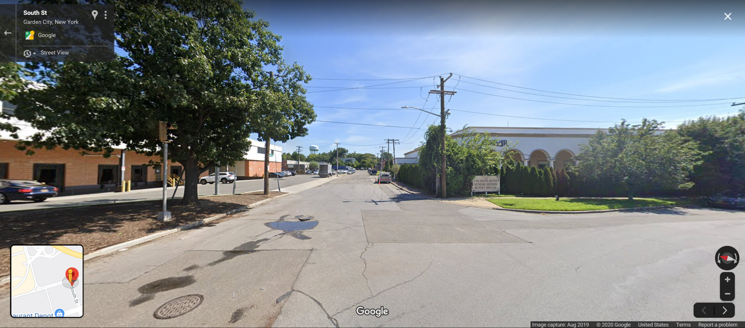
Now- Google Maps
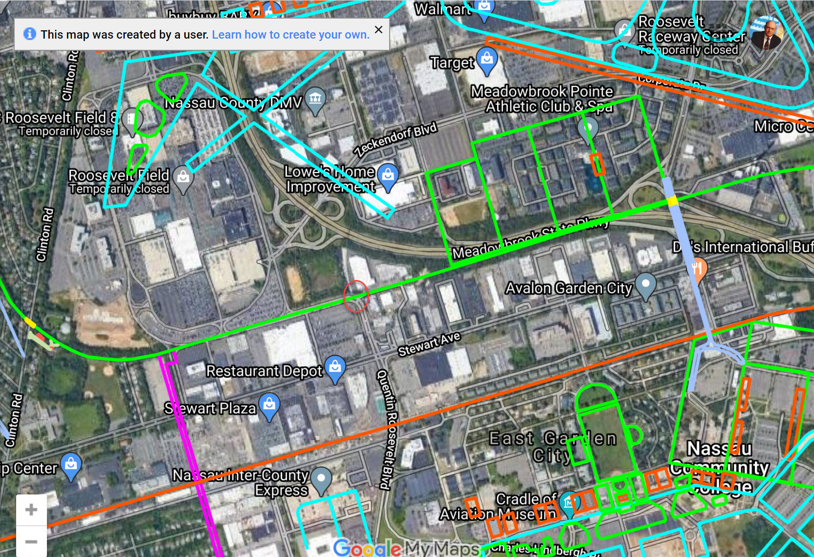
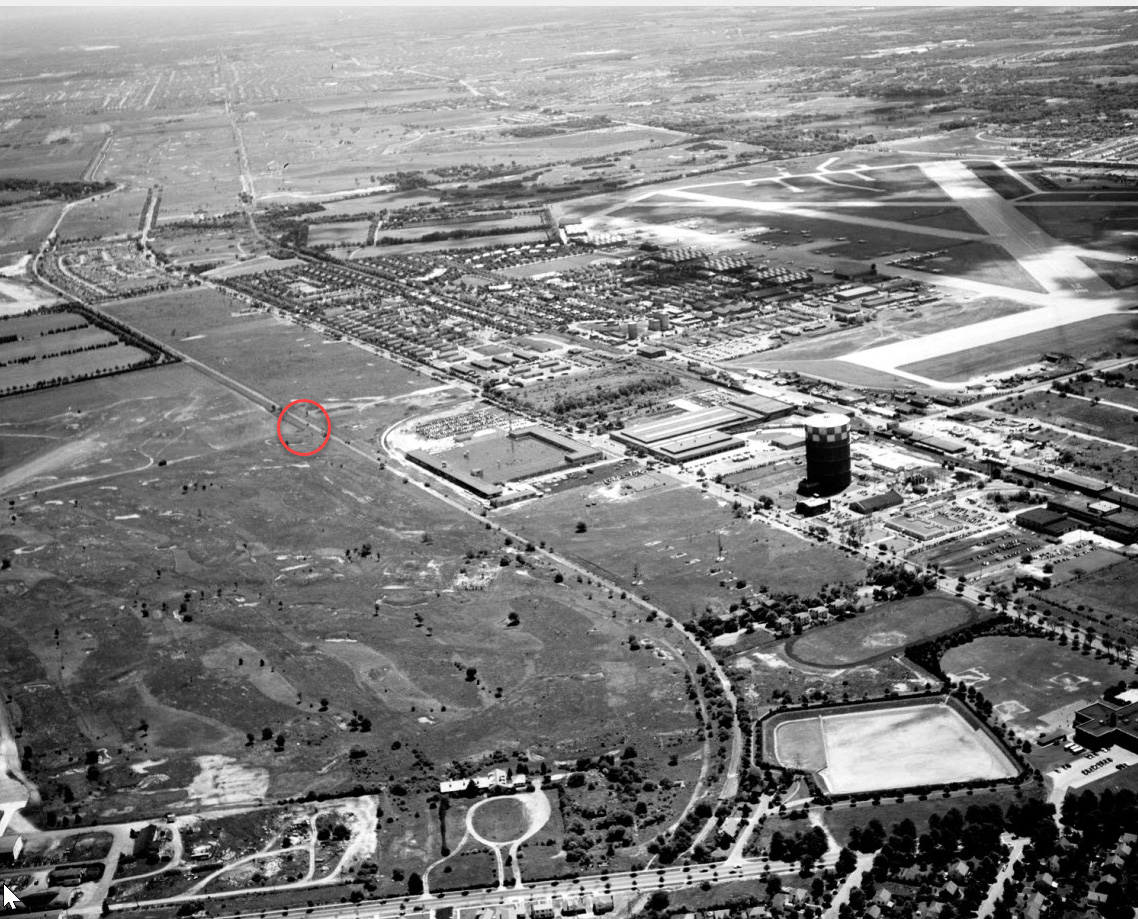
Aerial-1938
Aerial-1950
Aerial-1956
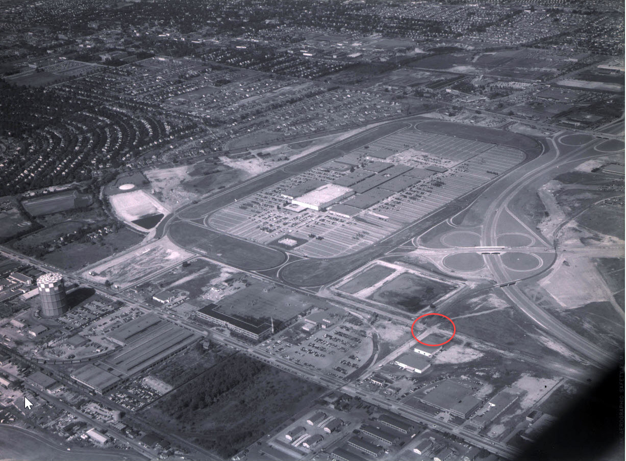
Note: The open-air Roosevelt Field shopping center.


Comments
Al is standing on the sharp curve on South Street (looking East down the dead end extension) -at the southeast corner of Roosevelt Field. (At Al’s back directly behind him was a Benigans I’d often go to at that time.) Judging by the years of the closest identifiable vehicles (Ford Explorer, Jeep Cherokee, Honda Civic) I’d place this sometime around 1998.
The sharp bend on South St./Ring Rd
Al is standing on South Street in East Garden City facing east. He is looking down an extension of South Street on the old VP ROW that ends at a dead end. You can make out the stack of Covanta in the distance. In the current day, BJs parking lot is behind him and Akbar would be to his right.
I’m guessing the year, but ‘92 is my guess based on the age of the cars.
The photographer is looking east down South Street from the Ring Road around Roosevelt Field. The buildings pretty much match those on a current Google Earth Street View. The Covanta stack to the east gives it away. I am crap at car models but I would say 2000.
Southeast corner of Roosevelt Field. Looking East.
No research, I’m 99% sure I know this one: Current LIMP I know. When you send pics from 100 years ago I have no idea (but still love it).
Garden City, South Street, looking East. This leads up to a fence that enters you into the woods to the south of the Meadowbrook, and north of Stewart Ave. That big driveway is no longer there, trees come into that space now.
Al is looking east on South Street in Garden City (S of Roosevelt Field mall and N of Stewart Avenue). Rationale: The smokestack in the background, which I figured to be the Covanta smokestack. This is the only road near the Covanta plant that lies in a straight line right over the Motor Parkway. The building on the left, and the large white building to the left of the smokestack, match buildings in Google Street View.
I found a document on the internet that indicates that Gabby’s Shoes was located at 11 South Street. This address is occupied by Bolla Transport today, according to Google Street View. If I only knew when Gabby’s went out of business, I could probably figure out when the Foto was taken. Without that info, and judging by the cars, I’m guessing that it was sometime in the 1990s.
Al captured this image on South St, this road is ‘T shaped’ between Stewart Ave and Roosevelt Field. The view is the east section that deadends. I always wondered about the building at the end, facing west. A bank maybe? Abandoned currently. Time period looks like 1990 - 1995. That’s the Covanta Stack, e/o Meadowbrook Pkwy.
The Covanta tower is the largest clue. Photo is East of the Ring Road at Roosevelt Field, running parallel to Stewart Avenue along the path of the LIMP in the direction of where Mitchel Gardens once was located near the tower.
The intersection in the foreground is the right turn running South and parallel to the LIRR spur that connects with Quentin Roosevelt Boulevard today at Stewart Ave.
Art Kleiner:
Causing me too much angst. But here goes - I’m assuming the smokestack is the Covanta plant off of Stewart Avenue. So I’m thinking the photographer is looking south from Old Country Road on Fulton Street in Westbury. Thought I found a listing for Gabby’s of Merrick Avenue but nothing else. Late 1990s or early 2000.
The picture, looking east was taken at the curve on South Street in garden City. The building on the right is still the Akbar catering facility. Judging by the cars most likely taken around 2004.
We’re looking east on South Street in Garden City. The road on the right comes in from Stewart Avenue, curves to the west, and functions as the southeast entrance to Ring Road and Roosevelt Field Mall. Gabby’s Shoes was in existence from 1983 to 2003 when it dissolved according to court records. I’m thinking that Gabby’s Shoe Outlet may have been a successor so I’ll guess the date of the photo to be around 2004-2005.
The Pic is of the ROW as it goes east from Roosevelt Field. The ROW is the eastbound roadway of the Mall access road. Just after the ROW passes by the Mall, you crossed over tracks (not here now) the mall road diverged south but the Row continus as South Street ( I believe) for about 300 yards, dead ending at a fence. However, there were trace of ROW beyond the fence as of 2002. I am going to say the time of the photo is 2005
Motor Parkway at eastern end of Roosevelt Field shopping mall facing east. Looks like Akbar restaurant didn’t have roadside service yet !! (late 80s timeframe). What would be a cool thing here on this site would be to have some info and pics then and now of the area on the other side of the last building east to Merchants Concourse. Theres gotta be some ruins up there
From Art Kleiner:
Great shot, Al. Another example of me getting one answer in my mind and not being able to think past that. Simply looking at a map of the Parkway would have helped!
There’s always the next one!
Great job guys identifying what today is called South St. Previously it called New Street when it was just that, and, even before that, referred to as Commercial Avenue. We almost didn’t lose that section of the Parkway. 1950 the County proposed to re-open the Parkway from Post Ave westward to north/south Ring Rd. on the west side of Roosevelt Field. It was the announcement of the developing of Roosevelt Field that prompted the County to make this statement. As we know it didn’t happen, did Moses step in (that early ?) and tell the County “whoa, I got plans for that property”, I could not find any evidence to support that speculation. In any event Hempstead town acquired the 100 foot wide ROW, built what was then called New St., on the most, roughly 60 foot portion, and sold off what was left to developers.
Regarding the large white building at the far end of my photo. No Brian, it wasn’t originally a bank building, the one that Al Prete also described as a dark building. It was built and first occupied by the Civil Air Patrol. On January 1, 1975 the County leased that portion of the ROW (I believe it measured 100x100), to that group. The lease ran to December 31, 1999. After they moved out it was occupied by a bank, I think it was Chase, Its been abandoned for quite a while, I think the County still owns the property. When I took the photo I was accompanied by my good friend Dan Di Masi, also a Parkway buff whose moved to Florida a few years ago, At the time we explored the area east of the building and did find a couple of concrete posts. That was more than 20 years ago, they might still be there.
Thanks, Al. Perhaps not as it’s now, but the white building appeared like there was ‘important business’ happening within. Was surprised to see a past friend & coworker of mine in the 1966 article below.