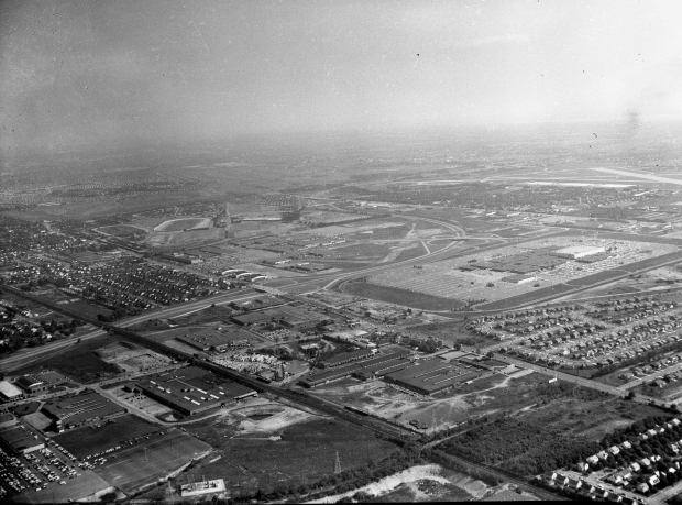
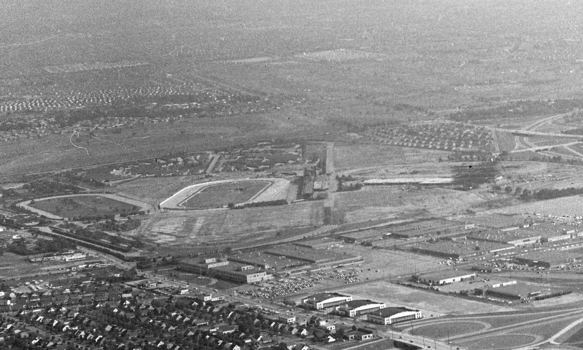
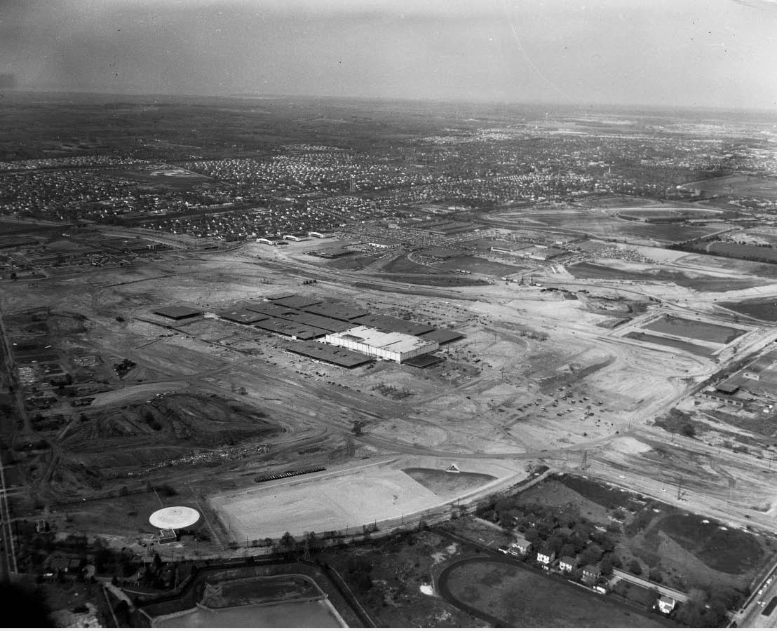
Mystery Foto #2 Solved: A 1956 aerial of the new opened Roosevelt Field and almost completed Meadowbrook Parkway
The Cradle of Aviation Archives challenged to identify this weekend's Mystery Foto.
Answers to the Mystery Foto questions:
Identify the following:
- Location and orientation of the photographer
The airplane was over Mineola looking southeast over the newly opened Roosevelt Field Shopping Mall (not yet enclosed).
- The major roads
Motor Parkway can be seen in the right corner of the Foto. Note the utility towers.
Old Country Road is on the middle of the Foto in the diagonal. Note the three hangars of Roosevelt Field next to the still to be opened Meadowbrook Parkway.
Ellison Road is east of the two horse tracks of the old Roosevelt Raceway.
Glen Cove Road is west of Meadowbrook Parkway and becomes Clinton Road south of Old Country Road.
Stewart Avenue can be seen south of the shopping mall with the Motor Parkway right-of-way.
- The significant buildings and complexes (More below in Comments)
Roosevelt Raceway (old) and the practice track are on the left, while the grandstand of the new Roosevelt Raceway is being constructed.
Mitchel Gardens complex is southeast of the grandstand construction.
The Avis World Headquarters is on Old Country Road, east of the three hangars.
E.J. Korvette's is on Glen Cove Road.
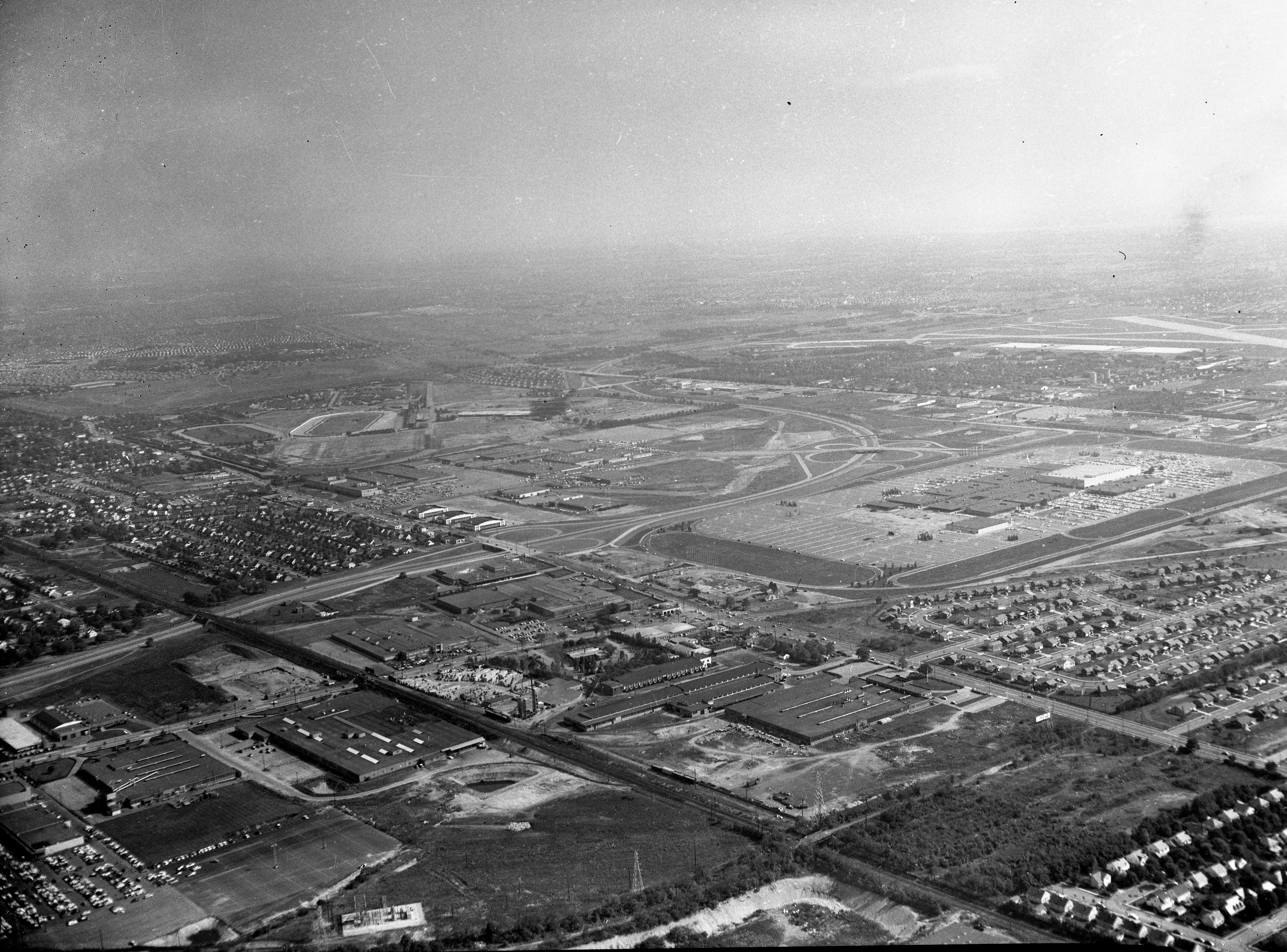
The newly opened Roosevelt Field Shopping Mall is highlighted in the Foto. Note the remnants of the runways can still be seen to the east of Meadowbrook Parkway.
The still active Mitchel Field is in the background.
- Link the Mystery Foto to the Long Island Motor Parkway
The Carle Place/Mineola section and the "Ring Road" section of the Motor Parkway are visible with the Mineola LIRR Bridge still intact.
- Link the Mystery Foto to the Vanderbilt Cup Race(s)
The old Roosevelt Raceway was the site of the 1936 and 1937 Vanderbilt Cup Races. The 1908, 1909 and 1910 Vanderbilt Cup Races ran in this section of Ellison Road and its extension to the Motor Parkway.
- The date of the Mystery Foto. Provide a rationale.
October 20, 1956. Rationale: The mall opened in August 1956 and the Meadowbrook Parkway was almost completed.
Comments (14)
Congrats to Joe Osterle, Maria Pisano, Al Prete, Lee Brodsky, Lee Chambers, Glenn Gordon, Steve Lucas, Ernie, George Philippides, Greg O. ,Casey DeNicola and Frank Femenias for identifying Roosevelt Field.
Kudos to Lee Brodsky, Lee Chambers, Steve Lucas, and Frank Femenias for posting the 1956 Mystery Foto date.
Enjoy,
Howard Kroplick
Close-Ups
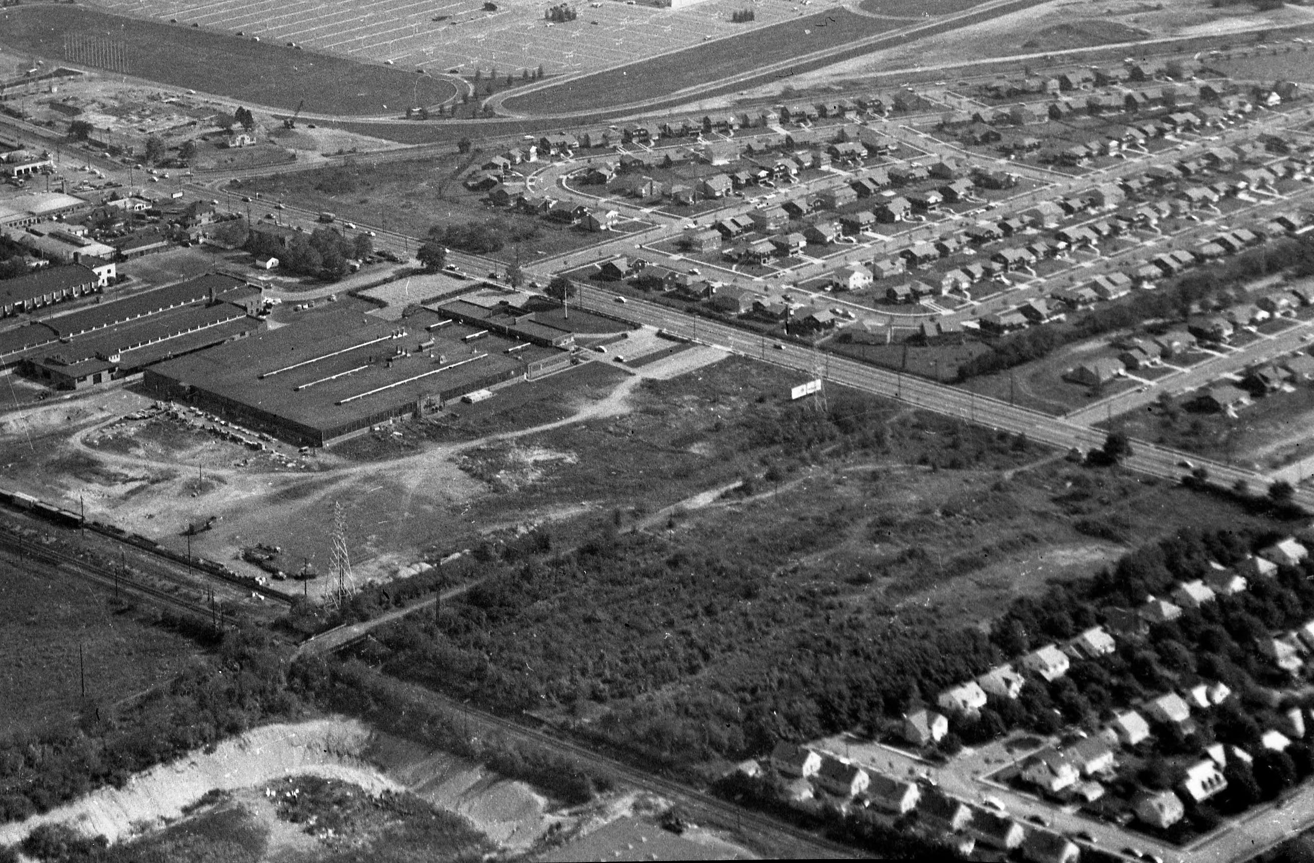
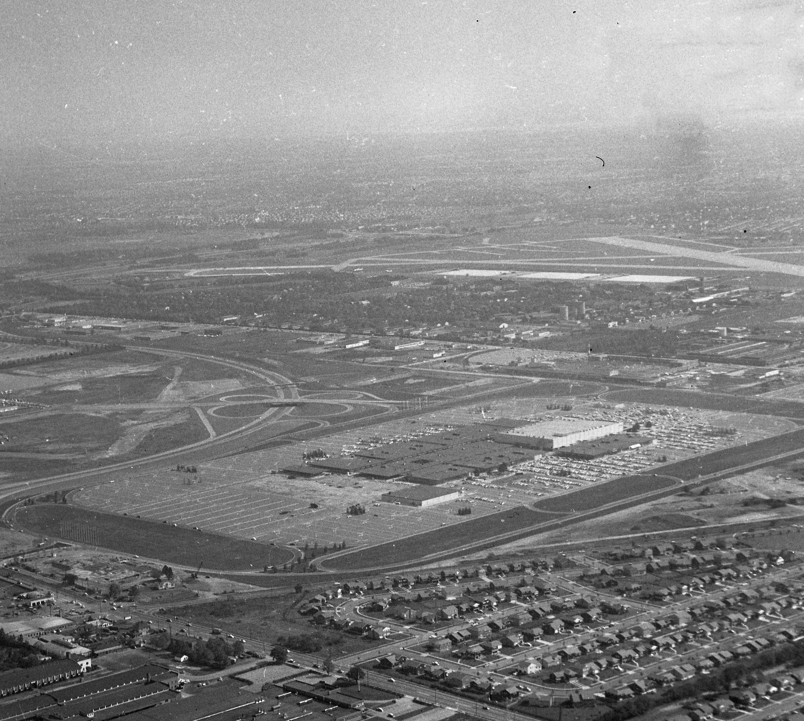
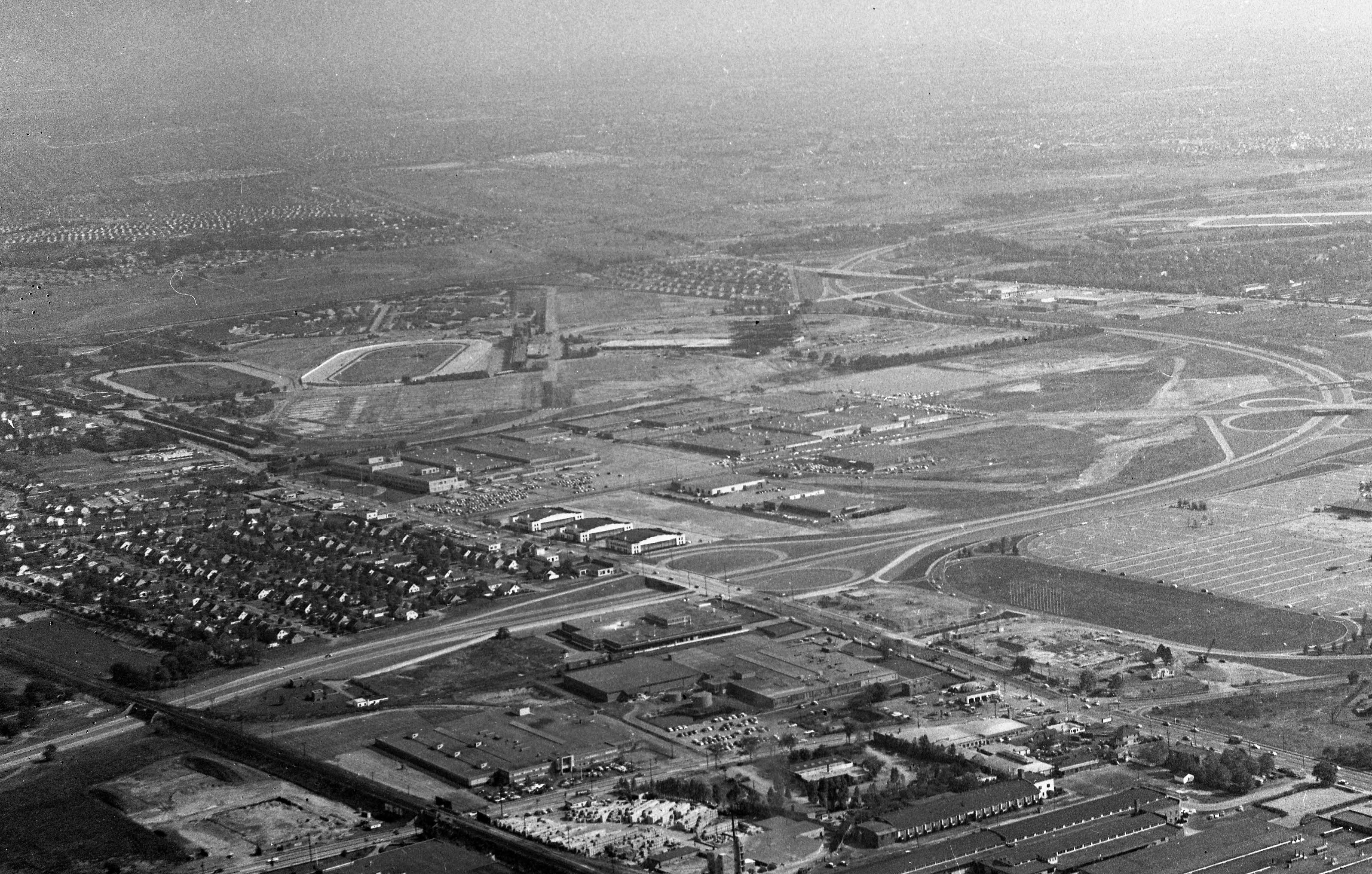
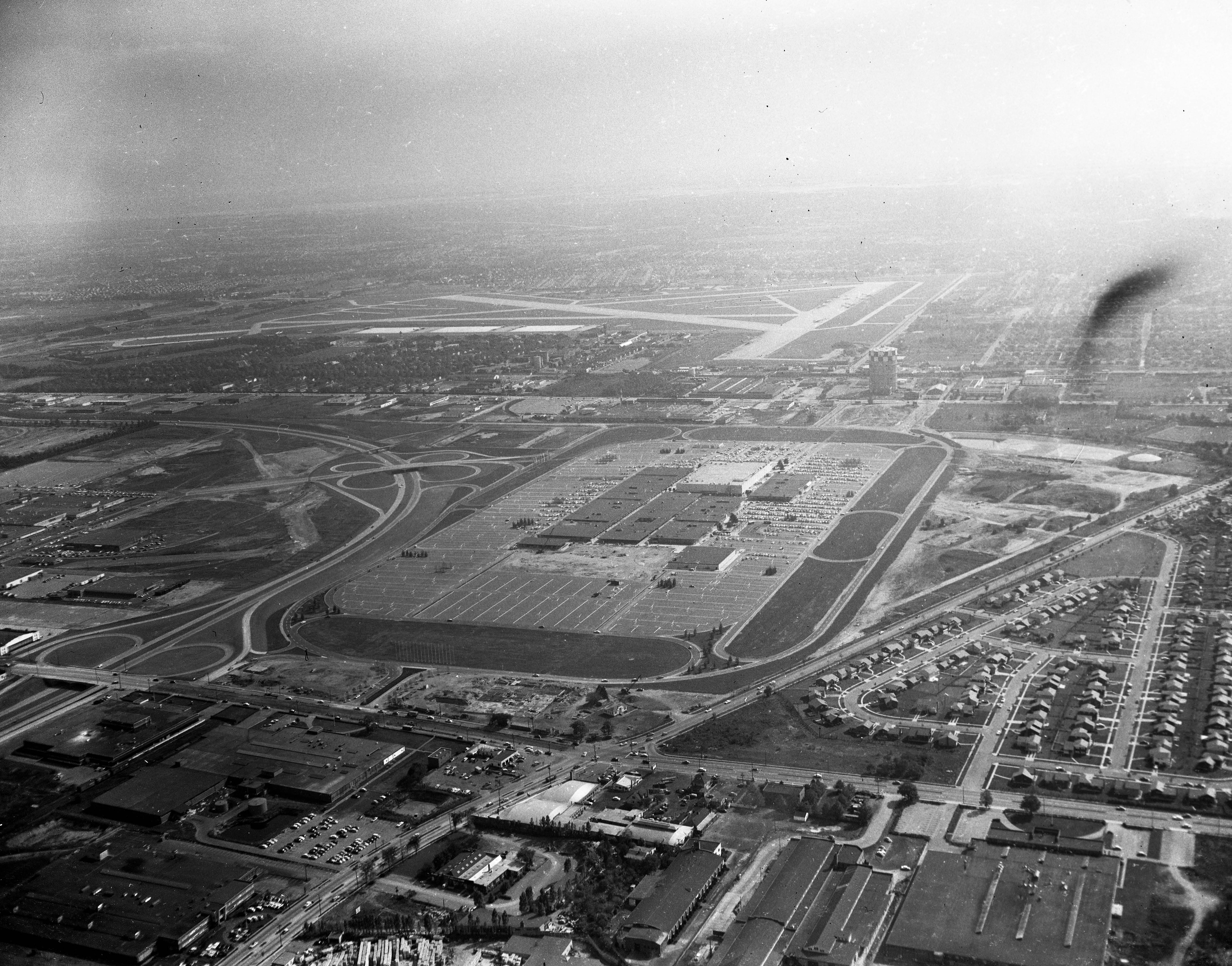
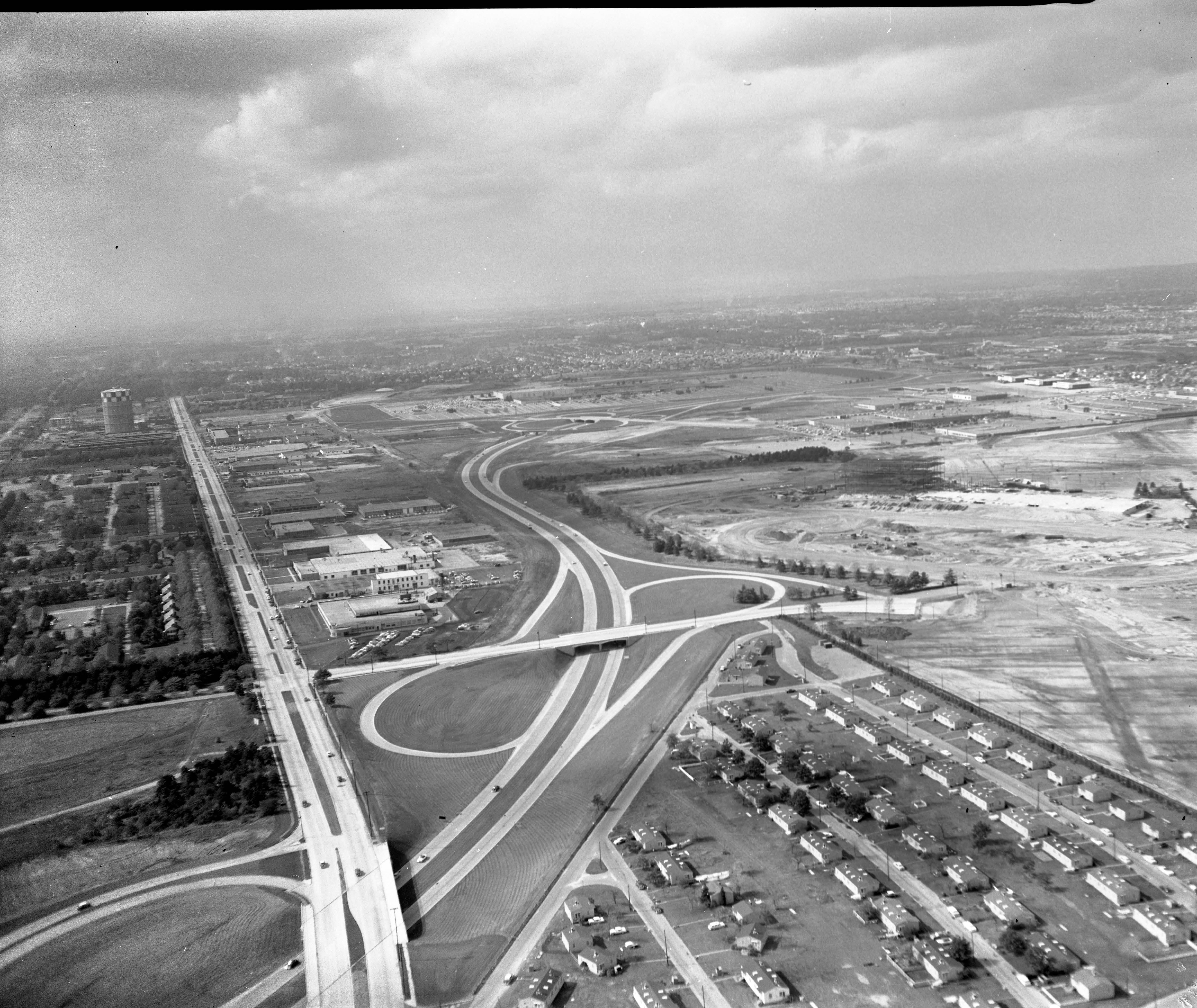
More Amazing Roosevelt Field aerials form the Cradle of Aviation.
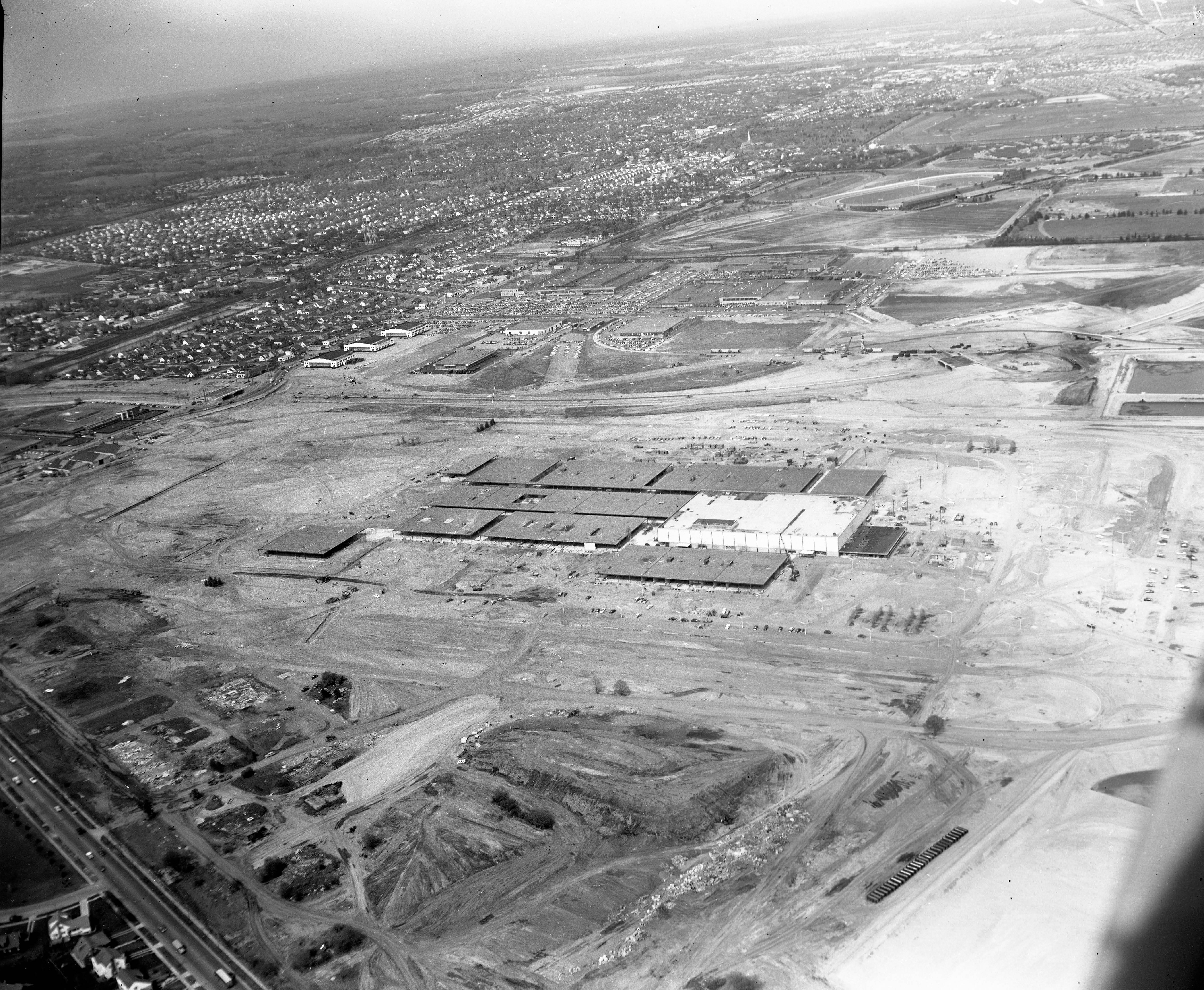
May 1956
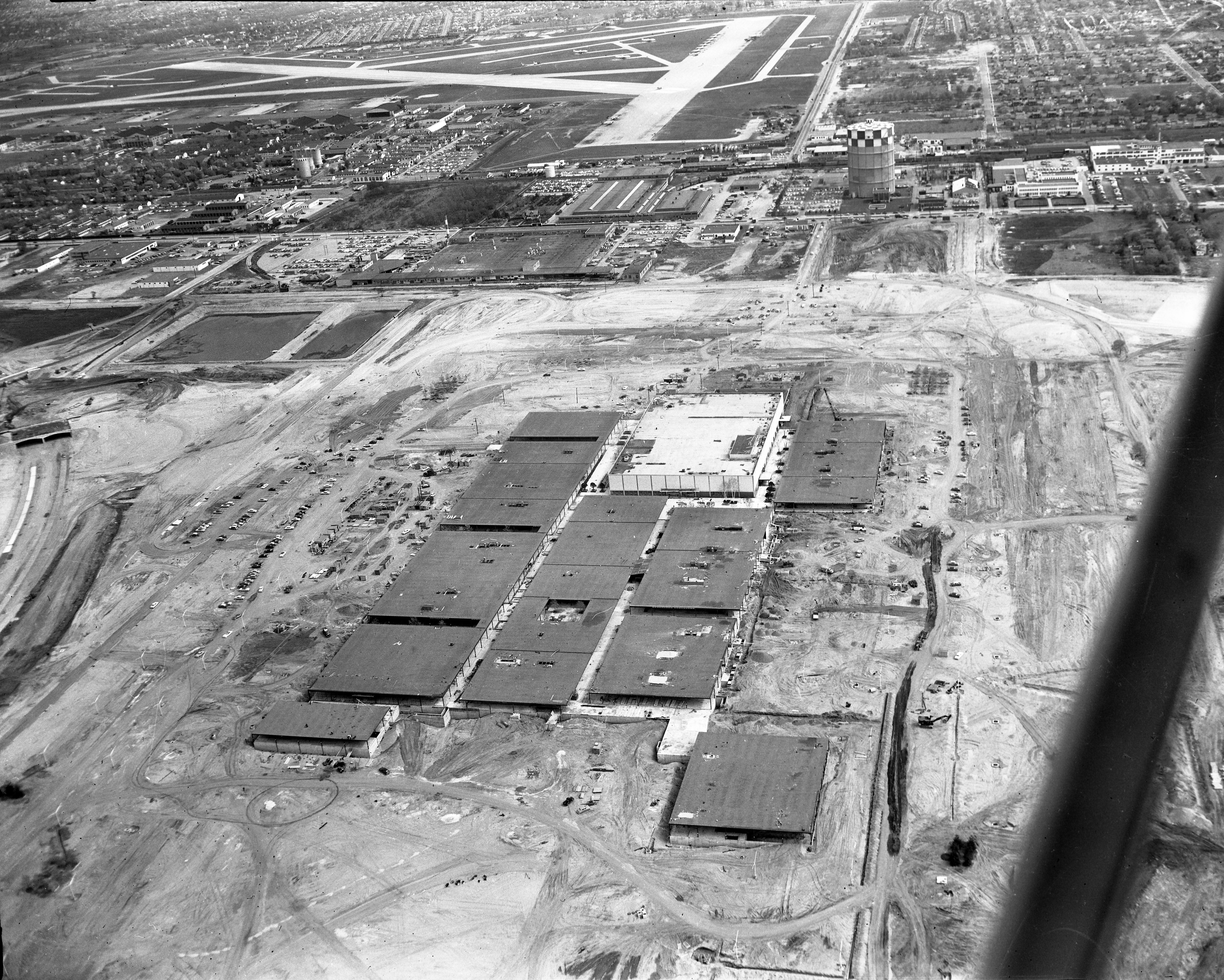
October 1956
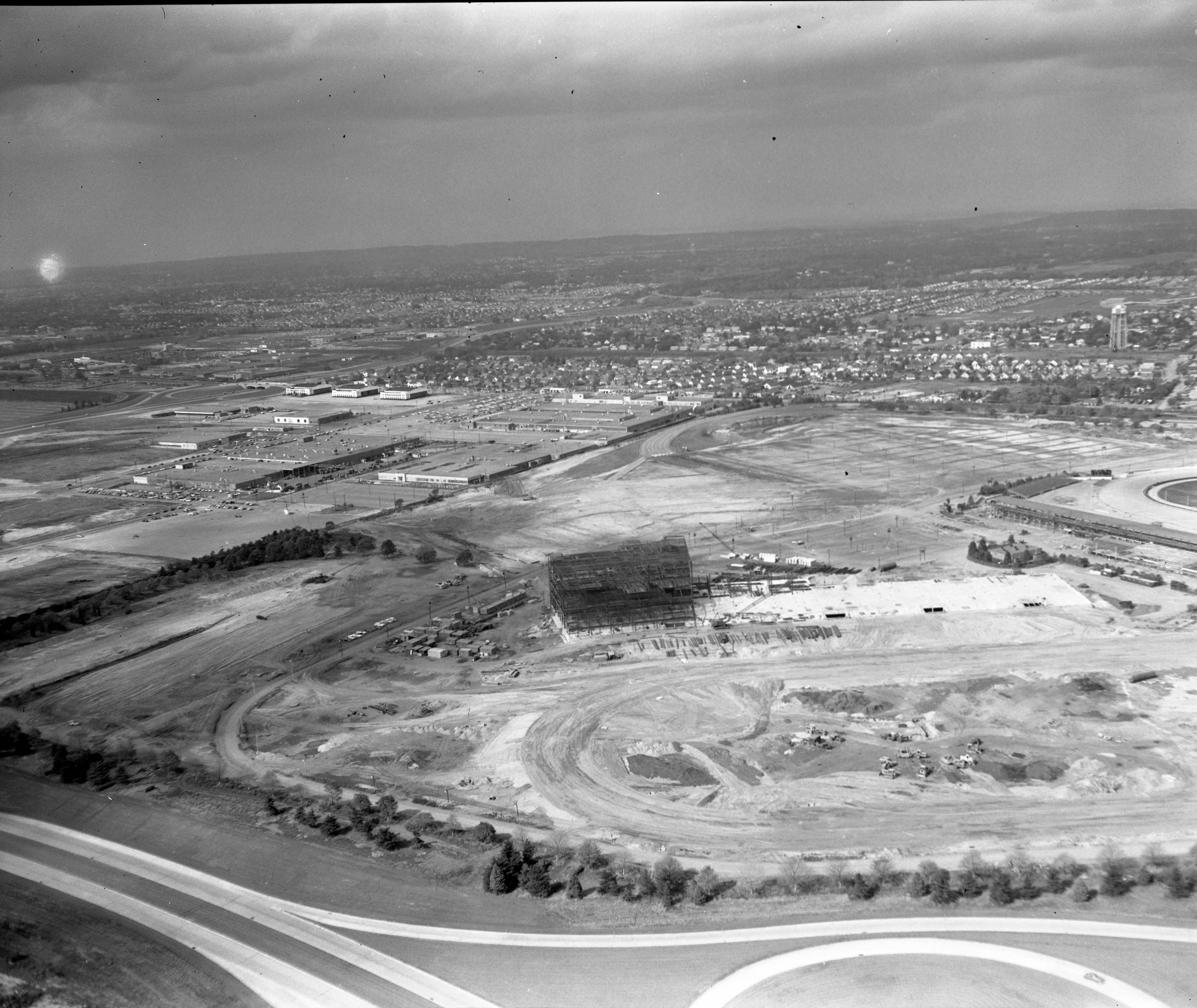
Looking northeast to the new Roosevelt Raceway grandstand under construction. This section of the Meadowbrook Parkway appears to be open.
Mitchel Gardens can be seen in the right


Comments
We see Roosevelt Field, late 1950s, from NW looking SE. LIMP bridge over LIRR in Mineola visible in lower right corner.
Orientation South /East
Motor Parkway bottom of foto from left diagonally to the right crossing over the LIRR between Mineola( west ) to Carle Place( east) crossing over Old Country Road into the Mott section of Garden City
Continuing along OCR east crossing over the Meadowbrook Pkwy ,3 Hangers from Roosevelt field.
Further along on the south side going east is Roosevelt Raceway two oval tracks . Vanderbilt race were held here.
In the middle of foto is Roosevelt Field Mall maybe mid 50’s?
The top of the foto is Mitchel Field
To left in the distance is Salisbury Park. That’s all I got☺️
Location: Northwest of the Roosevelt Field shopping center. The photographer is looking southeast. Major roads: Meadowbrook Parkway, Old Country Road, Clinton Road, Stewart Avenue. The LIRR Main Line and the old Central Rail Road can be seen. Buildings and complexes: The shopping center, Roosevelt Raceway, hangars on Old Country Road east of the parkway, and Mitchel Field.
I place the date between 1957 and 1959 because the parkway is complete, the shopping center is open (cars in parking lot), and there doesn’t appear to be any sign of Nassau Community College.
The LIMP ran between Roosevelt Field and Mitchel Field and crossed Clinton Road nearby (just out of range of Foto). Connection to VCRs: The LIMP and Roosevelt Raceway both hosted races.
Looking Southeast toward the New Roosevelt Field Mall.
Seen in the picture Old Country Road (East -West)
LIRR (East-West)
Meadowbrook Parkway (Looking South)
Vanderbilt Parkway crossing over Old Country Road and the LIRR Tracks (Bridge Seen)
Avis World HQ - Old Country Road (Now 2 story Shopping Center)
Original Race Tracks - Old Country Road (Now where Fortunoff Mall (1964) is located)
Hangers still seen on Old Country Road (Corner of Meadowbrook Pkway)
Approx. date of picture 1956 (Macy’s opened) (as seen in the mall overhead)
View looking Southeast towards East Meadow.
Roosevelt Field Shopping Center is visible. Photo is pre-1962 as Gimbels has not yet been built.
Meadowbrook Parkway interchanges at Old Country Road, Zeckendorf Blvd. and Stewart Ave. / Merchants Concourse are in place. Lack of cars on the parkway suggests it may not have opened yet in 1956.
Remaining standing hangers are seen along Old Country Road.
New grandstands at Roosevelt Raceway are not yet in place, post 1955. Original car racetrack used by the VC and reviewing stands are still in place. Pre-1956. Housing at Mitchel Gardens is adjacent to the track and borders the LIMP. Salisbury Park is east of Merrick Ave.
Remains of the LIMP can faintly be made out south of the Mall, running parallel to Stewart Ave. and the LIRR’s Central Line.
Runways at the still active pre-1961 Mitchel Field are in sight.
LIRR mainline through Westbury is in the immediate foreground.
GRUMANN LOOKING NORTH WEST 1950 S?
Old country Rd. east to west with Roosevelt race track in the distance going west you see Arma Defense Plant, 3 hangers one was Murry D-Kays across from hangers WAS
Joe Cranes Parachute Co. Going over bridge [ Meadow-brook parkway ] you’ll find Mason Mint candy plant on the right still going east on O.C.Rd..Next would be Roosevelt Field on the left .There was a Mobil gas station at entrance to the field.
At the next intersection you have the end of Glen Cove Rd.[north to south] South side became Clinton Ave. if I remember correctly? At this intersection you had
Garden City Shell on your left going west and across O.C.R. you had a Sinclair station and The Old Country Dinner . I believe 3 towns came together there. CARL PLACE,GARDEN CITY AND MINEOLA.
Following Meadowbrook the next exit would be East gate blvd and the rear way into the field. Stewart Ave would be at that end of the field .
We are looking southeast over Carle Place / Mineola toward East Garden City. Major Roads are: Glen Cove Road; Clinton Road; Old Country Road; Meadowbrook Parkway; Stewart Avenue and Merrick Avenue off in the distance. Buildings and complexes include: Roosevelt Fields (Raceway, Shopping Mall, Airfield Remnants including hangars); E. J. Korvettes; Mitchel Field. The LIMP link is the old R. O. W. that ran south parallel to Glen Cove Road before turning east over Clinton Road behind the mall. The V. C. R. link is the site of the 1936 & 1937 races along with part of the route for the 1908, 1909 and 1910 races (Ellison Avenue extension). Because the mall looks completed yet very few cars in the parking lot, I’m guessing the date to be around its opening in 1956.
Location and orientation of the photographer: high above Roosevelt Field Shopping Mall looking south east.
The major roads: Meadowbrook Parkway sweeps lower left to upper right. Running east-west from north (bottom) to south (top) are the LIRR, Old Country Road, the Mall ring road, Stewart Ave.
The significant buildings and complexes: in addition to the mall we have left of center hangers from the field when it was an airport (later used by Murry the K as a disco), Roosevelt Raceway for harness races, Mitchel Field and its runways
Link the Mystery Foto to the Long Island Motor Parkway: the parkway ROW appears in the lower right corner, in fact the bridge over the LIRR is still there.
Link the Mystery Foto to the Vanderbilt Cup Race(s): Before Roosevelt Raceway was a horse raceway it was a speedway where several cup races were held.
The date of the Mystery Foto: Sometime between 1962 when Gimbels opened at the mall and 1983 when the LIMP LIRR bridge was removed.
This aerial is taken over Carle Place looking south east over East Garden City and Roosevelt field.
Major roads include Old Country Road, Clinton Rd,Meadowbrook Parkway.
Significant buildings and complexes include Macys, at the south end of Roosevelt Field, a few hangars on Old Country road, the Old Roosevelt Raceway.
The Long Island Motor Parkway ROW can be seen on the south end of Roosevelt field, now Ring road, and then again in the lower right of the photo as it moves north out of Garden City ( between Russel Rd and Pell Terrace) crosses Old Country road and moves north in to Mineola. You can see the LILCO electricity towers along its path.
SEctions of many Vanderbilt cup races are included in this photo: 1908, 1909, 1910, 1936, 1937 and 1960 according to past entries.
For the date, I would say sometime after August 1956, when Roosevelt Shopping center opened and before August 1967 when the Grandstand for the new Roosevelt Raceway went up.
BTW, the house I grew up in is in this picture ...on Avalon Rd in Garden City. I spent alot of time in Roosevelt field as a kid.
Great picture. Thanks for sharing.
Question. I don’t think I see Franklin National Bank? Do you know when that was built? I could not find that information. Thanks George
Similar to the mystery photo in November.
Looking Southeasterly at the Roosevelt Field Mall. Newly built Meadowbrook Pkwy, Old Country Rd, Glen Cove Rd, LIMP diagonal in the lower right corner. Mall still open air, Roosevelt Raceway off to the left, hangars still present on OCR. Michell Field far off in the background. A few VCR courses ran through the area as well as the 1936/37 and 1960 races all at Roosevelt Raceway.
Construction complete on both the mall and Meadowbrook, my guess is around 1957/58.
I want to amend my answer. This photo is actually being taken over Mineola,( not Carle Place) near the Mineola, Carle Place, Garden City border
Where to start! Photog is looking SE. over Westbury/Garden City area. The major roads are Old Country Rd.(mid left to lower right). Meadowbrook Pkwy.(mid lower left). Glen Cove /Clinton Rd.(left to right,lower third of photo). Stewart Ave. (upper middle of photo where East bound Pkwy. bends to the South. Group of dark roofed buildings is Roosevelt field shopping center. To the left, across parkway is Roosevelt airfield with 3 hangers just east of OCR bridge over pkwy. Further east is Roosevelt raceway. Vanderbilt cup revival was held at Roosevelt raceway. Sections of LIMP went through the area of this photograph. I’m guessing at mid 1950’s as buildings on in front of shopping center are not up yet.It was originally the Diamond Exchange.
Always learning something from these fantastic aerials. Mineola/Carle Place/Westbury looking SE. Motor Parkway, Old Country Rd, Clinton Rd, Glen Cove Rd, Meadow Brook State Parkway (1956), LIRR, and more. Roosevelt Field Shopping Mall (1955), Partial Roosevelt Air Field landing ramps, Still existing Roosevelt Air Field Hangars along Old Country Rd, Roosevelt Harness Raceway, Mitchel Field, Motor Parkway LIRR bridge, Motor Parkway Old Country Road underpass bridge, and more. Colonel Lindbergh’s historic Spirit of St. Louis Hangar 16 has already been removed from the corner of Old Country Rd and Clinton Rd. Tree-lined Motor Parkway diagonal in the lower right corner. Though extremely difficult to see in this super aerial, the Motor Parkway’s Meadow Brook lodge hosted the 1908-10 Vanderbilt Cup Races. Appears a single car on the newly built MSP, date about 1956