Greg O’s Garage: Newly Discovered 1919 Blueprints of Camp Mills in Garden City
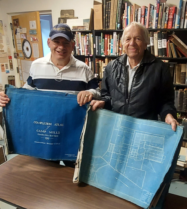
Long Island contractor Roy Knoernschild has once again generously donated more survey maps. This time, Roy discovered a 1919 Completion Atlas of Camp Mills in Garden City. The Atlas was given today to Bill Bellmer, the village historian of Garden City, for the Garden City Archives.
Greg O.
Back in 2017, a treasure chest of over 100 Long Island Motor Parkway surveys, maps, blueprints and drawings were discovered in the basement of a commercial building in Malverne, Long Island by contractor Roy Knoernschild. The chest belonged to engineer Arthur Archibald who surveyed the Motor Parkway from 1906 to 1938.
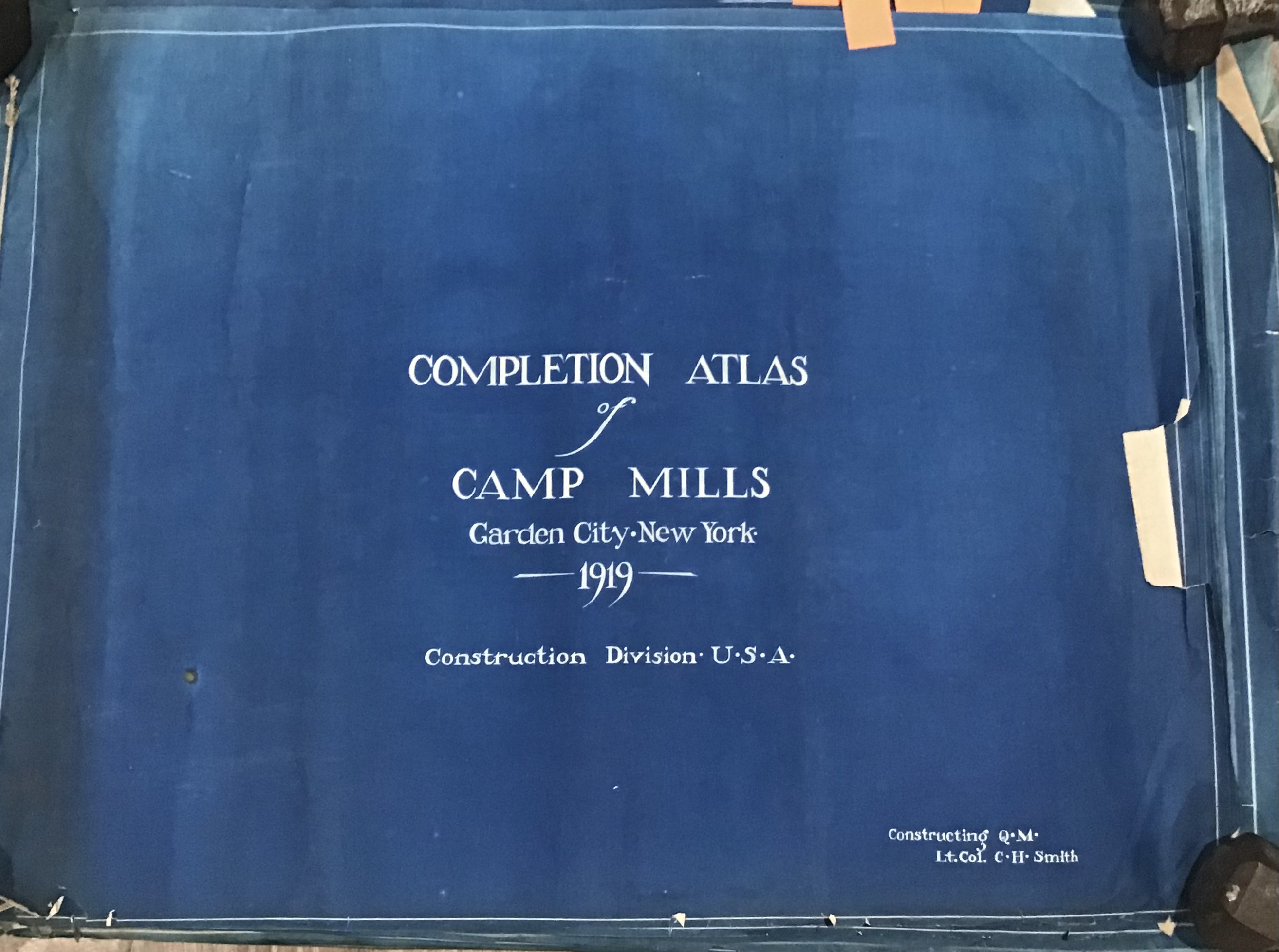
Also within that discovery were these blueprints forming the 1919 Completion Atlas of Camp Mills. Although incomplete, there are still roughly 50 pages of interesting blueprints mapping out Camp Mills. A curious Atlas since much of it was created the same month the order came for the camp to be abandoned, and property sold in August 1919. Was the purpose of the atlas to document the property for sale? The answer is unknown.
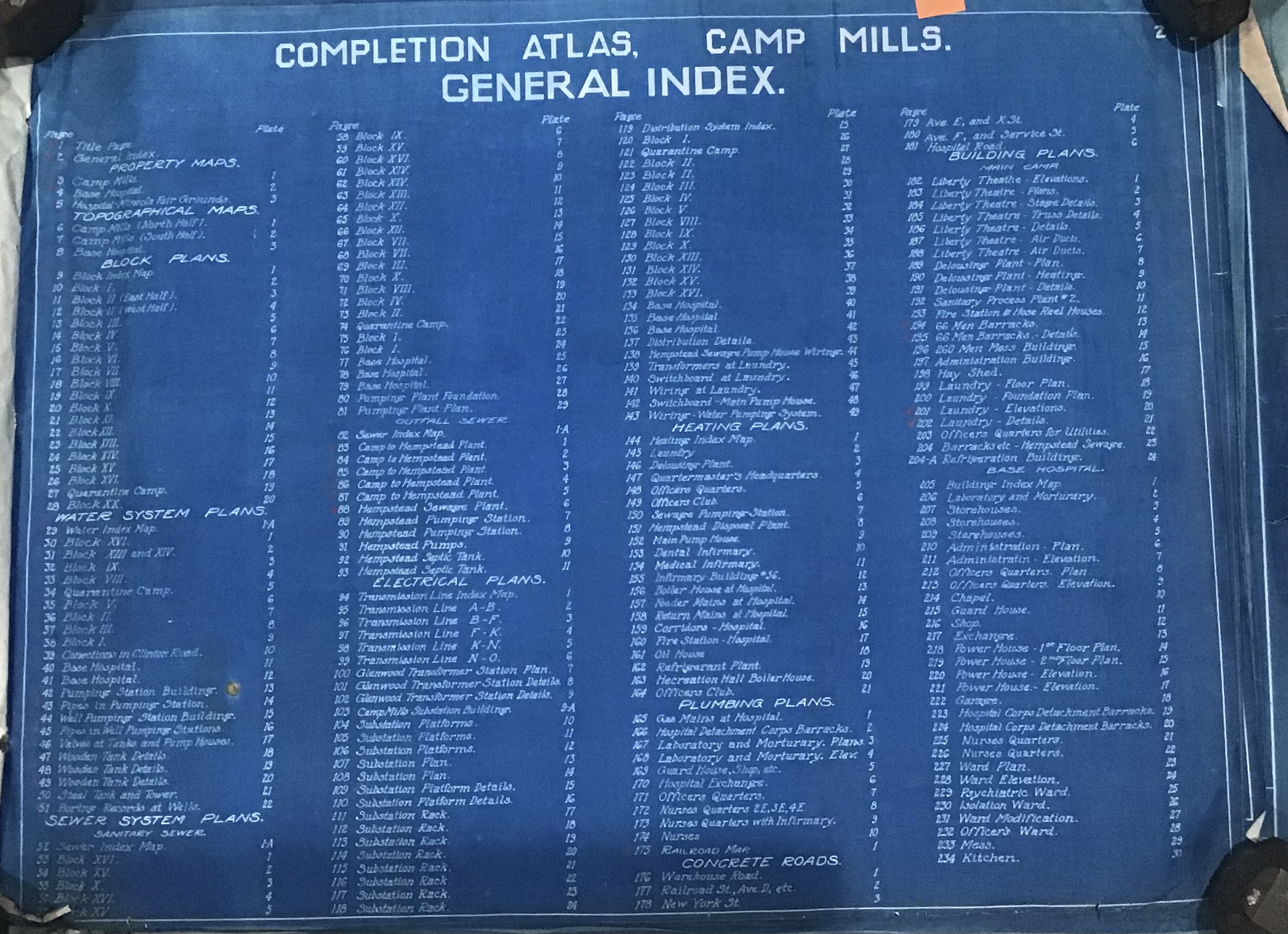
The extensive index for the plates of the atlas.
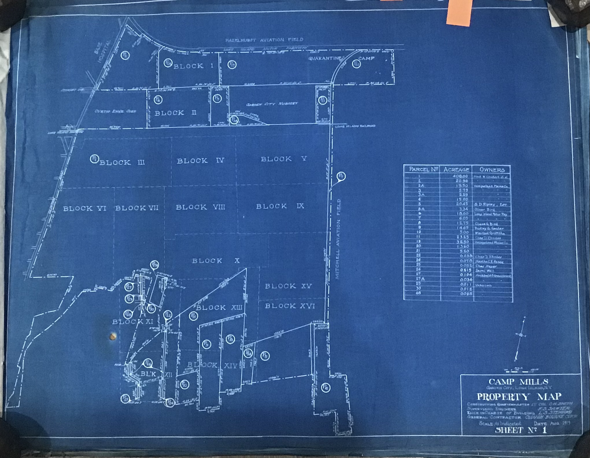
The property map showing various blocks of land of the base. Long Island Motor Parkway along the northern boundaries at the top. Clinton Road seen on the extreme left.
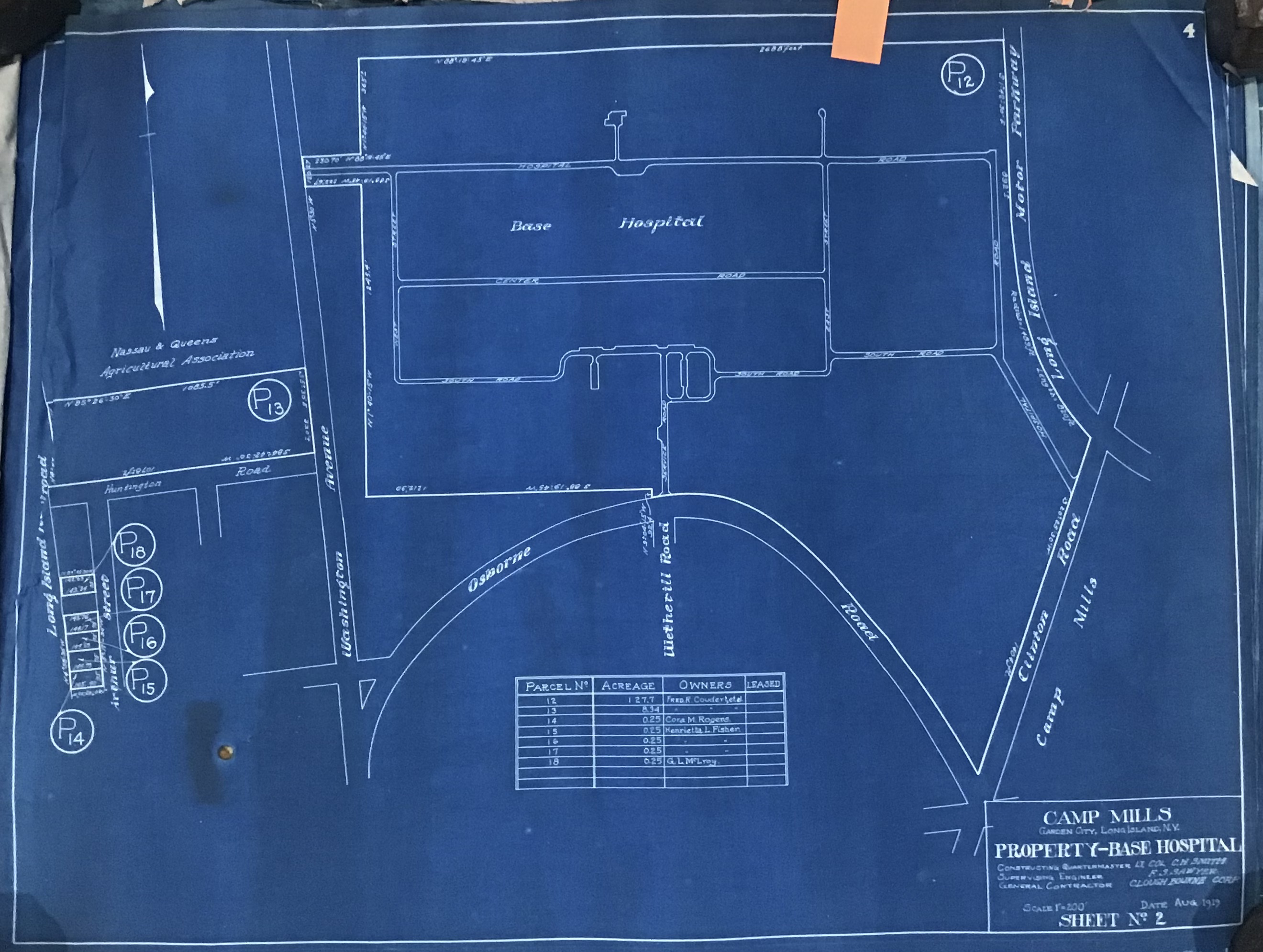
The base hospital property at the northern edge with the Motor Parkway on its way north to the east of the hospital property.
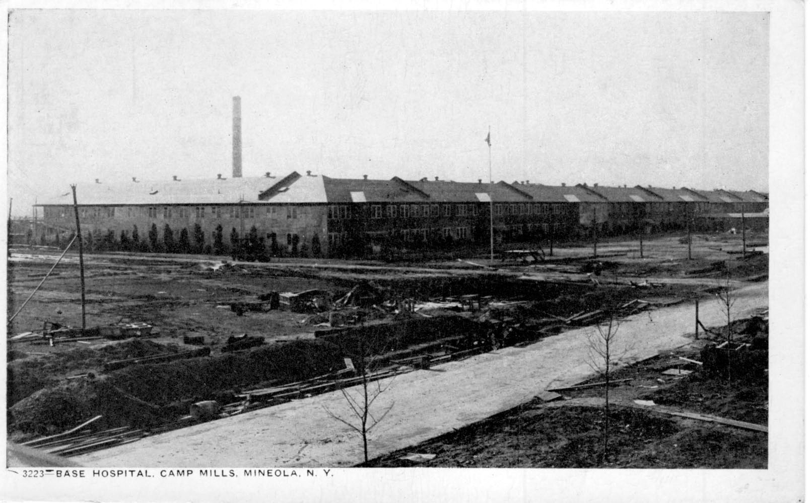
A view of the hospital ward buildings facing SW with Transverse Rd. in the foreground. The rail spur led to a powerhouse with a chimney that can be seen in the background.
Image courtesy of Bill Bellmer and the Garden City Archives
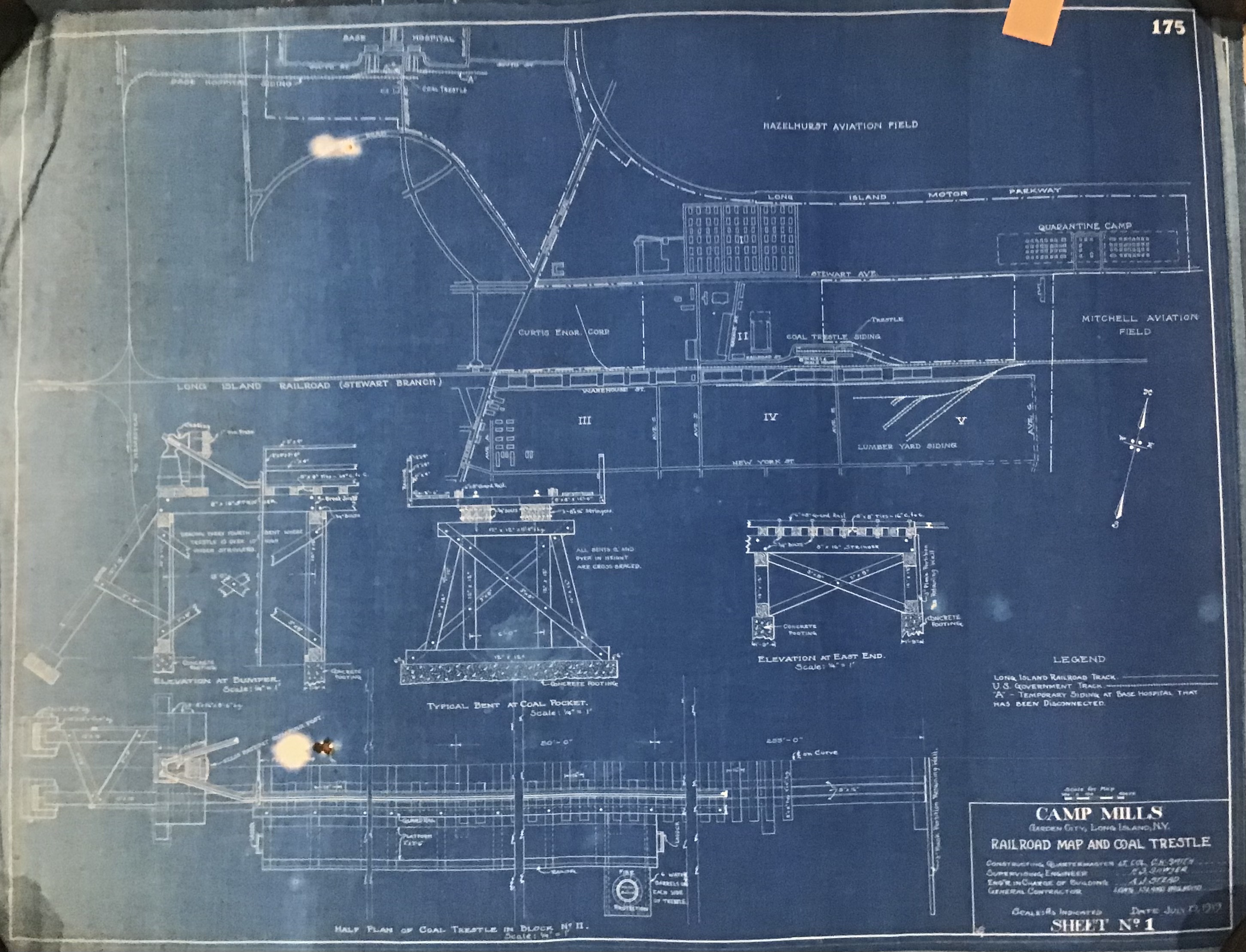
Railroad map and coal trestle. Of note is the spur for the base from the Central line.
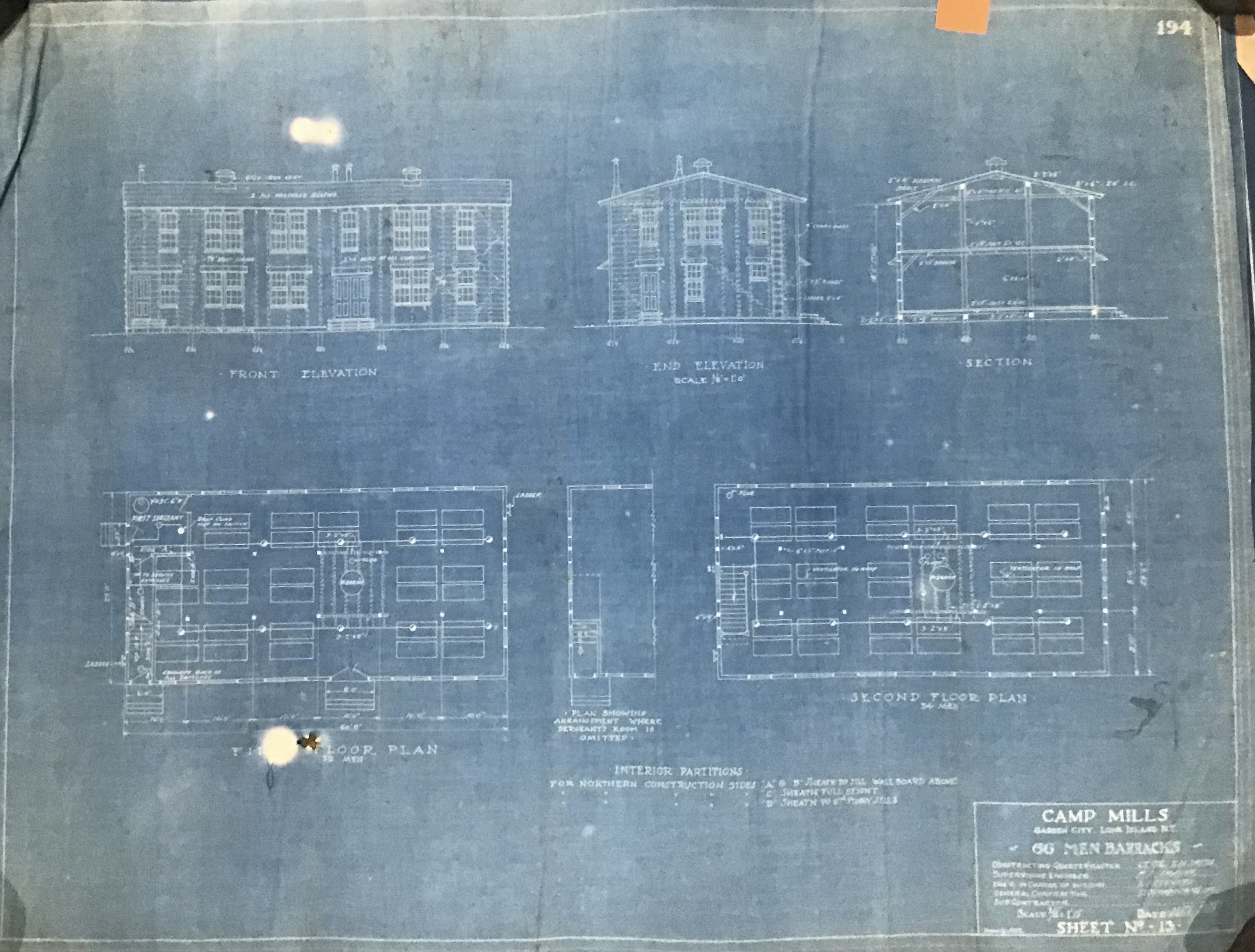
Barracks plans
Aerial of one of the barracks in 1919.
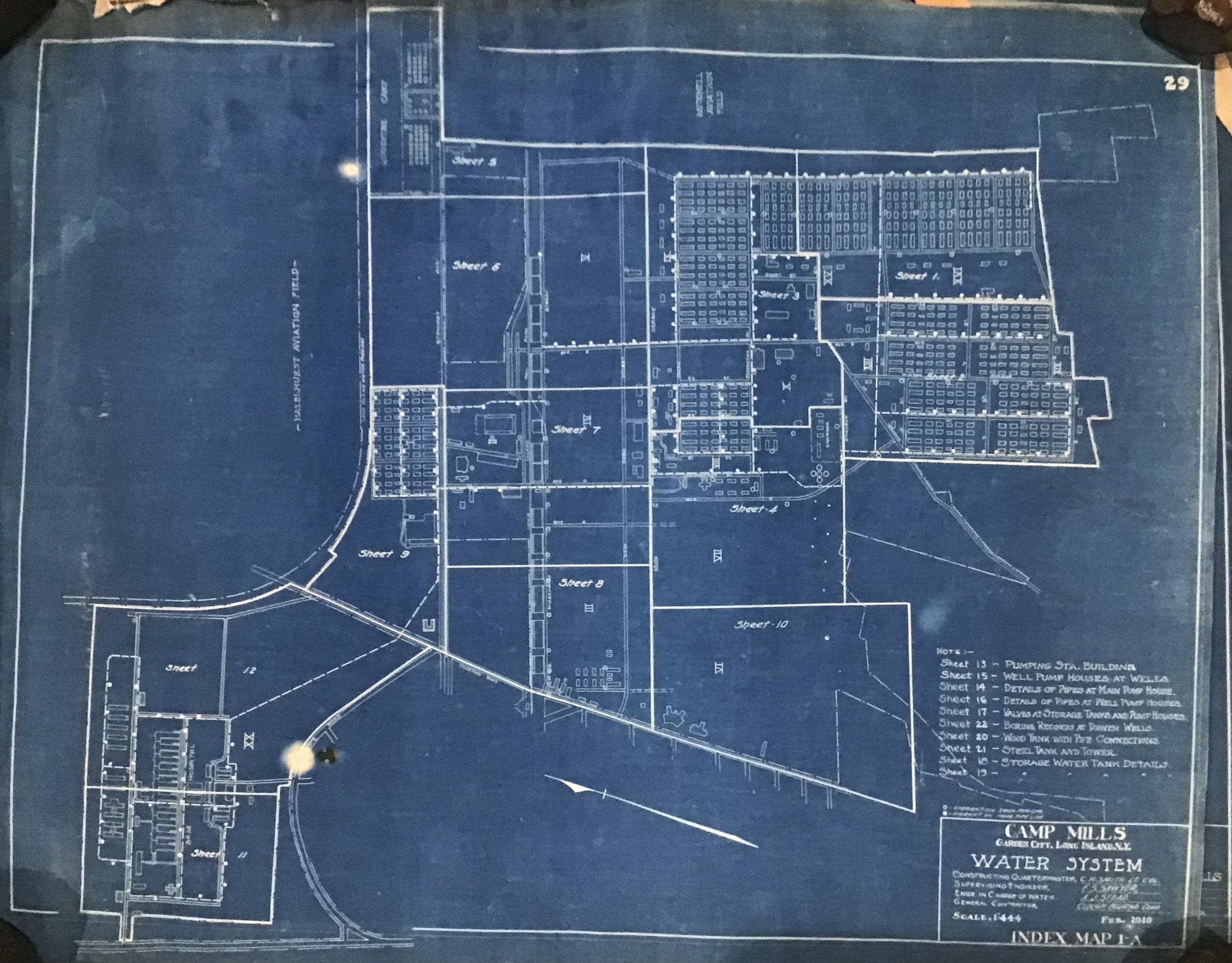
Pumping stations, wells and entire water system laid out.
As noted in the blueprints, a mixture of materials was used for pipe construction, including wrought iron, concrete, and even wooden pipes located underground.
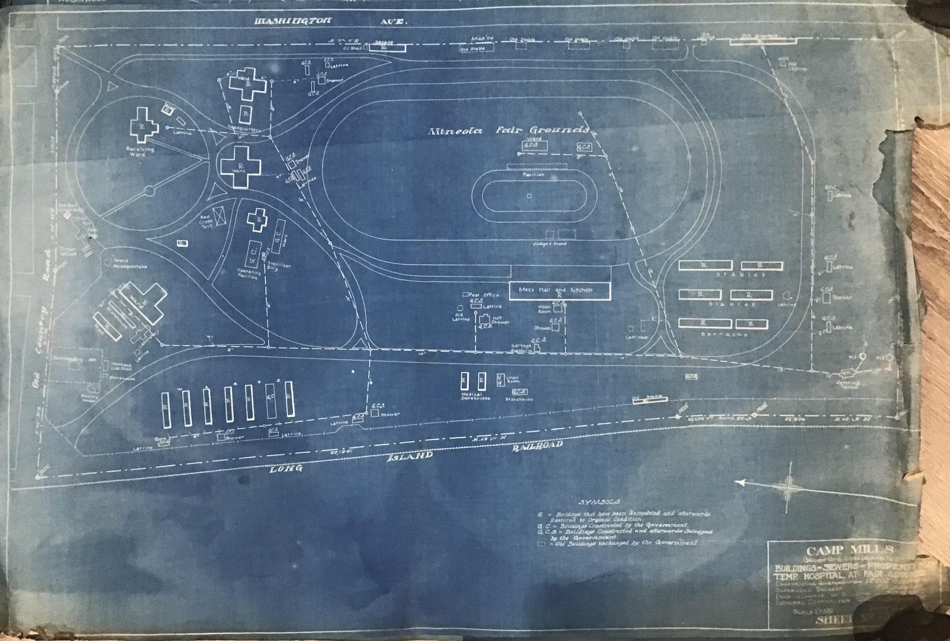
Plans in and around the Mineola Fairgrounds showing the railroad spur and surrounding roads and buildings.
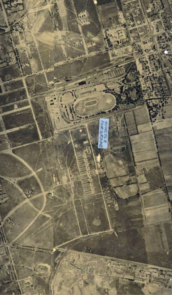
1926 Garden City aerial submitted by Cheryl Lynn Blum.
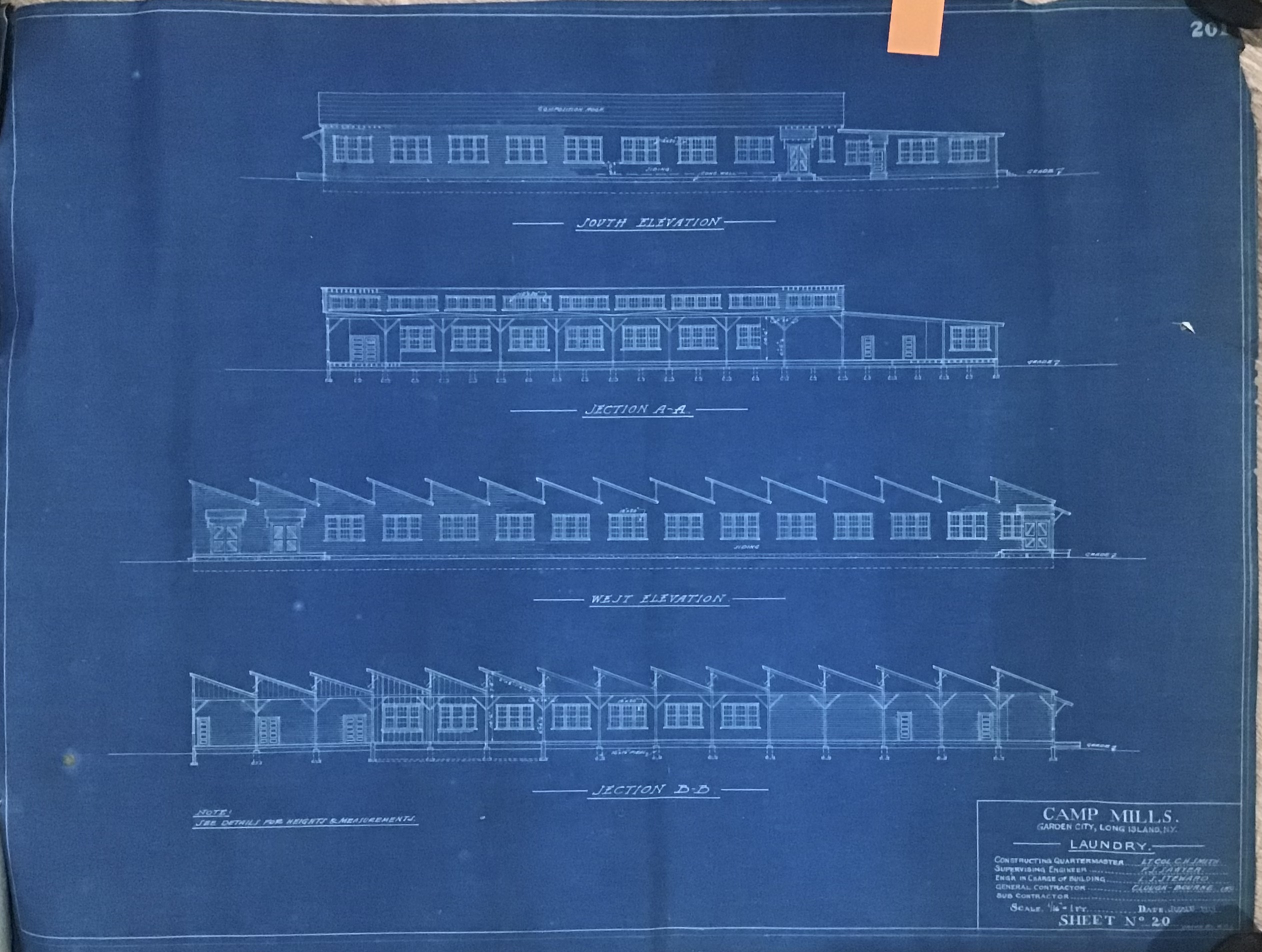
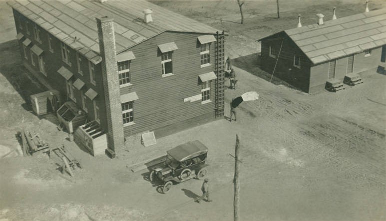
The laundry building.
When doing laundry for 10's of thousands of soldiers, you need a big building!
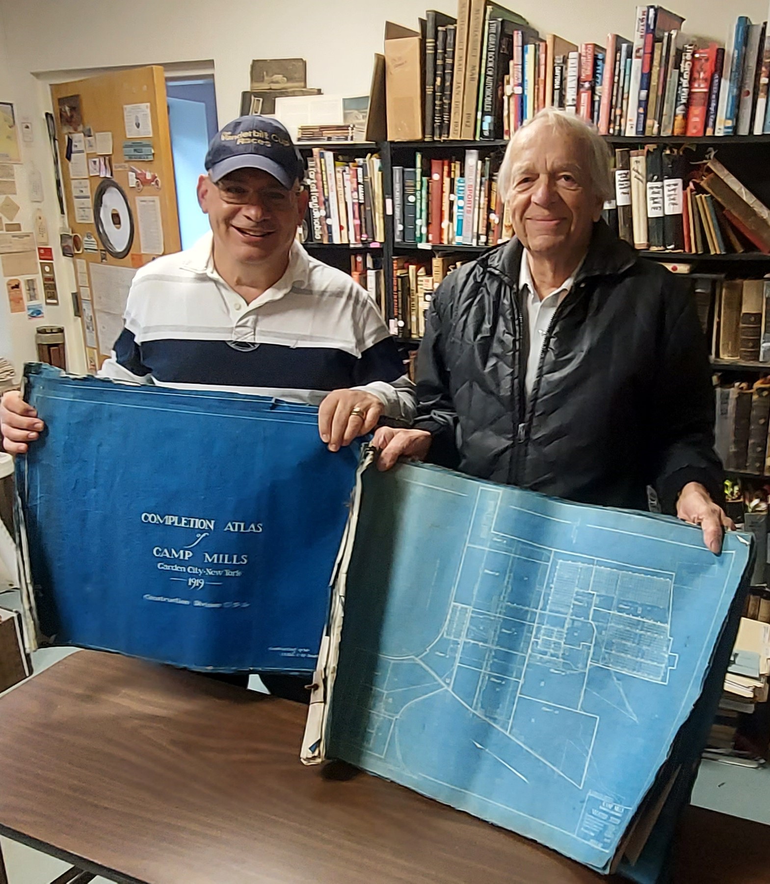
The Atlas is now in good hands and have been rightfully donated to Bill Bellmer, village historian of Garden City, for the Garden City Archives.


Comments
What a great find! It makes sense that the Agricultural Society of Queens-Nassau Counties Fairgrounds aka the Mineola Fair is included. In 1918 no fair was held, as the grounds were used by the United States Army as a base hospital to help treat the thousands of cases of influenza. The total number cared for was 12,693, of whom 399 died. This would be the first time an annual fair was not held since 1842. Will copies of these blueprints be available online for viewing?
Howard, The map showing Clinton Rd. on the left side also shows the Hempstead Turnpike Spur of the Motor Parkway on the right side which was never built.
The only map better than a old, clear aerial is an old & precise blueprint. Thanks again, Roy!
Great find, thanks for sharing!
Simply amazing. Another great find Roy! Thank you Roy again for exposing these buried gems for all to see and learn from.
Howard,
Those blueprints of Camp Mills are priceless! Which one of them shows the roadways in the area?
As you will recall from my post in 2018, we came to the general consensus that the ‘Mystery Road’ that ran from Clinton Street eastward through the Camp and later Mitchel Filed (dead-ending at East Road) was most likely New York Avenue (seen in this post from 12/21/18):
https://www.vanderbiltcupraces.com/blog/article/in_search_of_the_mystery_camp_mills_new_york_road
But as Frank pointed out, there remained a gap in the roadway east of where the Hospital building was constructed and where the Quadrangle would be created. It would seem unlikely these were once two discreet roads - they simply line up too perfectly.
My final analysis at the time was the only solution would be to go out there with a handheld GPS unit and capture the coordinates of the various streets in East Garden City west of Clinton Street, and the existing roadways through Mitchel Field.
Guess what? When I last visited the area this past July, I did just that, painstakingly noting the coordinates of all major intersections on the Base.
I have not had time yet to do a detailed analysis of which roadways from Camp Mills lined up with those on Mitchel Field. But a cursory view certainly indicates numerous instances of extant residential roads in East Garden City (all of which are named after trees for some reason) with roads on the Base still in use today (though in some cases, buildings now stand on the property once occupied by roadways in the 1927 - 1932 pre-reconfiguration of the Base).
When I have some free time, I will attempt to do an A/B comparison of the roads originating in East Garden City which extended eastward past Clinton Street onto Camp Mills with those thoroughfares on Mitchel itself. Something tells me, there’s gonna be a whole lot of nearly identical coordinates!
More details to come in 2023!
This is great stuff! I moved to the area in 2019 and have been interested in learning more about the history related to the land around my home. Obviously, Camp Mills dominates the area’s history and is of particular interest. I was able to overlay the “blocks” map image with a modern map of Eastern G.C. to discover that my house is located on the border between “Block VI” and “Block VII” (Tremont seems to be the divider). Does anyone know if there is a way to obtain images of pages from the blueprint collection? I’m specifically interested in the pages for Blocks VI & VII, highlighted in the attached image. Just curious to see what information/goodies they have to offer.
Lee…there are a few plates in the collection that could help you out with your New York St. research, not sure if you saw the bottom of the index page image. Under ‘Concrete Roads’ there is a listing for ‘New York St.’, wondering if that could provide you with additional information (see attached).
Joe,
Thank you so much for this information. I’m sure Page 178 of Plate 3 for ‘New York Street’ is precisely what I am looking for.
Does anyone know how this information can be accessed? Has this information and that which Joe is looking for been digitized?