Kleiner’s Korner: Part 2 - (Very) Quiet Viewing Locations on the Motor Parkway
Here's Part 2 of my series of cemeteries planned or located near the Motor Parkway. These are all in Suffolk County.
Art Kleiner
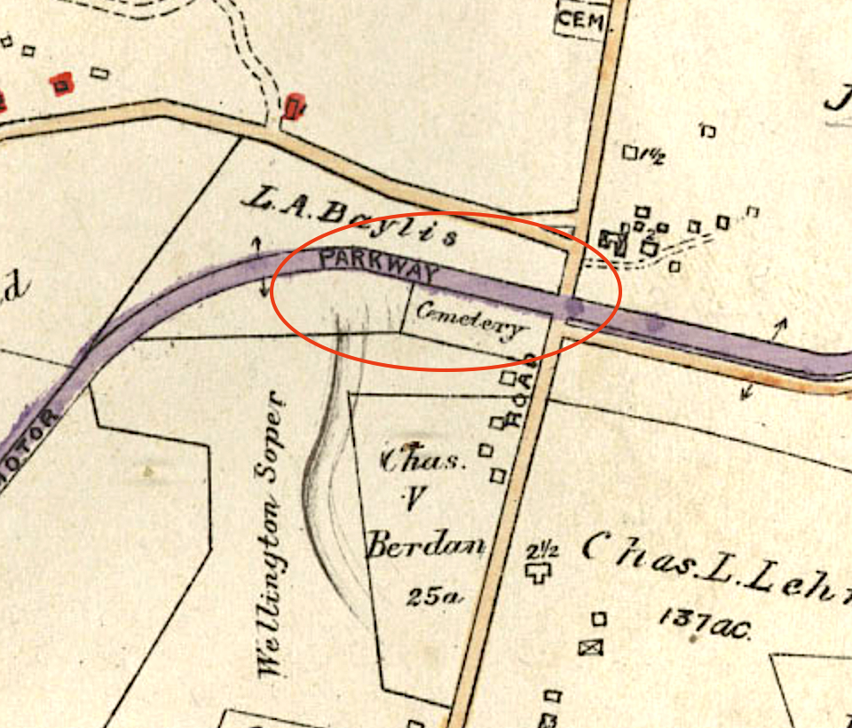
South Melville
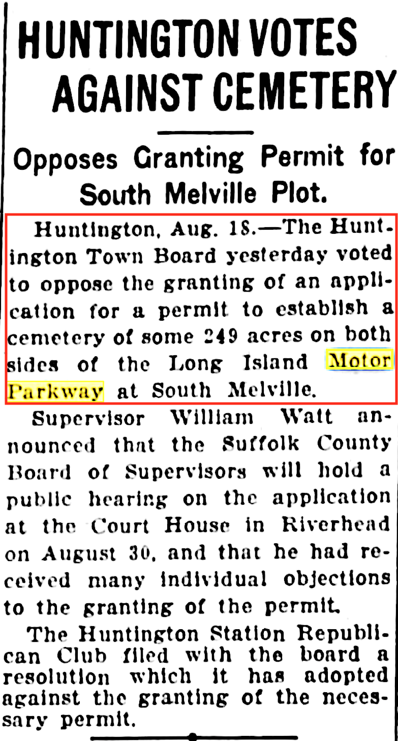
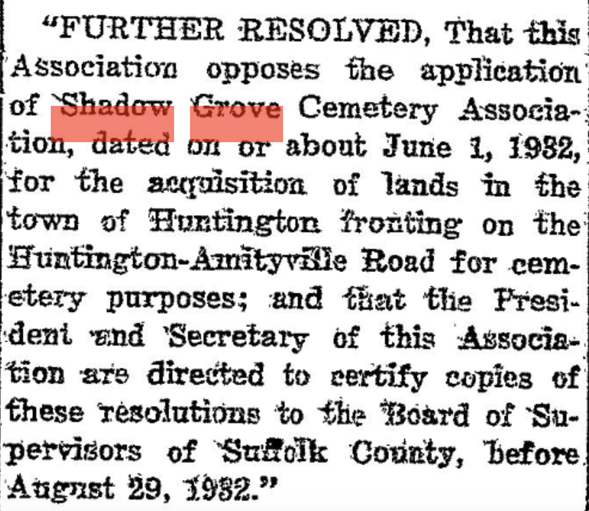
In June of 1932 the Shadow Grove Cemetery Association requested a permit to build a cemetery in Suffolk County adjacent to the Motor Parkway. Prior to the County Board of Supervisors making a decision the Huntington Town Board and other local organizations registered their opposition.
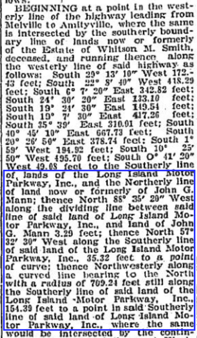
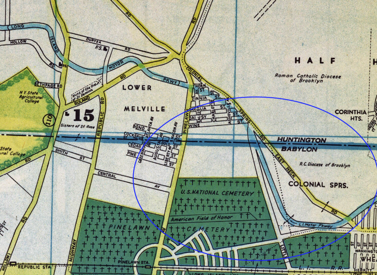
The request indicated the cemetery would be on both sides of the Motor Parkway just east of the Melville/Huntington to Amityville Road (today's Route 110) on lands owned or formerly owned by Witson M. Smith and John G. Mann.
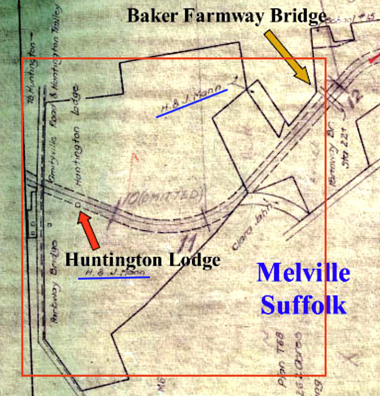
1928 map of the area.
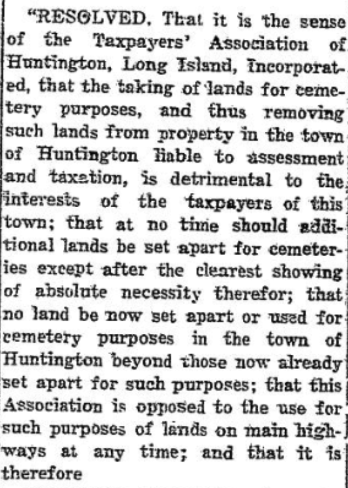
Further opposition by the "Taxpayers' Association of Huntington, Long Island, Incorporated" noted that approving the request would "be detrimental" to taxpayers.
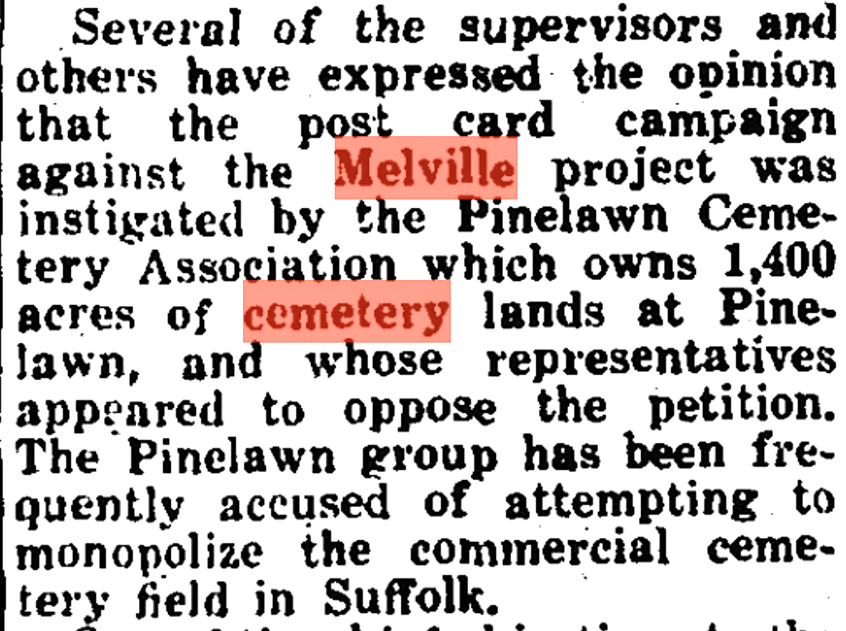
In order to show their opposition taxpayers sent postcards to the County Board of Supervisors noting their position. It was believed that the postcard campaign was instigated by the nearby "Pinelawn Cemetery Association" which obviously saw competition if the request was approved.
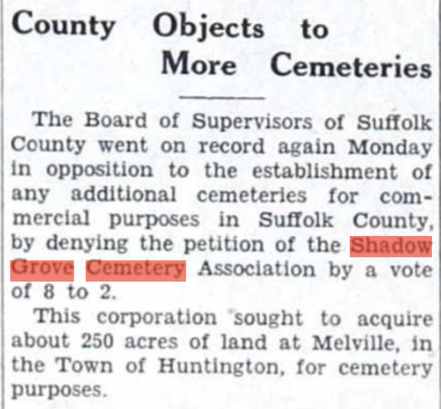
After numerous delays due to the Attorney General needing to rule whether the Board had authority to deny the permit request the Supervisors ultimately voted against it 8-2.
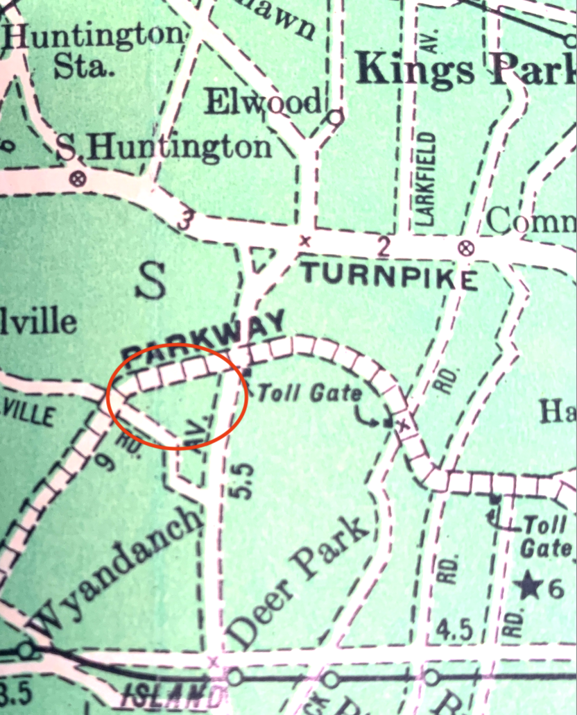
Long Island National Cemetery at Pinelawn
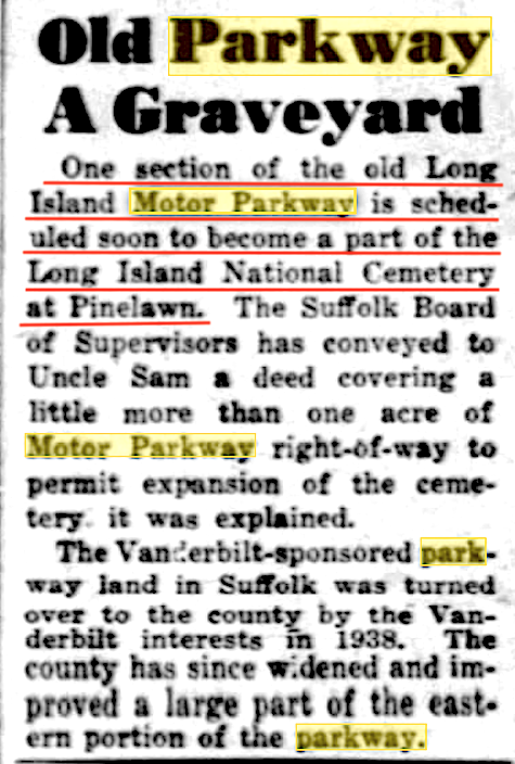
One acre of additional Motor Parkway property was handed over to the Long Island National Cemetery in Pinelawn in 1951. The cemetery was originally developed in 1936 when it received 135 acres from the Pinelawn Cemetery Association. (NY Daily News Dec. 30, 1951)
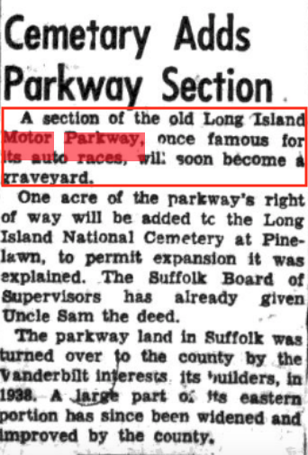
Nassau Daily Review Jan. 4, 1952
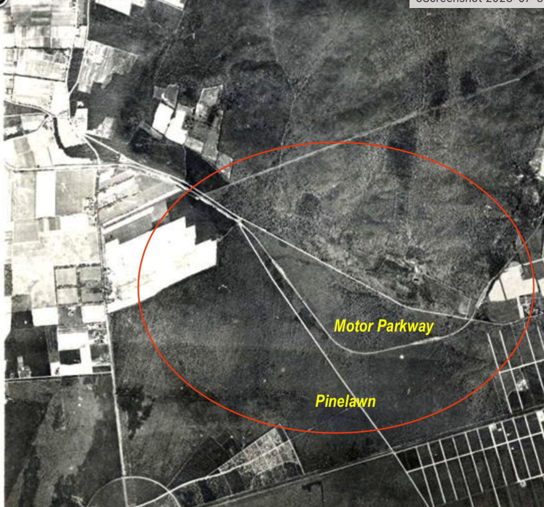
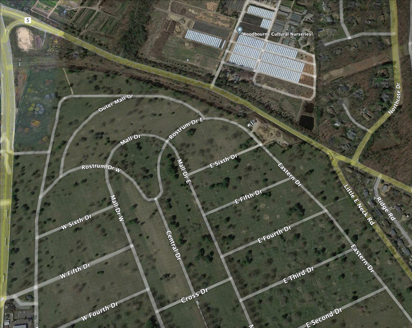
Early aerial view of the Pinelawn Cemetery Association in relation to the Motor Parkway.
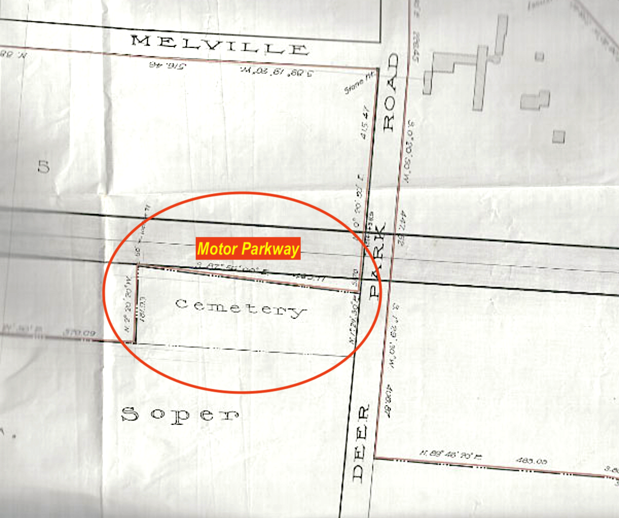
1915 map.
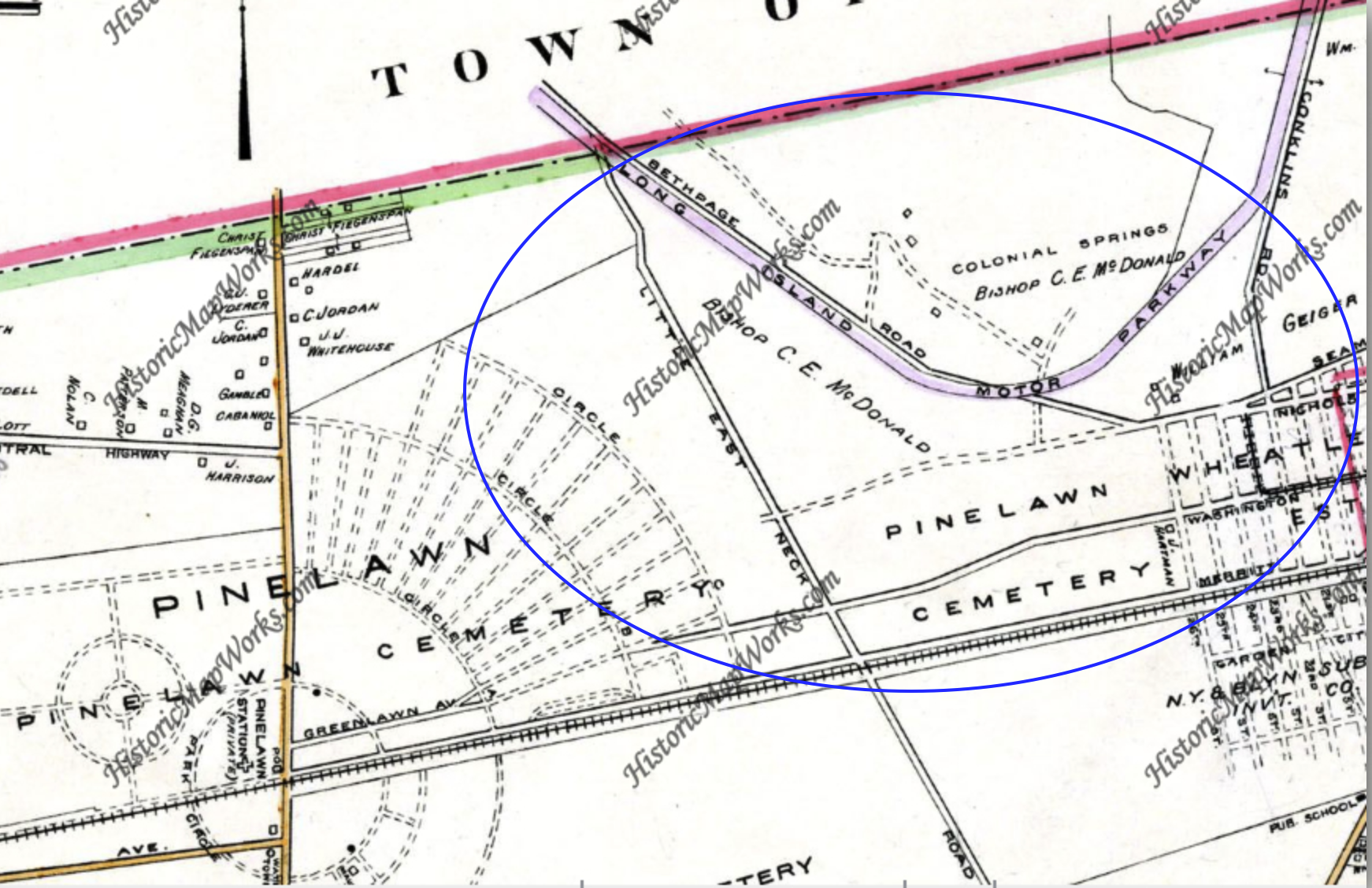
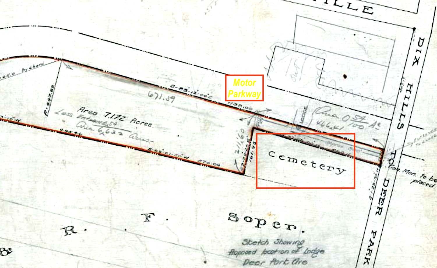
1952 map.
A current view of the area.
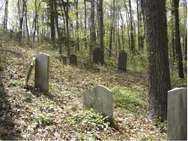
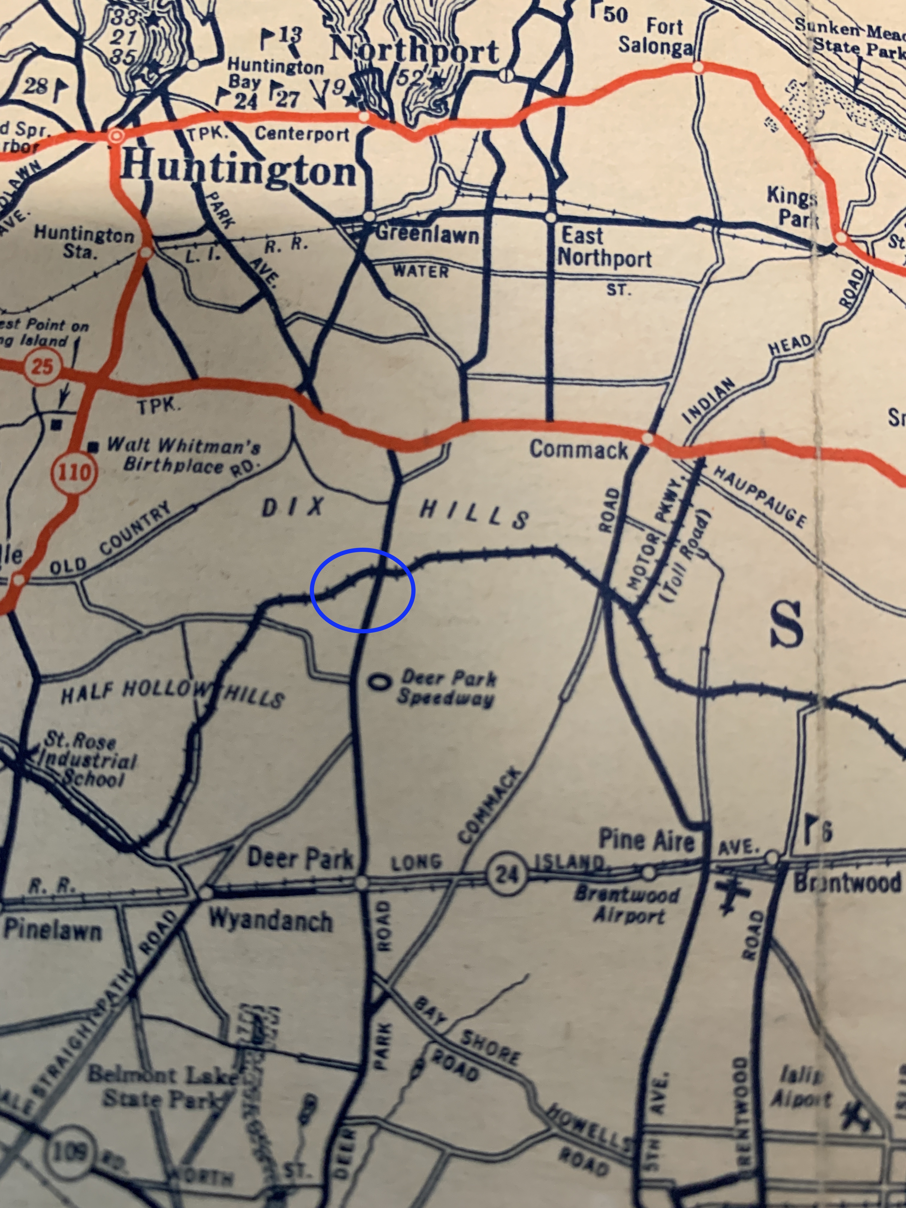
David Carll Cemetery
Located just south of the Northern State Parkway at the junction of the Motor Parkway and Deer Park Avenue is the David Carll Cemetery which was in use for over 200 years.

Current gravestones at the cemetery.
If you know of additional planned or actual quiet viewing spots (e.g., cemeteries) along the Motor Parkway, please provide comments.


Comments
Art, On the 1915 map, some of the property identified as the R.C. Diocese of Brooklyn was also used as a cemetery.
There is a small cemetery on the grounds of 5 Towns College in Dix Hills. I remember it from when it was Burrs Lane JHS. On the north - east side. I know the Parkway used to just clip the south -west corner of the athletic fields.
There is also a small cemetery on the east side of Harned Rd. in Commack, close to the Harned Rd. exit from the north bound Sunken Meadow Parkway.
It is called Nostrand Cemetery.
The cemetery at 5 Towns College is called Nostrand Cemetery. The parkway actually clipped the south-east corner of the property.