Kleiner’s Korner: “NY Daily News” Maps of the Motor Parkway (1929-1937)

A favorite pastime of mine is looking at old maps. This may have resulted from my interest in geography that partly stemmed from being a shortwave radio listener tuning in international broadcasters in my teen years and later morphing into being an amateur radio operator (call sign KB2IPH) in which I talk directly with other amateurs all over the world. I find looking at maps fascinating as I never know what new information I will uncover, even in areas such as LI in which I had lived for 65 years.
Take a look at these maps that were included in the "NY Daily News" and see what you can find. Maybe nothing new to you but others may have more knowledge about a particular notation on the map. All maps are from 1929 through 1937.
Art Kleiner
1929
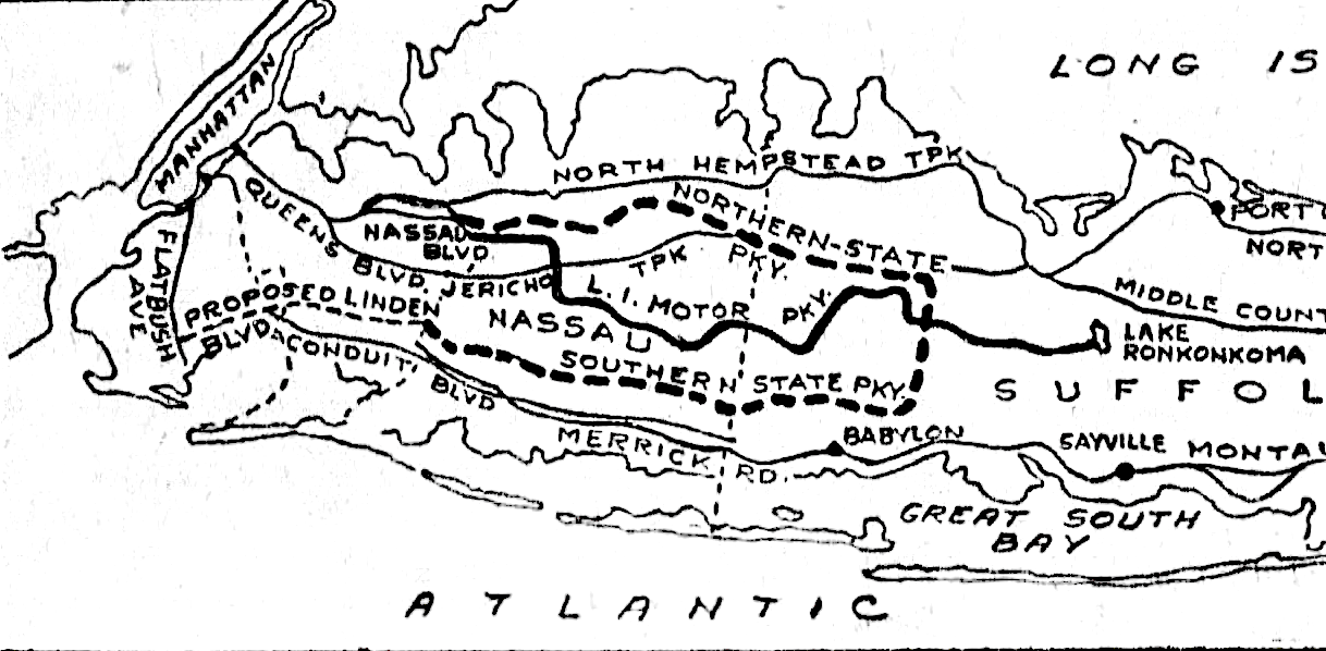
Note the Motor Parkway surrounded by the dotted lines indicating the future Northern and Southern State Parkways and the "proposed" Linden Blvd.
1930
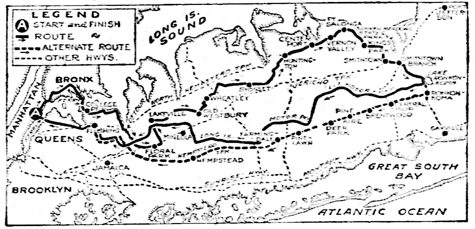
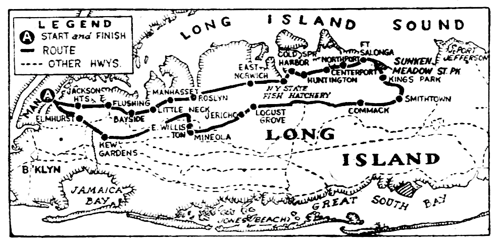
The Motor Parkway was included in the route of an automobile excursion on Long Island.
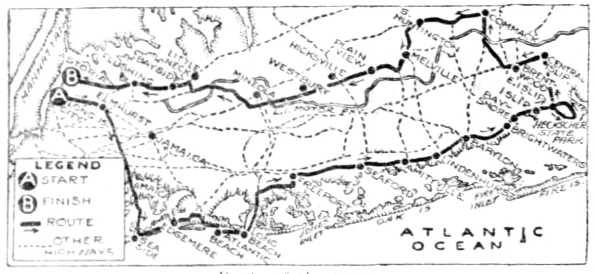
An alternate excursion published a few weeks later did not include the Motor Parkway in its route.
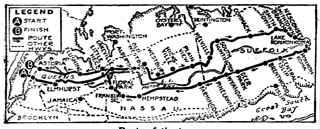
1931
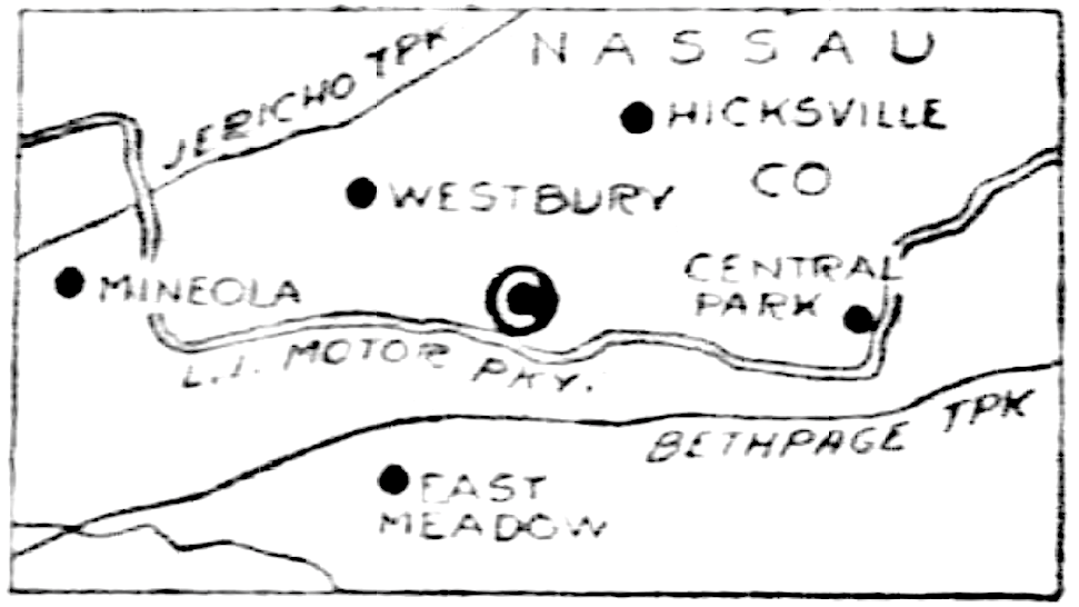
Notation "C" denotes the Motor Parkway very clearly in this 1931 map.
But a few months later not included in this excursion.
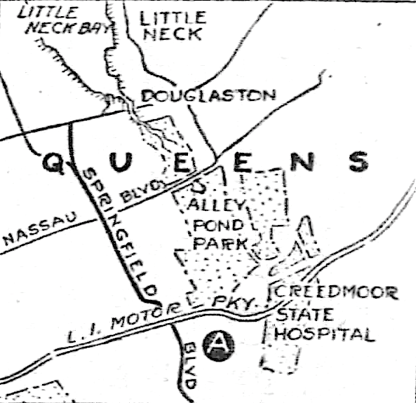
The Parkway crossing through Creedmoor State Hospital: any ideas as to the break in the Parkway just west of Springfield Blvd. (just to the left of "L.I.")?
1932
Another similar excursion in 1932 without the Motor Parkway as part of its route.
My original hometown of Valley Stream prominently featured.
1933
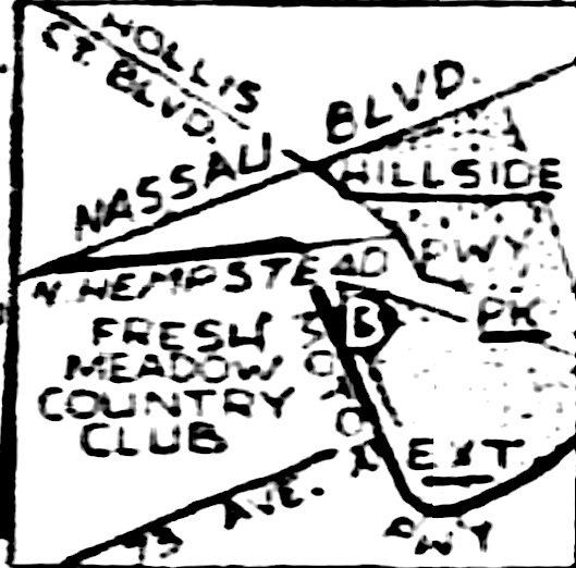
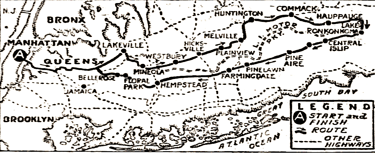
The Motor Parkway western terminus ("B").
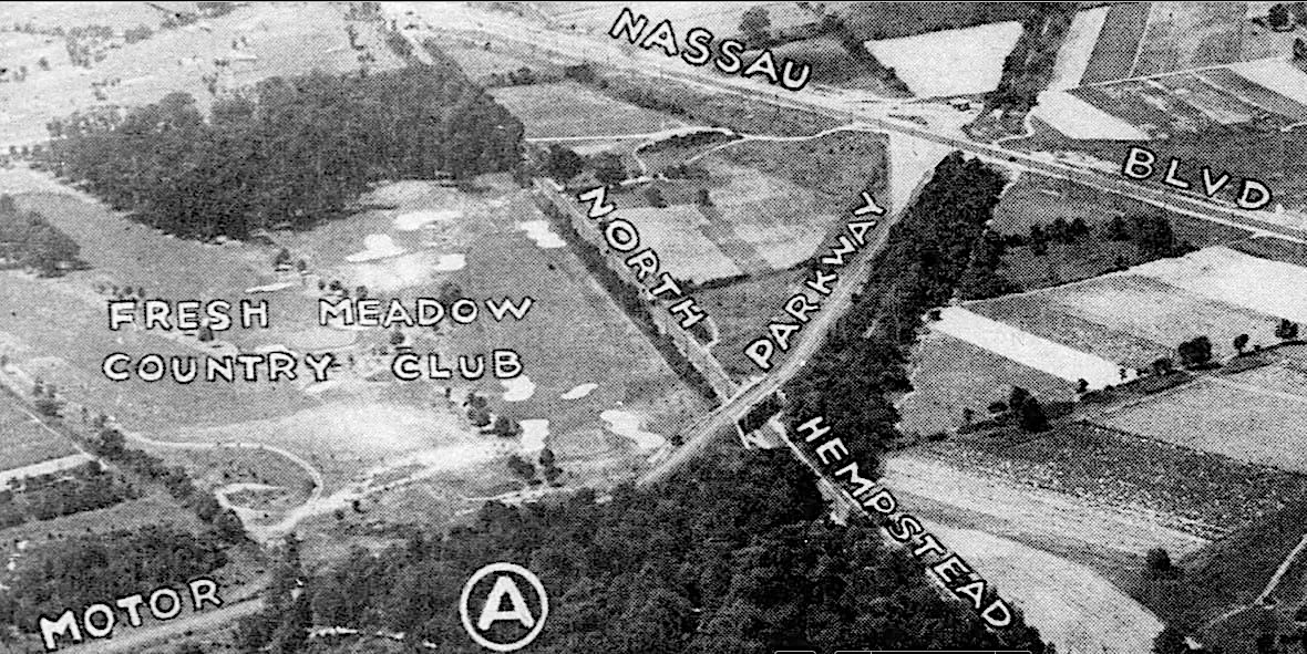
While not a map, this picture of the North Hempstead Turnpike Motor Parkway Bridge is one of my favorites! The view of the bridge and the notations are fantastic!
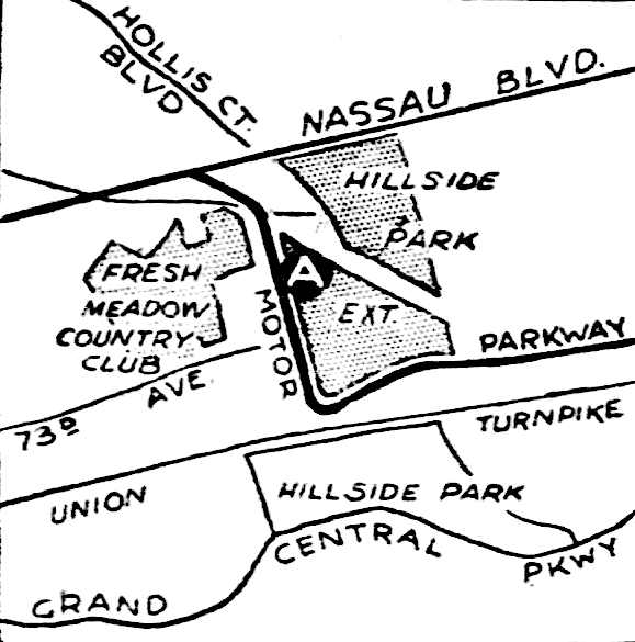
The map version.
The NY State Fish Hatchery in Cold Spring Harbor made it onto this map 50 years after its opening. While the Motor Parkway is not noted it can be clearly seen.
1934
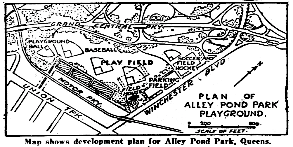
Planning for Alley Pond Park.
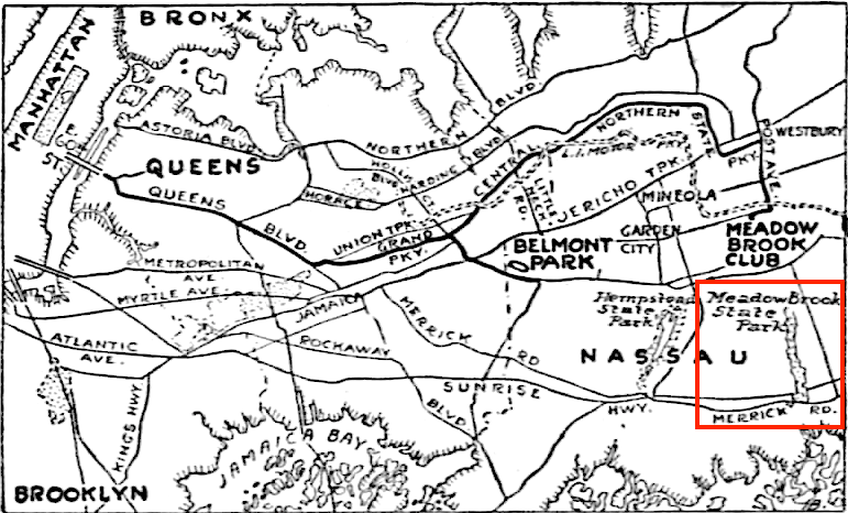
Shown here is the Meadowbrook Club just north of what was called The Meadowbrook State Park. The park was to be 457 acres serving as the right-of-way for the Meadowbrook Parkway; the second route to Jones Beach with the Wantagh State Parkway being the first. (hiddenwatersblog.wordpress.com)
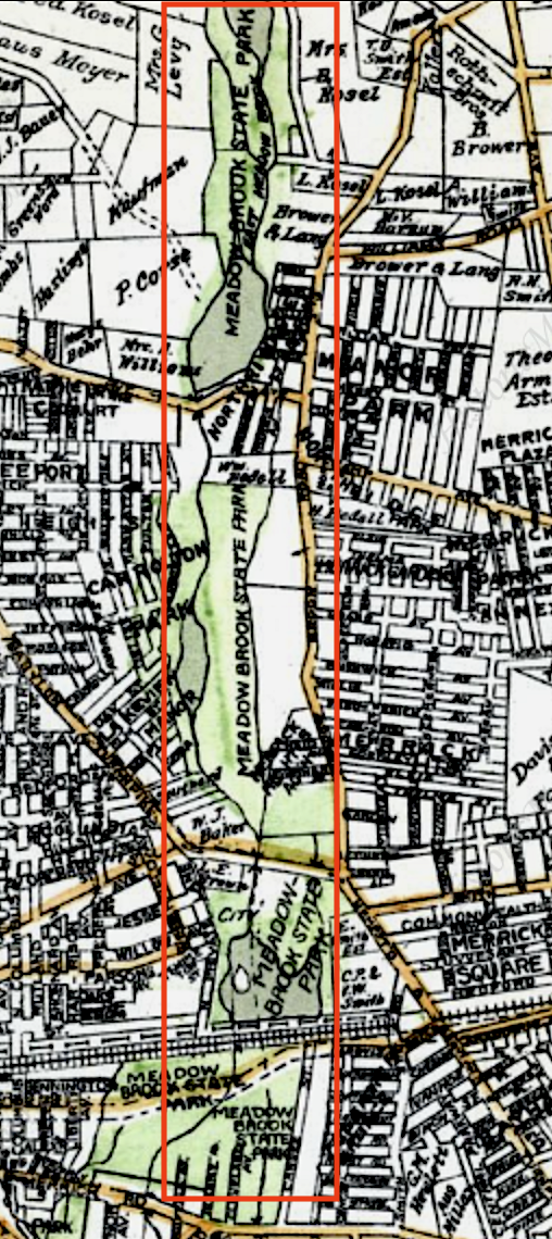
The park was noted on this 1927 E. Belcher Hyde map before the Meadowbrook Parkway was built.
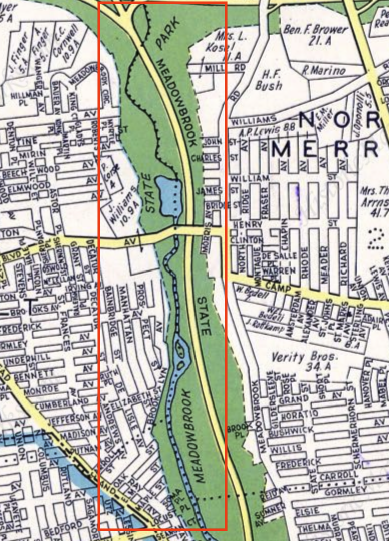
And again shown in this 1939 Dolph & Stewart map after the parkway was built in 1934.
1937
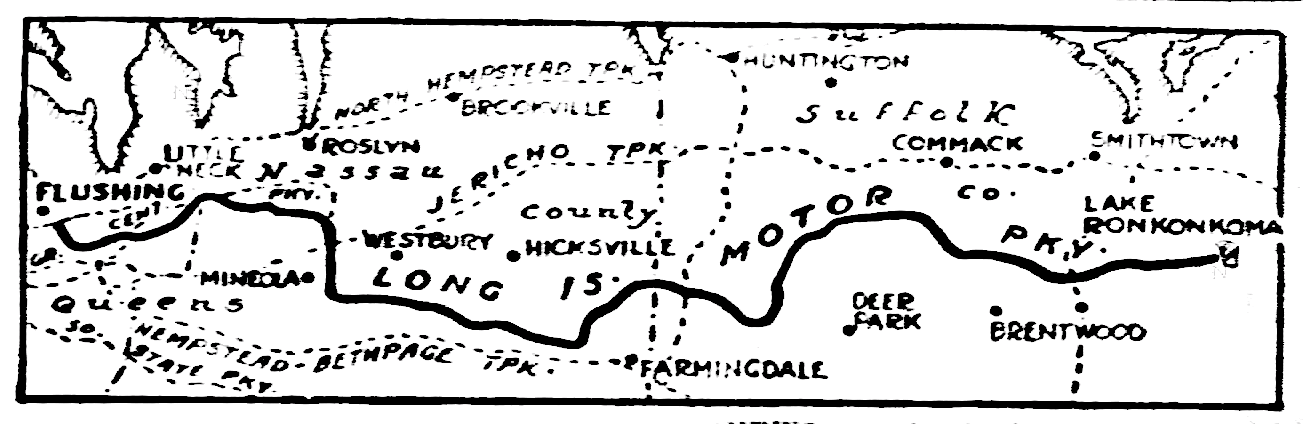
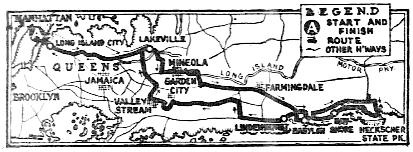
The Motor Parkway was prominently noted on this June, 1937 Daily News map a year before it was closed for good (the parkway, not the newspaper).
My next series of maps in a future post will include maps of the Motor Parkway from additional publications.
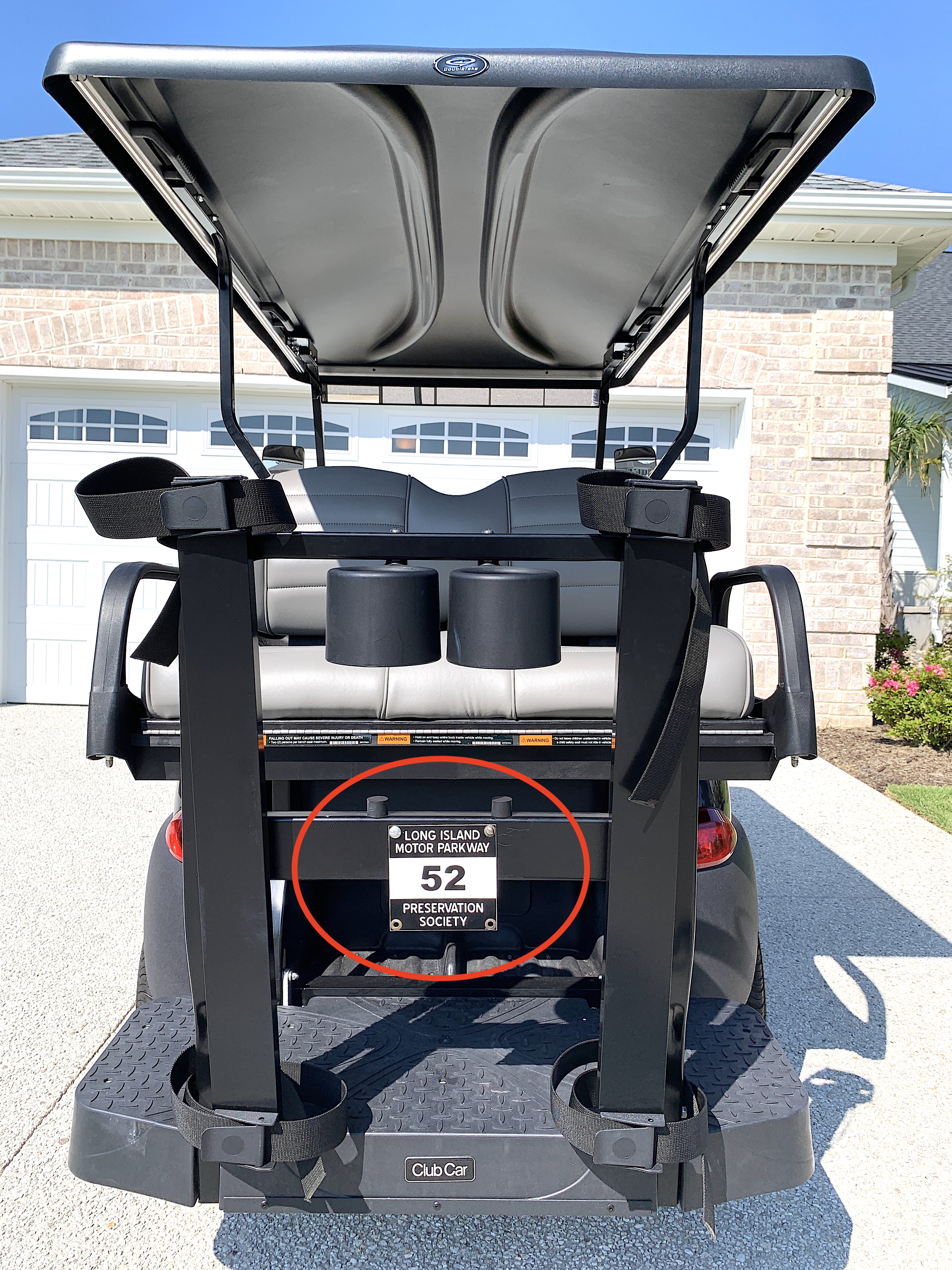
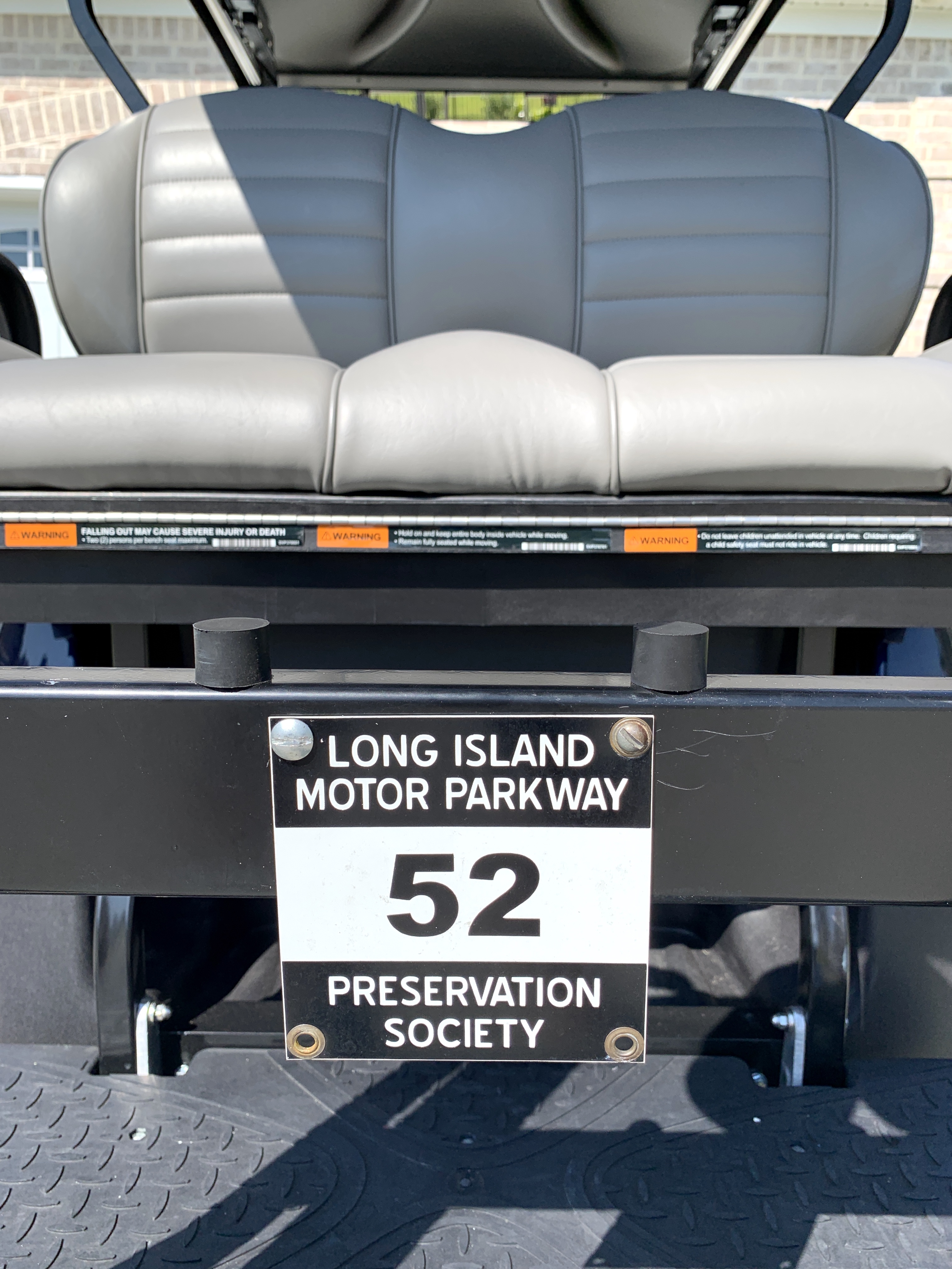
But before I get to that I finally got my Motor Parkway Preservation Society license plate on my golf cart! With so many ex-LIers in my community I'm curious to see if anybody will notice. Now if I can only get my better half to let me put my Motor Parkway concrete post and piece of roadway in my yard I'll be set! But not holding my breath!


Comments
The break in the LIMP west of Springfield Blvd is about where Bell or Hollis Court Blvds run north and south beneath the parkway.
Thanks.
Art, amazing maps loaded with information. The break west of Springfield Blvd possibly a failure to depict the LIMP jug at Bell Blvd, where LIMP utilized the abandoned CRR platform for their intended purposes. Below is the LIMP jug over Bell Blvd