Kleiner’s Korner: Miscellaneous Maps of the Motor Parkway and the Vanderbilt Cup Races
Maps were created for businesses that often times included or referenced the Motor Parkway.
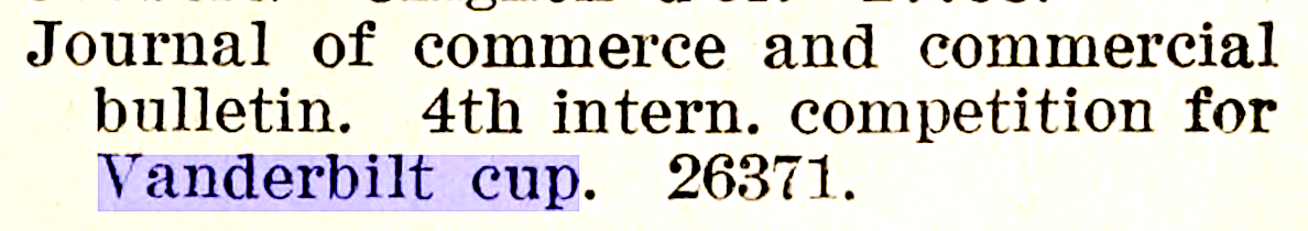
I've also included listings from trade publications referencing maps of the Vanderbilt Cup Race - I haven't been able to find the actual maps, but you never know when one might show up.
Columbia Lubricants Company of New York
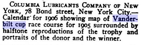
The Columbia Lubricants Company of New York showcased the course of the 1905 Vanderbilt Cup Race and related photos in their 1906 calendar. (The Automobile Mar. 29, 1906)
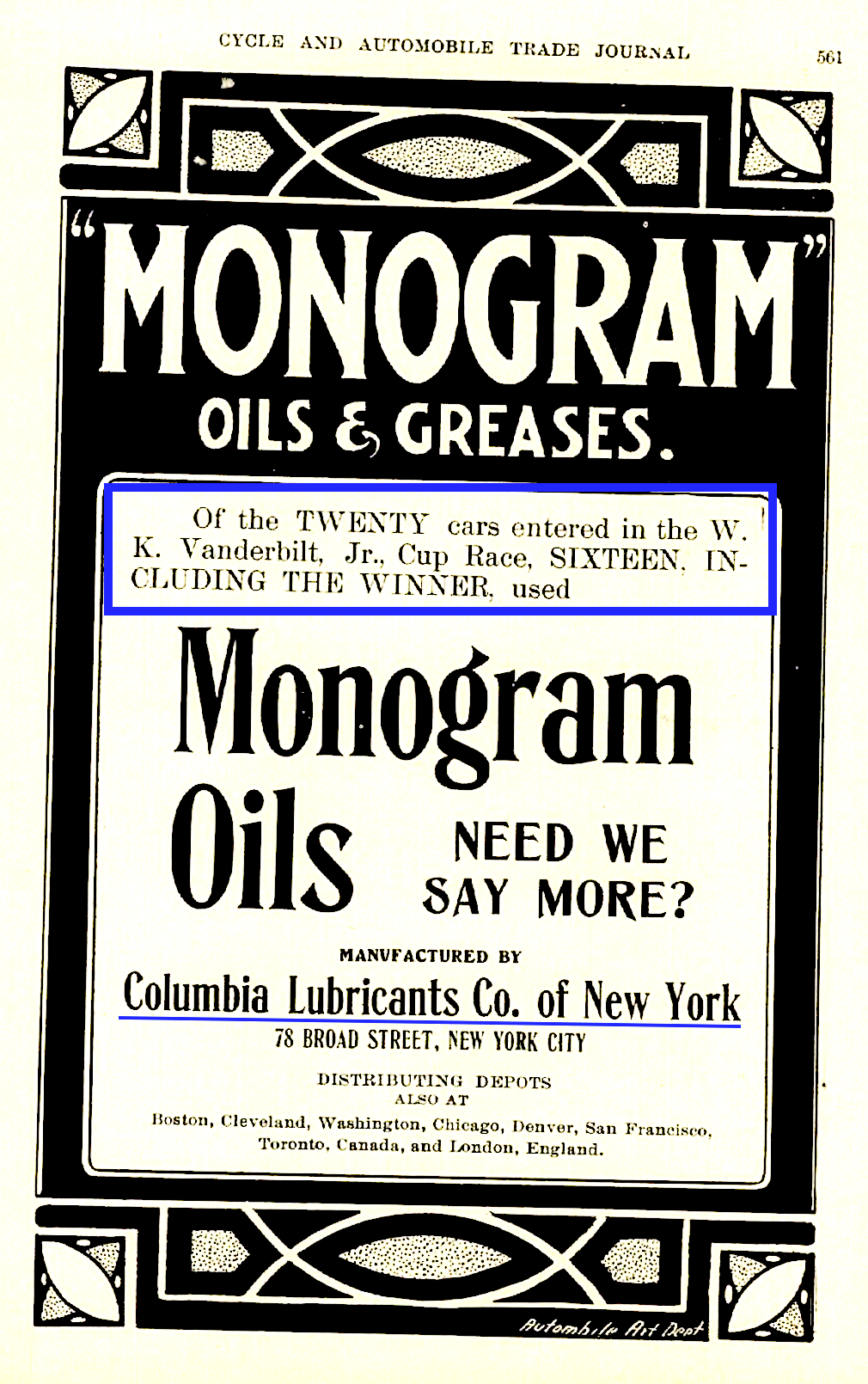
The company had a vested interest in the race as this advertisement indicates. (Cycle and Automobile Trade Journal 1906)
1908 Vanderbilt Cup Race
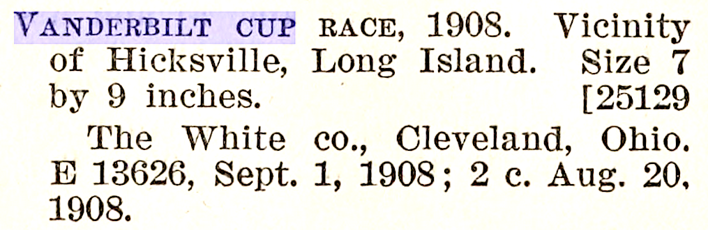
The White Co. of Cleveland also produced what may have been maps of the course as these two listings may indicate. (September, 1908)
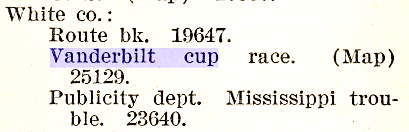
Was the company the same that produced the White Steamer that participated in the 1905 race? (1908)
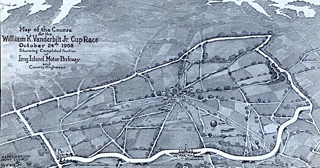
An interesting map of the 1908 course showing the grandstand (looks like Cinderella or Snow White's castle in Disney World) and the entrance to the Motor Parkway.
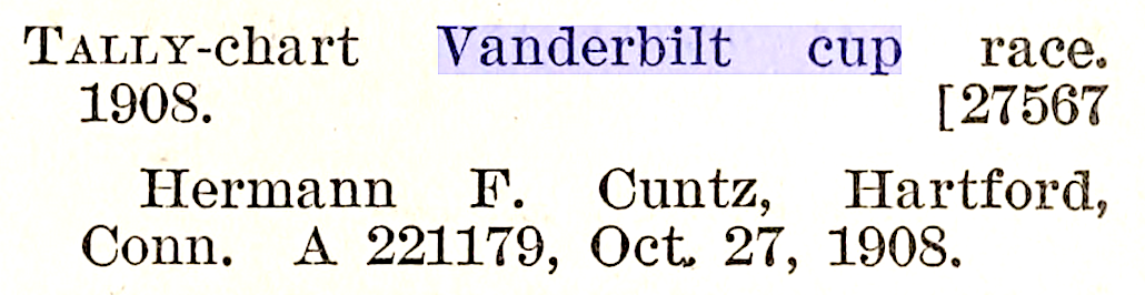
Probably not a map, Herman F. Cuntz produced a "Tally-chart" for the race in October, 1908. Defined as a mechanism to keep track of the frequency of something happening, might this be a form of scorecard for the race.
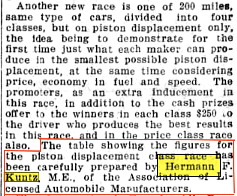
K(C)untz was a mechanical engineer and a member of the Association of Licensed Automobile Manufacaturers and produced charts for various races.
Not sure as to what this 1908 listing refers.
The Wheatley Hills Golf Club
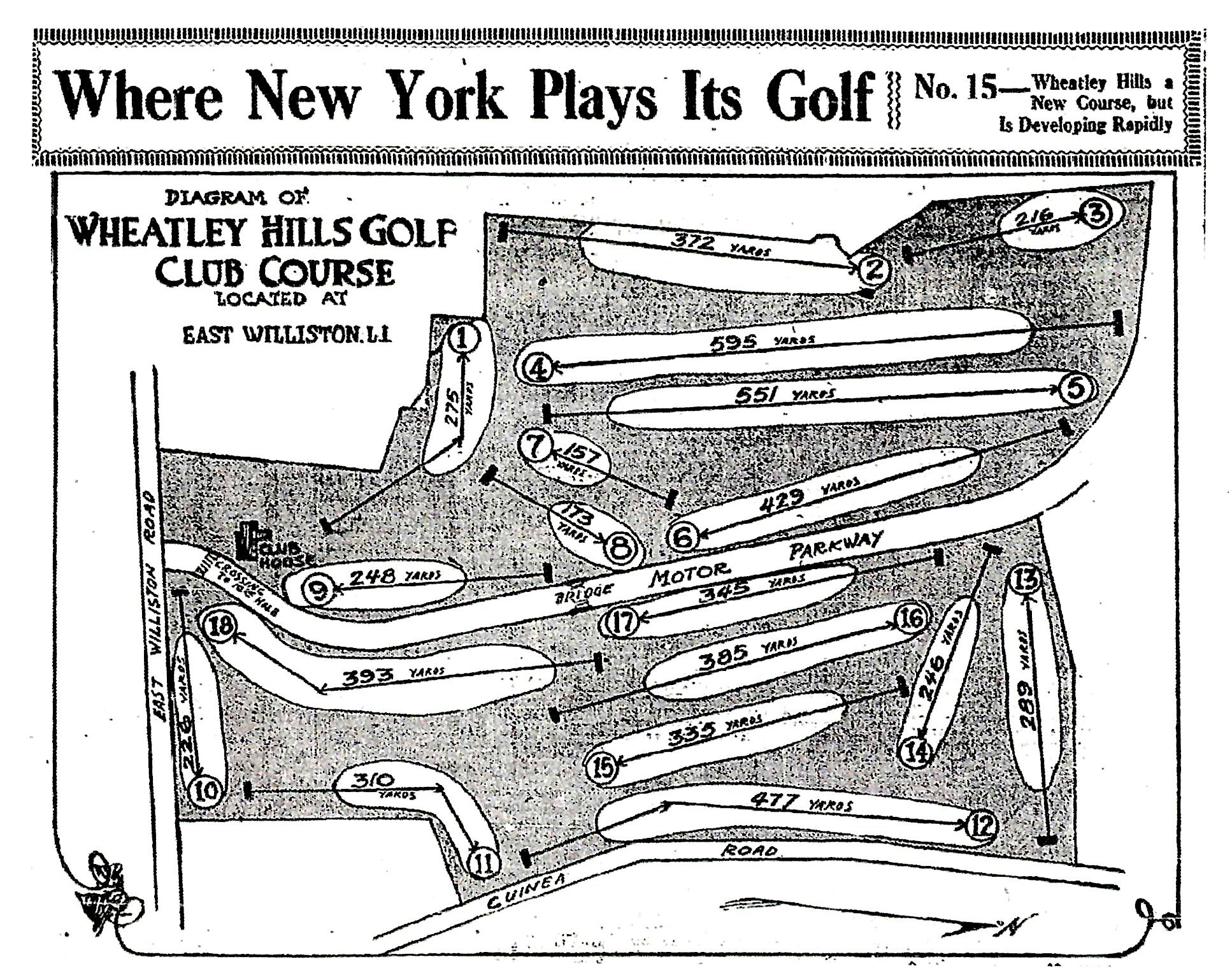
Now we get to a favorite of mine - the Motor Parkway bisecting the Wheatley Hills Golf Club. Note the crossing between the clubhouse and 10th hole (used when going from the 9th to 10th hole) and the bridge between the 8th and 17th holes. Also Guinea Road which today is Guinea Woods Road.
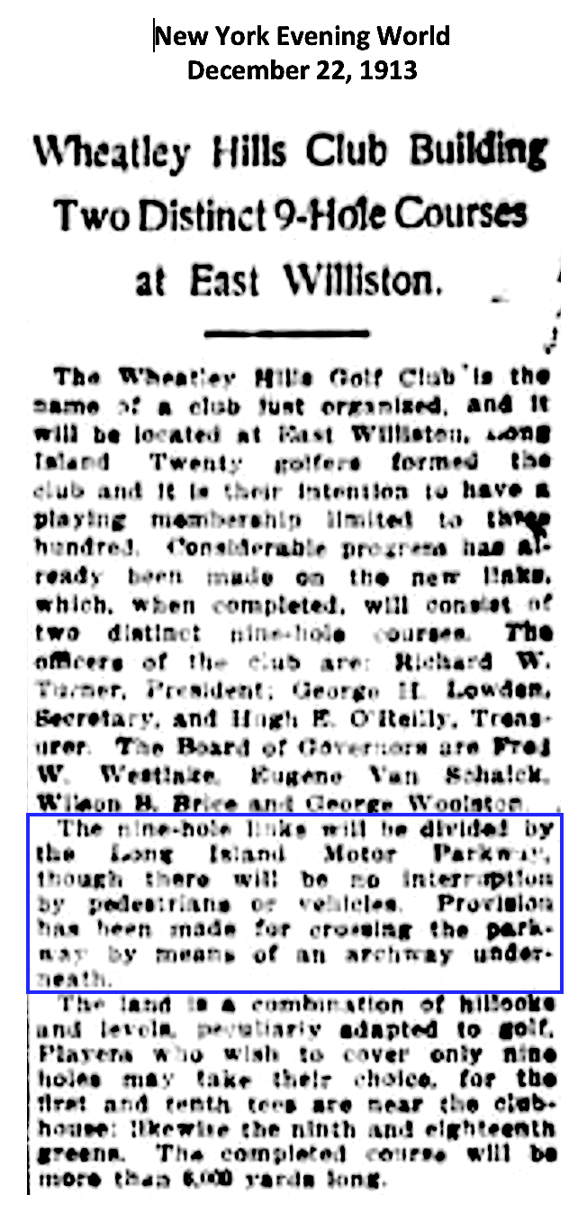
This 1913 article describes the building of the club's two nine-hole courses intersected by the Motor Parkway. (New York Evening World Dec., 1913)
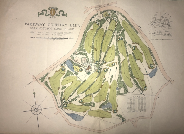
The Parkway Country Club
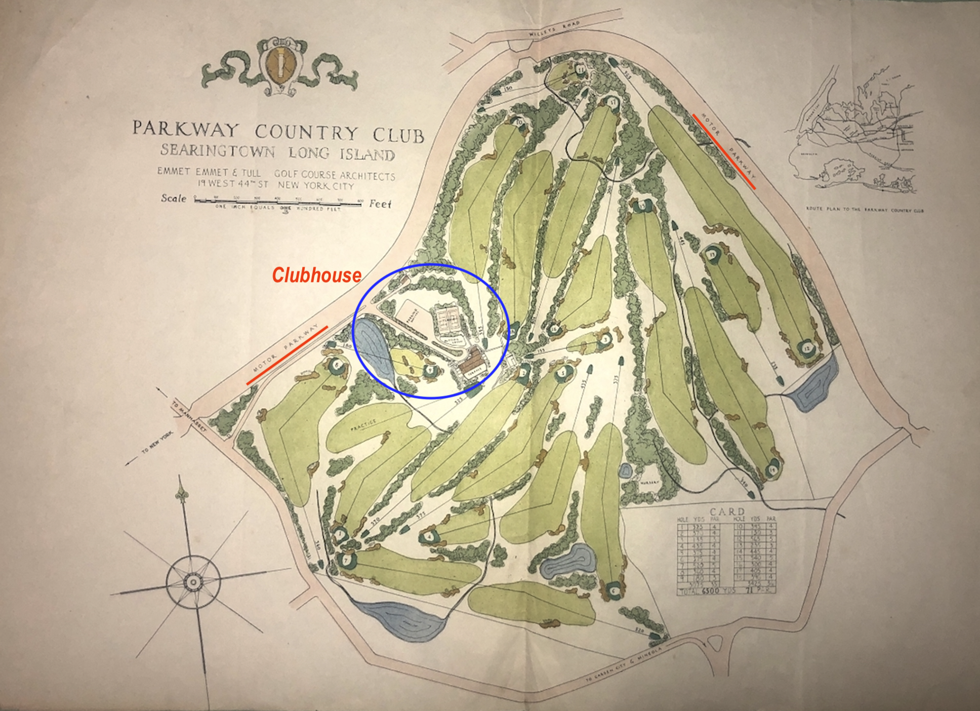
Another favorite of mine is a golf course planned but never built. This was to be named "The Parkway Country Club" in a very familiar section of Searingtown near the Motor Parkway. The clubhouse was to be accessed from the Motor Parkway (on the left/west side) with the parkway forming part of the perimeter of the course which was designed by Emmet Emmet & Tull, golf course architects.
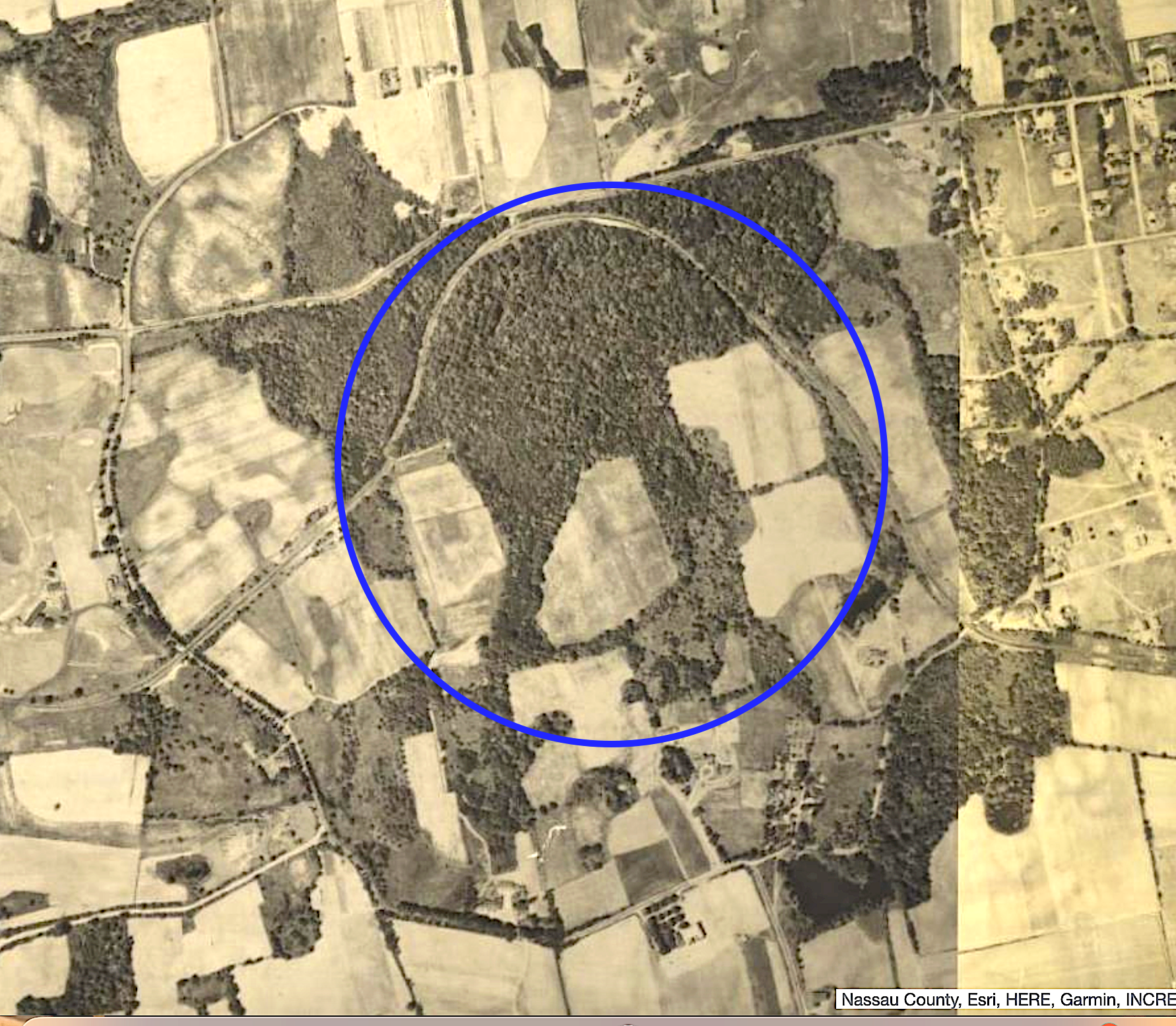
A 1926 aerial photo of the location.
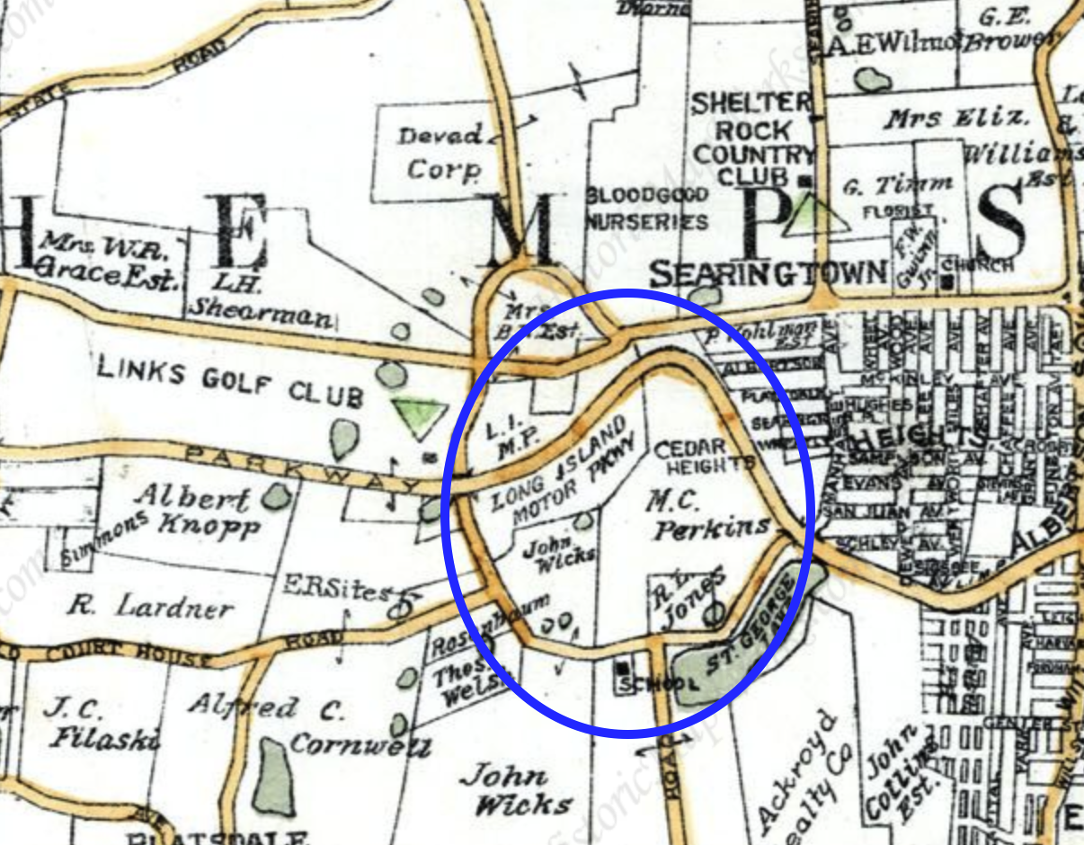
And a 1927 E. Belcher-Hyde map showing the property's land owners including the Long Island Motor Parkway.
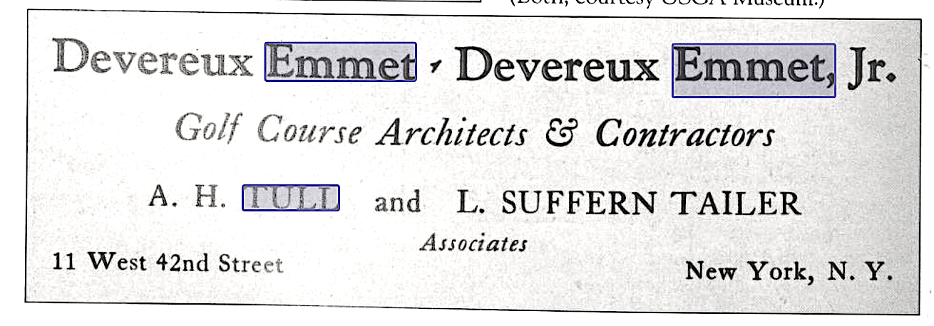
The firm of Emmet Emmet & Tull brought together a father and son as well as one other individual who was part of the firm from around 1930 - 1935 so I assume the golf course was planned around that time. (Images of America - Long Island Golf)
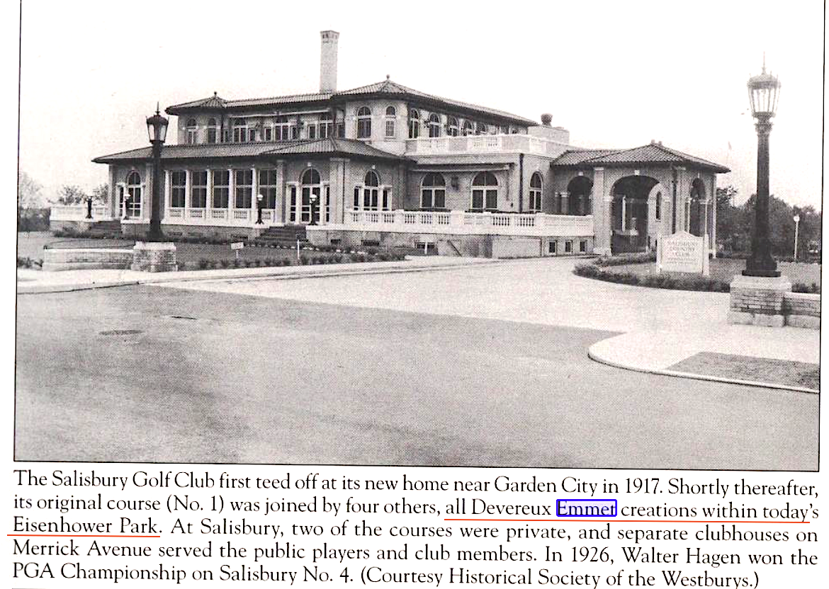
Deveroux Emmet was a preeminent golf course designer with many of his courses on Long Island such as at the Salisbury Country Club shown here. (Images of America - Long Island Golf)
Courses designed by Deveroux Emmet. Many are near the Motor Parkway.(golfpass.com)
Long Island Aviation Club
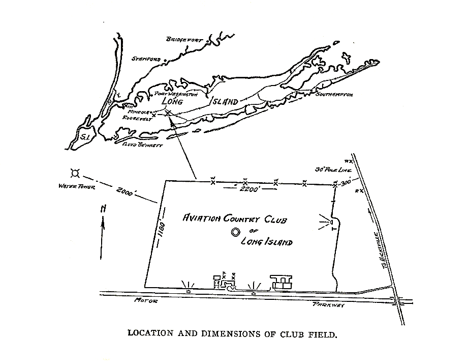
Much on vanderbiltcupraces.com has been written about the Long Island Aviation Club in Hicksville and its proximity to the Motor Parkway. Not much more to add here except I now notice the water tower 2,000 feet from the edge of the club. Will need more research to determine if the water tower is still there.
John Scheepers
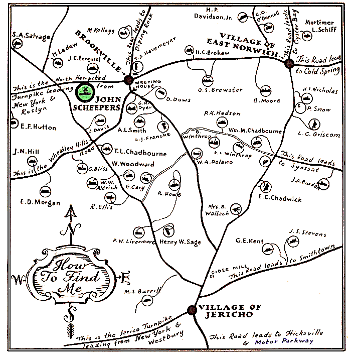
While not showing the Motor Parkway a reference to it is made on the lower right. The map highlights the location of the John Scheepers nursery company that specializes in bulbs from Holland. The 4th generation firm is still in business but now is located in CT.
Those familiar with prominent Long Islanders will recognize the property owners (feel free to comment on those of interest). And are there portions of the Vanderbilt Cup Race course also shown?
Estate Map
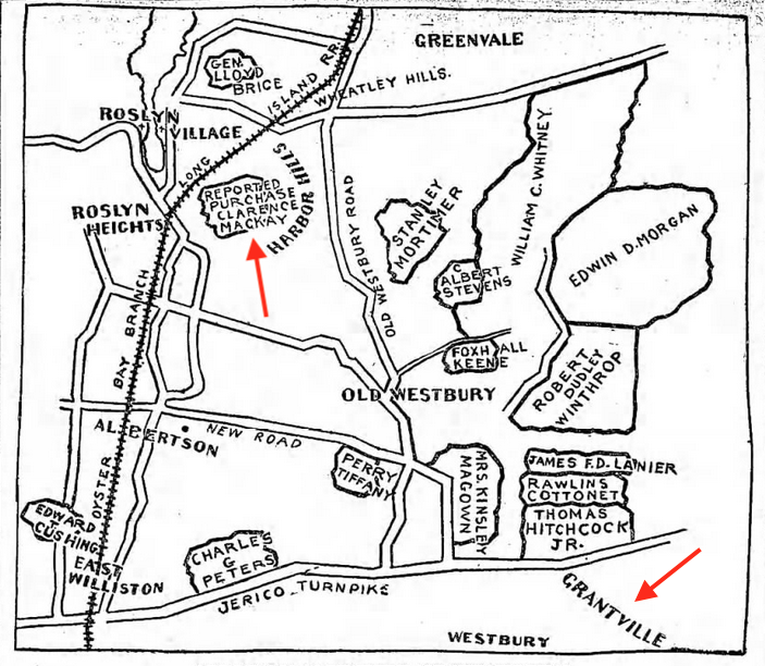
No reference to the Motor Parkway is made on this map (would make sense since it was produced in 1899) but still an interesting map as noted Long Islanders are shown, including Foxhall Keene (driver in two Vanderbilt Cup Races) and William C. Whitney. And see the notation on the reported purchase by Clarence Mackay and a town named Grantville. (Brooklyn Daily Eagle Aug. 13, 1899)
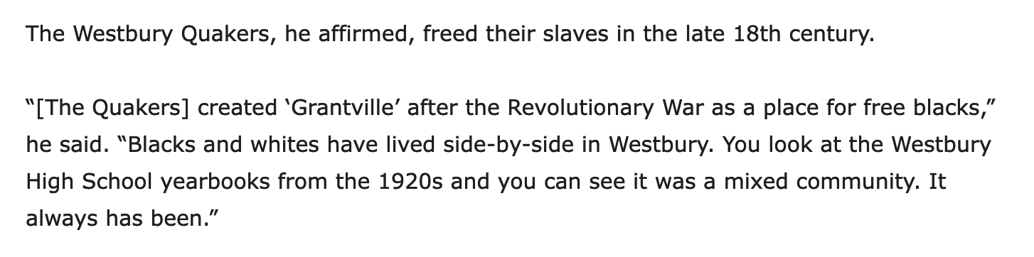
Grantville is described in numerous publications as a section of Westbury created for "free blacks" (in this publication by the Quakers after the Revolutionary War). (Nassau Illustrated, 2019)
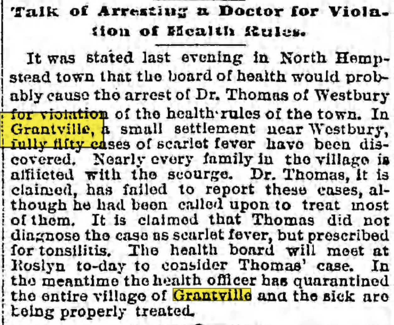
Grantville is mentioned in this article as experiencing an outbreak of scarlet fever caused by a Dr. Thomas of Westbury. (Brooklyn Daily Eagle Jul. 6, 1893)
I hope you find these maps and related material of interest.


Comments
Presently there is a water tower in that approximate location from the Long Island Aviation Club. Located at 410 Newbridge Road, Hicksville, NY, now part of the Hicksville Water District which took over from the Nassau Water Company in 1921.
What little info I could find was at https://hicksvillewater.org/history-through-pictures/
Thanks Ernie - I know that water tower well as my home in Levittown was about a 10 minute walk from it. Here’s a 1950 photo showing what I believe to be the tower and its proximity to the LI Aviation Club.
Hey my house is in that picture!
It appears that Levitt & Sons had yet to acquire any rights to the LIMP ROW (or the LI Aviation club) as Pintail, Heron, Skimmer, Crocus and Laurel Lanes all have one or both stubbed ends off Orchid Road but none cross the ROW.
as a kid I used to play on the LIMP ROW. I post a couple of pictures of the ROW between the sump off Skimmer and the Aviation Club, but I do not remember the LIMP being raised in that area. In a previous thread it was explained that wasn’t a farm bridge, just little creek jumper.
Nice, early photos of you growing up in Levittown; Ernie! Remember one of them was a Mystery Foto you entered. I added some road names to Art’s 1950 map to pinpoint where that Water Tower was. It was very close today’s Gina Marie Court, which wasn’t a residential street until after year 2000. Water Tower was there on a 1974 aerial, but not seen on a 1980 aerial.
Thanks Ernie and Brian for your comments. Here are three more photos - the first two are from 1966 and show the Gina Marie tower/tank and one a a little bit north on Newbridge Road indicating that both were around at the same time. As was noted the Gina Marie tower was taken down sometime in the early 1980s with the other one surviving. That one is now near a small strip shopping center now. Third photo is a current one showing the area.