Construction Work Has Begun on the Garden City Stewart Field Parking Lot Adjacent to the Motor Parkway
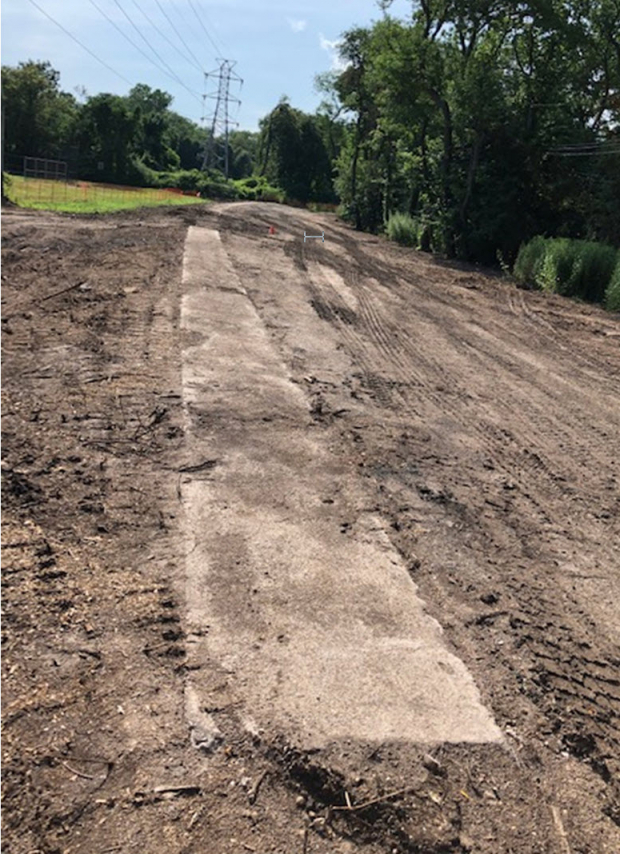
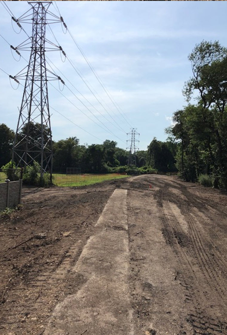
Cyril Smith of Garden City reports that work has begun on the Stewart Field parking lot off Raymond Court. As seen above, the Motor Parkway's southern 3-foot concrete extensions have been uncovered and remain intact.
Enjoy,
Howard Kroplick
Location
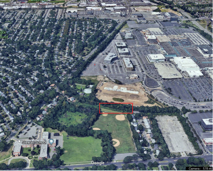
The Village of Garden City is creating additional parking spaces south of the right-of-way. It plans to preserve this section of the Motor Parkway.
June 25, 2019 (Courtesy of Howard Kroplick following a report from Al Velocci)
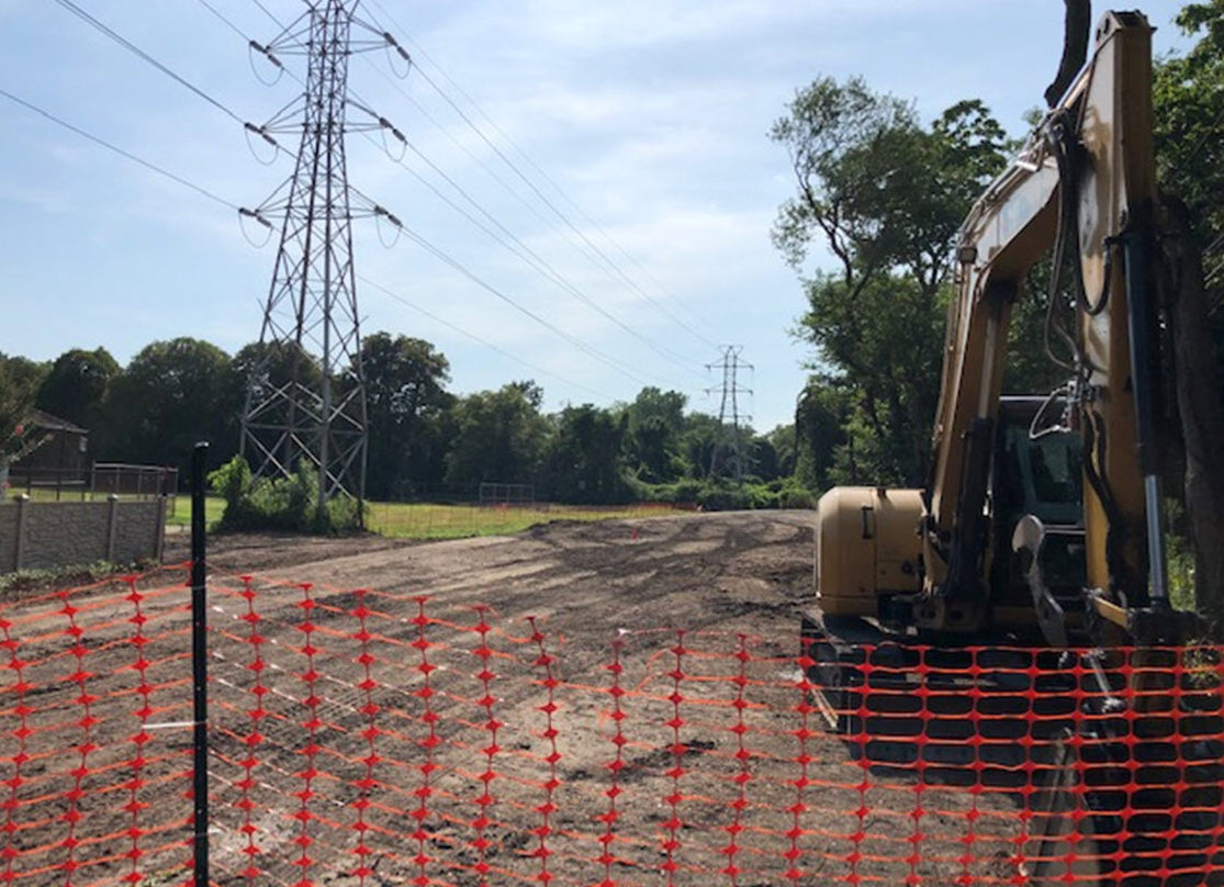
July 26, 2020 (Courtesy of Cyril Smith)

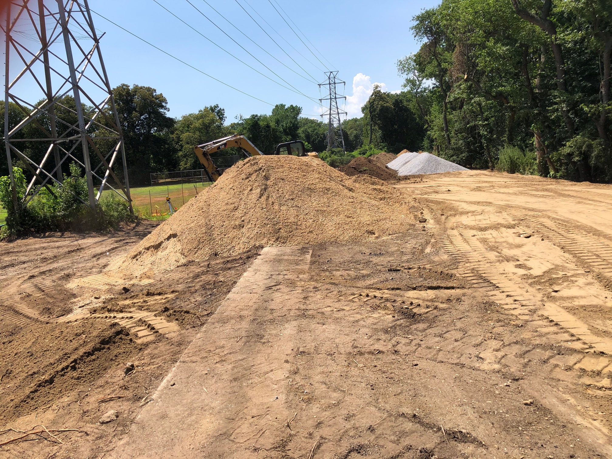
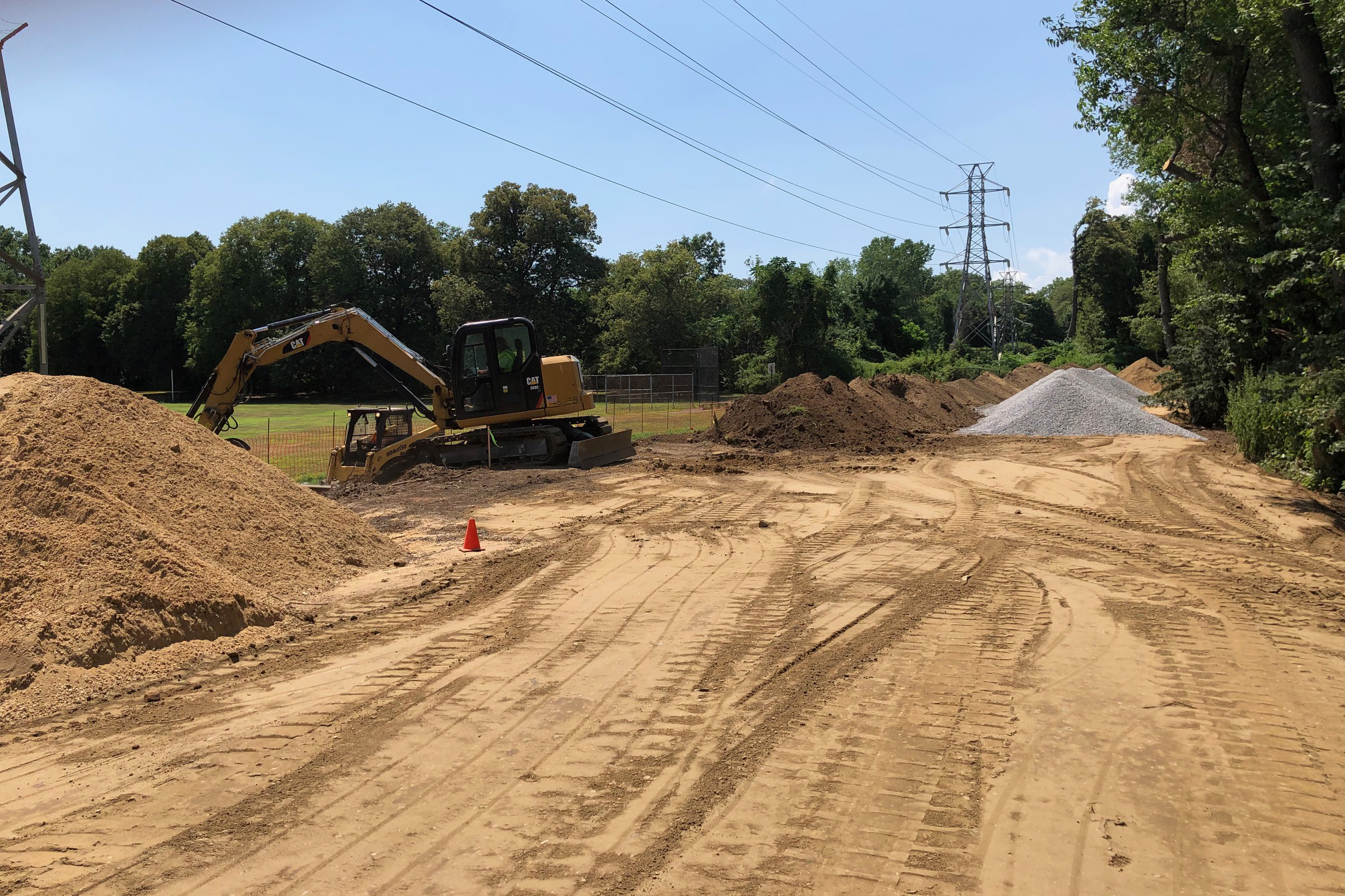
July 29, 2020
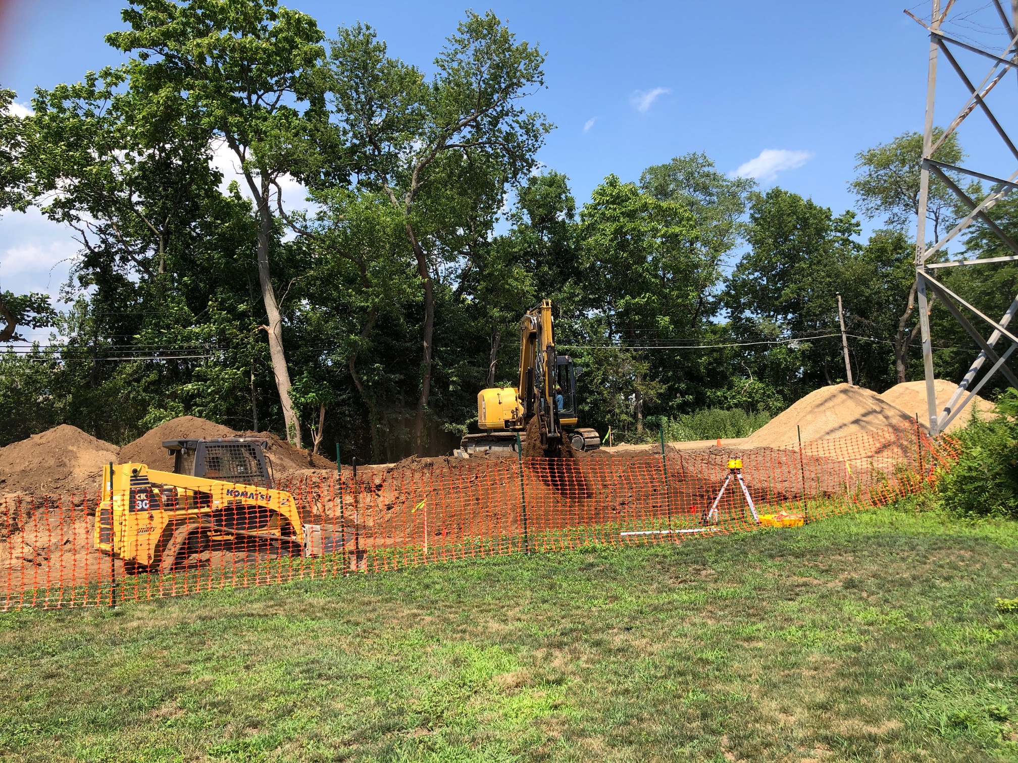
Revised: This area is approximately five feet below the Motor Parkway grade.


Comments
Great coverage of this Cyril, thank you. The banking of the roadbed along the curve is obvious in the 7/26 images. Seeing this brings to mind a past unsolved mystery photo, I’ll look back on this.
Seeing the curve actually brought this solved mystery to mind.
Amazing!. Thank you Cyril!
Thank you Cyril - I’ll be going over to keep tabs on it. Would you know if they’ve dug up the concrete posts that are in the area?
Howard, The vertical drop is close to five feet. Also, its right up against the Parkway’s concrete extension
Thanks to Cyril for the update. Fortunately the construction crew is following the plans on paper. That doesn’t always happen! Looking forward to seeing how this progresses.
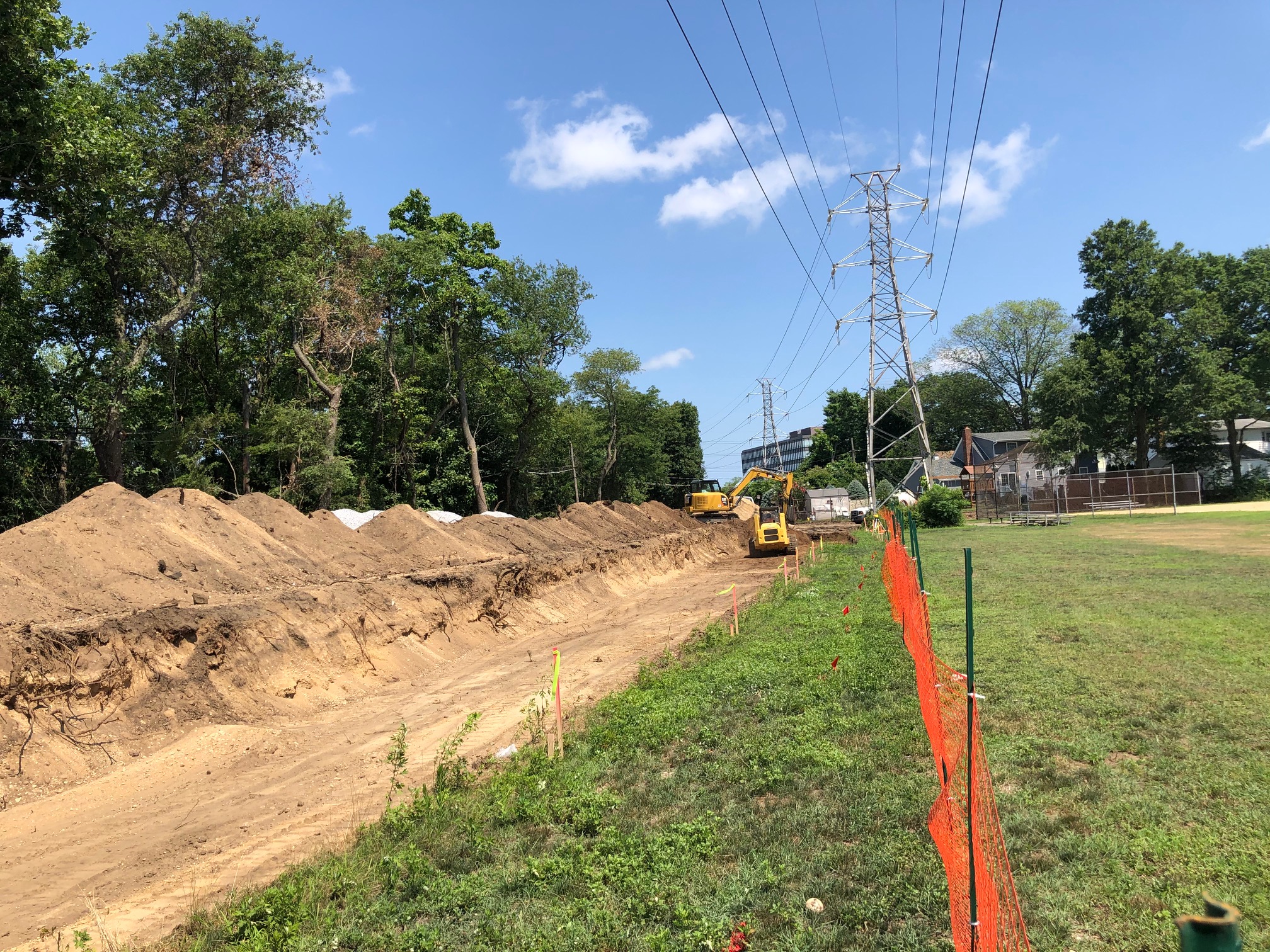
Howard, Just got back from the Parkway construction site off of Raymond Court, Garden City. Appears a retaining wall is going to built butting up against the Parkway’s concrete extension. According to Bill Belmer, parking is going to be only on the south side of the Parkway ROW in a north south alignment which means if you pull into to park, the front wheels are going to be on the concrete extension. Could not get a straight answer from any of the workers there about the mound of gravel, asked if that was going to be used as the final surface covering. Suggest to anyone visiting the site to park in the Stewart Ave. ball field parking lot to get a good view of whats going on.
Art, Asked the workers there if they knew anything about the clearing of the area and the posts, nada. My recollection there were at least three posts in that area, will keep checking.
Thank you Cyril and everyone for keeping us all informed.
Al, I’m gathering the southern three foot extension/parkway is higher in elevation than the parking lot construction site, and will be out of reach from autos, thanks to a retaining wall protecting the parkway. I’ll be down soon as well to check on progress and record. Thanks for the updates.
Frank, To clarify, the Parkway ROW level is about is about 5 feet higher than the ball field level, hence the need for a retaining wall The cars will be parking ON the Parkway . See my earlier post .
Howard, Garden City Village is spending a lot of money to provide parking spaces for the users of the ball fields. I think they should charge a small fee for the privilege. To identify them, issue a small metal plate to be attached to the front of the vehicle saying something like…Long Island Motor Parkway parking. ????
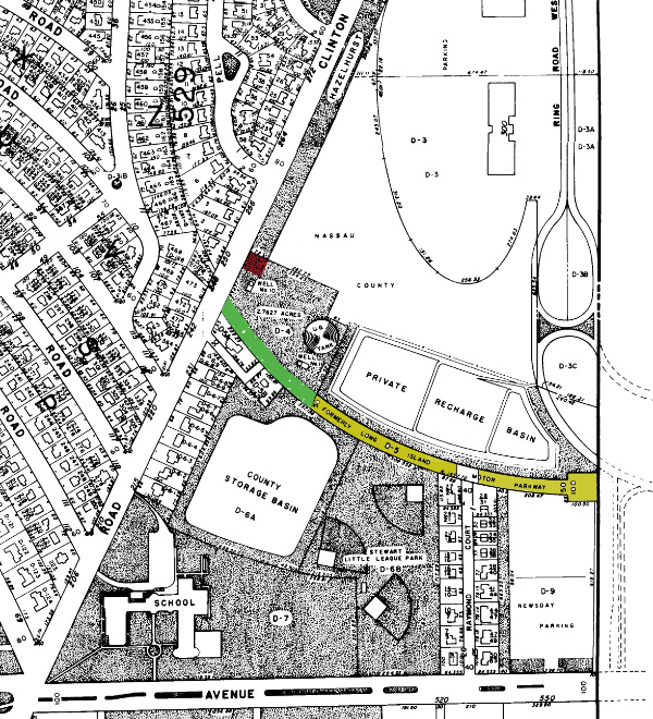
The LIMP ROW is 50 feet wide. The roadway itself was centered and occupied 22 feet including the 3-foot concrete edges, the north edge having been removed for a water main installation. The parking area will extend to the property line and its south edge will therefore be 18 feet from the edge of the concrete. A retaining wall will be installed on the property line with fill behind it to level that area. The whole parking area will be covered with bluestone gravel, including the existing concrete and asphalt. The total width of the graveled area will be 40 feet, or to the north edge of the original roadway. No stall markings will be provided - the area should accommodate about 20 cars parked on the south side perpendicular to the roadway.
Cyril and I tried to have the concrete and original asphalt roadway left uncovered, with a curb added on the north side to delineate the original edge of the roadway, but were not successful. However, the gravel layer will be thin - maybe after the work is complete we can go and sweep it off the concrete.
Correction: the south edge will be 14 feet from the concrete.
Thanks Bill - two questions:
1. What do the markings (SS, hp, CP, TC, bc) on your first survey refer to?
2. The far west side of the parking area shows a new 6’ chain link fence - will this prohibit walking further west along the old ROW?
3. Is it possible to view the other sheets referred to?
Thanks for documenting this unfortunate destruction of the Motor Parkway remnants. Hopefully something will be left for us parkway enthusiasts.
Added that last question, so actually three questions!
I’m not sure whether to cheer or cry. Cheer that some care is being taken. Cry at one more example of so-called “progress” unnecessarily eroding the LIMP RoW. Thanks to all who are on top of this. Sam, III
Speaking of crying, I simply can’t find my old pix of the Raymond Court segment; I KNOW they were posted! However, on my LIMP History page 2, at <http://sbiii.com/limphst2.html#kienzle> is a 2002 pic looking down on the GM’s house from the RoW, specifically showing the difference in grade noted above <http://sbiii.com/limppix/limpgc02.jpg> (attached). Sam, III
To answer Art: My interpretation is: SS=solid surface [the LIMP asphalt], hp=high point [the edge of the concrete], CP=control point [reference point], TC=top of curb, bc= bottom of curb. The fences at both ends will have both pedestrian and vehicle gates for access to the parking area and beyond. The other sheets are details for the steps, fences, lights, etc - not so interesting except to the company doing the work.
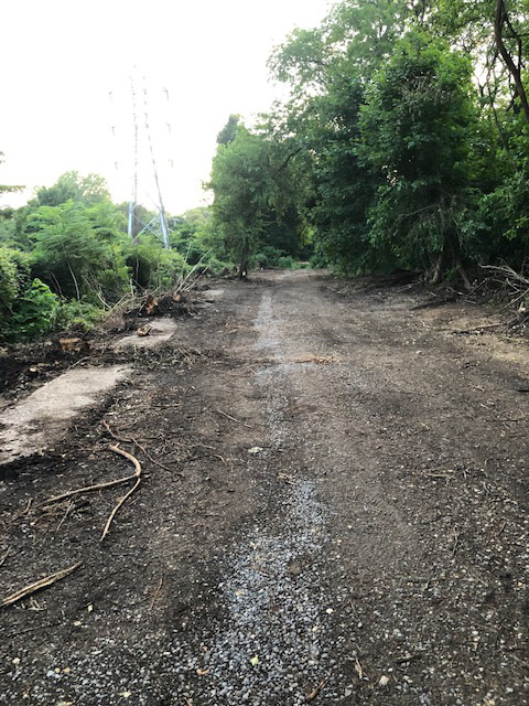
Attached are photos taken today, 2 August. #1 shows the start of retaining wall construction at west end. #2 shows embankment cut away to install retaining wall to be followed by backfill up to the level of the roadway concrete. #3 shows what appears to be the original grade [dark dirt at bottom] before the area was filled to create the superelevation of the LIMP curve; also a broken concrete post. I have not been told so far of any salvaged whole posts in the work area.
The gravel overlay is called out as 4 inches thick over the entire area, so I guess it can’t be swept off as easily as I thought.
August 8: recent pics (post storm) showing retaining wall, gravel, steps, possible post and roadway extension.
Two more . . .
Aha! My Raymond Court pix (from 16 Feb 1999) were right under my nose, at <http://sbiii.com/limpkwy2.html#today>; sample attached. Sam, III