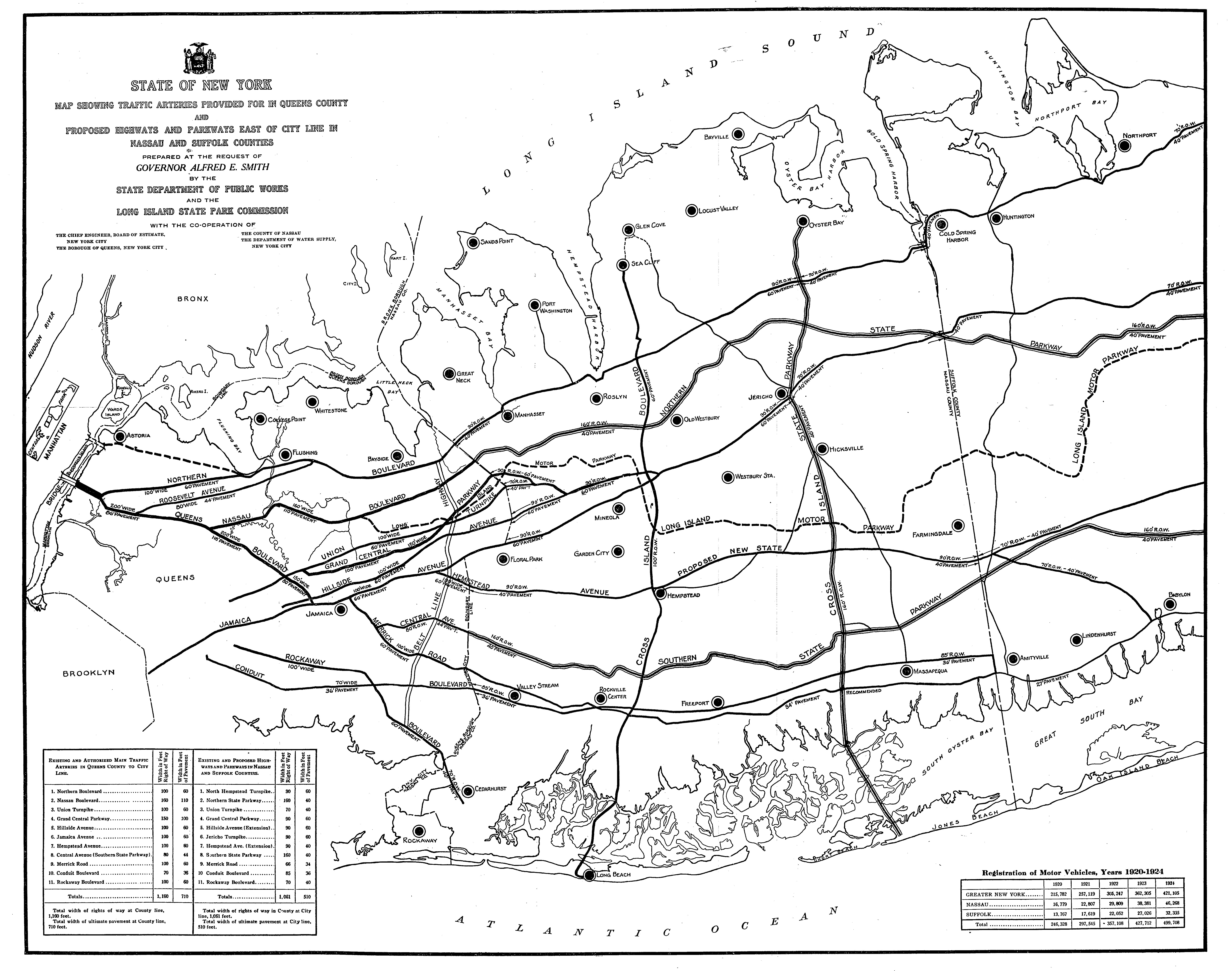
1925 Long Island Map of Queens Traffic Arteries & Proposed Highways and Parkways in Nassau & Suffolk

In 1925, the New York State Department of Public Works and the Long Island State Parkway Commission prepared this map at the request of Governor Alfred E. Smith.
Enjoy,
Howard Kroplick
Long Island Motor Parkway from Fresh Meadows to Dix Hills
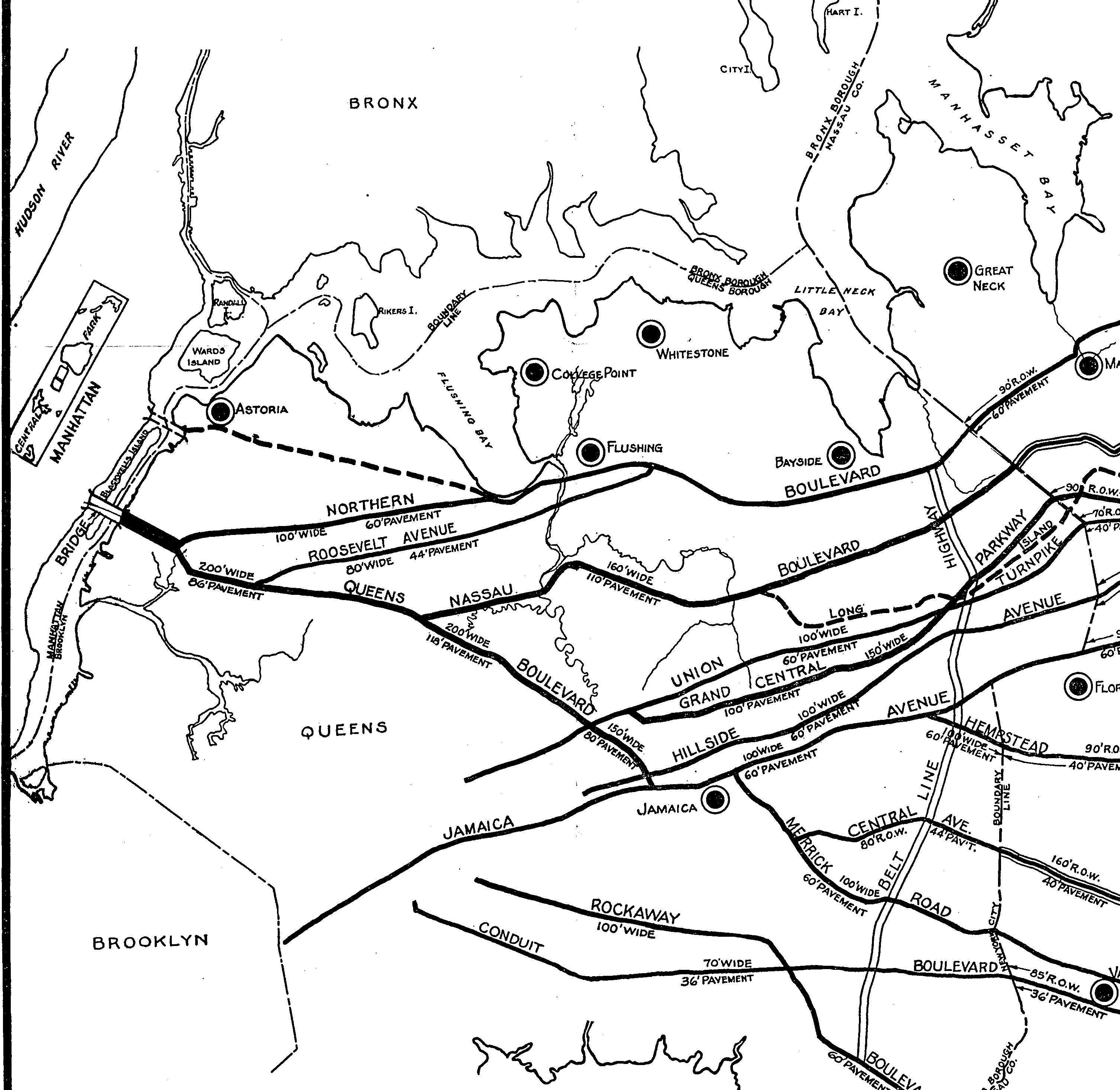
The Queens section. Note: The proposed Belt Line Highway.
Very interesting that at first the proposed Northern State did not bypass Old Westbury!
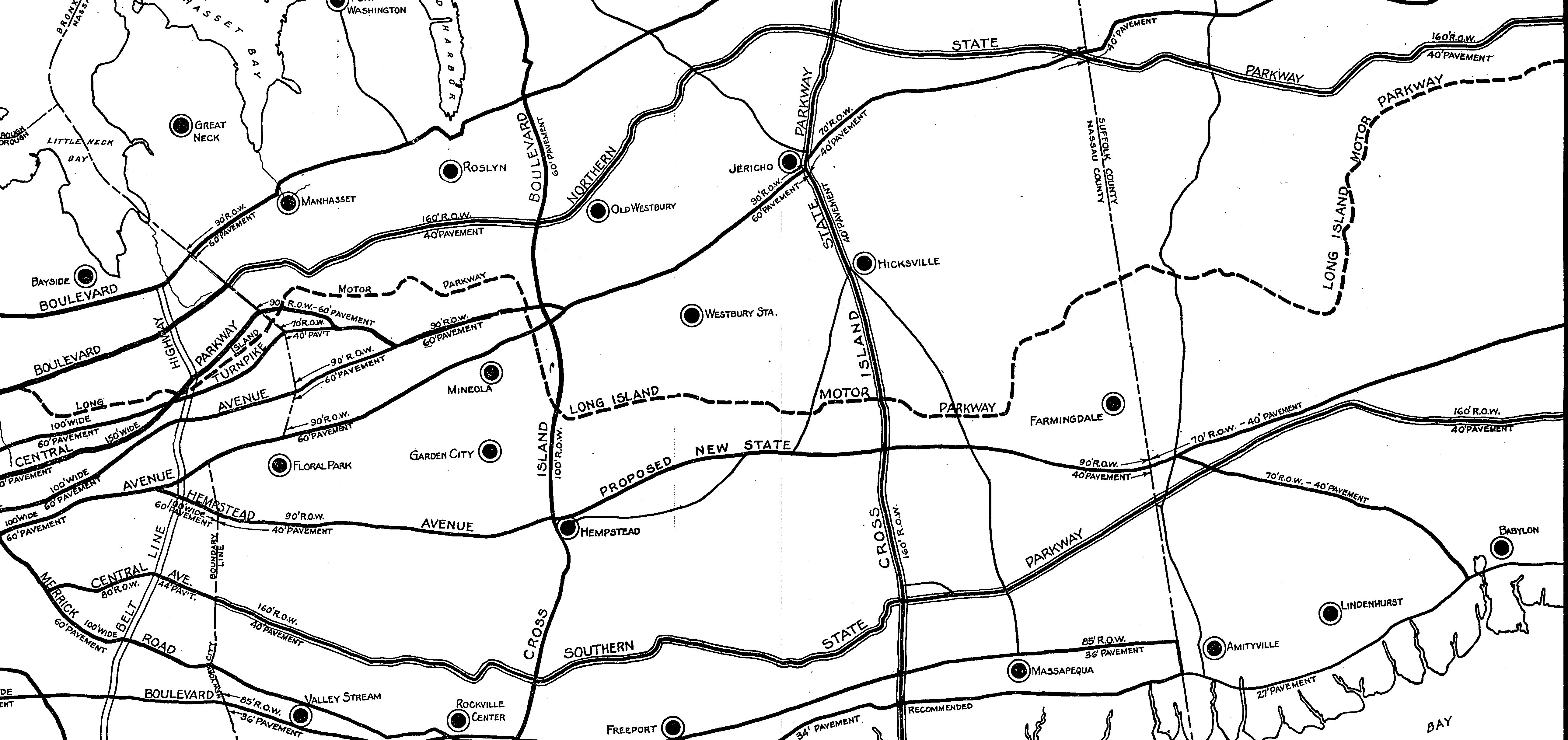
The Nassau County section. Note:
-As per Jerry Mintz' below comment: "Very interesting that at first the proposed Northern State Parkway did not bypass Old Westbury!"
-The proposed Cross Island State Parkway from Oyster Bay to Jones Beach which approximately became Wantagh State Parkway.
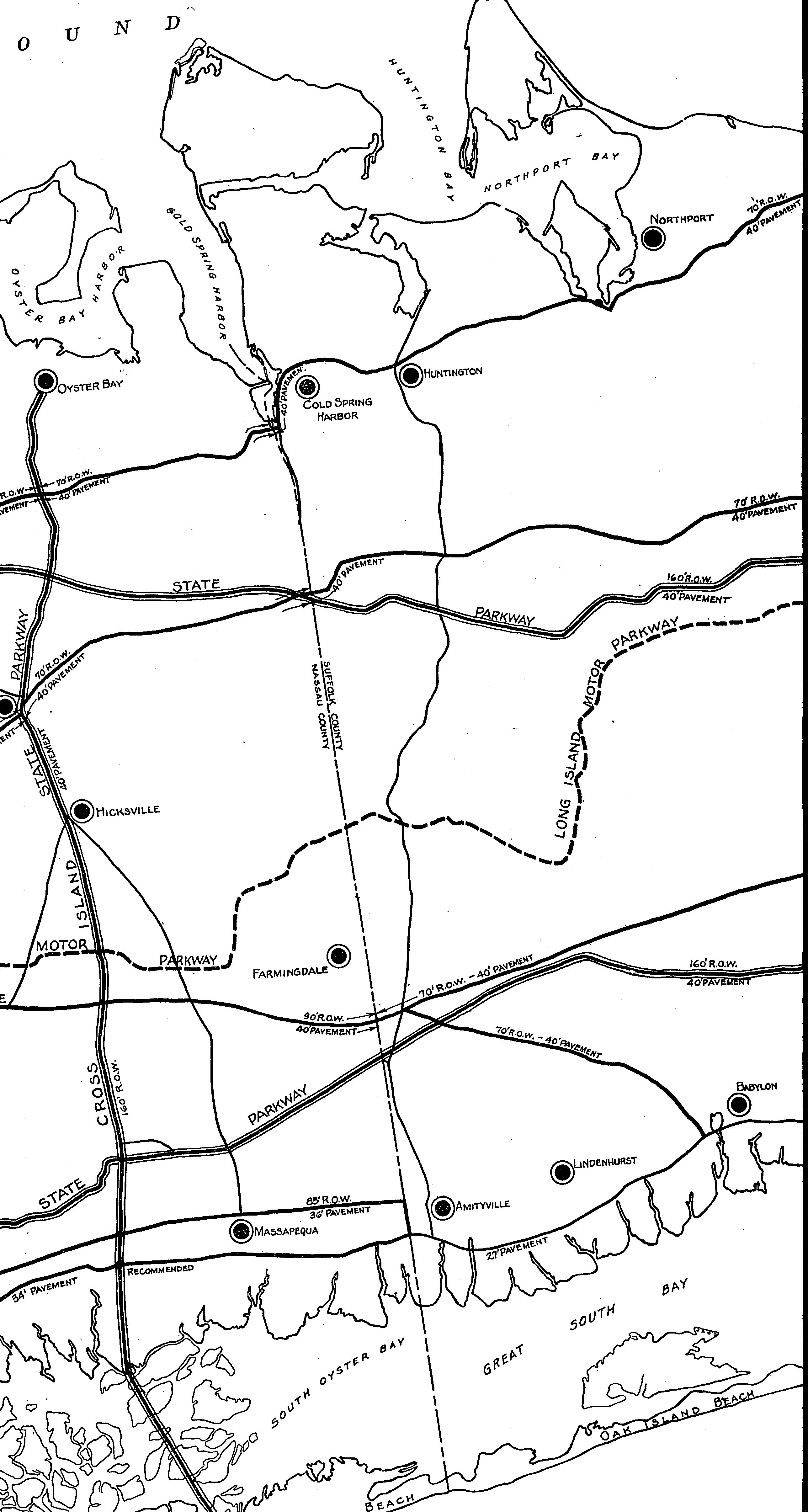
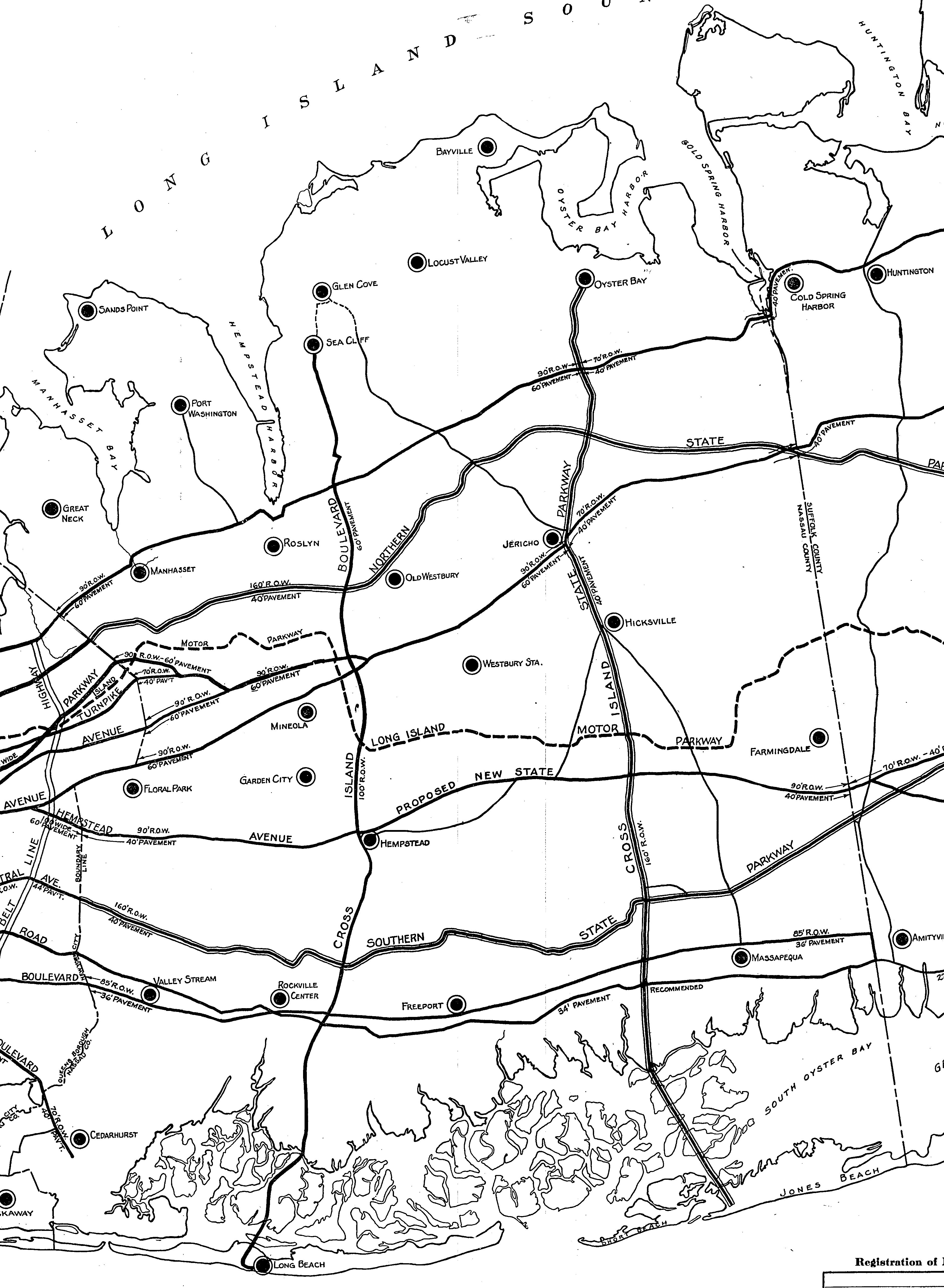
The Suffolk County section.
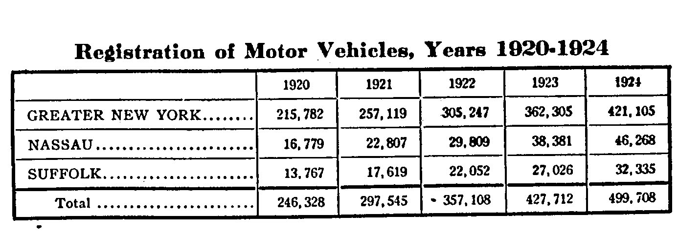
In five years from 1920 to 1924, motor vehicle registrations doubled in New York City and Nassau and Suffolk Counties.
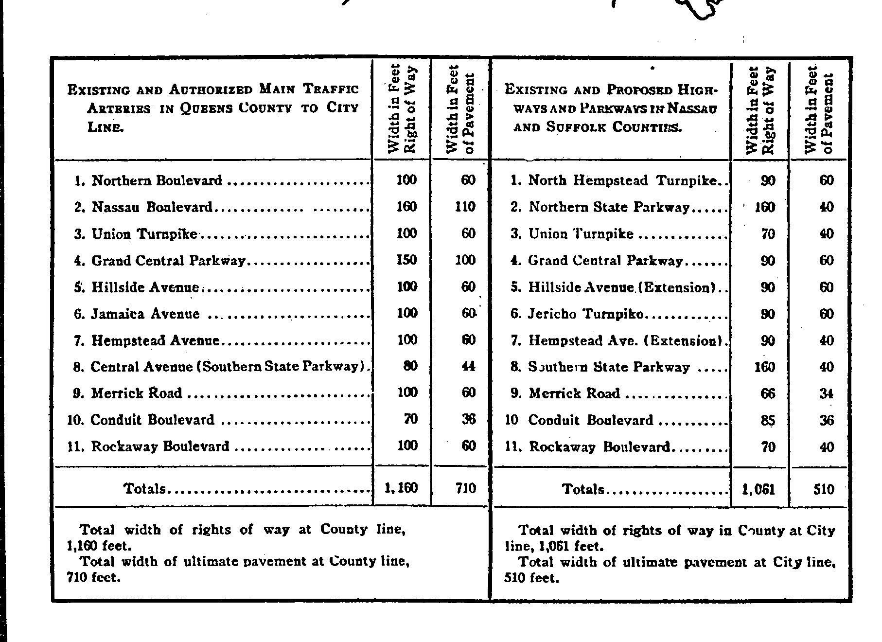
Width of right of ways and pavements.


Comments
From Jerry Mintz
Very interesting that at first the proposed Northern State did not bypass Old Westbury!
The bend towards the south in the NSP just west of Glen Cove Road is known as “Objectors’ Bend” because nearby estate owners objected to this 1925 routing, believing that it would ruin their property values. Robert Moses was eventually forced to build the parkway parallel to the Motor Parkway to Carle Place and then take a more middle route for his “northern” parkway in the segment to the Wantagh State Parkway that Howard has well documented in aerial photos. Ironically, less than a decade later, many of the same objectors lobbied for a spur through their area as this NSP segment was being built as they came to realize how the new parkway had been enhancing property values elsewhere. Moses snubbed them, happily, according to some reports. For fans of Oheka Castle, note that the 1925 routing would most likely have led to its early demise.
I’m a little surprised that this map does not show the proposed Creedmoor Parkway which was to run along the abandoned Central Railroad ROW from somewhere west of the still in operation Creedmoor Spur to the Flushing area. Some other maps from the 1920’s showed this as part of the grand plan to expand arterial highway construction. For some reason all this old highway/railroad/subway/trolley history in East Queens is fascinating to me,e.g.,your recent Union Tpke. underpass discovery. Keep up the good investigative work and thank you for making my neighborhood (Queens Village) more interesting.