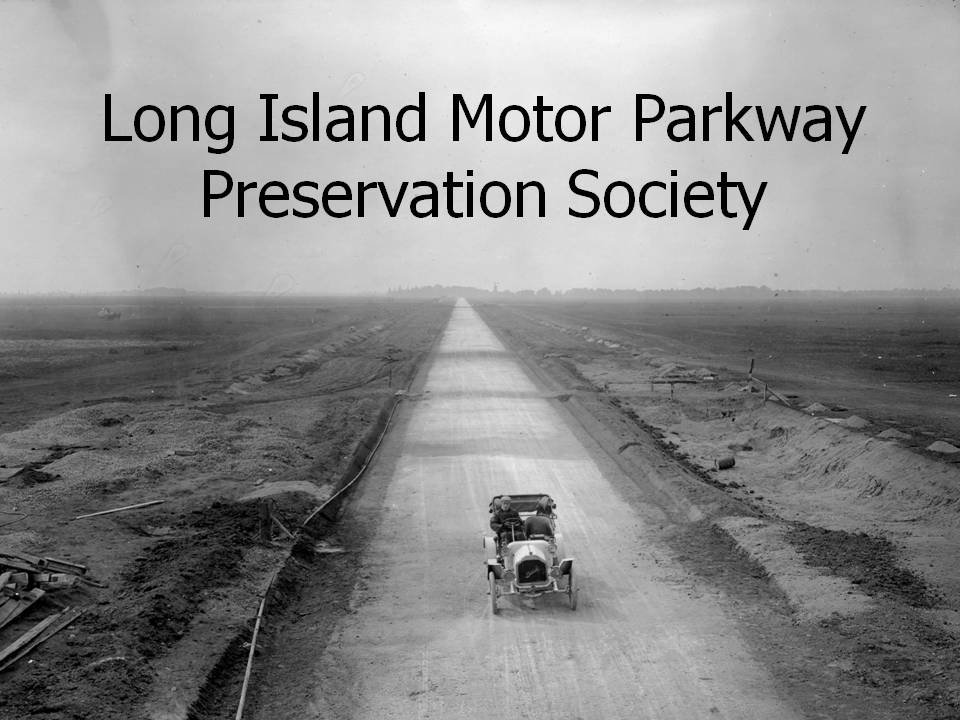
The Last Intact Motor Parkway Bridge in Suffolk County
Over the last five years, there have been numerous unsuccessful attempts to photograph the reportedly last intact Motor Parkway Bridge located in the Melville Sand Pits. Long Island Motor Parkway Preservation member Chris Giffuni sadly reports that this bridge was in destroyed sometime during the last ten years.
Chris Giffuni: "I have been informed that there is nothing left of that bridge up there. They unknowingly (uncaringly) demolished the whole thing in the last decade or so. The site engineers believe there is no longer a trace of the parkway on their property anywhere at this point."
December 6, 2011 Update: Several reports indicate that the bridge is still standing. The mystery continues.
In tribute to the Clody Motor Parkway Bridge, here are photos from 1972 and the 1980s:
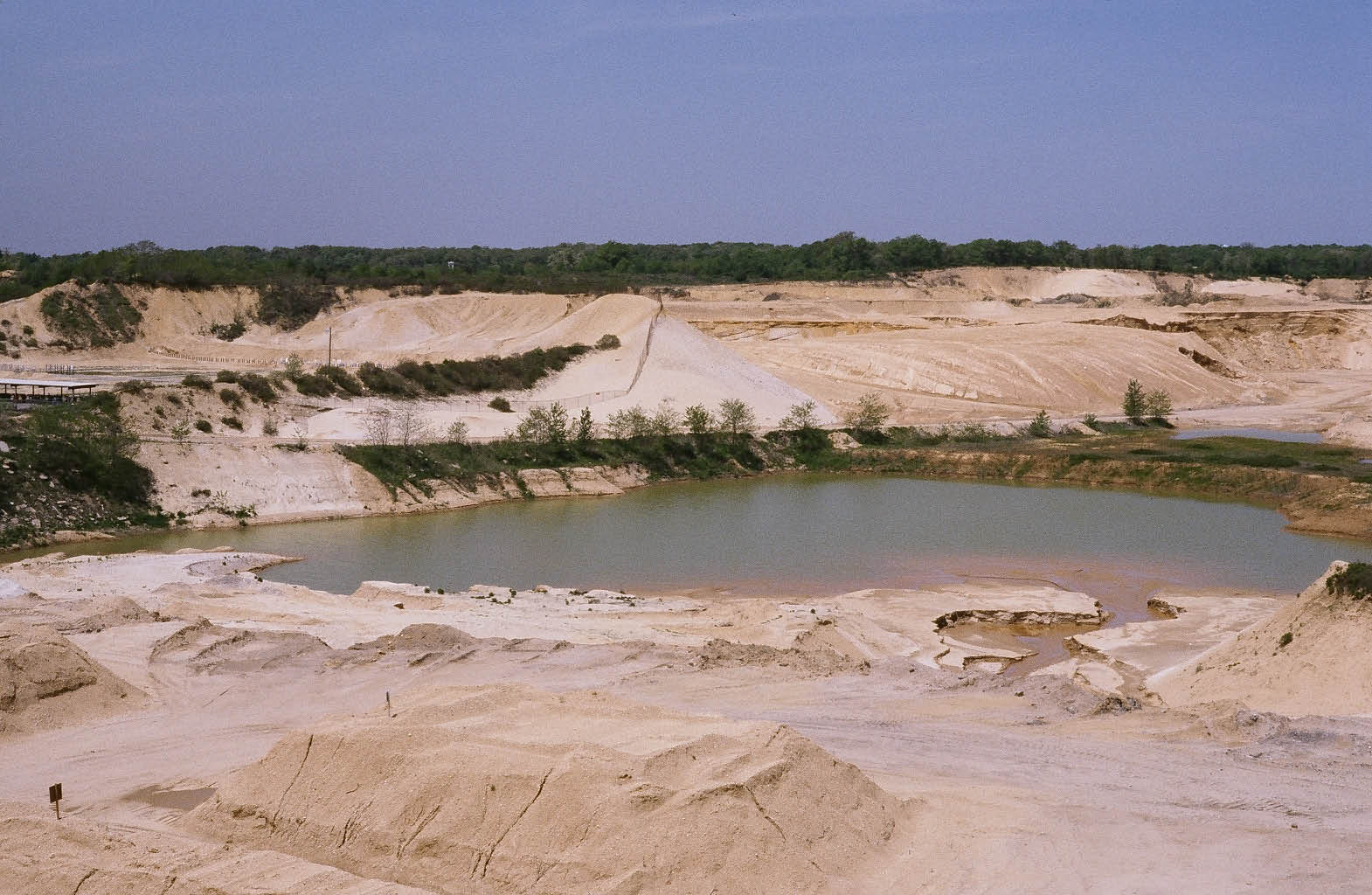
Long after the Motor Parkway closed in 1938, the 14-acre Clody Farm was purchased and made into one of the largest sandpits on the Long Island in the 1950s. Although the huge sandpit was soon closed to the public, Ron Ridolph was able to document the Clody Motor Parkway Bridge as part of his Motor Parkway photo essay in the 1980s:
Views Looking East
The Motor Parkway right-of-way was still being used as a road for deliveries. The office buildings on Route 110 can be seen in the background.
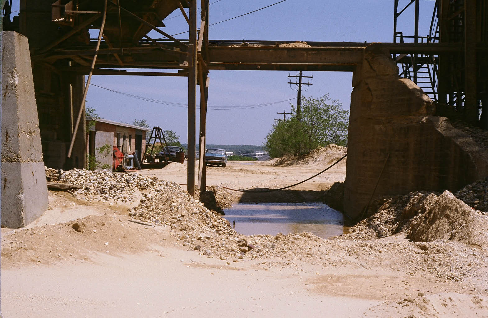
The warning on the bridge has almost totally faded away. Note the small building on the left which can also be seen in the current Google Earth aerial below.
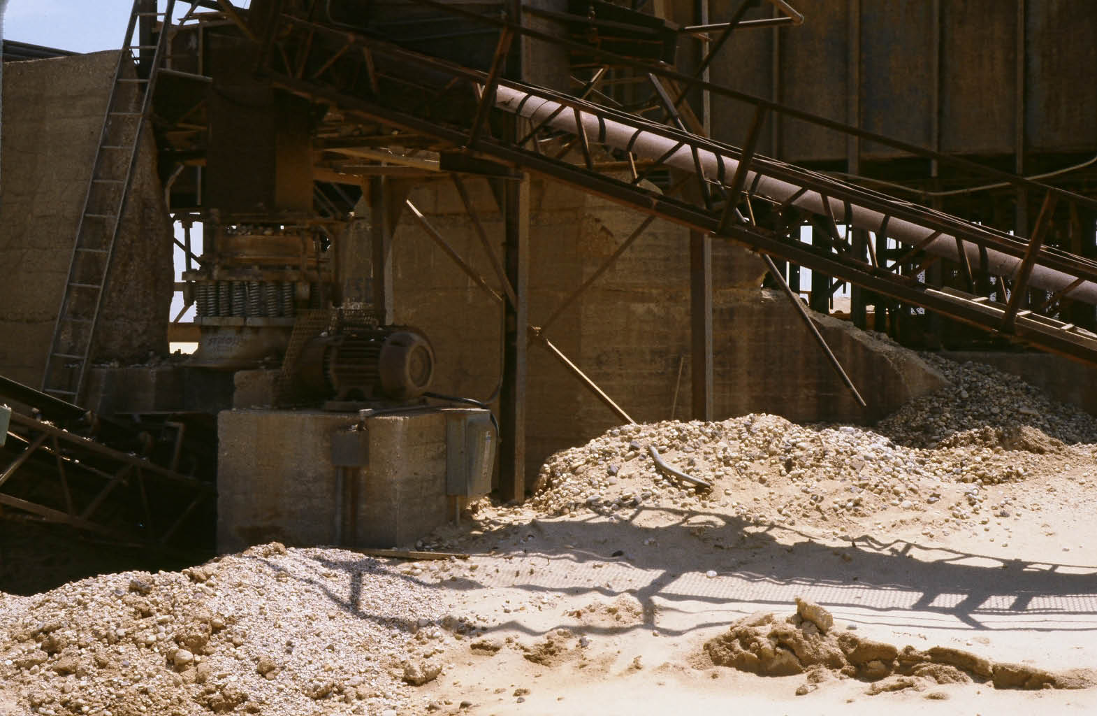
The north abutment.
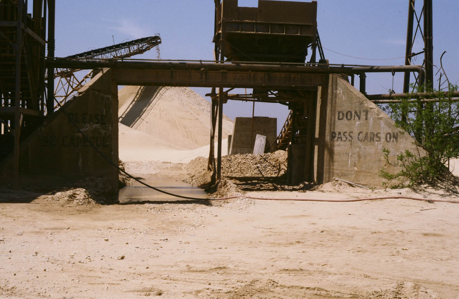
Views Looking West
Decades after being constructed, the embankments of the bridge were still strong enough to support a hopper capable of holding 30 tons of sand.
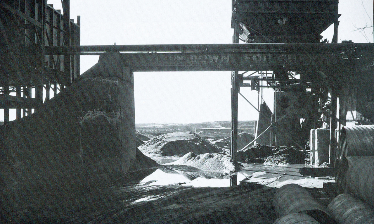
As seen in this 1972 image, the faded warning on the bridge once read "Slow Down For Curve". (Courtesy of Margaret and George Vitale)
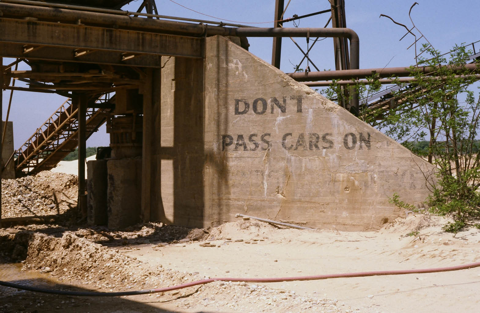
The opposite side of the north abutment with the warning "Don't Pass Cars On...(The Left)".
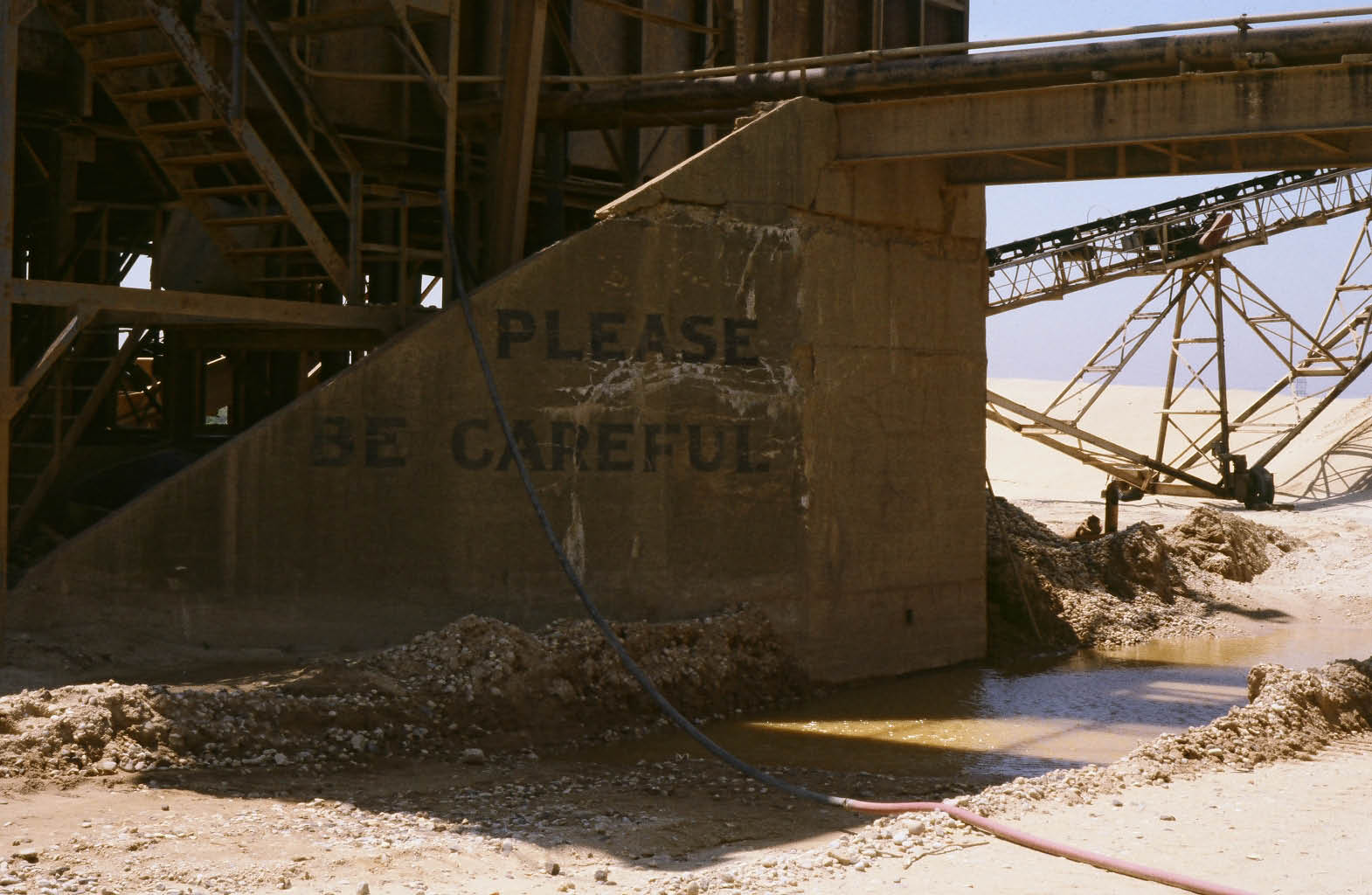
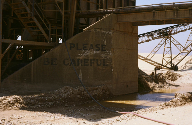
The south abutment with the warning "Please Be Careful".
There are now only seven remaining intact Motor Parkway bridges of the original 65. If you wish to assist in projects to help preserve them and other parts of the Motor Parkway, please join the Long Island Motor Parkway Preservation Society. Become a member by completing the information in this registration form and sending it to [email protected] . No fees are required-just energy and dedication.
Links to related posts on VanderbiltCupRaces.com:
From the Ridolph Collection: The Motor Parkway Bridge in the Melville Sand Pits
The Intact Long Island Motor Parkway Bridges
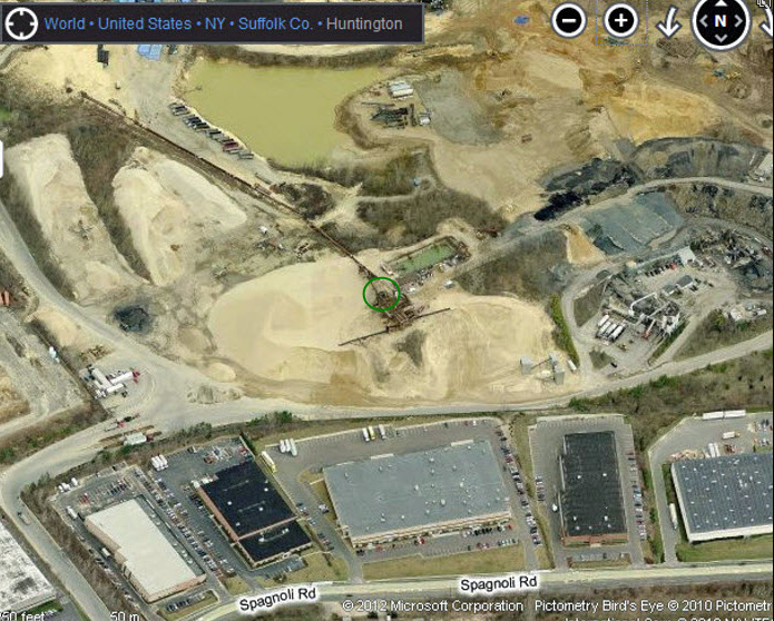
Update March 26, 2012: Location of the Clody Farmway bridge as seen on Bing Maps.


Comments
Sad - I read a good deal about the motor parkway in Tom Lewis’ Divided Highways.
It was quite an egotistical little vanity project, really, but what a piece of history!
1) what is a sandpit (other than the native habitat of a Sarlacc?)
and 2) why couldn’t anyone, in ten years, get on that land and photograph the bridge (again, Sarlacc?)
Hi Agent:
A sand pit is a commercial mine to extract sand used primarily for concrete. This New York Times article provides background on sand mining operations on Long Island:
http://query.nytimes.com/gst/fullpage.html?res=9A0CEEDE1738F935A25752C0A9639C8B63
The Melville sand pit is private property. Over the last decade, the owners refused requests to photograph the Motor Parkway bridge.
Howard
Not good news of course. Maybe that’s why I was met with somewhat of an abrupt response when I inquired about the bridge to the sandpit company a month or two ago. Hopefully our efforts will result in better results going forward. Is there any way to be forewarned when this type of destruction is going to take place on other remaining bridges, posts, roadway, etc.?
Do you have a google map view on where the bridge would/should be ?
I recently was on a commercial flight and I have a picture taken of that area. I’m not sure ..but maybe my picture could help. Let me know I can send you the.jpg. It was taken from my cell phone camera..so I wish it was clearer.
Lee, I have added a Bing map of the location of the Melville Sand Pit Motor Parkway Bridge. Please send the jpeg to me at .(JavaScript must be enabled to view this email address). Thanks!
I photographed it today (9/19/2018) with permission from someone on the site. It IS falling apart, but such is the fate of a 118 year old bridge. They may demolish it for safety reasons, but it’s still there. I’d post the pictures here but I’m not sure how to.
Lindsay - That’s wonderful news and a rare opportunity to photograph that bridge. Viewers, including myself, would enjoy updated photos of the bridge. Please send to .(JavaScript must be enabled to view this email address). Thanks!
Frank
Field trip in the works, possibly?
They won’t let you on the site. It’s too dangerous. You need to be insured in order to be on the property.