Tag: Aerials
-
Mar 24 2026
Mystery Friday Foto #12 Solved: A 1938 Aerial…In Color!
Did you identify this color aerial?
-
Jul 14 2018
Favorite Website: NYCityMap - New York City’s Online Map and Aerial Portal
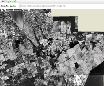
Tom Padilla has forwarded a link to NYCityMap, which provides a wealth of information on all properties within New York City. The amazing map type feature on the website offers New York City and the Long Island Motor Parkway aerials from 1924 to 2012.
-
Dec 16 2017
Favorite Website: MyNassauProperty.com- 1926 and 1950 Aerials of Nassau County
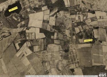
The MyNassauProperty.com is a valuable resource on every residence in Nassau County. Last October, Brian McCarthy discovered that 1926 and 1950 aerials are embedded into the website.
-
Oct 23 2017
Mystery Foto: #42 Solved: A 1926 Aerial of the Motor Parkway & A Guide to Finding 1926/1950 Aerials
This weekend's Mystery Foto was inspired by Brian McCarthy's discovery of 1926 and 1950 aerials found at the MyNassauProperty.com website.
-
Apr 24 2017
Mystery Foto #16 Solved:1930 Aerial of the Long Island Motor Parkway at Lake Ronkonkoma-Updated 9/18
This weekend's Mystery Foto documented an early aerial of a large section of the Motor Parkway.
-
Jul 16 2016
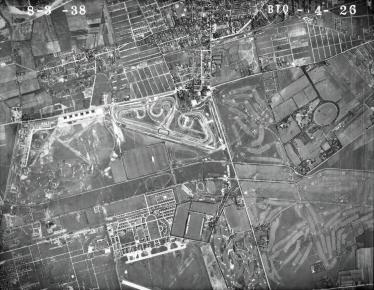
The 1938 U.S. Department of Agriculture Aerial Suvey of Nassau County #2: Garden City to East Meadow
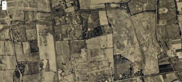
On August 3, 1938, the United States Department of Agriculture conducted an aerial survey of Nassau County. These enlargeable aerials (NC_8_3_38 series) have been posted on the Stony Brook University Digital Research Collections. Unfortunately, these aerials are not sorted, indexed by location and are combined with other aerials in the Stony Brook Collection. VanderbiltCupRaces.com has located the relevant aerials and will post them in a new series. Second in the series is the Long Island Motor…
-
Jul 13 2016
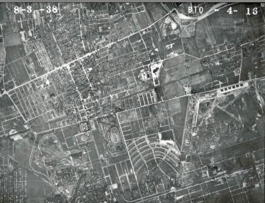
The 1938 U.S. Department of Agriculture Aerial Suvey of Nassau County #1: Searingtown to Garden City
On August 3, 1938, the United States Department of Agriculture conducted an aerial survey of Nassau County. These enlargeable aerials (NC_8_3_38 series) have been posted on the Stony Brook University Digital Research Collections.
-
Sep 30 2013
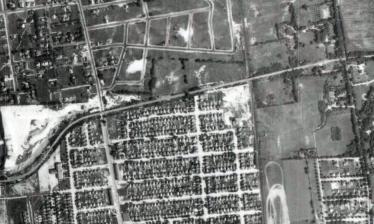
Mystery Foto #35 Solved:Williston Park/East Williston/Albertson Section of the Motor Parkway in 1938
Master Mystery Foto detective Greg Oreiro has submitted this Mystery Foto aerial of a section of the Long Island Motor Parkway.
-
Dec 26 2011
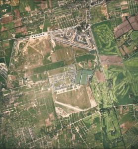
Spectacular Aerials of Roosevelt Field and Roosevelt Raceway (1924-1938)
There is nothing like a good vintage aerial to document roads, buildings and bridges. These are several of my favorite aerials taken over Roosevelt Field and Roosevelt Raceway from 1924 to 1938:
-
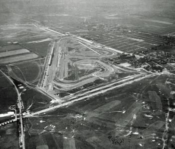
Sep 10 2011
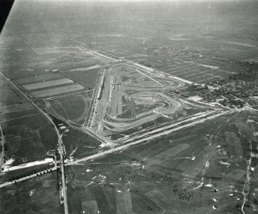
Cradle of Aviation Archives: Amazing 1937 Aerials of Roosevelt Raceway
In April 2010, the Cradle of Aviation Museum received a gift of the photographic archives of a man long-associated with Long Island aviation. Among the hundreds of photos in the collection was one box of 265 negatives and glass plates related to Long Island automobile racing. The images were taken by photographer John Drennan of Mineola from 1935 to 1965. These photos are available through VanderbiltCupRaces.com with permission of the Cradle of Aviation. Check out the collection's amazing…

