Tag: Aerials
-
Mar 23 2011
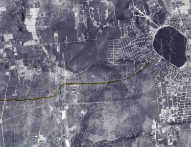
Suffolk County Airmap 1930 Aerial Survey #1: Ronkonkoma
In 1928 Suffolk County commissioned an aerial photography company to create a comprehensive record of their roads, terrain and properties. Two years later, the Airmap company photographed the entire county including our favorite historic road; the Long Island Motor Parkway. Courtesy of the Suffolk County Department of Planning, the first in the series of Suffolk county Airmaps highlights the Ronkonkoma area:
-
Jul 03 2009
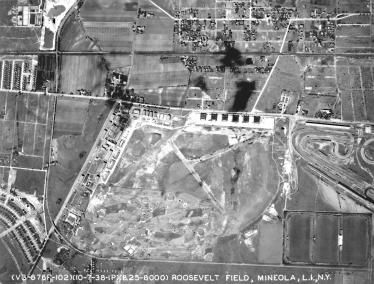
Then & Now: The Motor Parkway Around Roosevelt Field
Izzy, as shown in the above 1938 aerial, the Long Island Motor Parkway was located to the west and south of the historic airfield Roosevelt Field.

