Tag: Queens Maps
-
Oct 15 2025
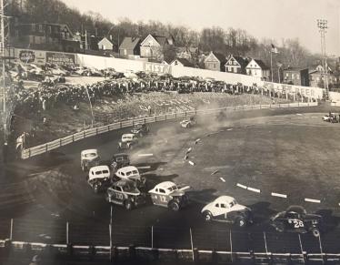
InstaGRAM Report: Long Island’s Lost Dexter Park Raceway
The history of Queens’s lost race track Dexter Park, which was built inside a baseball field.
-
May 27 2013
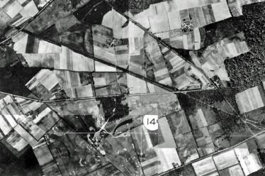
Mystery Foto #17 Solved: A 1924 Aerial of the Future Western Terminus in Fresh Meadows
Frank Femenias submitted this 1924 aerial of Fresh Meadows where the Western Terminus will be located off Nassau Boulevard (Horace Harding Boulevard)
-
Jan 02 2013
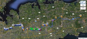
A New Online Map of the Long Island Motor Parkway
Wayne Consolla of Viewtown, Virginia has developed an online map of the Long Island Motor Parkway.
-
Sep 18 2010
A Map of the Long Island Motor Parkway & Queens Historical Sites
Steven W. comments: "Do you have a detailed road map of the full route of the Motor Parkway with surrounding residential streets? This would be highly appreciated, as I would love to see it and bike through the trails of the demolished part in Nassau County".
-
Dec 17 2008
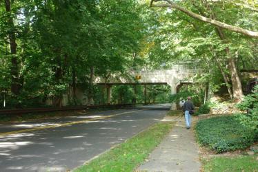
A Queens Tour of the Long Island Motor Parkway
Many viewers have requested maps of the Long Island Motor Parkway so they can walk this historical road and find remnants of America's first parkway. I have put together routes in Queens, Nassau and Suffolk Counties using a 1940 map which still showed the Long Island Motor Parkway right-of-way. In the first of a three-part series, Click here for a pdf of the Queens LIMP map. Nassau County and Suffolk County maps will follow over the next week.

