Tag: Mitchel Field
-
Mar 24 2026
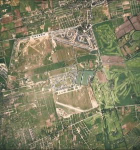
Mystery Friday Foto #12 Solved: A 1938 Aerial…In Color!
Did you identify this color aerial?
-
Jan 28 2025
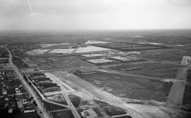
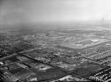
Friday Mystery Foto #4 Solved: Newly Discovered 1953 Drennan Aerials of Roosevelt Field
The Cradle of Aviation challenged you to identify these newly discovered Drennan aerials of Roosevelt Field.
-
Jan 03 2024
Kleiner’s Korner: The Motor Parkway’s Contribution to Military War Games
The Long Island Motor Parkway, being the main thoroughfare on LI in the early 20th century, was used by military planners in several training exercises leading up to and during times of conflict.
-
Jul 04 2022
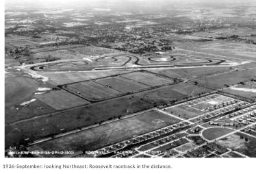
Mystery Friday Foto #27 Solved: An amazing 1951 aerial over Roosevelt Field and Mitchel Field
My favorite co-author Al Velocci challenged you to solve this holiday Mystery Foto.
-
Mar 10 2021
Hot Post Alert & Update: Beneath the shadow of wings: Mitchel Field and the Motor Parkway (1924-1948)
Author/historian Paul R. Martin III is working on the first ever comprehensive history of Long Island's Mitchel Field "Beneath The Shadow of Wings". The aerials from Paul's website have resulted in 37 Comments and 42 East Meadow Facebook Comments and counting.
-
Jan 11 2021
Mystery Foto #2 Solved: A 1956 aerial of the new opened Roosevelt Field and almost completed Meadowbrook Parkway
The Cradle of Aviation Archives challenged to identify this weekend's Mystery Foto.
-
Oct 19 2020
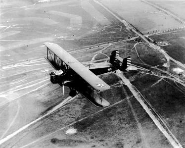
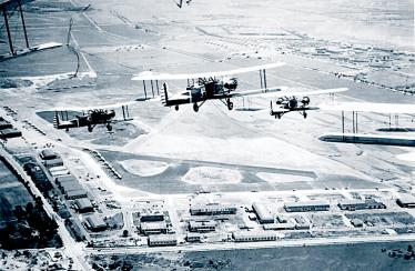
Mystery Foto #42 Solved: A 1929 Curtiss B-2 Condor Bomber Flyover Over Roosevelt Field, Merrick Avenue and the Motor Parkway
Garden City Village Historian Bill Bellmer challenged you to identify this weekend's amazing Mystery Foto.
-
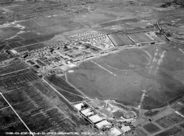
Feb 24 2020
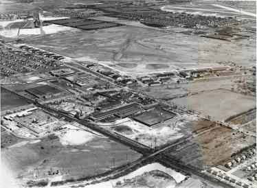
Mystery Foto #8 Solved: A 1951 Aerial View of Mitchel Field & the Motor Parkway & 2017 Circus Trains
My favorite co-author Al Velocci challenged you to identify this weekend's Mystery Foto.
-
Feb 04 2020
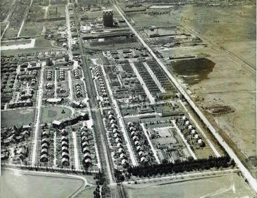
Kleiner’s Kolumn: Part 2- Mapping the Motor Parkway, Mitchel Field & Mitchel Gardens
This post continues with my examination of Mitchel Field documents provided by the Nassau County Dept. of Public Works and pertains to post-WWII development of the area.
-
Dec 18 2019

Kleiner’s Kolumn: Part I-Mapping the Motor Parkway, Mitchel Field & Mitchel Gardens
Recently received documents from the Nassau County Dept. of Public Works (NCDPW) highlight the Motor Parkway and Mitchel Field in Garden City.

