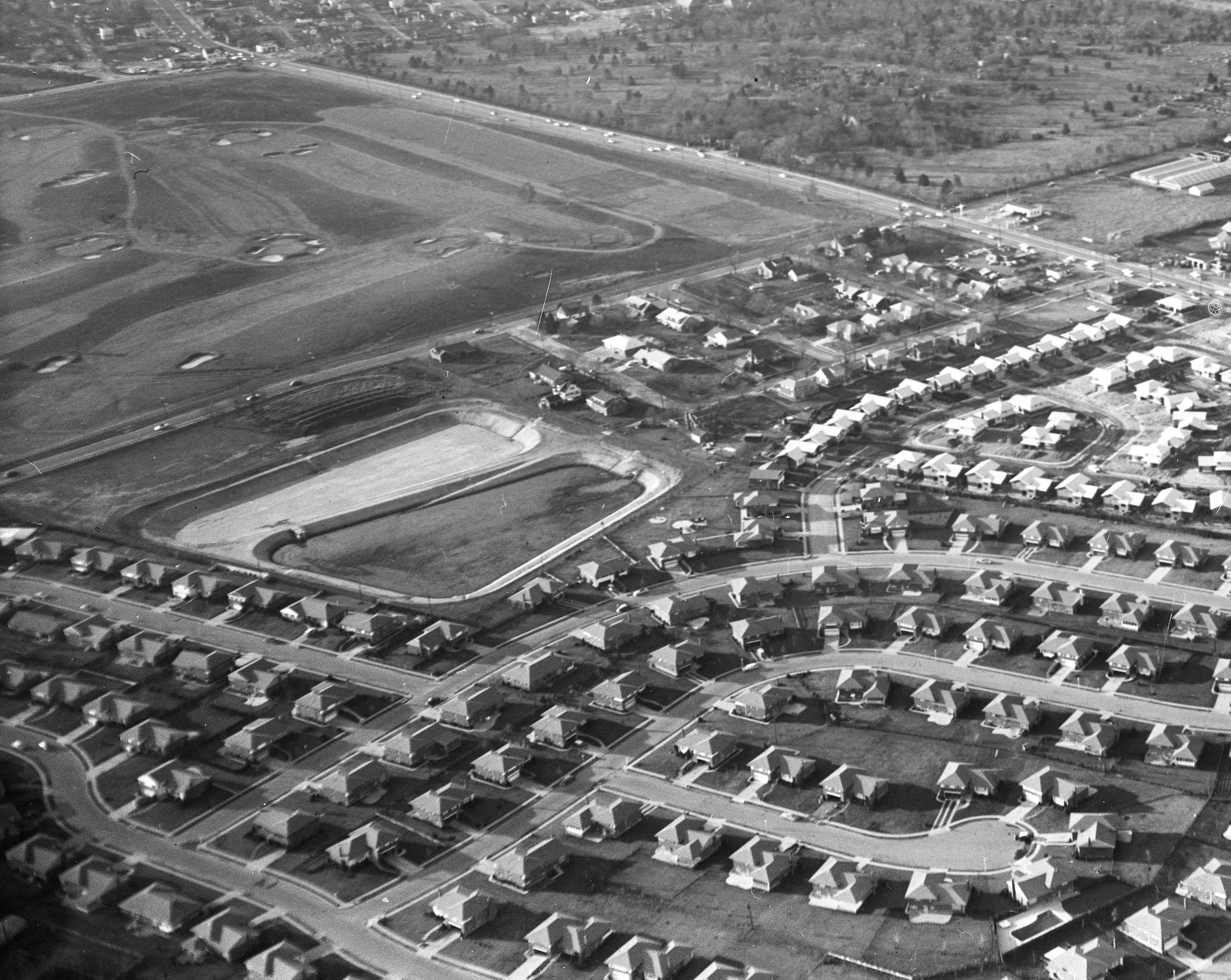
Mystery Foto #11 Solved: A view of Old Country Road (Salisbury) section of the 1909 and 1910 Vanderbilt Cup Race courses
The Cradle of Aviation Archives challenged you to solve this weekend's challenging Mystery Foto.
Answers to the Mystery Foto questions:
Identify:
- The location and orientation of the photographer
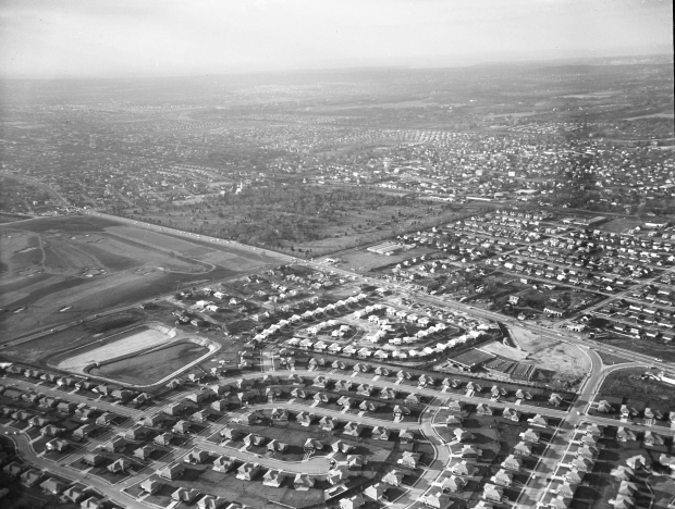
View of East Meadow, the Salisbury section of Westbury looking north west towards Westbury.
- The major roads
Old Country Road, Merrick Avenue/Post Avenue and Westbury Road (see below)
- The golf course
Salisbury Links Golf Course (now Eisenhower Park's Red Course).
- The large property above the golf course
Cemetery of the Holy Rood with St. Brigid's Church on Post Avenue, Westbury. Check out details of the Cemetery of the Holy Rood on this survey of the Town of North Hempstead Cemeteries. Three notable internments in the cemetery are:
– Margaret “Unsinkable Molly” Brown (1855-1932) Survivor of the Titanic sinking, wife of one of the wealthiest men in the 1800s.
– William Casey (1913-1987) CIADirector
– Oleg Cassini (1913-2006) Prominent designer
- The location of the Vanderbilt Race course and years used for the races
Old Country Road in the 1909 and 1910 races
What was the date of the Mystery Foto? Provide a rationale.
December 21, 1957. Rationale: Construction of the Salisbury Plaza
Comments (7)
Congrats to Art Kleiner, Brian McCarthy, Greg O., Steve Lucas, Glenn Gordon, Frank Femenias, and Al Velocci for correctly identifying the Mystery Foto location.
Kudos to Art Kleiner, Brian McCarthy, Greg O., Steve Lucas, Frank Femenias, and Al Velocci for knowing that Old Country Road was part of the 1909 and 1910 courses.
Enjoy,
Howard Kroplick
Close-Ups

Kleiner's Korner (Submitted by Art Kleiner)
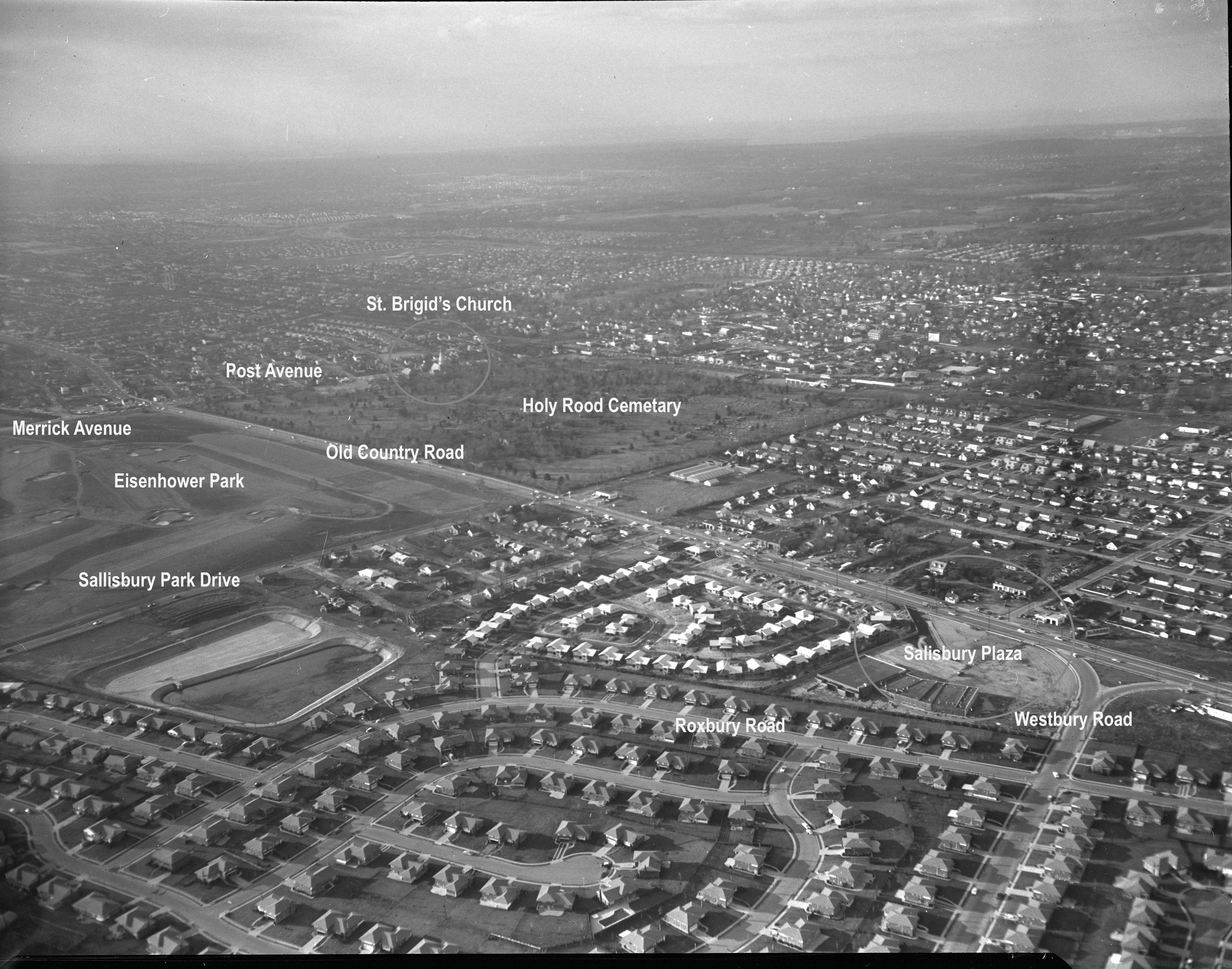
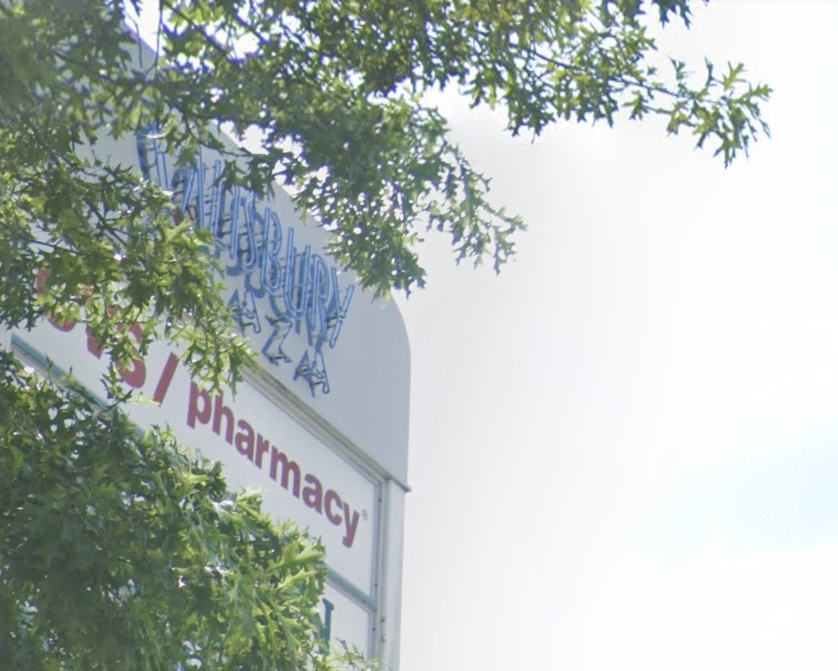
Art Kleiner: I know this location and shopping center very well.
Its the Salisbury Plaza shopping center on Old Country Road in Westbury.
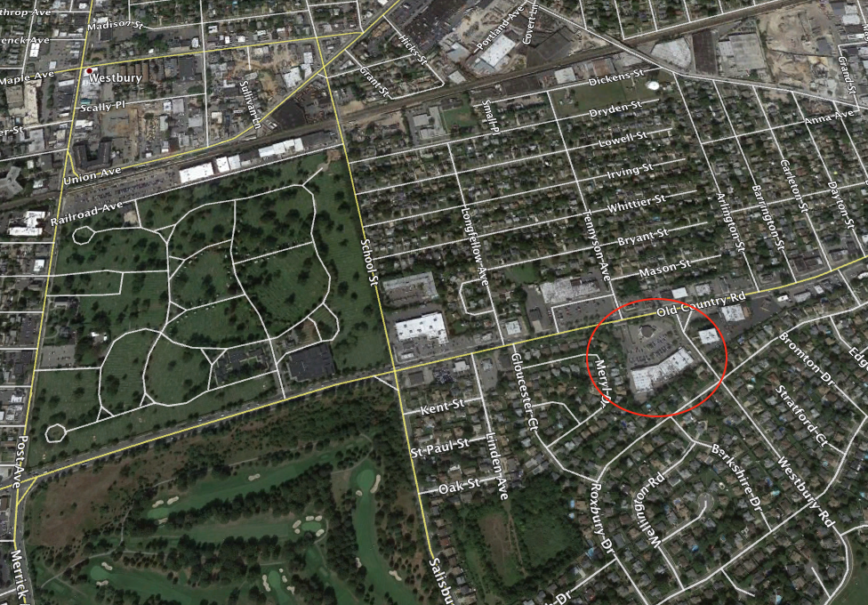
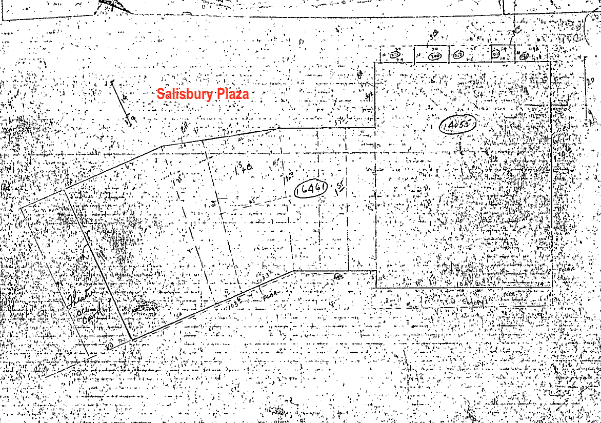
Tax records show it was constructed in 1957. Used to house the Salisbury Theatre which exhibited pornographic type movies during the 60s, 70s and early 80s. http://cinematreasures.org/theaters/8651
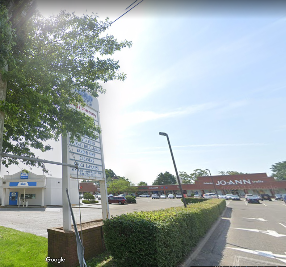
Currently has a Jo-Ann's Fabrics, CVS (formerly the theater), Mario's Pizza, etc. )


Comments
Attempting my answers to this Mystery Foto below.
-The location and orientation of the photographer
Photographers plane is flying directly over my old house in the Salisbury section of Westbury looking North west.
-The major roads
The horizontal road in the center is Old Country Road. Between the houses and golf course is Salisbury Park Drive. The road that splits going into OCR is Westbury Rd. The far side of the course is Post/Merrick.
-The golf course
Now the Eisenhower Red course.
-The large property above the golf course
Cemetery Of The Holy Rood
-The location of the Vanderbilt Race course
-The years that this section were used for the races.
Very wide shot, so many can be seen, but the main races on OCR were the 1909 & 1910 courses.
-What was the date of the Mystery Foto? Provide a rationale.
My old house along with most in that area were built in the mid 50’s. My guess would be 1958ish.
I think we are over Salisbury looking northwest toward Westbury / New Cassel. Major roads include Old Country Road, Merrick Avenue, Bellmore Road (Newbridge Avenue), and and Westbury Road. The golf course is the northern most course of the old Salisbury Links, part of today’s Eisenhower Park. Just above the golf course is Holy Rood Cemetery. This section of Old Country Road was part of the course for the 1909 and 1910 races. Based on a 1950 Hagstrom map that does not have the roads for the Salisbury community (foreground), I think this photo is about 1952-1953.
looking northwest
Salisbury Park Golf Course
Old Country Rd. running east to west between course & cemetery
large track of land is Holly Rude Cemetery with St.Bridget’s church steeple raising up.
looking west and following RR tracks you will see Carle Places water tower.
looking southeast and south you will see the development of Salisbury Estates
if I remember correctly .
Running along golf course N&S is Salisbury Park Dr.
Great high resolution photo!
Salisbury looking NW over former Emily Ladenburg’s Estate, once an oasis in the flat Hempstead Plains.
Major roads include Old Country Rd, Newbridge Ave (formerly Bellmore Rd, today’s Salisbury Park Dr), School St, Westbury Rd, Merrick Ave, Post Ave, and LIRR. Wellington Ct is the cul-de-sac at the bottom center. Motor Pkwy is just off the photo at the bottom, about half mile south of the water sump in the bottom left corner.
Salisbury Links Golf Course (today’s Eisenhower Park’s Red Course).
Holy Rood Cemetery with St Brigids Church on the west side of cemetery.
1909, 1910 Vanderbilt Cup Races used Old Country Rd as part of the race course.
Guessing 1955, when the houses in the foreground were built. The neighborhood looks new with little vegetation planted yet.
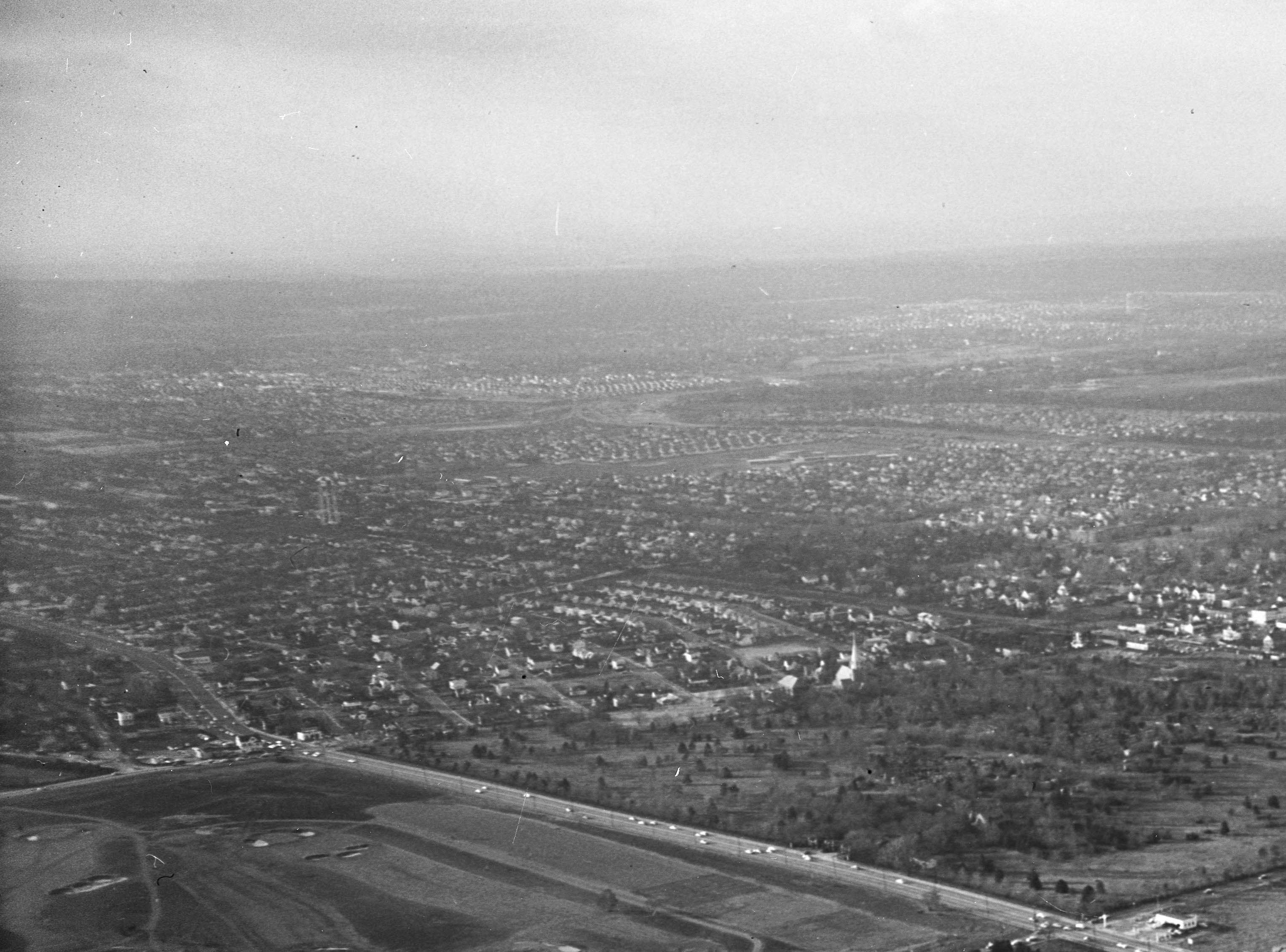
Bottom photo: Motor Pkwy in Eisenhower Park looking east towards “Oasis”, Emily Ladenburg’s Estate in 1908.
The view is to the northwest from the Salisbury area. Major roads are Old Country Rd. running from left to right, Merrick Ave. left center I can see Felice’s Restaurant. North of Old Country Rd. it becomes Post Ave. with St. Brigit’s Church,
The road center of the photo is School St. north of Old Country Rd. and Salisbury Park Dr. south of Old Country Rd. The golf course is the Red Course at Eisenhower Park showing holes 7, 8 and 9. The large property above the golf course is the Cemetery of the Holy Rood. In 1909 and 1910 Old Country Rd was part of the Vanderbilt Cup Race course. Time frame ? I say early 1950’s, none of the automobiles are later than 1953 and most are from the 1940’s.
Al - Most vehicles are from the 1940s? You must’ve used an electron microscope! :D
Frank, Just the opposite. I hacked into the Hubbell Telescope Observatory, used the automotive aperture, the heat sensing combustion engine option and the manufacturer app, was able to discover more than half the automobiles were GM and Ford products, followed by Chrysler. 3 Studebakers and one 1908 Alco.