Mystery Friday Foto #39 Solved: The Western Terminus in Fresh Meadows (1929)

Motor Parkway sleuth Brian McCarthy challenged you to identify this very rare and incredible 1929 Motor Parkway photo of the Fresh Meadows terminus.
Identify;
- The rare, ground view location and orientation. Provide a rationale
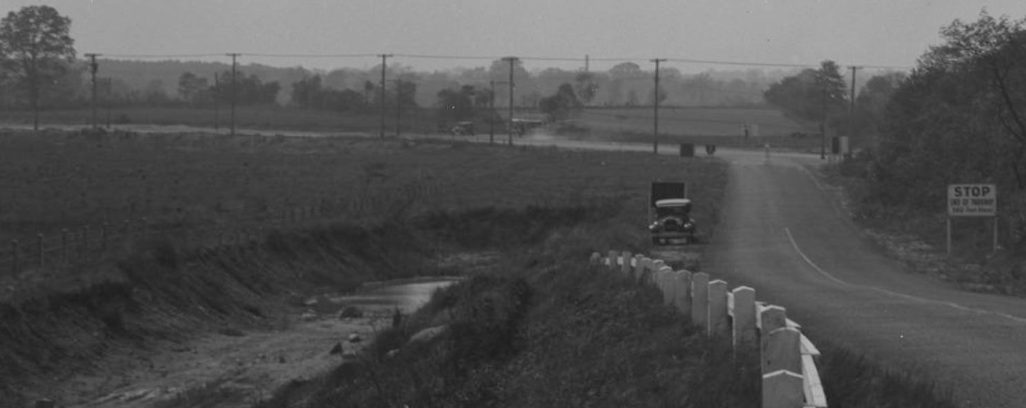
This rare ground view has the photographer standing on the northern embankment of the North Hempstead Turnpike Motor Parkway bridge looking Northwest towards Nassau Blvd and the fairly new Fresh Meadows Motor Parkway terminus.
- Closest Motor Parkway structure
The North Hempstead Turnpike Motor Parkway bridge is directly to the photographer's back.
- Super kudos question- The make and model of the vehicle on the side of the Parkway and the copy on the sign (big hint for the location)
The vehicle on the roadside is a Ford Model A, and the copy on the sign says "STOP, End of Parkway (2nd line)" and the bottom line is illegible.
Comments (6)
Congrats to Joseph Oesterle, Eric C Shaffer, Art Kleiner, Frank Femenias and Steve Lucas for identifying the Fresh Meadows terminus. Super Kudos to Steve for identifying the Ford Model A.
Greg O. and Howard Kroplick
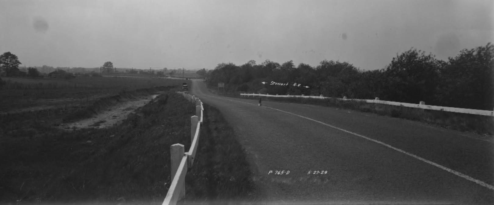
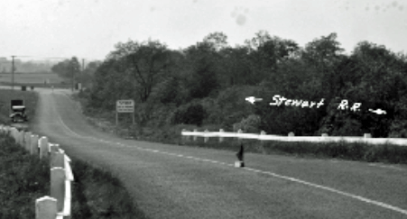
Note the caption "Stewart RR"
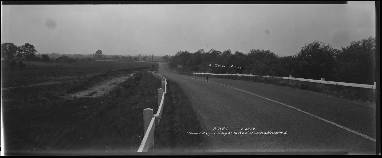
The original, unedited photo found in the NYC Dept of Records and Information Services.
Dated 5/27/29
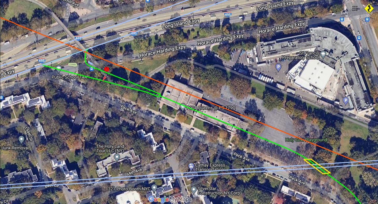
Frank's photo perfectly captures the stretch now and shows the only location where Stewart's R.R. (in red) perfectly paralleled the Motor Parkway (in green).
Another odd object on the road.
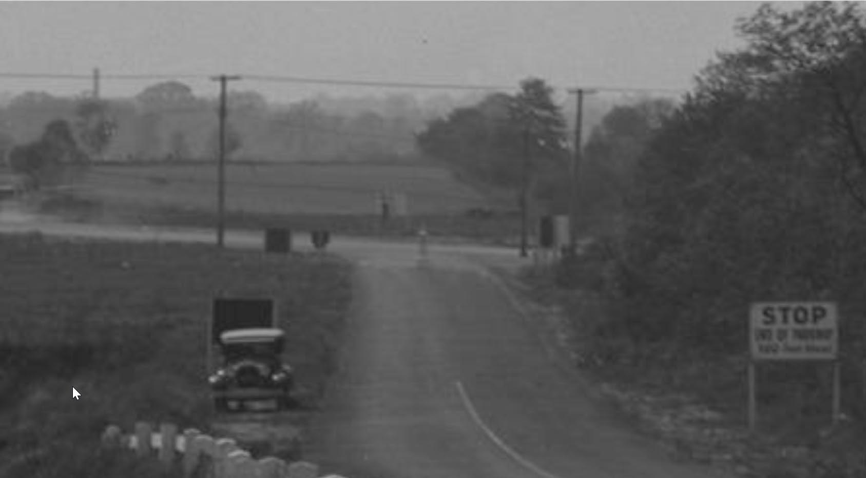
Note: The "Stop" sign and the post in the middle of the road in the background.
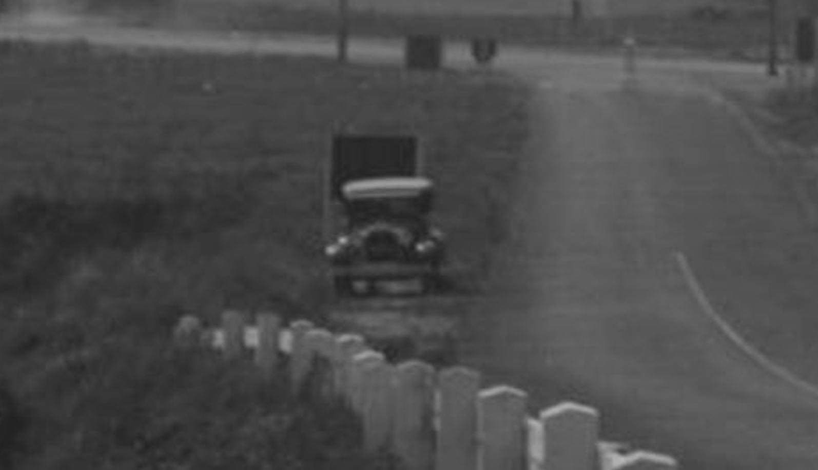
The automobile was likely owned by the photographer.
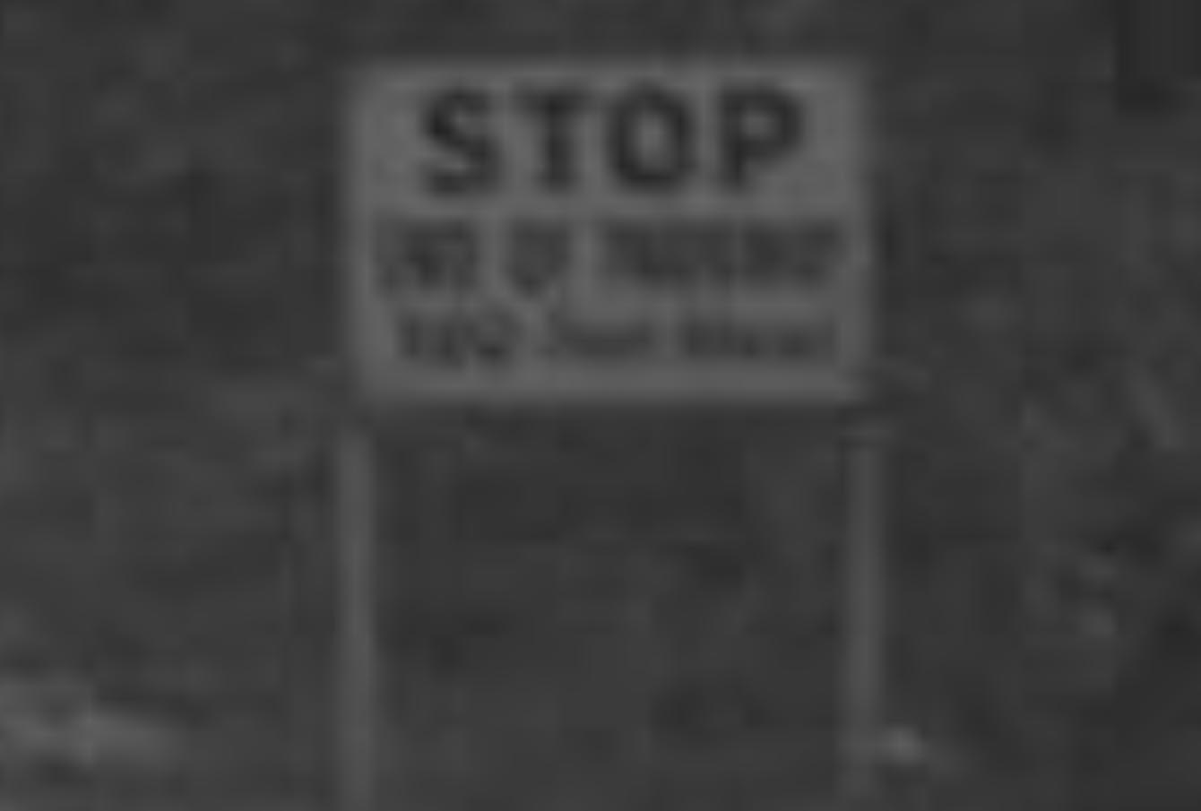
"STOP
END OF PARKWAY
(illegible- possibly 'XXX Long Island') "


Comments
This seems like a tough one. My thoughts immediately go to Suffolk County. Because to me there appears to be an intersection ahead. And in Nassau almost all intersections were eliminated with bridges. The “STOP” sign is also a warning. And to me they are warning of an intersection.
But then my thoughts went another way, and this is what I see. The western terminus of the Long Island Motor Parkway. From atop the North Hempstead Turnpike Bridge, looking down the slope. What we see at the end is Horrace Harding Blvd. My clues are the guard rails. They look new for 1929, and this section of the parkway would be new. But the clincher, we the “R.R.” As the old line of the Central Long Island Railroad passed through here. Long ago abandoned, which is why we do not see any tracks.
This did not come easy.
Photo looking north towards the entrance, beginning, of the Motor parkway where the Horace Harding Boulevard meets the Motor Parkway. The photographer is on the first bridge, that’s probably his automobile at the sign, which puts the time frame at about 1923.
Great photo Brian. I can’t wait to hear where you found it. My guess for the location is looking north at the Nassau Blvd. entrance although I’m not too confident. Nearest structure would be the bridge over North Hempstead Tpke. which would have been just behind the photographer. I think the second line of the sign reads “End of Parkway”; the third line, who knows? Regarding the car: 1928 Ford Model “A”.
I’ll say the Western Terminus of the Motor Parkway at Nassau Blvd/Horace Harding Blvd. Looking north.
The North Hempstead Turnpike Bridge would be the closest structure.
Great find, Brian! It’s the end of the road at mile 0, at the LIMP’s western terminus intersecting Nassau Blvd (Long Island Expwy). Photo is looking NW. Photographer is standing on the future site of PS 179Q by Holy Cow Playground, on the ascending ramp towards the North Hempstead Turnpike Bridge just behind. The bridge was built just 3 years earlier. The western terminus would later be widened to accommodate parked vehicles after the LIMP closed in 1938
Mile 0
The hilly parkway immediately started with an ascent! Never thought I’d ever see this view. Thanks for sharing
Hey Howard and Greg, Great mystery photo. Never saw it before. However, that location of the Motor Parkways’ terminus at Nassau Blvd. was not the first choice. The Stewart R.R. notation reminded me of that. Not obvious in the photo is that at the North Hempstead Turnpike Bridge the Motor Parkway makes a 45 degree turn to the northwest. The Parkway’s original choice was to take the r.o.w. north in a straight line to Nassau Blvd. which meant crossing the old Stewart RR line. Problem was that the Stewart RR line was still technically in play which meant the Motor Parkway would have to build a bridge over the railroad ROW. Obviously that was going to be more expensive and probably more time consuming so the Parkway went with plan B.
Hi All. I was definitely surprised to come across this image. Was really looking through the 1924 and 1950 aerials of NYC, then found myself on NYC Department of Records. Literally typed Motor Parkway in their search. This image of the several they have, I’ve never seen. Think they continue to digitize any new photos that are found in their archives. Knew most of you wouldn’t have trouble figuring it out. Just that the fact that it’s newly discovered in our minds.
Much thanks for sharing this gem, Brian!
That too, Al. Photographer took the photo in a more northerly direction. and positioned on the west side of the parkway. If on the east side, then the angle to the northwest would be more obvious. But then we wouldn’t see the overgrown RR ROW.
Found on the site here that the connection with Nassau Blvd was open 7/1/1928. So this photo was taken a year later. If you look closely, we can see the Boundary Wire Fence & Posts on the west side. We can imagine future 199 St and Peck Ave being parallel of the boundary fence. Below is maps from the site here showing this area in 1938 and later.
Delayed in seeing this. Thanks for finding this Brian!
Makes a nice complement to the later photo shown in mystery photo #40!
Just saw this on the NYC Archives site (some other interesting stuff there) about the designation of the Queens “bike path”. Letter from Robert Moses about a month after the LIMP closed, stating his intention to open the path .