Update 5/6/2025: Now open for further discussion and a new poll- Mystery Friday Foto #18: An Unknown Motor Parkway Location
Al Velocci once again challenges everyone with an unknown photo.
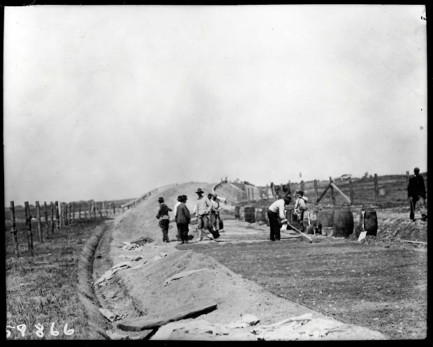
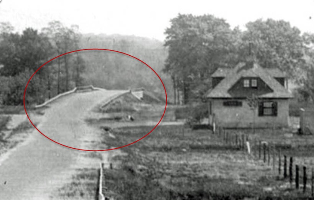
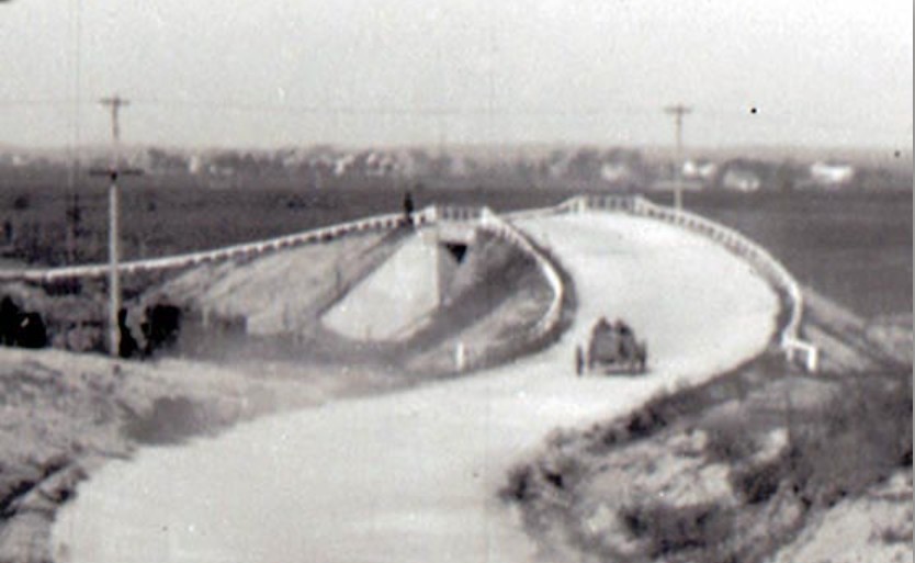
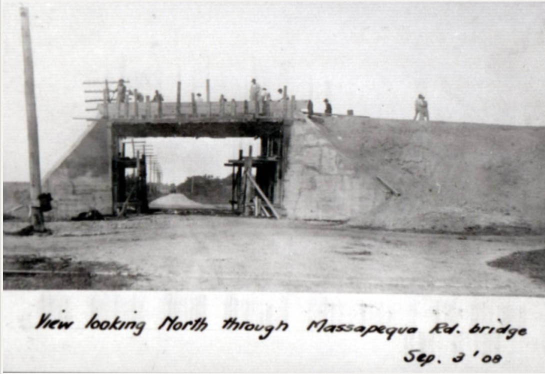
This photo is currently unknown. There is no caption and the exact location has us stumped. All that is known is that was taken during the early Motor Parkway construction from 1908 to 1911.
Mystery Foto Question:
Provide your best guess as to where the location is and your rationale.
Update: Added close-ups and a horizontal flip of the image (as suggested by Steve Lucas).
The Bridges of the Vanderbilt Cup Races (1908-1910)
This is the second time this Mystery Foto has been posted. In 2019 we were unable to solve the Mystery!
Join the fun and take our latest poll on the location of this wonderful Mystery Foto.
Greg O. & Howard Kroplick
VanderbiltCupRaces.com Poll Results
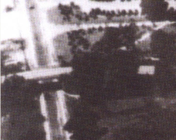
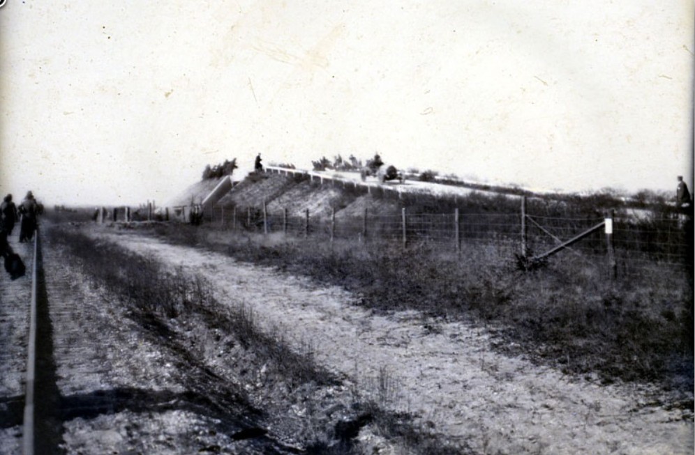
Close-Ups
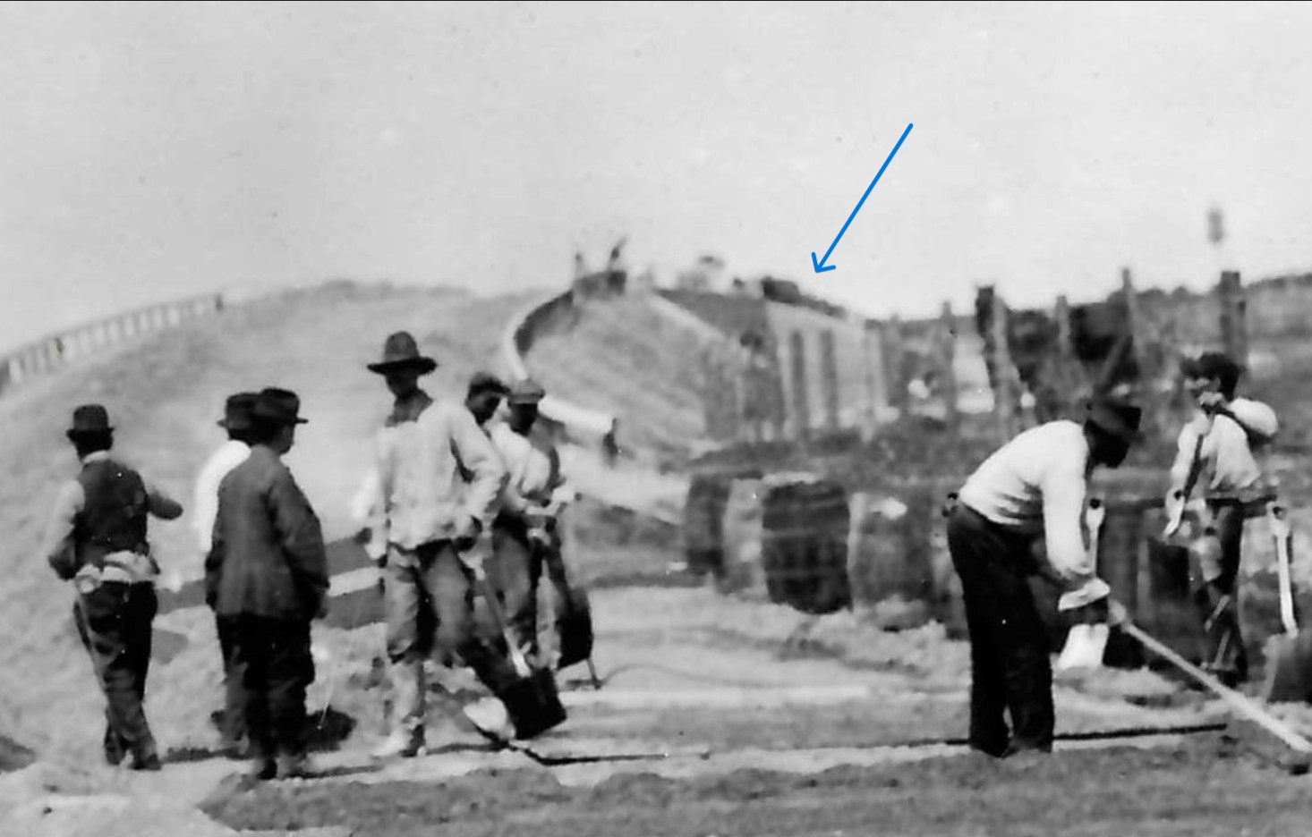
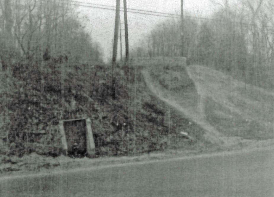
The blue arrow in Close-up #1 gives a slightly better view of what seems to be a strange structure for the bridge. Possibly multiple openings? Maybe the wooden forms for the concrete abutments still up?
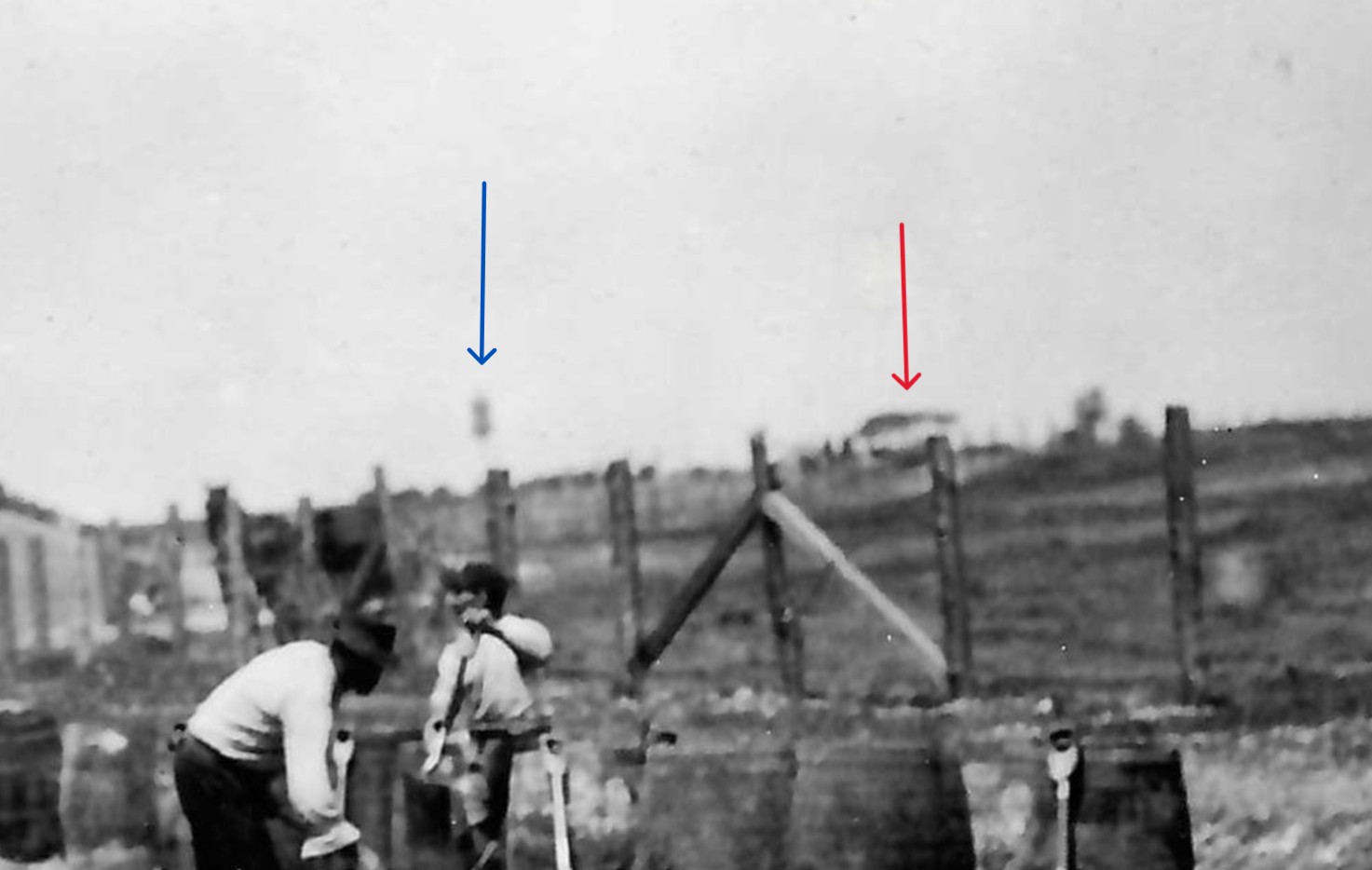
In Close-up #2, the blue arrow is pointing to a likely water tower. One of many constructed throughout the Parkway construction for concrete mixing.
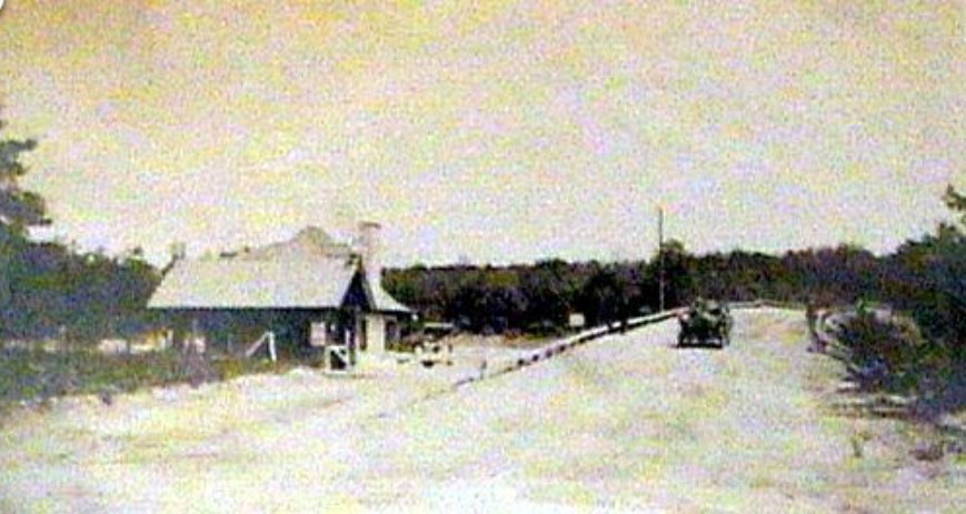
The red arrow points to a structure on the horizon. In the plains section of the Parkway, this could have been the grandstands, or possibly the Newbridge Road Hotel. However, I would think you would have seen the construction of the very close Newbridge Road Bridge since the bridge was about half the height of the hotel. See below.
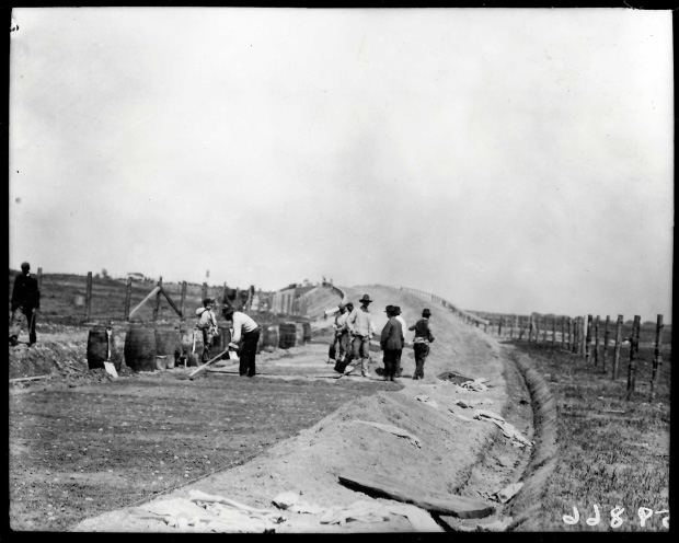
Image flipped horizontal- in case image was printed incorrectly.
If the fairly safe assumption is the roadway being built in this mystery photo is the Motor Parkway, we can see that the parkway goes over the existing roadway. This would logically make the bridge in the mystery photo a 'parkway' bridge. 'Parkway' bridges indicate that the Motor Parkway goes OVER the existing road. 'Highway' labeled bridges means the Motor Parkway goes UNDER the bridge. Using our interactive map, we can now look at all the 'parkway' bridges and omit the 'highway' bridges. I will also omit the Queens bridges as they were built much later than the possible date this photo would appear to be, and were mostly an identifiable steel trestle design. Also, all other steel railroad bridges were left out as well.
Westbury Avenue Motor Parkway/Trolley Bridge
This was a very unique bridge, and the only one of this design. A double opening for Westbury Ave. AND a trolley track.

Clinton Avenue Motor Parkway Bridge in Garden City
Another unique bridge with a one-of-a-kind 3 openings for Clinton Ave. to go under.
The Merrick Avenue Bridge in Westbury/East Meadow
This is a fairly straight portion of the Parkway. The Meadow Brook Lodge was also in very close proximity to the bridge.
Westbury Road Bridge in East Meadow
A strong contender, but only if the photo was printed incorrectly.
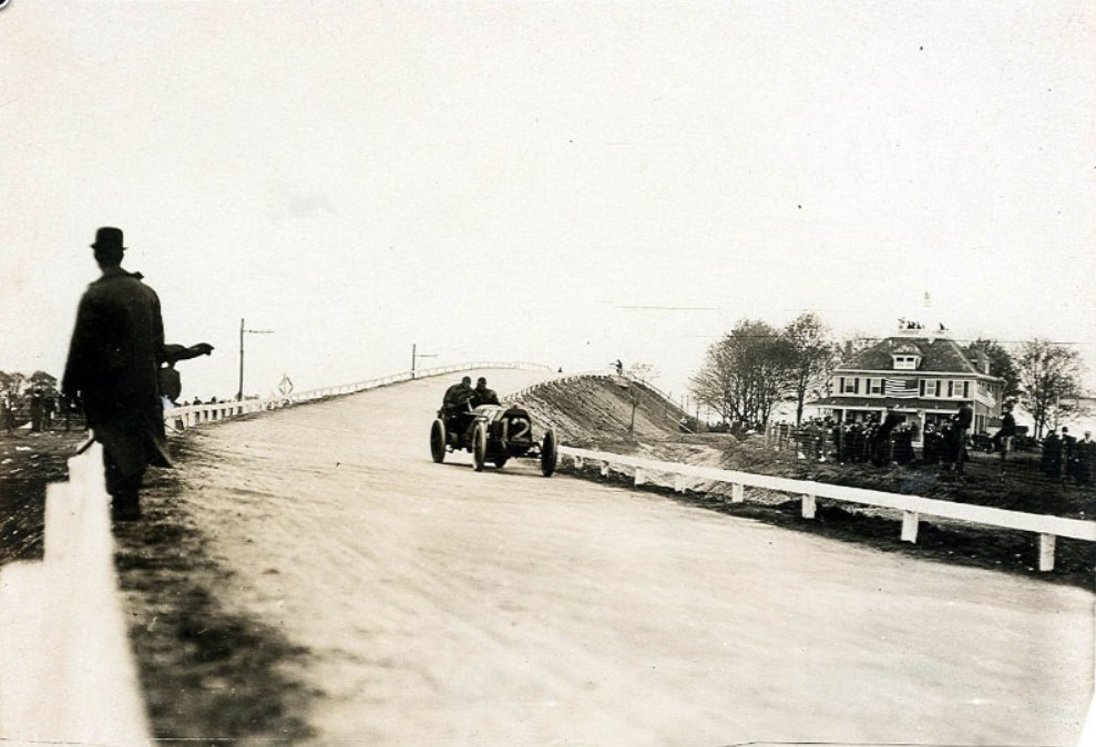
Newbridge Road Bridge in Hempstead Plains
Another strong contender, but I feel the trees, Newbridge Road Hotel and/or the railroad crossing sign would be visible as well in the mystery photo.
However, they are not.
Wantagh Avenue Bridge in Hempstead Plains
Another very straight portion of the Motor Parkway with no curves immediately before or after the bridge.
Massapequa-Hicksville Motor Parkway Bridge in Plainedge
Same straight portion of Motor Parkway as the previous Wantagh bridge.
The Round Swamp Road Bridge in Old Bethpage
Lodge proximity and tree lines do not appear to align with the mystery photo.

The Old Bethpage Motor Parkway Bridge
Other than modern clean-up photos, no vintage ground level photos.
Broad Hollow Rd. Motor Parkway/Trolley Bridge in Melville
Unique double opening bridge.
This is where I will end as the likelihood of the eastern bridges to be the mystery photo is highly doubtful.
Final thoughts - Greg O.
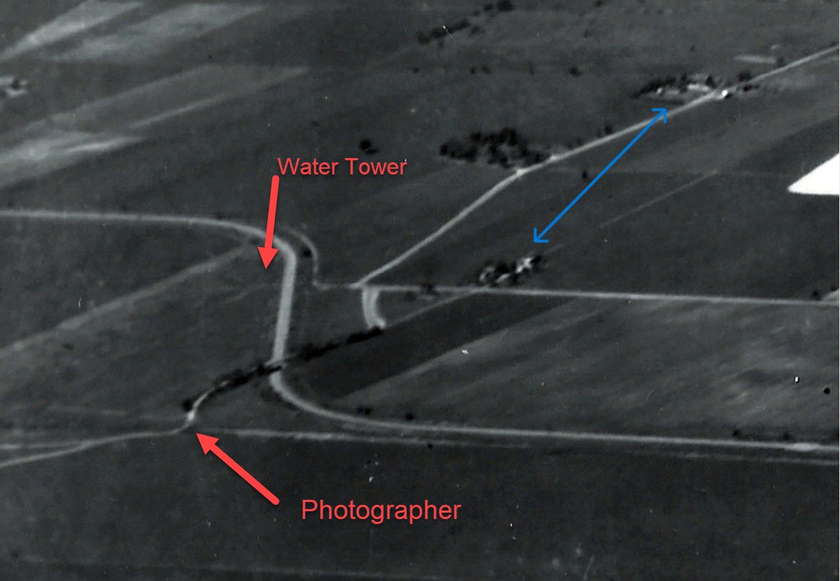
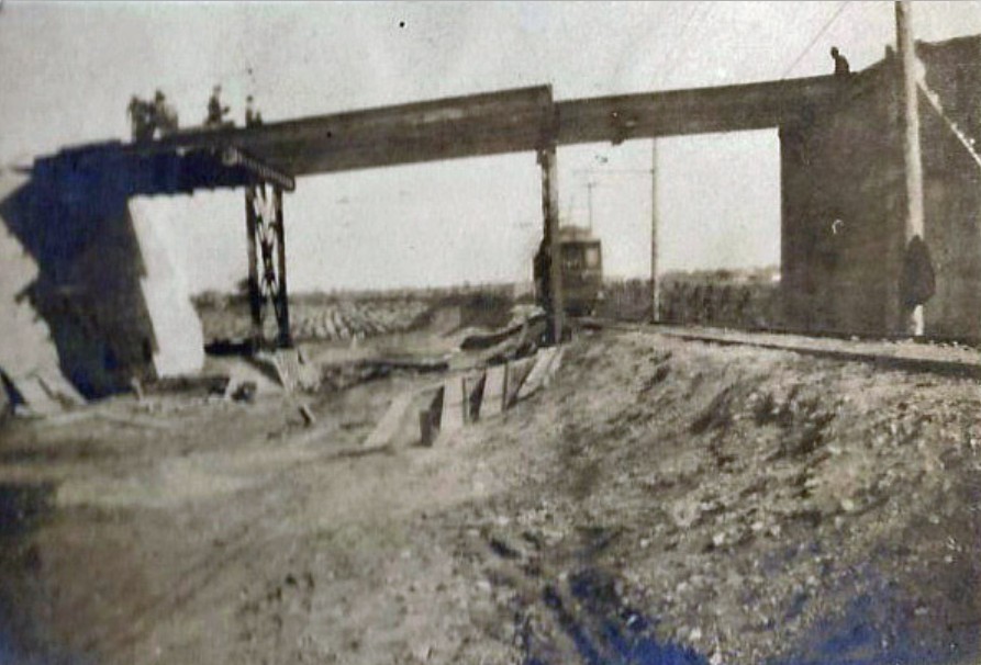
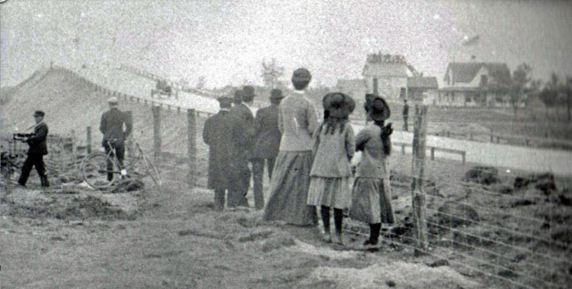
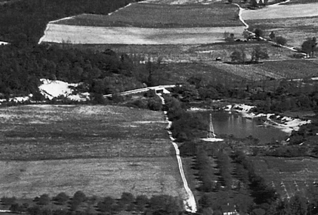
Maybe a little 'out-of-the-box' thinking may be of service here. If we throw away the assumption that the roadway being constructed in the photo is the Motor Parkway and instead assume it is the approach to the Bloomingdale Rd. bridge going over the bridge, this would fit. As Howard proposed in the 2019 post, the photographer would have been standing on the Bloomingdale Road curve just before the bridge looking directly north. The Bloomingdale Rd. bridge would have needed long approaches to go over the bridge and what we see being built in the photo, NOT the Motor Parkway. In his photo he gives the photographer's position on the Bloomingdale Rd. curve looking north and points out the water tower. My blue arrows would indicate the structure seen on the horizon in the mystery photo.
Some great aerial and Bloomingdale ground view photos HERE.
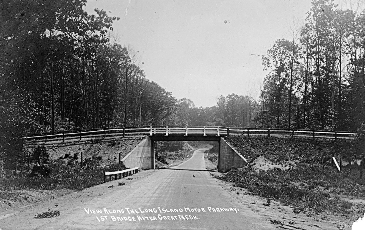
Long Island Motor Parkway Bridge Series #41: The Bloomingdale Road Bridge in Hempstead Plains
My vote goes with Howard on this and we are looking at the Bloomingdale Road bridge, but add your thoughts and vote in the new poll!


Comments
Could be any of a dozen spots, but my guess is the North Hempstead Turnpike overpass in what is now Fresh Meadows, Queens. That would probably be around 1927. If true, it would be a great photo.
Another stumper. My guess, based on the curve, being a LIMP overpass, and the general pattern of fencing both on the bridge and surrounding area, would be the Newbridge Avenue / Bellmore Road overpass, looking east.
After staring at this photo for far too long and not being able to place it, I thought maybe there’s something wrong with the photo. It’s possible the photographer flipped the negative before printing so I reversed it (see attached) and I think we may have the answer: looking east at the Clinton Road bridge.
Maybe its the Newbridge ave / Bellmore rd bridge in East Meadow.
I remember this mystery, and it may never be truly solved. Originally Mystery Foto #45 11/11/2019 My guess back then remains the same. LIMP Bridge over Clinton Rd, Garden City. Viewed northwest Circa 1910 -11 Even the flipped image ( good thinking Steve Lucas ) still strikes as the Bridge over Clinton, just viewing southeast. LIMP is an arc curve in both directions, east and north. There are other possible locations, but my guess makes sense to me.
The flat countryside void of trees makes me believe this is either Wantagh Avenue or Massapequa-Hicksville Rd bridges. Except those have no curve. NHP, Shelter Rock, IU Willets, Searingtown, Willis Avenue, Roslyn Rd, Hillside Ave all, I suspect, would have trees in the picture. Westbury Avenue, for me is a possibility.
Photo is looking mostly Southwest based on the shadows (photo below). Note the Motor Pkwy curve maintains all the way to the parkway bridge. Possibilities: Clinton Rd bridge, the illusive Old Searingtown Rd bridge, and the Little Neck Pkwy bridge. The background scene should solve this mystery bridge but it’s difficult indeed! If the image was flipped (unlikely), all above is incorrect
Greg, Regarding the mystery photo, note that the cedar posts fencing is much narrower than the normal 100 foot wide Motor Parkway. There is only two, maybe three instances where the overall Motor Parkway ROW is less than 100 feet wide.
I tapped the link for the Poll a few times, just took to me to the poll results so far. Tried tapping my choice, but nothing happened. My answer is the LIMP bridge over Clinton Rd, viewing northwest. Or viewing southeast with the image flipped.
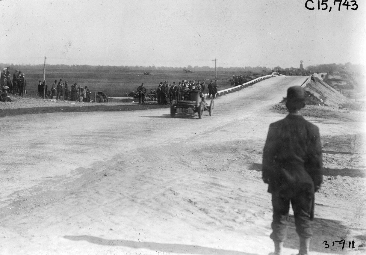
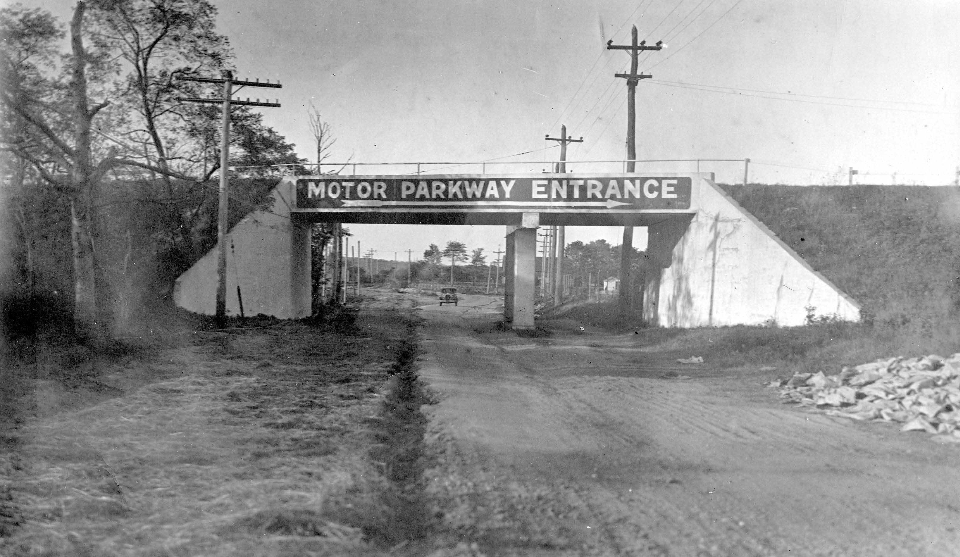
On the poll, I see the Bloomingdale Rd Hwy Bridge at the highest vote. Know the curve looks right and distant structures look convincing. But another thing I realized is about the Cedar Posts & Wire Fencing. The fencing is obvious on both sides of the parkway to the bridge. The image of the Bloomingdale Rd Hwy Bridge with all the spectators - Cedar Posts & Wire Fencing on both sides of the parkway, ending at the face of the bridge. I don’t see any Cedar Posts & Wire Fencing along the slopes of the Hwy Bridge ( only the railings along the top for safety ) Those are my latest thoughts.
I should’ve added the below images of Bloomingdale Rd Hwy Bridge with my above comment. So the main image, then I zoomed in on each side to see the wire fencing along the LIMP to the bridge face. I don’t see wire fencing on either of bridge slopes, just safety rails along the top.
Now, I’m noticing the safety railings for the Mystery Foto Bridge and Bloomingdale Rd Hwy Bridge are obviously different styles. Now I know for sure that the Mystery Foto is not Bloomingdale Rd Hwy Bridge.
The poll link did not work! This photo is dated 1908-1910. This is not a highway bridge. Note the extensive gutter work in progress for the roadway, extra work that Motor Pkwy Inc would not extend for Bloomingdale Rd development. Al Velocci has a point where the Right-of-Way is less than 100ft in this location, a rare occurrence on Motor Pkwy RoW. Al’s observation should narrow down the bridge location.
The approaches of Bloomingdale rd as it goes over the LIMP are straight. In the mystery picture, the upper road is still curving as it goes over the lower road. The particular care the workers are giving to the road in question lends me to believe that it is indeed the LIMP as the upper road. It is odd that the right of way is so narrow though.
The Clinton Rd bridge has the best WSW orientation as seen in the photo. The “bridge openings” below are part of the same array of cedar posts. When the group visited the Clinton Rd bridge a few years ago, there was little room on either side of the roadway suggesting a narrow RoW.
The fact that the fencing follows the upper road leads me to believe the upper road is the LIMP. Doubt it is Old Searingtown Rd. Was swampy with trees. This area void of trees eliminates so many places. Leaving Garden City and the entire Levittown/Westbury area left as candidates. The idea of the upper road being Bloomindale Rd is very interesting. But those fence posts just do not reconcile for me.
In between the cedar posts on the left appears structures of the same height. These could be barns belonging to the Mineola Playground (1866-1950)
Figured I see if the Mystery Foto is possibly The Westbury Ave LIMP Bridge. The curve in the mystery foto ( not flipped ) is comparable to The Westbury Ave LIMP Bridge viewed South. But there should be trolley tracks and a utility pole & wires visible, but these aren’t seen in the foto. Westbury Ave didn’t extend here yet here either. Here’s some screenshots anyway below.
To the best of my recollection there was only two places where the Motor Parkway was unable to get the 100 foot wide sections they preferred for the ROW. The first was the Alfred Cornwall section 50 feet wide from R. W. Smith to New Hyde Park Rd. The other 50 feet wide section was the Stewart Heirs piece from Old Country Rd. to the Raymond Court area in Garden City. One section the Parkway had difficulty in obtaining the desired 100 foot width was with Jacob Ganger who supplied the piece between the Old Westbury Rd. and what was Newbridge Ave. at the time. As it turned out the distance between the north side of the Parkway ROW and the Newbridge Hotel was less than 50 feet wide.
How about over Carman Ave, looking southeast ? Also, the bridge in the sandpits, in Meville believe it had the same kind of curve.
Greg, Another location with a curve to the right over a road is in East Williston. Looking north, the Motor Parkway as it crosses over East Wiliston Ave. (Hillside Ave.), bends to the right,