Long Island Motor Parkway Bridge Series: #10 Commonwealth Boulevard Bridge in Queens
When the 48 miles of the Motor Parkway were completed in 1926, a total of 65 bridges were built by William K. Vanderbilt Jr. and his associates over and under the parkway. Going west to east, the tenth bridge from the Western Terminus at Nassau Boulevard (Horace Harding Boulevard) was a trestle bridge over Commonwealth Boulevard:
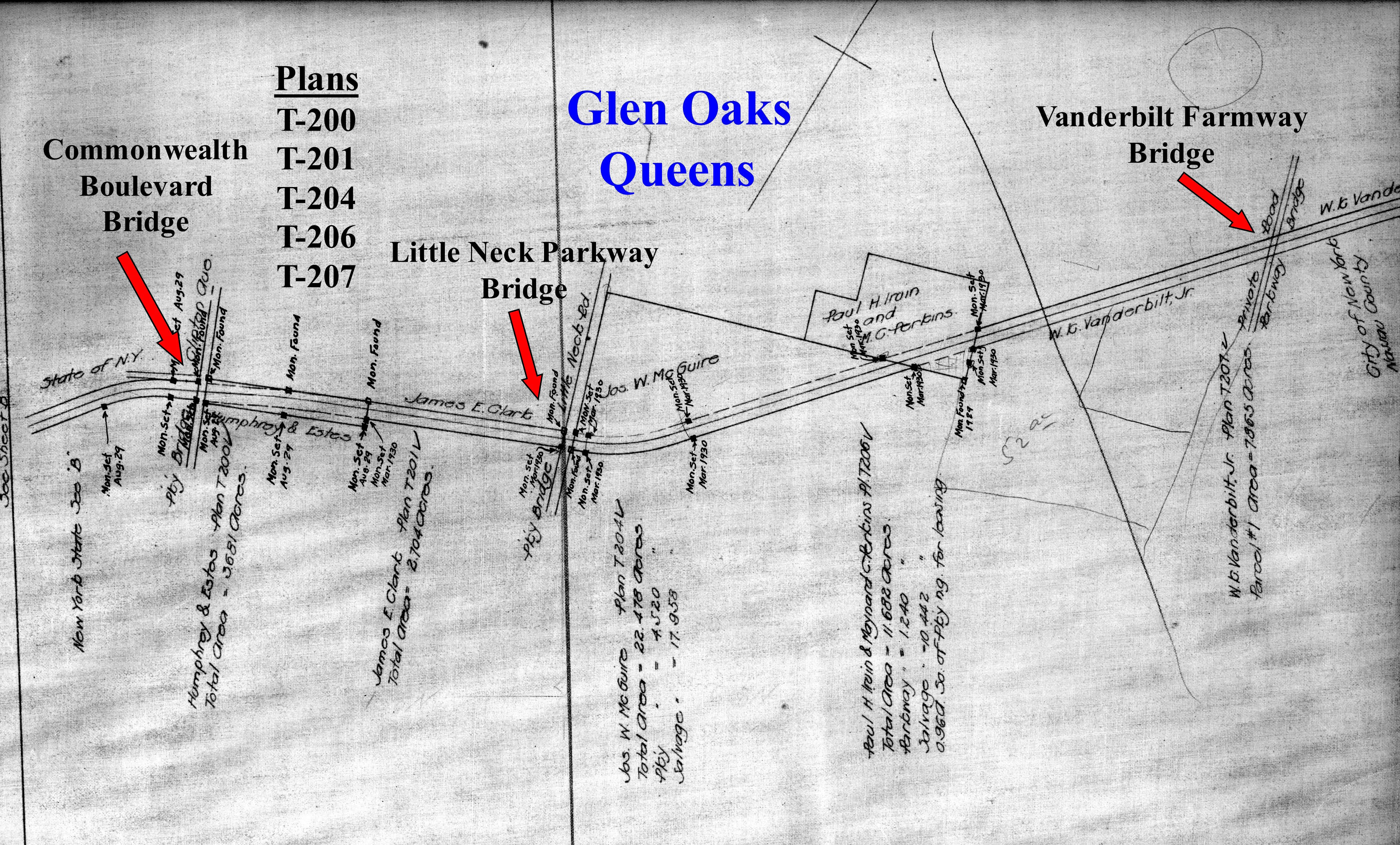
February 1911 Survey
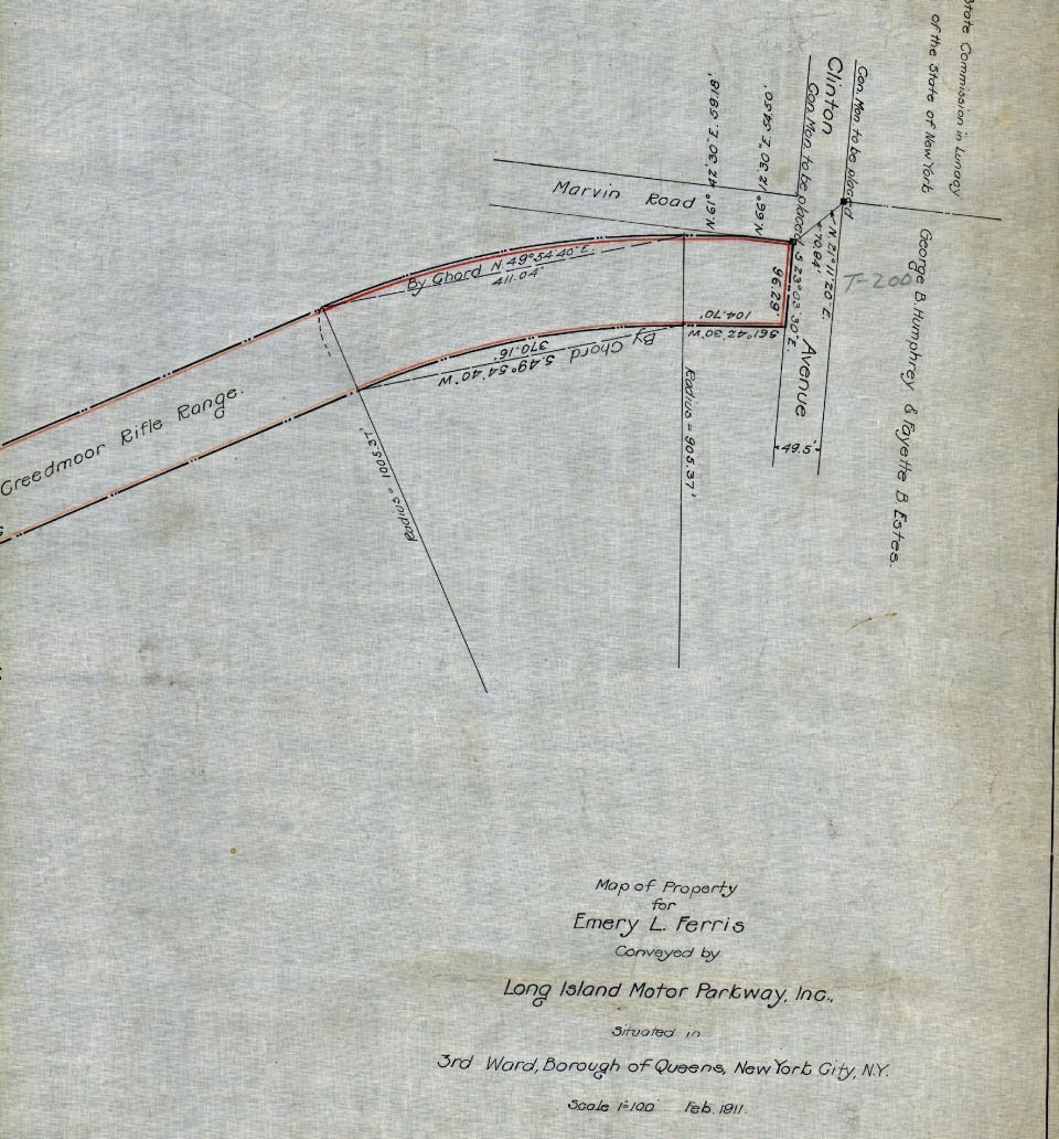 This original survey show the path of the Motor Parkway to Clinton Avenue, later renamed Commonwealth Boulevard.
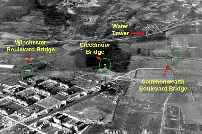
1924 Aerial- Queens
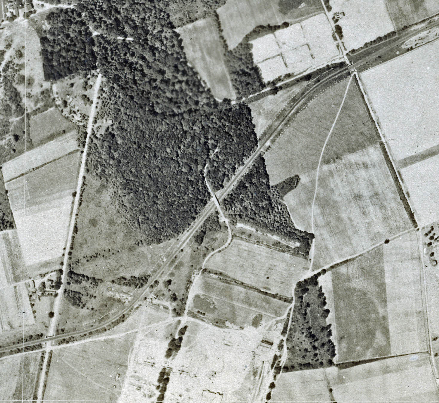 This aerial shows the section of the Motor Parkway from Winchester Boulevard (bottom left) to Commonwealth Boulevard (top right).
B_edited-1.jpg) A close-up of the Commonwealth Boulevard Motor Parkway Bridge. Click on the photo to enlarge it and , amazingly, you can see the Motor Parkway concrete posts on the north and south borders.
A close-up of the Commonwealth Boulevard Motor Parkway Bridge. Click on the photo to enlarge it and , amazingly, you can see the Motor Parkway concrete posts on the north and south borders.
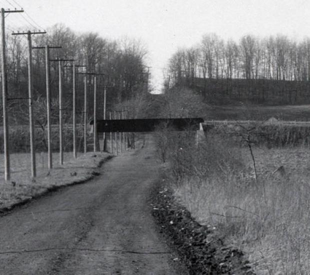
1928 Photo- Courtesy of Queens Borough President's Collection
 This may be the only grade level photo of of the Commonwealth Boulevard Bridge. Loking north, a water tower can be seen on a small hill in the background.
_edited-1.jpg) When the bridge was built in 1912, New York City required the Motor Parkway to use railroad-type trestle construction over the Queens public roads
When the bridge was built in 1912, New York City required the Motor Parkway to use railroad-type trestle construction over the Queens public roads
1928 Motor Parkway Atlas Blueprint
 The Motor Parkway Atlas shows the right-of-way in the Glen Oaks area.
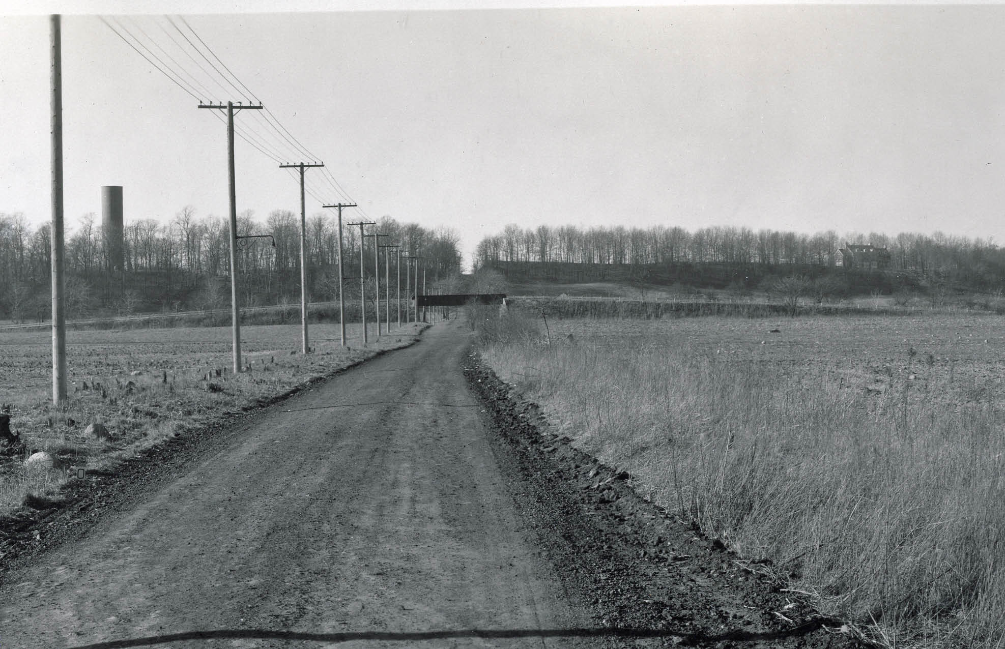
November 23, 1937 Aerial- Winchester Boulevard to Commonwealth Boulevard, Queens
 This aerial shows the Creedmoor State Hospital complex and the farm land surrounding the bridge. The water tower seen in the 1928 photo was still standing in 1937, located just south of Grand Central Parkway.
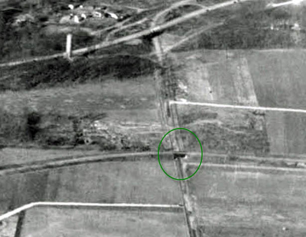 A close-up of the bridge
Current Views-2011
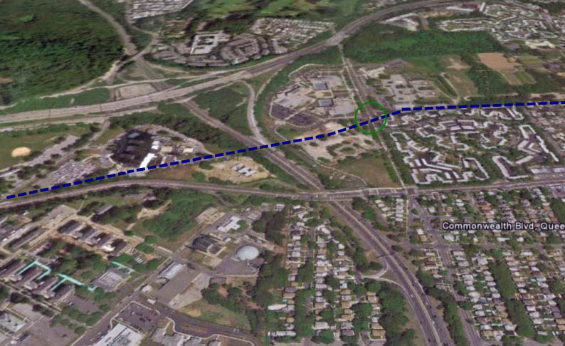 This Google Earth aerial highlights the Motor Parkway right-of-way and the approximate location of the bridge.
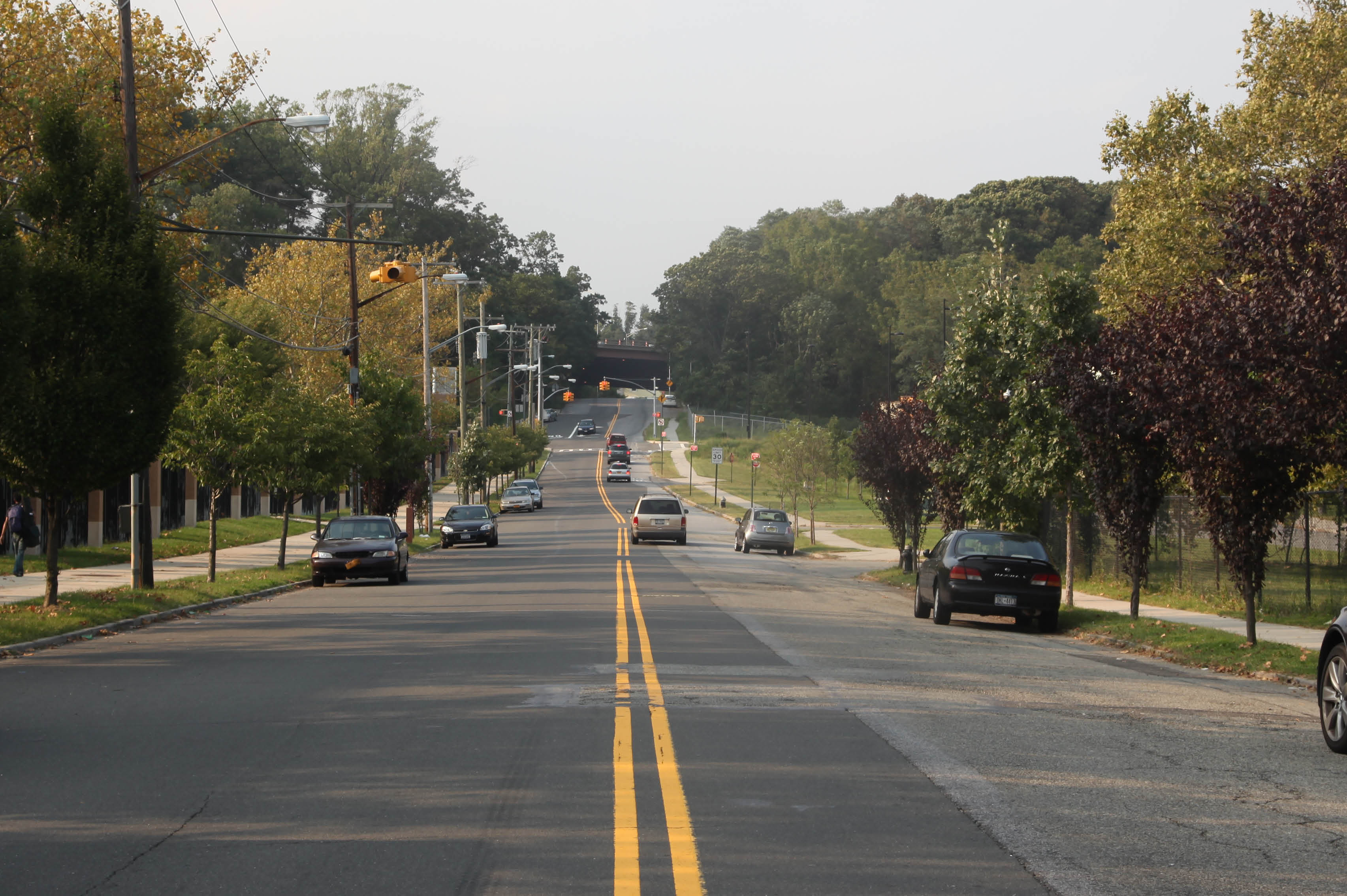 A current view looking north along Commonwealth Boulevard. The water tower was taken down years ago with the expansion of the Grand Central Parkway.
Links to related posts on VanderbiltCupRaces.com and the Internet:
Archives: Long Island Motor Parkway Bridge Series
The 1928 Long Island Motor Parkway Atlas
Archives: Long Island Motor Parkway- Bridges
Archives: Long Island Motor Parkway Bridges- Queens
Google Map: Commonwealth Boulevard


Comments
Ahh wow, there was actually open space/land/farm land in Queens! Once upon a time.
Cool shots
I have been following this blog since last summer, when I wondered about the first parkway was built in America. The first images I found were the bridges over 73rd St and Old Court House Rd. I was reminded of some ancient ruins and the more I explored on the net, the more fascinated I became. This is the best site. I use Google Maps many times. The old photos make it seem I am looking into another world. I have even read portions of the “Auction Block” by Rex Beach on line and have numerous bookmarks of the LIMP. Excellent dedication to something this historic.