Kleiner’s Korner: The Mysterious Seaford “Speedway” (posts and all!)
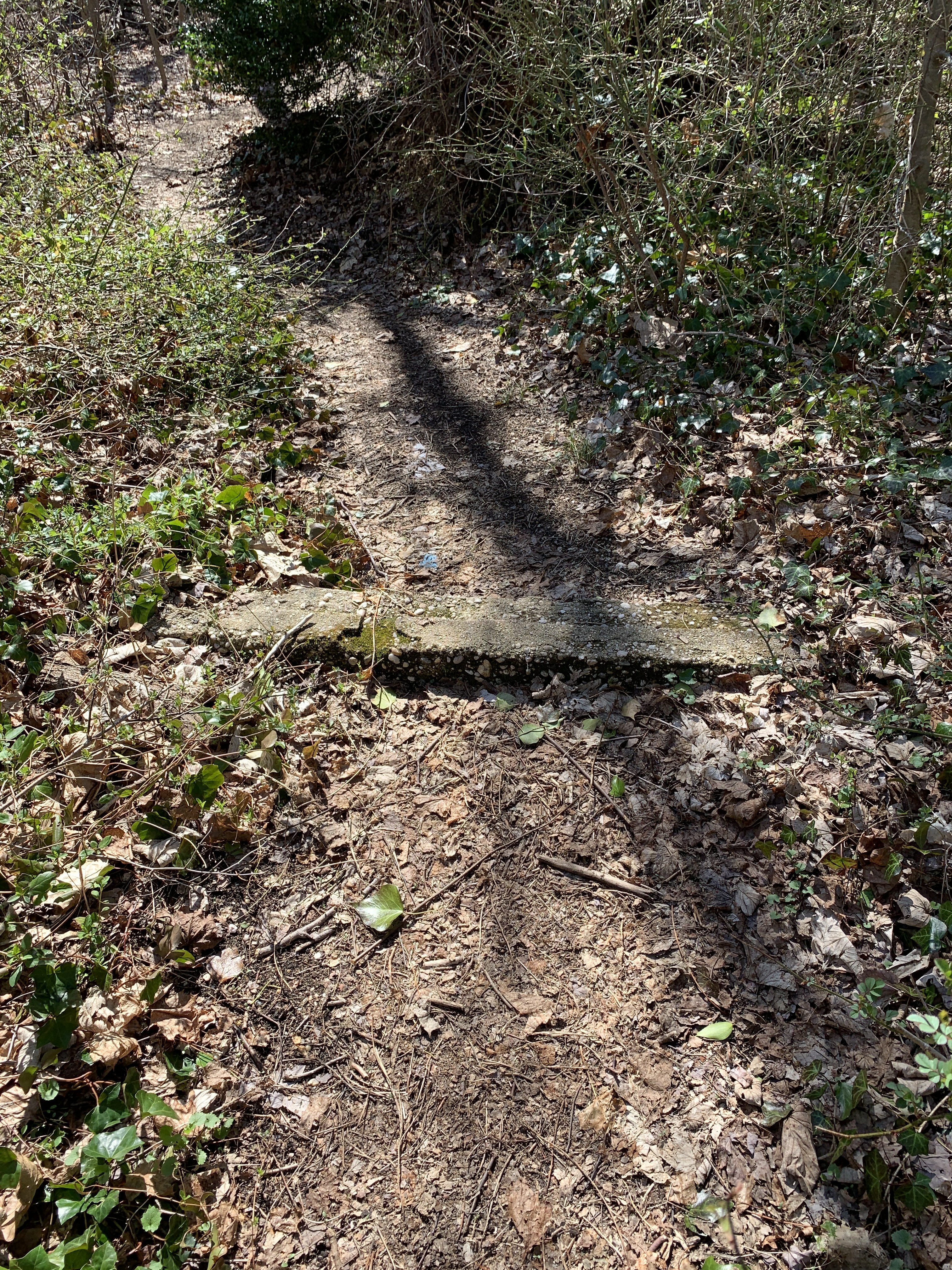
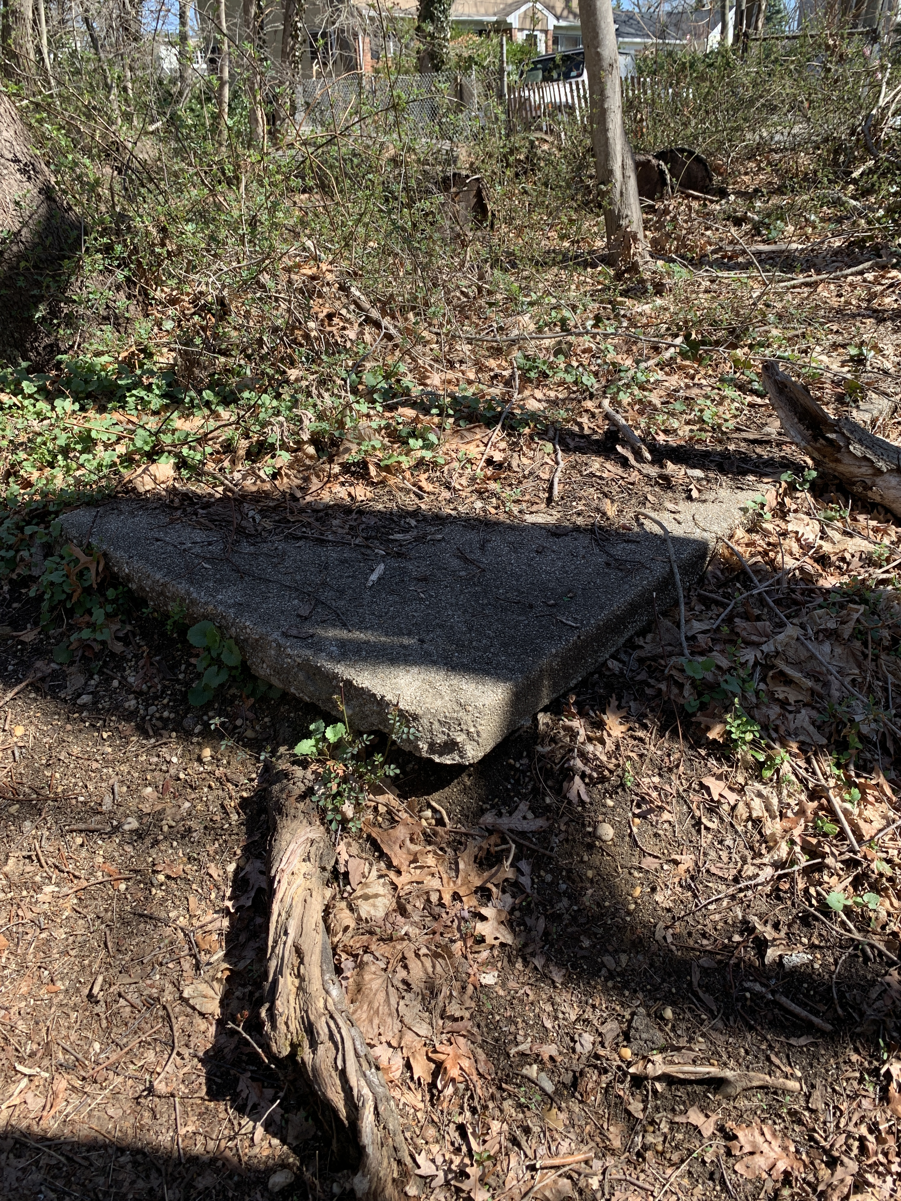
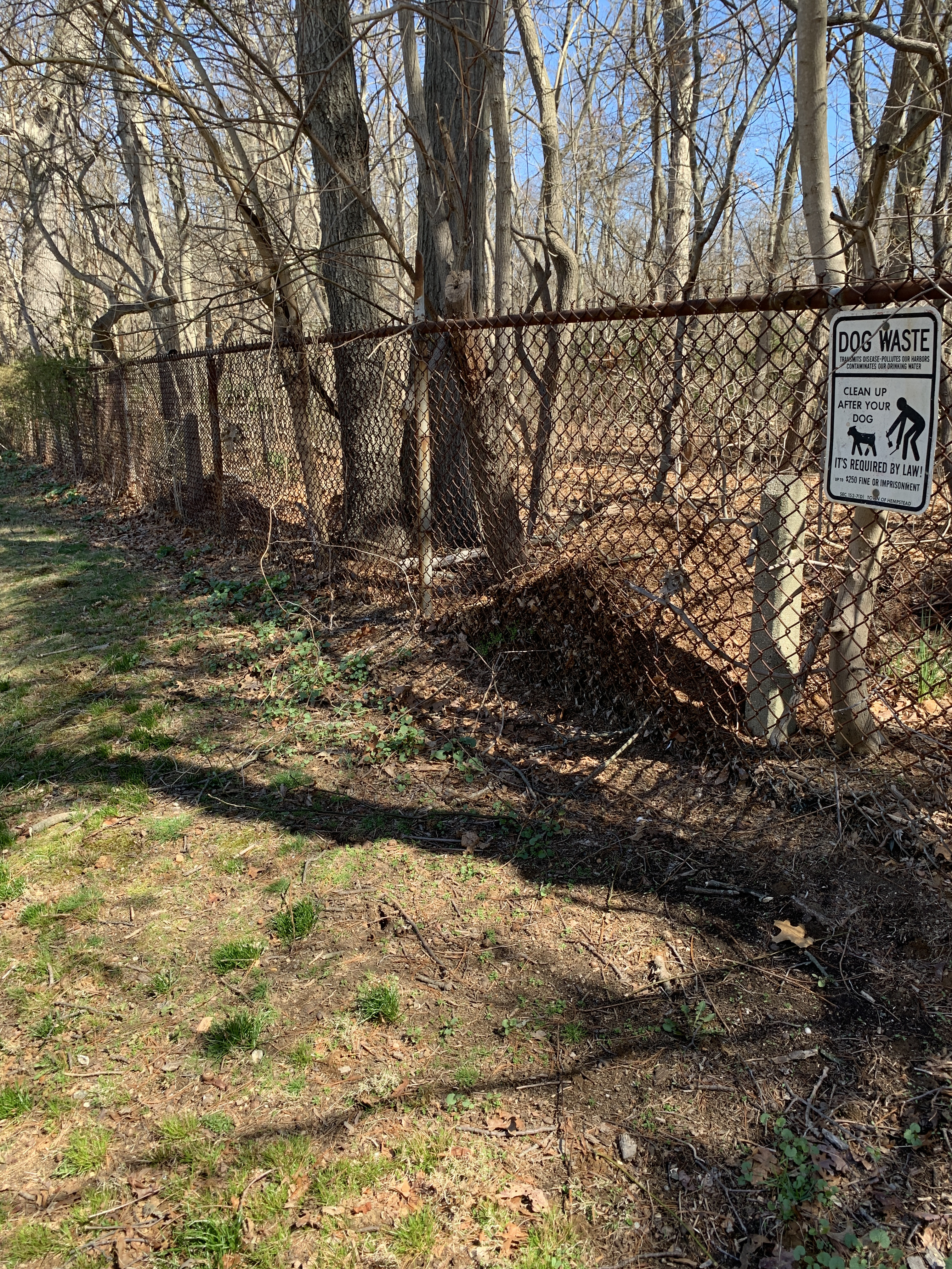
While hiking in Taukapausha Preserve which forms the Seaford/Massapequa border I noticed concrete posts very similar to those used along the Motor Parkway. What were these posts used for?
Art Kleiner
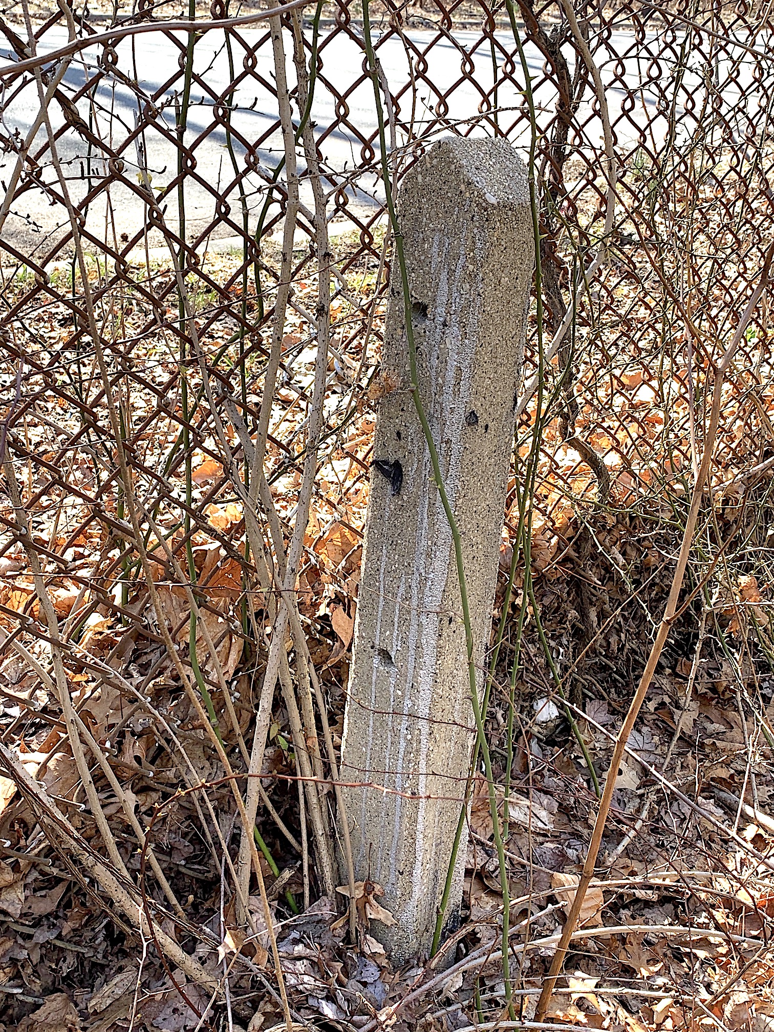
The posts had three holes most probably for the type of twisted wire found on Motor Parkway posts.
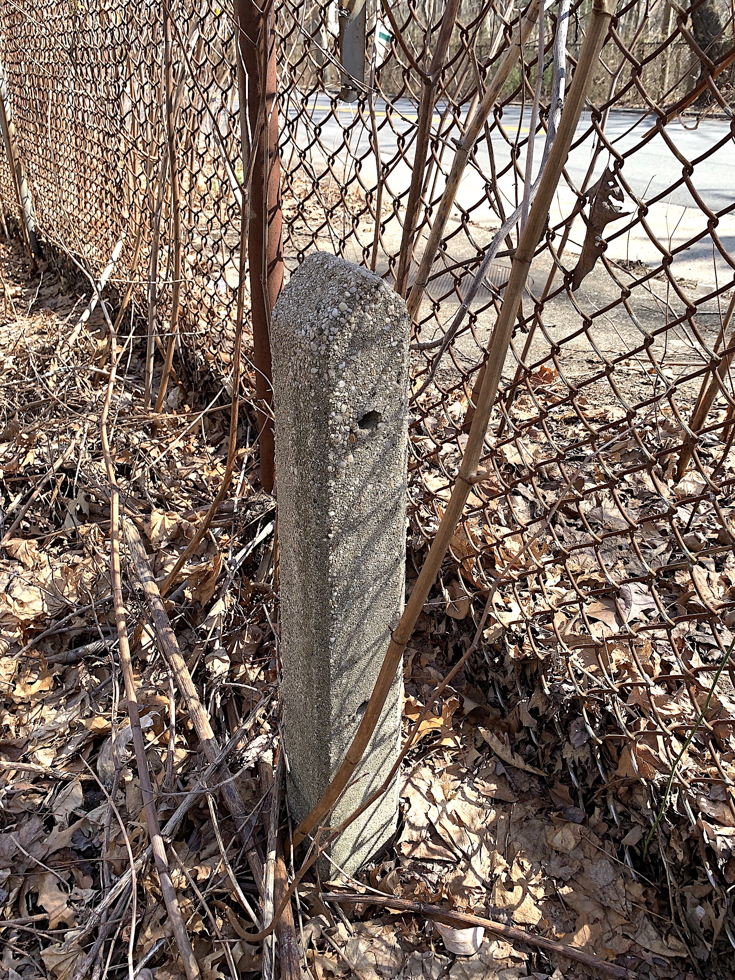
Posts were approximately 10' apart and were on the inside of a chain link fence that ran around the perimeter.
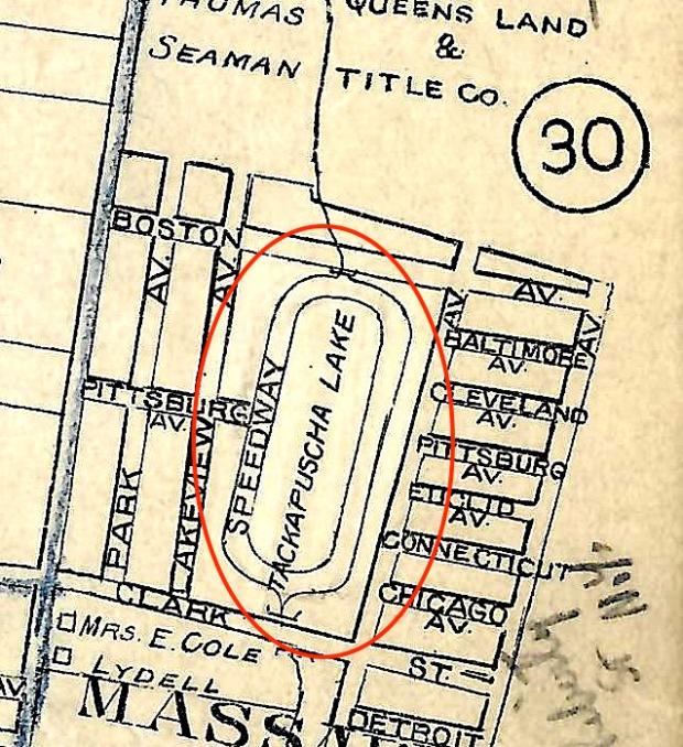
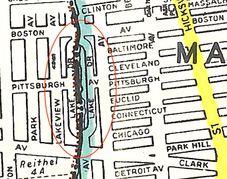
The Seaford "Speedway"
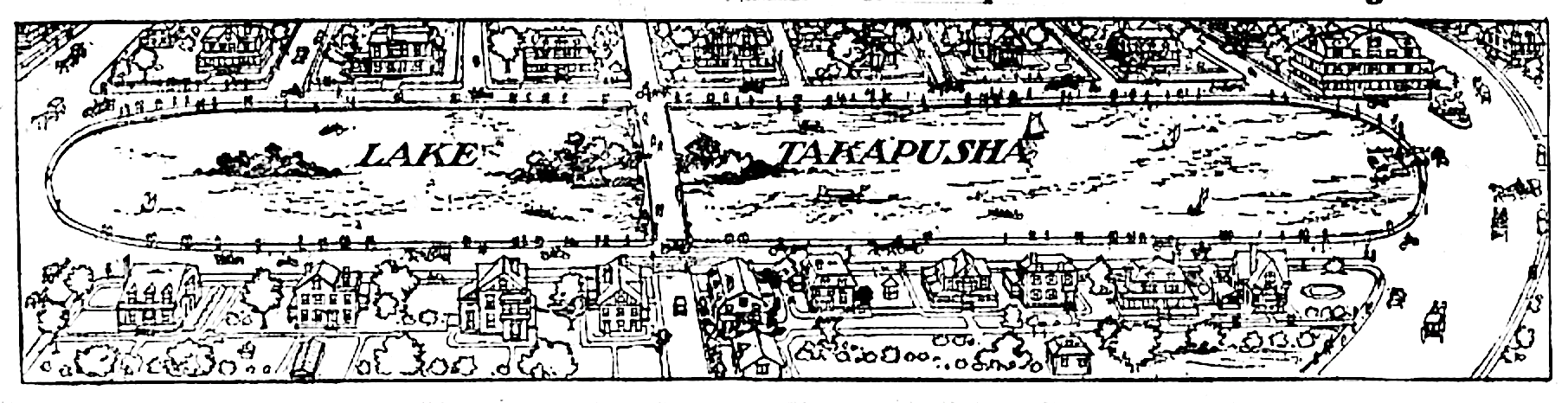
Early maps show a road on the perimeter of what was known then as Lake Takapusha. A combination of automobiles and horse drawn carriages shared the road in 1907.
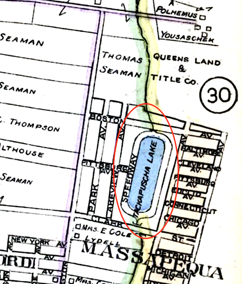
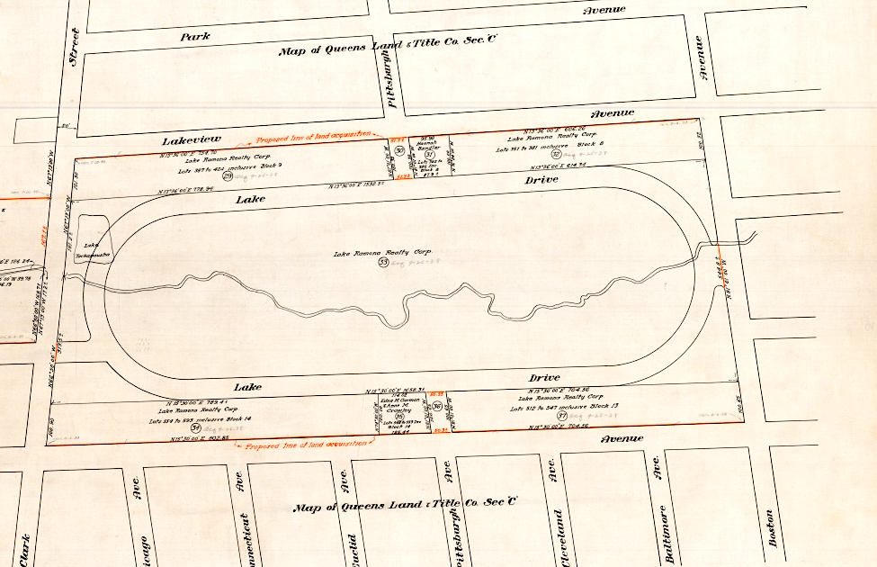
This 1914 map distinctly shows a "speedway" around the lake between Boston Avenue and Clark Street. Interestingly, today's Boston Avenue ends at Lakeview Avenue and the preserve extends north.

1922: The stream running from each end of the lake is named Seaford Creek and the "speedway" is clearly marked.
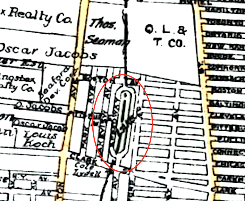
1927
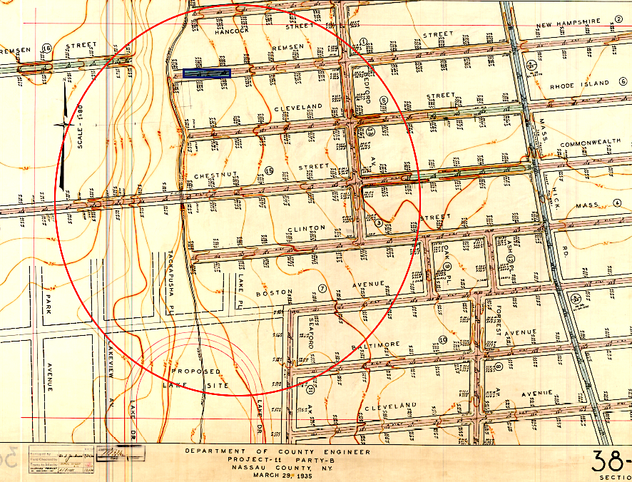
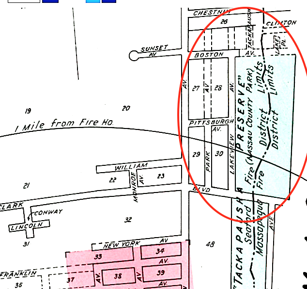
Comparing this 1935 map with the current map shown next indicates that in the 1930s streets were planned on the north east side of today's preserve.
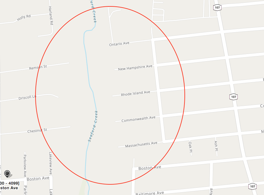
North of Boston Avenue, the current preserve extends to Jerusalem Avenue, however that section in the previous map shows streets; probably homes were also to be built.
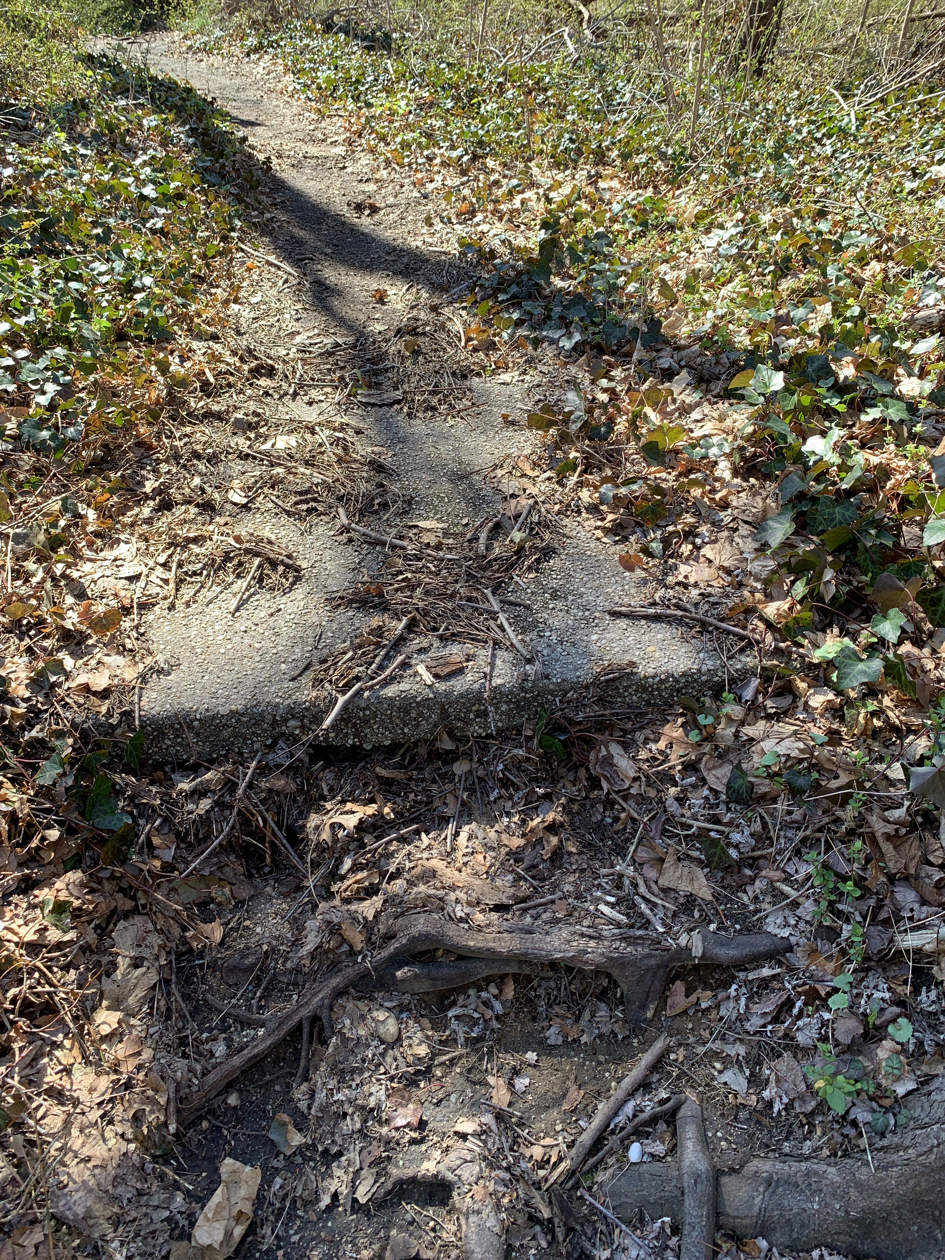
Pieces of the streets that extended through the preserve can be found today.
By 1938 the preserve area was owned by the Lake Ramona Realty Corp., which had many contracts for dredging Seaford Creek. Also sometime around then a boy drowned while rafting on the creek. Streets north of Boston Avenue (shown as the street running top to botttom on the right) are once again evident.
1945.
This 1947 map does not have any indication of a "speedway" or Lake Drive which had been shown on earlier maps around the lake's perimeter.
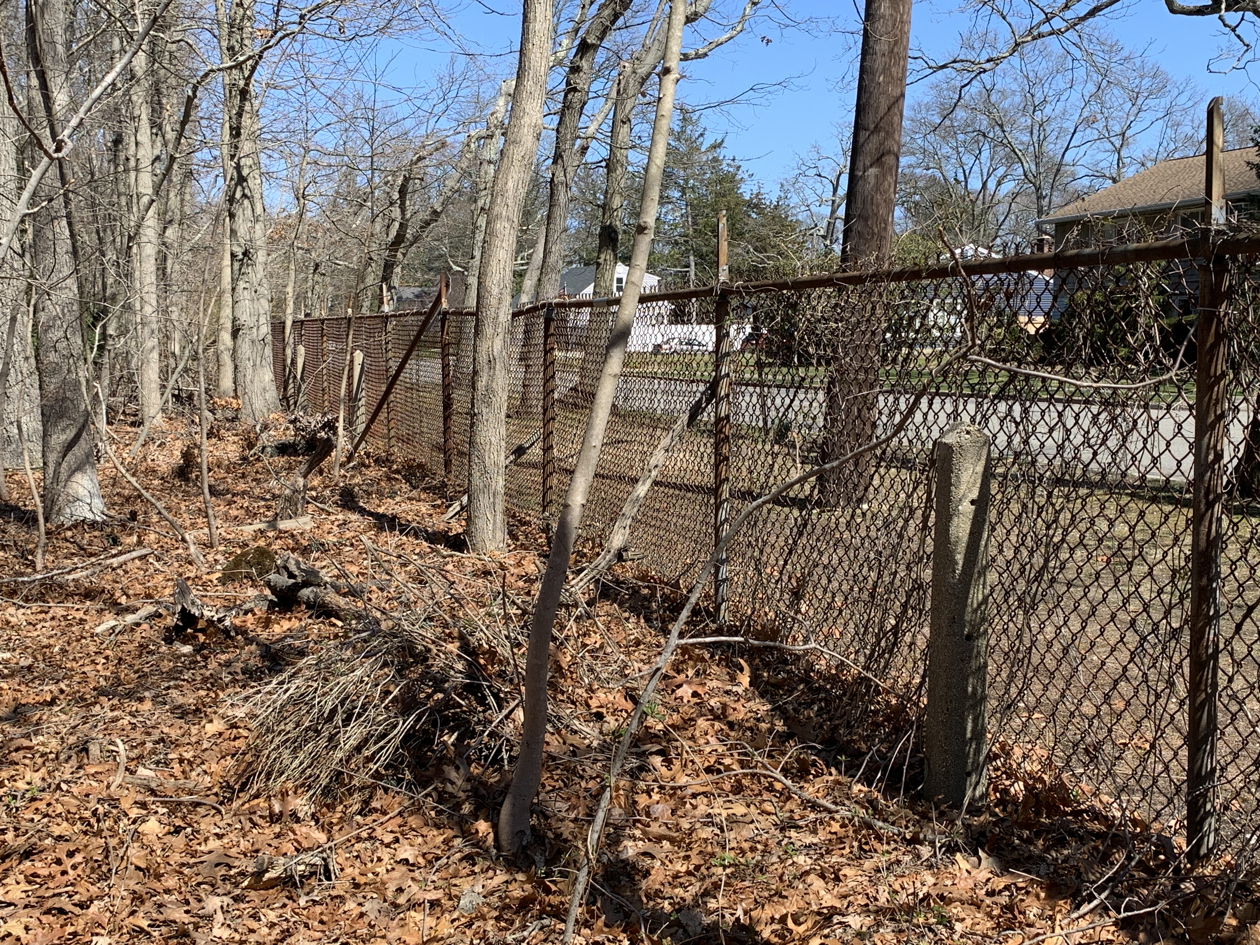
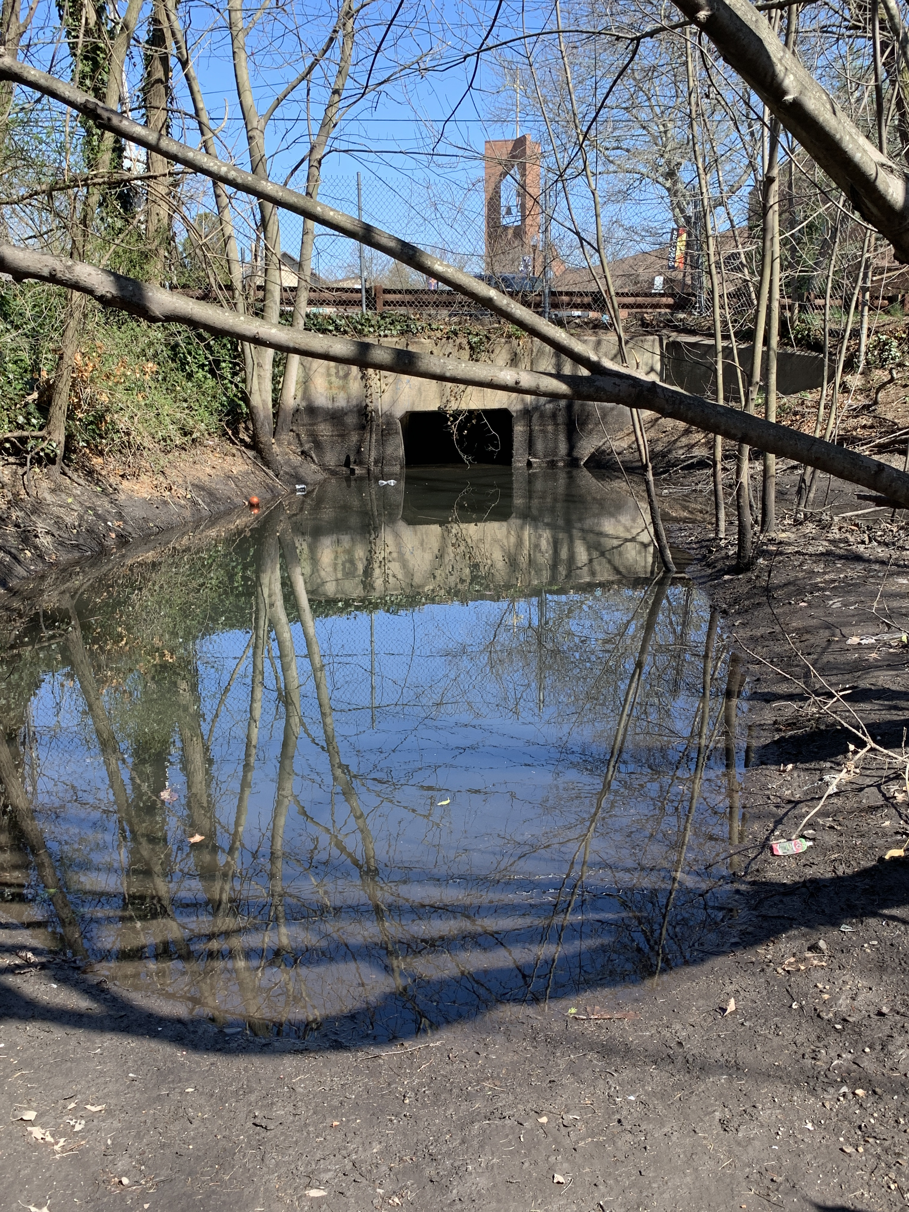
But the posts remain around the entire section of the preserve.
However, to be fully honest (and to be followed up at a later date) I believe posts can also be found around the southern portion of the preserve (south of Clark Street) and where no speedway was ever shown. But the hike proved successful in terms of getting some exercise and uncovering additional Long Island history.
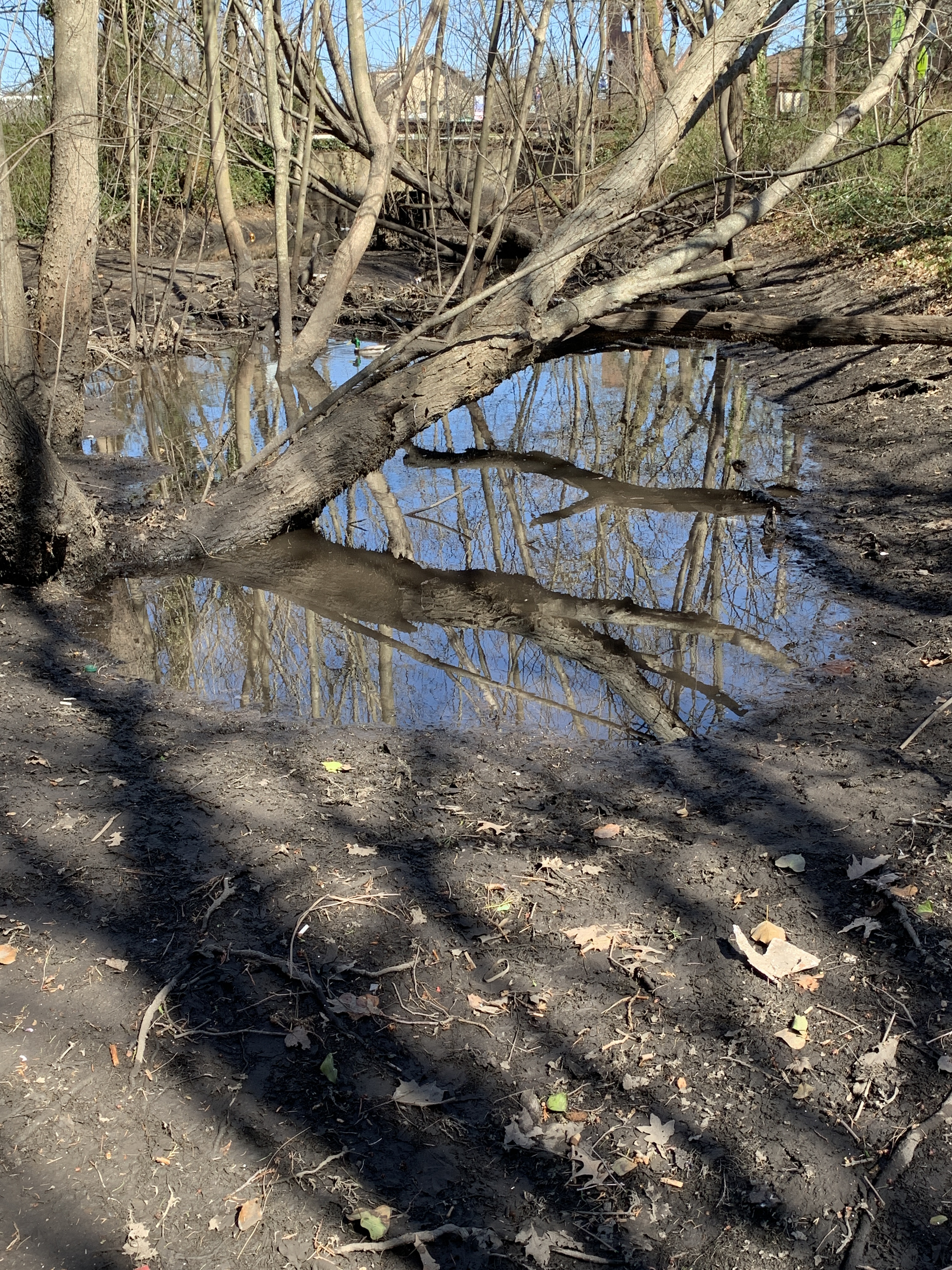
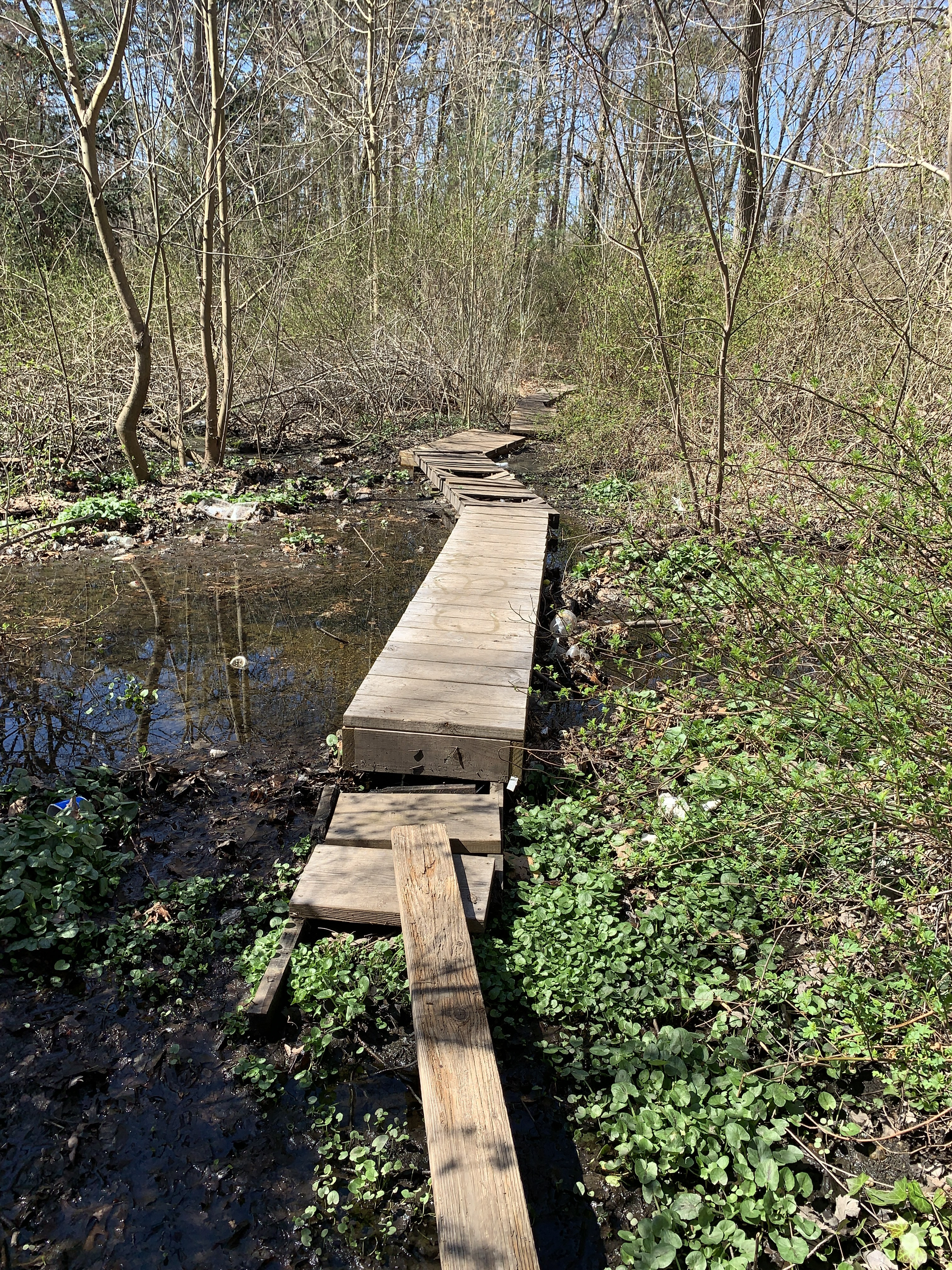
And I even got some nice pictures of nature!


Comments
As in the case of many other Nassau County owned parks and preserves, the property composing the Tackapausha Preserve was originally acquired for drainage purposes back in 1939. The property contained 70 acres which controlled drainage along the 6 miles of the creek through Seaford. Trails were laid out and marked and the 1st Nassau County Museum opened in May 1947 to provide information on the natural history of the region. At the time there wasn’t a Dept. of Recreation & Parks, instead all the properties were under the N.C. Dept. of Public Works (NCDPW). All of this was happening even before the creation of Salisbury Park.
I wouldn’t be surprised if those concrete posts were installed by NCDPW when it acquired the property. They look like standard posts used along other roads and properties at the time. Also, the 1935 map clearly states, “Proposed Lake Site”, so as is the case in so many maps, how much is proposed development versus actuality. As an actual survey, that map shows it as a stream flowing from north to south. The 1906 E. Belcher Hyde Nassau County Atlas shows the area as mainly owned by the Queens Land and Title Co. for future development.
Why was the museum named for Tackapausha? Massapequa Sachem Tackapausha (aka Tackapousha) served as a mediator between the colonists and the Indians, eventually becoming the head Sachem of western Long Island between the 1640’s and 1690’s. In 1947 it seemed like a fitting remembrance to him.
Here’s some early photos of the Preserve and the original Museum Building when it was located on Sunrise Highway. Notice the posts & twisted wire in the last photo of the path leading up to the museum!
Interesting discovery, Art. Maybe dog or horse racing in the past? Time to check out some aerials. Know that I’m thinking about it, I recall seeing quite a few track ovals on older aerials throughout Long Island.
Nice find Art. I agree with Brian’s horse racing, but unlikely dog racing here on Long Island. The first location I’ve ever heard of dog racing was in the ‘70’s at Florida’s Hialeah Race Track in Miami. Gary’s historic views are priceless, that can be applied to further discoveries as well.
What a find! Hiked in the preserve many times as a kid. Who would have thought. I have to think “Speedway” is a bit of hype of the times. Looks more like a residential neighborhood.
Gary, thank you for your comments, and photos. They add to the overall picture and history tremendously and place it in a proper perspective time wise. Gives all of us a much better picture of “the way it was”.
Looking more closely at the map I realize now that I walked around the most southern portion between Sunrise Highway and Merrick Road. Still, it’s all quite amazing when these finds are discovered. Even more amazing is that in the before the “preserve the wetlands” time these areas weren’t buried undergound in culverts. We can be thankful to the powers that be at the time to have preserve these green areas for our use.
I’d say the road east & west across the oval & creek on the early map is today’s Pittsburgh Ave. Must’ve been dirt roads back then. Maybe the pavement you found Art is Pittsburgh Ave extending a bit towards the creek. Raceway must’ve went out of use early, can’t see any ovals on the aerials below.
In 1939 my great uncle DR Allen Haight who’s brother George F Haight my maternal grandfather were principles in queens land and title company sold land in question to Nassau County for $100,000. The real estate which he transferred to the county extended north from Merrick road to Boston Ave and west from Seaford Creek. As a kid remember riding my bike on parks trails, some fun.
I too remember biking with my childhood pal John Berner, ca 1947-50. I also recall that there were locked entry gates at times and occasionally we would lift our two-wheelers over the fence so that we could zip through the ‘paved’ paths of Tackapusha.
Interesting pictures, stories and comments.
Do you know more about the original Takapausha Museum building? Was it a residents prior? Age? Actual original address? Thanks. Great job.