Kleiner’s Korner: The Motor Parkway in Maps - Part IV
Part IV in this series includes maps primarily published in the touring magazines of the Automobile Club of America (ACA) plus other maps that I've recently uncovered. The ACA's publications were first named The Club Journal (approx. 1909+) and later Motor Travel (approx. 1916+). All maps courtesy of the HaithiTrust Digital Collection and The Crittenden Automotive Library except where noted.
Art Kleiner
The ACA's First Issue
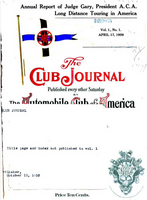
First published April 17, 1909 with issues every two weeks.
ACA Governors
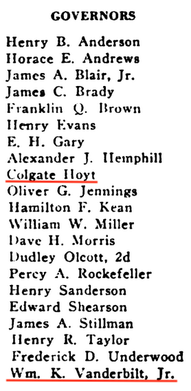
Willie K. and Colgate Hoyt were officials of the ACA along with other prominent men in the automobile industry.
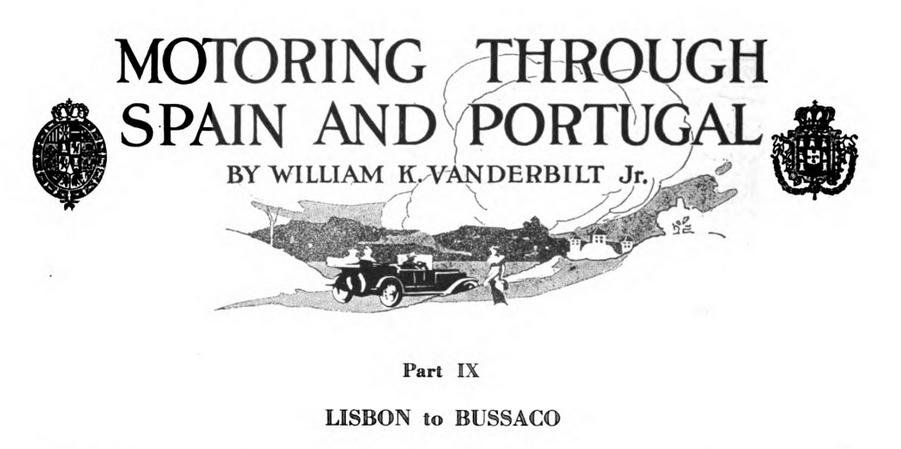
Willie K. authored a series of articles detailing his automobile trips around the world.
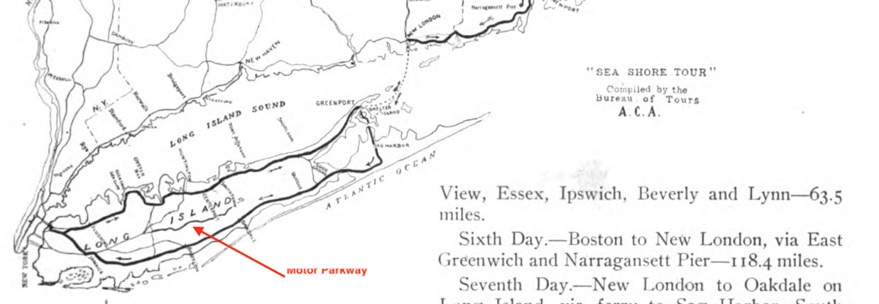
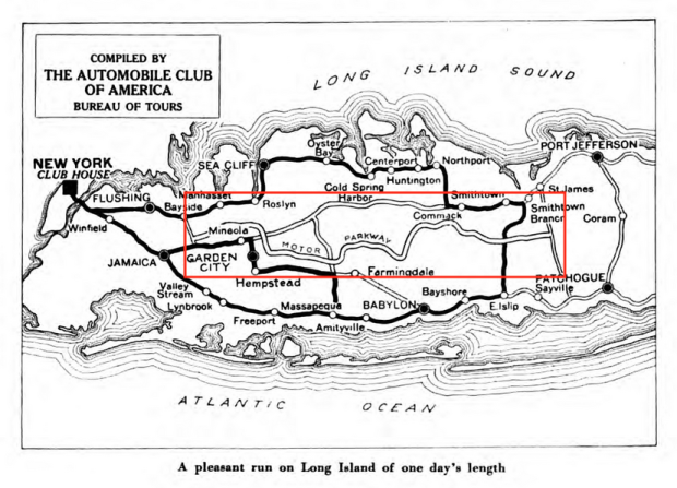
The ACA's Bureau of Tours compiled numerous motor trips across the US, inlcuding some on Long Island.
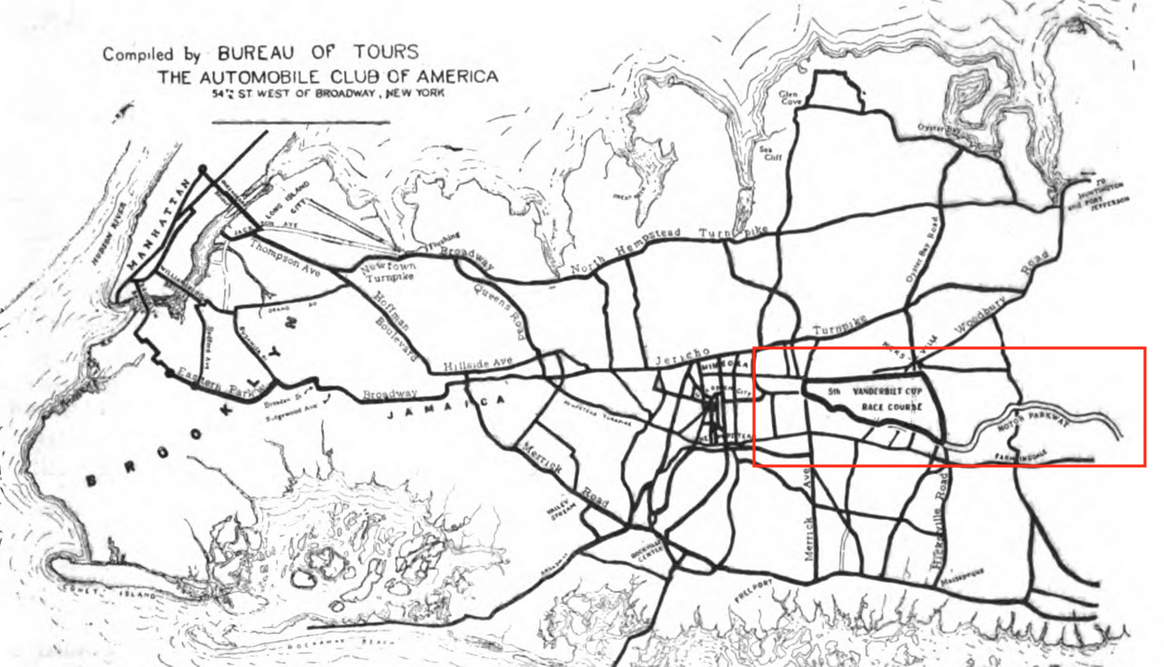
Plotting the course of the 1909 Vanderbilt Cup Race.
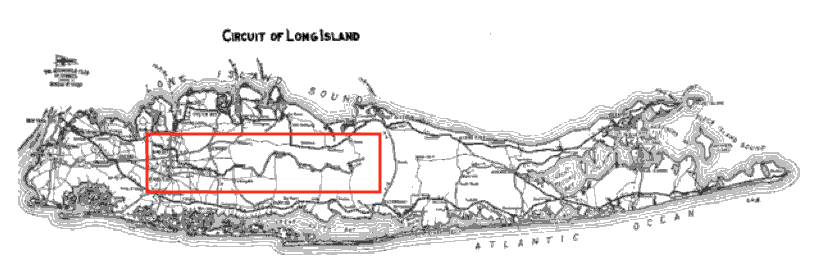
1910 "Circuit of Long Island"
The Long Island tours often started and ended at the club's headquarters in NYC.
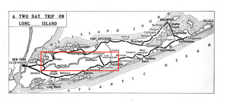
A 1915 two day tour.
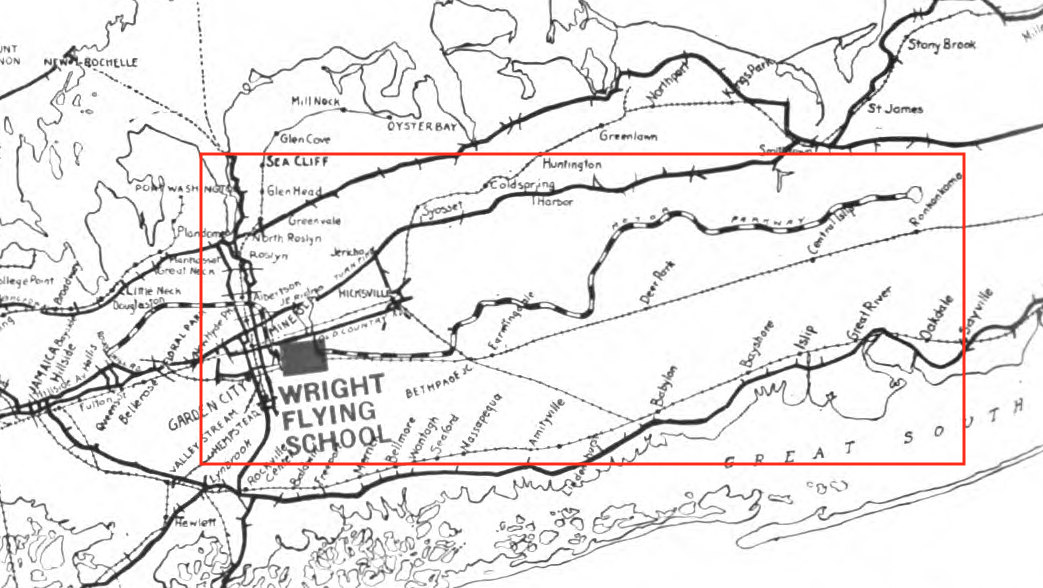
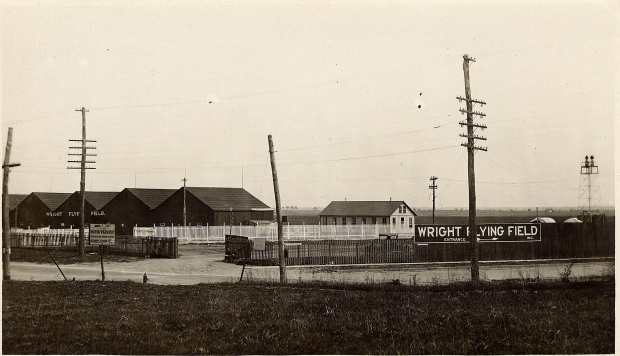
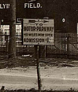
The Wright Flying School
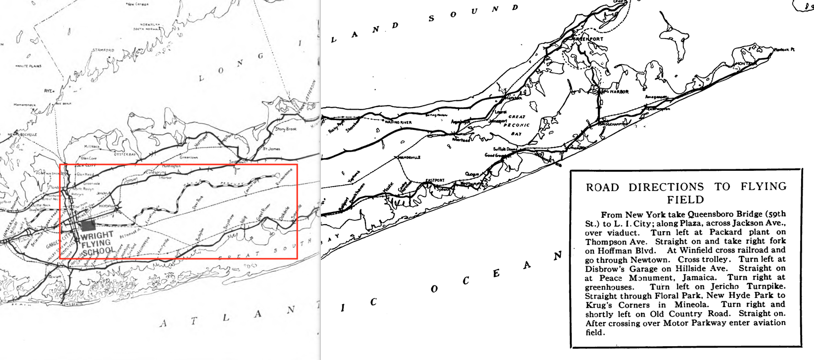
Located near Mineola (East Garden City) The Wright Flying Field and school were situated adjacent to the Motor Parkway. (The Wright Flying School, 1916)
"Motor Travel"
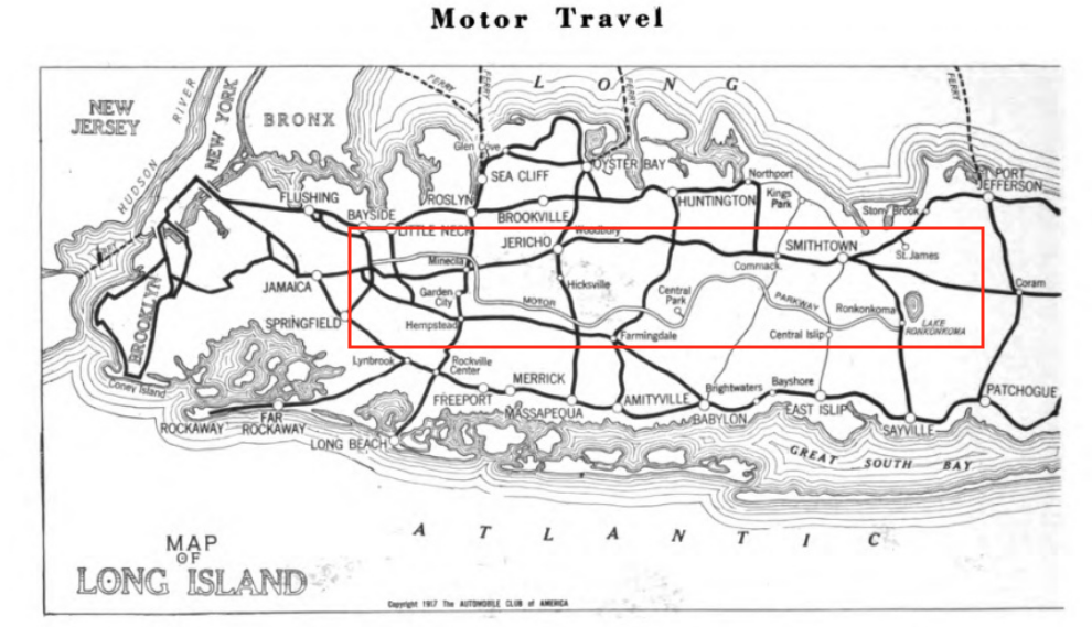
Sometime around 1916 the ACA's journal became Motor Travel.
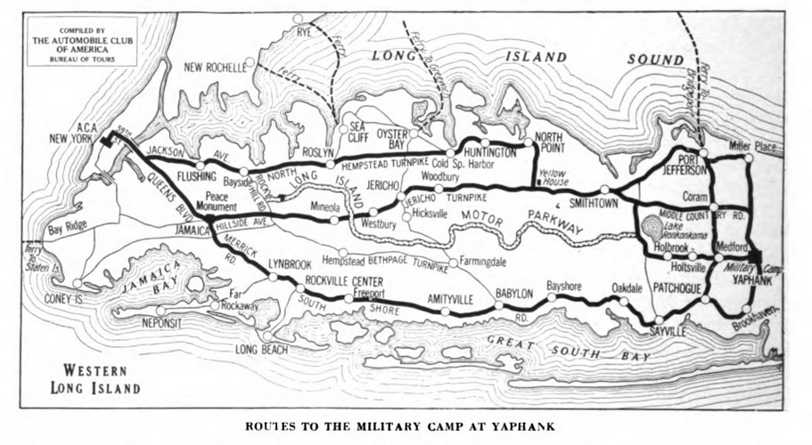
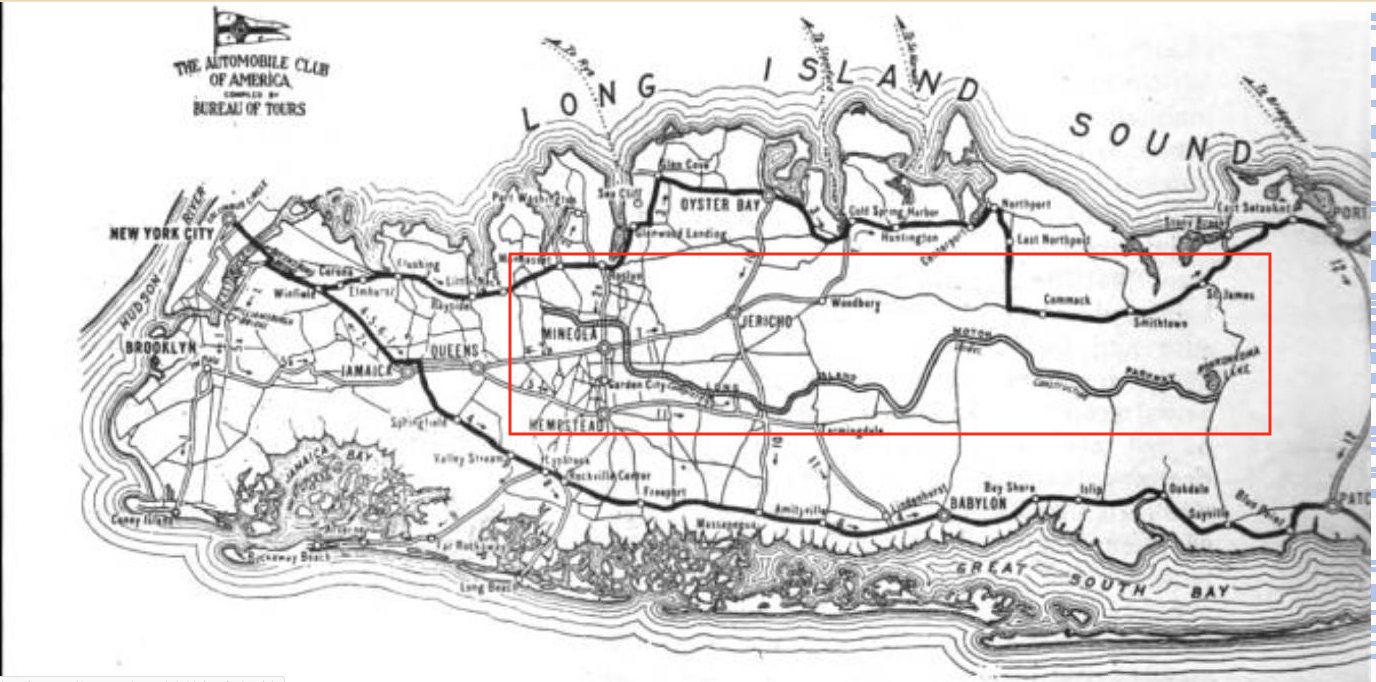
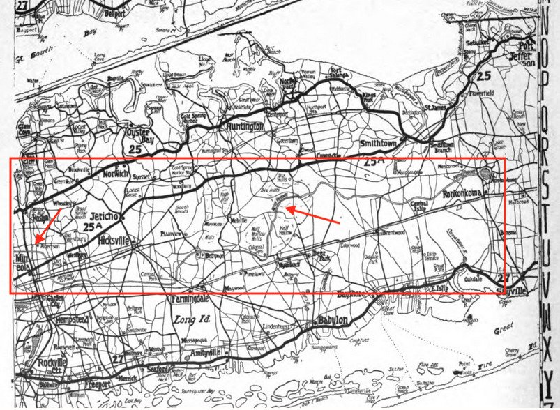
1917: Note Rocky Hill Road near the western end of the Motor Parkway, the "yellow house" west of Smithtown and the "military camp" at Yaphank far right.
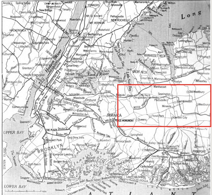
1918: Each year the maps got more detailed.
1918
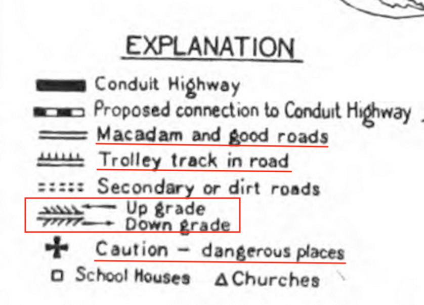
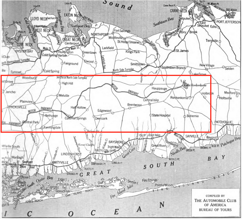
This 1921 showed the planned route of the proposed "Conduit Highway" connecting Brooklyn and Amityville and noted "good roads", trolley tracks, up grades and down grades and "dangerous places".
The Motor Parkway was shown as a "Macadam and good road".
Two places were shown as "dangerous places", not including Deadman's Curve! Want to provide some guess as to where these are and why they demanded caution?
NYS Council of Parks Report
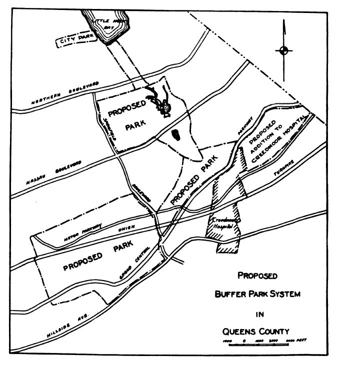
This 1925 map is not from the ACA but rather from a report issued by The NY State Council of Parks. The "buffer parks" proposed included Cunningham and Alley Pond Parks in Queens of which the Motor Parkway abutted. Also shown are proposed additions to Creedmoor Hospital
Motor Trips
Today's final map is from the publication Motor Trips and was published in 1928.


Comments
One of my all time favorite photos, Old Country Road and Clinton Ave looking SE at old Roosevelt Air Field. Today, its busiest intersection in Nassau County.
I wish I had a time machine, so I could cruise by the Packard plant, Disbrow’s garage, and the Peace Monument on the way to the Wright flying school!
Of the 2 ‘dangerous places’ on the map. I believe the one in the upper right was the Jericho RR crossing where the 1908 course went through. Shown below when it was the 1st mystery photo of 2019.
The PEACE MONUMENT on the 1917 thru 1921 maps captured my curiosity. Shows on the north side of Hillside Ave, opposite of Merrick Blvd ( 166th St ) Jamaica. A bit of research brings me just a little north to CAPTAIN TILLY PARK. The park was named in honor of Captain George H Tilly, who died in 1898 during the Spanish American War. Prior to 1935, it was known as Hillside Park. A Spanish American War Heroes Monument was erected in the park in 1941.
Maybe there’s an older PEACE MONUMENT being that it’s noted on these maps?
Correction- The park was named Highland, not Hillside, prior to being presently Captain Tilly Park. Must be a nice place to enjoy & relax.
I believe the so-called Peace Monument actually refers to the Jamaica Civil War Monument dedicated in 1896 (see attached postcards). Originally located at Hillside & Bergen Avenues, it was moved in 1960 to Major Mark Park. Look at NYC Parks website for more info.: https://www.nycgovparks.org/parks/major-mark-park/monuments/1464
Thanks Gary, you explained what I just learned : ) Jamaica must be an interesting area.
The last and final map publish in 1928, has the labeling of Rt. 25 and 25A in reverse order.
Hey, Art! Is Howard paying you overtime? You sure deserve it. The two danger points are both RR crossings. OMG! The “Victory” Monument (as I knew of it) - I’d forgotten all about that one, too; it impressed me as a kid then - gone. Keep it coming! Sam, III
From Art Kleiner:
Thanks Gary and Brian for educating us on the Peace Monument - interesting that as the following articles indicate there was talk way back in 1909 to have the monument moved due to traffic considerations. Bergin Avenue has since been renamed Merrick Blvd. which turns into Merrick Road further east.
Sam, overtime? Labor of love - lol.
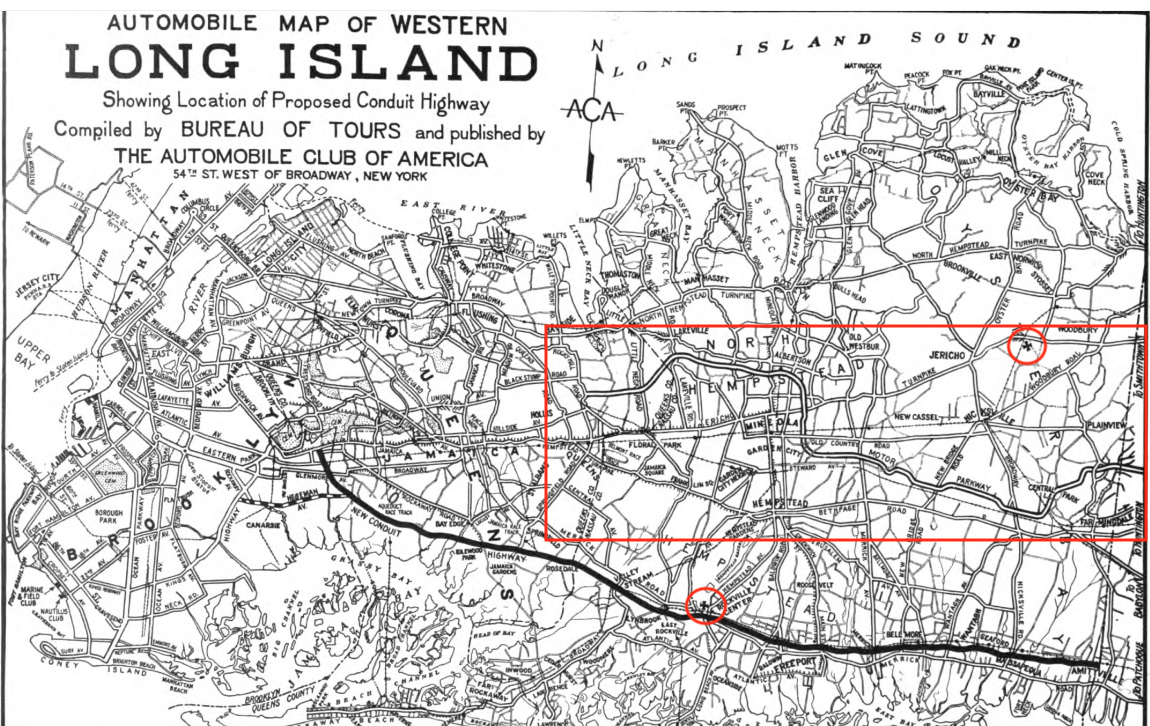
Since this re-opened, I should’a named the other Dangerous Place as the crossing of Hempstead-cum-North Village Avenue over the South Shore line of the LIRR at Rockville Centre station. That was, of course, long before the grade elimination project of ca. 1960. Wonder why that particular crossing was singled out; I don’t recall it being so bad ca. 1950, when I first started driving there. Seems to me that the Grand or Milburn Avenue crossing in Baldwin was far worse, obscured by a big store or some such at the NW corner. Now, closer to the LIMP, who remembers the huge hump of the crossing at the far western end of the OTHER Hempstead Avenue (Route 24, the Hempstead Pike) where it crossed the Main Line at grade immediately south of its Jamaica Avenue (Route 25, the western end of the Jericho Pike) terminus in Queens Village? LOVE the twists and turns of these threads. Sam, III
Your welcome, Art. I’m always learning something new here!