Mystery Friday Foto #39 Solved: A Bethpage Aerial
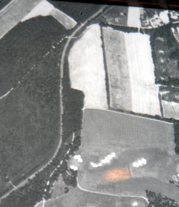
Did you identify the location of this aerial in Bethpage?
Identify;
- Location and orientation of the photographer
Over Bethpage State Park. North is up.
- Any Motor Parkway structures
- Approximate year
1939
- Identify the golf course in the lower portion of the photograph. When did it open?
The Bethpage State Park Golf Course. Opened 1934/35.
- Kudos: Where can this photo be seen on display?
This photo currently hangs in the Bethpage State Park clubhouse.
Comments (5)
Congrats to Robert Greenhaus, Joseph Oesterle, Steve Lucas, Art Kleiner and Brian McCarthy for identifying Bethpage State Park. Thanks to Art and Brian for their additional images.
Greg O.
1908
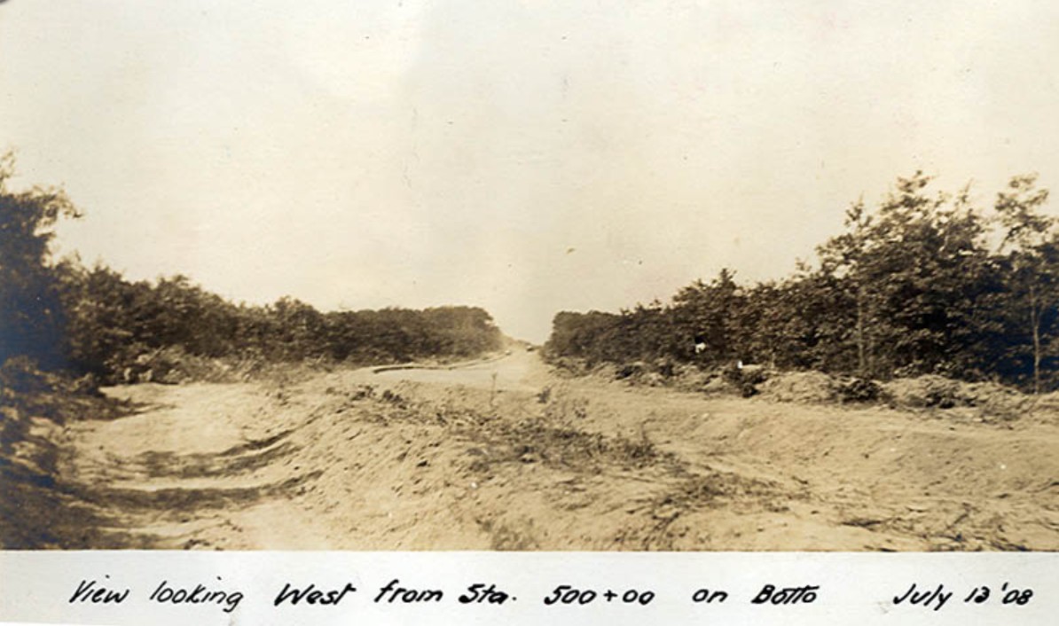
July 1908 construction photo
1935
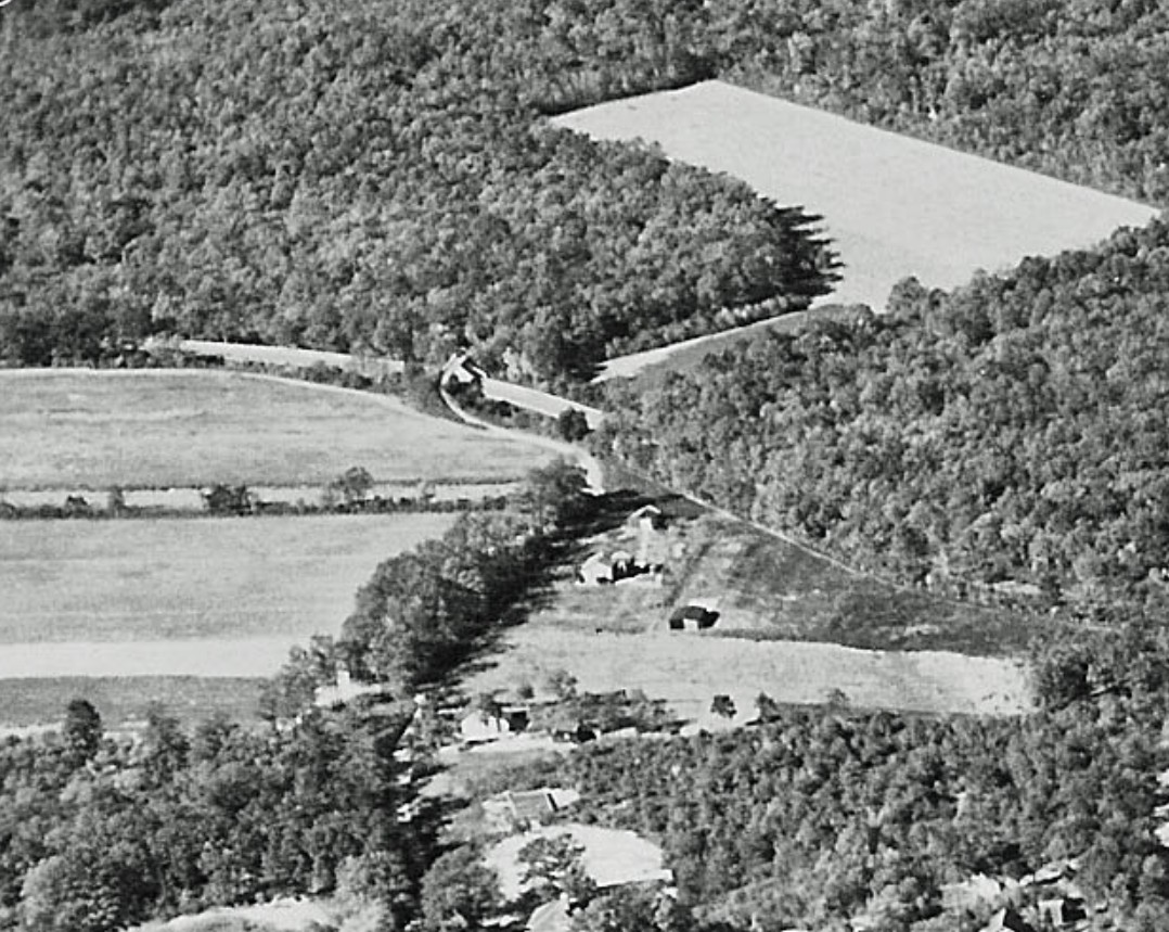
November 16, 1935 aerial with the Botto Bridge in the center
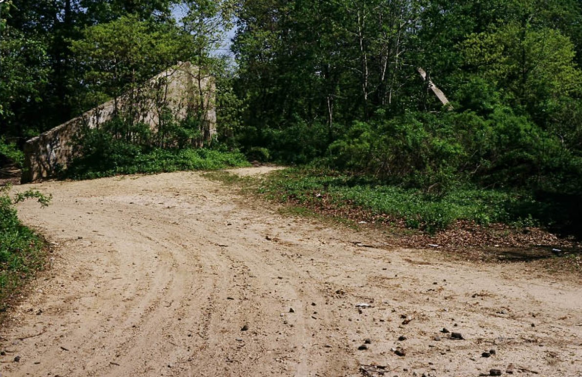
Today
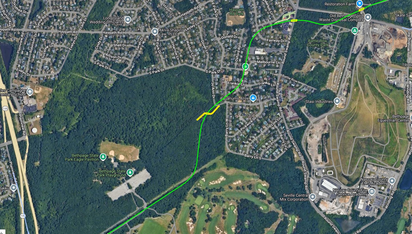
Check out Wayne Consolla's online Motor Parkway map to find the location of the Plainview Road Bridge.


Comments
• Location in photo: Old Bethpage/Farmingdale
• Orientation of photographer: Southwest → Northeast (North to the upper-right)
• Motor Parkway structure: Botto Farmway Bridge
• Year: 1923–1932, probably mid-1920s
• Golf course: Lenox Hills Country Club (now Bethpage Green)
• Display locations: Cradle of Aviation Museum
We are looking at current day Bethpage State Park. Namely, where the new bicycle path runs on top of the LIMP. And where the old Botto Farmway Bridge crossed the LIMP. If we could pan this picture a bit further north and east, we would see the Toll Lodge at Round Swamp Rd. The golf course is currently part of Bethpage State Park.
We are over mostly Bethpage with north at the top of the photo. The LIMP runs from the lower left corner to the top center. The Botto farmway bridge is near the top. The year is 1939. The golf course is part of Bethpage State Park. I believe it’s the Red Course which opened in 1935. The photo is hanging in the clubhouse at Bethpage State Park.
Bethpage/Old Bethpage, looking north.
Botto Farm Bridge
1939
Might this be the Red Course at Bethpage Sate Park - If so, it opened in 1935.
The photo is displayed in the Clubhouse at Bethpage State Park.
Aerials from 1926 and 1953 showing what I believe to be a Motor Parkway Bridge. Interesting that the second and third (1953) show the area somewhat cleared.
Hi everyone. Photographer & Pilot were aboard a Plane taking film of Long Island in 1938. This area is looking north at Bethpage State Park along with mostly farmland. LIMP was closing this year as well, so clearly seen. Bethpage State Park & Golf Course opened in 1934. Know I read somewhere in here that this aerial photo is in the Golf Course Clubhouse. Below is a 1926, 1938 & 1950 of this area. Mystery looks very much like 1938.
Old Central Park, today’s Bethpage State Park with Motor Parkway traveling under the Botto farmway bridge approaching Old Bethpage. The bridge’s abutments attached below may no longer exist. North is up. About 1936 when Bethpage’s Black Golf Course opened during the depression era
Old Bethpage aerial with the Botto bridge
May I ask? What exactly was “station500+00 on Botto.” Was that the bridge?
Hi Joe, According to what I can find on the site here, the Botto Bridge is Station 472. Pretty sure station numbers were assigned to anything that was built along the parkway. Maybe culverts had station numbers too. Station 500 may’ve been a bridge that was going to built, but cancelled. Don’t know how to attach a web link to a comment. But I’ll leave screenshots below about bridges etc.