The Motor Parkway and the Wheatley Hills Golf Club in East Williston
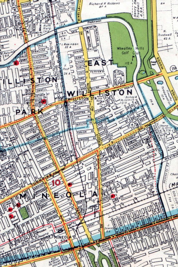
The Long Island Motor Parkway changed directions in East Williston from Roslyn Road (East/West) towards East Williston Road (North/South). As seen in this 1940 map, the parkway split the Wheatley Hills Golf Club in half. Several questions immediately come to mind in looking at this section: Which came first the parkway or the golf club? How did members enter the club from the Motor Parkway? Are there any parts of the parkway still existing today? Here are some answers:
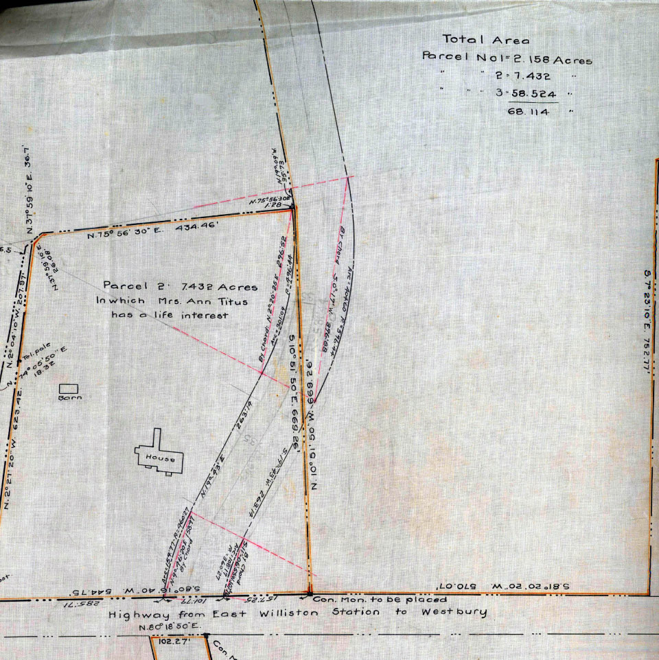
This is a March 1909 Motor Parkway survey of the East Williston section from my map collection. It indicates that the Motor Parkway purchased 68.114 acres of the William Titus farm in order to build the road through this section. Accordingly, the Motor Parkway was built before the Wheatley Hills Golf Club was established.
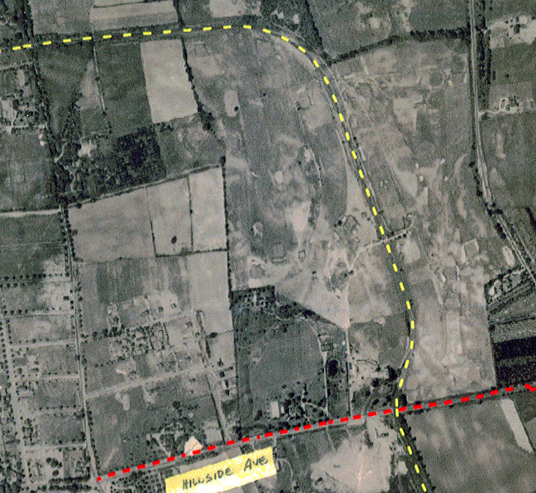
A 1928 aerial clearly shows how the Motor Parkway split the Wheatley Hills Golf Club. Note halfway in the north/south section there was a bridge over the Motor Parkway connecting the two sections of the course.

According to my favorite co-author Al Velocci, the Wheatley Hills Golf Club was established four years after the Motor Parkway purchased this section in 1913 as the Midland Golf Club with the old Titus house as the clubhouse. This Wheatley Hills Golf Club brochure (circa 1920s, courtesy of the Suffolk County Vanderbilt Museum) noted: "the course is divided into two almost equal parts by the Long Island Motor Parkway which...will be attraction rather than a detriment both by the reason of the way it divides the land and by reason of the facilities which it offers for access to the club house."
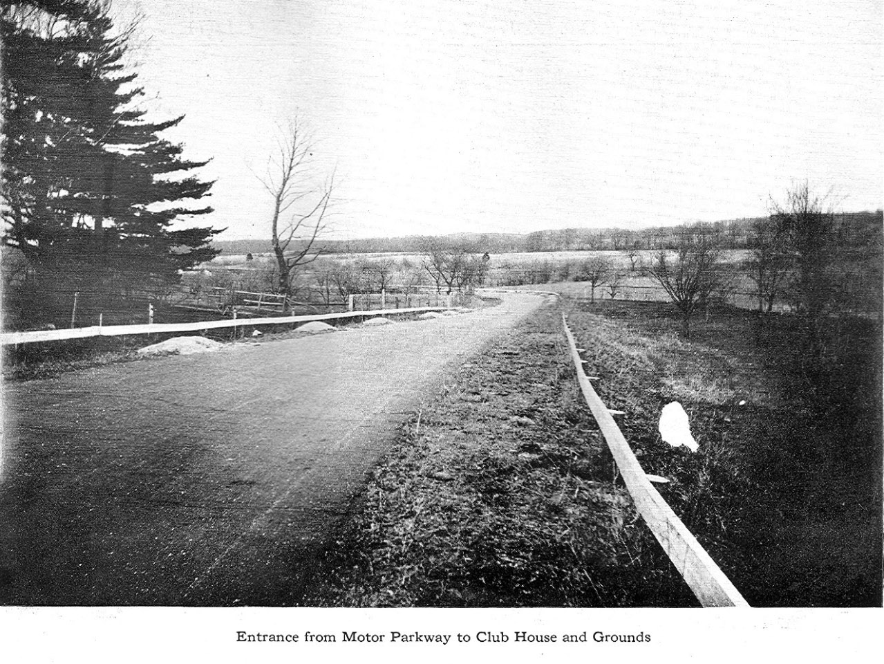
This photo shows the private entrance for club members from the Long Island Motor Parkway.
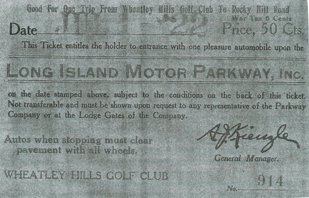
In his excellent book The Toll Lodges of the Long Island Motor Parkway, and Their Gatekeepers' Lives, Al Velocci provided this Wheatley Hills toll ticket with this description:
..the Club functioned as a quasi-lodge in that discounted toll tickets were printed with the Wheatley Hills Golf Club designation and sold to Club members. The Club steward collected tolls from members and guests issuing toll tickets as they left the golf course to re-enter the Parkway. A condition of the sale was that the tickets were good only going west, and only to the Mineola gate if going east..."
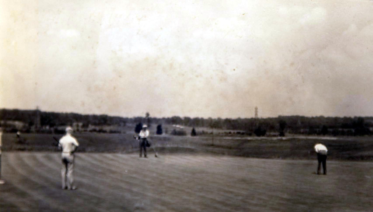
In this photo, the Motor Parkway can be seen behind the golfer in the middle to just above the golfer on the right.
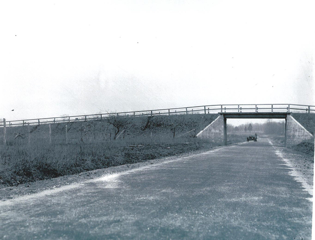
Correction: May 7, 2012: This is a rare photo of the Motor Parkway bridge that connected the Wheatley Golf Club.
Finally, do any remnants of the Motor Parkway still remain in the still very active Wheatley Hills Golf Club? Since the club is private property, this question has vexed LIMPers for years. With the approval of the Wheatley Hills Golf Club and with the assistance of East Williston Mayor Nancy Zolezzi and her husband Joe Zolezzi, Al Velocci and I received permission to tour the course in search of the Parkway. Check back next week to discover the results of our East Williston adventure.
August 31, 2010 Update: Now and Then: The Motor Parkway in Wheatley Hills Golf Club, East Wlliston


Comments
Good stuff Howard, can’t wait to see if any relics remain. I often go past the golf course while traveling on the Northern State and daydream about what’s there. I’m also a golfer so it would be an interesting highlight while playing to see a post. Not a member of the club so not sure I would ever have the opportunity.
There are LIMP posts on the north and south sides of East Williston Road (HIllside Avenue, 25B)by the golf course but according to one one of Sam B’s web pages, these may have been placed there at some point to accommodate the road being widened. I show these posts on my website on the East Williston page. Happy Hunting.
I grew up in the 1040s a block away from the old Motor Pkwy where it traveled thru East Williston. I don’t have photos but do have great memories of playing at and riding our bikes thru that entire stretch….. 😊
I remember seeing a photo of the excavation of the LIMP UNDER Jericho Turnpike just south of this. Has anyone ever seen this photo? I haven’t been able to find it again.
Hi Art, Allan and Sara:
Thanks for the comments and memories!
Sara, I will feature images of the LIMP near Jericho Turnpike in a post next week.
Enjoy,
Howard