Aerial View of the LIMP: Follow the yellow-lined path
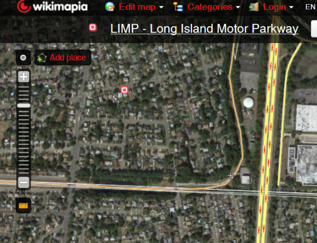
Check out the Wikimapia website. Someone has mapped out most of the right-of way fro the Long Island Motor Parkway. For example, just place your cursor over the Western Terminus box, and the Long Island Motor Parkway right-of way will appear as a yellow-lined path.
The search feature on the right of the aerail has over 20 LIMP locations. Among the marked locations are:
-the Western Terminus in Fresh Meadows, Queens
-the Old Courthouse Road Bridge in Manhassett Hills
-the General Manager's House in Garden City
-Battle Row Campground ROW in Old Bethpage
-ROW approaching the site of the Claremont Road Bridge in Old Bethpage
Remember, place the cursor over the boxes and the LIMP right-of way will appear.Also note that several of the marked locations are incorrect, including the one for the still-standing Ronkonkoma Lodge, which is further west on the Motor Parkway.


Comments
Thanks, Howard. By the way, a couple of the links on the Wikimapia website you mentioned, when clicked on the box, bring you to my website.