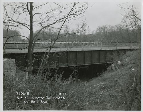
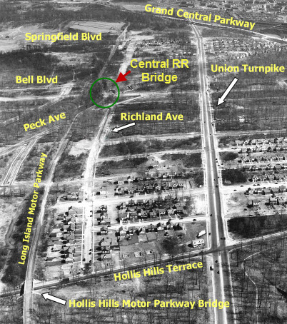
Long Island Motor Parkway Bridge Series:#4 The Bridge over the Queens Central Rail Road Right-of-Way
A total of 60 Motor Parkway bridges were built from 1908 to 1926 ...a pioneering concept to eliminate grade crossings for an automobile road. There are four types of Motor Parkway bridges; over crossroads (parkway bridges), under crossroads (highway bridges), over railroad tracks (railroad bridge) and, as part of right-of-way agreements, to connect farmlands (farmway bridges). This series will document these bridges beginning at the Western Terminus in Fresh Meadows, Queens to the Eastern Terminus in Lake Ronkonkoma. Today's focus: the unusual Motor Parkway Bridge over the Central Rail Road of Long Island Right-of-Way in Hollis Hills, Queens.
Although abandoned in 1879, the rails for the Central Rail Road of Long Island were still in existence until World War I. .
1912 and 1924 Surveys- Hollis Hills, Queens
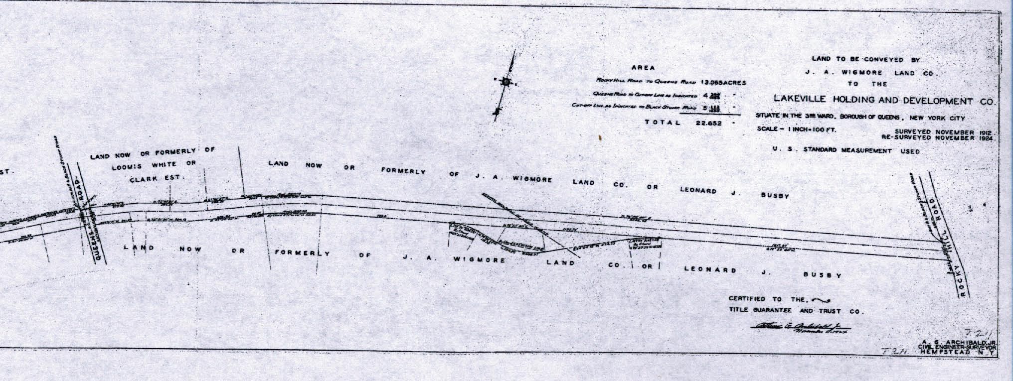
A shown in this 1912 survey, the original design of the Motor Parkway at the Central Railroad ROW was a straight path between Queens Road (Hollis Hills Terrace) and Rocky Hill Road (Springfield Boulevard).
1928 Motor Parkway Atlas-Fresh Meadows, Hollis Hills
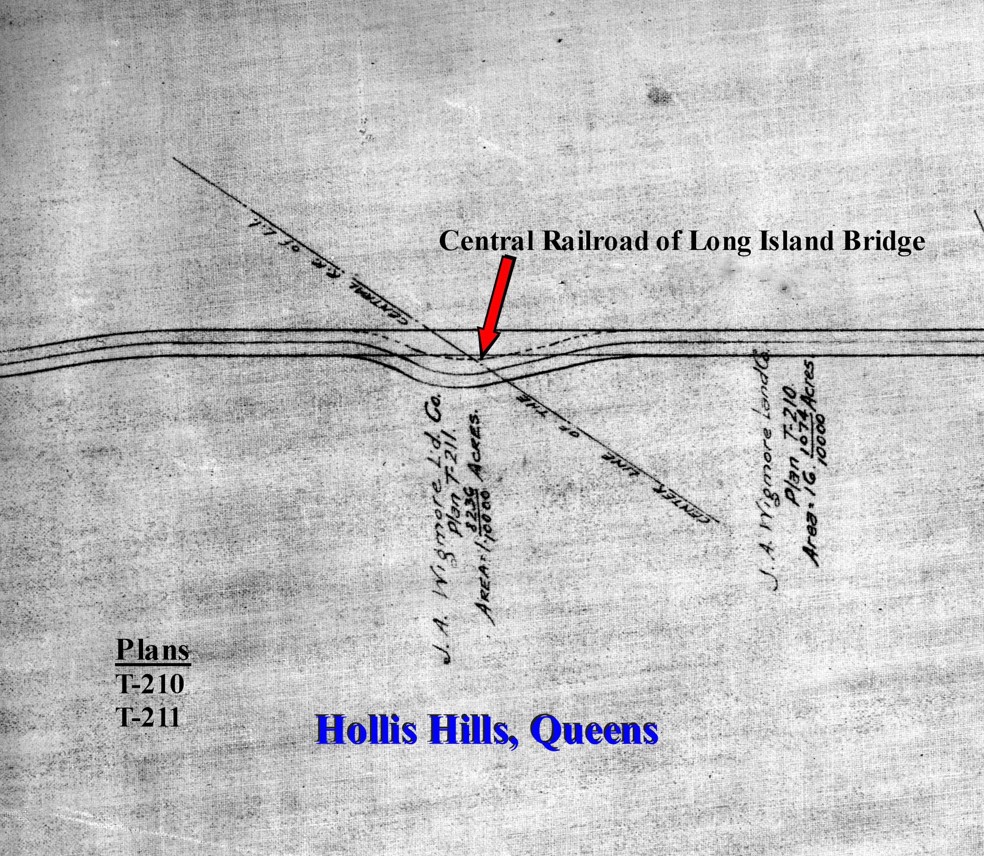
The actual path of the Motor Parkway at this location area curved to the south. Why? I checked with my favorite co-author Al Velocci who had the answer.
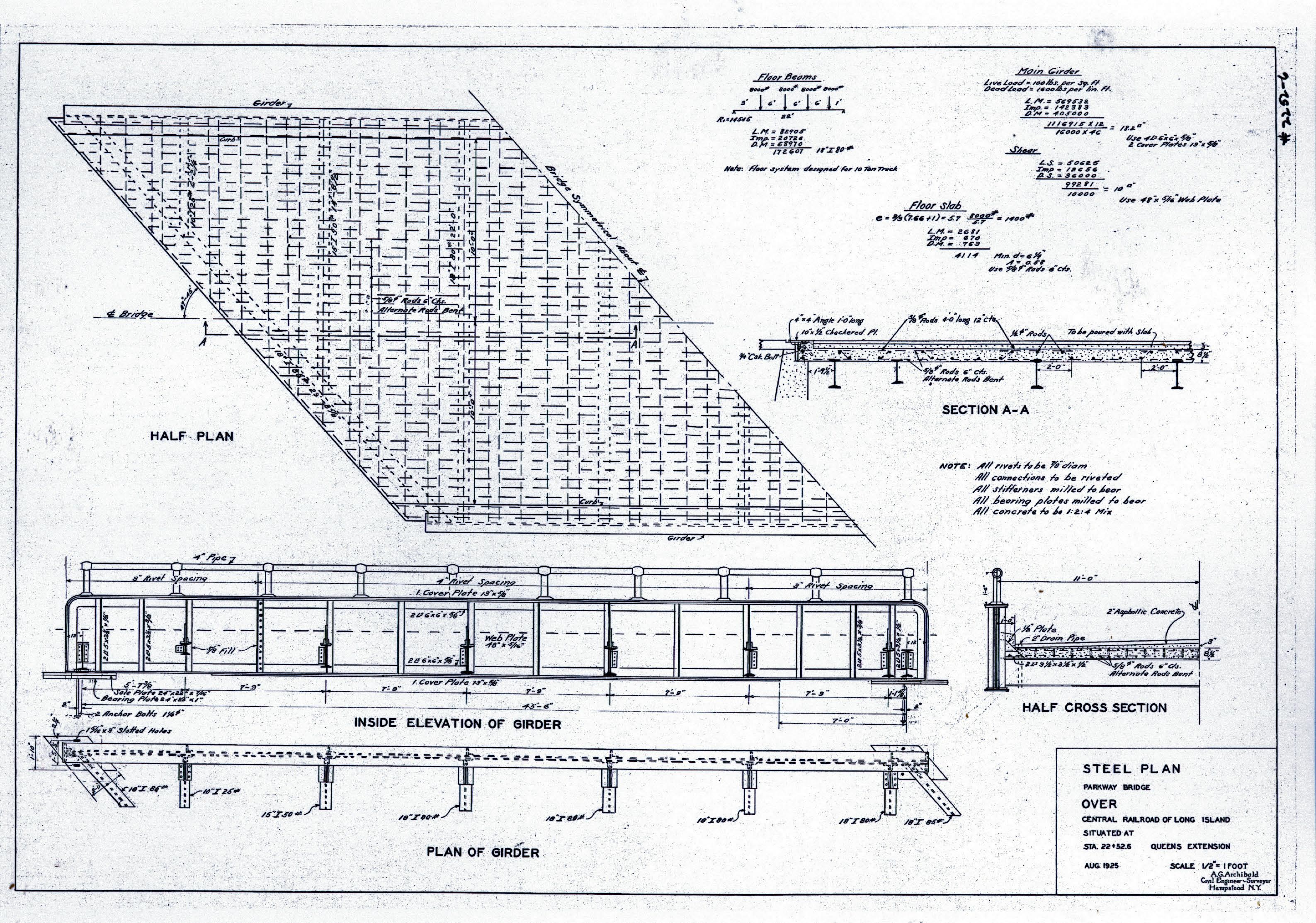
1925 Steel Plan of the Central Railroad of Long Island Bridge
Al reported that two abutments were previously built by the Central Rail Road in the 1800's for a bridge for a future road. However, the bridge was never completed just south of the Motor Parkway ROW. In an attempt to save money, the Motor Parkway utilized these existing abutments for their own bridge and curved the road.
1941 Aerial
Courtesy of the Fairchild Collection at the Benjamin and Gladys Thomas Air Photo Archives located in the UCLA Department of Geography
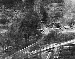
This aerial captured the unique curve of the Motor Parkway and provides the best details of the Motor Parkway Bridge over the Central Railroad.
1951 Aerial
Forwarded by Mitch Kaften
.jpg)
Mitch Kaften: "Here’s the aerial from 1951. Note the old bypass is still extremely visible."
2011 Current Views

When the Motor Parkway closed in 1938, the original bridge was taken down and soon replaced by this existing bridge over this section of the Central Railroad ROW (later becoming Bell Boulevard). The path to the bridge also reverted back to the original straight ROW of the Motor Parkway, thus eliminating the curve.
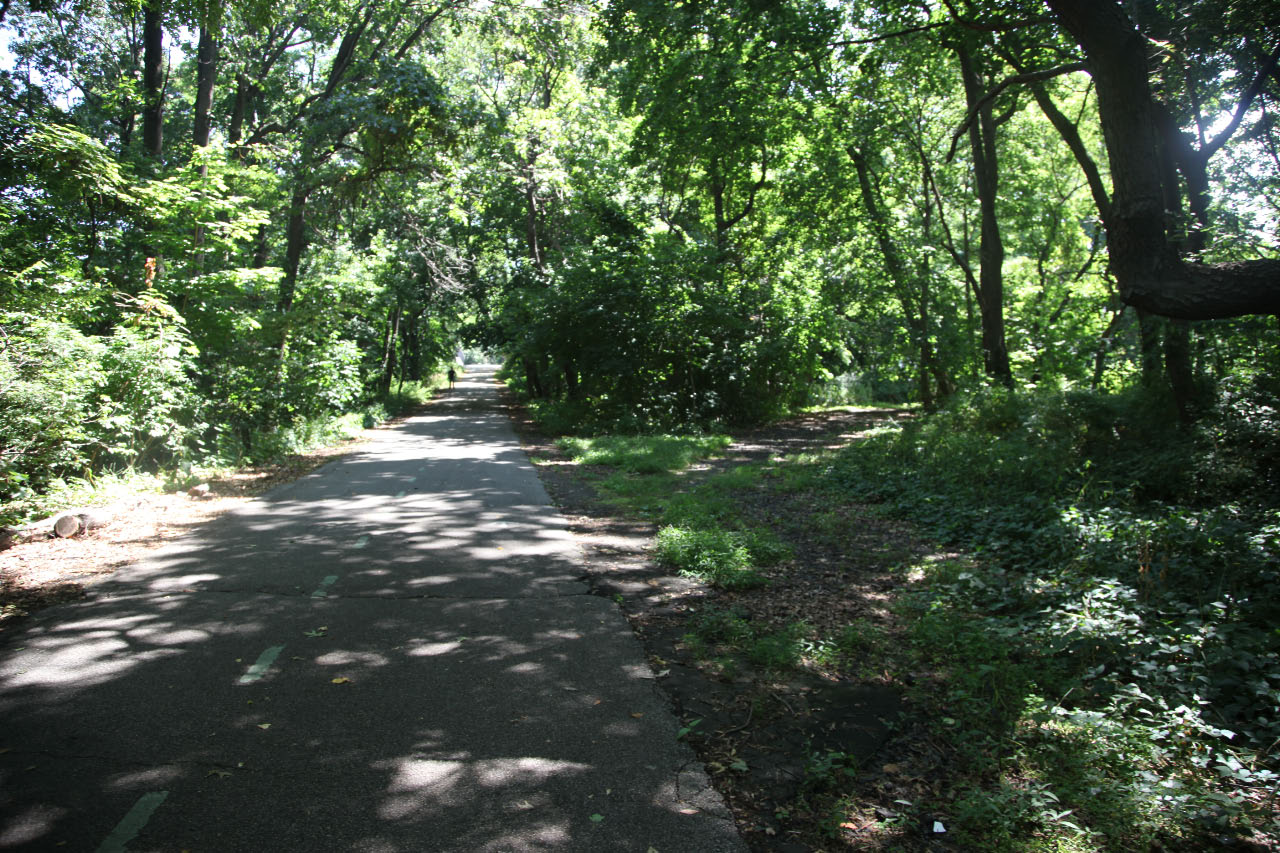
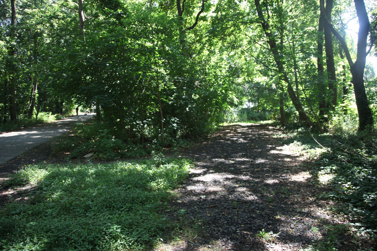
Now for a big surprise....Last month, Al Velocci brought me to the site just west of Bell Boulevard. Remnants of the Motor Parkway curve still exist! The original pavement on the curve can clearly be seen.
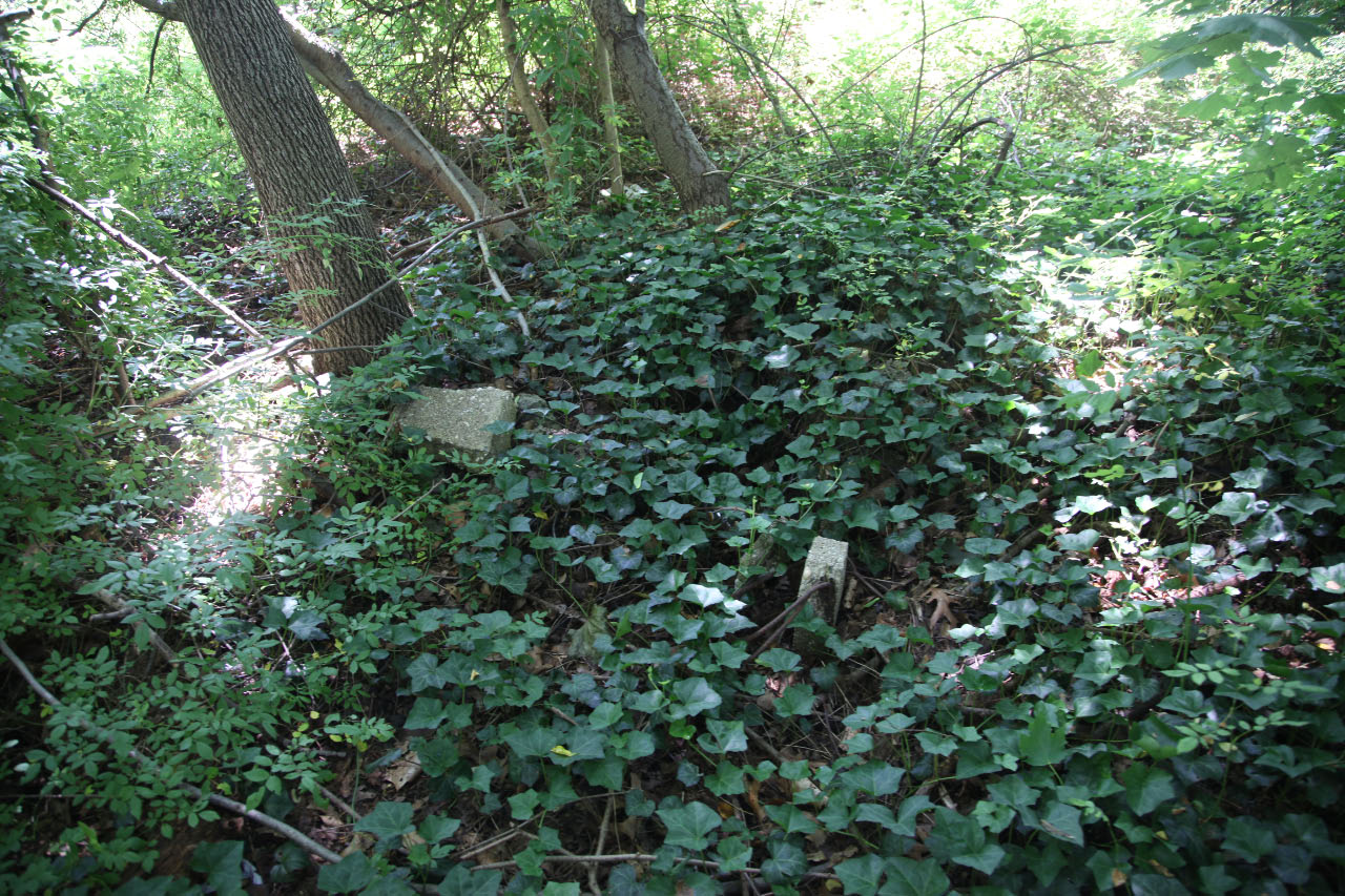
Walking down the original path, the original concrete posts that held wooden railings for west bridge embankment were battered but still in place.
Links to related posts on VanderbiltCupRaces.com and the Internet:
Google Map of Bell Boulevard, Queens
Archives: Long Island Motor Parkway Bridge Series
The 1928 Long Island Motor Parkway Atlas
Brooklyn-Queens Greenway Guide
Archives: Long Island Motor Parkway- Bridges
Archives: Long Island Motor Parkway Bridges- Queens
Index: Archives on VanderbiltCupRaces.com


Comments
Fascinating find, Howard! Since the (unfinished) bridge abutments were built before the Motor Parkway, do you have any idea what road the bridge was originally planned to pass over?
I don’t think I asked that question correctly. What I meant was: what road was the bridge built to carry over the RoW? (I think that’s right).
Hi Mitch:
According to Al Velocci, the Central Railroad of Long Island was required to build abutments in that location for a planned bridge for a road that was never built.
Howard
After viewing the google map of this area, I can “see” where the limp and old railway crossed paths. I remember reading that stewart rd is basically the route of the old tracks, and then just picture the tracks continuing in a NW direction. It’s neat that the limp/brooklyn queens greenway is noted on these maps, as well.
Hi Brian:
I would assume that Stewart Road was named to honor A.T. Stewart, the owner of the Central Railroad of Long Island.
Check out Arrt’s Arrchives images of the area:
http://arrts-arrchives.com/flushtocrd2.html
Howard
In the NYC aerial map from 1951, the old bypass road is still clearly visible. Howard, I’ll send you a screen shot. The site is: http://gis.nyc.gov/doitt/nycitymap/
Mitch
I have been riding my bike past there for YEARS and wondering what that side road was all about! Howard, you’re doing great work here.
Any idea why that piece of land was never developed? There are houses on what would have been the bridge and rest of the road.
Mitch:
Thanks for the aerial. I have added the image above. The orignal Motor Parkway was certainly visible 13 years after it closed.
Dennis:
This land was originally part of the Motor Parkway ROW. Accordingly, it is likely owned now by Queens County or is part of the NYC Department of Parks.
Howard
From Robert Miller:
“It’s always been my belief the bridge was installed, but not used, ca 1911, as the one print I’ve seen of it ca 1944/6, shows it to be the same type of railroad through girder bridge used over the Oyster Bay and Main Lines, plus a few north-south roads from Winchester Boulevard east.
The biggest difference from the older plate girder bridges seems to be the addition of the tubular top rails which the old bridges didn’t have. I have a paper print from the Queens Archives file dated ca 1944/46, with the bridge badly overgrown/surrounded with all kinds of vegetation—it looked as old as the 1911 steel bridges further east—couldn’t see the railroad right-of-way beneath it. Grateful for your data.”
Courtesy of Arrts Archives - The second paragraph describes the framework of a bridge, likely for Granger Ave, which became abandoned. Must be the same abutments utilized for the LIMP.
Below is a overlay of a 1873 and a current map, courtesy of The David Rumsey Collection. Shows a proposed Granger Ave between Rocky Hill and Queens Rds. Granger Ave never came to be. Even though the Central RR was long abandoned, the LIMP still built the bridge so as not to sever the RR ROW.