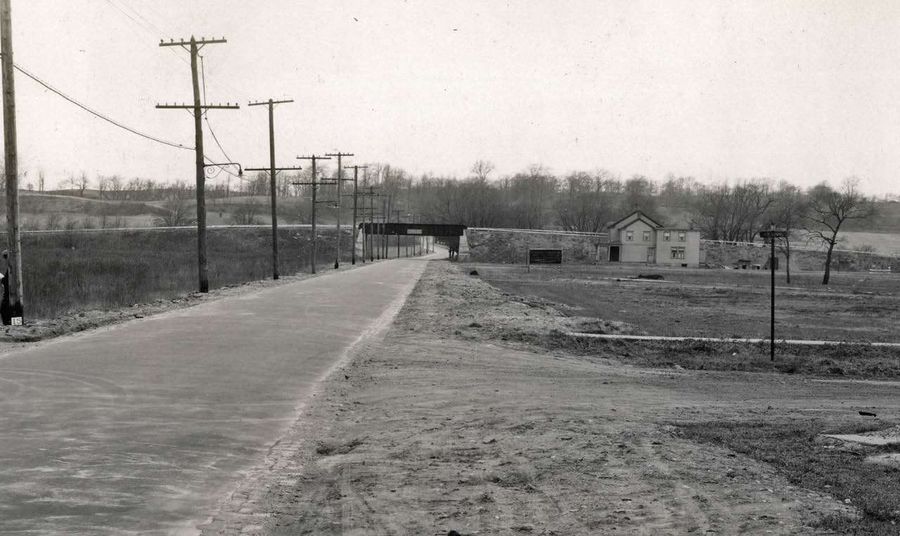
Long Island Motor Parkway Bridge Series: #11 Little Neck Road Motor Parkway Bridge in Queens
When the 48 miles of the Motor Parkway were completed in 1926, a total of 65 bridges were built by William K. Vanderbilt Jr. and his associates over and under the parkway. Going west to east, the next to last of the 12 Queens bridges was the Motor Parkway bridge over Little Neck Road (later renamed Little Neck Parkway):
January 1911 Survey
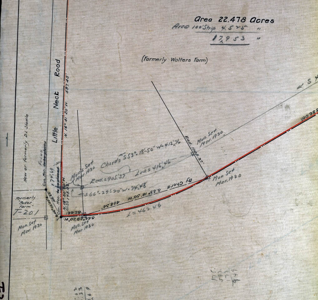 This original survey show the path of the Motor Parkway in the area of Little Neck Road. The property for the Motor Parkway in this area was purchased from the owners of the Muller and Walters farms.
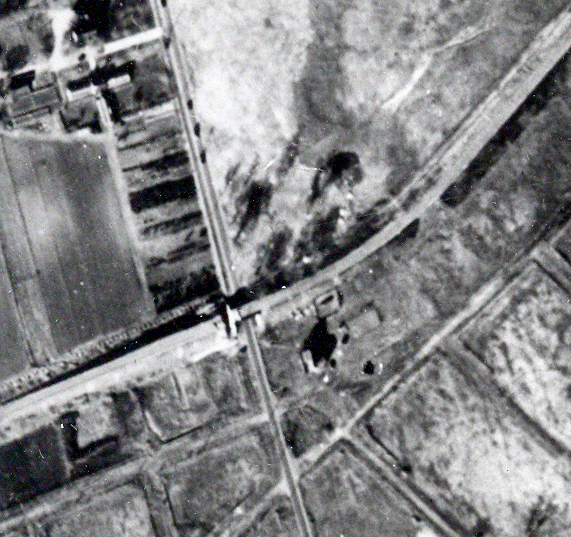
1924 Aerial- Queens
A_edited-1.jpg)
_edited-1.jpg) This aerial shows the Little Neck Road Motor Parkway Bridge and the surrounding farms. Many of the buildings of the north farm are still standing as part of the Queens County Farm Museum.
This aerial shows the Little Neck Road Motor Parkway Bridge and the surrounding farms. Many of the buildings of the north farm are still standing as part of the Queens County Farm Museum.
1928 Motor Parkway Atlas Blueprint
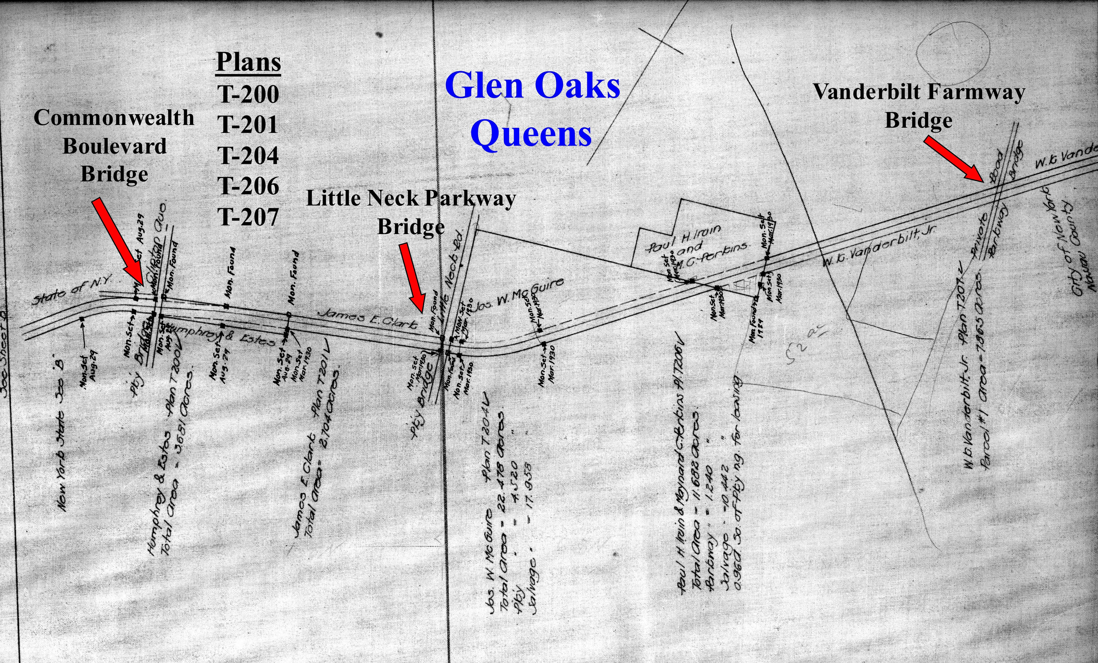 The Motor Parkway Atlas shows the right-of-way in the current Glen Oaks area.
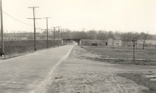
1932 Photo- Courtesy of Queens Borough President's Collection
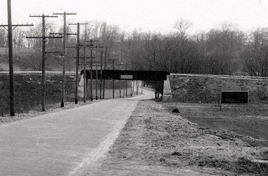 A ground-level view of the bridge looking north from Union Turnpike.When the bridge was built in 1912, New York City required the Motor Parkway to use railroad-type trestle construction over the Queens public roads.
1939 Aerial
 When the Motor Parkway closed in 1938, concrete barriers were placed througout the Motor Parkway to keep cars off the road and bridges.
July 30, 1942 Demolitian
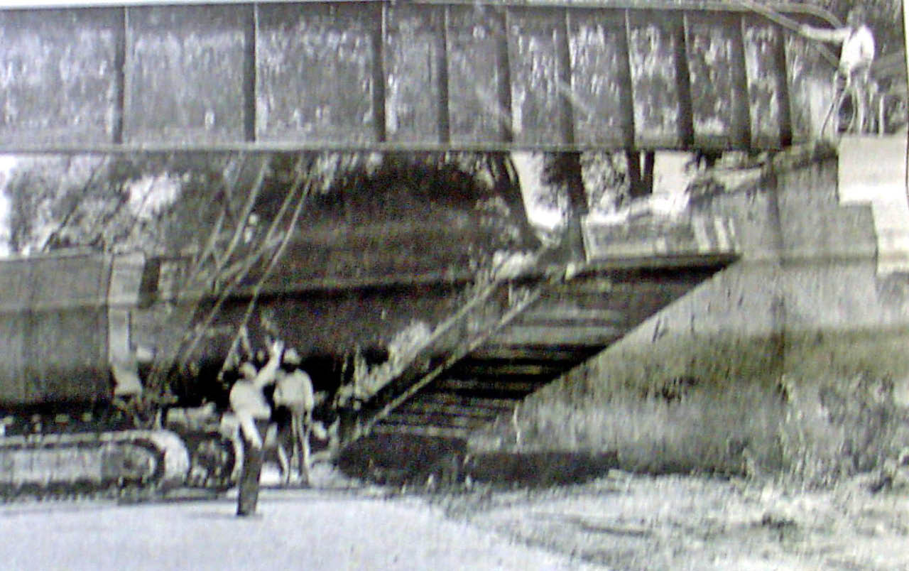 Four years after the Motor Parkway closed, the renamed Little Neck Parkway Motor Parkway Bridge was taken down. Queens Borough President James Burke can be seen here directing the salvaging of a 14-ton steel girder from the bridge
1952 Aerial- Queens
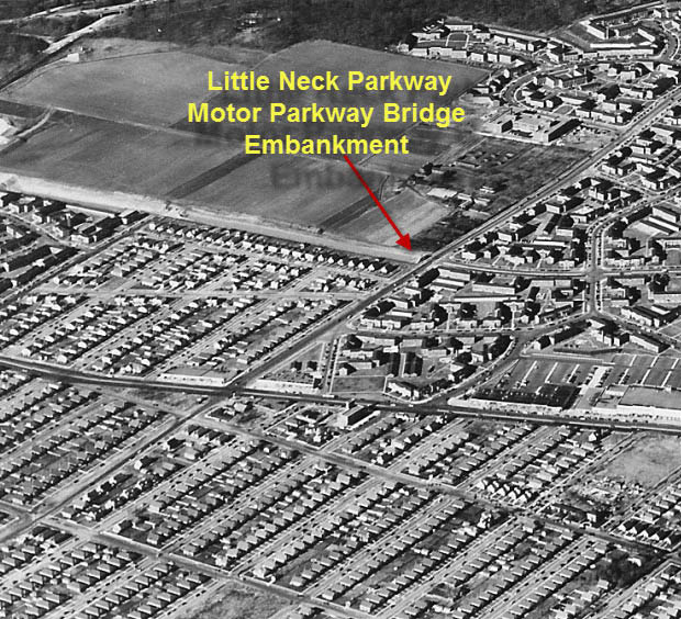 Although the bridge was long gone, the west embankment was still standing in the 1950s.
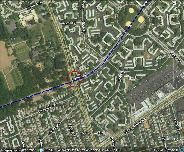
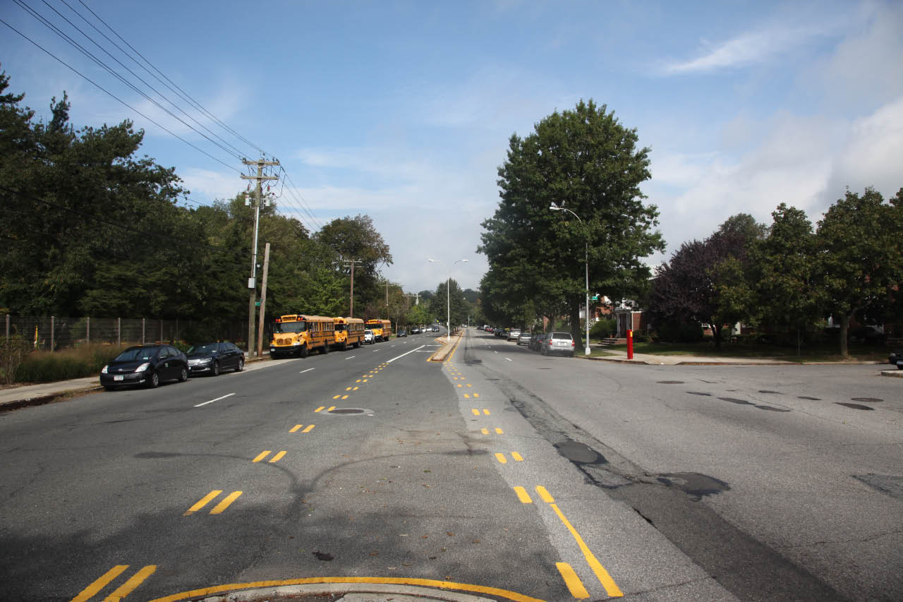
Current Views-2011
 This Google Earth aerial highlights the Motor Parkway right-of-way and the location of the bridge.
 The view looking north on Little Neck Parkway matching the 1932 photo.
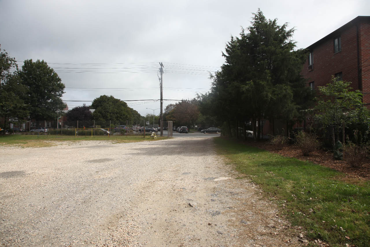
 The view west of Little Neck Parkway on the location of the bridge embankment. Remnants of the Motor Parkway are still there!
Links to related posts on VanderbiltCupRaces.com and the Internet:
Archives: Long Island Motor Parkway Bridge Series
The 1928 Long Island Motor Parkway Atlas
Archives: Long Island Motor Parkway- Bridges
Archives: Long Island Motor Parkway Bridges- Queens
Google Map: Little Neck Parkway


Comments
Thanks Howard. The picture at the top of the page shows the road having some sharp curves after it passes under the bridge. But the 1924 aerial makes it look like the road is very straight. Is it just the odd angle of the photo? Also, is the sign on the right an entrance sign of some kind? The aerial shows what looks to be an entrance road.
Hi Mitch:
It is likely just a photo effect. The caption on the photo reads “Little Neck Parkway N. at Union Turnpike”.
I tried to enlarge the sign to read the copy…without success.
Howard
Hi Howard,
I think I can shed some light on Mitch Kaften"s question regarding the sign on the right side of Little Neck Parkway. It is a street sign and in all likelihood says Shiloh Av. Prior to the building of Glen Oaks Village the area was laid out in a regular grid pattern and Shiloh Av., which is on the west side of Little Neck Parkway, was to run all the way to the Nassau County Line. The buildings abutting the Motor Parkway on the east side of Little Neck Parkway front on what was to be Elkmont Av., which still exists on the west side of Little Neck Parkway. Look at maps of that part of Queens published before the late 1940’s to get a better understanding of what the area looked like prior to the building of Glen Oaks Village Al Velocci
Thanks Al. I was referring to the large placard-type sign that was closer to the LIMP, not the street sign in the near-view. It’s not in the style of a street sign. Which one are you referring to? Since the aerial seems to show an entrance road on the right side, I thought maybe it was a Motor Parkway sign.
Regards, Mitch
Al is correct. That must be Shiloah at LNP. That cross street (with the sign too small to read) is way to close to the bridge to be Union at LNP.
Also, at LNP/Union intersection, in 1931/2, in other photos from this series that featured the bridge in the background, there was a large pile of stones/concrete on all four corners and the same long, iron pieces at all four corners of that intersection.
From “The NY Daily News”, July 30 and August 9, 1942.