The Bethpage Challenge Part II: Building the Central Avenue Motor Parkway Bridge
Part II of "The Bethpage Challenge: Documenting the Second Deadman's Curve" features photos of the construction of the Central Avenue/LIRR Bridge located in Bethpage (then Central Park). Because this bridge was the largest on the Motor Parkway and was used for the 1908 Vanderbilt Cup Race, it was well-documented by photographers. The following rarely seen photos are courtesy of the Garden City Archives. Reference points have been noted to match common areas in the photos.
Views looking East
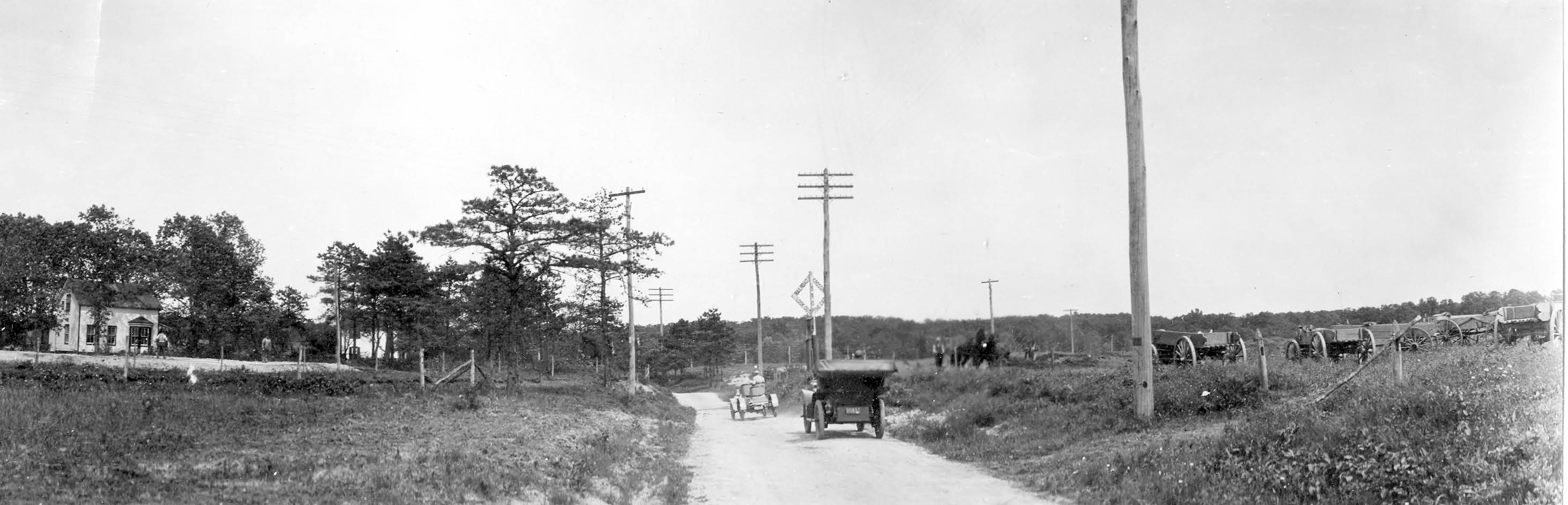
In this 1907 photo, cars are on Central Avenue prior to major construction of the Motor Parkway Bridge. Reference points: The small house off Central Avenue on the left, a tree cluster behind the house on the left, the railroad crossing sign and the telephone poles on the right along Central Avenue.
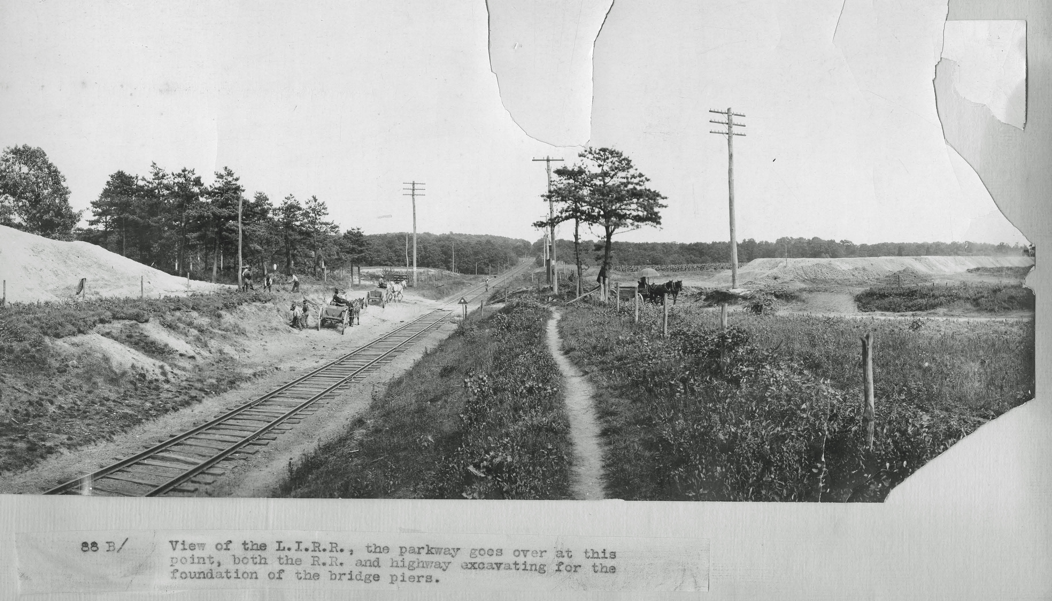
This is the view in June 1908 looking from the LIRR tracks. The caption reads: "View of the L.I.R.R., the parkway goes over at his point, both the R.R. and highway excavating for the foundation of the bridge piers". Reference points: Central Avenue on the right parallel to the telephone poles, the large tree cluster on the left, the railroad crossing sign and box south of the railroad tracks and a pedestrian path in the middle.
Views looking West
The large mound for the south side of Motor the Parkway Bridge is seen to the left of Central Avenue in June 1908. Reference points: Central Avenue diagonally in the middle, LIRR to the right, the telephone poles on both sides of Central Avenue, the railroad crossing sign and box south of the railroad tracks and Central Avenue, and the pedestrian path to the right and west of the track.
The completed Motor Parkway Bridge in October 1908. The steel trestle construction, rather than concrete, was mandated by the railroad. Reference points: Central Avenue opening under the bridge to the left of the tracks, the pedestrian walkway on the right, and the railroad crossing sign and box- which was apparently moved to a new location north of the tracks.
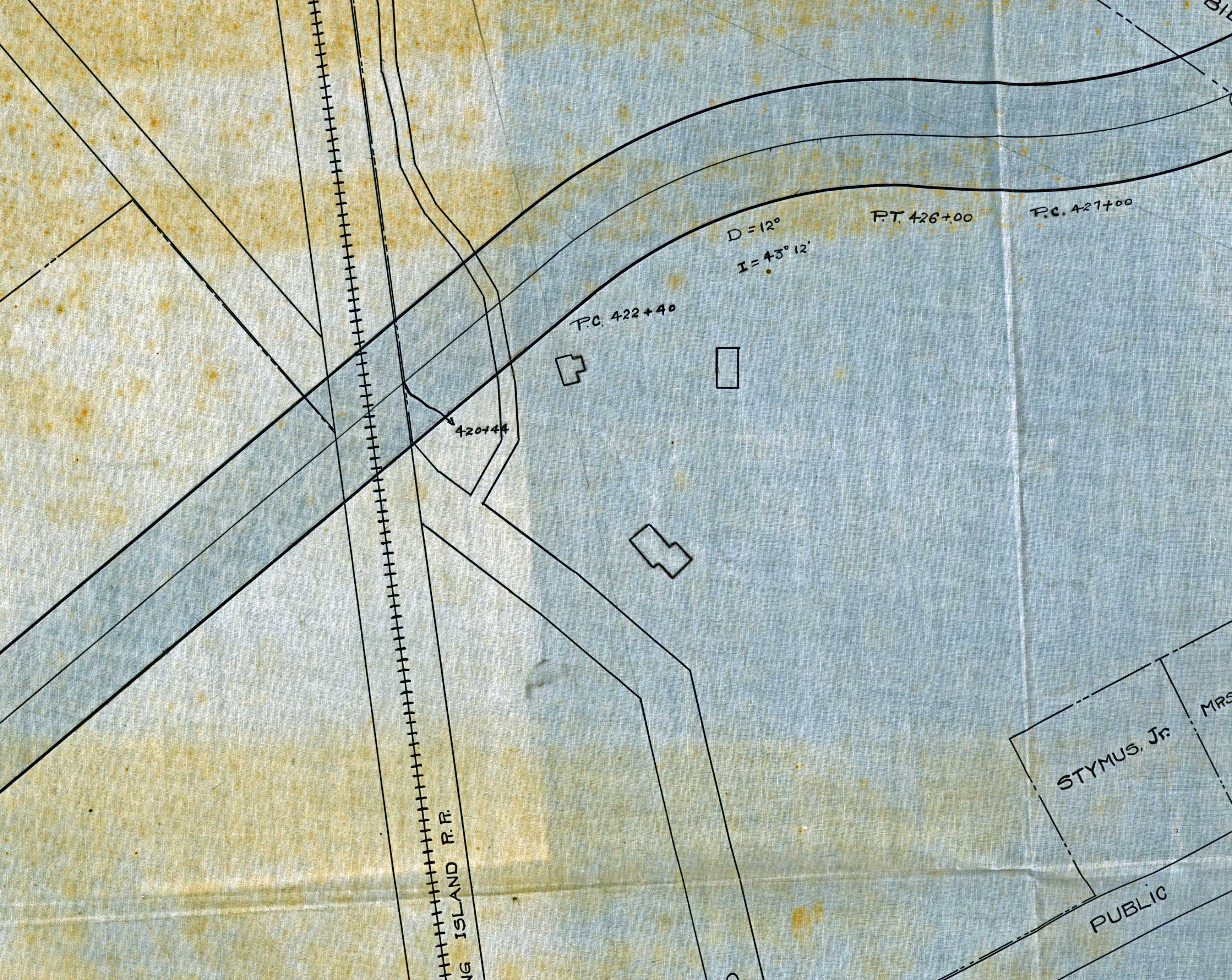
The above photo matches the 1907 survey map for the bridge.
Views looking South
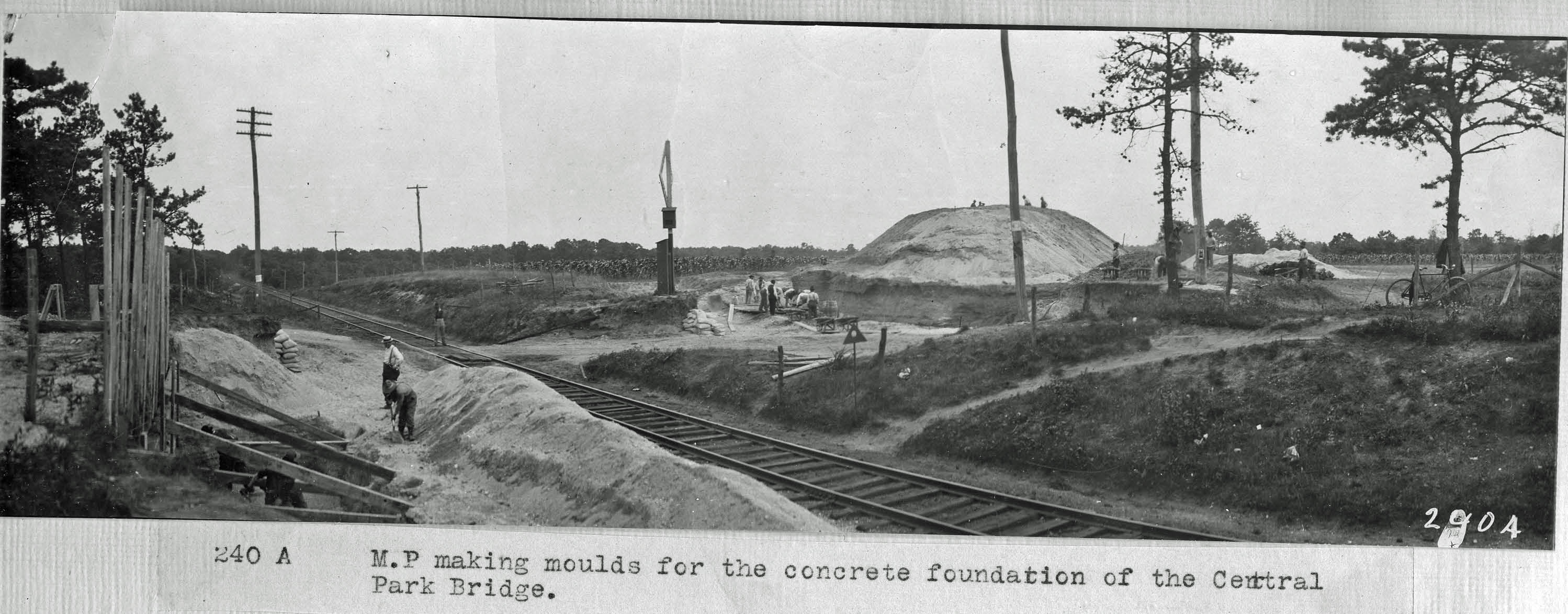
This is a different view in June 1908 looking from the LIRR tracks. The caption reads: "Motor Parkway making moulds for the concrete foundations of the Central Park Bridge". Reference points: Central Avenue on the right parallel to the telephone poles, the railroad crossing sign and box south of the railroad tracks, the wooden moulds for the north side of the bridge, the large mound for the south side of the bridge and the pedestrian path in front and to the right.
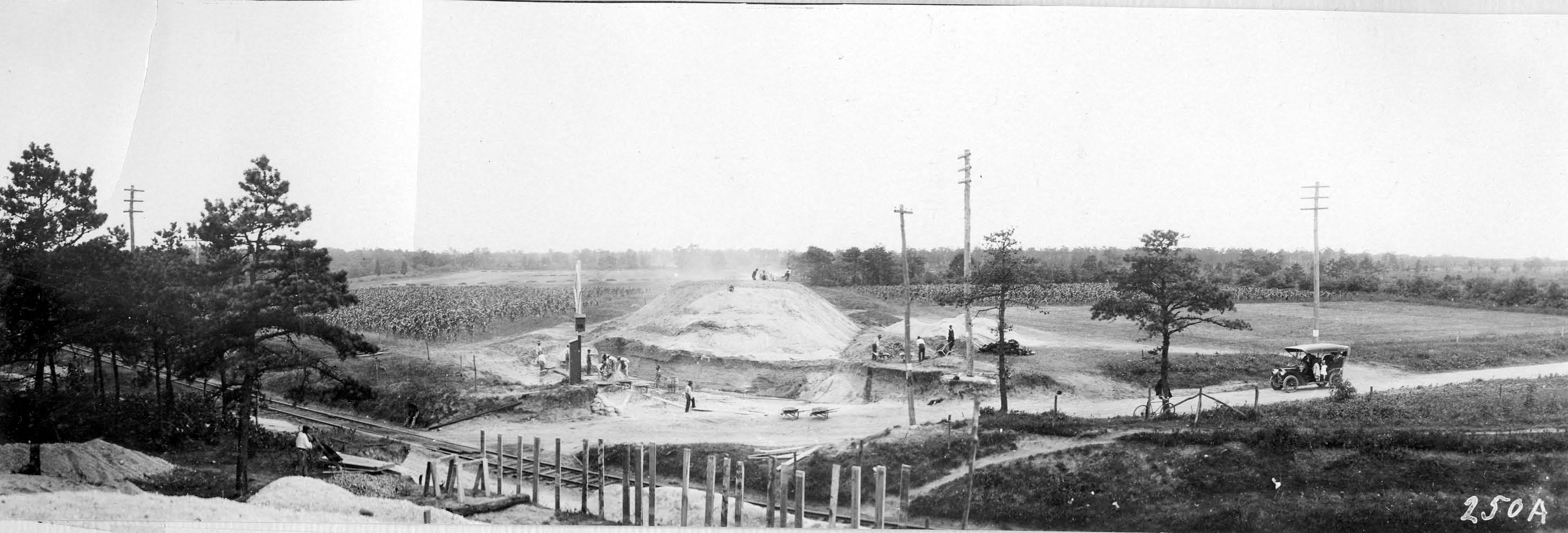
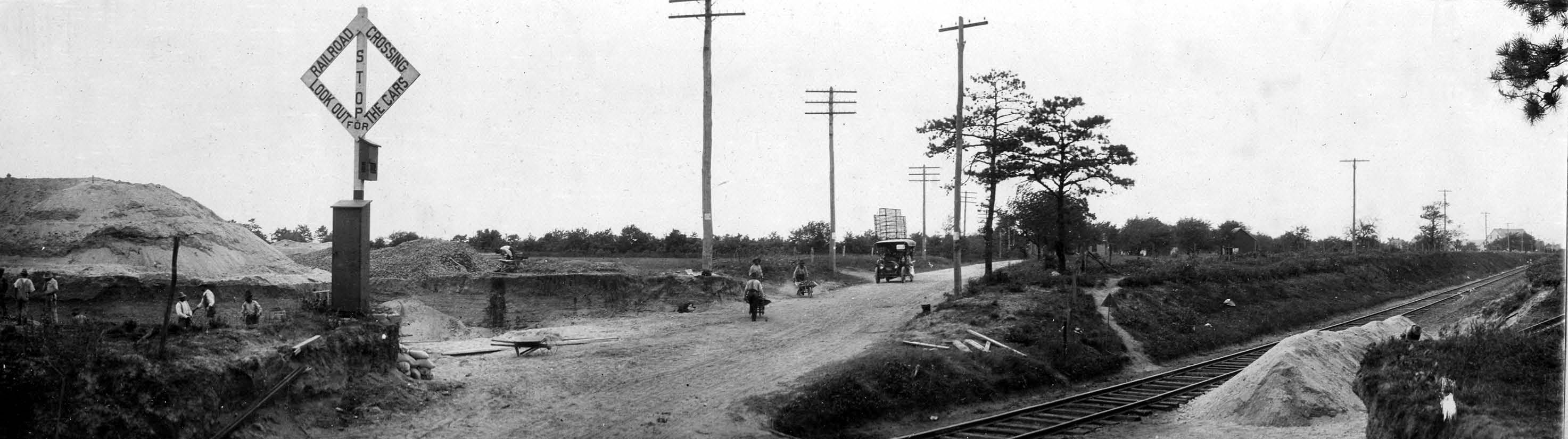
This is a fantastic view of the Motor Parkway Bridge construction site in June 1908. Reference Points: Central Avenue on the diagonal, telephone poles on both sides of Central Avenue, the LIRR tracks, the railroad crossing sign and box (south of the railroad tracks and east of the Motor Parkway), the wooden moulds for the north side of the bridge, the large mound for the south side of the bridge and the pedestrian path in front and to the right.
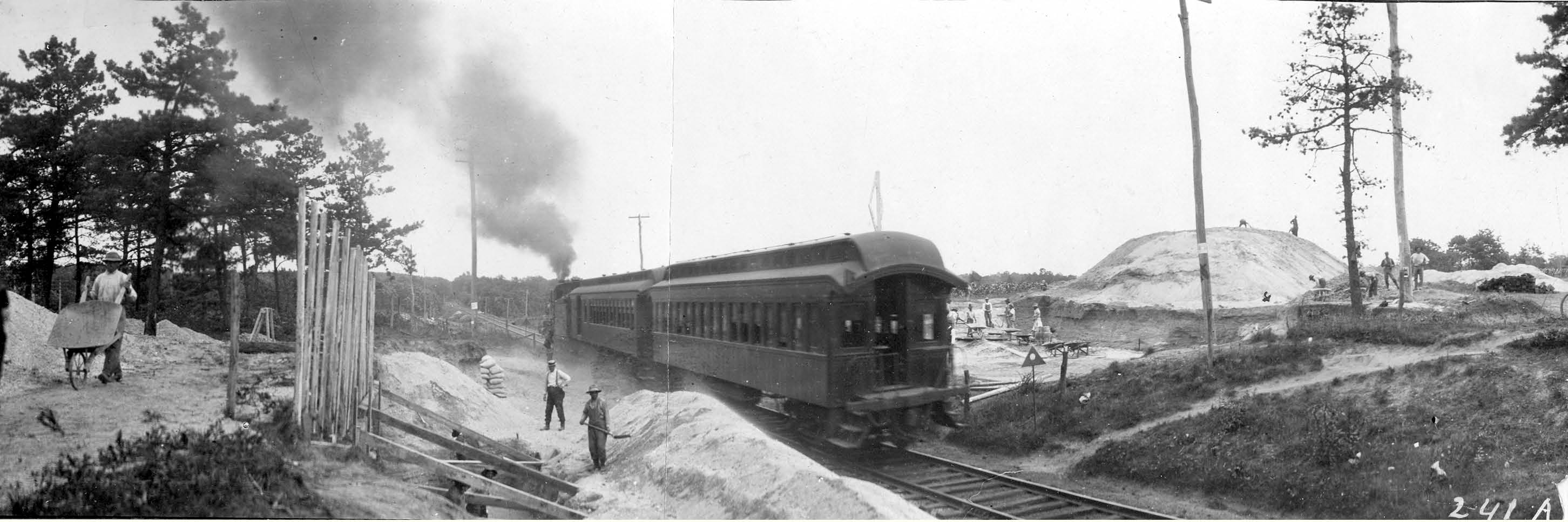
Same view with a train heading west to New York City
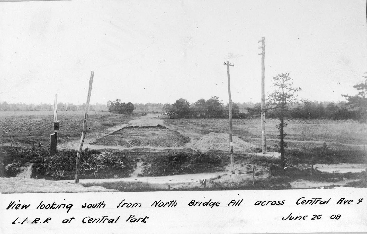
This photo was taken on June 26, 1908. The caption reads: "View looking South from the North Bridge Fill across Central Ave and L.I.R.R at Central Park". Reference points: The Motor Parkway in the middle, Central Avenue at the bottom, the telephone poles on both sides of Central Avenue, the railroad crossing sign and box south of the railroad tracks, and a small cluster of three trees west of the Motor Parkway
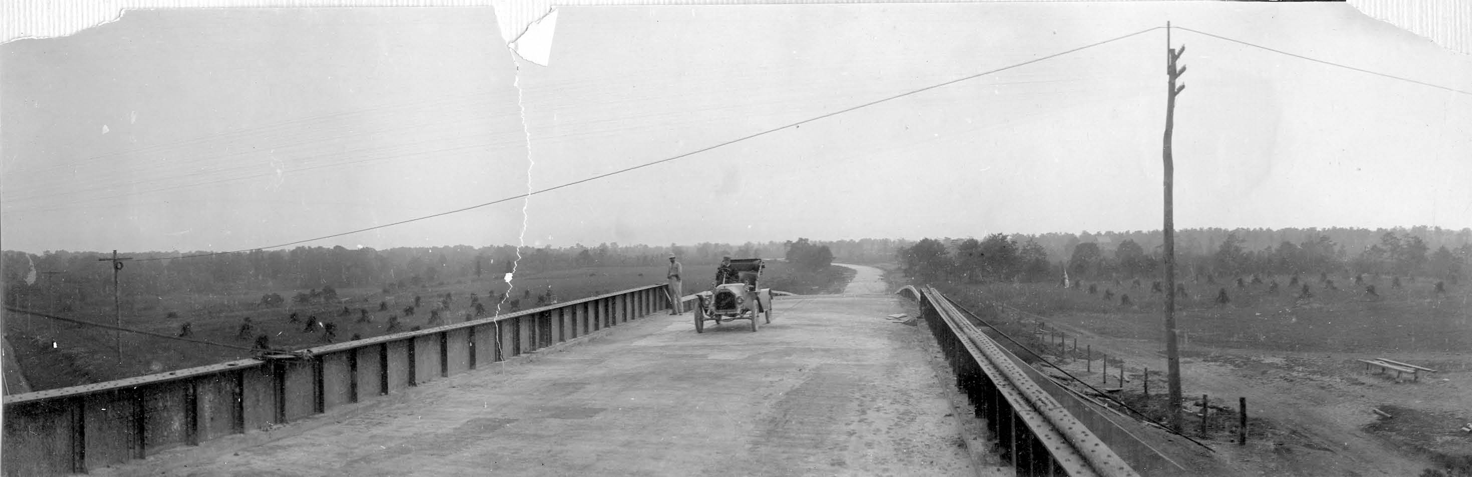
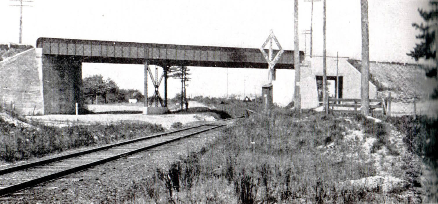
Here is the completed Central Avenue/LIRR Motor Parkway Bridge in October 1908, one month prior to its opening. Reference points: The Motor Parkway in the middle (which heads slightly east before reaching the first Deadman's Curve), the telephone pole along Central Avenue to the right, and a small cluster of three trees west of the Motor Parkway. The railroad crossing sign and box (seen south of the railroad tracks in June 1908) have been moved due to the Motor Parkway Bridge.
Views looking North
_edited-2.jpg)
Another view from early 1908. The caption reads: "View from the road, No 52A, looking north over the railroad. Parkway crosses over the railroad and the Highway by a long steel span. Reference points: The Motor Parkway in the middle, the small house off Central Avenue on the right, the large cluster of trees behind the house and a large "L-shaped" tree on the left.
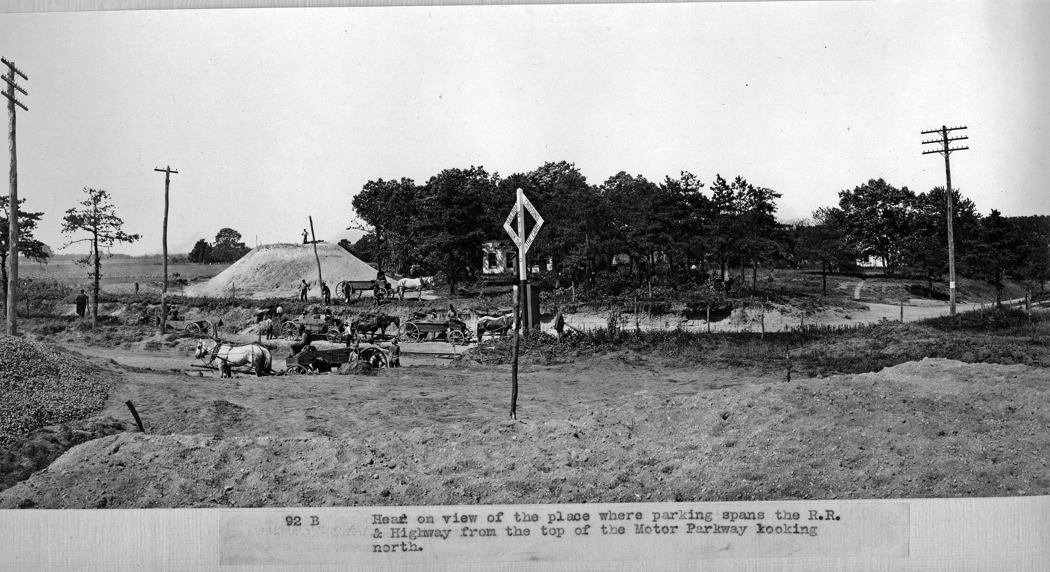
The same view as seen in June 1908.The caption reads: "Head on view of the place where parkway spans the R.R. & highway from the top of the Motor Parkway looking north". Reference points: The mound of the north side of the bridge in the middle, the small house off Central Avenue in the middle (partially hidden by trees, the large cluster of trees behind the house, the large "L-shaped" tree on the left and the railroad crossing sign and box east of the Motor Parkway and south of the tracks.
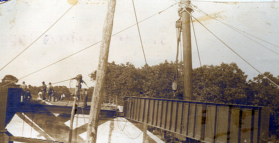
The steel girder of the bridge and the concrete abutment of the north side of bridge as seen on September 8, 1908. Reference points: The large cluster of trees behind the house and the top of the large "L-shaped" tree on the left.
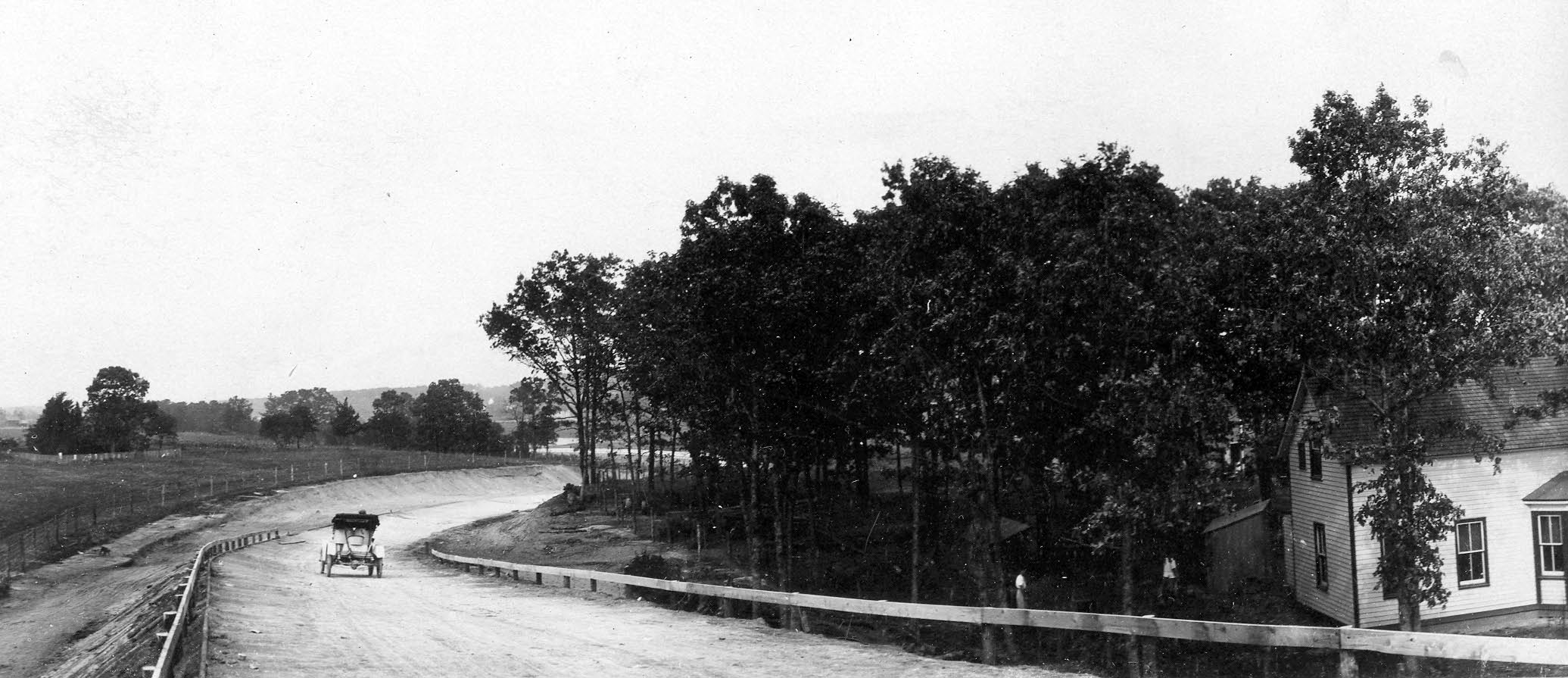
The completed north side of the Motor Parkway Bridge in October 1908. Note the Motor Parkway is banked, protected by guardrails and beginning to curve to the east. Reference points: The small house off Central Avenue on the right, the large cluster of trees behind the house, and the large "L-shaped" tree on the left in the middle of a small family cemetery.
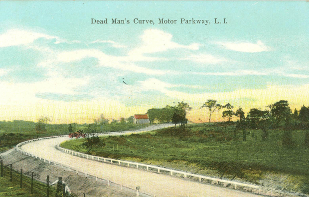
Beware, we may be approaching "Deadman's Curve" !!!
Tomorrow, in Part III of the Bethpage Challenge, we will follow the curve through the Stymus property.
Links to related posts on VanderbiltCup Races
The Bethpage Challenge Part I: Documenting the Second Bethpage Deadman's Curve
The Bethpage Challenge Part II: Building the Central Avenue Motor Parkway Bridge
Historic Motor Parkway Sites in Bethpage
Index: Long Island Motor Parkway- Nassau County
Survey Maps of the Motor Parkway
Pioneering Road Features of the Long Island Motor Parkway
Starting Lineup- The 8 “N” Cars of the 1908 Nassau Sweepstakes


Comments
Awesome Job Howard. Thank you so much for all your work. These pictures are priceless.
Back in 1990 or so I knew a guy who worked for the MTA Transportation Planning Department. He had many old hand written surveys. He had one from the exact spot where the LIRR crossed. A small arrow pointed to the bridge. It said, “Removed, 1950.”
Your fan,
Joe Oesterle
Hi Joe:
Thanks for the Motor Parkway story!
Howard
Howard, great pics once again. The cemetery you mention in the last pic is still there, on the west side of the access road to the current Tennis Club that sits just north of the railroad and Central Avenue, at the point where the bridge crossed over. I have some pics and commentary on the computer somewhere - when found, I’ll e-mail to you.
Indeed great photos!