VanderbiltCupRaces.com Exclusive: The 1910 Motor Parkway Survey Bookmap
In 2009 I purchased 572 original Motor Parkway surveys and maps from the firm of Barrett, Bonacci and Van Weele. Over the last 90 years, this company had acquired many very original Long Island survey firms, including those which work for the Long Island Motor Parkway, Inc. from 1906 to 1985. One of the treasures of this purchase was a 1910 "Bookmap" documenting the right-of way, the original property owners, and the corresponding survey plan #s. As noted by Al Velocci, the term bookmap was used by the Motor Parkway's general manager A.R. Pardington to describe this document.
The Motor Parkway Survey Atlas (1910)
The Motor Parkway Survey Bookmap consists of 22 canvas pages (each 17 1/2" x 12"). Unfolded, the Bookmap measures 32 feet by 1 foot The original canvas pages are marked from 1 to 18 with surveys from Lakeville Road, Lake Success to Lake Ronkonkoma. Three more canvas pages (A, B, and C) were added documenting the Motor Parkway extension west from Lakeville Road to Nassau Boulevard, Fresh Meadows from 1910 to 1928. There is also an Index page to find properties and roads.
Although the original canvas pages of the Bookmap are not dated, it was likely created in 1910 based on the Lakeville Road western terminus and the identification of the Petit Trianon as the L.I.M.P. Inn. The original surveyor was probably Arthur Archibald , who created many of the Motor Parkway surveys in the Barrett, Bonacci collection.
From 1927 to 1930, my copy of the Motor Parkway Survey Bookmap was used to indicate the location of survey monuments and changes in the Motor Parkway right-of-way including the Commack Etension (Spur). These notations were hand-written in ink.
My plan is to scan the entire Motor Parkway Survey Bookmap and place it on VanderbiltCupRaces.com. Here are some examples.
Howard Kroplick
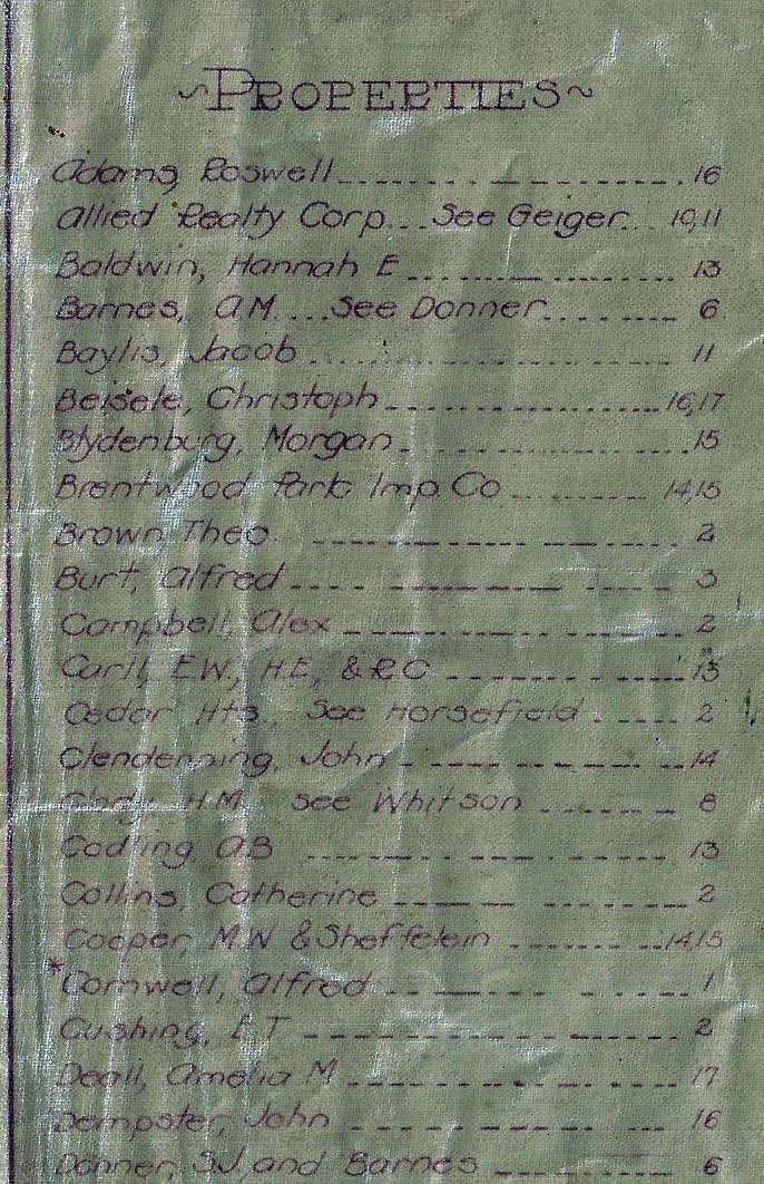
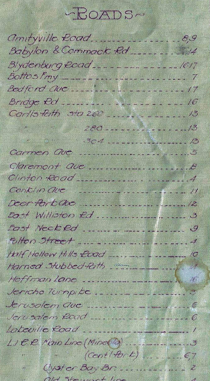
Index
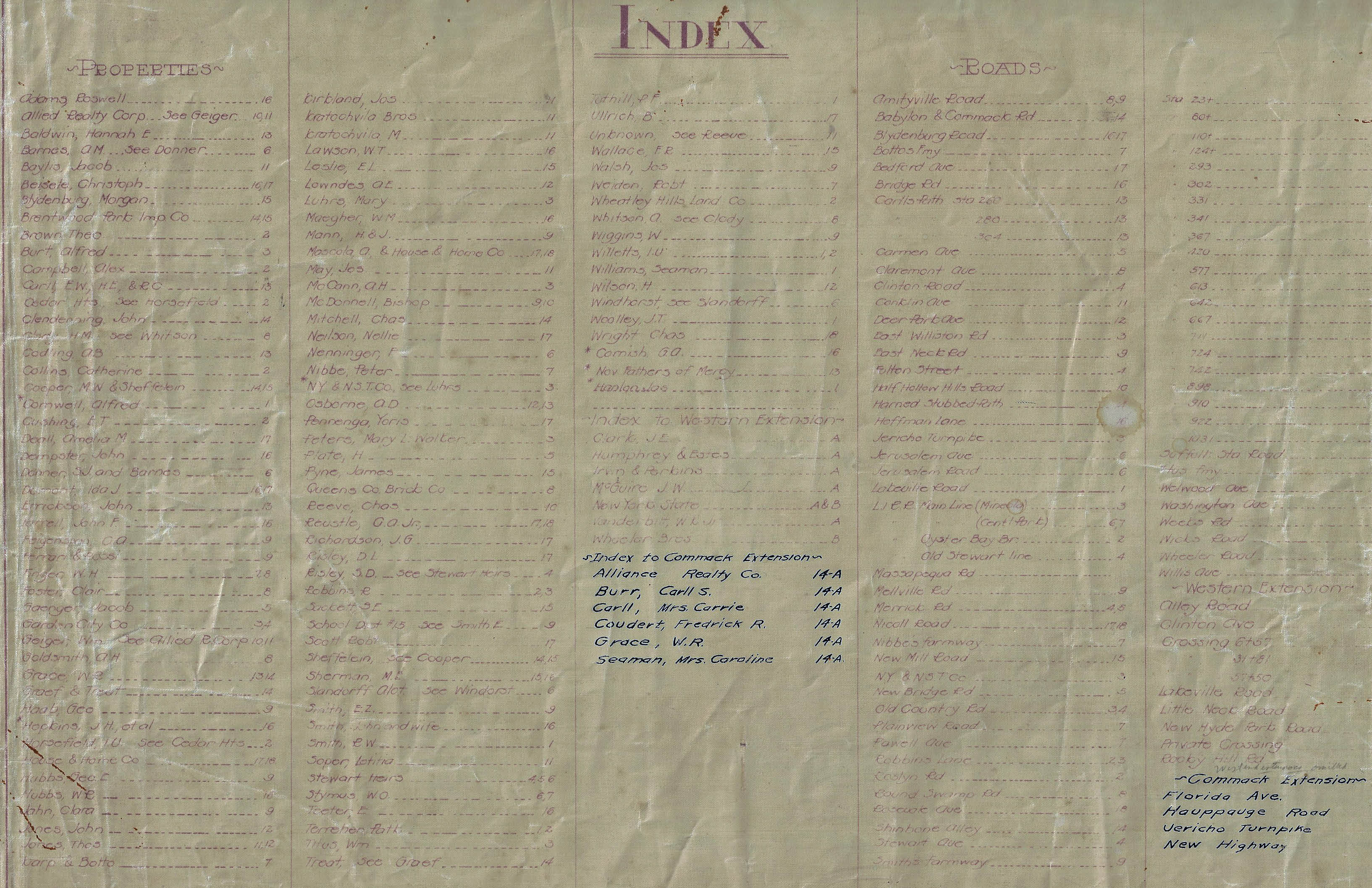
The Index page. Note: The hand-written additions from the Commack Extension
Page 1 The Western Terminus in 1910
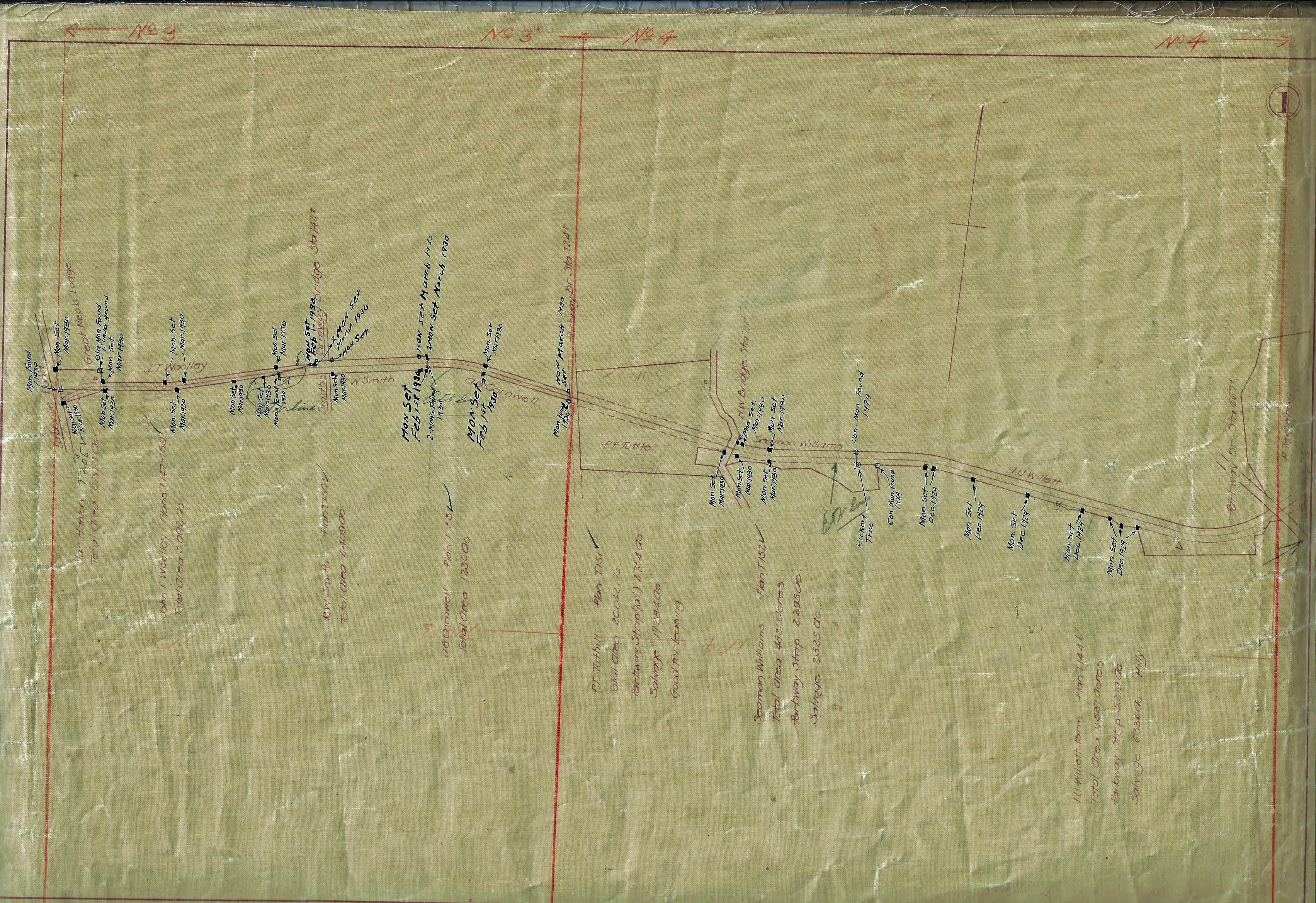
Lakeville Road, Lake Success to New Hyde Park Road
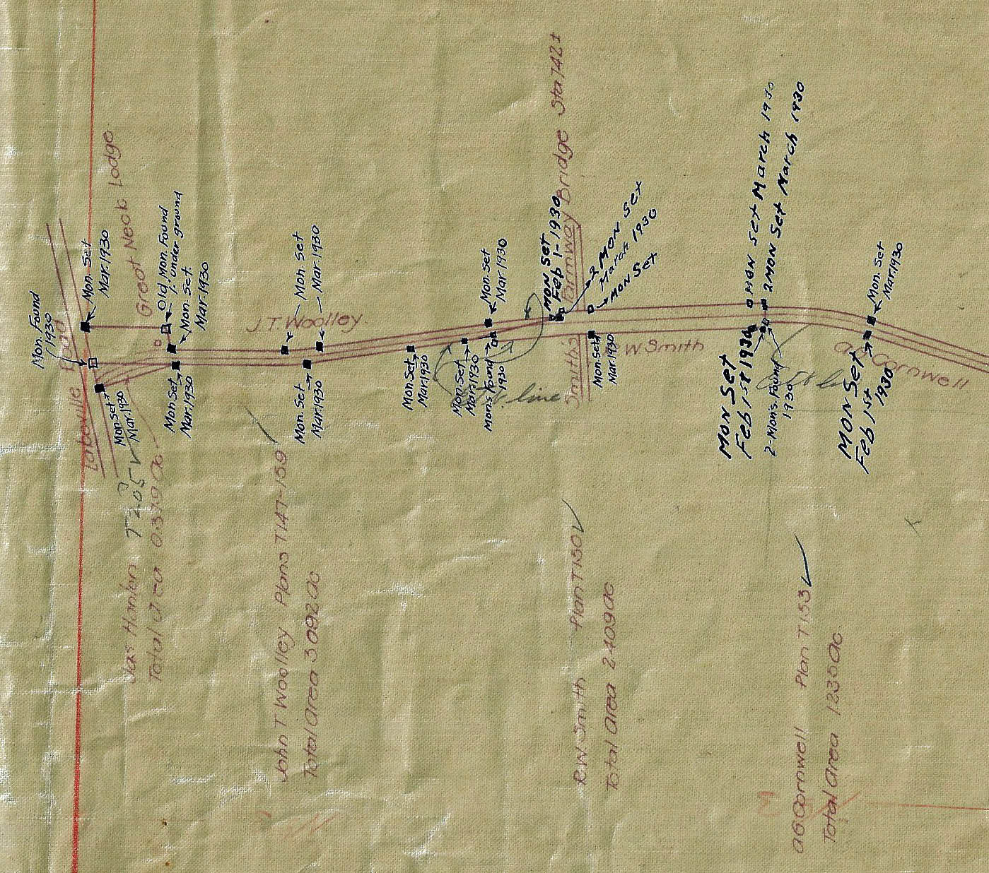
Note: The hand-written 1930 monument notes
Page 4- Garden City and the Hempstead Spur
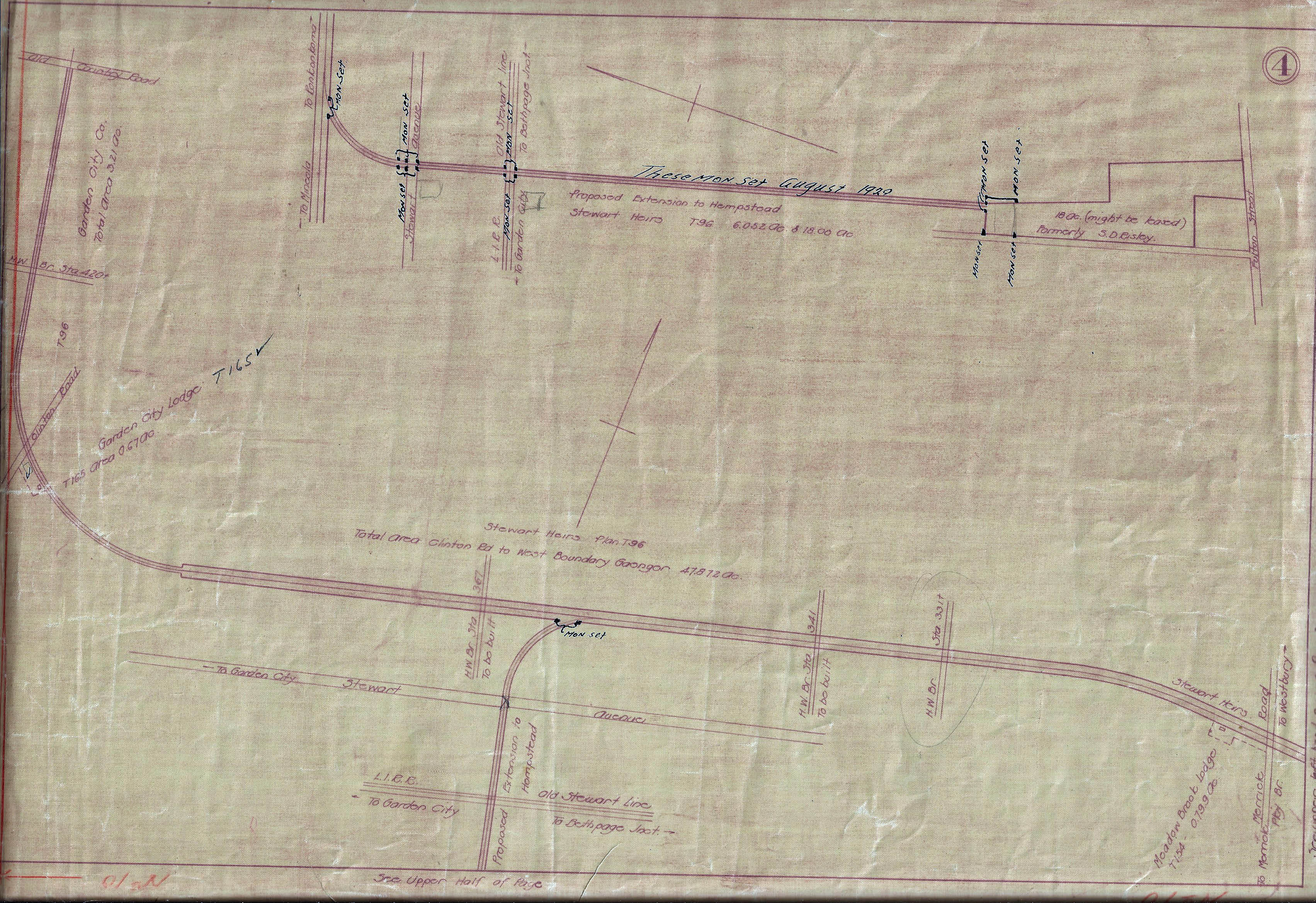
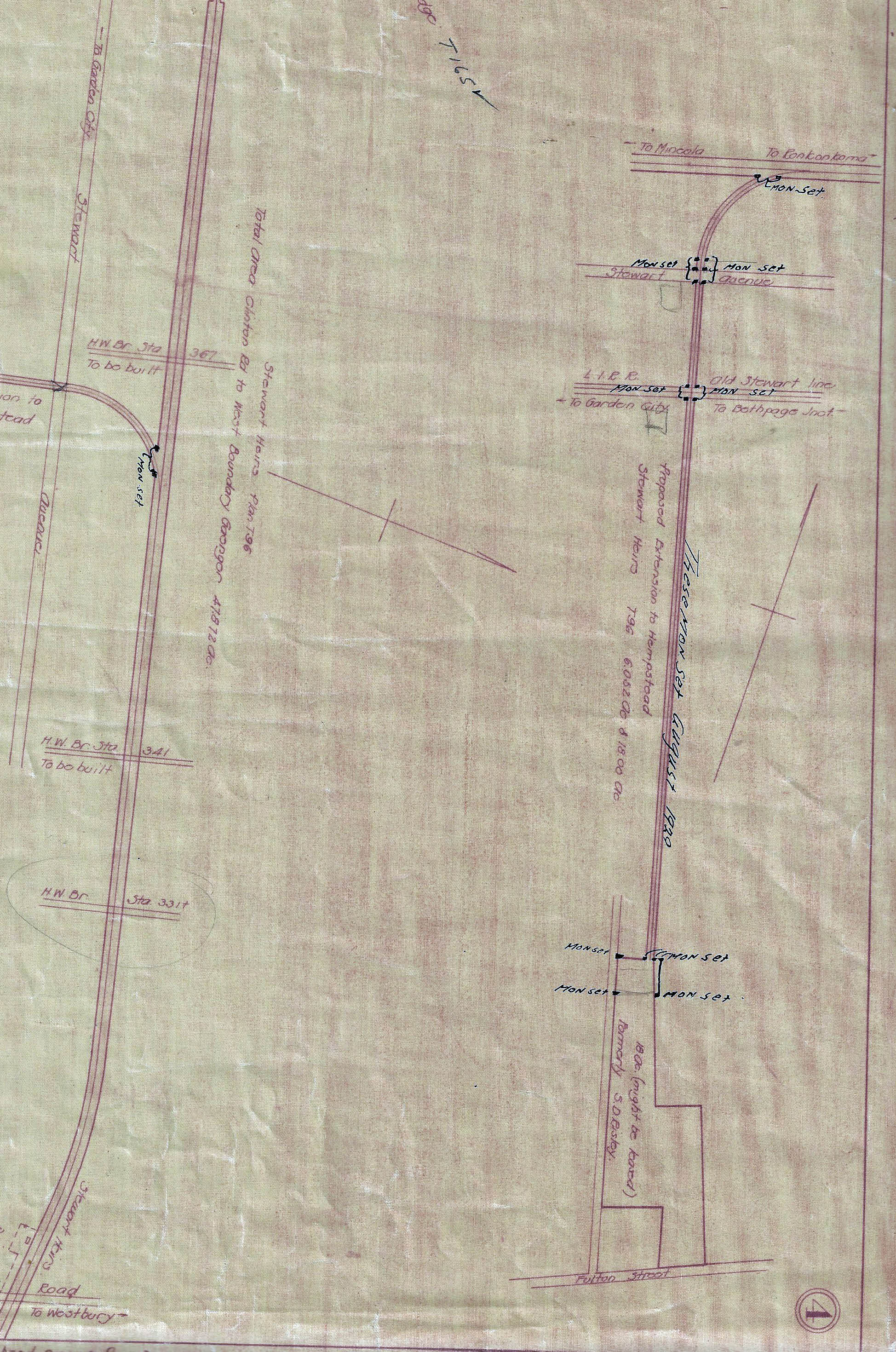
The never-built Hempstead Spur to Fulton Street
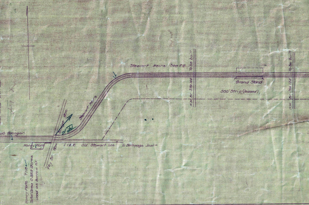
Page 5 East Meadow and Hempstead Plains
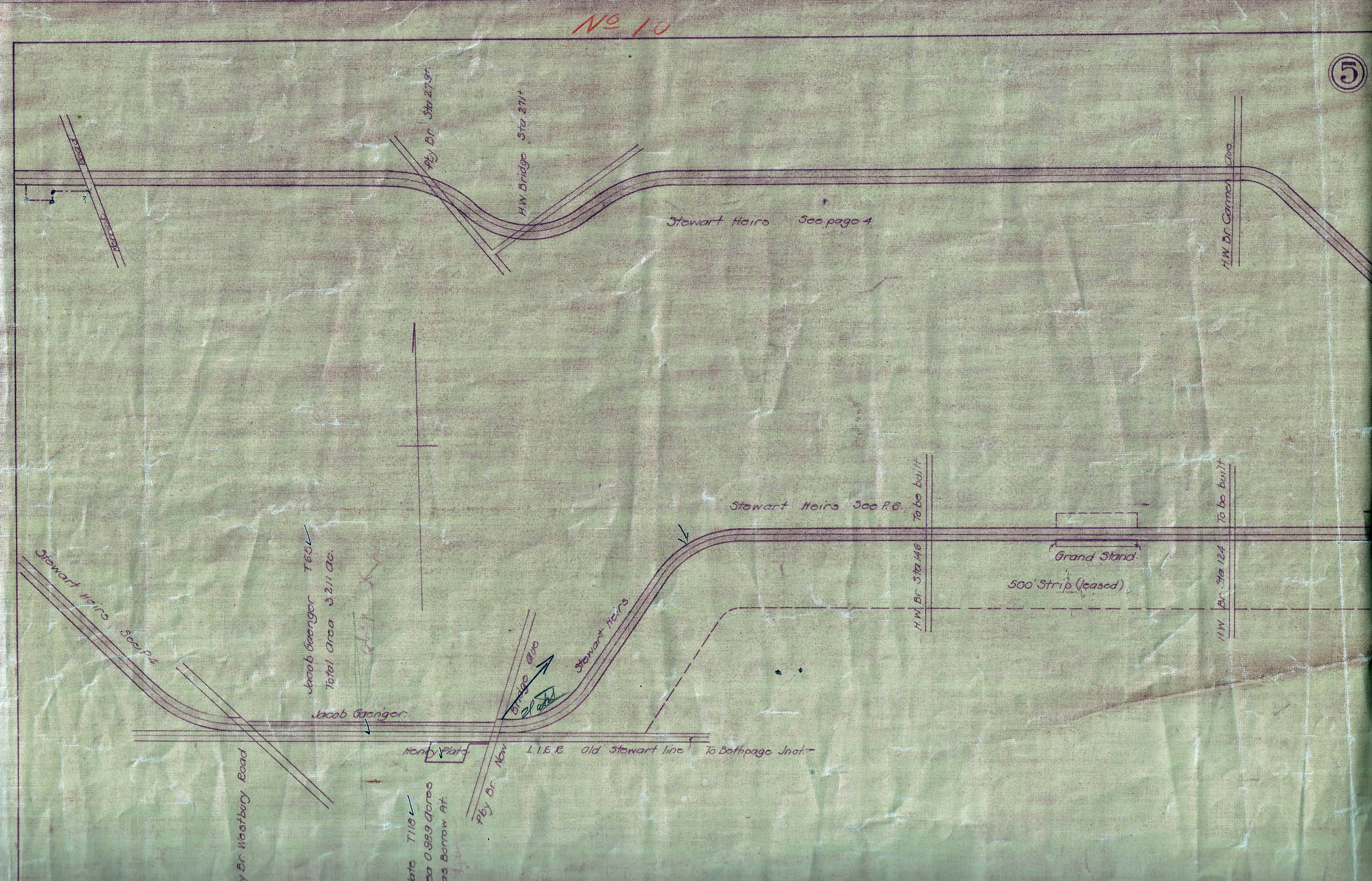
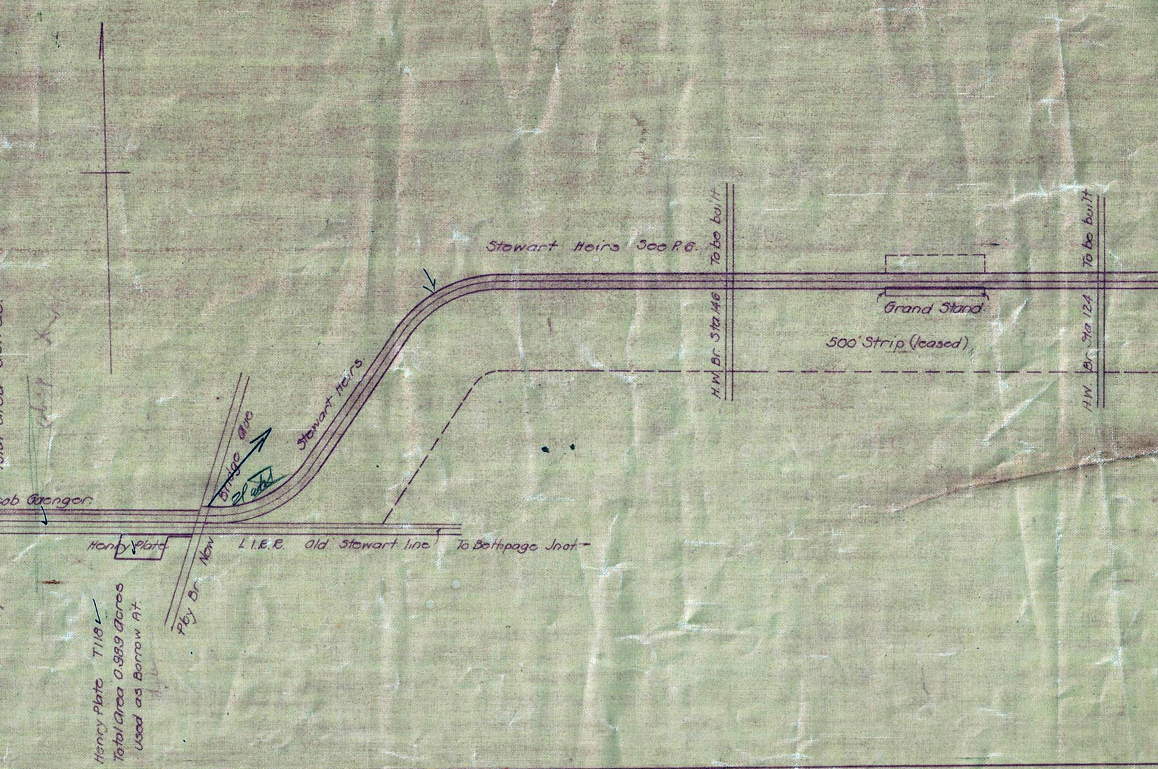
The location of the grandstand for the 1908 to 1910 Vanderbilt Cup Races
Page 6 Central Park (Bethpage)
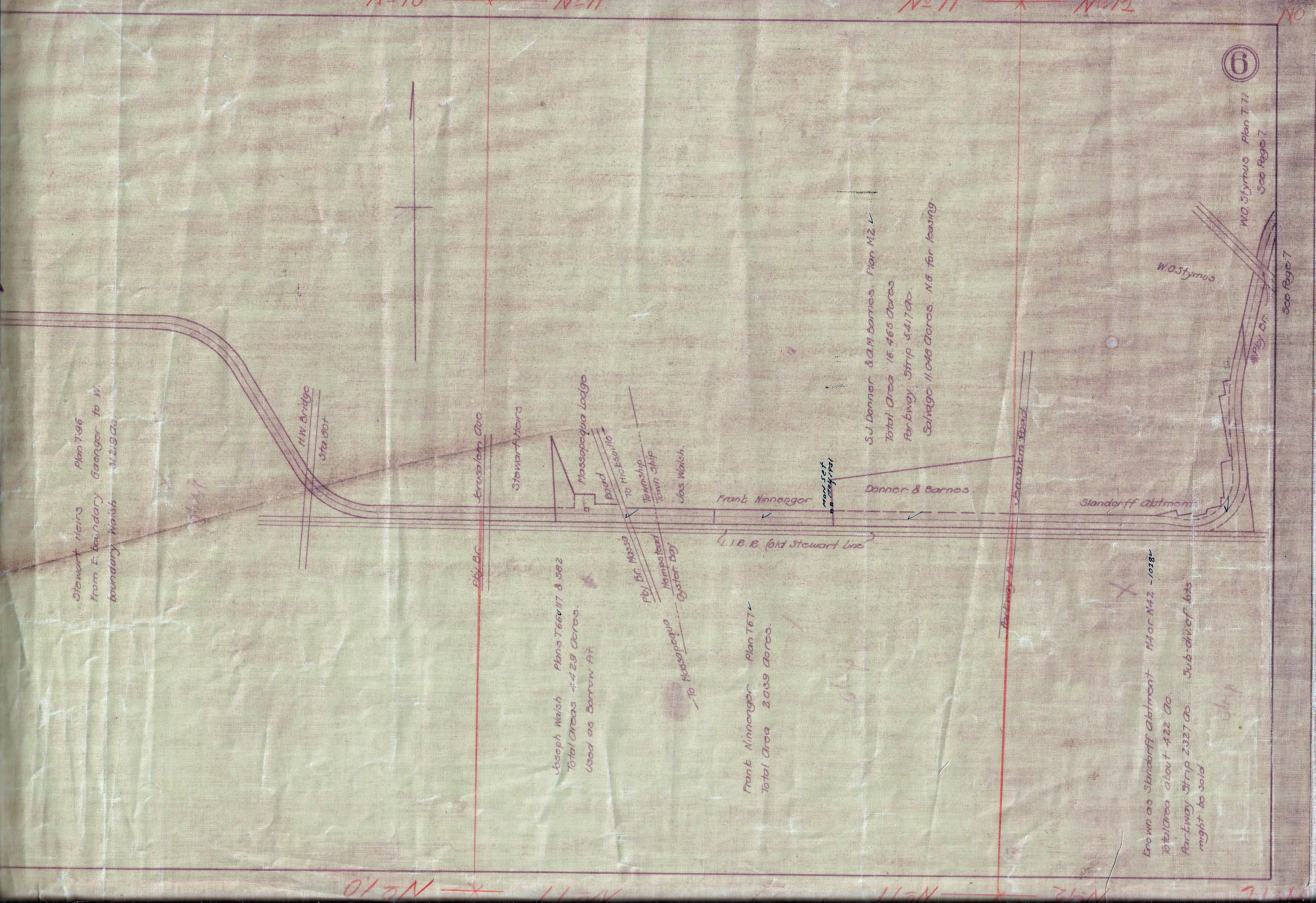
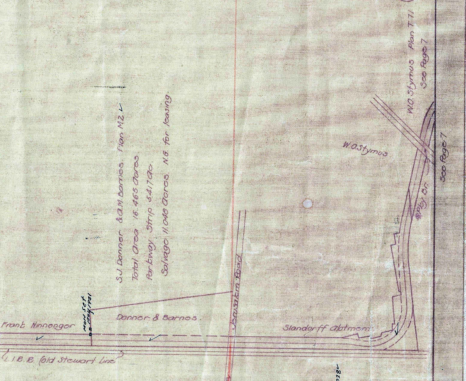
The location of the ground-breaking ceremony and Deadman's Curve
Page 8 Bethpage to Melville
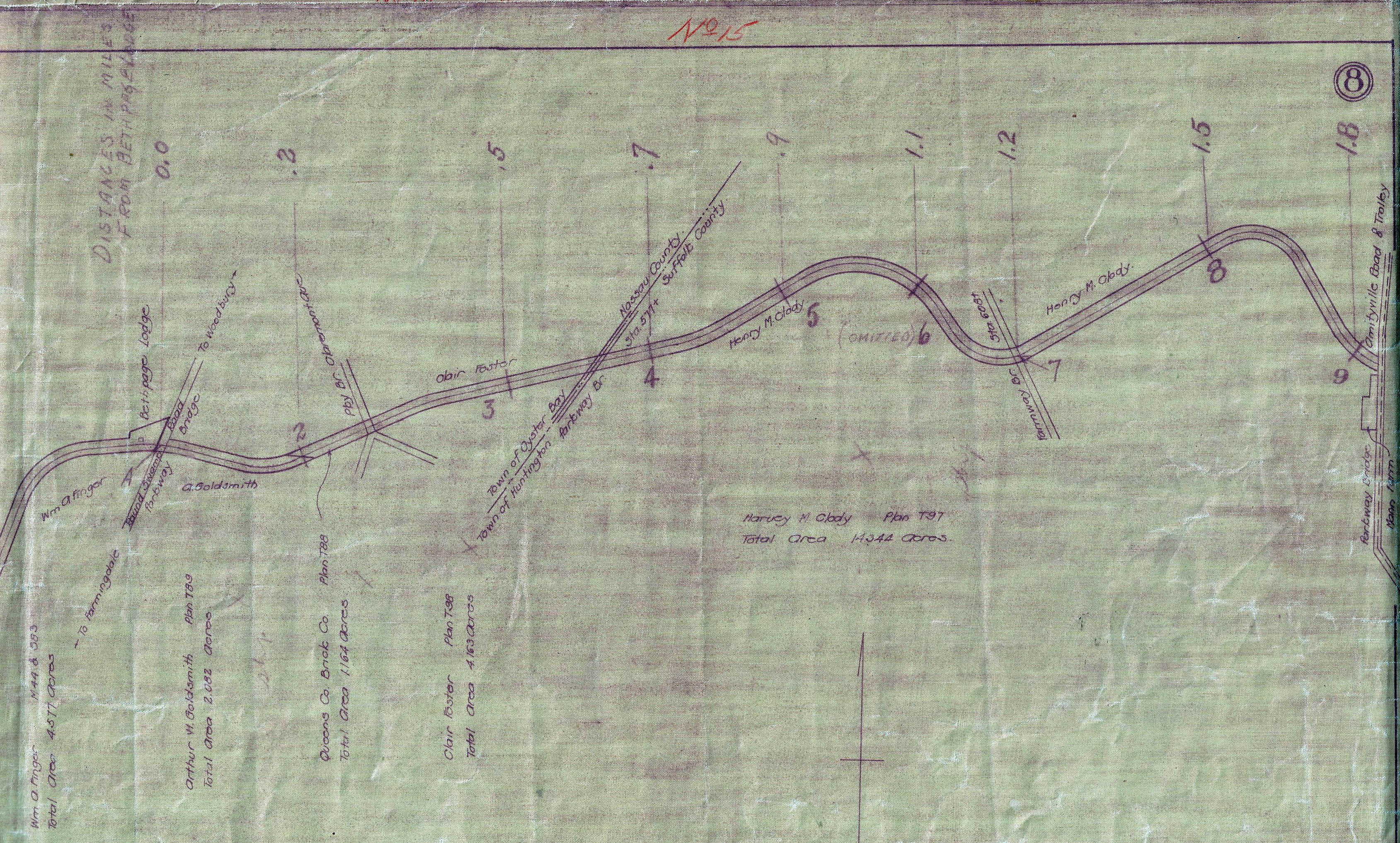
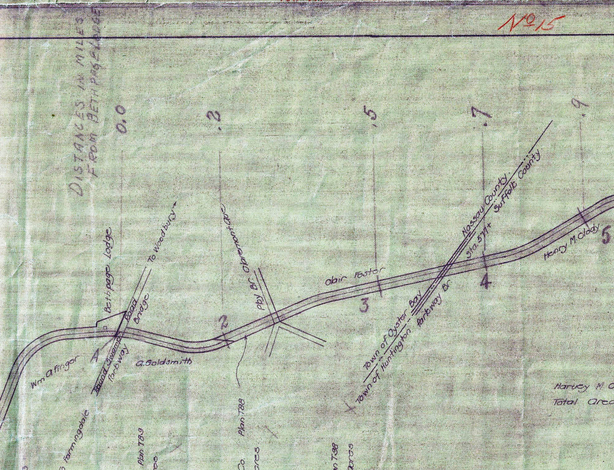
Note: the "Distance from the Bethpage Lodge" is indicated on the top of the pages heading east to Lake Ronkonkoma.
Page 12 Dix Hills
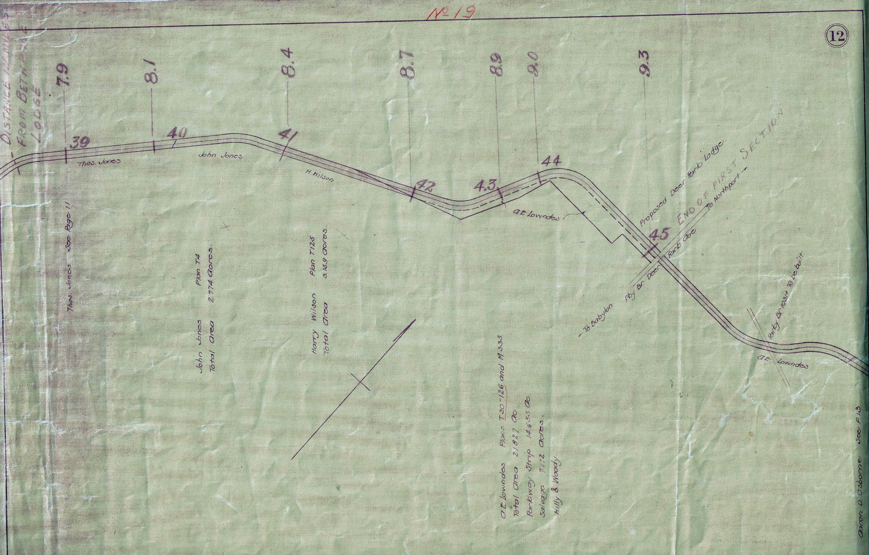
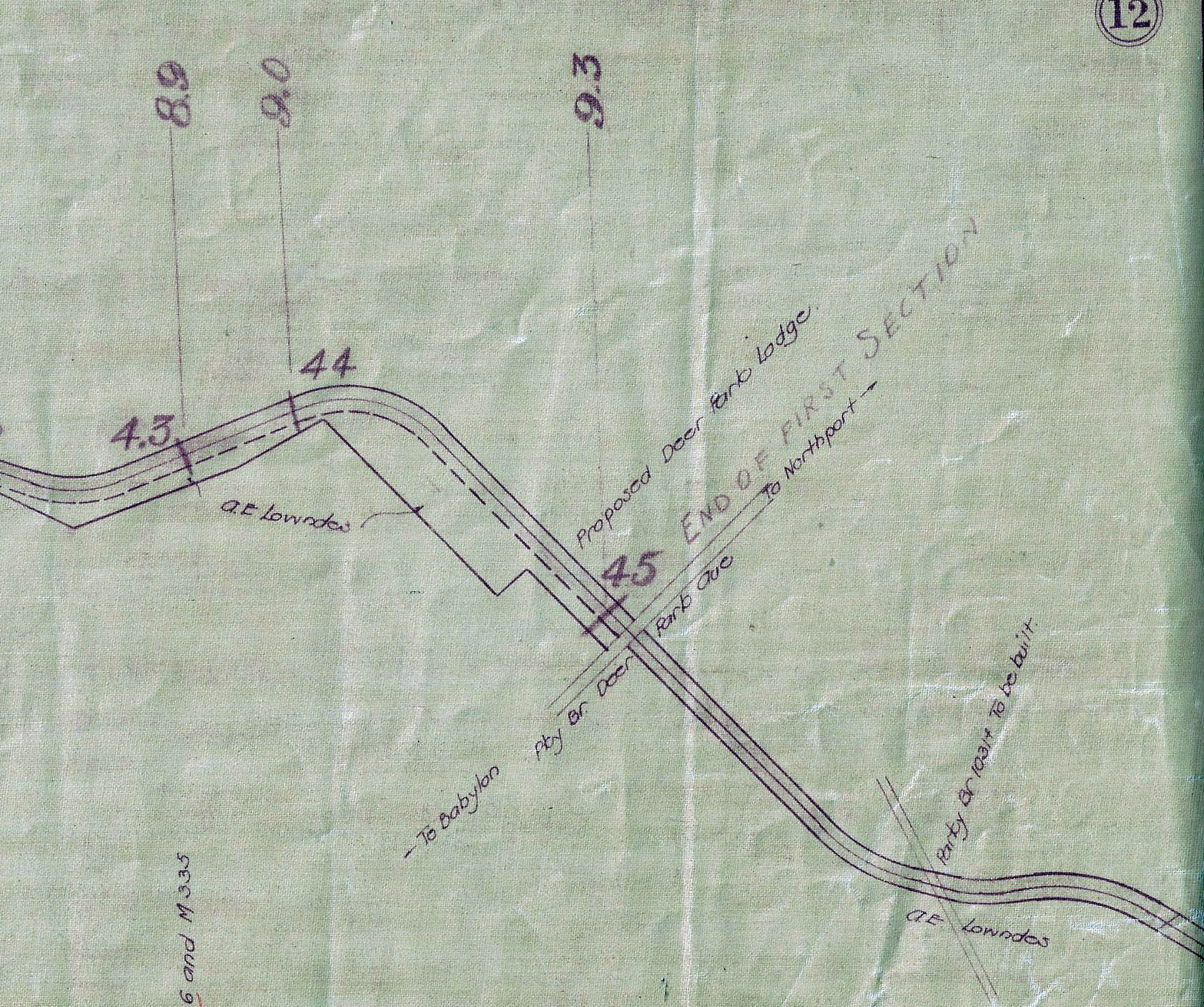
The proposed location of the Deer Park Lodge that was never built. 9.3 miles from the Bethpage Lodge.
Hand-Written Note: End of First Section
Page 13 Dix Hills
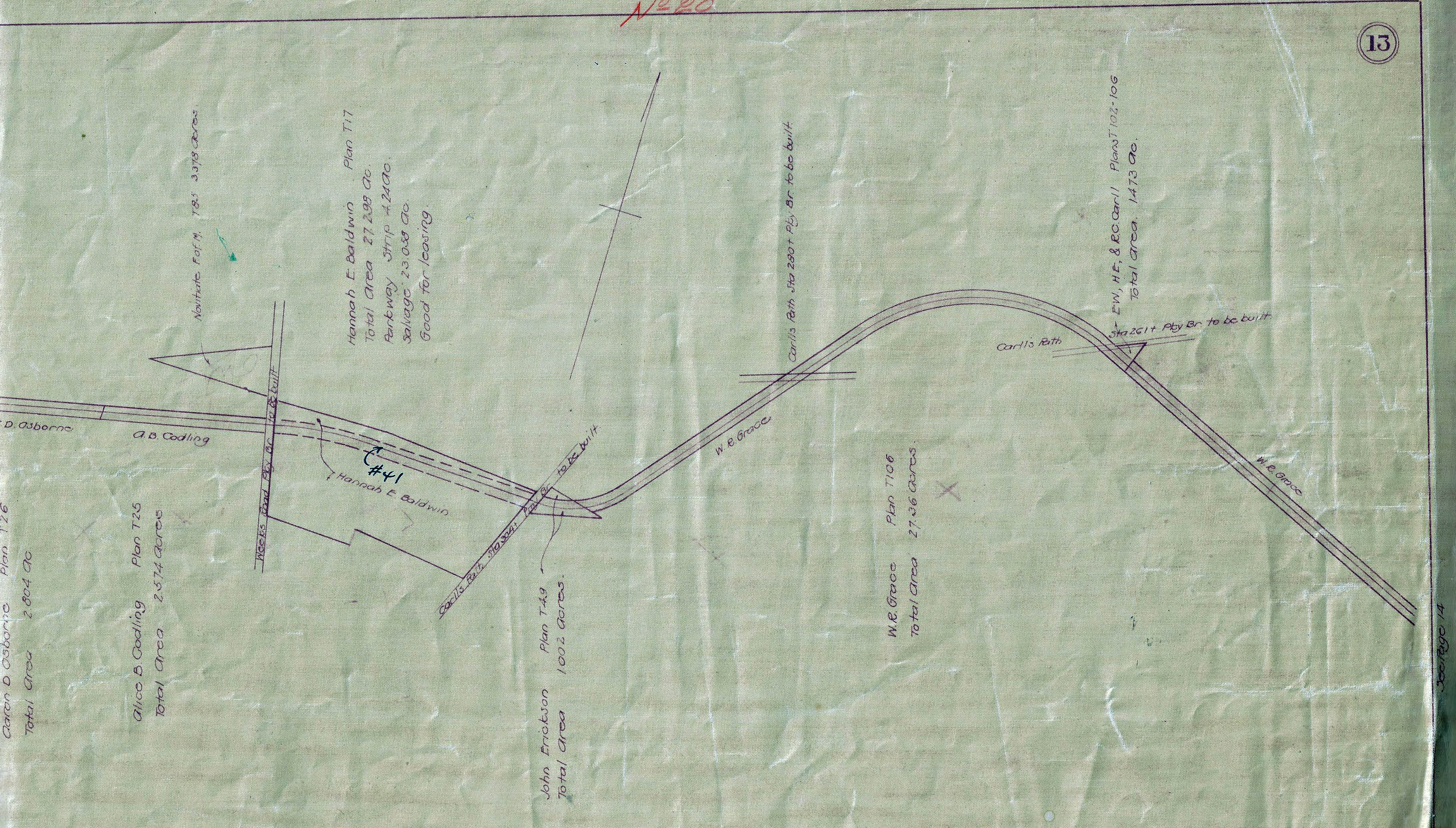
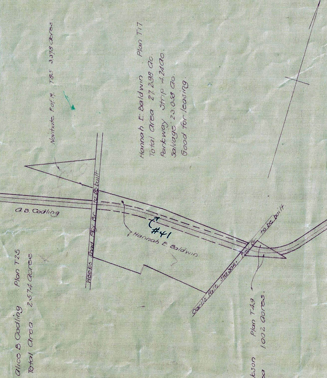
Page 14 Commack
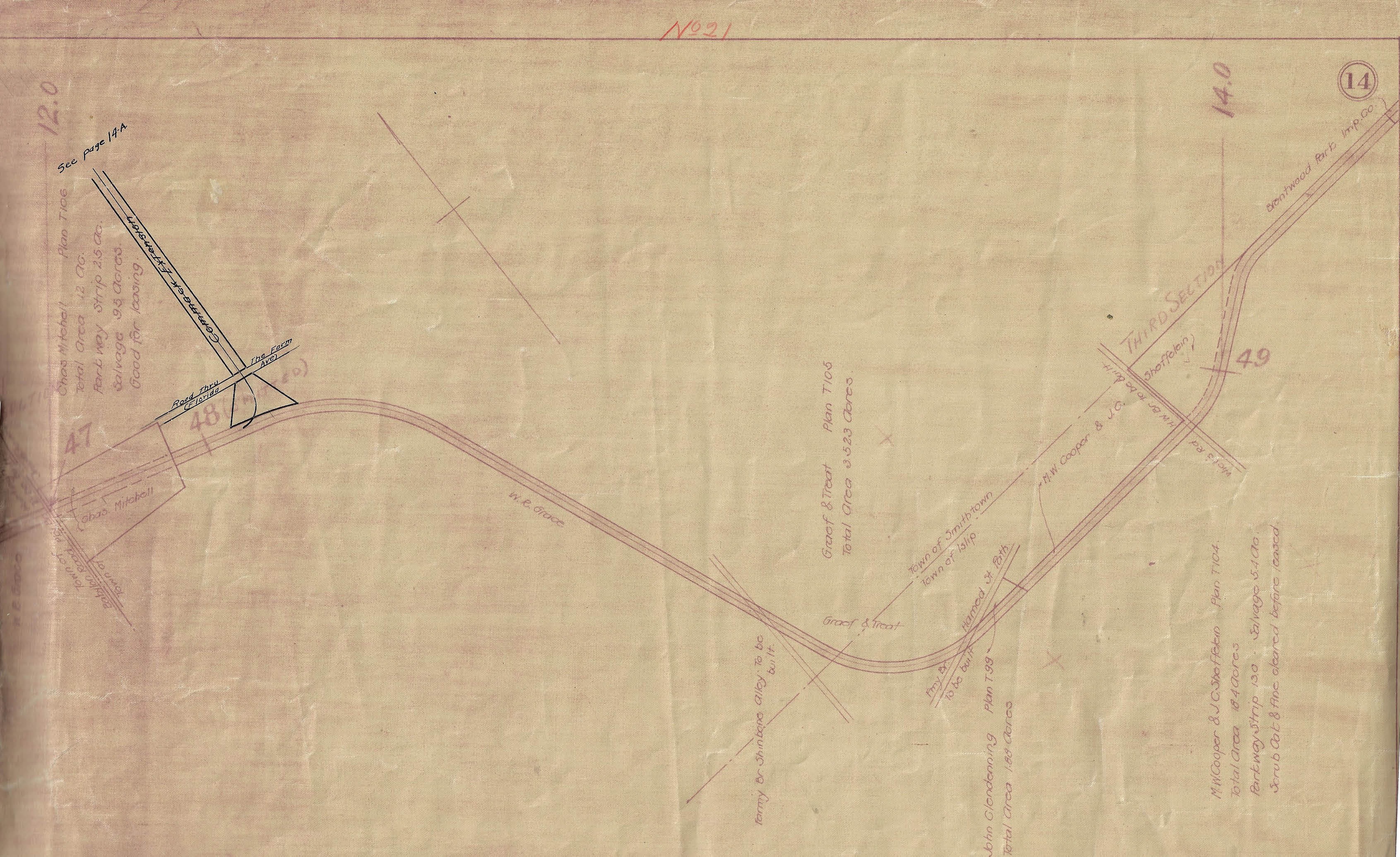
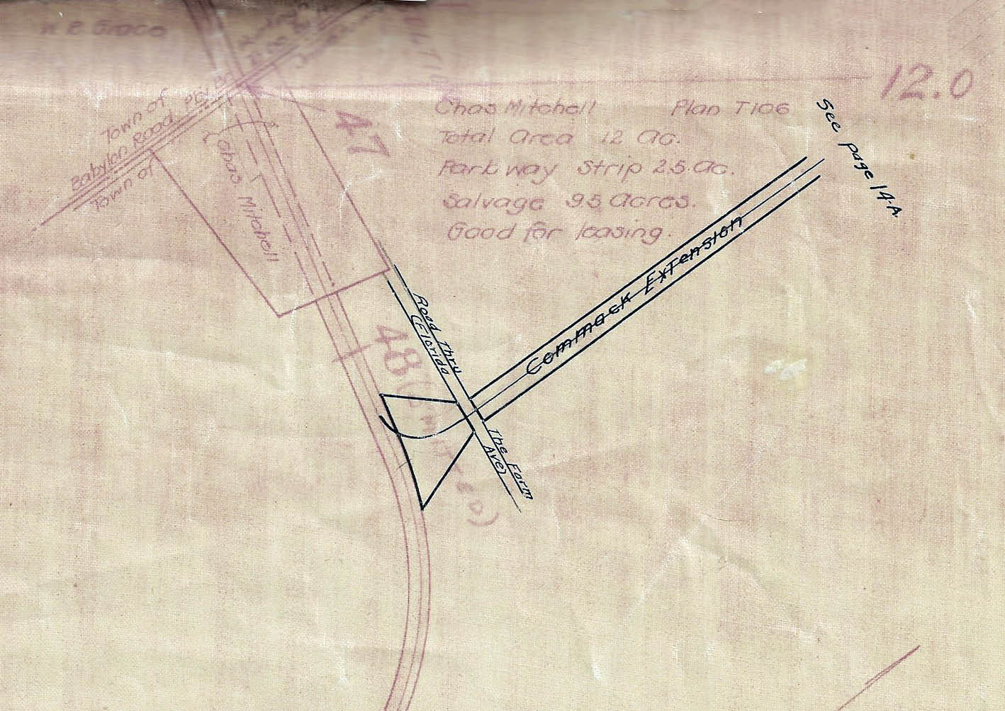
The Commack Extension
Page 18 Lake Ronkonkoma
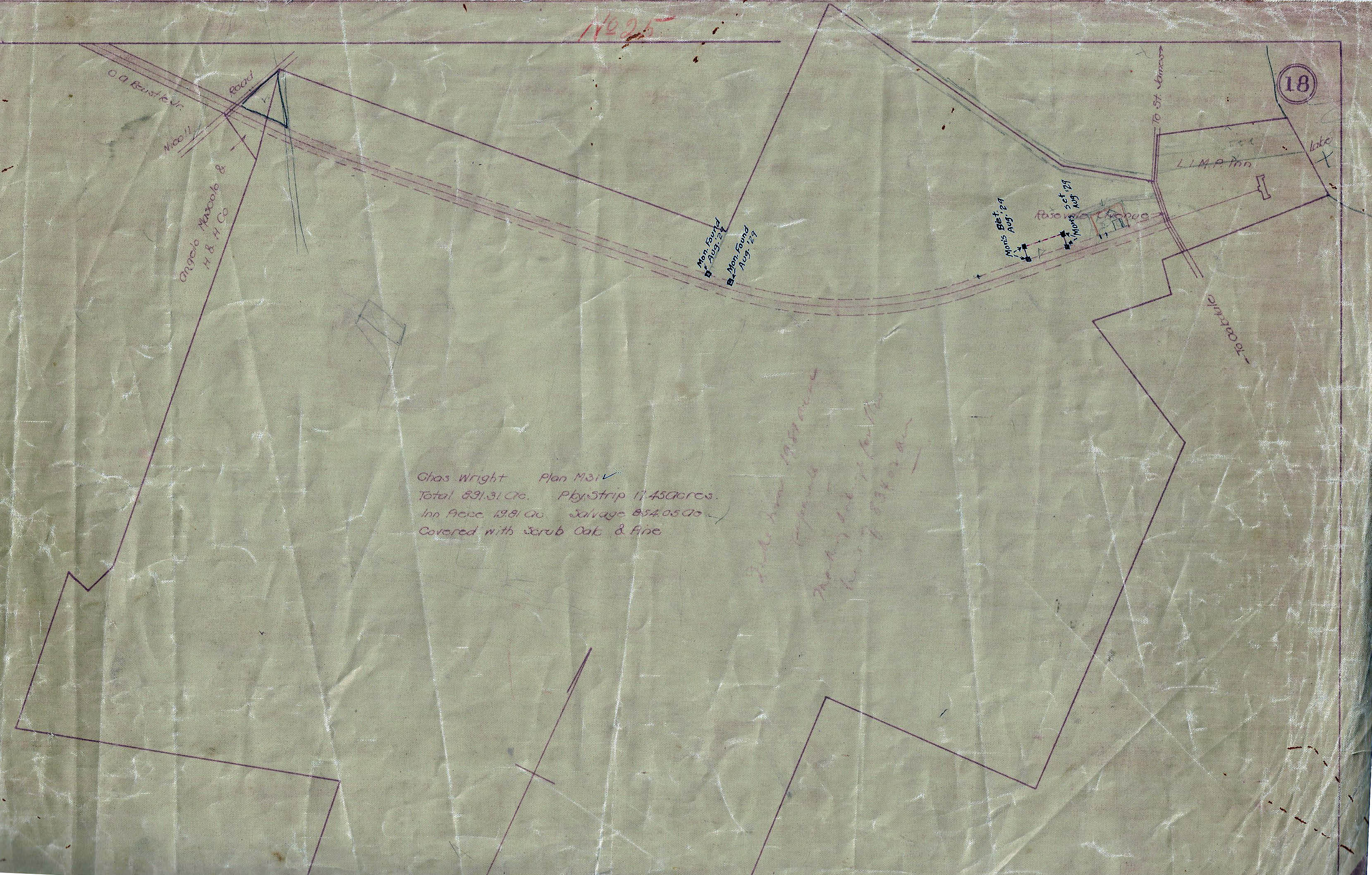
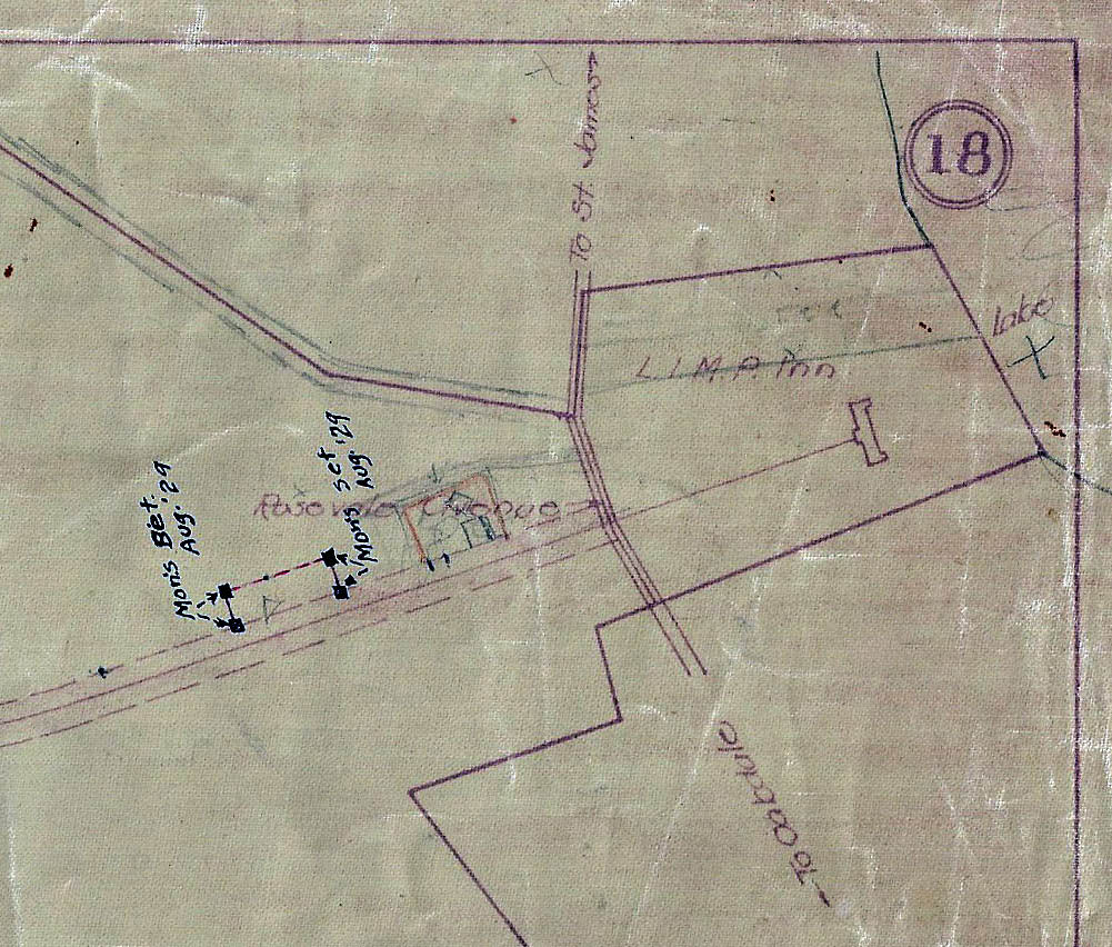
L.I.M.P, Inn (later named Petit Trianon)
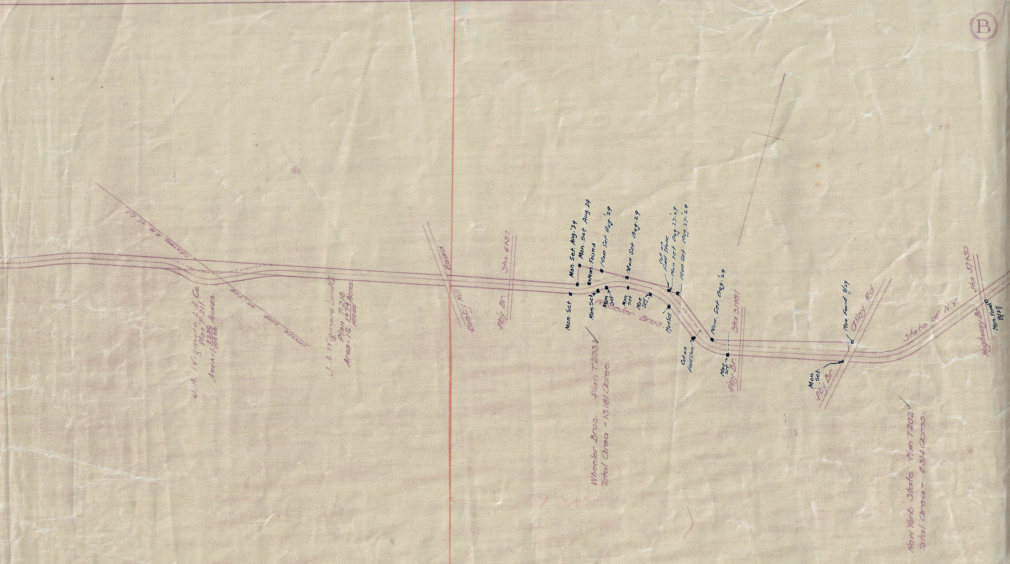
A Queens
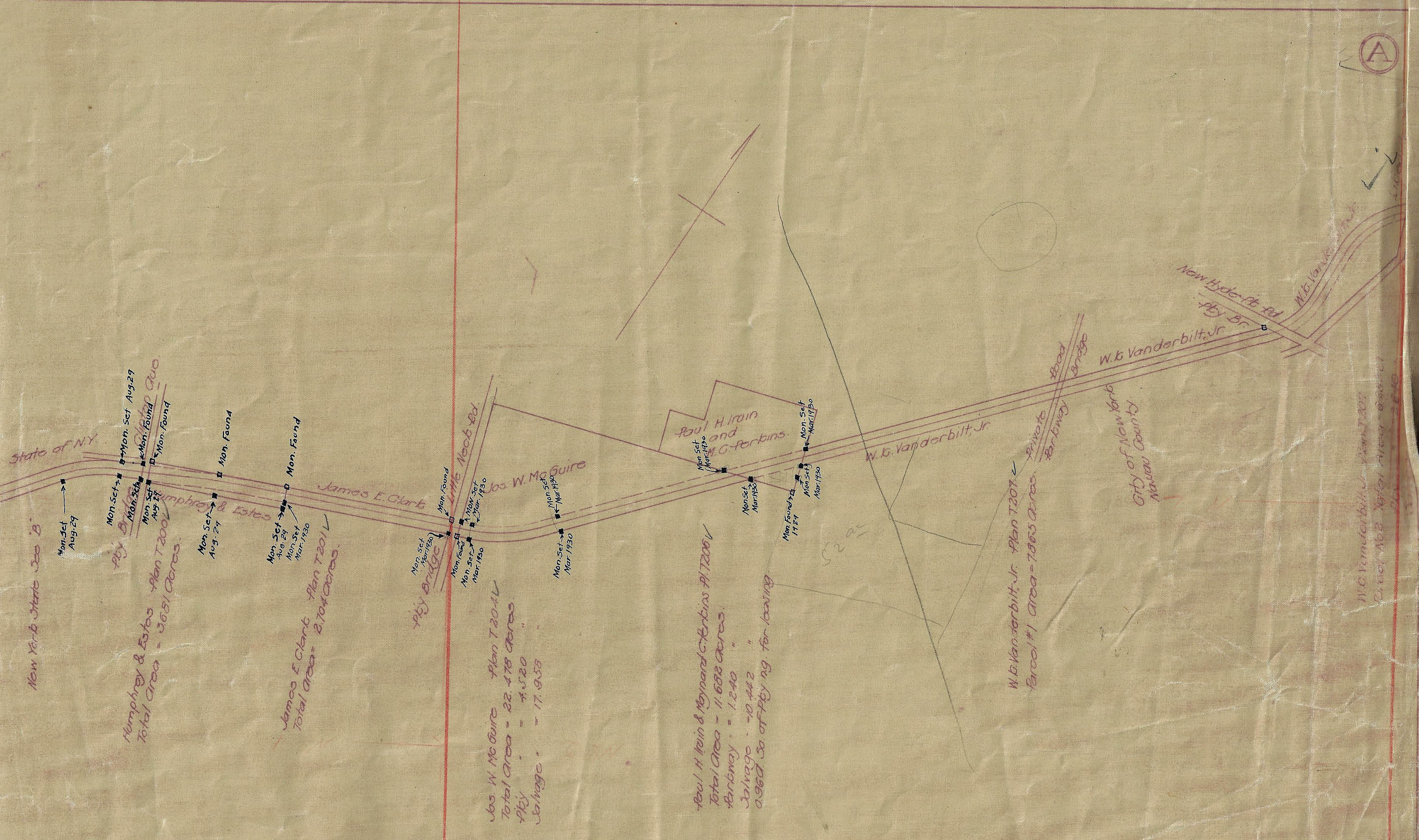
Pages A, B, and C were added to the original Bookmap
B Queens
C Fresh Meadows, Queens
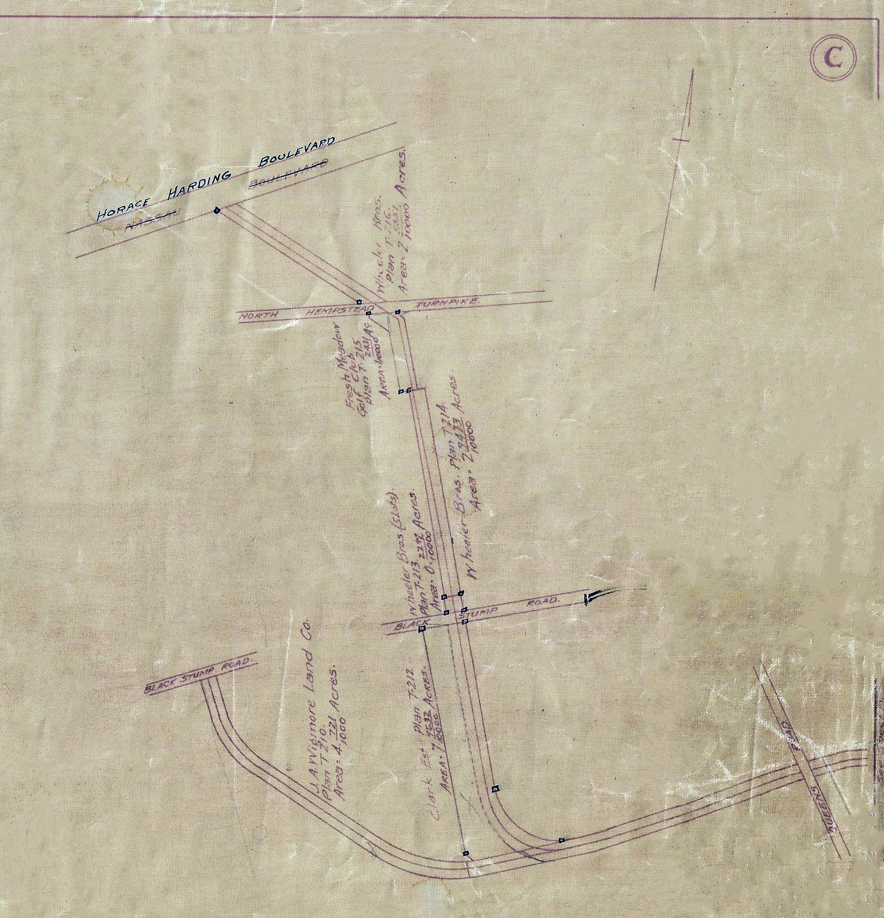
The original planned Western Terminus and the actual Western Terminus at Nassau Boulevard.


Comments
LOVE IT ! THANK YOU HOWARD
Particularly page 6 showing the OBVR portion and how far it went into OBVR versus Bethpage-Spagnoli Rd which can be computed from the Battle Row Curve.
Wow! Great Atlas purchase and rare opportunity to preserve historical data. Thanks Howard for all your efforts. Love the Queens B map with the GCP nowhere in sight, for another 23 years! It’s a long shot but always wondered about that old monument that hasn’t been discovered yet. Tiny as they are, that would truly be a needle in the haystack search
Photo below: Bike riders in Alley Pond Park 1940, braving the 8% grade under the GCP bridge.
Know this a year old+ post, but I was wondering if pages 10 and 11 of the mapbook exist? I’ve been looking within the site here to locate them. Great purchase!