Motor Parkway from Little Neck Parkway to Marcus Avenue Part II
Joe, thanks for the comment and excellent observation. LIMP expert Sam Berliner agrees with you and suggested the Motor Parkway bridge that I labeled Little Neck Parkway actually went over Hewlett Avenue. To determine the facts, I called in the LIMP CSI Team and requested a Concrete Scene Investigation.
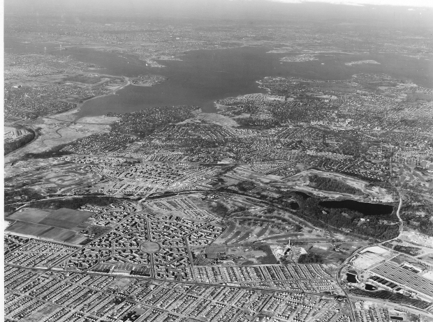
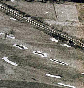
First, the above 1952 Queens aerial of the Motor Parkway right-of-way definitely indicates that Little Neck Parkway is further west than I indicated in my October 8th post. One point for Joe and Sam.Kroplick, zero
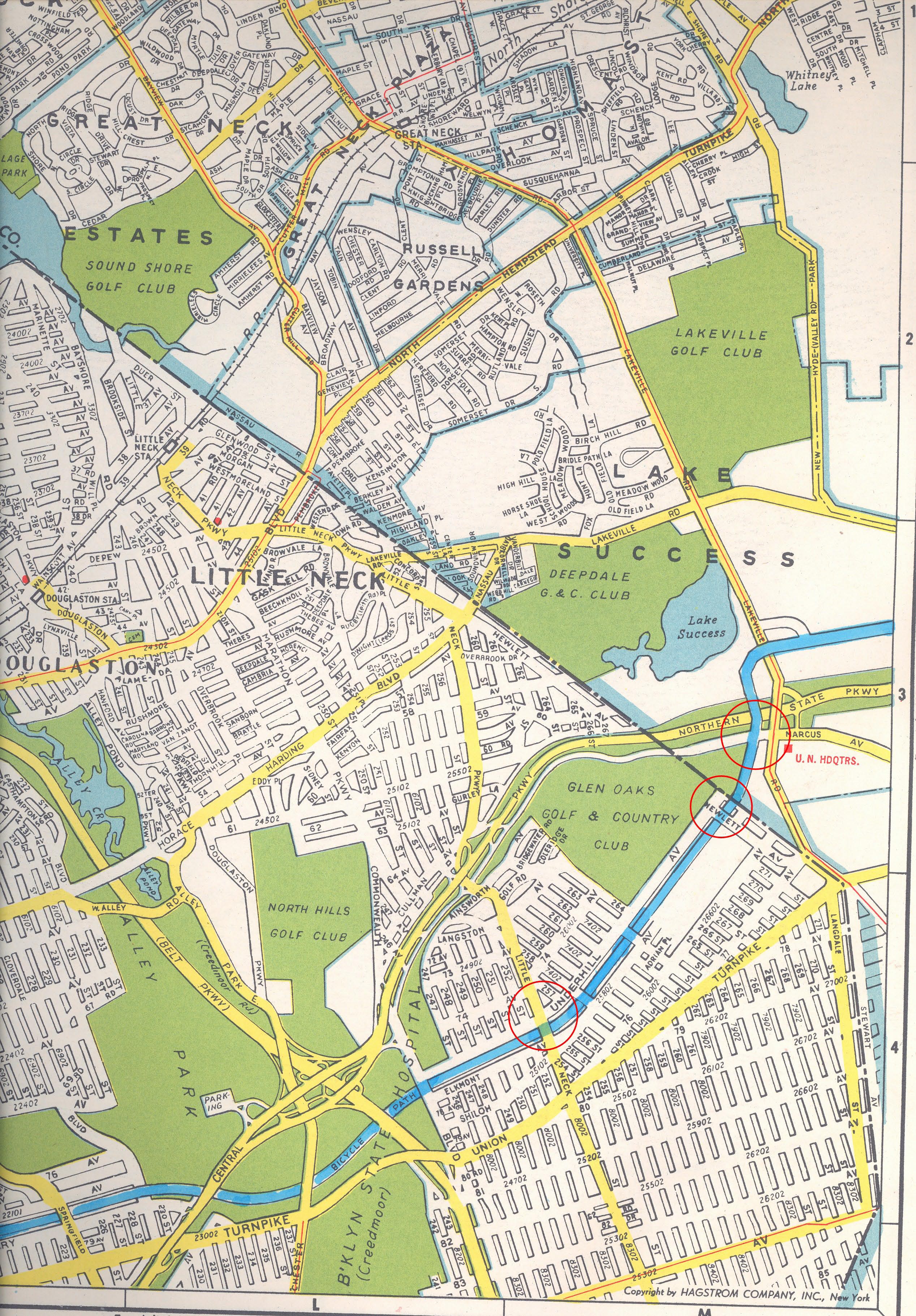
Second, this 1941 map still included the location of the Motor Parkway which closed three years earlier. The map indicates that Hewlett Avenue existed and was in the correct position as suggested by Sam Berliner relative to Marcus Avenue. Two points for Joe and Sam, still a goose egg for Kroplick.
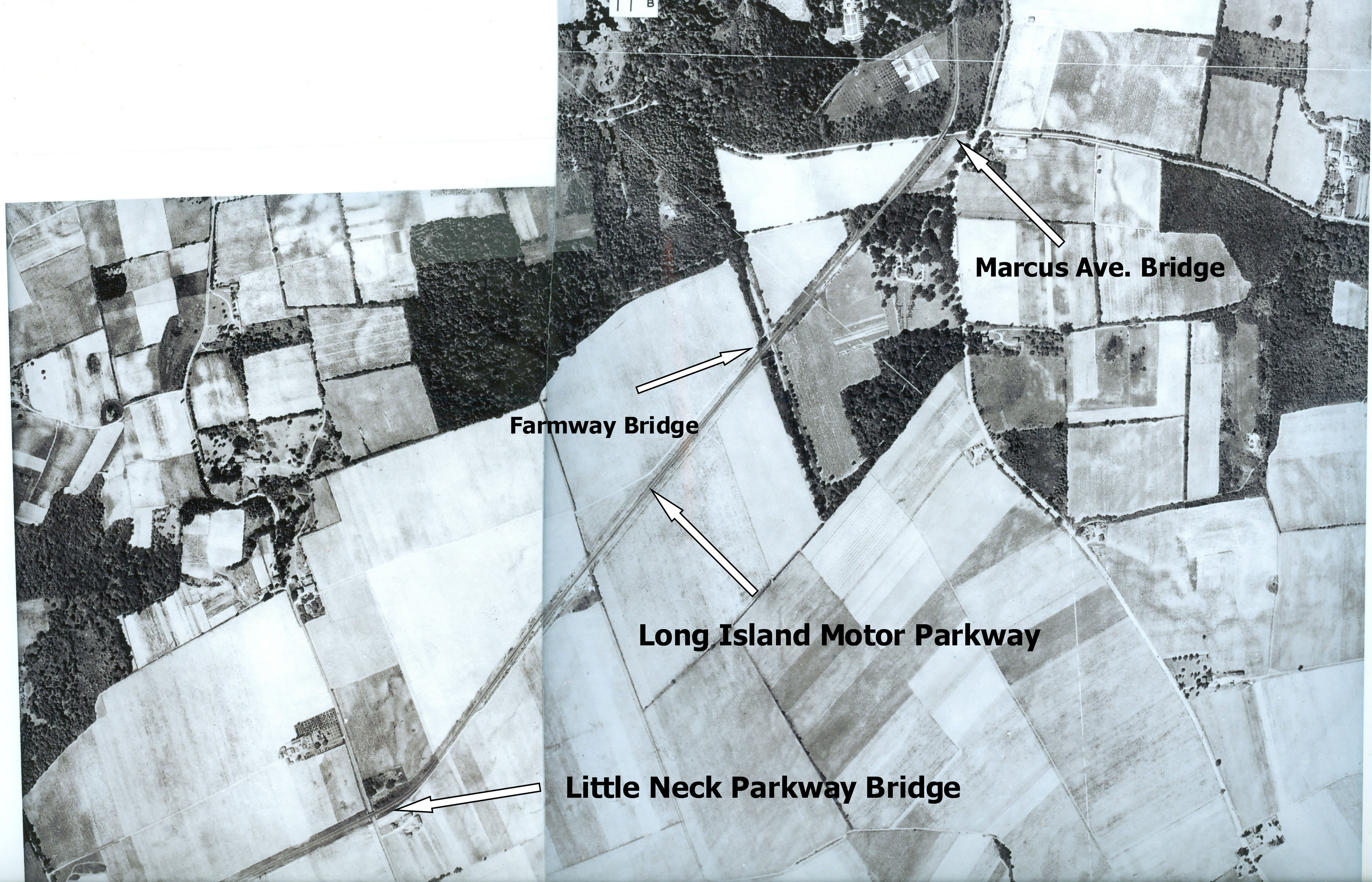
The crack LIMP CSI Team combined two separate 1924 Queens aerials of the area and compared it to the 1941 map. The results are conclusive; Joe and Sam win 3-0. This larger aerial is now properly labeled. Thanks Joe and Sam for the correction.October 26, 2009 Update: The map has been corrected to indicate a "farmway bridge" rather than the "Hewlett Avenue Bridge" (see comments below).
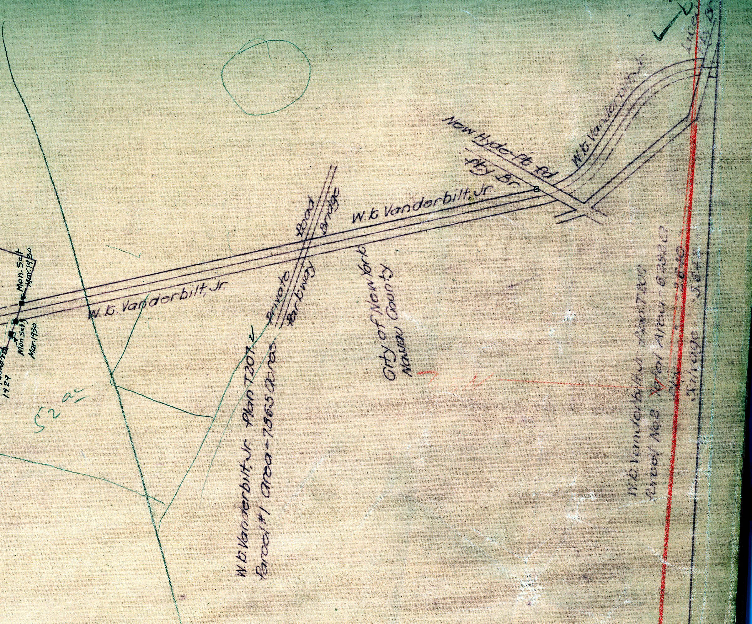
October 26, 2009 Update: A survey of the Motor Parkway confirms Al Velocci's view that the bridge between Little Neck Road and Marcus Avenue was a farmway bidge that connected William K.Vanderbilt Jr.'s Deepdale estate. One point for Velocci!!
October 31, 2009 Update: This 1929 aerial shows a close-up view of the farmway bidge that connected William K.Vanderbilt Jr.'s Deepdale estate.
If you would like to see aerials of your favorite section of the Motor Parkway featured in a future post, please leave a comment below.


Comments
Yes Please… a foto of the Motor Parkway in the Melville area. To be precise, East of then Route 100 along the Parkway, from where it passed over the Ruland and Pinelawn Roads at the junction of Colonial Springs Road to the first house in from the corner on the North East side of the Parkway, the Hairston Residence (Mr. Hairston was then Suffolk County Commissioner of Elections). This is the route we children would ride our bikes in the mid 1940s—down old Route 110 to the Parkway bridge at Route 110 and then East on the Parkway to the Hairston Residence where we left the Parkway and coasted down the short hill to the Hairston Residence. It was still “real” country then, so this was permitted as it was like a private bike tail.
Howard, Regarding the dialogue between yourself, Sam & Joe. There was no Hewlett Av. bridge as there was no Hewlett Av. in 1911 when the bridge was built. The bridge was located west of Hewlett Av. and took the Parkway over property that Vanderbilt owned on both sides of the Parkway right of way. The bridge was located on property eventually acguired by Long Island Jewish Hospital. The bridge survived into the 1970’s. It was demolished at that time when an employee parking lot was built on the Parkway right of way. A huge hole was dug adjecent to the bridge and was tumbled into the hole almost intact. The entire area was leveled off and all traces of the Parkway disappeared. A good view of the area can been seen by taking 74th Av. (which is in the bed of the Motor Parkway), to it’s eastern terminus to the gates of the employee parking lot. The Parkway right of way is right in front of you. Al Velocci.
Fascinating details! Thanks Al and Howard. Al, one question. I’ve always assumed that 74th Avenue was the “bed of the Motor Parkway” but how do you account for the fact that on the Hagstrom map clip provided by Howard, 74th Avenue seems to run one block north of the Parkway? It seems like it should be “75th Avenue”...in between 74th and 76th Avenues. Was the map wrong, or were the streets changed…or something else?
Hi Mitch, The Hagstrom you are refering to shows the street layout as planned by New York City. When the Glen Oaks Garden Apartment complex was built the developer rearranged the street layout. The Hagstroms published after Glen Oaks Village was built (1950’s) show the roadways as actually constructed and fortunately for Parkway buffs when 74th Av,. ends at tne Nassau County line it shows the Parkway right of way into Naassau County in alignment with 74th Av. Hope this clears the matter for you. Al Velocci
I would like to see the section of the Motor Parkway between Clinton Road and Post Avenue in Westbury and the toll taker. Do you have any information on what happened to him? He lived in a house near by the Post Ave. Bridge. His name was McKemish.
Hi Jack:
I will cover this area in a a future post.
According to Al Velocci’s book “The Toll Lodges of the Long Island Motor Parkway, and Their Gatekeeper’s Lives”, Otto and Pernella McCarnish were the lodge keepers at the Meadow Brook Lodge from 1928 to the Motor Parkway closing in 1938. They worked and lived in the lodge. According to Al, “On August 1938, the McCarnishes, for the sum of $2,000, became the owners of the Meadow Brook Lodge and three-quarters of an acre of land. The lodge survived until the early 1960s.”
Enjoy,
Howard
Have you folks ever seen HistoricAerials.com ? It’s a neat little resource. (if you haven’t already checked it out)
Thanks Al, for the info on 74th Street. I would’ve gotten back sooner, but I lost this page, and forgot where I posted! Thanks Howard, for providing the link to “Recent updates to older posts” in your latest email. Without that, I would never have gotten back! PS: is it possible to search for posts by poster’s name or email address?
Hi Mitch:
At this point, you can not do a search by poster’s name on the website. Maybe in the next upgrade.
Howard