The Motor Parkway North of Westbury Avenue on the Carle Place/Mineola Border

A wonderful section of the Long Island Motor Parkway is located south of Raff Avenue and north of Westbury Avenue on the border between Mineola and Carle Place.
Enjoy,
Howard Kroplick
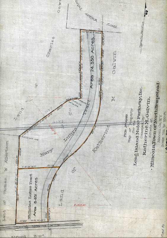
A 1907 survey shows that the Motor Parkway purchased 24.330 acres for the right-of-way in this area.
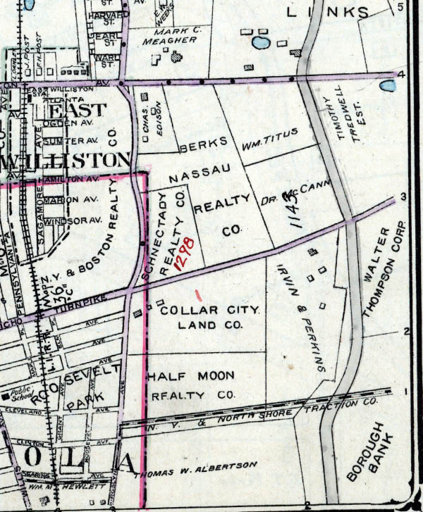
As shown in this 1914 Belcher-Hyde map, Westbury Avenue did not exist when the Motor Parkway was built. A bridge was built at this location to go over the trolley tracks for North Shore Traction.
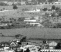
The bridge over Westbury Avenue can be seen in this blurry 1938 aerial. Note: The 300-foot embankments.
The bridge was similar in design to the Clinton Road Motor Parkway Bridge in Garden City.
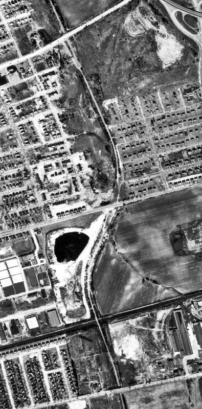
This 1950 aerial shows the Motor Parkway from Jericho Turnpike to Old Country Road. The bridge over Westbury Avenue was long gone.
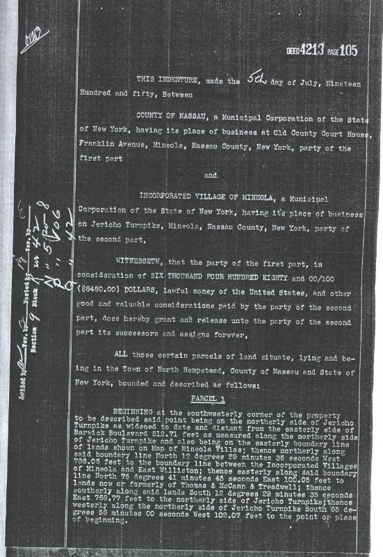
The property on the Motor Parkway right-of way from Jericho Turnpike to Old Country Road was transferred from Nassau County to the Village of Mineola for $6,480 on July 5, 1950. (Indenture courtesy of my favorite co-author Al Velocci).
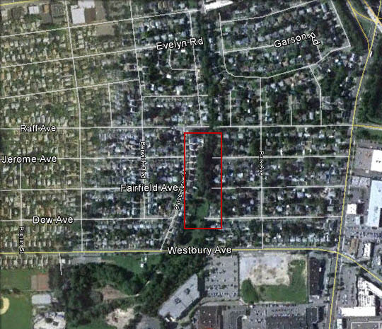
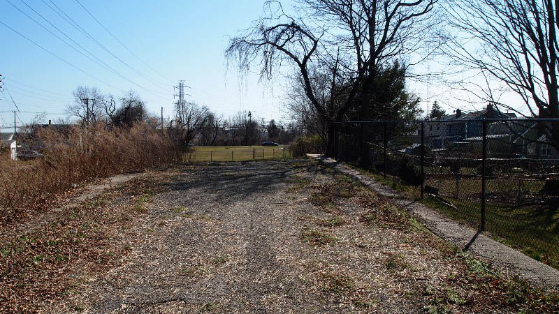
A Google Earth view on the area.
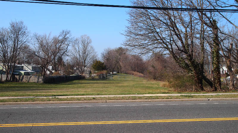
Looking north from Westbury Avenue, a section of the bridge embankment still exists.
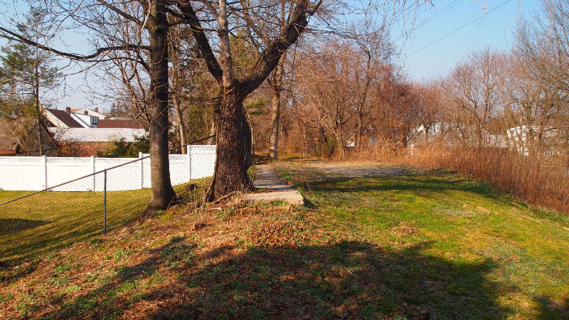
Eureka! On top of the embankment, pavement and two three-foot concrete extensions.
A view looking south to Westbury Avenue approximately 8 feet above grade.
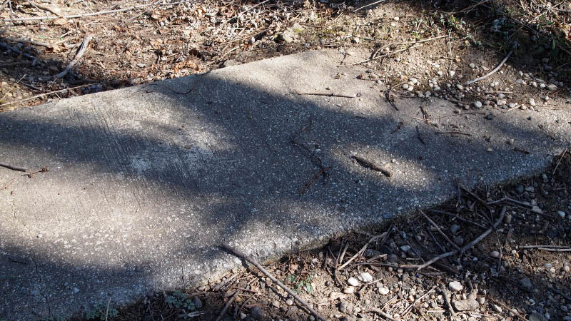
The concrete extension.
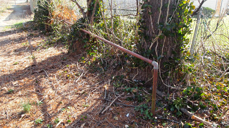
A unusual pipe railing just to the right of a small section of the concrete extension. Anyone have a clue for its purpose?
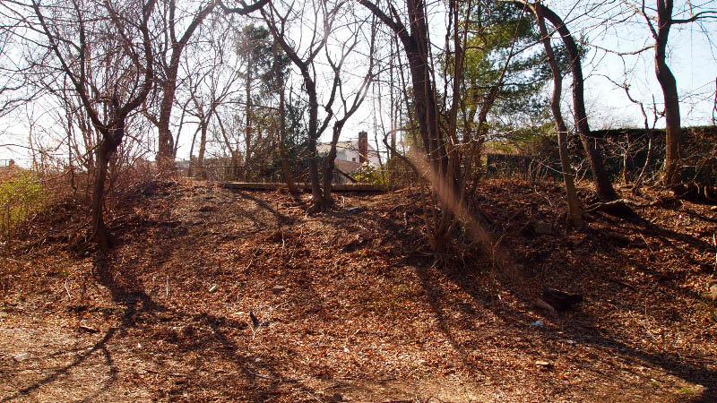
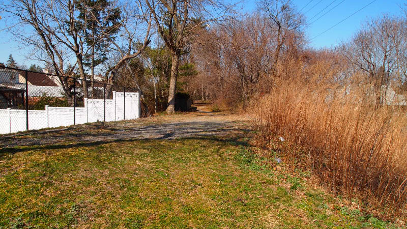
A view from grade level.
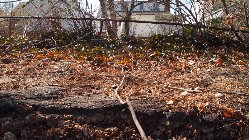
A close-up of pavement remains.
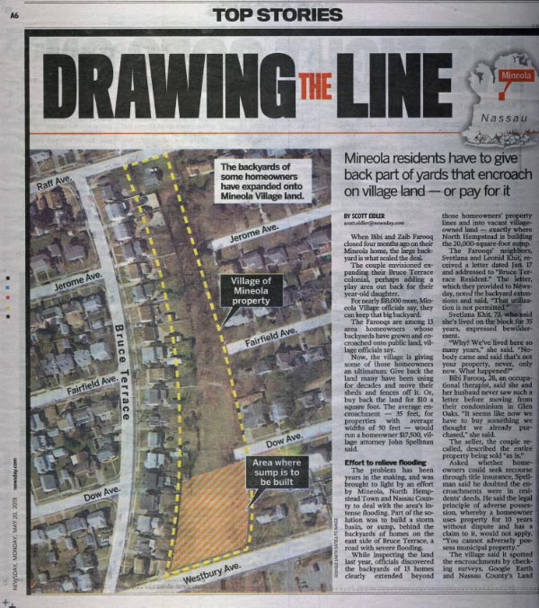
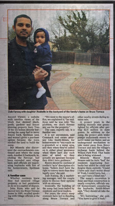
This area has been recently in the news due to efforts to provide flood mitigation to residents of Bruce Terrace. Members of the Long Island Motor Parkway Preservation Society will be following the project to ensure that remnants are not disturbed.
Update: May 20, 2013


Comments
What about the area south of Westbury Ave? Is that property off-limits to the public? We’ve explored the area on both sides but just up to a few feet in on each side but on the north it looks to be private property and to the south there is quite a bit of fencing.
James, I believe the areas both north and south of Westbury Avenue are both owned by the Village of Westbury.
Hi Howard. I’m familiar with this area ( work for National Grid/Lipa ). Maybe the pipe railing was put in for a safety purpose? The ground is level on this side of the parkway now, but perhaps the ground sloped down like the opposite side of the parkway before there were houses built? And to change the subject, I’m looking forward to the next bridge series; when your ready of course.
Brian
Brian, you may be right. I have never seen this type of railing any place else along the Motor Parkway
James, check out this page on my website for a view of some posts found on the southern side of Westbury Ave.
http://www.freewebs.com/limparkway/westburyavesouth.htm
I’m not sure about what I mentioned to be original roadway. These pics were taken within the last 4 or 5 years but I was there a weekend or two ago and did see one of the posts still there. But not much else.
South of Westbury Ave the old roadway is clearly visible in an area owned by the town of Westbury.It’s overgrown and has been used as a dump by the town.
The area to the south is largely owned by the village, but I forget if it is Mineola or Westbury. It would be nice if they cleaned it up. I don’t recall seeing the pipe railing north of Westbury Ave, but it was probably overgrown last time I was in there. It looks a lot cleaner now and much more visible pavement!
I have lived in this neighborhood all my life, since 1953. The area south of Westbury Ave is Village of Mineola property. The area north to Raff Ave was open when I was a kid and we used it as a walkway when headed from home to the Korvettes shopping center which was just east of the roadway. The south side was also not enclosed at the time. We both walked and road our bikes over these areas, never really realizing what they were or why they were there.
The ROW south of Westbury Ave. has been cleared by the Mineola Sanitation Department.