The 1913 Metropolitan Automobile Guide and the Long Island Motor Parkway
The lovely Roz found this 1913 publication The Metropolitan Automobile Guide at the Long Island Antiquarian Book & Paper Fair in Brookville on Saturday. It provides several insights on the Long Island Motor Parkway.
Enjoy,
Howard Kroplick
If you were planning an automobile tour around New York City in 1913, you likely had a copy of The Metropolitan Automobile Guide.
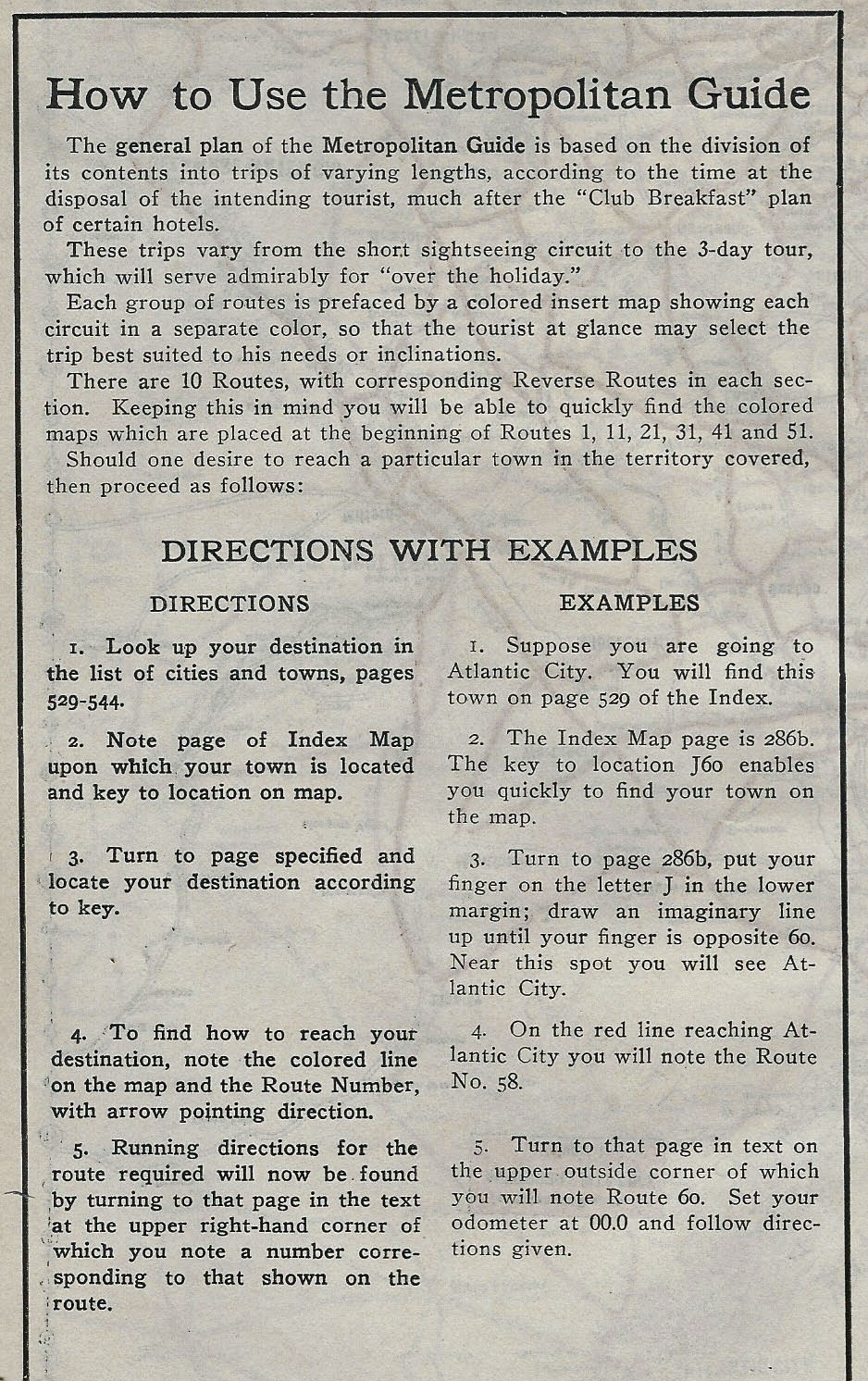
The Guide suggested long and short automobile trips with recommendations for routes, hotels and sight-seeing locations.
Long Island Map on Inside Cover Issued by the Long Island Motor Parkway
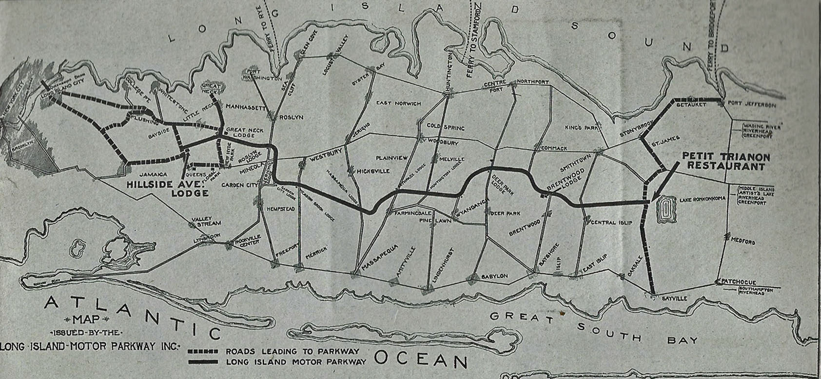
This map issued by the Long Island Motor Parkway was glued to the inside cover.
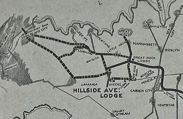
The arrow pointed to the Hillside Avenue Lodge. Oddly, it was not on Hillside Avenue and was not a lodge. The location was the entrance to the Motor Parkway at Rocky Hill Road (the western terminus in 1913.)
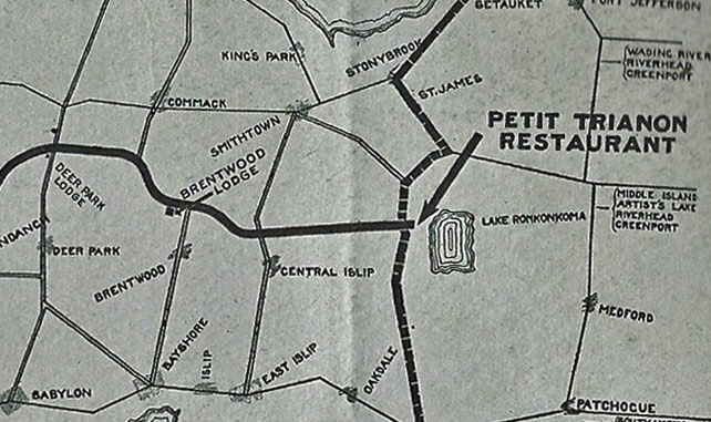
The other arrow pointed to the Petit Trianon at the eastern terminus of the Motor Parkway in Lake Ronkonkoma.
Petit Trianon Ad (Page1)
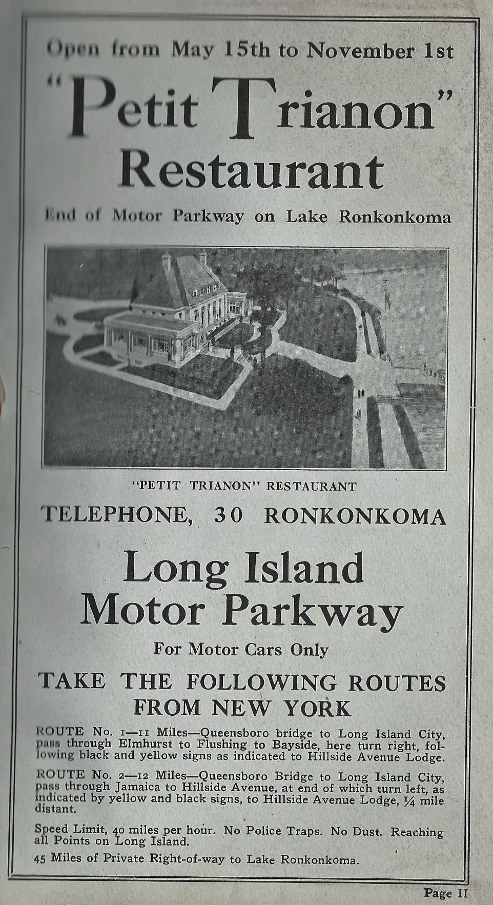
Opposite the Long Island Motor Parkway map, this was the ad for the "Petit Trianon" Restaurant, Open from May 15th to November 1st.
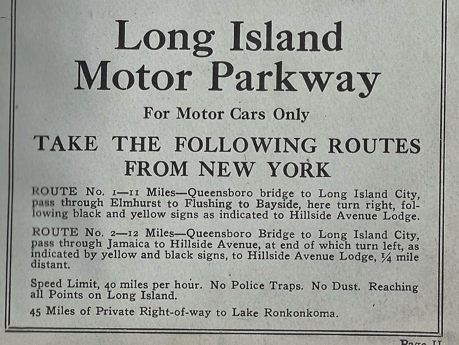
The route to the Motor Parkway was described.
Note the highlighted features:
-Speed limit 40 miles per hour.
-No Police Traps.
-No Dust
-Reaching all Points on Long Island
-45 Miles of Private Right-of-Way to Lake Ronkonkoma
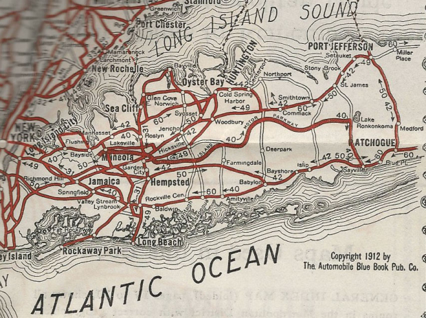
Long Island Maps Showing the Motor Parkway
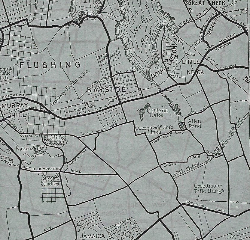
Queens from the 1913 western terminus at Rocky Hill Road.
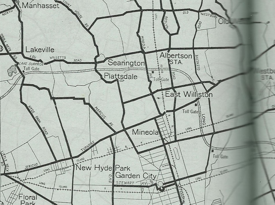
Lake Success to Garden City.
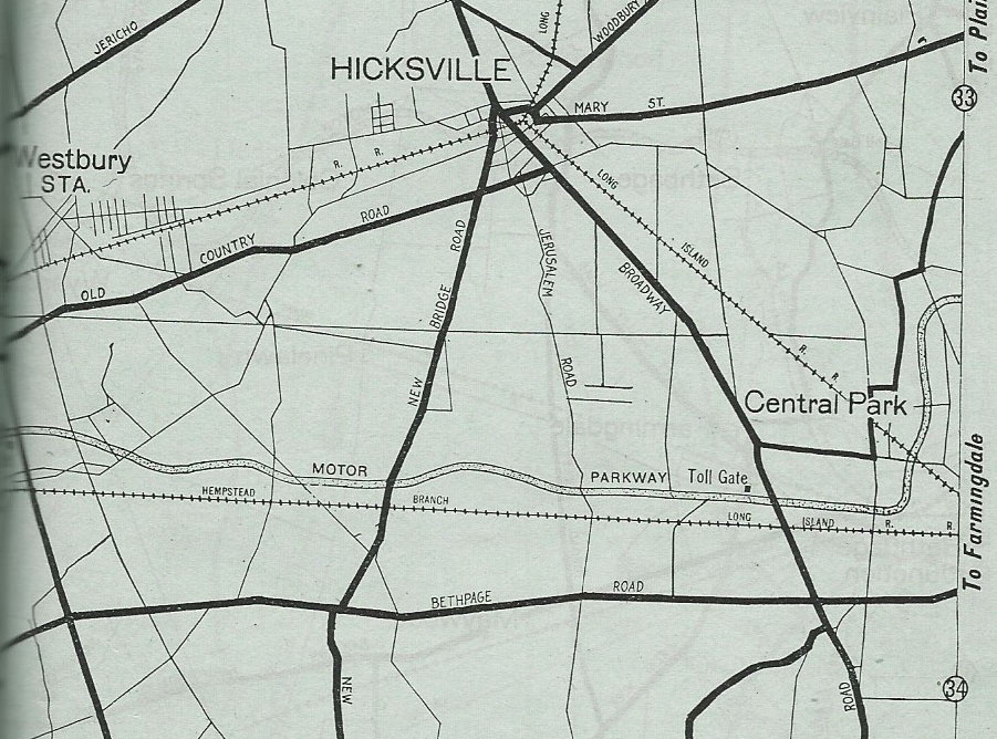
East Meadow to Central Park (Bethpage)
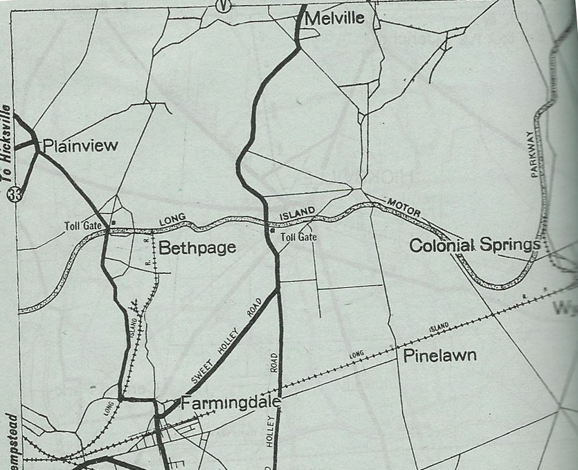
Bethpage (now Old Bethpage) to Colonial Springs (Half-Hollows Hills)
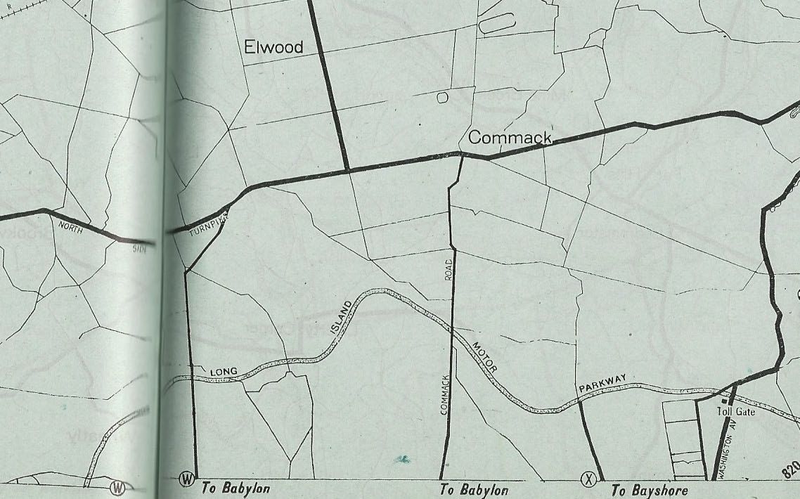
Commack to Brentwood.


Comments
Nice catch Roz. This one is a first for me and most likely not published anywhere. These things are extremely rare to come by and you were at the right place at the right time! Very nice.
Check out Old Courthouse Rd extending to the north. I was unable to connect it to anywhere. Is East Shore Rd its continuous route?
Great find, Roz!
Very good find. The map portraying Bethpage and Colonial Springs exhibit LIRR spurs extending to the LIMP northwards in 2 areas. I know spurs existed in Bethpage and Colonial Springs for the transportation of bricks. The spurs impacting the LIMP is what I’m not so sure of.
TRIANON?
My Google search revealed: “itdoesn’t really have a meaning, it is an actual name, though in either French or Spanish, “Trianon” suggests a special place with pleasant surroundings, beauty and balance”. Seems a suitable location after a strenuous motor trip and before returning to the City.
Thanks Howard !
GREAT FIND ROZ !!!