Opportunity to Provide Input on the Motor Parkway Trail
As reported on November 6, 2009, the contract for developing a master plan for a Motor Parkway Trailway in Nassau County has been awarded to VHB Engineering, Surveying and Landscape Architecture, P.C. Here is an opportunity to provide your input on the master plan.
The project description for the Trailway as issued by Nassau County is as follow:
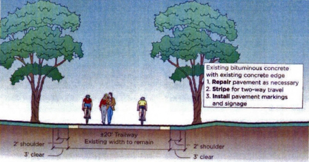
This project entails the preparation of a master plan for the preservation of the entire route of the Long Island Motor Parkway (Vanderbilt Parkway), a historic roadway that could become a valuable greenbelt and recreational trail. This project also includes the installation of route and historic signs, and construction of the initial phase of the master plan. Nassau County will fund cleaning of greenways.
It is anticipated that a small section of the Motor Parkway right-of-way will be developed. The big question is; Where should this pilot be located?
Please provide your input in a comment in the Blog or by sending an email to [email protected] on where you suggest the section of the Motor Parkway should be initially developed. I will forward your feedback to VHB Engineering.
Here are possible pilot locations moving from west to east. Please feel free to add other suggested areas:
-Lake Success: On the property of Great Neck South High School
November 24, 2009 Update: Art's Motor Parkway Site's views of Lake Success
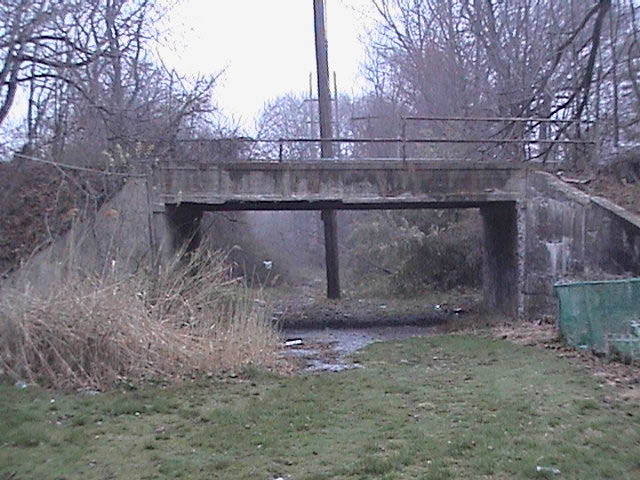
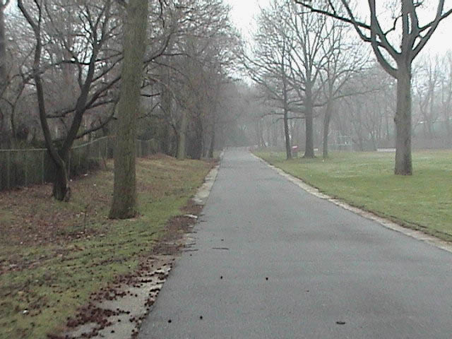
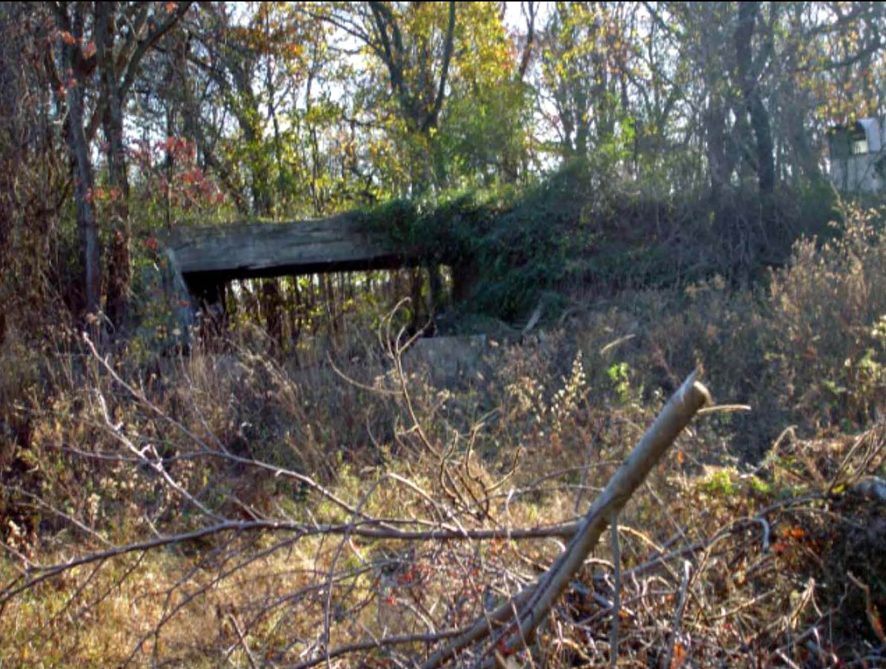
-Manhasset Hills: Includes the existing Old Courthouse Road Bridge over the Motor Parkway
November 24, 2009 Update: Art's Motor Parkway Site's views of Old Courthouse Road
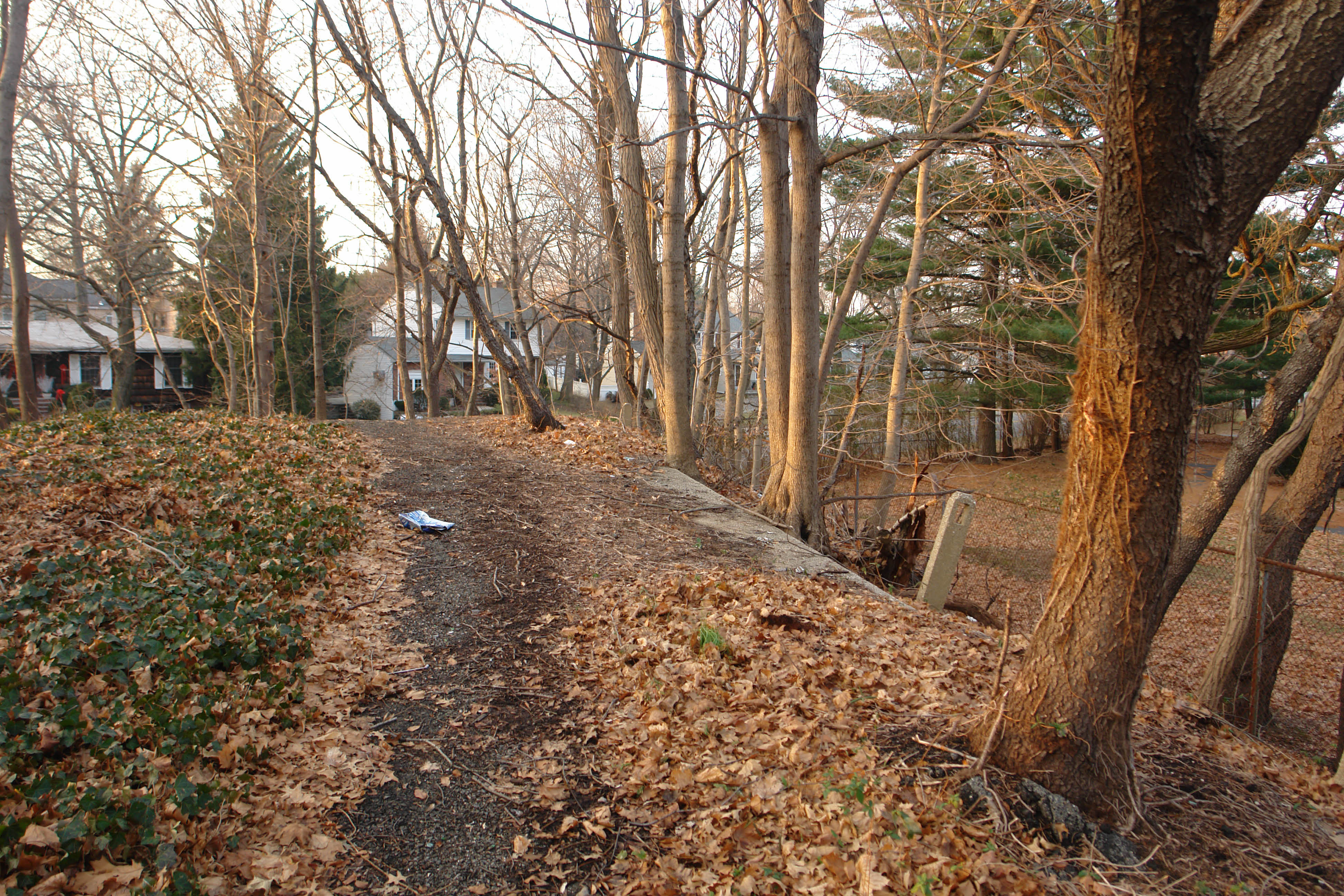
-Garden City : Former site of the Clinton Road Bridge, the original Garden City Lodge and the General Manager's Home
November 24, 2009 Update: Art's Motor Parkway Site's views of Clinton Road #1
November 24, 2009 Update: Art's Motor Parkway Site's views of Clinton Road #2
November 24, 2009 Update: Art's Motor Parkway Site's views of Clinton Road #3
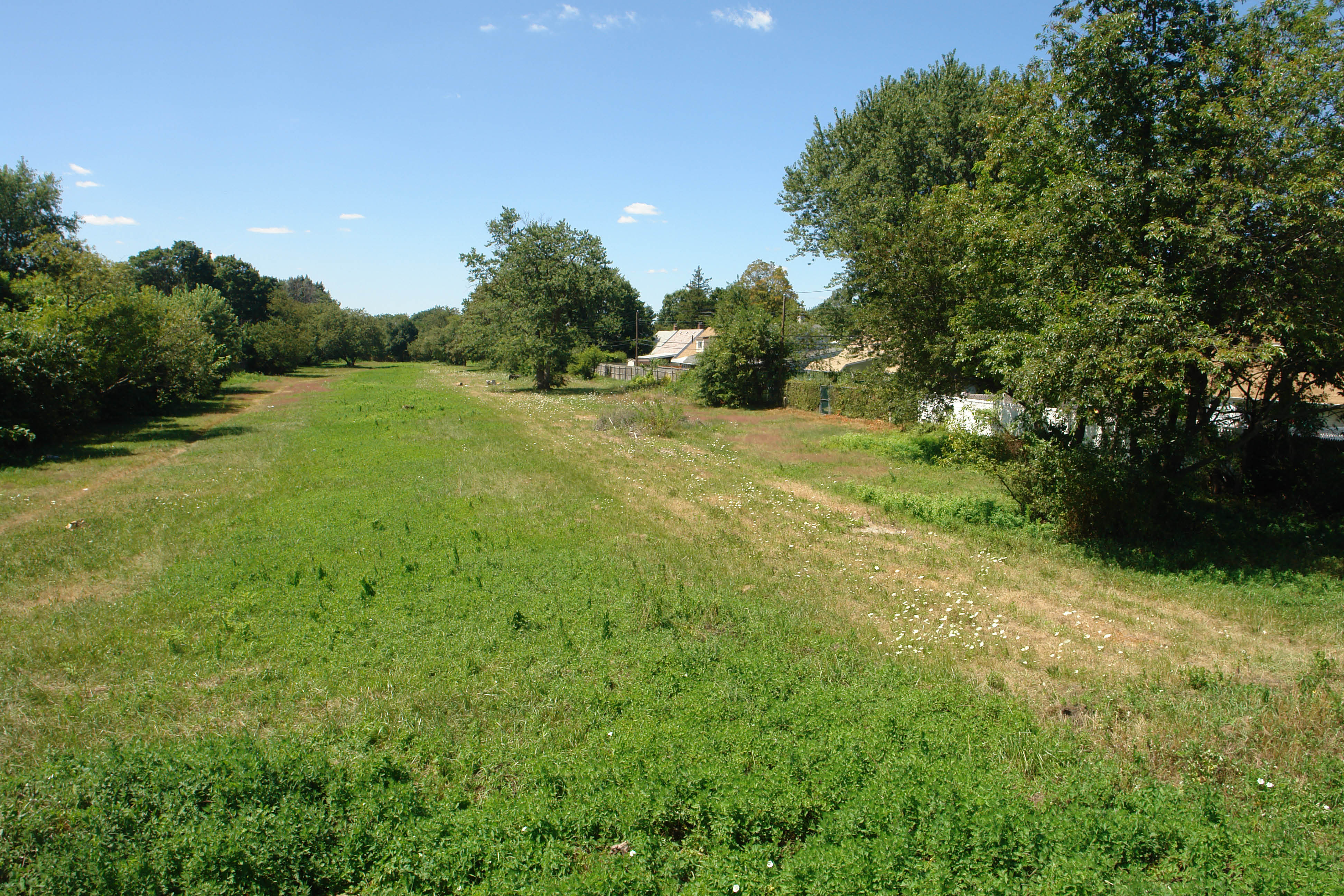
-Levittown: Former site of the Vanderbilt Cup Race grandstand and press box near Orchid Road and Skimmer Road
November 24, 2009 Update: Art's Motor Parkway Site's views of the grandstand area
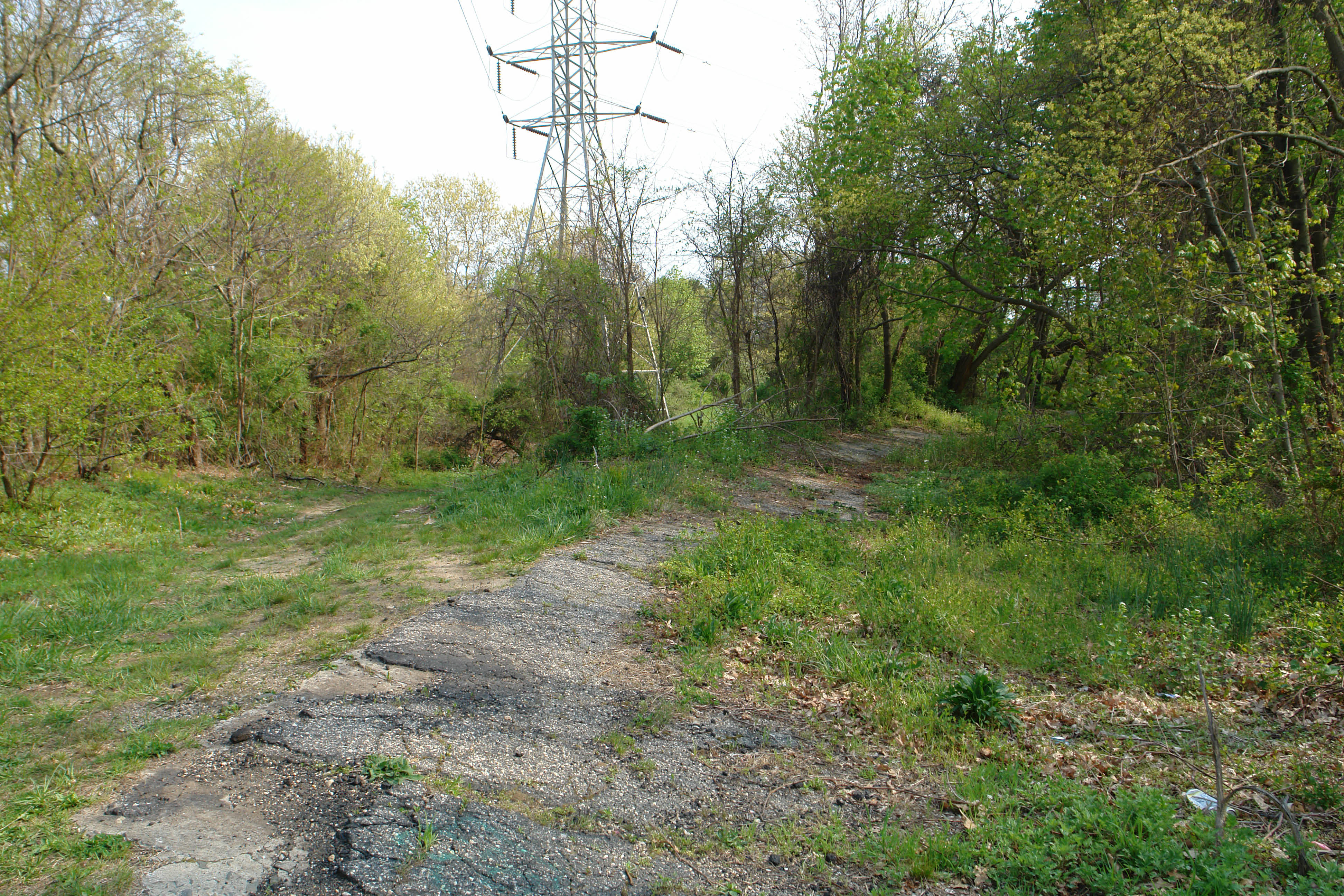
-Bethpage: Site of Deadman's Curve at N.Hermann Road and Sofia Road
November 24, 2009 Update: Art's Motor Parkway Site's views of Deadman's Curve #1
November 24, 2009 Update: Art's Motor Parkway Site's 2009 views of Deadman's Curve
November 24, 2009 Update: Art's Motor Parkway Site's views of Sophia Street's posts
November 24, 2009 Update: Art's Motor Parkway Site's views of Deadman's Curve #4
-Farmingdale: Located in Bethpage State Park
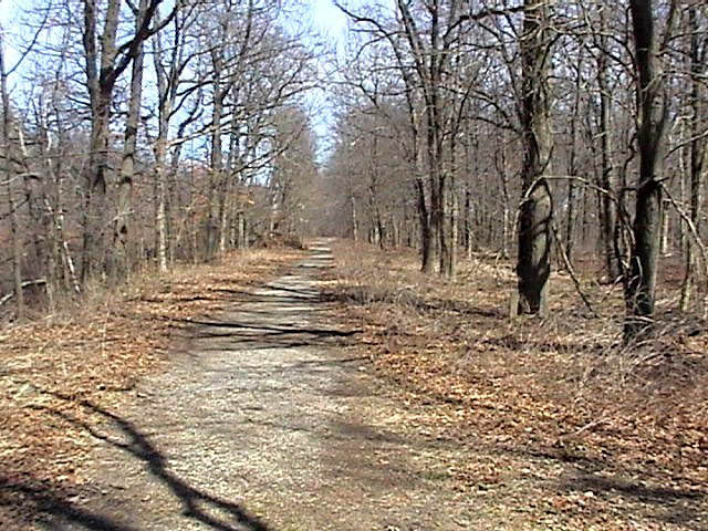
-Old Bethpage: Located in Battle Row Campgrounds including remnants of Round Swamp Road Bridge
November 24, 2009 Update: Art's Motor Parkway Site's views of Battle Row Campgrounds
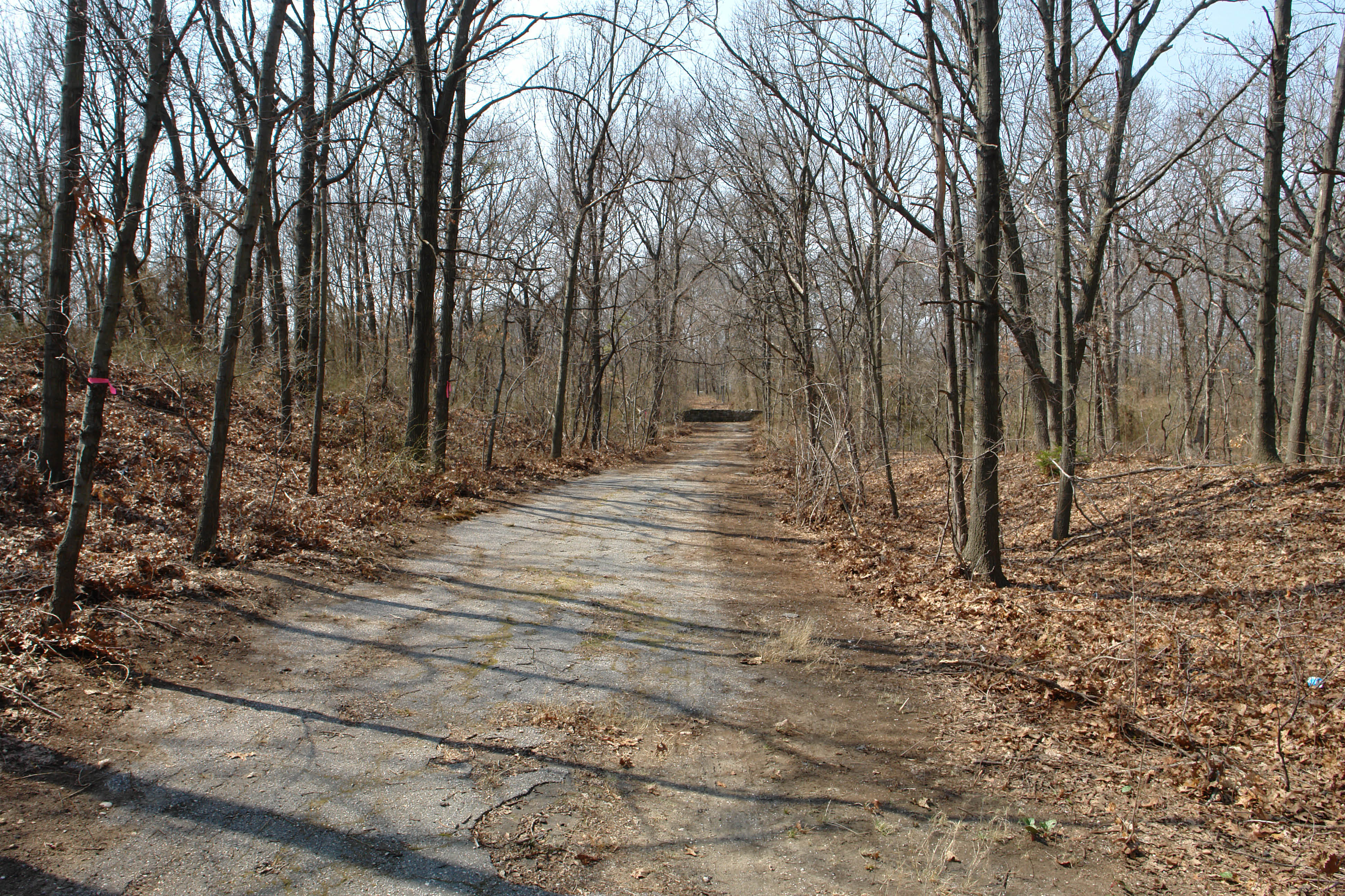
-Old Bethpage: Motor Parkway located in the Restoration Village including the existing farmway bridge
November 24, 2009 Update: Art's Motor Parkway Site's views of the Restoration bridge
Links to related posts on VanderbiltCupRaces.com:


Comments
I favor Great Neck South (Lakeville to Northern State) at the west end and Battle Row Campground (Round Swamp to Sweet Hollow-Spagnoli) and Old Bethpage Village Restoration (Sweet Hollow-Spagnoli to the County Line) at the east end. Those segments are simply gorgeous and also require relatively little work.
Also, are we restricted to only one segment? If only one, I’d prefer the east end. Where does this leave us in regard to the urgencies, such as Deadman’s Curve?
Of course, the northern (Botto) segment in Bethpage State Park is already 98% clear and improved and magnificent, so we should help the State to monument their segment and open the fence at JoAnn and Schoolhouse at the same time as the County presents the pilot section.
Having so stated, I am truly thrilled that ANY segment will be upgraded and offered up for the public to enjoy.
The easternmost section, east of Bethpage State Park that Sam mentioned, would also be a nice segment as long as we mark the short on-street section from Bethpage to Battle Row so people can find their way to it. I believe the section within BSP is already going to be renovated as part of the state plan to extend the Bethpage Bikeway so we need to check on the status of that project and if in fact they are still going to cover the entire original route through the park and make the proper repairs to the 60 or so foot missing part of that banked curve. The state already installed a new opening in the fence at Joann and Schoolhouse where the parkway exits the park. And we recently spotted some intact pavement north of the old Botto fence under the decades of overgrowth that was cleared, chances are more is buried under the leaves and soil. The sections east of BSP are also on county owned parkland and do not have any LIPA poles located on the right of way.
Great Neck South HS would also be a great site but only if we can make it contiguous all the way over to Herricks HS, which would cover a few miles.
The old right of way (and much of the original roadbed) already exists, we just need to figure out how to get safely across the Northern State Parkway.
I think we’ll need more funding for that, but we can only hope that we’ll find it sooner rather than later. Once we have an agreement with LIPA, that segment merely needs stripping and resurfacing in most spots. The type of power pole there are typical wooden poles used along roadsides.
The area west of Bethpage State Park including Deadman’s curve is still my favorite for reasons including connectivity to contiguous pathways at Bethpage Bikeway, historical and engineering significance, and threat of loss by neglect or encroachment. One adjacent house seems to have part of his yard extended onto the west side of the curve by a few feet.
Of course extending the trail eastward from the Wantagh Parkway is also a good idea for trail connectivity but it has little original roadway and little danger of loss of right of way at this point. So while we’d be thrilled to see any segment built, that just west of Seaford-Oyster Bay Expressway section including the curve will remain my personal first choice.
Thanks again!
Denis
Keep in mind that if any of this land is owned by a municipality and has been used for recreational purposes, selling it off could be considered an alientation of parkland. Alienations of land are not just for land that is designated parkland, but could include land that by use is considered parkland.
Here is the link:
http://www.nysparks.state.ny.us/publications/
Look under Guidance and Policy Documents
What should be saved in LI? Any portion that would provide the public with the easiest access. I guess Great Neck South would be closed to the public for most of the time. Would Bethpage also be closed most of the time? Is there any way to join the right of way on the State bicycle path that cuts through Woodbury (the old right of way for the never built Bethpage State Parkway) with the remains of the parkway as a deadend spur?
What is meant by “developed”? Perhaps restoration of all the remaining roadway with it’s features - maybe a couple of bridges; rest stops for hikers, interpretive kiosks or even a toll house/museum. Think Big.
My vote goes to the Levittown section, where the original grandstand stood. It is more central than the Bethpage and Great Neck sections.
I believe some lands in Levittown were sold by the county years ago before the trail effort began, but the developer was unable to get permits to build homes that many local residents thought were too large. I am not sure of the current plans for those lands, but the people would like to see them preserved as open space and trails.
Thanks for the feedback, so far. More comments and suggestions are very much welcomed.
My favorite section for a pilot section for the MTP (Motor Parkway Trailway) is in Levittown parallel to Orchid Road. The reasons are as follows:
1. The land is open and free of obstruction and homes and, as noted by Tim, centrally located on Long Island.
2. It is historically important as a section of the original Motor Parkway opened in October 1908, the site of the Vanderbilt Cup Race grandstand, press box, service pits, Start-Finish Line and even the Long Island Aviation Club. Historical markers would be perfect for this sectionl. An archeological dig could also be set up at the race pits with a local university such as Hofstra.
3. Sections of the roadway are still there and even two concrete Motor Parkway posts
4. There is room for bike and car parking
5. Very important- As noted by Denis, the Levittown residents surrounding this land are 100% in favor of building a greenway park here. It is currently used as a walking path. Every few years the residents fight off land developers who want to build homes on the property.
Here is a film on the area:
http://www.vanderbiltcupraces.com/index.php/blog/article/saturday_june_27_2009_the_levittown_vanderbilt_cup_race_grandstand
Enjoy,
Howard
Howard - thanks for the opportunity to provide comments:
1. Levittown stretch for all the reasons above and two more - I live about 2 minutes from the grandstand site and there is also a stretch in Levittown before the grandstand site, along Salisbury Park Drive that could be included. Here’s some more info. on that - http://www.freewebs.com/limparkway/levittownsalisburypkdr.htm
2. Dead Man’s Curve - best example of how the Motor Parkway was developed including long stretches of the curved banking, many posts in the area, entact pieces of roadway, very tranquil, would possibly limit its current use as a teenage hangout, and maybe the most important, its close to the starting point of the Parkway and the groundbreaking ceremony.
Hey Guys I am currently putting together a petition to allow the Motor Parkway Greenway in Queens further east (over Winchester to Little Neck Parkway), so I’d be lying if I said I wasn’t partial to the Great Neck section. However, if people in Levittown are least opposed to the building of the trail, then obviously they should get the first chance. That being said, I believe people are referring to the section between Pintail Lane and Bloomingdale Road is that of sufficient length for the “proof of concept”? If however we are talking about the portion along Salisbury Park Drive through the “grandstands” and if you could somehow link the grandstands section with the section from Universe Drive to Bethpage bikeway that would be a really strong proposal I believe Once the master plan is assembled, we should organize a letter writing campaign to get every congressman on Long Island from Coney Island to Shelter Island to appropriate funds for the full build out.
Joby:
Good suggestions!
Howard
It is my belief that the pilot should be where the ground breaking ceremony took place. It is the most appropriate spot given the historical significance it holds.
Hi Christopher:
Thanks for the comment.
Here is a link to more information on the location of the ground-breaking ceremony.
http://www.vanderbiltcupraces.com/index.php/blog/article/thursday_4_22_2010_the_ground-breaking_ceremony_for_the_long_island_motor_p
Howard
Hi Howard! I am very impressed with the many people who want to preserve the land of the LIMP. We desperately need the opportunity to preserve our local history and the benefits of trails is an added bonus. A great way to involve the people from the surrounding towns to come together and work for the good of this project.