Then & Now: The Motor Parkway Around Roosevelt Field
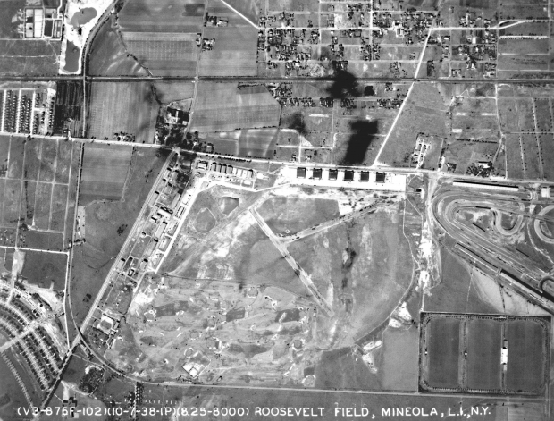
Izzy, as shown in the above 1938 aerial, the Long Island Motor Parkway was located to the west and south of the historic airfield Roosevelt Field.
From north to south, the parkway can seen going over the Long Island Rail Road and under Old Country Road. At the bottom of the photo, the parkway headed east by crossing over Clinton Road. The original Old Westbury Golf Club adjoining the parkway can be seen below the airfield.
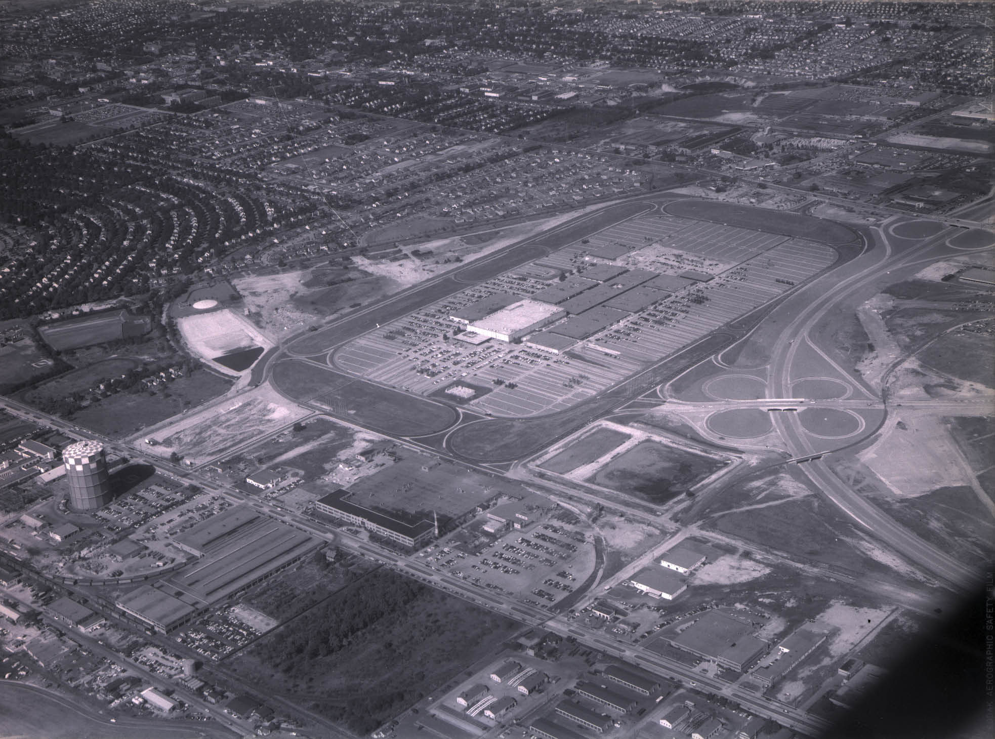
This is a similar view of this area as seen in 1956. The airfield and golf course were replaced by Long Island's first and largest shopping mall Roosevelt Field. The Motor Parkway right-of-way was still easy to identify.
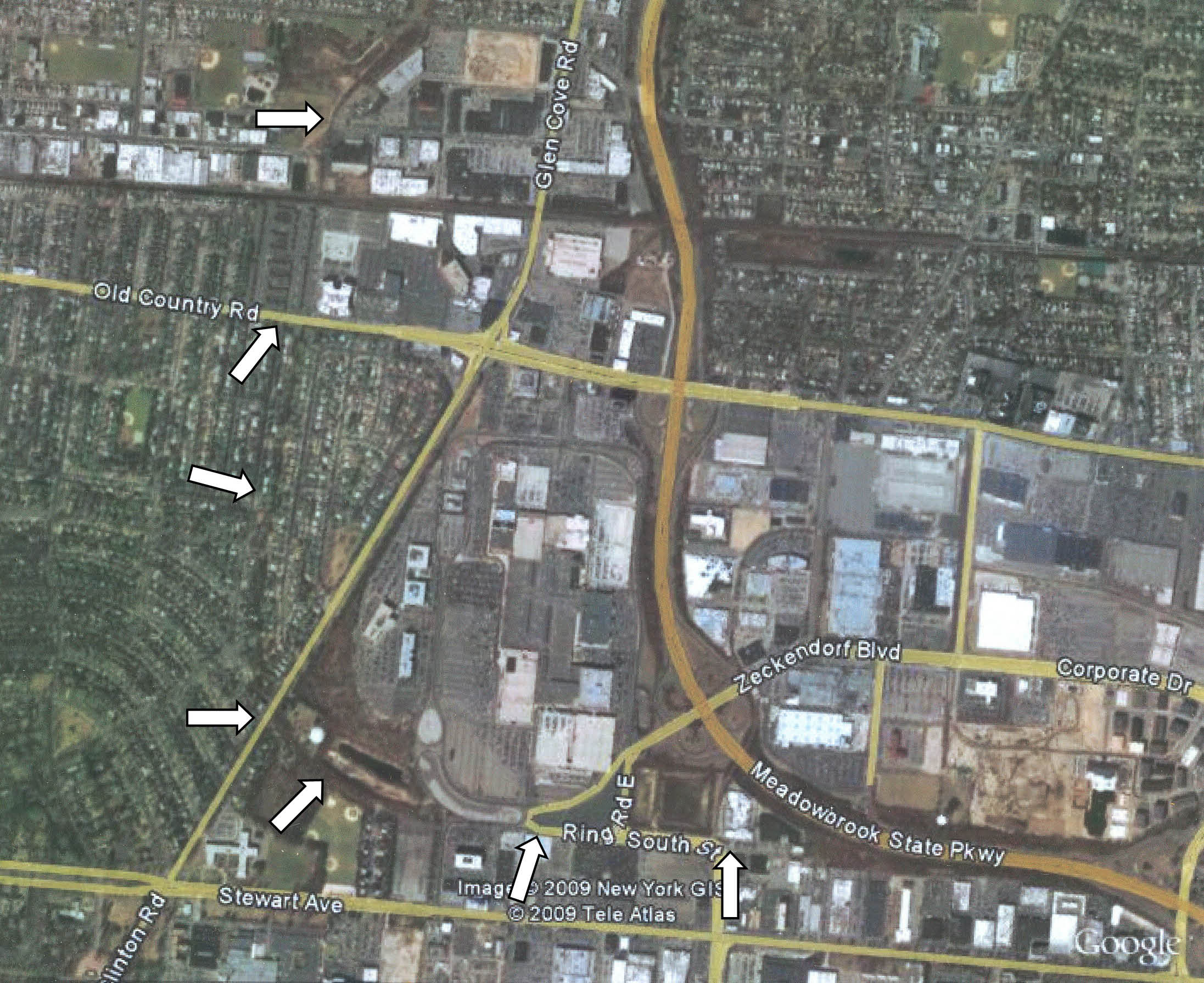
This is a current aerial view of Roosevelt Field courtesy of Google Earth. I have outlined the right-of-way for the Motor Parkway. Today when you are driving on the south service road of the Roosevelt Field Shopping Mallor South Street, you are on a rare section of the Long Island Motor Parkway that is still being used as a road in Nassau County!
Reminder: Join us on Sunday, July 26that Roosevelt Field for the Second Annual Vanderbilt Autocross and Concours.


Comments
I grew up in Mineola near a section of the Parkway. I stumbled upon your book at the barnes and Noble in Massapequa.
It is a wonderful resource and a tremendous piece of local history.
Congratulations on a wonderful piece of research and writing and for this fine website
This was a great find today in my inbox. You see when I was a little boy, about 11 or 12 years old I moved to Garden City. I lived on Chestnut Street and I used to walk to Roosevelt Field to go to the Mall. I found a short cut with my friends; it was along a semi-paved section of road, just behind a school. It was overgrown with trees that led to the corner of the mall. We took it for years…it’s behind Steward Ave School, then behind a small Park, then behind the old parking lot for Newsday and it wasn’t until I was older that I discovered it went all the way to Clinton Ave, where a small house stood on the opposite side of Clinton Ave. Strange I thought, that it would sit all alone on the opposite side of the street and such a busy street too. I discovered it when I was 13, and discovered it once again from a friend that told me it was a toll house left over from a highway built in the ‘30’s.
What’s so cool is we used that road all the time, I wonder if pieces of it are still there? I know the toll house is, I remember seeing it all the time, as we went up Clinton Ave to Old Country Rd.
I used to walk to Mitchell Filed too, to watch the radio Control airplanes as a boy fly on the old runways, I saw a Harrier Jump jet perform at an air show in the late ‘70’s at Mitchell Filed with my Mom and sisters, and I played hockey on early winter mornings in a hanger at Mitchell filed when I was 17.
I knew the history of the area, but only now do I realize the significance, and how rich a history that lived in this part of Long Island. The Rainbow division Bivwacked at Mitchell field, and Garden City, before the moved out to France, my Grandfather being part of them. The monument is just next to the old unused train station on Clinton Ave in Garden City. Would War 2 aircraft were built at the old Pendeflex file factory along Steward Ave, and then flown out of Mitchell field. I live in Brooklyn now and play hockey at Floyd Bennet field, where at least some of the history of aircraft of generations ago has been preserved, and it seems as if at least some folks are caring for and preserving our past on Long Island, and that’s great to see.
Hi John and Gene:
Thanks for your positive comments!
FYI, pieces of the Motor Parkway and several concrete posts are still near the Clinton Road Bridge location. The Garden City Lodge has been preserved and has been relocated to Seventh Avenue in the village of Garden City.
http://www.vanderbiltcupraces.com/index.php/blog/article/toll_lodges_of_the_long_island_motor_parkway
Enjoy,
Howard
From Gordon White:
The maps of the 1908 Vanderbilt course, the 1937 Vanderbilt course and Roosevelt Field and the Motor Parkway are in my Lost Race Tracks book.
http://openlibrary.org/b/OL9419580M/Lost-Race-Tracks
Hello, my name is Patrick I’ve been living in garden city my whole life. I am currently twenty years old. I didn’t realize as a little kid I have also taking the left over road behind Stewart school. My friends and I have taken that road many times to the mall. Not until I was nineteen, I discovered this was a highway. This is the coolest thing. I wish I could find more about the old country road underpass