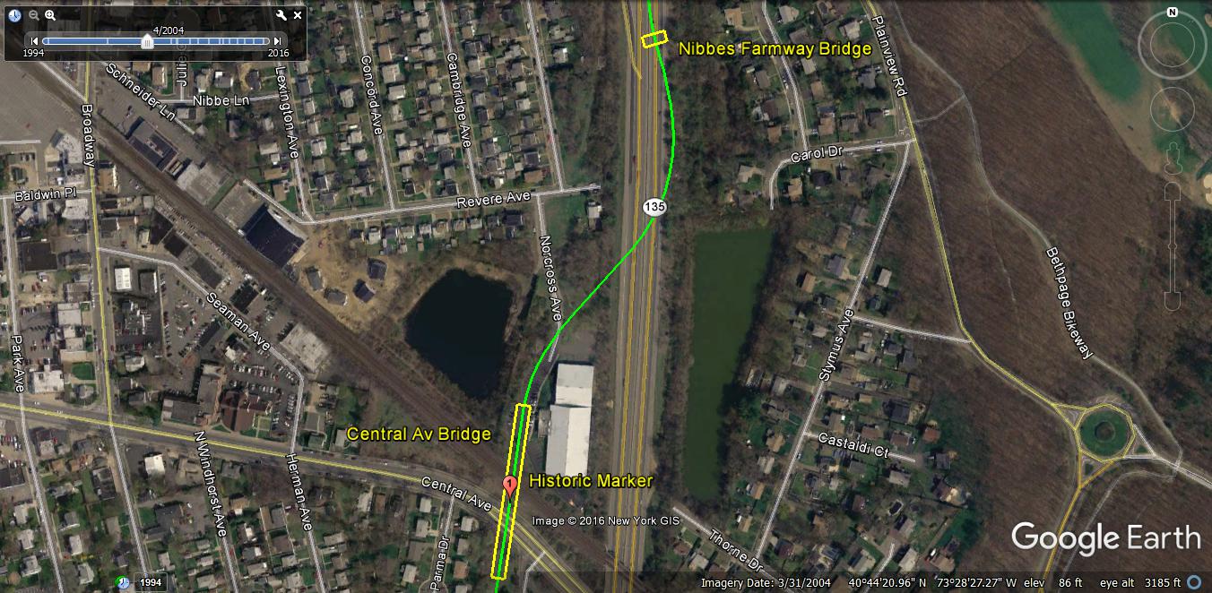
Sam & Dave’s “Excellent Motor Parkway Hike” II: Central Avenue to Caroline Street-Updated 5/10/2017

In the second of this new series, Sammy and Dave documented their excellent Motor Parkway hike from Central Avenue to Caroline Street in Bethpage.
Updated April 26, 2017: Frank Femenias has mapped out Sam & Dave's Bethpage hike.
Enjoy,
Howard Kroplick
On Sunday, April 2, 2017, Dave Russo and his 12-year old son Sammy embarked on their third annual "Vanderbilt Day". Instead of duplicating the Queens to Melville route, they decided to hike the "unknown" sections of the Motor Parkway from Bethpage to Dix Hills.
Dave Russo April 2, 2017: "The original plan was to start at the Maxess Road Bridge and work our way east but we feared that would not be long enough so we decided on a new starting point.....The starting point was Stewart Avenue in Bethpage and we made our way to Dix Hills. This time we left the bikes at home and walked 13 miles. And not a normal 13 miles, there were large portions of the exploration through woods, thorns and thickets. We both came out with many scratches and bites, but at the end of the day we completed our mission and can add another chapter to the memory book!"
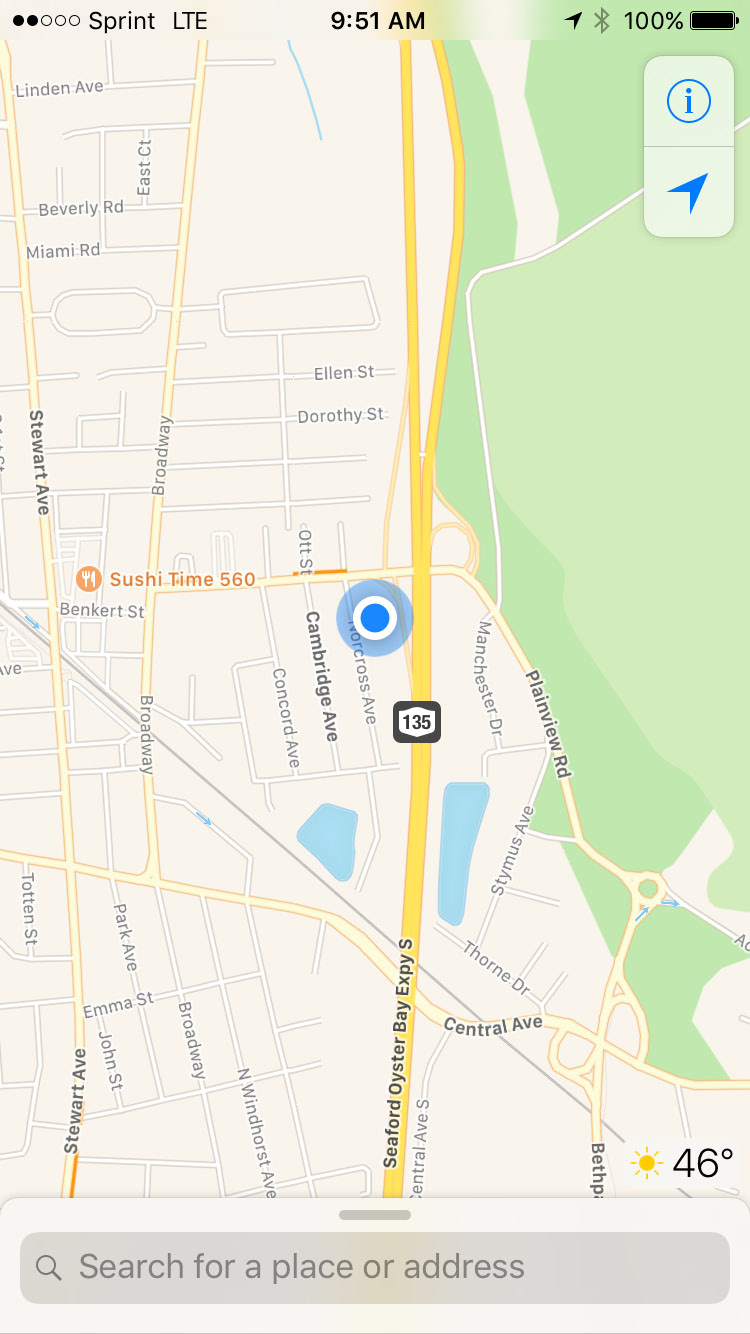
Hiking Area
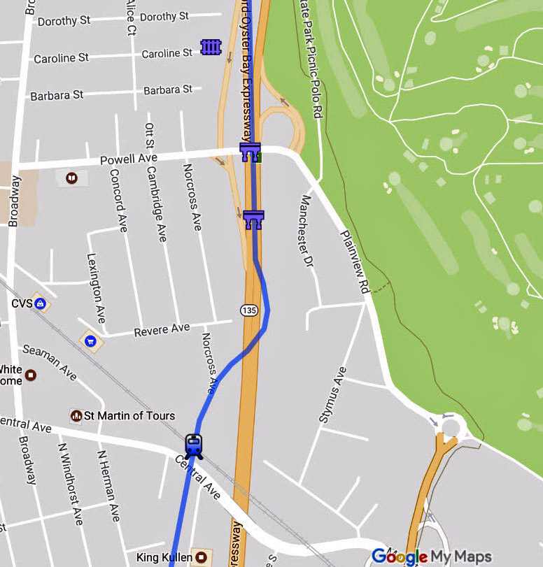
Submitted by Frank Femenias.
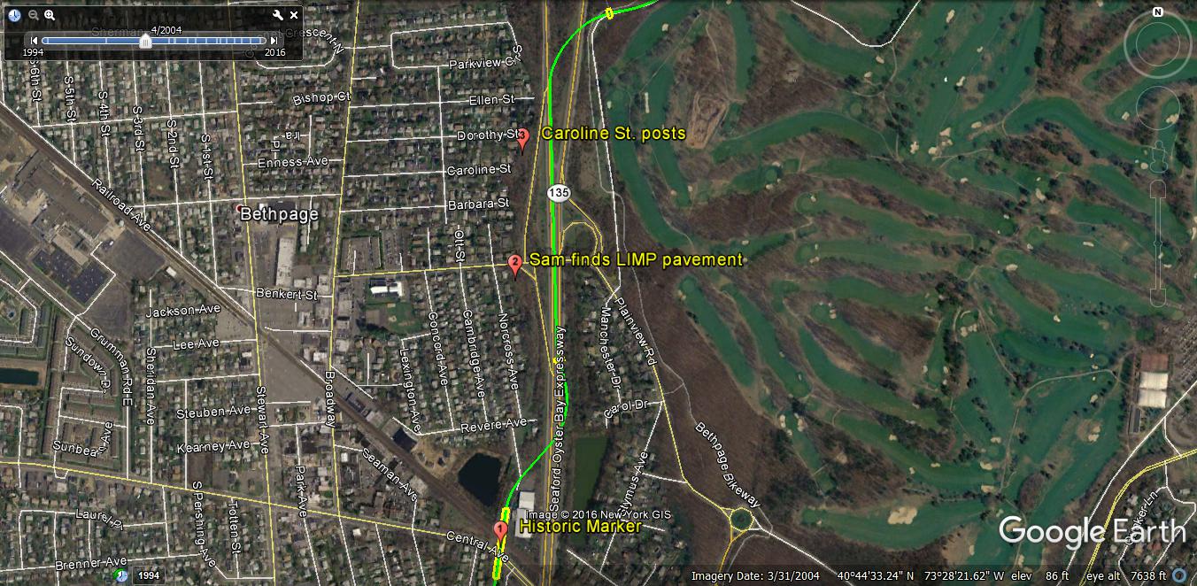
1907 Survey
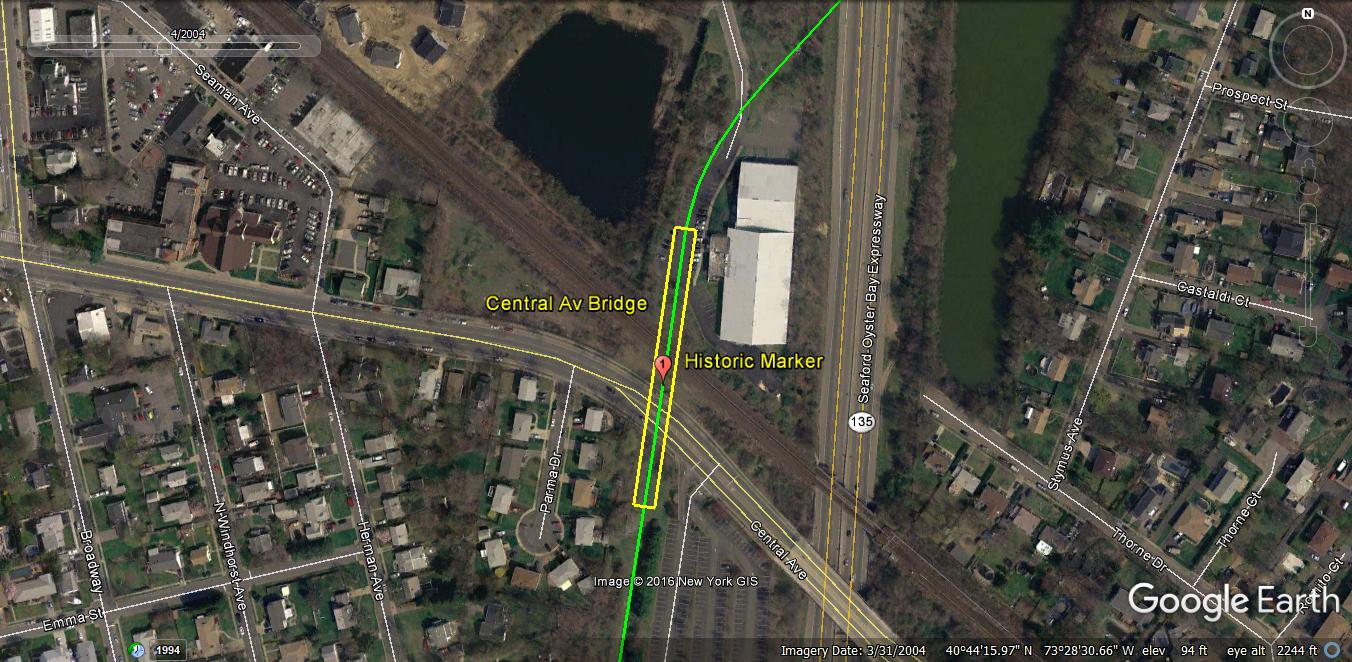
A 1907 survey of the Motor Parkway at Central Avenue and the LIRR.
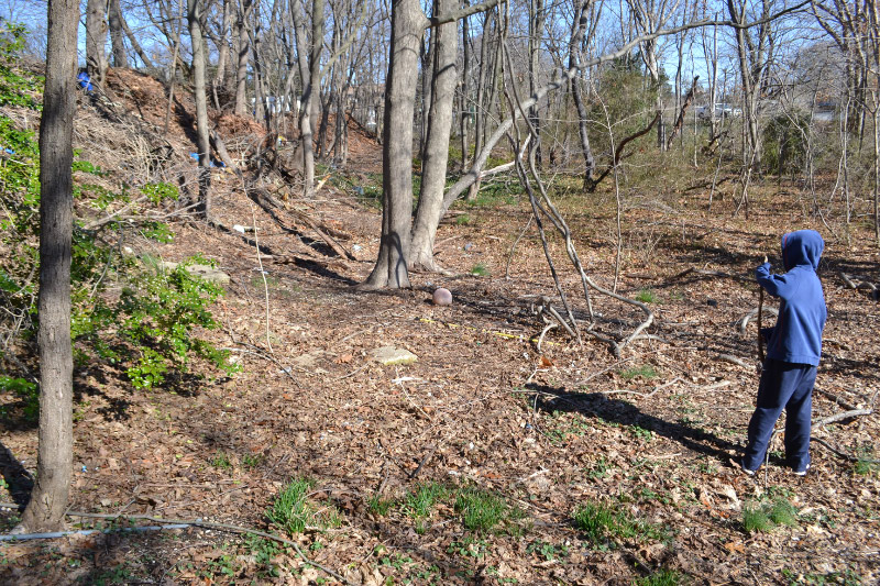
.South of Central Avenue and LIRR
On top of the Central Ave embankment looking north at historical marker in the distance.

The same embankment (far right) as seen in 1908.
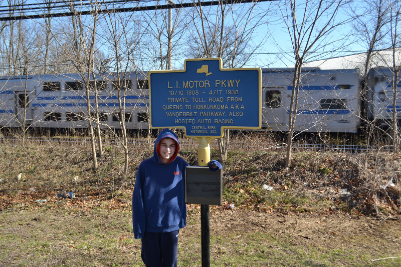
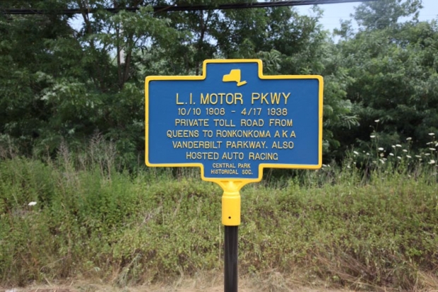
The historical marker
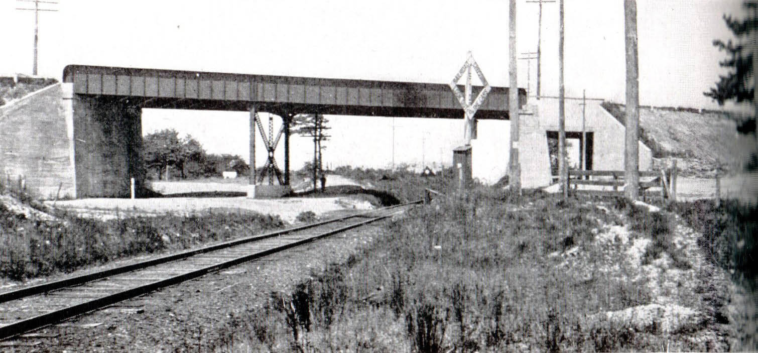
The completed Central Avenue/LRR Motor Parkway Bridge.
Central Avenue/LIRR Bridge (Submitted by Frank Femenias)
Nibbe Farmway Bridge (Submitted by Frank Femenias)
.North of Central Avenue and LIRR
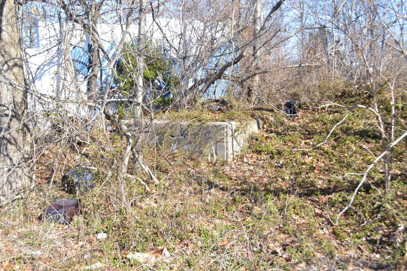
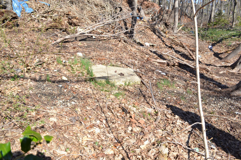
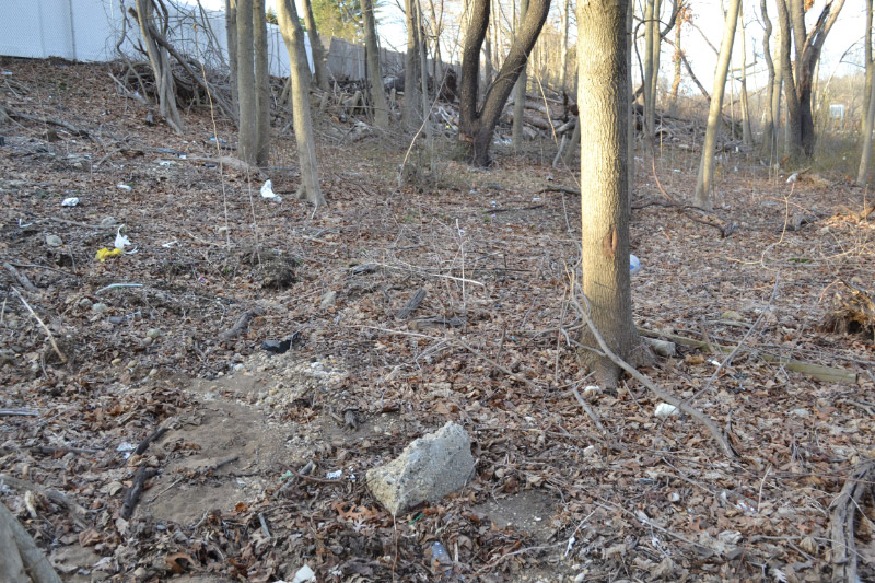
What could this be? Remaining abutment piece from train bridge??? We never noticed this before. The location can be seen in the first photo,to the extreme left and next to the white fence.
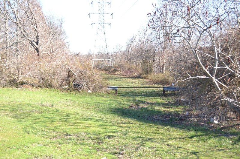
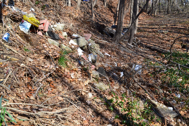
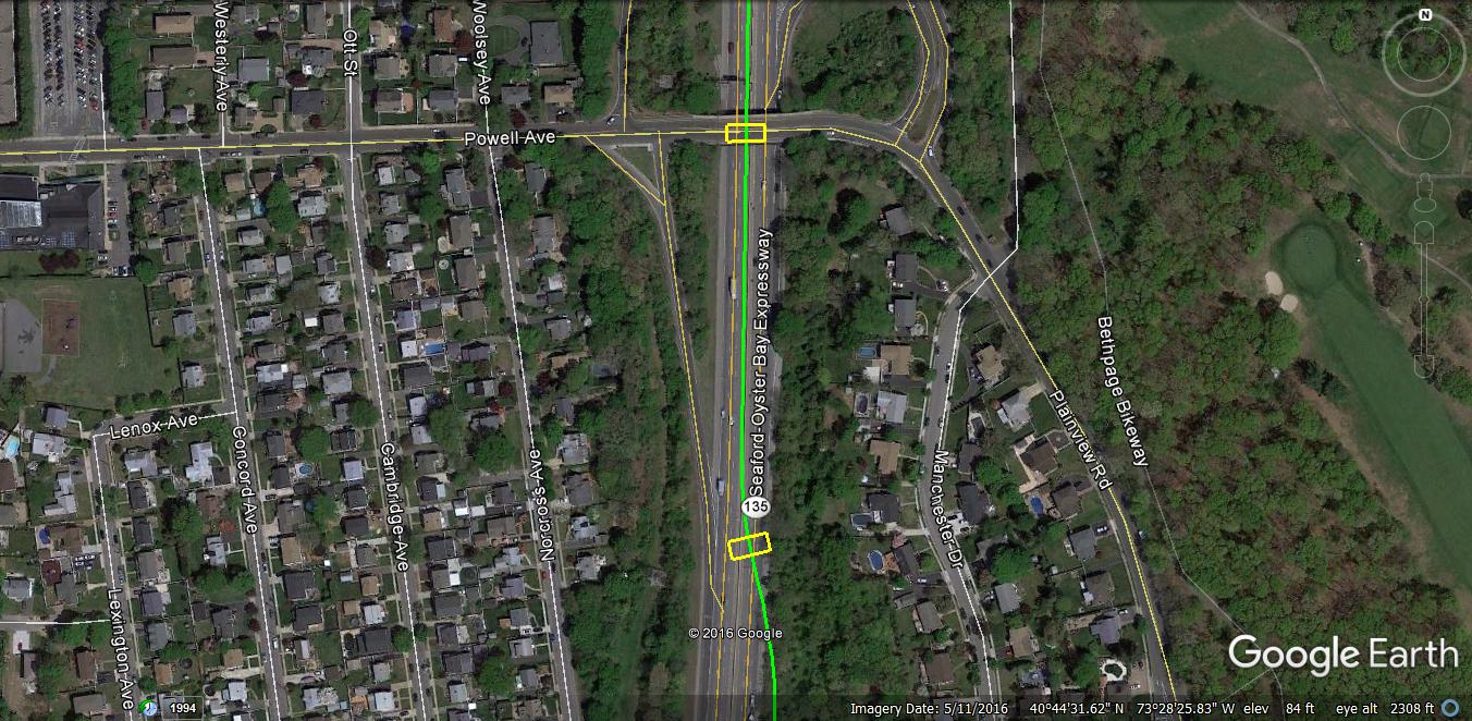
Now remember the LIMP was consistently to the LEFT of the power lines, but now according to Wayne's map the LIMP takes a rather dramatic right hand turn over the present day Seaford Oyster Bay. Well we went over to the other side and found absolutely nothing. But we stayed to the left of 135 and found tons of road fragments!
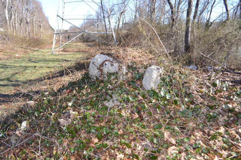
We could send you ten more pictures of LIMP fragments like this one on the west side of 135. None on the east side.
South of Powell Avenue
Now this I believe might be our first major discovery of Vanderbilt Day III. Again Wayne's map shows the LIMP pretty much right in the middle of 135 in this location. But Sam actually veered to the west side of the thickets and found LIMP pavement in the weeds in this location (blue dot)!
Pavement!
Hard to argue with this!
Can anyone help with this one?
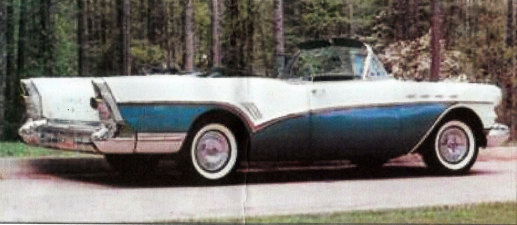
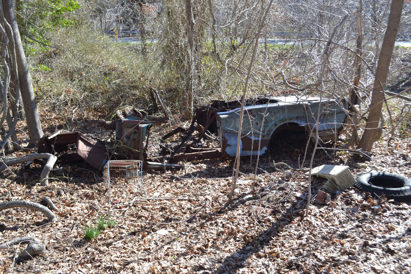
1957 Buick Super Convertible. Submitted by Mark Schaier.
Tons of pavement everywhere.
Nibbe Farmway Bridge and Powell Avenue Bridge (Submitted by Frank Femenias)
Near Caroline Street
Now if we follow this same route north - we continue to find pavement everywhere and it leads us right up to the famous Caroline Street posts off in the upper left! This would explain the location of these posts. Maybe there is some sort of mistake or issue when mapping this location using old aerials? Maybe something is off. I'm not the cartographer of the bunch, that honor belongs to Frank, but what I can tell you as the guy on the ground is that along this path that we walked there is pavement everywhere and it leads right up to the Caroline Street posts and stays to the left of the lines as it always did....consistency! And then it takes the sharp right hand easterly turn, following to the left of the lines again, into Bethpage State Park.
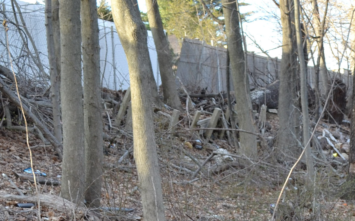
Caroline Street posts
Submitted by Frank Femenias.
Submitted by Frank Femenias.
Plainview Road Bridge (Submitted by Frank Femenias)


Comments
I looked at the 1953 aerial maps of LIMP in this area and my map seems to be correct in this area. Go to <https://www.historicaerials.com/aerials.php?op=home> and enter this in the search : “N40.74023 W73.47343” ( with out quotes). Click on the 1953 aerial and you will see the hard right (east) curve. For advanced users: I used the slider to superimpose the 2011 aerial with the 1953 aerial. I need another set of eyes to verify my current map. Thanks!!!
Another fantastic journey Sam and Dave, always looking forward to your photos. Where was the possible bridge abutment located? I could not locate the fence and white building in the back. I’m sending Howard some attachments with the Central Av RR bridge’s position, hoping it’s in this area. You may be onto something big here.
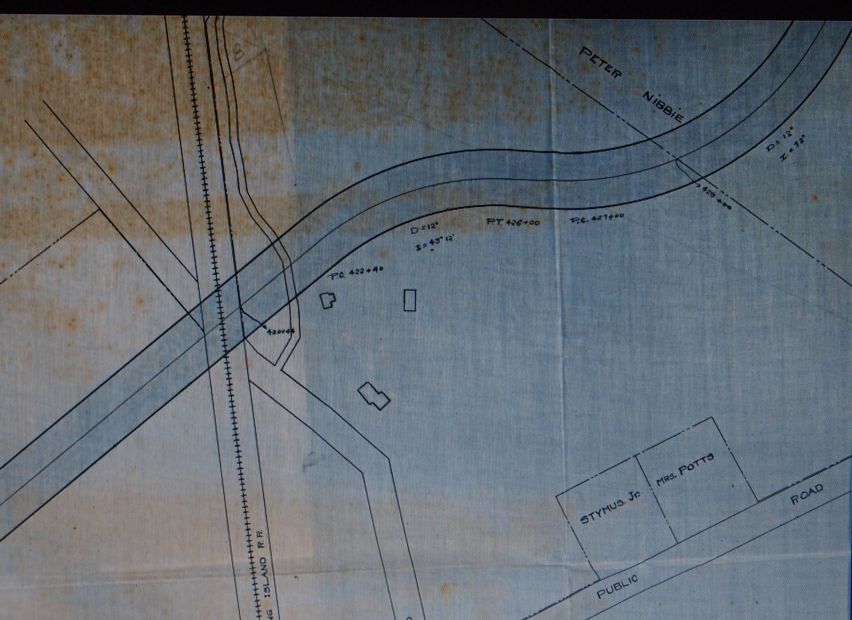
Dave - Wayne and I used different methods to draw this section of LIMP ROW and both obtained same results. Deadman’s curves was an appropriate name with its bizarre twists and turns, especially when ending a curve right at the bridge wall! This happened twice here at Nibbe’s and Plainview Rd. bridges. Most likely the result of failed attempts to acquire land for the road.
You guys did great! That photo of the concrete base/foundation near the white fence is significant. It had to be part of a past support structure. Then I thought that one photo was some kind of drainage culvert ( W/S of Rte 135 ). After expanding it…...Good one! Your right about the comparison of being the trekker and the science of old aerials, etc. When something is smack in front of you, it is what it is. It’s like that show ” What on Earth”. Satellite imagery finds interesting views from space. It’s not verified until someone views it on terra firma.
When building 135, they wiped the slate clean of any remnants, possibly using the west side as the collection site, the same side as the Caroline posts. There’s still a water shed on the east side to avoid.
Wayne—first of all thanks for your map, the single most important tool for LIMP navigation. The first time we did this mission your map was right by my side. Now I know it without your map! But I wonder how those such as Sam III did these exploration missions prior to internet mapping! Hats off to them.
I tried to check the aerial map site but do you have to register to see anything? Subscribe to the site? I wasn’t able to see anything. Most importantly…..Is there a map that shows the LIMP in place (portions) at the time of the construction of 135?? That would answer this question. What year was 135 built?
Frank—I knew someone would suggest that when creating the Seaford/Oyster Bay Expwy and digging up the LIMP they just discarded the debris to the west side. The problems: it’s not like it’s on the western edge. It’s pretty far in there. Did they pick the pieces up and carry them over? Also, according to Wayne’s map there is one section of LIMP where it was east of 135. We went there and there is nothing.
In the portions leading up to Central Ave, the actual in place remaining segments of the LIMP, they are slightly to the north or west of Wayne’s line. But I’m thinking there is some kind of aerial image issue with the map view online north of Central Ave because there is just so much there on the ground it is really hard to believe it was all just picked up and thrown over.
And it all makes sense! It follows the LIPA lines as it always did. Why stray at that point? The area itself looks like the LIMP - there is a clearing of sorts throughout. The road pieces are all there and then the Caroline St posts make alot more sense in terms of their placement, not their frequency….we’ll never know the answer to that one. By all means please go there for yourself and investigate!! It’s really hard to argue with what is on the ground! Suspend your Ronkonkoma investigation for a week and try this one! LOL.
Brian—-love the idea of that show “What on Earth”. They honestly just haven’t had the most interesting subject matter and they never really pursue it as much as they should to get the “ah-ha” moment but maybe it will get better.
You really can’t argue with what is found on the ground in place right now. It would be one thing if there was one piece of fragment, maybe you can chalk that up to coincidence, but there is so much. It’s there for anyone to see.
And others please chime in on that abutment piece. I have to look at that again in more detail. Maybe there is something else in there.
Regarding the LIPA lines, I know you worked there, is there any way to investigate their construction? They must have maps. Obviously they obtained the LIMP ROW and they followed it very closely for so much of the way, why would they deviate at this location? I dont think they did. And I’m not disputing it made a sharp turn to the east, just not in the exact location shown on Wayne’s map. Again the lines cross over 135 (sharp turn east) right after the Caroline St post location.
Frank—the possible abutment piece is on the north side of Central Ave and west of the historical marker. If you look at our first photo on this post from the top of the abutment looking over Central Ave you can see the white fence to the extreme left. I know the bug is biting you on this one….you have to go and investigate!
Hi Dave. A good website for the history of roads etc. is “nycroads.com”. This site includes the major roads of Long Island as well.
I had a grid map book of all the now PSEG LI TRANSMISSION ROWS while at work ( Wish I brought one home ). Even though my memory is OK, I’ll see if I can get a hold of one. Their quite detailed ( the older maps used to show the LIMP, but not the newer maps. If I can obtain the grid book, we could just draw the LIMP on the pages.)
LILCO obtained a good portion of the LIMP ROW fairly soon after the parkway closed. I don’t know the exact year, but I’ve seen many older aerials on Howard’s site here that show the towers running right along side of the LIMP. Quite a few LIMP bridges were still in existence in those times. Ex: Plainview Rd bridge. If you haven’t already, try the SEARCH option here. I use it quite a bit when I’m looking for a particular subject. About the LIMP naturally.
I have been going on NETonline Historic Aerial maps for looking over place in Connecticut. Not all places have a wide variety of times aerial photos were taken over a said city. But I fond a 1953 aerial of Bethpage, and see the LIMP clearly at “Dead Man’s Curve, and into the Bethpage St. Park. Anyone interested link:
https://www.historicaerials.com/aerials.php?
lon=-76.601138137217&scale=5&lat=39.329990696388&year=1964 and type in wanted location
Yesterday I went to site where the vintage car that in the your photo that I could not identify, the car is a body shell of a 1957 Buick Super convertible. As far the Limp going through there, I have my doubt about it, the debris I had saw could come from the properties above or the debris when they dug up parts of the old Limp where now is the 135 expressway.
Dave and Sam, Thanks for all your hard work on the ground!! Try to view the maps using my first comment in a different browser. I couldn’t get it to work in Chrome so I used Windows 10 Edge. The 1953 map shows LIMP clearly but I will look at later maps - I think Rt-135 was built around 1970. I started work in Grumman Bethpage around 1968 and remember hearing about the “new” way to work around 1970. Keep up the good work - Thanks. Hope we get this solved. Wayne
Dave….I took my own advice and used the SEARCH option here. When you get a chance, take a look at the 6/13/14 Blog. LIMP Bridge Series #47- Powell Ave Bridge. There’s a grainy but clear enough 1935 aerial that displays the Nibbe Farmway, Powell Ave, and Plainview Rd LIMP bridges. I was surprised to see the present tower line run W/O the LIMP ROW. Always thought the tower construction wasn’t done until 1938+. I couldn’t quite see the tower that would be E/O the Plainview Rd Bridge. You and Sam were there, but I recall there’s a LONG span of transmission wires between the last tower W/O Rte 135; then east to the next tower in BSP. The next tower heads north across the road in the Park, then east again. ( that road is a paved over LIMP. Follow the road east to a booth, then a wood barricade. Original LIMP pavement continues east till it turns north to the new path).
I will TRY to obtain the transmission book. Some of the info in the book would have to be edited out ( the editing wouldn’t compromise the historical aspect ). Brian McC
Dave - thanks for the Central RR abutment location. Will check this out soon. This area has long been on the ‘to do list.’ While searching on the East side of 135 back then, I came up empty as well by the water shed. Too many high fences not allowing access to the ROW. A camera driven drone once came to mind. It could work. That would solve and reveal some hard to reach places. But I still believe 135 has swallowed most (if not all) of the LIMP already. The search continues
Brian: the LIPA towers are all west of 135 today until they cross over to bethpage park. The last tower before crossing over is basically just northeast of Caroline street, next to Dorothy street and then the lines cross over. So what I’m saying is the pavement that we were finding (lots of it) was all to the west of the lines! That’s what I’m saying…it’s not like it’s right next to 135, it is in a bit, west of the lines.
Frank: fences don’t stop us! There is actually a hole in the fence at Thorne Drive spot which enabled us to get in and walk all the way up to Powell exit ramp. There is nothing to see. Listen to that big and get over to this spot and check it all out! The LIMP ghosts are calling you!
Love this! Since you called up my ghost, I just sort of blundered through the brush by guess and by golly, working on my supposed knowledge of the old RoW north of Central. That jog between the Central and Nibbe bridges just doesn’t sit right - the path along the west side of the SOB has “always” been there and is far too wide and obvious, even from the satellite, to be merely a local walking trail. Even later on in subsequent slogs, when Howard and Al and others joined me, we never thought twice about our path. I’ll be following this investigation with great interest. Sam, III
As I’ve noted before, my grandfather worked on this section of the parkway. The we showed great curiosity about the road in the late 50s he told us that it skirted what he called “the new parkway” to the left side (the West side) and when we walked that area (with some posts still in sight) we were positive we were on the Motor Parkway. As kids we stopped struggling with the rough terrain as it started to veer toward Bethpage’s then-new park.
James, this is great info. So you agree that the ROW was slightly west of 135. That is where the remnants are today. Do you have any pictures of this time? That would be outstanding! Do you recall the posts at the Caroline Street location? Were they there in the 50’s???? Did you ever compare Wayne’s online map with your memories?
Brian referred to Steve Anderson’s fabulous site; Steve documents the SOB/135 at <http://www.nycroads.com/roads/NY-135> thusly: “Right-of-way acquisition began in 1958, and construction commenced one year later.” and, regarding that specific portion of the road, “The next section, between EXIT 10 {Old Country Road} and EXIT 4 (Southern State Parkway) was completed in 1963.” Sam, III
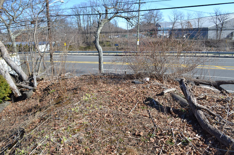
Concrete Footing next to white fence, Central Ave Bethpage, Is an old footing for
Electrical Tower, Cut down in mid 1950s
From Brian to Brian, were both in agreement. Frank Femenias and I took a real good look at at this last year. We located where the 4 tower legs were cut flush on the footing. This tower was definitely smaller than the current towers ( each leg has it’s own footing ).
The Electrical Towers were about 1/3 the size of the current towers, I saw the towers
Along the west side of the Motor Parkway, When I was about 6 or 7 Years Old.
Brian Sansom——by any chance do you have any pics of the Motor Parkway back from when you were a kid?