Sam & Dave’s “Excellent Motor Parkway Adventure” VIX: On to Bethpage State Park Updated 1/14/16
On April 4, 2015, Dave Russo and his 10-year old son Sam experienced a one-day 38-mile bike tour on the Long Island Motor Parkway. In the ninth post of this series, Sammy and Dave continued their exploration after leaving Deadman's Curve in Bethpage and headed to Bethpage State Park.
Enjoy,
Howard Kroplick
Sammy & Dave's "Excellent Motor Parkway Adventure"
By Dave Russo
April 5, 2015
My name is Dave Russo from Rockville Centre. Last summer my 9-year old son Sammy started playing travel baseball and had his practices were held in Cunningham Park in Queens. During practice I would go on runs through the area and came across the Motor Parkway. So this sparked a little flame in my head as I am a fan of Long Island history in general, specifically the old mansions and remnants of them.
I began to research the Motor Parkway (which I thought was only a Suffolk County thing that is still used today) and came across your site and others and was just amazed at the history of this road. So my son and I took little trips to various locations on the route and familiarized ourselves with the road and what it had to offer, often meeting people who live right on the road itself with zero knowledge of it or it's fantastic history. So we educate them and they are always very impressed.
So the two of us since then have really become Long Island Motor Parkway buffs and have seen everything there is to see from Queens to Melville. Queens offers one glimpse as NYC has maintained the road. Bridges remain, entrance ramps are there, and posts are everywhere but it was built later and although preserved and nice it lacks that "throwback historical" feel of the original road. In Nassau as you know the power lines were run which in one sense ruined the road but in another preserved the authenticity of the original road and so much of it is still visible and the fact that you can go there and see it and imagine a time when tens of thousands of people were standing behind the posts/fence watching this annual race in otherwise farmland filled Long Island is very impressive. Equally impressive is how few people know of this at all and major locations that should be of historical interest like the bridges, lodges, the grandstand are completely neglected or not known.
So yesterday, we did our long awaited "Vanderbilt Day" where we got up early and got a ride to Queens with our bikes and rode from the Queens beginning all the way to the Maxess Road Bridge in Melville in one day. It was about 38 miles total and we had a great time! (followed by dinner at Friendlys!) .I have become close with an older couple who live directly next to the Old Courthouse Road bridge who took us in for tea and cake and have lived there since farmland was on the other side. We visited Arthur Jesper in Garden City and he showed us his backyard. We have pictures of everything. We have many favorite locations.
I've been visiting your page for a while now, checking for updates all the time. If there are any pics you are in need of or any part of the Parkway that you need further detailed exploration of we are your team! There is nothing that intimidates us and we love the challenge! We trespass the right way, by simply asking permission. We've never been told no. My little 10-year old is pretty cute and nobody can say no to him. The Sand Pits Bridge was high on our list until the recent pics arrived on your site which took the pressure off of us. Those were great to see.
Dave & Sammy Russo
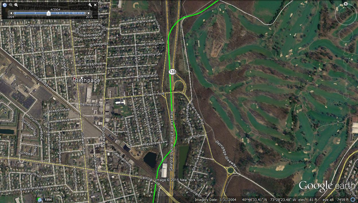
Heading north to Central Avenue
Lots of posts against backyard fences heading east leading up to Central Avenue.
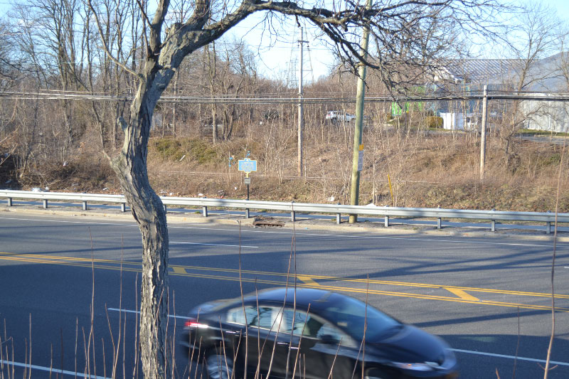
Next to King Kullen Headquarters- on bridge abutment looking over Central Avenue and the LIRR tracks.
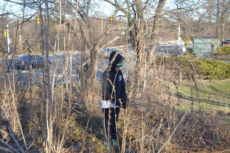
Sammy in the weeds of the remaining abutment
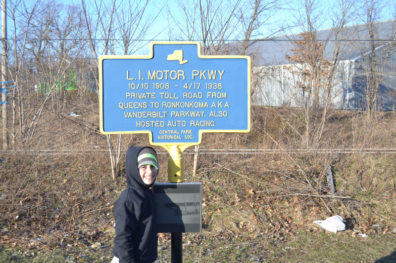
Historical marker on Central Avenue
Stymus Farm Cemetery
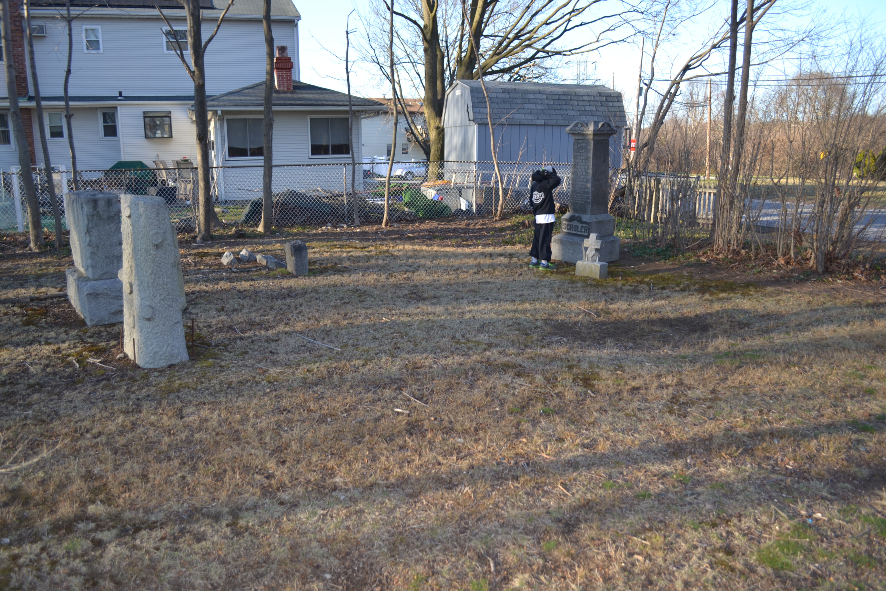
Just east over Central Avenue, past Sportime is a small private cemetery right next to the Mort Parkway.
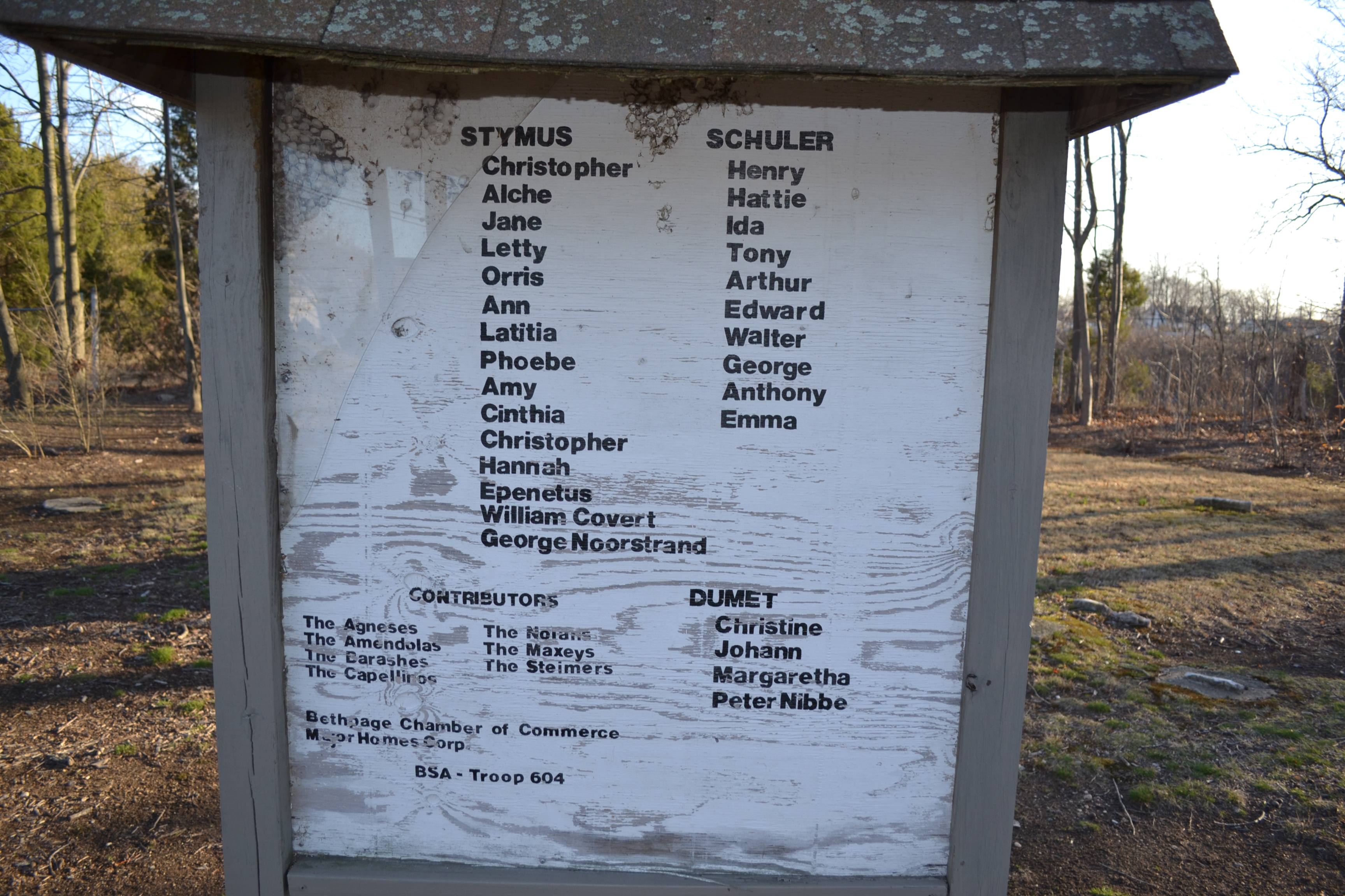
Buried in the cemetery are several people who sold part of their farms to the Long Island Motor Parkway, Inc. to create the right-of-way, including Peter Nibbe and the Stymus family.
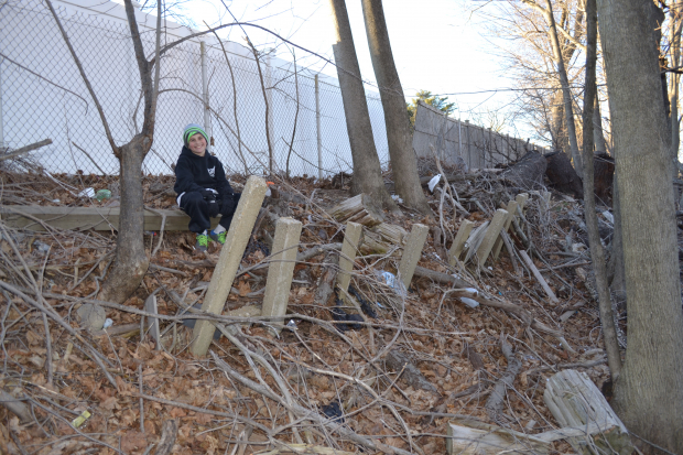
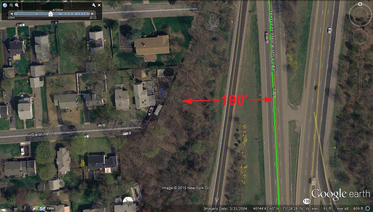
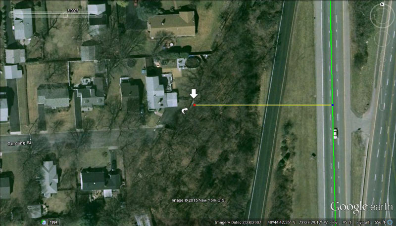
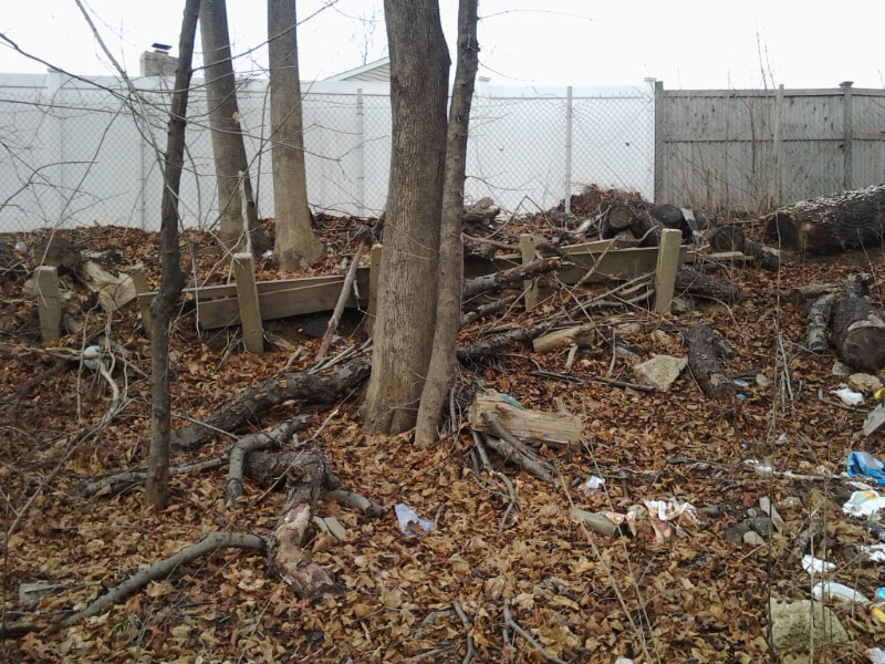
Caroline Street

Really cool spot full of posts at the end of Caroline Street, right before the Motor Parkway takes an eastern turn into Bethpage State Park. What do you think the purpose of all of these posts so close together was? I never saw this frequency of posts in any other location
Submitted by Frank Femenias (Updated: January 2016)
Approaching Deadman's Curve #2. Are there any concrete posts there?
______________________________________________________
From Howard Kroplick: There are no concrete posts in this 1908 photo. Concrete posts were added by the Motor Parkway in the 1920s.
"I think Al may be correct though, in that the posts are unrelated to the parkway. They seem smaller in size and missing the holes for metal wire as said. But their proximity to the parkway I'm sure, will keep many heads scratching for some time lol. What do you think? As always, great job on your site."
Updated: 1/10/16
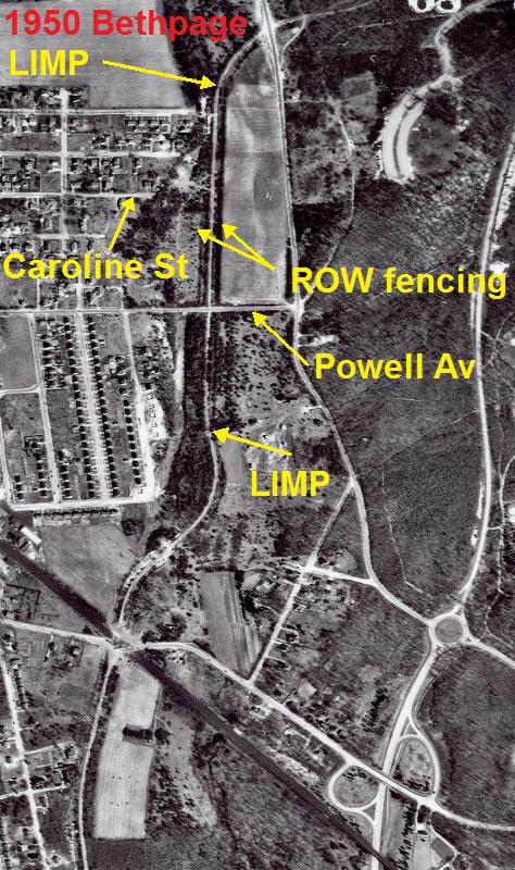
1950 Bethpage Aerial
Wooden posts on fence and guardrails looking north between Powell Avenue and Bethpage State Park curve.
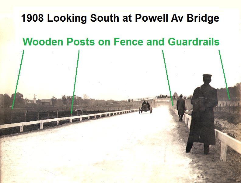
Another view of the posts looking south on the straightway.
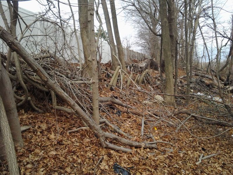
Caroline Street posts

Caroline Street posts zoomed
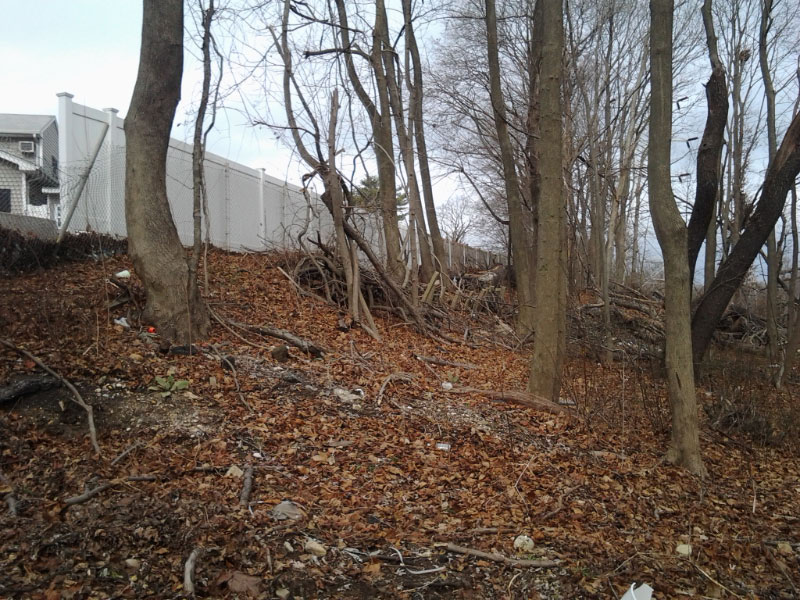
The steep slope
The steep slope zoomed
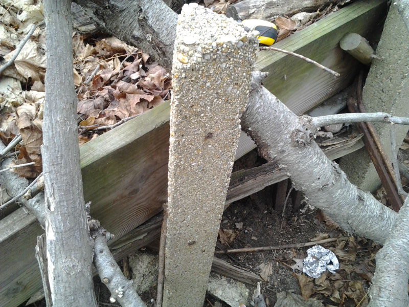
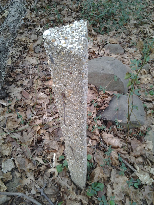
Caroline Street post
Caroline Street post zoomed
Fresh Meadows post
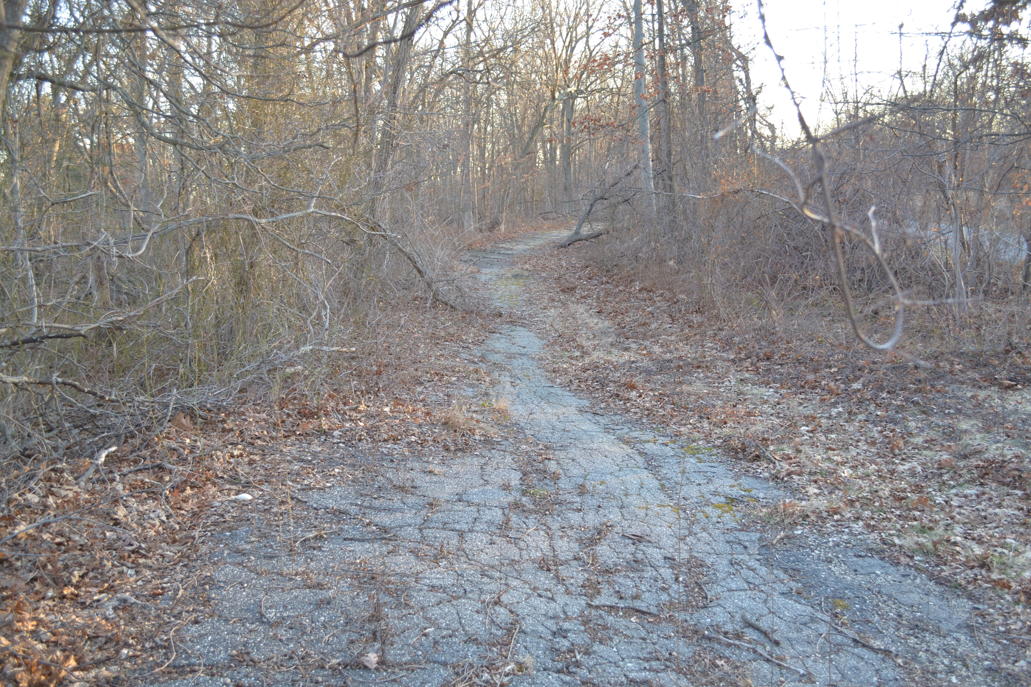
Bethpage State Park
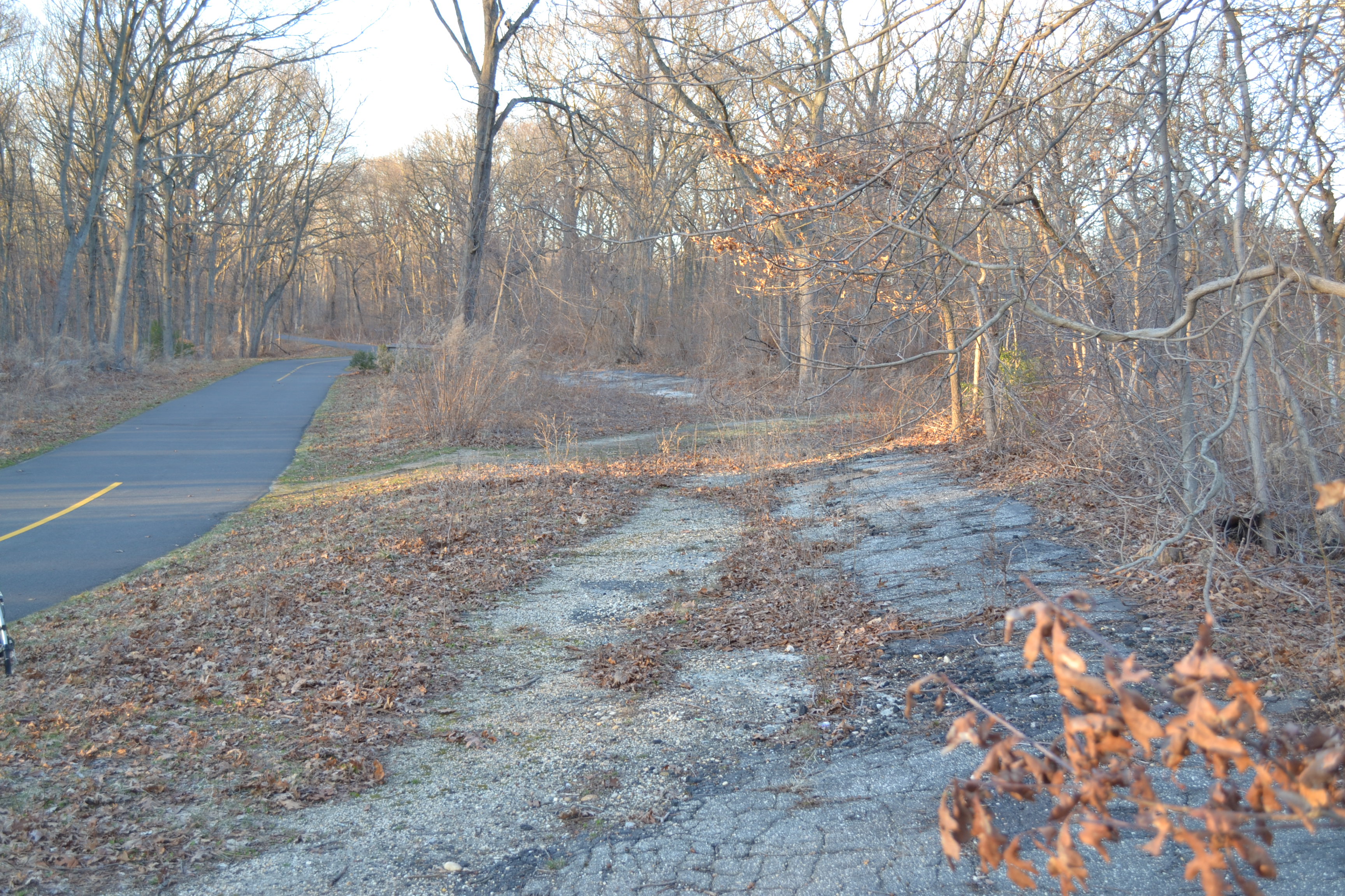
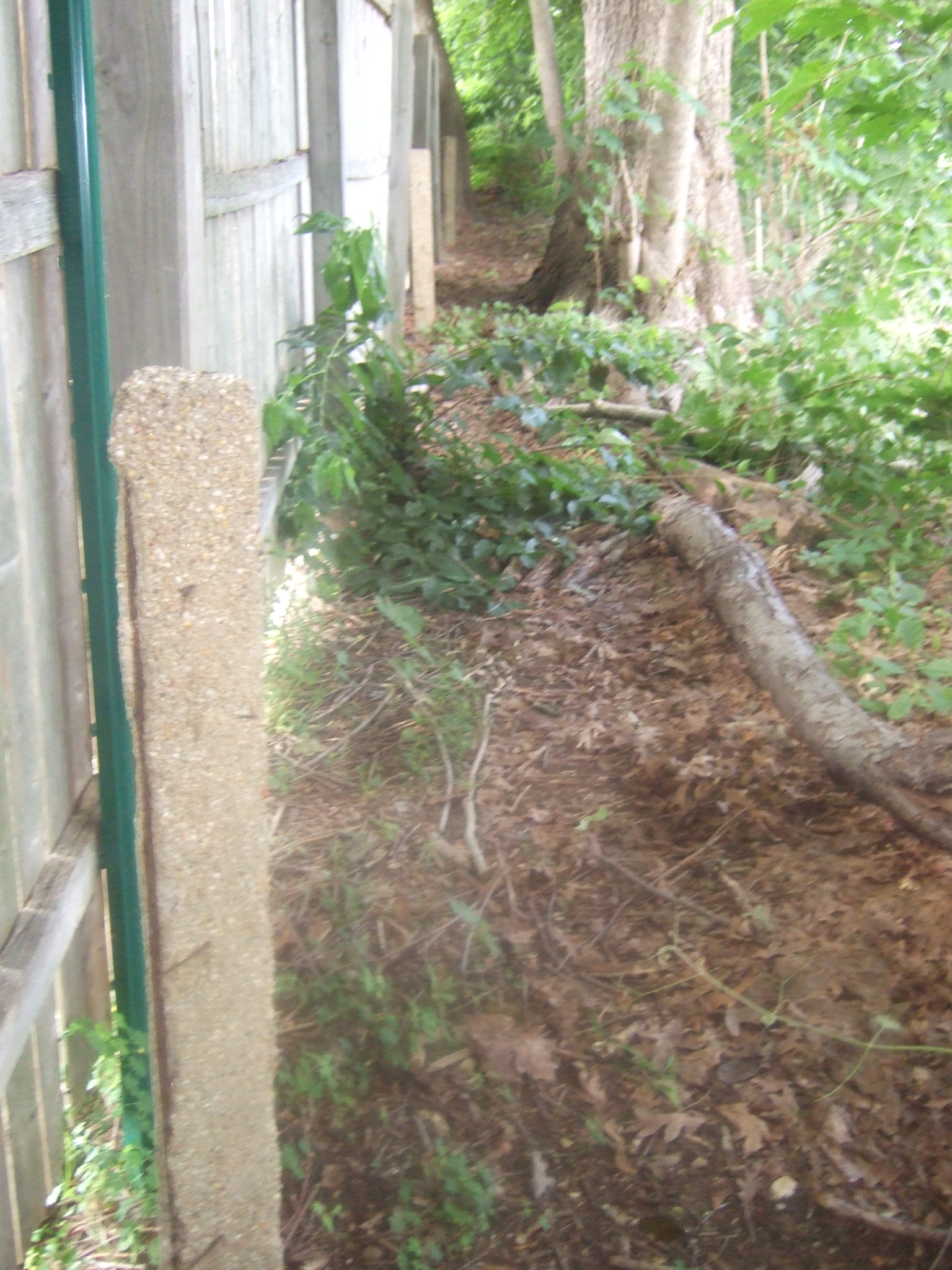
In Bethpage State Park, I was surprised to find this remaining original road next to the bike path.
We looked hard for any sort of remnants of the Botto Farmway Bridge, with zero luck.


Comments
This Stymus Farm Cemetery in this article is right in my neighborhood, it is located right up the street from me Howard and I walk my dog in the area frequently. We also walk up near Caroline Street as well interesting that you should post this tonight we were just up just past Caroline St today on our daily walk.
I’m really interested to see if anyone has any feedback on the Caroline Street posts. The frequency of the posts is one thing that’s puzzling. Any thoughts?
But according to Wayne’s map page we are also quite far away from the Parkway at this location. I think the Parkway was a bit more over to the west at this point, closer to the posts. Why would they put the posts that far away? There were many locations along the way where the map didn’t precisely line up with road.
Don’t get me wrong, Wayne’s map is the single greatest tool for Motor Parkway exploration but slightly off in some spots we found.
According to his map after Sportset the Parkway turns east (across 135 now) and then bends back west to proceed north along today’s 135. I’ve never explored east of 135 in this location. Has anyone found any remnants here? The power lines are west of 135 and I’m wondering why the lines would have deviated from the Parkway at this point. That along with the Caroline western post location, I think the Parkway was slightly west of his map.
The fill behind the eastern abutment of the Botto bridge is still there on the right heading north, ‘way up near the Schoolhouse Road fence. It’s so heavily covered with brush that it’s hard to spot but there’s a dirt scramble path up to the top from the base on the southeastern corner at a bicycle cross-trail. If I recall correctly, it’s about 200’ southwest from the corner of Schoolhouse Road and JoAnn Drive. Go back! [Also, see Howard’s 08 Jan 2010 blog.] Sam, III
Hi Dave and Sam. I don’t know why the concrete posts are spaced so close together at that point. For my own curiosity, I “compared” a current aerial view along with a 1953 aerial view using the “slider tool” within the HistoricAerials website. The LIMP is well defined on the 1953 map. I never ventured in this area say N/O Powells up to the easterly curve into BSP, but I’m fairly sure it’s ravined.
I have a memory of the bridge abutments in BSP while working in the area around 1985. The foreman told me it was the motor pkwy. That’s when the LIMP bug bit me.
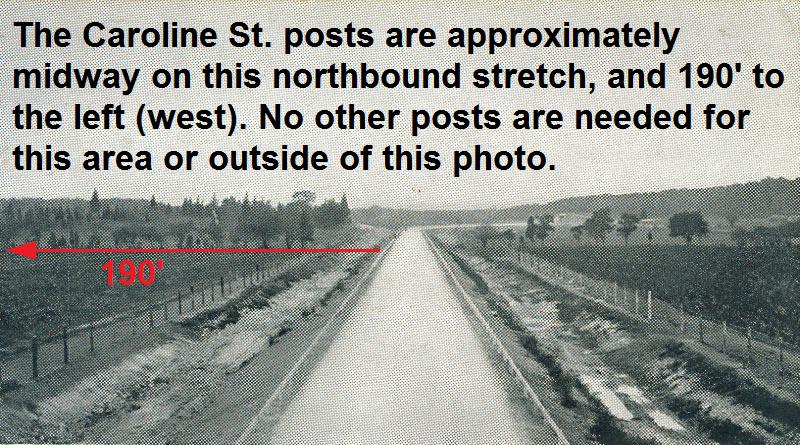
Happy New Year Sam, Dave, and All! Awesome adventure you guys accomplished and a nice find of the concrete posts by Caroline Street. But those posts are indeed peculiar. Had to look back at Wayne’s online map for the right-of-way and compare with mine. I recall this was a tricky section of LIMP to sketch as the roadway in this area had been removed entirely (or buried) from the construction of the expressway (135). As it turns out, the two maps are nearly identical. (sending Howard pics for comparison). Dave, I believe Wayne’s got it right, or very, very close. At Caroline Street, the LIMP ran on the southbound lanes of present day Rt 135. That would place the Caroline posts at nearly 190ft away from the right-of-way. So what are they doing there? Any ideas are welcome.
Thank you Sam and Dave for sharing the exploration.
Art came across this site in ’07.
http://www.freewebs.com/limparkway/bethpagesob.htm
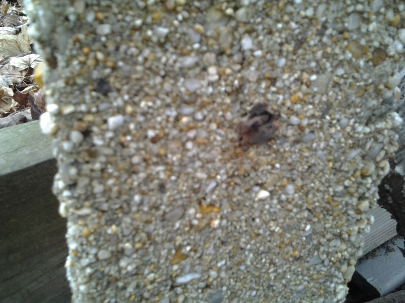
Thanks for sharing your memories with us Ron. I doubt that the Caroline St. posts have anything to do with the Motor Parkway. The square posts used by the Parkway had thee holes in them that carried the spiral wire. The posts at Caroline Av. are probably related to the building of Route 135. With regard to the triangle shaped posts, they might have been used when the Parkway closed and the R.O.W. resurveyed when it was turned over to the various agencies. However, I have never come across any invoices for cement posts in 1937/1938 at the Vanderbilt Museum.
Why would someone put those posts there if not Parkway related? If it were right at the end of Caroline Street one could say maybe at one point it was a barrier or fence of sorts to prevent cars from rolling over. But it’s not. It’s basically just over a fence beyond someones backyard. I can’t see any reason why a regular guy, resident, town worker or 135 road builder would do this! Just makes no sense.
There are several types of posts here. Some square and others triangular. Some taller than others. So that is puzzling, why they would differ.
Sam and I theorized this might have been a “press box” or seating of some sort? Some type of seating overlooking the Parkway or any reason why someone would be watching at this location? Not sure if any race past this point. The posts offered protection and supported “seating”??
At what other point are the posts 190 feet away from the Parkway? None that I know of and this is why I think the Parkway is a little more west (assuming posts are legit). I’m not sure how you guys chart this vs today’s exact spots but I’m sure you are way smarter than me about this stuff. Basically if you guys are right with the exact road placement then the posts have to be fugazi (or fake - for you non Italians LOL). But again, what is the the reason for someone to do this?
And on our Second annual Vanderbilt Day we are definitely going to look for more posts in this sector as I seem to remember there were some others and that would definitely add to the debate, and we also have to stroll onto the east side of 135 and see if anything remains there. This reminds me of the area next to the Meadowbrook and behind commercial buildings on Stewart in GC, as clearly that was also “dug” out and it’s doubtful we’re going to find any road next to 135 as I’m sure it’s buried.
Hi Dave,
Just a thought, the concrete posts could be leftover posts from LIMP construction in the area (1908), that somehow worked its way there, but not leftover from the nearby LIMP. They used wood in that section of the parkway (sending Howard some pics). It’s possible the posts were used as seating for Farmer Nibbe and neighbors to view the races from a quiet spot, instead of the mob scene on top of the bridges. Also, Rt 135 construction crew may have transformed them into a lunch bench, just outside the expwy work area by the Powell Av exit ramp. They had the heavy equipment to easily do this. Or perhaps the posts that have been missing over the years from Richard Foran’s Motor Parkway ‘Drive-Thru’ Deluxe Hot Dog Stand, once located 1.2 miles south of here on Broadway and the LIMP (the house is still there, check it out with Sam next time). But those posts had the three holes with spiral wire. Did any of the Caroline posts have any holes in them? Truly a mystery.
Thanks for continuing the conversation Frank. Too often it seems people check the link, comment and then disappear when we have really interesting subjects on the table worth further discussion. I recommend some kind of continuous blog for the site. Once a site post becomes older, people dont go back and continue to check and the discussion just dies.
You bring up a very interesting point. How did they determine what locations would get wood and what would get the concrete posts? Obviously we know that south of Central Ave there were (and still are) posts and going into Bethpage Park there were (and still are) posts, so why in this small in between section did they decide only wood?
If you are correct and it was only wood here, it makes it even more interesting that someone would have done this. Love the private seating theory. Doubt the lunch spot one! Especially if they had to hunt for the posts. But then again, some town employees go unsupervised for quite some time! I believe some of the posts did have holes in them. I will definitely take more/closer pics next time. Will check out the hot dog stand in more detail too. I know where it is.
Hi Dave,
Had to check out the Caroline posts today for a closer look. Physically being there made all the difference. I believe they’re genuine Motor Pkwy posts. There were rectangular and triangular types and both are identical in size to posts in Fresh Meadows. The triangular’s also had the two rust stains where wires once protruded from, as in Fresh Meadows as well. The hole for this style wire (not the spiral) is an exact fit around the wire and can easily be overlooked when the wire is completely missing. Some of the posts in Fresh Meadow still have the little rusted strand sticking out. I think this style triangular post/wire was used away from the roadway where it defined the Motor Pkwy property line, and dressed with denser fencing material to keep the undesirables out, such as bicyclists like me. :D
But I believe those posts do not belong there. I think they’re being used as a makeshift retainer wall for the steep sloping hill in this area. Next to the posts is a heavy weight downed tree, strategically placed adjacent to the backyard fences. The fences on top of the hill are less than 10’ from the drop! Most likely the posts were temporarily placed there by Rt. 135 construction crew upon completion in 1963, to increase stability on top and help prevent terrain from spilling down. Probably an unexpected occurrence or expwy design overlook. The crew had access to this state owned property and the heavy machinery to accomplish this, a problem too much for the homeowners and probably illegal for them to fix anyway.
So where did the posts come from? Checked out some of Howard’s photos of Dead Man’s #2 curve that was located further south (also involved in the 135 construction). The posts down there were similar to the ones up north and all appear made of wood, but that is questionable. Sending Howard some pics of the findings.
PS. I stopped by the east side of 135, and at the dead-end of Carol Dr. (north of the watershed where Dead Man’s Curve #2 was situated nearby), I encountered another NY State area that was sealed off to the public with locked fences. Camera equipped drone came into mind, but considering any remnant hindering the efforts of a major construction project would likely just be swept away clean and/or destroyed. We’ll never know for sure until it’s investigated. See you guys on the trail!
Great work Frank. You are the man. I love how the curiosity got you so strong that you had to get in your car and check this out for yourself! I’m the same way.
I dont know if I’m buying the retaining wall theory. It’s a theory as good as any other right now, but I’m having a hard time thinking this would have been their best solution for a possible land slide location.
Were there any other posts in the area? Did you take pics? I actually have a video of this spot that we took that day, I’ll send to Howard.
Howard has remained quiet on this question….please chime in and let us know your opinion on this!
_______________________________________________________________________
From Howard Kroplick:
Dave, I will need first to take a road trip to see the posts!
Howard, I had sent you pics of my visit to Caroline St. and Fresh Meadows. I’ll resend if you did not receive them. Please let me know.
______________________________________________________________________
From Howard Kroplick:
Found them and posted above.
Concrete posts were not original? Anywhere? Or just in this section? Were all of the concrete posts were added in the 1920’s?
If all of the original posts were wood, WHY would they and WHO would require that they swap them out with concrete ones?
Hi Sam and Dave.
Check out the link below. It’s possible one or more of the posts in the photo are the same larger posts that were found nearby at Caroline Street. Though these posts have convex tops, I’m willing to bet the ones at Caroline are some of the few that survived the excavation when building 135, and that they were inserted upside down for easier installment. But removing one just to check may upset the homeowners! : Anyone with ideas is always welcomed.
http://www.vanderbiltcupraces.com/blog/article/mystery_foto_8_can_you_identify_these_two_motor_parkway_bridges_near_the_hu
Hey Frank,
The posts are definitely different. Some are long and some short. Some squared and some triangular. But the question is why. Why did someone go through the trouble of collecting these posts to line them up like this? And why this spot?
I’d be willing to knock down a post but I’m not clear what that would teach us. It’s not on anyone’s property.