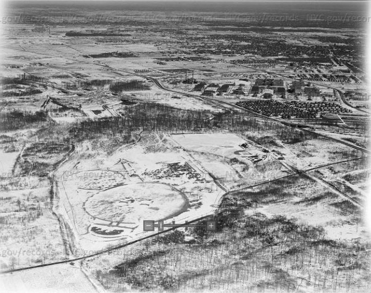
Mystery Foto #46 Solved: A Spectacular 1940 Aerial of the Rocky Hill Lodge & the Gatekeeper’s House

Frank Femenias challenged you to solve this amazing Mystery Foto aerial that he discovered on the Internet.
Mystery Foto questions:
- Identify the location and orientation
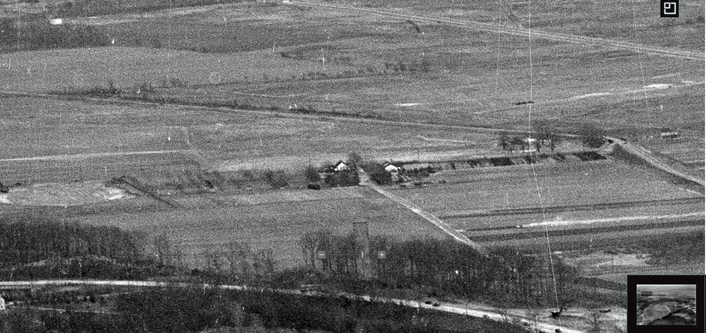
Queens looking east at Alley Pond Park and Springfield Boulevard (Rocky Hill Road)
- Identify the major roads
Long Island Motor Parkway,Union Turnpike, Springfield Boulevard (Rocky Hill Road), Cross-Island Parkway (under construction), Grand Central Parkway (see below Femenias' Findings)
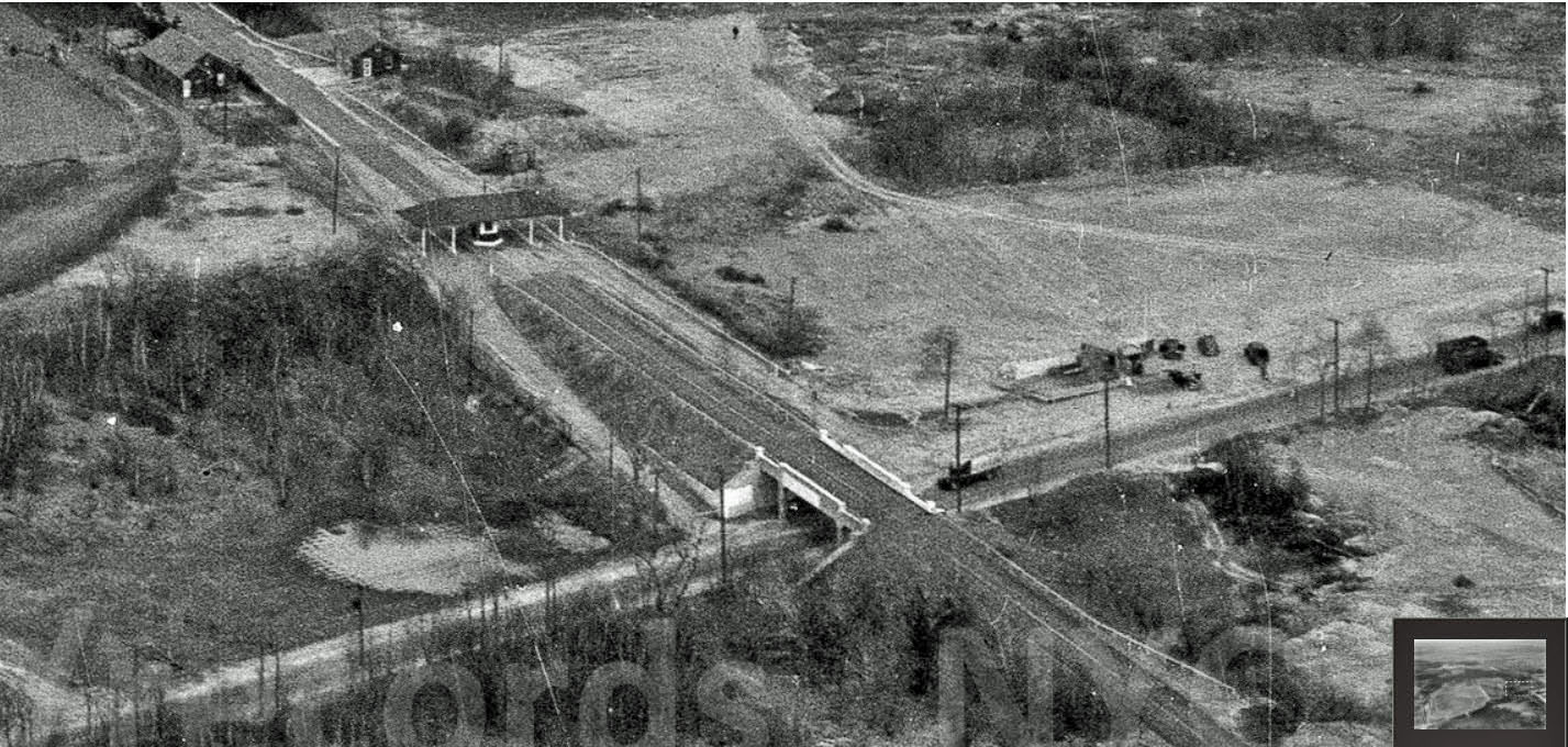
- Identify the Motor Parkway structures and buildings
-Rocky Hill Road Bridge
-The entrance ramps to the Motor Parkway (unique to this location)
-The Rocky Hill Lodge
-The home and garage of gatekeeper Sidney Jones
-Wheeler Farmway Bridge #1
-Grand Central Parkway Bridge
-Wheeler Farmway Bridge #2
-Winchester Boulevard Bridge
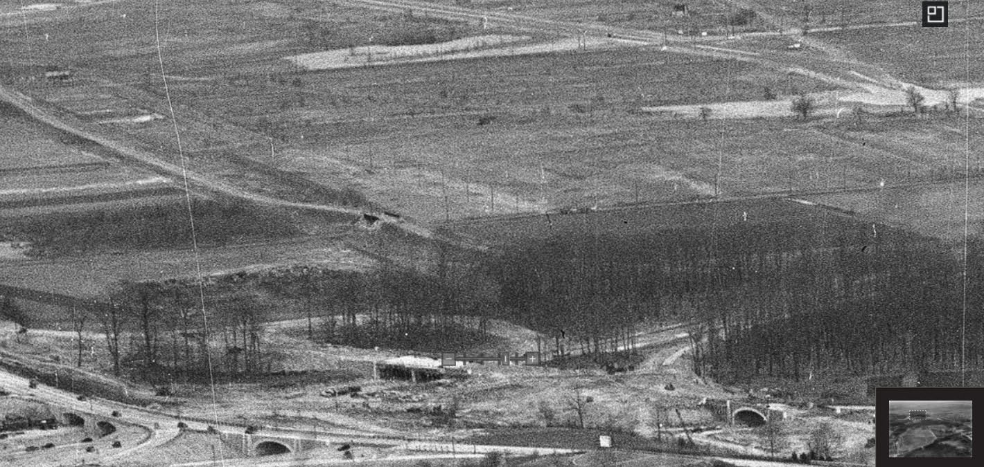
-Creedmoor Bridge ?
-Commonwealth Boulevard Bridge
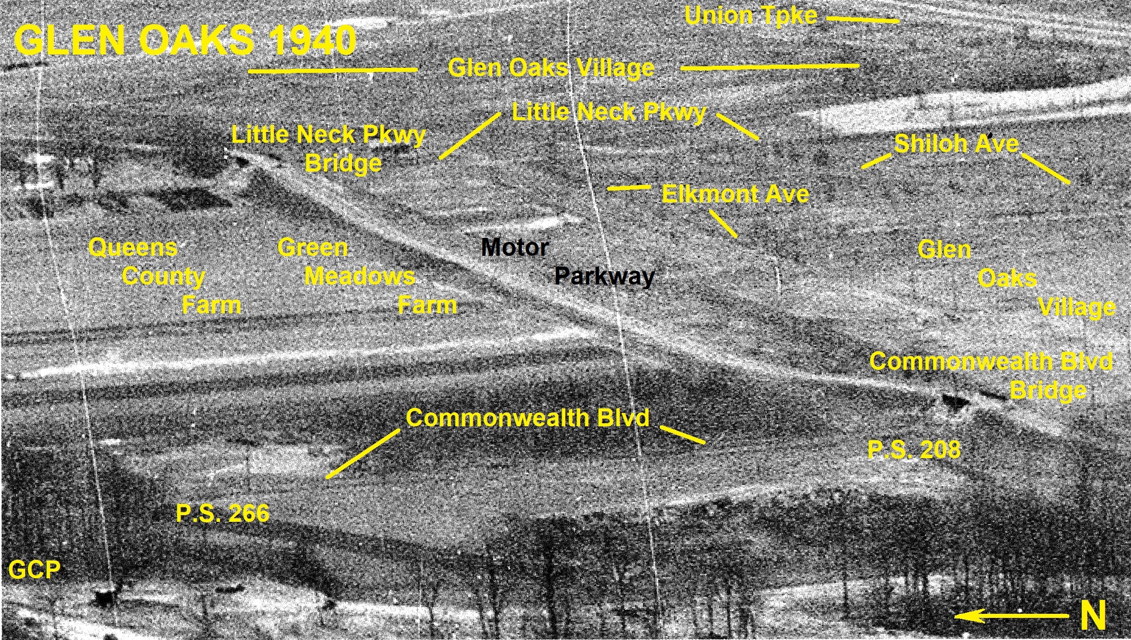
-Little Neck Parkway Bridge
- What is the approximate date of the Mystery Foto. Provide a rationale. Bonus: Provide the Internet link to this aerial.
March 7, 1940 Lack of traffic on the Motor Parkway and the caption on NYC Department of Records & Information Services website.
Comments (13)
Congrats to Joe Oesterle, Dave Kilkenny, Alan W., Greg O., Tim Ivers, Brian McCarthy, Steve Lucas, Erci Shaffer, Art Kleiner (see Kleiner's Korner), Steven Waldman, and Frank Mendyk.
Kudos to Frank Femenias, Greg O., Brian McCarthy, Steve Lucas, and Art Kleiner for finding the original source of the Mystery Foto.
Enjoy,
Howard Kroplick
Close-Ups Union Tpke, Springfield Blvd/Rocky Hill Rd., Grand Central Pkwy
Updated: 11/19/2017
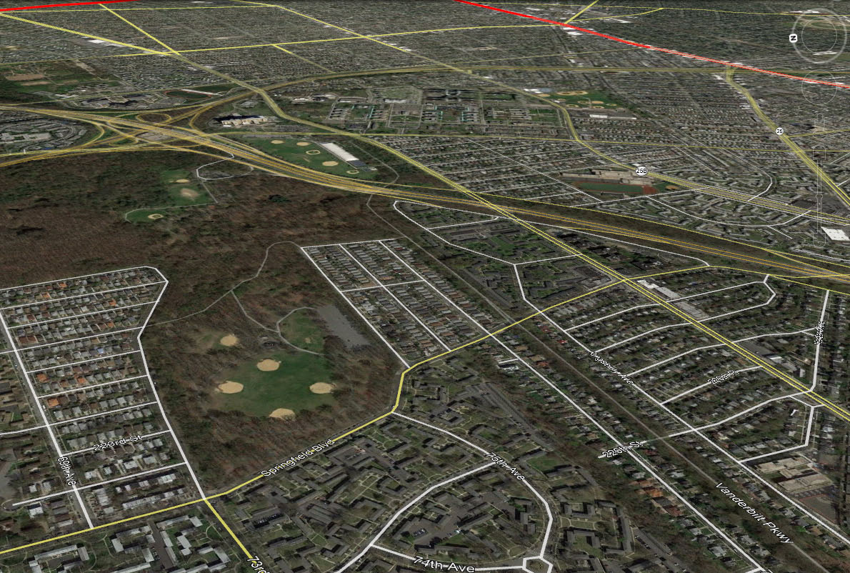
Current Google Earth view
Kleiner's Korner (Submitted by Art Kleiner) Source: NYC Department of Records & Information Services
Link to the image in the NYC Archives.
Submitted by Art Kleiner.
Link to a similar aerial taken on January 6, 1940.
Submitted by Art Kleiner
Femenias' Findings (Submitted by Frank Femenias)
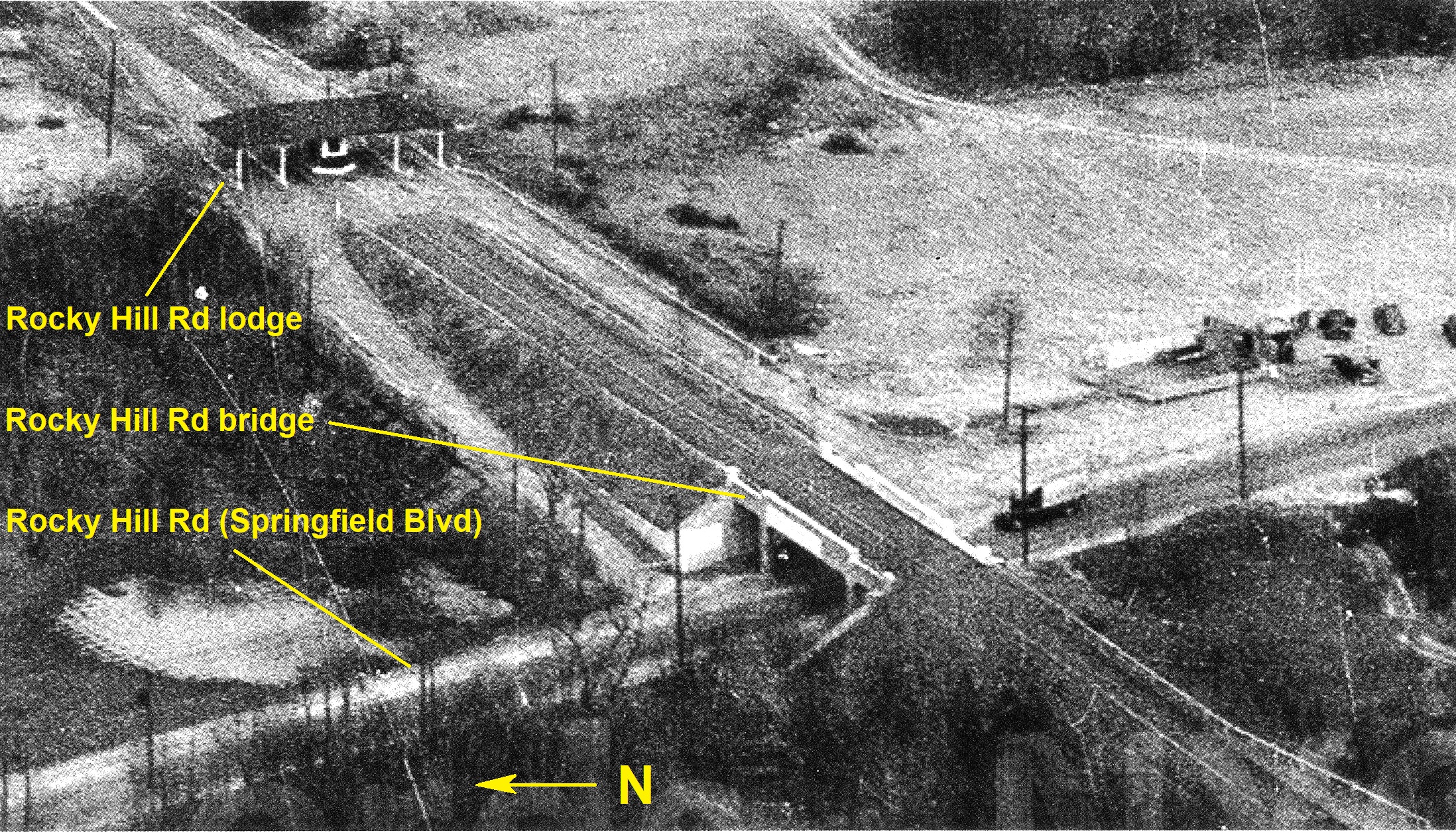
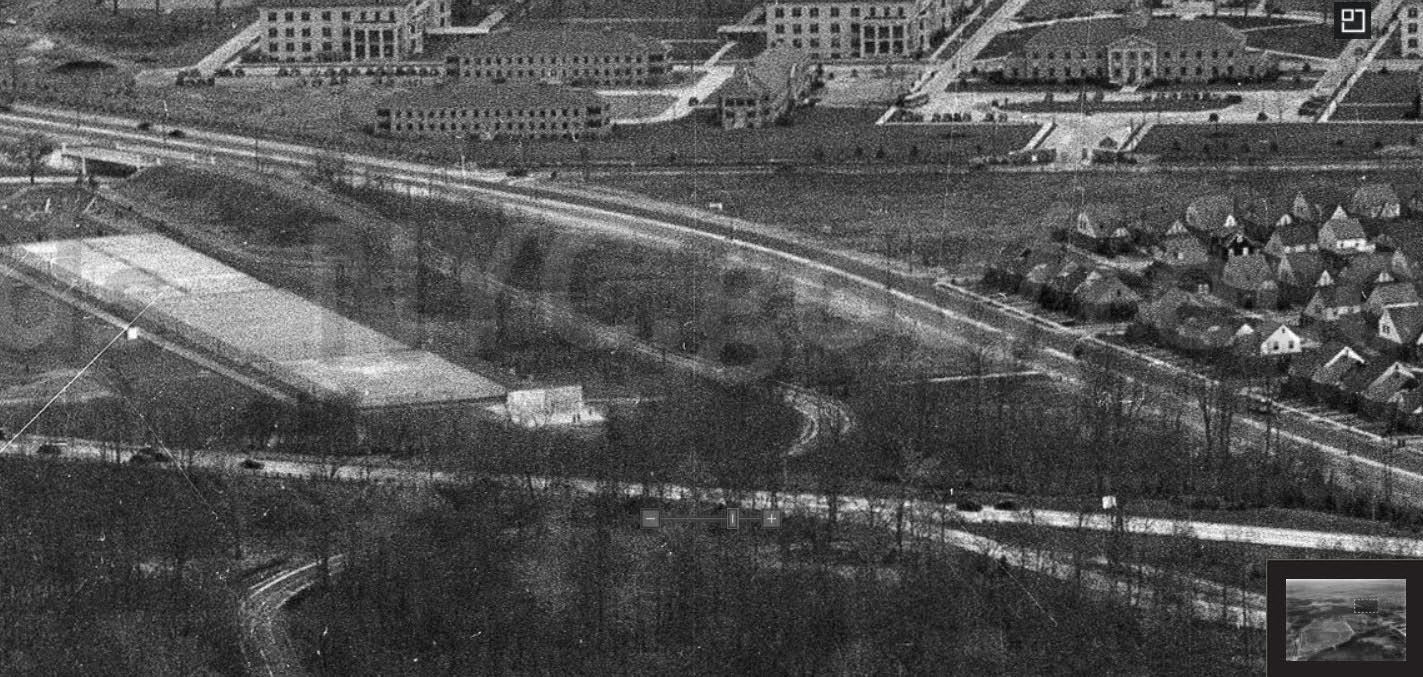
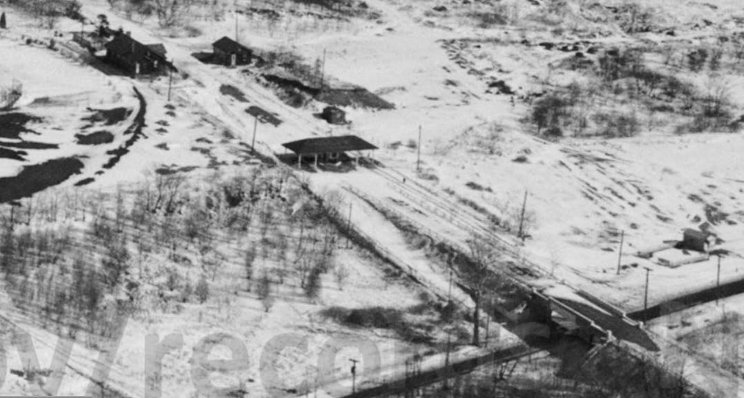
Rocky Hill Road Bridge (Springfield Boulevard)
Entrance ramps to the Motor Parkway
Rocky Hill Lodge
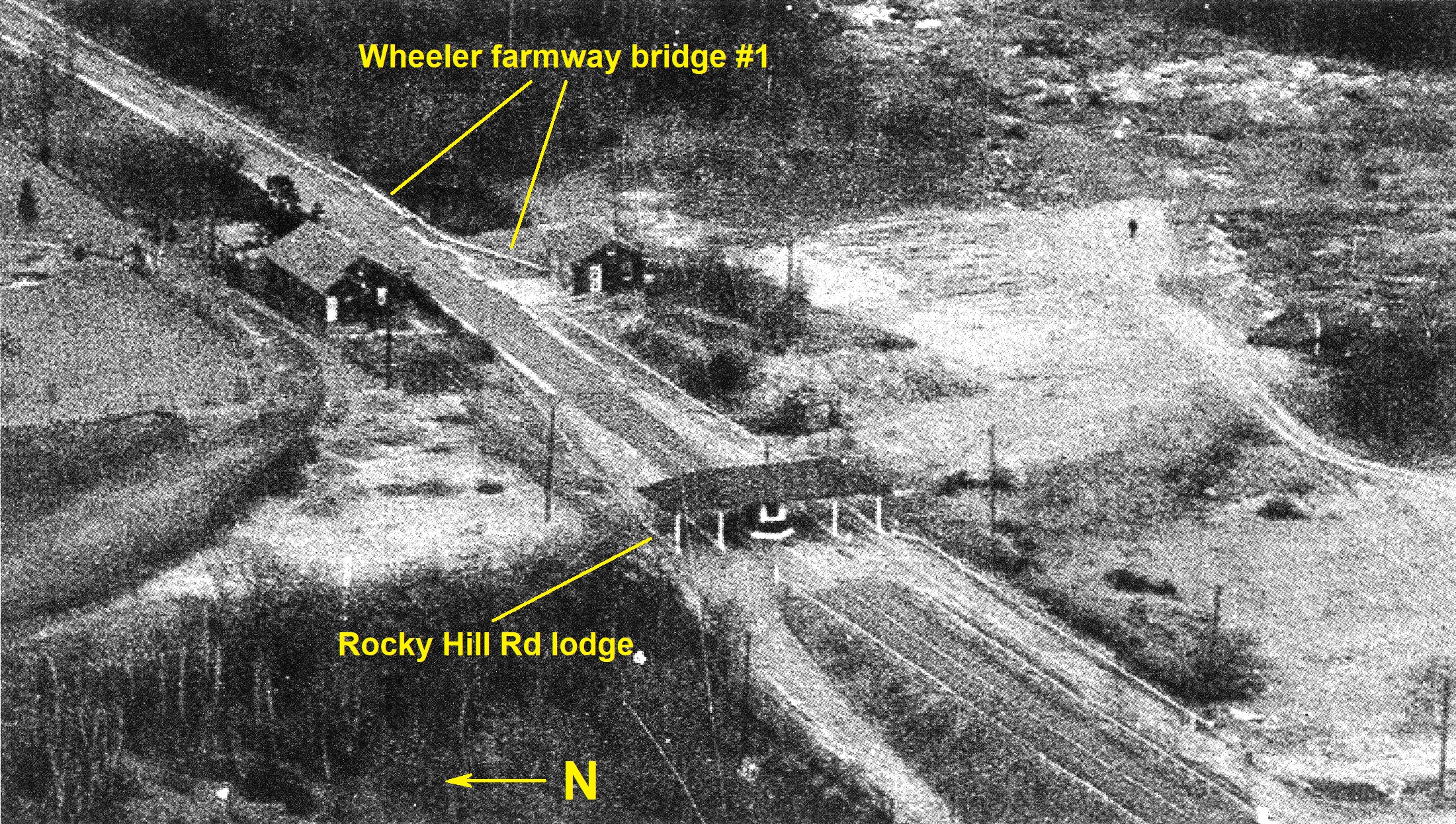
The Home and garage of gatekeeper Sidney Jones.
Wheeler Farmway Bridge #1
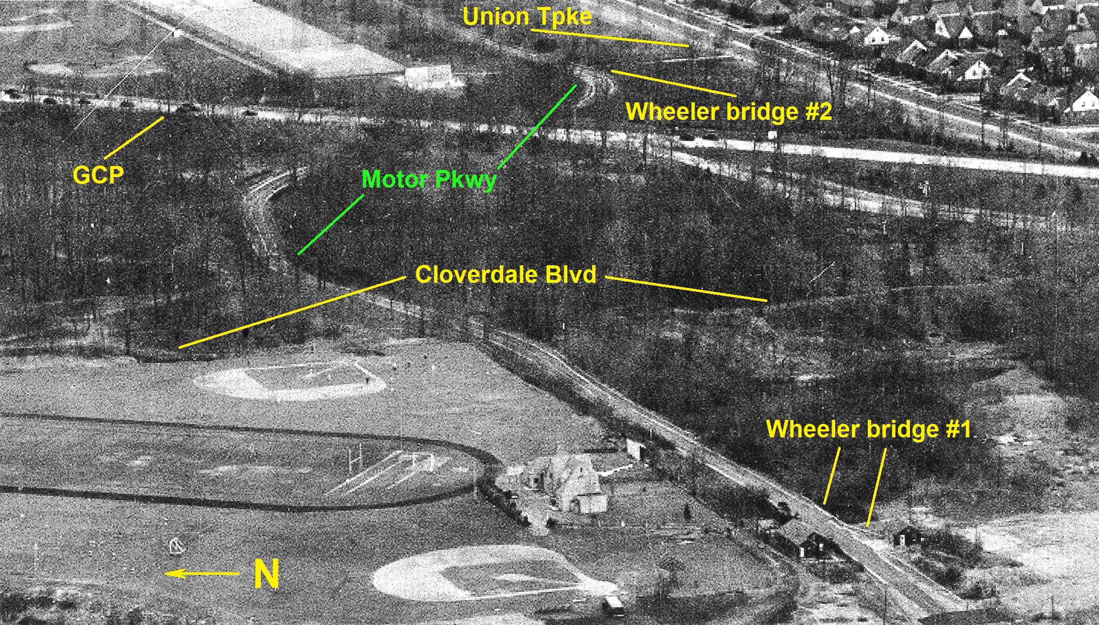
Grand Central Parkway Bridge
Wheeler Farmway Bridge #2
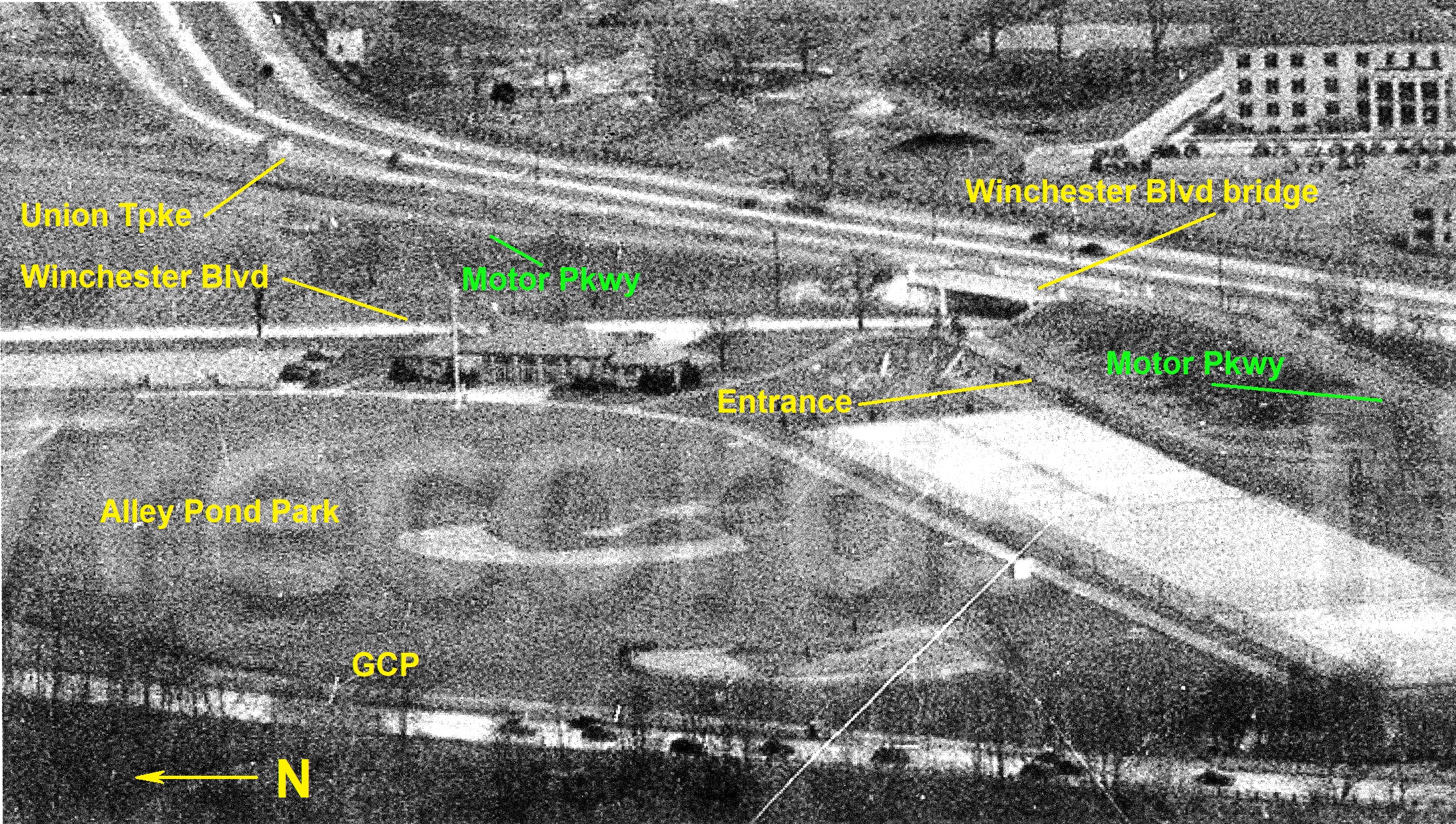
Winchester Boulevard Bridge
Commonwealth Boulevard Bridge
Little Neck Parkway Bridge
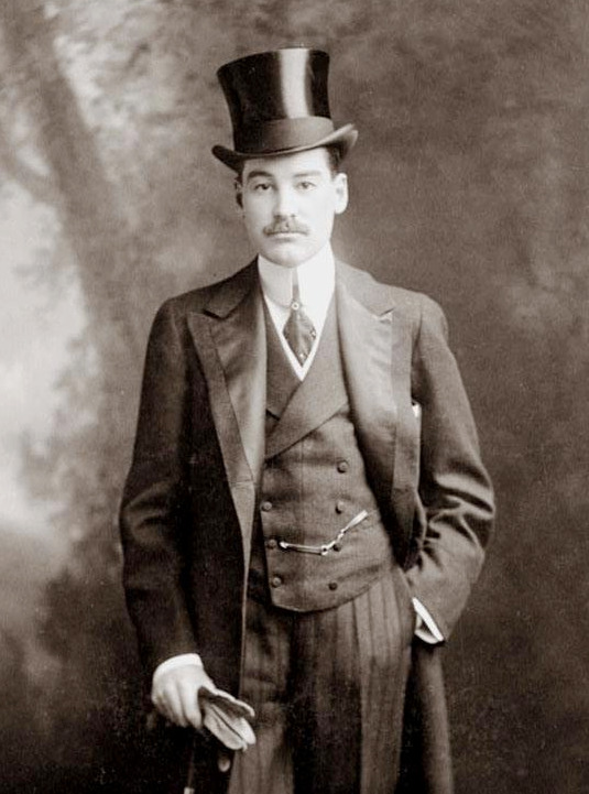
Rocky Hill Lodge
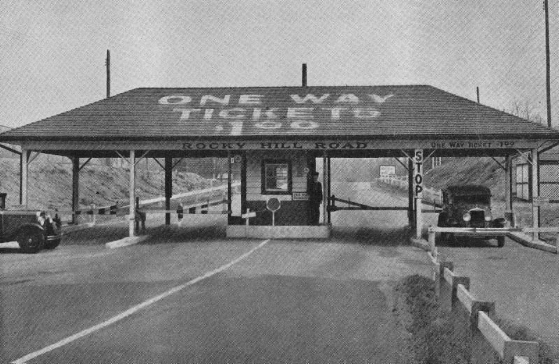
Lodgekeeper Sidney Jones manning the gates.
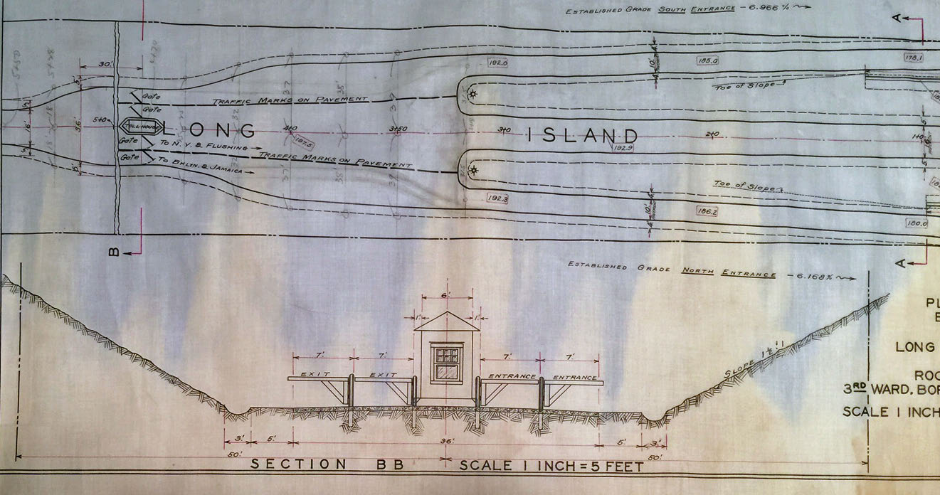
Plan showing the planned toll lodge and "entrance-ways" to the Long Island Motor Parkway at Rocky Hill Road (November 19, 1924. Courtesy of Roy Knoernshild.
The Home and Garage of Lodgekeeper Sidney Jones
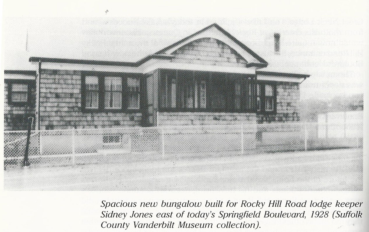
Courtesy of Al Velocci. and his wonderful book The Toll Lodges of the Long Island Motor Parkway, and Their Gatekeepers' Lives.


Comments
Rocky Hill Rd. Springfield Blvd. I saw this picture last week online. It’s a good one.
I believe this is Queens, looking East. I think that’s the Rocky Point toll and Rocky Hill Road Bridge over Springfield Ave. The Grand Central looks new, so I’m assuming it may have opened fairly recently. The park is Alley Pond Park to the left and you can make out Creedmore in the distance. You can also make out the Alley Road Bridge and perhaps Clinton Ave? Not sure about that one.
Great find!
From a date perspective, I want to say 1932-1933.
This shows the Motor Parkway winding through Eastern Queens,going over Springfield Blvd.,past the Adelphi Academy and Alley Pond Park athletic fields,under the Grand Central Parkway,over Winchester Boulevard,past Creedmoor State Hospital,probably dead-ending at the under construction Cross Island Parkway,resuming and passing over the Commonwealth Blvd. bridge. The time frame is around 1939-40 when the Cross Island was being built. My neighborhood! Great picture!
-Identify the location and orientation
Alley Pond Park, View Southeast, With Recreation Area on Springfield Boulevard in Foreground
-Identify the major roads
Union Tpke, Springfield Blvd/Rocky Hill Rd., Grand Central Pkwy
-Identify the Motor Parkway structures and buildings
Amazing view of the Rocky Hill Rd lodge/entrance! Zooming in far enough, brings in almost every LIMP structure (still standing up to March 7th, 1940) to the Little Neck Pkwy Bridge.
-What is the approximate date of the Mystery Foto. Provide a rationale.
March 7th, 1940 -Union Tpke expansion, GCP both completed
-Bonus: Provide the Internet link to this aerial.
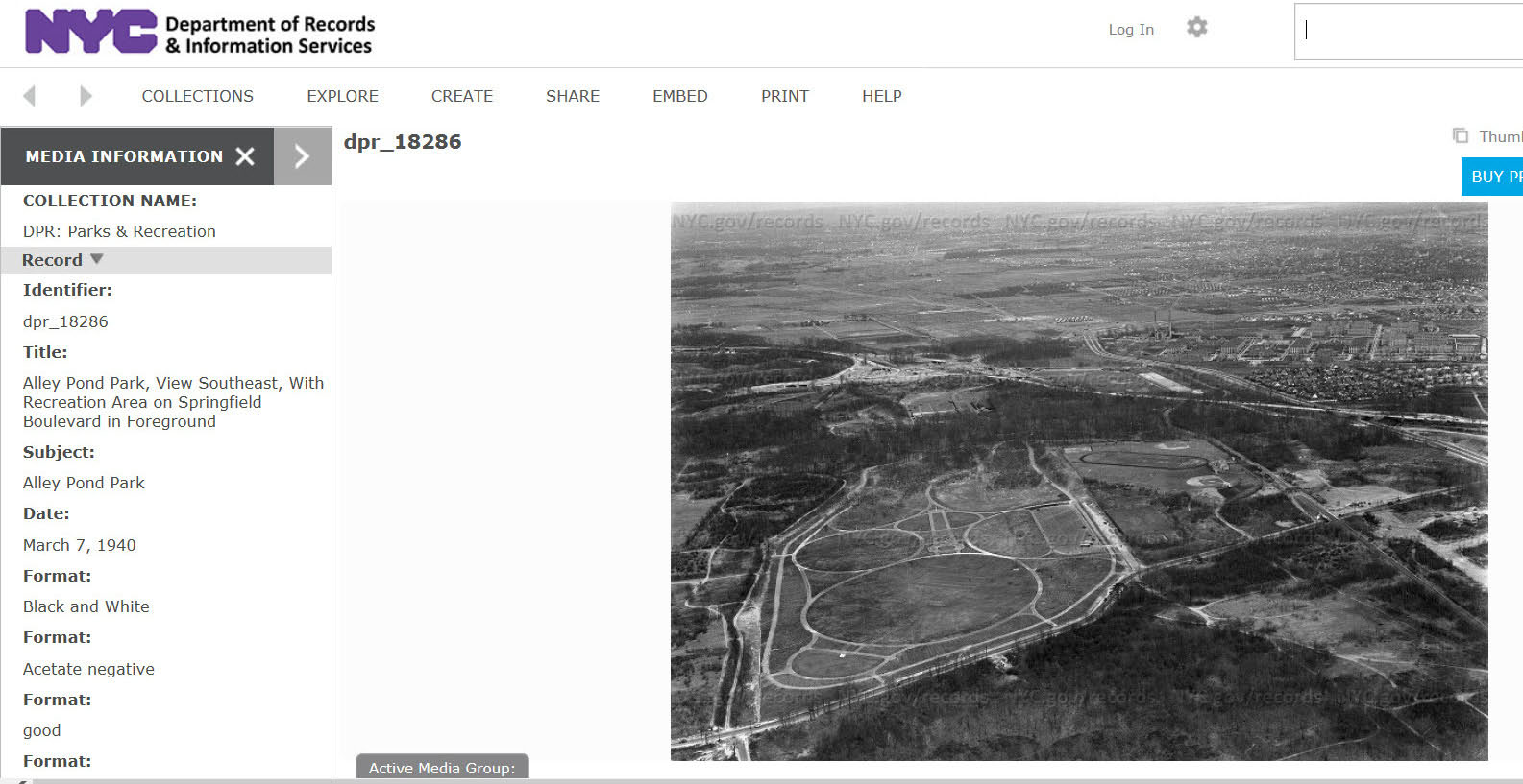
http://nycma.lunaimaging.com/luna/servlet/detail/RECORDSPHOTOUNITARC~35~35~1437298~143832:dpr_18286?qvq=q:Alley+Park&mi=28&trs=33
Looking southeast in Queens from Union Tpke left to right across bottom; Winchester Blvd bottom to top; Alley Pond Park lower left; Rocky Hill Road entrance to Motor Parkway at bottom; and Creedmoor Pyschiatric Hospital and Grand Central Parkway at top right.
Photo from NYC archives about 1930.
Great Image, Frank! Nice find.
ID Location/Orientation: Birds Eye View of Oakland Gardens & Glen Oaks, Queens. View is East.
ID Major Rds.: From west to east…LIMP, Springfield Blvd, Union Tpke, Cross Island & Grand Central Pkwys, Winchester & Commonwealth Blvds, Little Neck Pkwy.
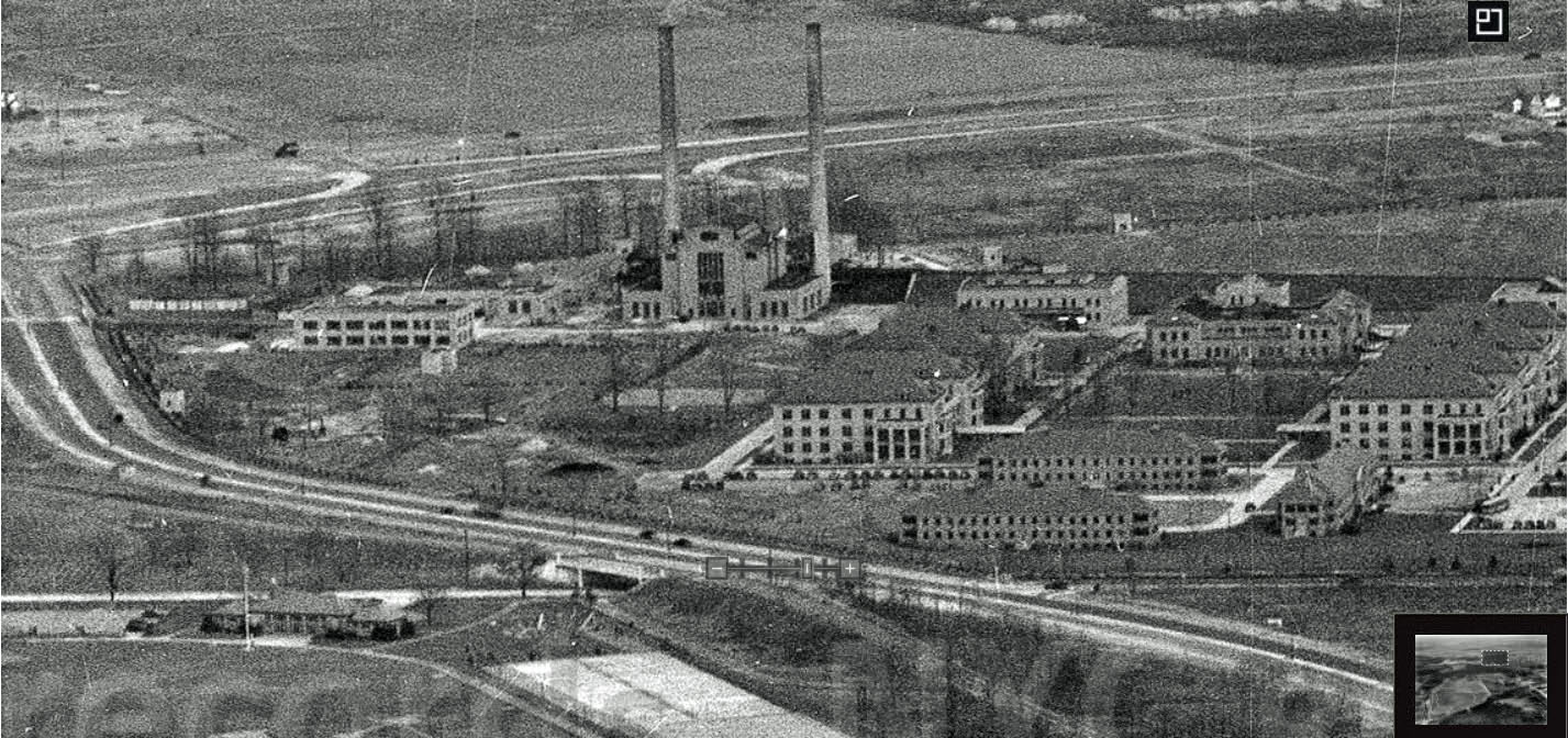
ID LIMP structures&buildings;: From west to east…Pkwy bridge ( Springfield ), Rocky Hill Toll Booth, Wheeler bridge #1 ( Fairly sure I see an opening/underpass on the N/S of the LIMP, just E/O the House; that’s E/O the Toll Booth in an enlarged view ), Wheeler bridge #2 ( See a path north & south of the LIMP, between Grand Central & Winchester; in an enlarged view ), Pkwy bridge ( Winchester ), Creedmoor Hwy bridge ( Looks to be a “white” overpass N/O Union Tpke, between Winchester & Commonwealth Blvds; in an enlarged view ), Pkwy bridge ( Commonwealth ), Pkwy bridge ( Little Neck ), and Creedmoor Facility ( S/O Union Tpke ).
Aerial Date/Rationale: The Rocky Hill Toll Booth was removed within 3 yrs of LIMP closing. So I’ll guess 1940.
Internet Link: Perhaps Frank found this image a “www1.nyc.gov”. I didn’t explore this site, yet. But it’s bookmarked.
We’re looking southeast over Alley Pond Park in eastern Queens County out to Nassau County. The major roads are Springfield Blvd., Union Tpke., Grand Central Pkwy., Cross Island Pkwy. (still under construction), and the recently closed LIMP. We can see LIMP bridges over Rocky Hill Road (Springfield Blvd.), Winchester Blvd., Commonwealth Blvd., Little Neck Pkwy., and under the GCP bridge over the LIMP. I think the Wheeler farmway bridge is there also. The Rocky Hill Road toll lodge (kiosk) is also visible. The date of the photo is definitely March 7, 1940 since I was able to track down the actual image on the http://www.nyc.gov/records website in the DPR: Parks and Recreation collection of photos image number dpt_18286.
The photo is looking east from Queens into Nassau County .Rocky Hill Toll House on right Union Turnpike in the middle. The motor parkway snaking its way towards Nassau County over the newly constructed GCP and CIP interchange.
Identify the location and orientation: Alley Pond Park in Queens, looking southeast
Identify the major roads: LIMP, Winchestser, Grand Central Pkwy., Cross Island Pkwy., Union Turnpike, Springfield Blvd. 73rd. Ave., 76th Ave., Rocky Hill Rd.
Identify the Motor Parkway structures and buildings: Rocky Hill Rd. Bridge and Lodge, Creedmore Bridge, probably others.
What is the approximate date of the Mystery Foto. Provide a rationale. March 7, 1940. Completion of Cross Island Parkway around that time and caption in photo sent to Howard.
Bonus: Provide the Internet link to this aerial.
http://nycma.lunaimaging.com/luna/servlet/detail/RECORDSPHOTOUNITARC~35~35~1437298~143832:dpr_18286?qvq=q:alley&mi=36&trs=126
And one more taken in January - showing snow on ground.
http://nycma.lunaimaging.com/luna/servlet/detail/RECORDSPHOTOUNITARC~35~35~1436940~143795:dpr_18179?qvq=q:alley&mi=8&trs=126
View south east from Alley Pond Park,Winchester Blvd crossing Cross Island Parkway that appears almost completed which dates this photo about 1940, in view is Union Turnpike and Motor Parkway crossing under Grand Central Parkway, Creedmore Hospital in view, this looks like Fairchild Aerial Survey the 7th down is the Cross Island Parkway Grand Central Parkway interchange,4th down is view North to Grand Central Parkway with Motor Parkway crossing under 5th down shows Union Turnpike crossing Motor Parkway and Grand Central Parkway and is view south, the top 3 down are Little Neck Parkway crossing under Motor Parkway toll house?
Just recovering from surgery and complications and still too groggy to think clearly BUT - bet that’s looking NNW over the still-surviving Brentwood track and ball field at today’s LIU Brentwood campus. I could always cheat of look up that “dead -giveaway” transverse toll gate, which would then seem to be at Wicks Road - ??? Uh, oh. Better pack this in. Sam, II
______________________________________________
Howard Kroplick
Sam, here’s to a quick recovery!
The photo is taken facing east/southeast over Alley Pond Park and Creedmoor.
Major Roads
Grand Central Parkway, Cross Island Parkway, Utopia Parkway, Winchester Blvd., Rocky Hill Rd (Springfield Blvd,), Hillside Ave 25B, Commonwealth Blvd., Little Neck Parkway. LIMP
LIMP - Rocky Hill Rd bridge, Rocky Hill Rd Toll Lodge, Wheeler Farmway bridge, Winchester Blvd. (Alley Rd) bridge , Commonwealth Blvd. Bridge, and Little Neck Parkway bridge.
The photo was taken on March 7, 1940 just after the close of the LIMP as observed in the photo. The Grand Central and Cross Island Parkways were still under construction. The parkways were completed at the end of 1940.
The website from were the photo was posted is NYC.GOV/records. The photo is also posted on Facebook “Old images of Queens and Nassau”.
Thought the buildings on the N & S sides of the LIMP were affiliated with the Wheeler Farm. Sidney and his family had nice living arrangements. Wheeler bridge #1 wasn’t filled in back then. It served as a convenient way to traverse between their home & garage.
I am not at all abashed but find it pretty funny that, of ALL the well-known features, some of the very best, my fog lifted for the ball field and track out in Brentwood, of all places. What a remarkable geographic similitude. Sam, III
Wonder what became of the House&Garage; that the Jones Family resided in after the LIMP closed? Looks to be a well constructed home. Perhaps the family was able to purchase it and relocate nearby?
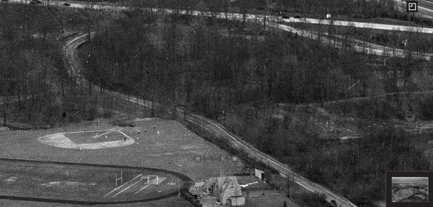
What are those circles in the left half?
___________________________________
Howard Kroplick
I believe these were paths in the original Alley Pond Park
The paths in Alley pond park haven’t changed all that much from photo. Field house is located between the parallel paths in center.
Out of curiosity, I looked on Google Maps and, uh, oh, the Field House seems to be south of the south path. Did the paths change or what, Frank? The ol’ nitpicjker, Sam, III