Mystery Foto #43 Solved : A 1956 View of the Motor Parkway in Levittown Looking West
My favorite co-author Al Velocci challenged you to solve this previously unpublished 1956 photo of the Long Island Motor Parkway.
Answers to the Mystery Foto questions:
- Where exactly was the Mystery Foto taken? What was the orientation of the photographer? Provide a rationale.
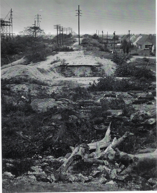
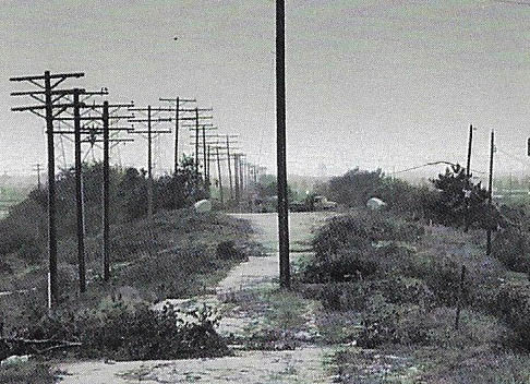
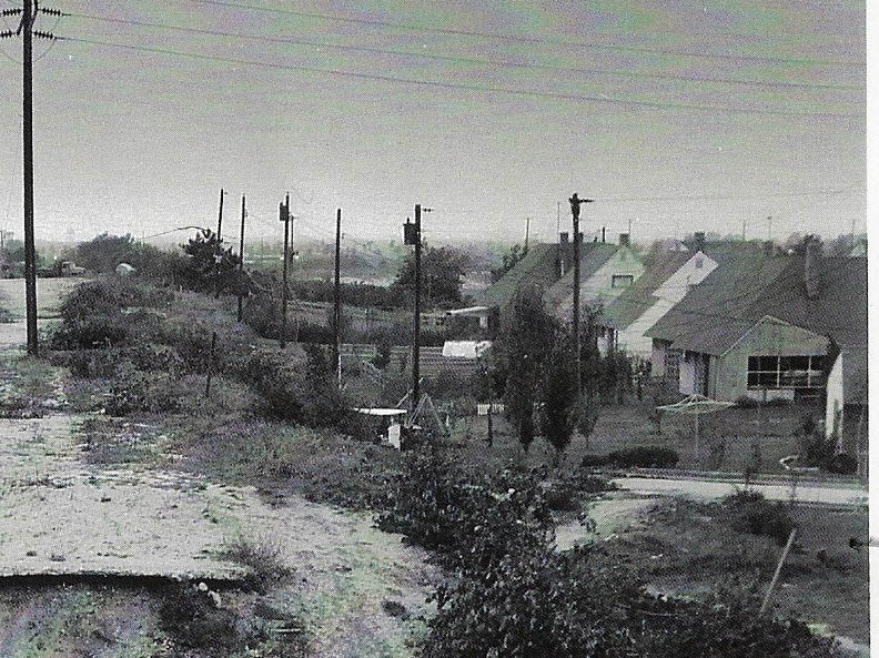
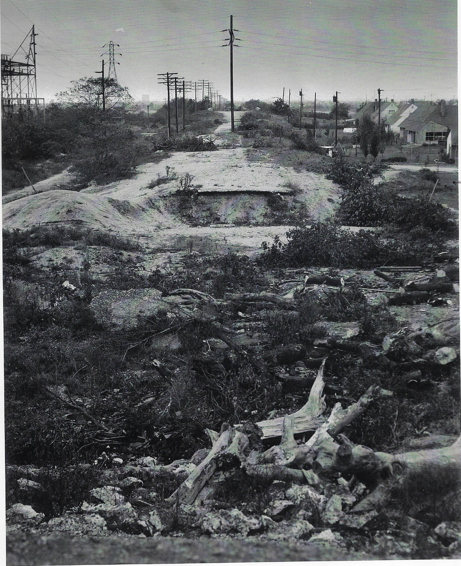
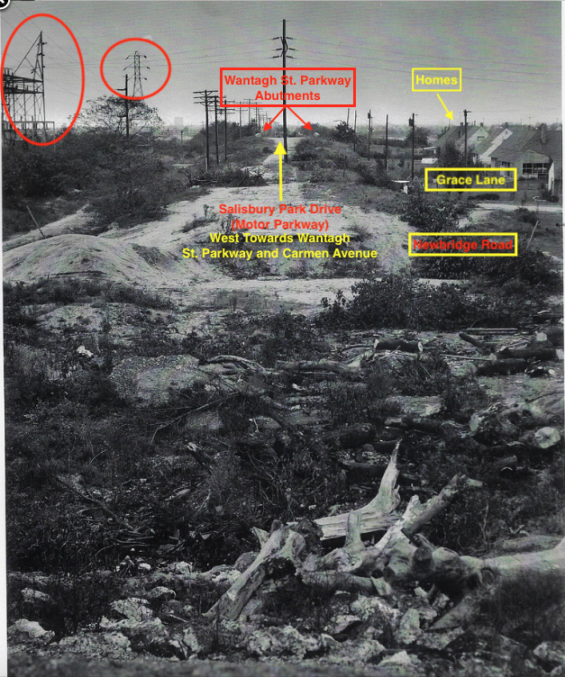
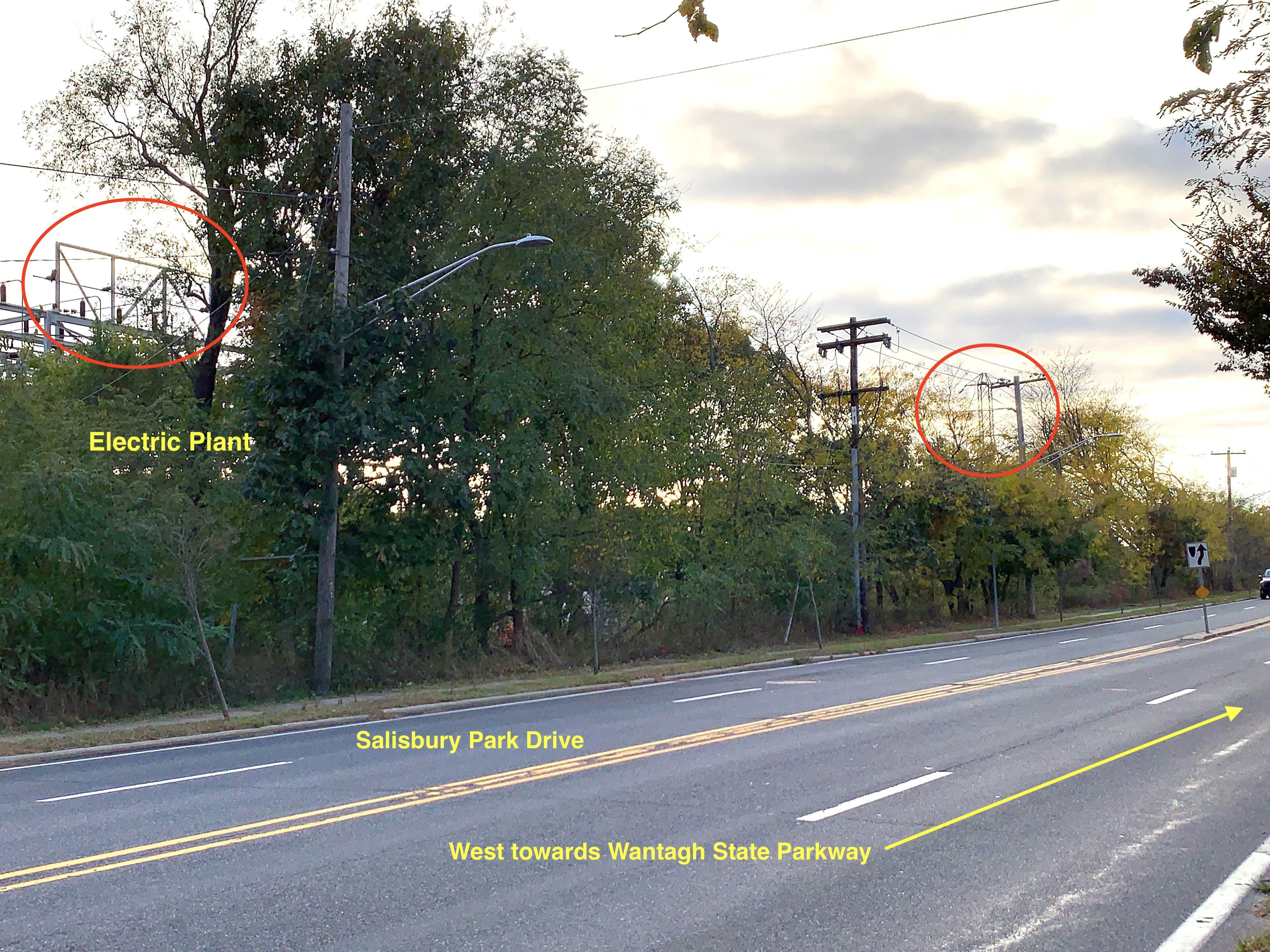
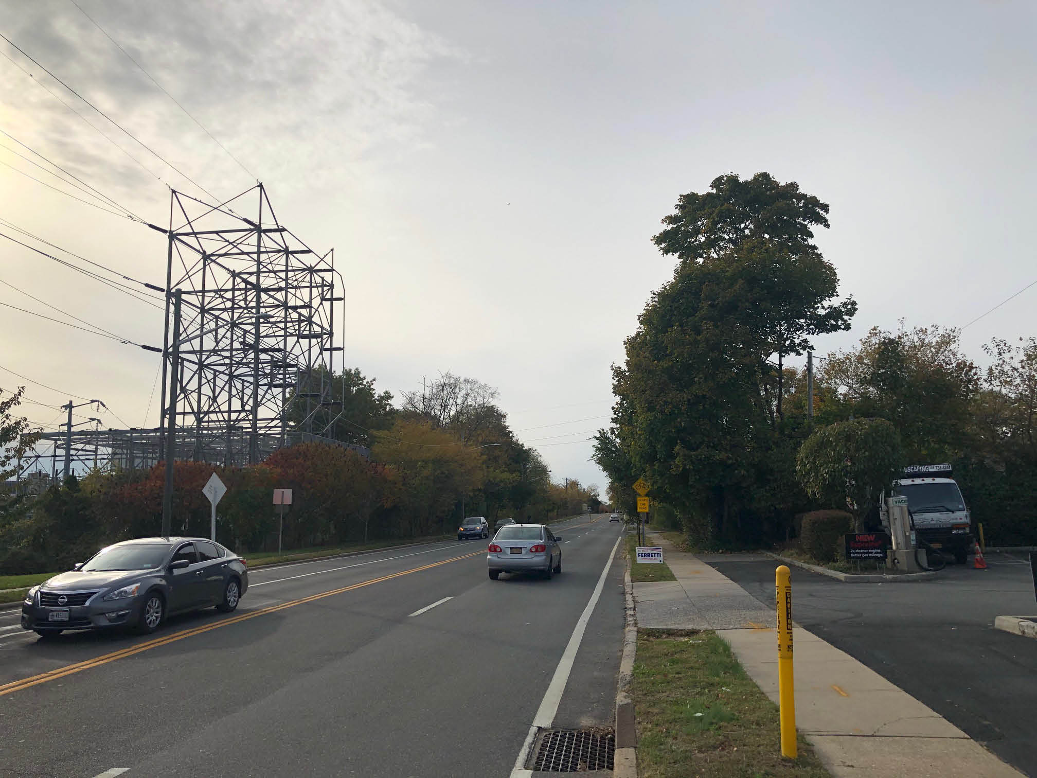
This 1956 photo was taken east of Newbridge Road in Levittown. The photographer was looking west towards remnants of the Newbridge Road Motor Parkway Bridge and the Wantagh State Parkway.
Rationale:
-Levitt houses on the right
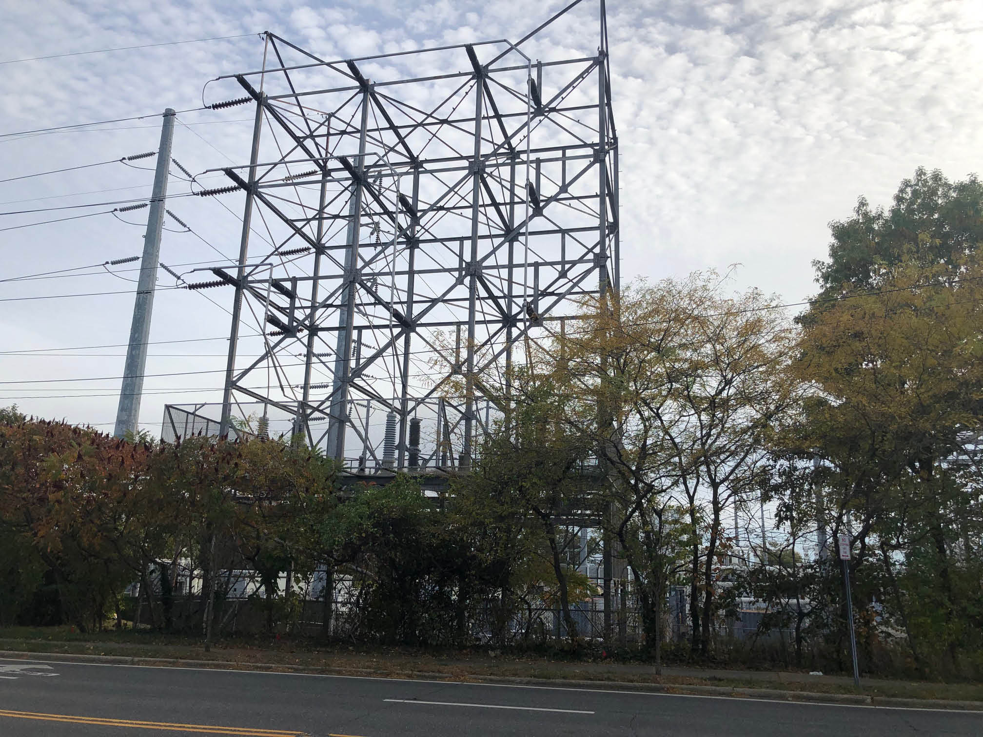
-Long Island Lighting utility substation on the left
-Street on the right
- Identify the Motor Parkway structures
-Newbridge Road Motor Parkway bridge remnants.
-Wantagh State Parkway Bridge built for the Motor Parkway by Robert Moses
- Identify other structures in the Mystery Foto.
-Long Island Lighting gas tank located on Stewart Avenue in Garden City
Comments (18)
Congrats to Pete Mann, Tim Ivers, Brian McCarthy, John Cunningham and Frank Mendyk for correctly identifying Newbridge Road, Levittown as the location of the Mystery Foto.
Kudos to Brian McCarthy for his image documentation and identification of Grace Lane.
Also, a big "tanks" to Sam Berliner III, Steve Lucas, Frank Femenias, George Philippides and Frank Mendyk for correctly identifying the Long Island Lighting Gas Tank in the background of the Mystery Foto.
Enjoy,
Howard Kroplick
Close-Ups
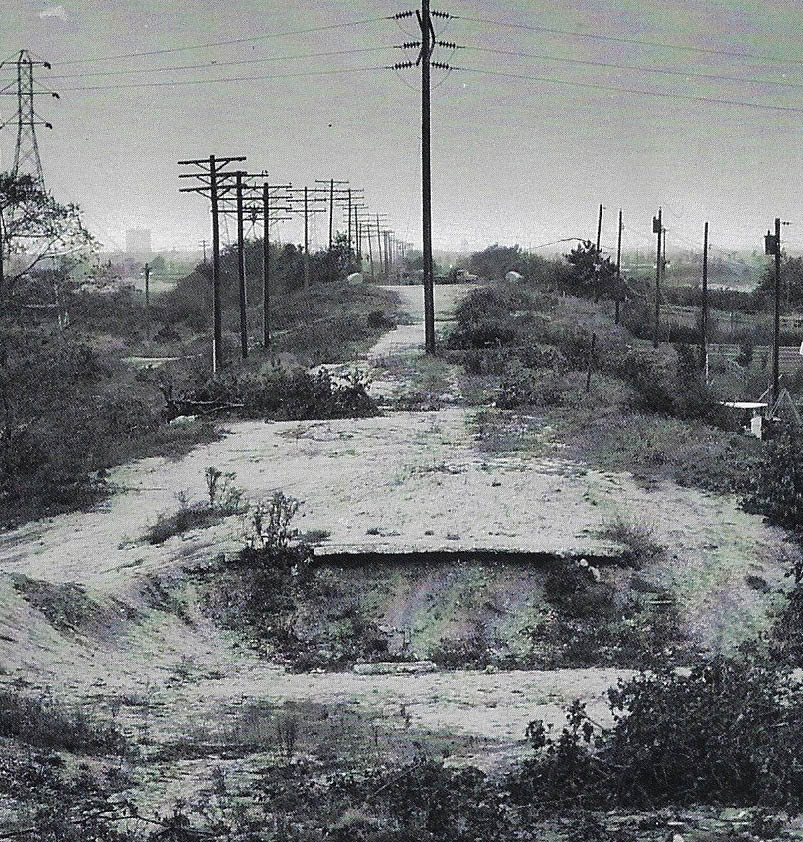
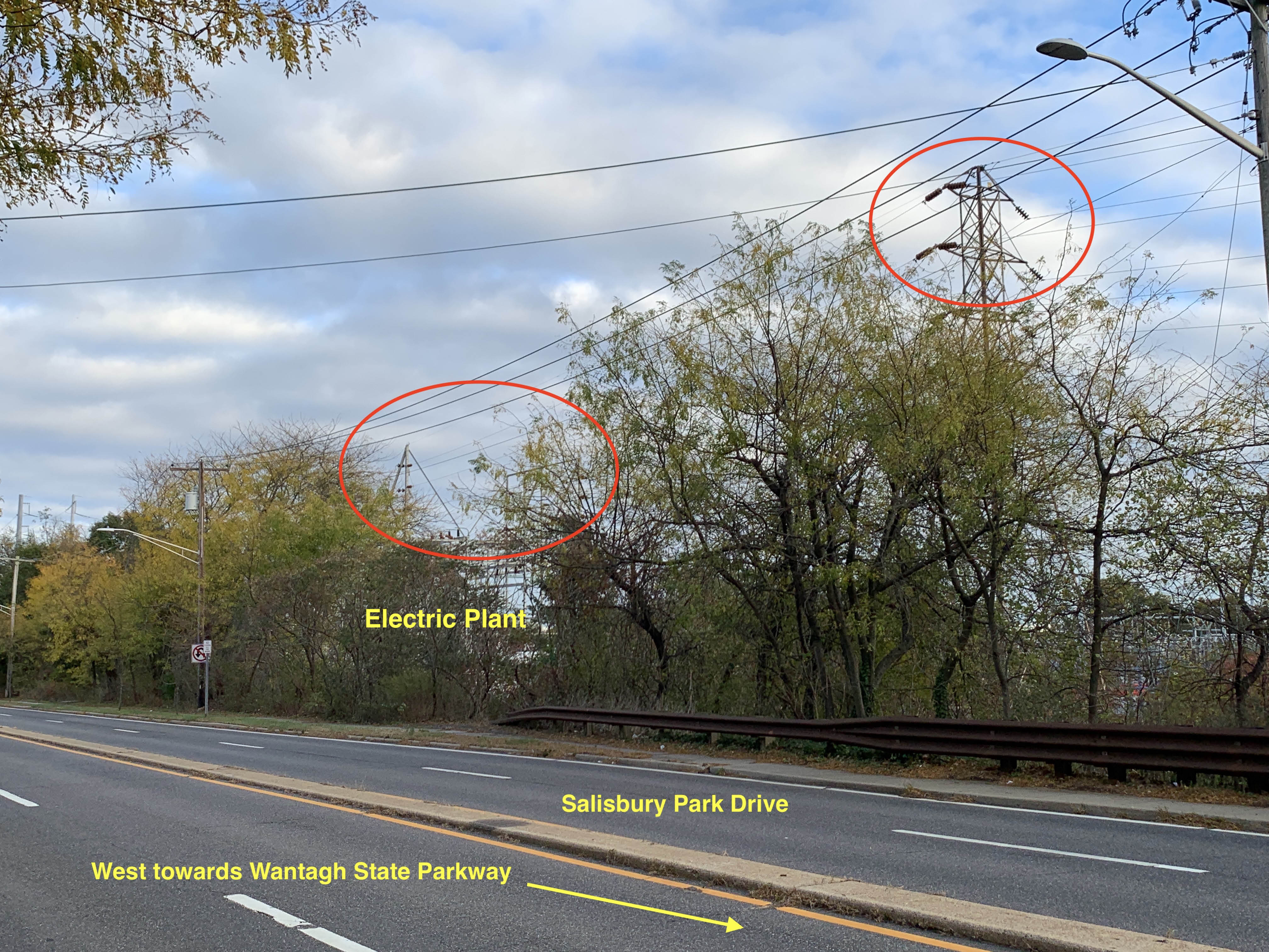
Guardrails of the Wantagh State Parkway bridge.
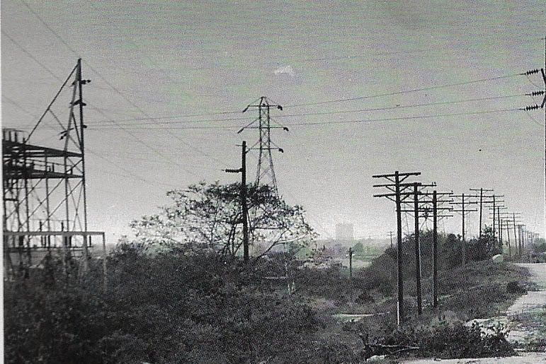
The Long Island Lighting substation and the Stewart Avenue Gas Tank in the background.
Grace Lane in Levittown is on the right.
The Levitt homes are located on Greenbelt Lane.
Kleiner's Kolumn (Submitted by Art Kleiner)
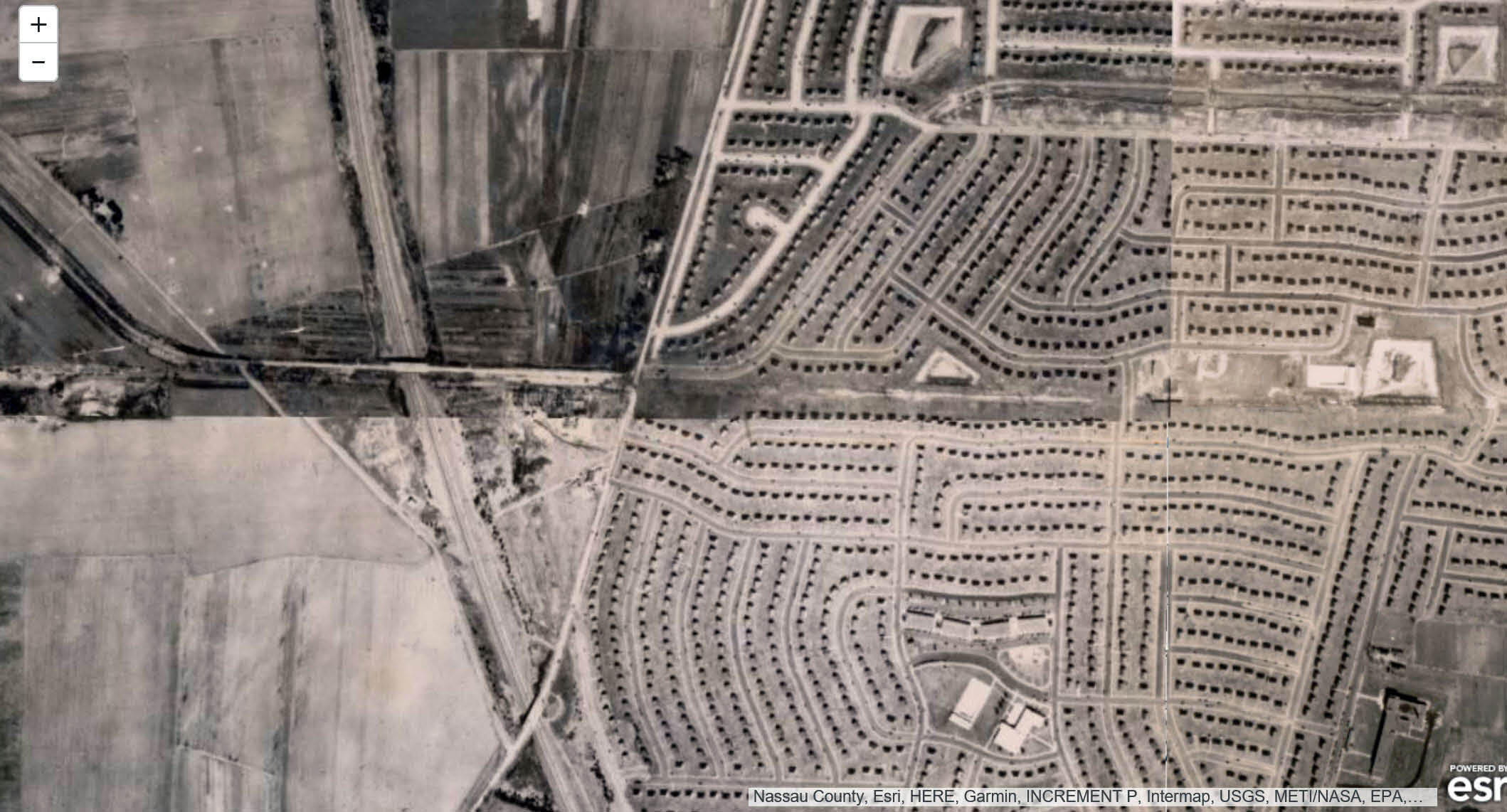
Google Earth-Today
October 21, 2019
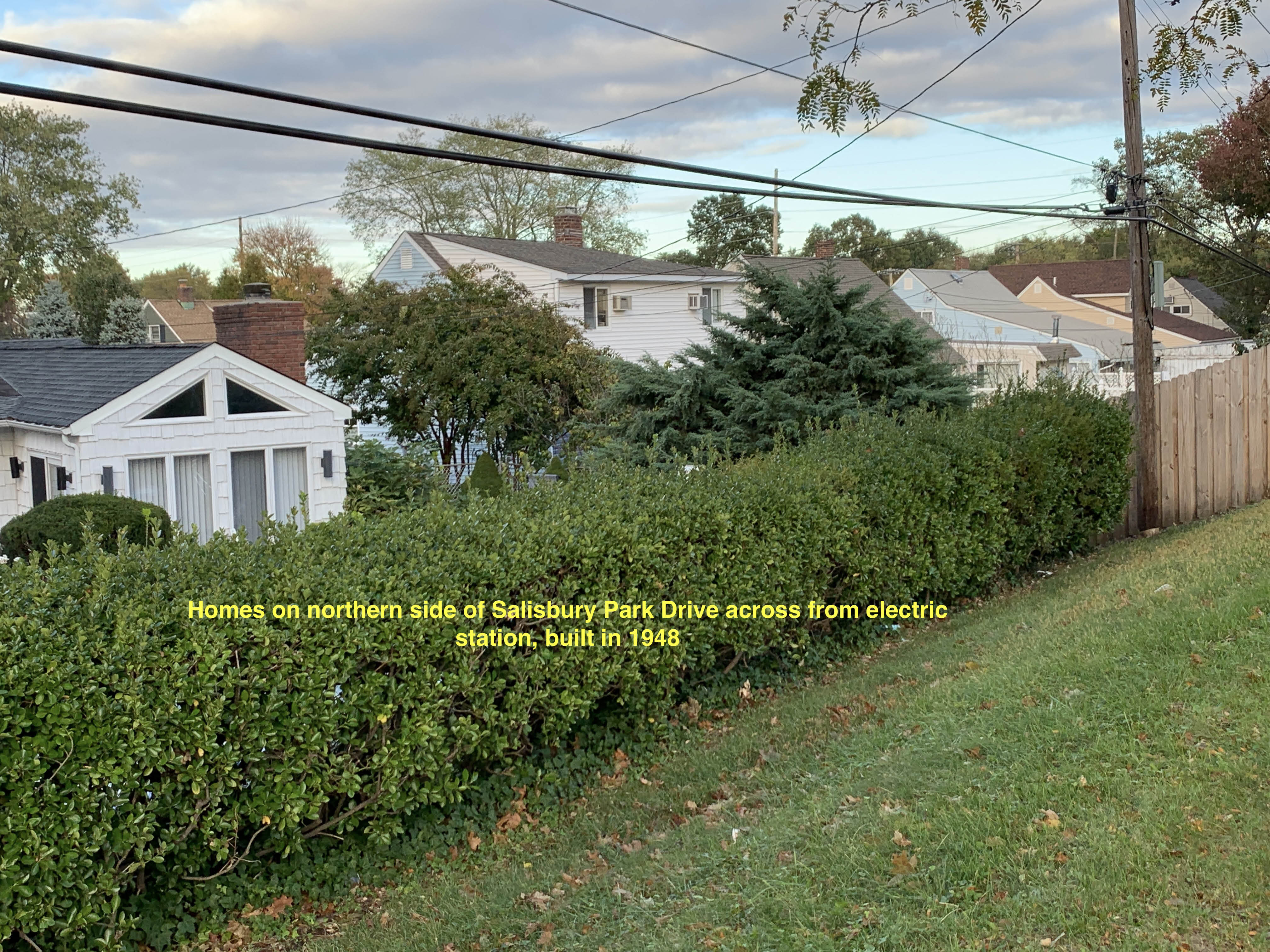
These Levitt homes were built in 1948.
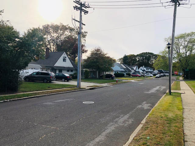
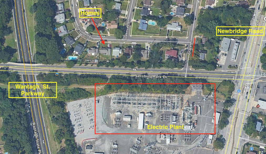
Current Views
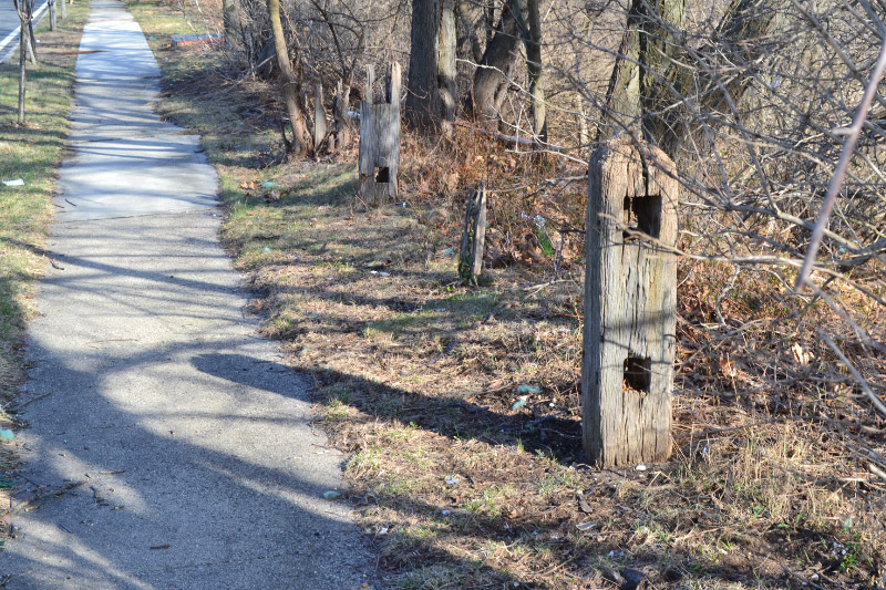
Current view looking west down Salisbury Park Drive from Newbridge Road.
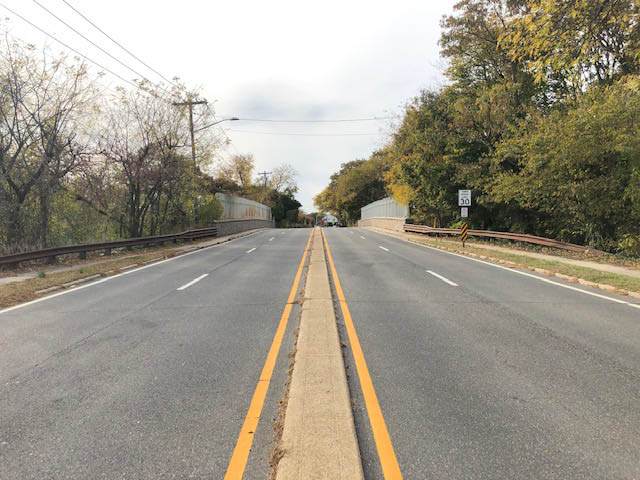
The bridge over Wantagh State Parkway. The bridge was originally built in 1938 by Robert Moses. After the Bridge had been completed, the Motor Parkway had already closed.
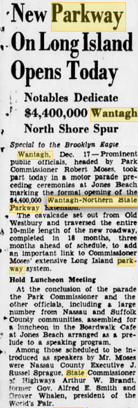
The Brooklyn Daily Eagle December 17, 1938 (Submitted by Art Kleiner)
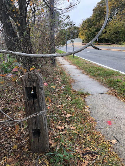
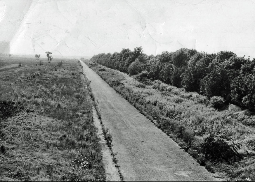
Remnants of the original Motor Parkway bridge over the Wantagh State Parkway can still be found on the south side of Salisbury Park Drive.
Vintage Views
1926- The Hempstead Plains
Location of the Motor Parkway bridge over Wantagh State Parkway as seen on May 27, 1947. The Newbridge Road Motor Parkway was still standing.
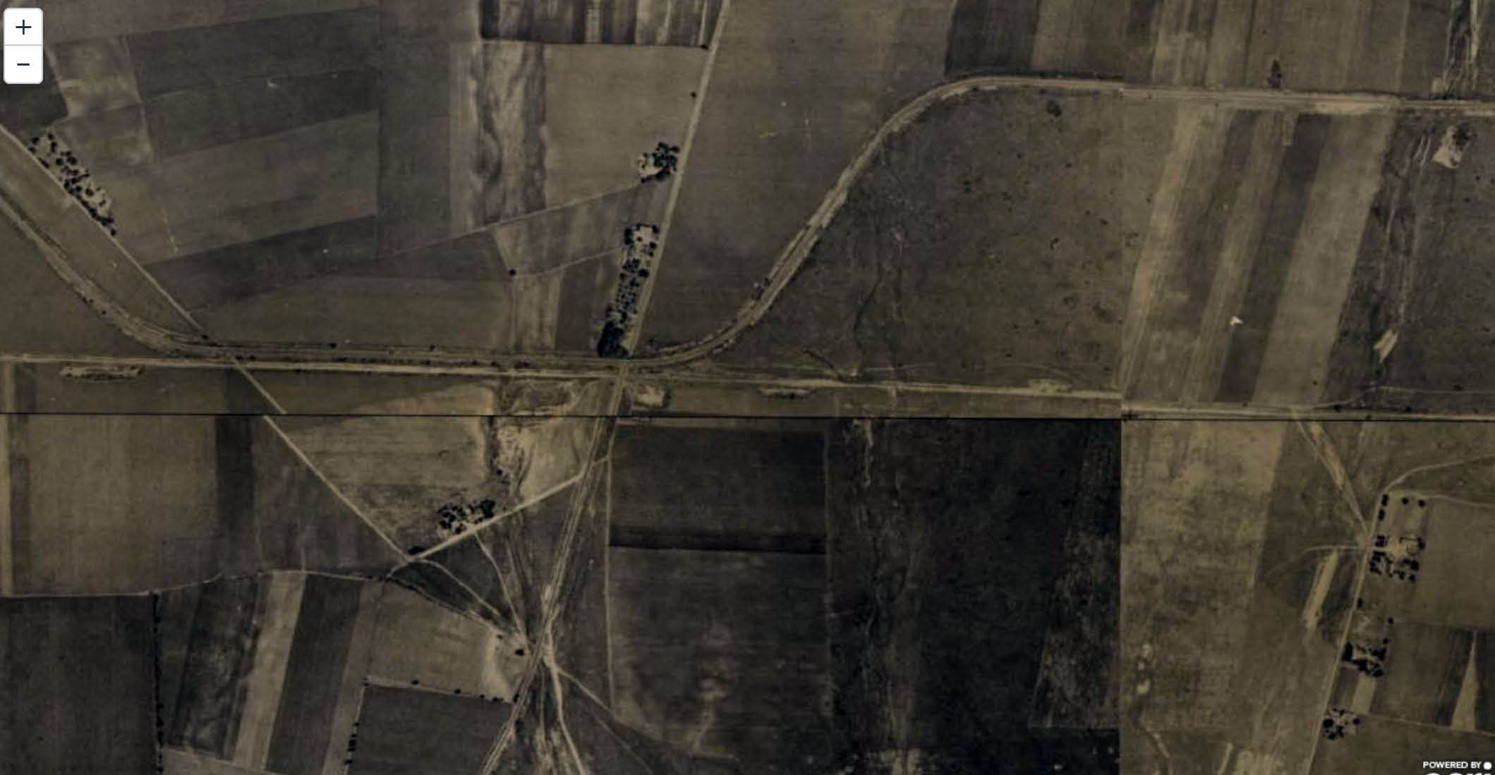
1950- The Newbridge Road Motor Parkway Bridge had been taken down. Salisbury Plains Drive had still not been built.
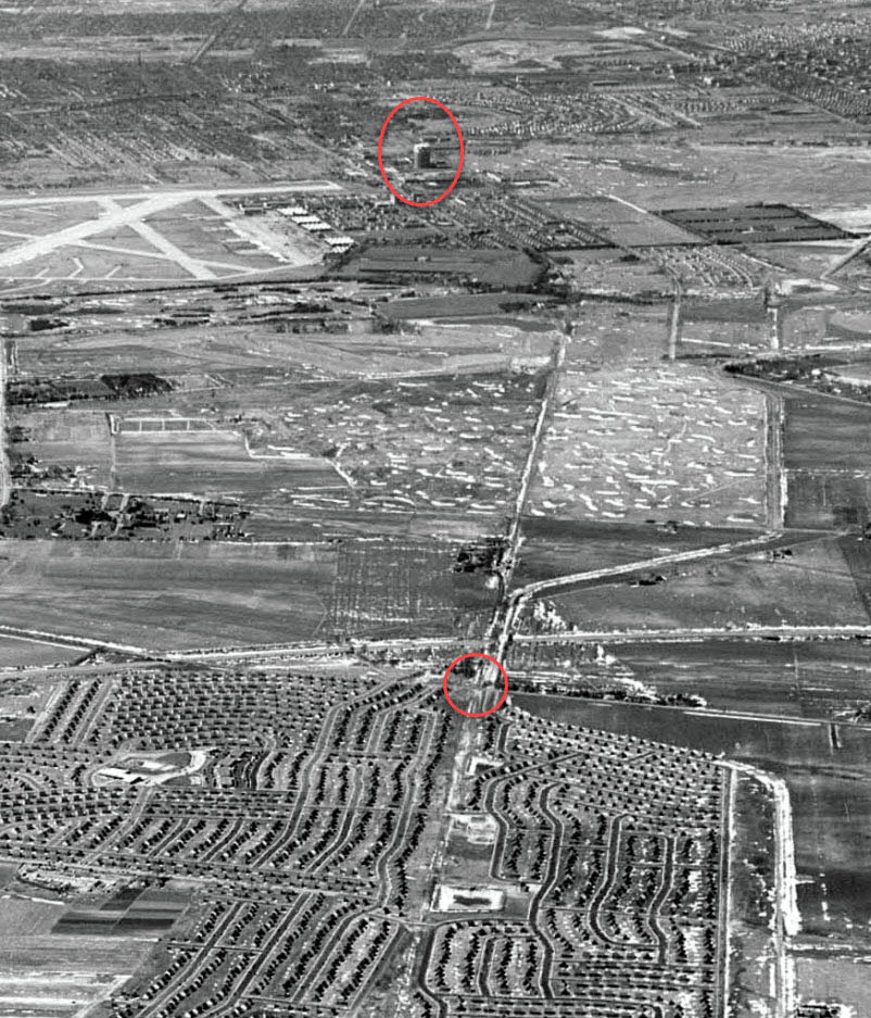
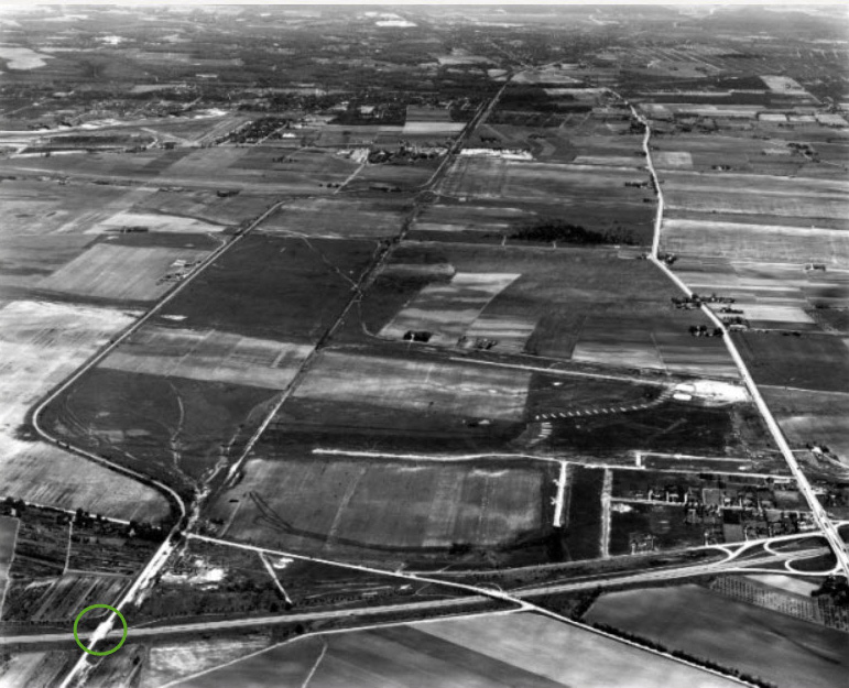
This early 1950s aerial confirms the relationship between our Mystery Foto location and the Stewart Avenue Gas Tank located in Garden City.


Comments
Those look like Levitt houses on the right, so I’m guessing Levittown. I see a tall building in the background, so I’m guessing the photographer was looking west, towards the city. There appears to be a bridge in the background, behind the utility pole in the middle of the photo. Could it be the bridge over Jerusalem Avenue?
Looks like Long Island Motor Parkway before it became Salisbury Park Drive, looking west from Newbridge Road towards Carman Avenue. To the right are Levitt ranches down the block from my home on Grace Lane. To the left is the LIPA substation, in the distance is the Nassau medical center. A neighbor of mine, told me her and her friends would go down the block to play on the motor Parkway.
Besides the obvious ruins of the Motor Parkway, you can see the bridge going over the Wantagh Parkway, when I get home from work I will take pictures of today’s view and forward them.
Looking west from Newbridge Road Levittown at Salisbury Park Drive. The bridge over the Wantagh State Parkway is in center, Parkway light pole (wooden) also visible on left of overpass. Greenbelt Lane homes on right. LILCO substation on left. Meadowbrook Hospital in distant left.
Standing on what’s left of the East embankment of the Massapequa-Hicksville Rd bridge looking West in Plainedge/Bethpage. Power lines which are on the south side of the LIMP to the left. In the photo, the bridge is still standing, but was removed by 1959. Looks like the power sub station is still under construction and the larger power lines and towers have not been erected yet.
No research, and I’m probably wrong, but this looks like possible former location of Massapequa lodge, looking west, wantagh ave ahead of you, former bridge location. Just reminds me of that spot.
Excellent photo! Photographer was positioned at Newbridge Rd, facing west. LIMP bridge over Newbridge Rd is obviously demolished. I know that’s the PSEG substation to the left. LILCO at the time had the wood transmission pole set in the middle of the LIMP, a wood transmission pole is now on the N/S of Salisbury Park Drive. Bridge ahead over the Wantagh State Pkwy is existing post 1938. Going by the 1957 topo map below, a usable roadway didn’t exist between here to Carmans Rd. The bridges are noted at the Wantagh & Old Westbury Rd ( RED B ) Grace Lane is shown as a deadend like the mystery foto. Salisbury Park Dr became fully built by 1966 ( Historic Aerials ).
Ooh; good one! Gas holder or huge building on horizon and high-tension wires in BOTH directions. Should be a dead give-away (but not for me)! Sam, III
Just a guess. Motor parkway in Lake Success going north over Northern State Pkwy. Hi-rise in background might be the first two hi-rise apartment towers in Fresh Meadows.
These are only guesses,but the houses look like Leavitt homes,making the location some where in Levittown.I’m also guessing the tall structure in the far background is Meadowbrook hosp.(Nassau cnty. med center) Hi Al,how are you? Casey
I think we’re looking west from the top of the western bridge abutment at Massapequa - Hicksville Road with the bridge over Wantagh Avenue visible in the background. My rationale is that these were the only 2 parkway bridges that were built this close together. Way off in the distance is the storage tank that was on the south side of Stewart Avenue in Garden City. Could that be remnants from the demo of the Massapequa Lodge on the right edge of the photo?
What a classic Motor Pkwy image! Thanks Al and Howard for sharing this image of the abandoned pkwy. Amazing this photo has survived after all this time!! I believe this mystery will test the experts’ knowledge of the LIMP roadway, where I now find myself struggling to solve as well. My best guess is we’re in Levittown looking west, ON future Salisbury Drive, looking towards the Garden City gas tank in the far distance. This mystery can’t be solved without the zoom feature. The concrete bridge guardrails in the distance likely the Old Westbury Rd bridge and NOT the Wantagh State Pkwy bridge later built by Robert Moses. This photo appears to be pre Wantagh Pkwy. This was a tough one. Thanks guys!
I believe that is the Lilco Gast Tank on Stewart Avenue, Garden City in the distance.
That means this picture is either some place near Jericho Turnpike in Mineola looking south, or Levitown/Bethpage looking west.
This view has to be in Levittown. The Levitt houses are visible plus the power lines.
Motor Parkway Levittown looking west? Newbridge rd Bridge in middle of picture?
Levitt homes on right, power substation on left? Just a guess
possibly NUMC in background
Did not have a lot of time to look at this one. My gut instinct says we are at the Jerusalem Avenue bridge area looking west, along what is today Salisbury Park Drive. I am sad to see the poor condition of our road. The houses we see to the right are on Greenbelt Lane. The LIMP bridge over Westbury Rd.
Photo location- LIMP just west of Newbridge Rd in Levittown. The photo is
looking west towards the Wantagh Parkway bridge.
You can see the Wantagh parkway’s light post just left of the
parkway bridge.
On the left of the photo the Lilco substation can be seen
Other structures- The Lilco gas dome plant on Stewart Ave in Garden City in
just left of the LIMP
The Water Tower next to the Meadowbrook Parkway and
Roosevelt race track is just right of the LIMP
The Stewart RR line ran parallel to the LIMP in this area. It was on the left of the photo. Even after 70 years of non existence the footprints of the tracks are still visible through the pavement of the Wantagh Parkway as you look south 50 feet from the parkway overpass (Salisbury Park Drive).
Funny, none of us picked up on the dirt path immediately south of Salisbury Park Drive on Art’s “Google Earth-Today” aerial. That’s the RoW of the Central RR of LI. You can make it out on the enlargements (now that we know). Sam, III
Excellent detective work, it all makes sense now. What struck me most of this mystery photo is how the elevated roadway cuts through the town, and the massive removal/clean-up yet to follow! Salisbury Drive at grade today gives the neighborhood a different look. The old LIMP looked like an expressway cutting through the small town, essentially what it was.
Growing up in Levittown a friend of mine I spent many summer days exploring this area during the 1963-1966 period along Salisbury Park Drive, the woods next to the Wantagh Parkway, and at a sump that was located just west of the parkway. We would come across railroad ties from the LIRR Central Branch as well as what we now know was the LIMP remnants. The first photo must have been taken from the western edge of Newbridge Road looking west since there isn’t any Newbridge Road pavement visible in the photo. I’m curious to know the year Salisbury Park Drive was built. I think it would have been in the late 1950’s not the 1960’s. Hopefully Art can confirm the date. Great Photos! Thanks to Al and Art.
Hi Casey, Good to hear from you, notice you regularly this site. Still working-construction?
From Art K: I live about a 5 minute walk from this location and have walked in the woods next to Salisbury Park Drive many, many times. Back in 2006 several Motor Parkway posts were there. Up until a couple of years ago I confirmed they were there (at least pieces of them) but have to go back now and see if they are any remaining. In 2009 LIPA did a major undertaking which I detail on on my website which also shows the posts and several pieces of original Parkway.
https://www.freewebs.com/limparkway/levittownsalisburypkdr.htm
From Art Kleiner:
Thanks Mike, now you’ve got me interested in answering your question about when Salisbury Park Drive was built! Remember, Salisbury Park Drive now extends from Newbridge Road to Old Country Road - back in the 50s it didn’t so the answer is not as straightforward as you may think. But look for an answer with some documentation in hopefully the not too distant future. Initial thoughts are in the mid-50s for the section in question.
I used to spend my childhood days riding my bike along what we used to call “Old Motor” in Levittown and we had no idea why it was called that… Between Orchid Road where it curved towards carnation Rd to Newbridge. We were curious about the curved pavement next to the sump between Orchid Road and Pintail Lane. We had bike trails headed east past Pintail Lane school and down to Skimmer lane in the rear yards on Orchid Road where the sump is. Many years later I met my wife who grew up on Orchid and Skimmer which turned out to be the site of the grandstand. Today the is a sign on Skimmer proclaiming the site of the grandstand next to my In-laws house.
From Art Kleiner:
Look for an upcoming blog providing further details about Salisbury Park Drive; however here’s a picture of the Newbridge Road Bridge (at the easterly end of Salisbury Park Drive) being demolished in 1948 and 1947 County improvement plans to Salisbury Park, including changes to the Motor Parkway.
Credit for the above goes to The Nassau Daily Review Star.
Not to quibble with Frank F. (Heaven forfend!) but the LIMP did not “cut through a small town”. For our neophytes, there WAS no town there ‘way back; only the open Salisbury/Hempstead Plains, the East Coast’s only true prairie. The town(s) grew up on either side of the LIMP. Later on, though, it sure did look that way, as we “experts” know and Frank notes. Sam, III
I was about to note that only one tiny patch of the original prairie still exists [at southeast Mitchel Field, tended by Hofstra/LI Studies Inst.(?)], but thought better of it and looked first; there’s more than I realized: <https://en.wikipedia.org/wiki/Hempstead_Plains> - take a look; its well worth your while! Sam, III
Well put Sam. That early in the game there was nothing in sight for miles!
Sam - about 112 acres worth of original prairie, and it’s still vacant! That tract always had me curious. Likely flourishing with water issues associated with that pond just to the north.
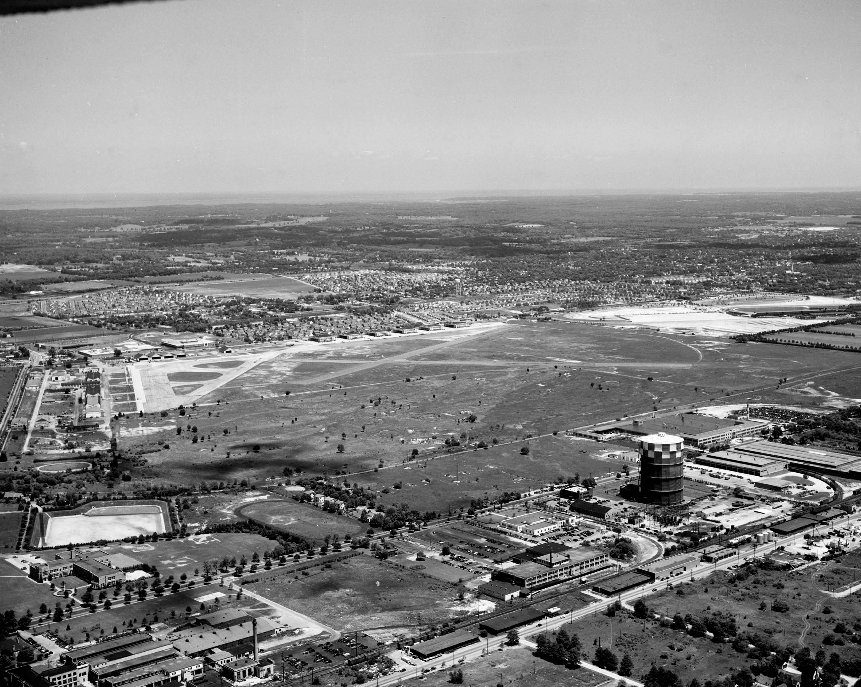
1950 rare view of the Motor Pkwy just south of Roosevelt Field, heading west towards the Garden City lodge. Photo likely taken from the top of the Roosevelt Field bridge.
Hey, folks; Frank F. posted one of the most iconic views of the LIMP, showing next to nothing but the touring car, the open plains, and the ubiquitous construction water pipe at left. It’s SO iconic that I use it on my main LIMP page! But on looking again, I see a busy skyline, with a hill dead ahead, a steeple{?}, woodlands, and somethng off to the right [a spot? - a bird? - a plane? - Sup—- (no, Jor-El was on Krypton and Kal-El hadn’t even been born yet!)]. It could (should?) be a mystery photo in its own right and may well have been one, but, worse yet, I can’t find the story of this pic. HELP, please. Also, in Frank’s 1950 view directly above, there’s that gas holder and the Curtiss stacks {or what?}. Hey! That’s no 1950 view; there aren’t any of the WWII-era buildings along Stewart Ave., especially the Marine Corps center. I vas dere, Cholly, ‘way back then - I’m sooo old! :·) Sam, III
Sam III, below explains the location of Frank’s image. If you zoom into Frank’s image, the windmill is seen on the Ladenburgh property.
Shoulda linked Art Huneke’s ARRT’S ARRCHIVES great page on the electerification tests: <https://www.arrts-arrchives.com/newpage1.html>. Detective work much like on our own LIMP. [By the way, if you haven’t yet, you should also see his LIMP/VCR pages: <https://www.arrts-arrchives.com/MOTORPKY1A.html>, <https://www.arrts-arrchives.com/MOTORPKY1Br.html>, and <https://www.arrts-arrchives.com/limp2.html>] Sam, III
September ‘08, great photo!!
Sadly, today there are homeless people living in the woods of those remaining 112 acres. Walking along the old Perimeter Road southbound on Mitchel Field east of the Marriott hotel heading towards Hempstead Turnpike and the Santini area on the other side, you may encounter some of them as I did.
From Art Kleiner: Lee, yes, I’ve encountered homeless (or signs as to where they’ve been) a few times in my explorations! Sad.
Sad to hear about the homeless in this area. I’ve yet to visit here and always thought this tract to be swampy and uninhabitable; satellite images always show the foliage well flourished throughout. Thank you Lee for the update.