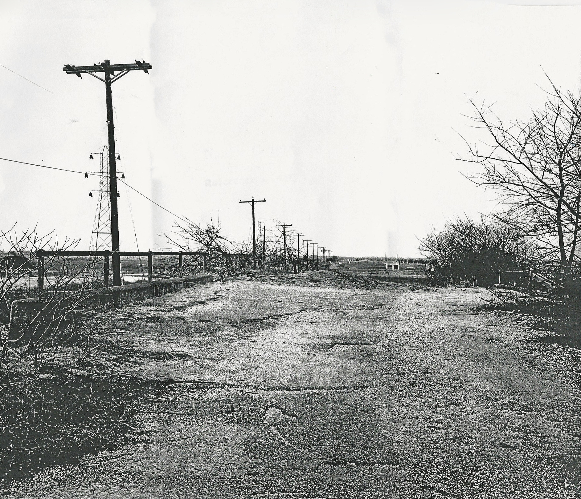
Mystery Foto #29 Solved: A 1955 View of the Old Westbury Road Motor Parkway Bridge
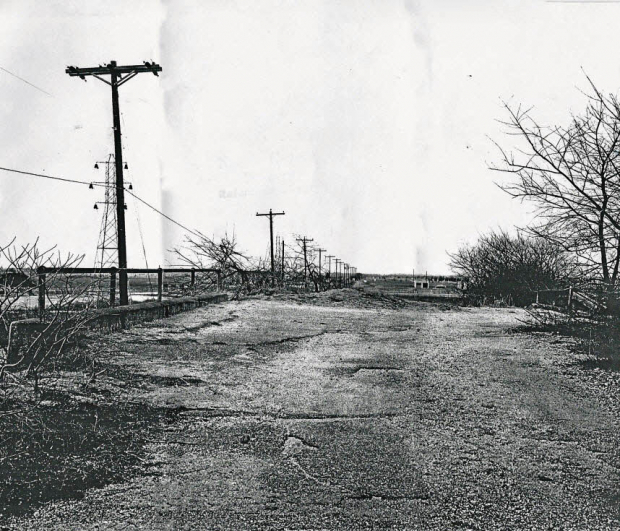
Al Velocci, my favorite co-author, forwarded this never-before- published 1955 photo of an abandoned Long Island Motor Parkway Bridge courtesy of the Nassau County Photo Archives.
Mystery Foto questions:
- Identify the Motor Parkway Bridge. Provide a rationale.
Old Westbury Road Motor Parkway Bridge located in East Meadow, originally Westbury Road in the Hempstead Plains.
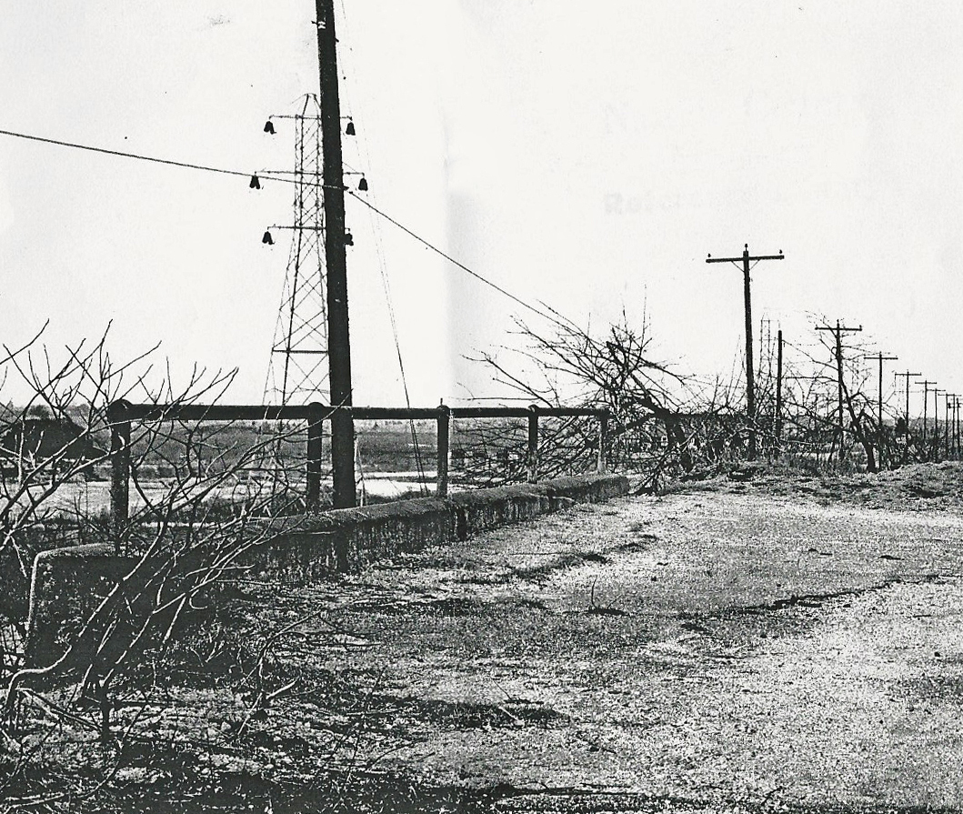
Several clues in the photo:
- The utility poles on the left
- The banking on top of the bridge especially in comparison with the below September 1908 images
- The parkway format of the bridge (Motor Parkway on top) versus the highway format (Motor Parkway under the top)
What is the orientation of the photo?
Primarily west and slightly south.
Kudos to Frank Femenias, Brian McCarthy and Joseph Osterle for solving this very challenging Mystery Foto.
Enjoy,
Howard Kroplick
Photo Caption
The photo appears to have been taken on August 24, 1955. The listed location was Levittown, the area is now East Meadow.
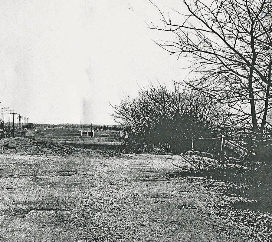
Closeups
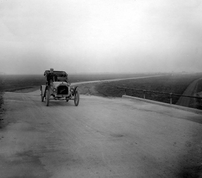
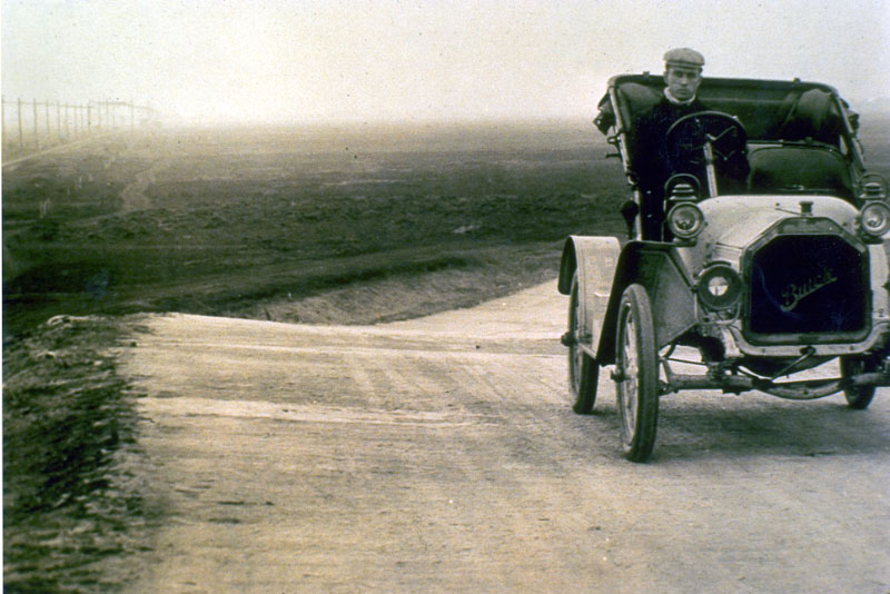
September 1908 Views of the Bridge


Comments
Amazing. Very nice find. Way to go Mr. Velocci.
Ok. The power lines pick up at the Albertson RR crossing. They stay with the parkway all the way out until the Bethpage State Park. And the bridge is the LIMP crossing over another road. It is a standard bridge, and not the larger designs we have seen crossing Westbury Ave in Carle Place, and Clinton Ave in Garden City. So let’s have some fun.
Roslyn Road is first. But the LIMP seems to be going straight for some distance. It curves south shortly after Roslyn Rd. The area does not look right either. I do not believe it is Hillside Ave, the Roosevelt Field, Merrick Ave, or the Meadowbrook Bridge either. Even though the terrain is nice and flat for Roosevelt Field. But now it gets interesting.
It could be the Westbury Road in East Meadow. And there is some evidence to support it. Old pictures of this bridge show the railing low, just like your 1955 picture. The large LILCO power lines are to the south of the LIMP. So this picture would be facing west. The older power cable poles would be there too. Running along the old right of way for the LIRR. I believe by 1955, after the completion of Levittown, the LIRR no longer used this line. At least not east of the Nassau Community College area. Hmmm. This is looking like a real possibility. But for all this to be true, the LIMP would make a significant bend to the northwest. The 1955 picture is grainy. It is hard to tell. But these is one more piece of important information. In the older 1908 era pictures of the Westbury Rd Bridge, the parkway immediately dips at it turns to the northwest. And in our 1955 photo, I do believe I can see the same. I am not saying this convincingly. But with all the other information gathered, it looks like a real possibility to me.
I am strongly in the opinion that the older power lines are there as a remnant of the LIRR right of way. Going further east along the LIMP, the only other bridges that could be placed next to the LIRR are Wantagh Ave, Massapequa Rd and Stewart Ave. I believe the Stewart Bridge was already down by 1955. The Massapequa-Hicksville Bridge would more than likely still show the Massapequa Toll Lodge or the Wantagh Ave Bridge. And I do not see either in this picture. My last possible bridge is Wantagh Ave. But I will trust my instincts…..
Final Answer…. Westbury Rd Bridge. Looking west toward what is today the Nassau County Jail, and Eisenhower Park. The LIMP quickly dips and veers off to the right in this picture. The LIRR ROW runs next to the photo, just south of the LIMP.
Thank you guys so much. I love this.
-joe oesterle
I would guess this is Levittown looking West because the telephone poles are on the left. Based on the angle of the tracks meeting up with the roadway, we are probably east of the grandstand and pressbox, so the bridge is probably Bloomingdale Road, Wantagh Avenue or rt. 107.
My brain is taking a break from the 1973 Newsday photo article. After poking around a bit, I’m thinking this is the LIMP bridge over Old Westbury Rd. The view is facing west. Wood pole line and tower line S/S of bridge. Took a look back at the 10/22/13 LIMP Bridge Series #38 Westbury Rd Bridge in East Meadow. “Ground Image Photo-1950’s” is facing south. Sometime after 1955, certainly by 1966; Old Westbury Rd between Carman Ave and this bridge became Salisbury Park Dr ( LIMP roadbed would be south of here between these points ). And after the demolition of this bridge, Salisbury Park Dr continued east on the LIMP roadbed. Also noticed pipe railings match with 10/22/13 main blog photo. Curious about the double garage looking building in the distance. Maybe part of the corrections facility property?
Another great, tricky mystery with only vague clues to go by. So need to wild guess three possibilities here;
a. It appears we’re on top of a ‘parkway’ bridge, and a ‘highway’ bridge with writing is up ahead.
b. This place seems too desolate for ’55 Queens (more likely Nassau or Suffolk).
c. Those two power lines on left look familiar in East Meadow / Salisbury.
d. The ‘bridge’ pillars down the road look like those of a Queens Motor Parkway bridge.
e. I’m lovin’ it! (not McDonalds).
Less likely:
1. We’re on top of Wantagh Av bridge in Levittown, looking West at the abandoned Bloomingdale Rd bridge. (Unlikely, this place was flooded with Levitt houses in ’49)
More likely:
2. We’re on top 73rd Ave bridge in Queens, looking North at the abandoned North Hemp Tpke bridge. PS 179 (not visible) was built in the same year, 1955.
Most likely:
3. We’re on top of Westbury Rd bridge in East Meadow/Salisbury, looking West at some structure that looks like a bridge.
Once again looking forward to this week’s answers.
Using the visual clues provided: it’s a “parkway” bridge; there’s a fairly long straight run of roadway through open, flat land; Lilco power lines on one side and a long run of telephone poles which might indicate prior train tracks—I’m going to guess the Stewart Avenue (formerly Jerusalem Road) bridge in Bethpage, looking west.
Jerusalem Road Bridge in Bethpage looking West. My rationale is it’s my best guess!
guesses - Westbury Avenue Pkwy. Bridge - Mineola/Carle Place or the Mineola LIRR Bridge
All did well on this one. See new people. As I said,I don’t have much time for this.I’m lucky I have time to check this out now and then,there’s so much to do here,there’s not enough time in the day to do it. I’ll try to keep in touch
Howard,
I think the date is FEBRUARY 24th, not August - look at the foliage - more Winter like - no leaves, not Summertime. At the time (the 1950’s & 60’s) NCDPW documented all sort of projects - before & after - throughout the County with their own photographers - they did B&W photography, color slides & even motion picture film. Fortunately some, but not all, of this documentation was turned over to the Nassau County Division of Museum Services over 40 years ago (they were already there when I started with the Museum) for preservation. It’s great that Al is systematically going through them, something I never had the time to do.