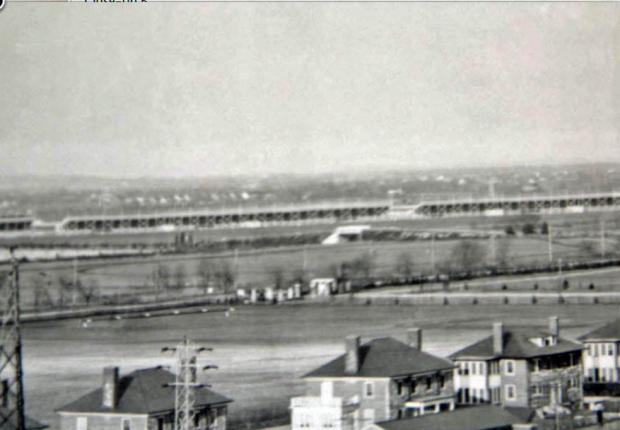
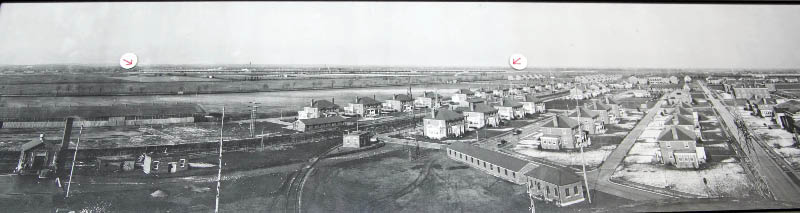
Mystery Foto #21 Solved: A 1937 Cirkut Photo of Mitchel Field and Roosevelt Raceway Update: 5/27
This weekend's amazing Mystery Foto was courtesy of the archives of SPLIA (Society for the Preservation of Long Island Antiquities.)
Mystery Foto questions:
- Identify the location and orientation of the Cirkut photo
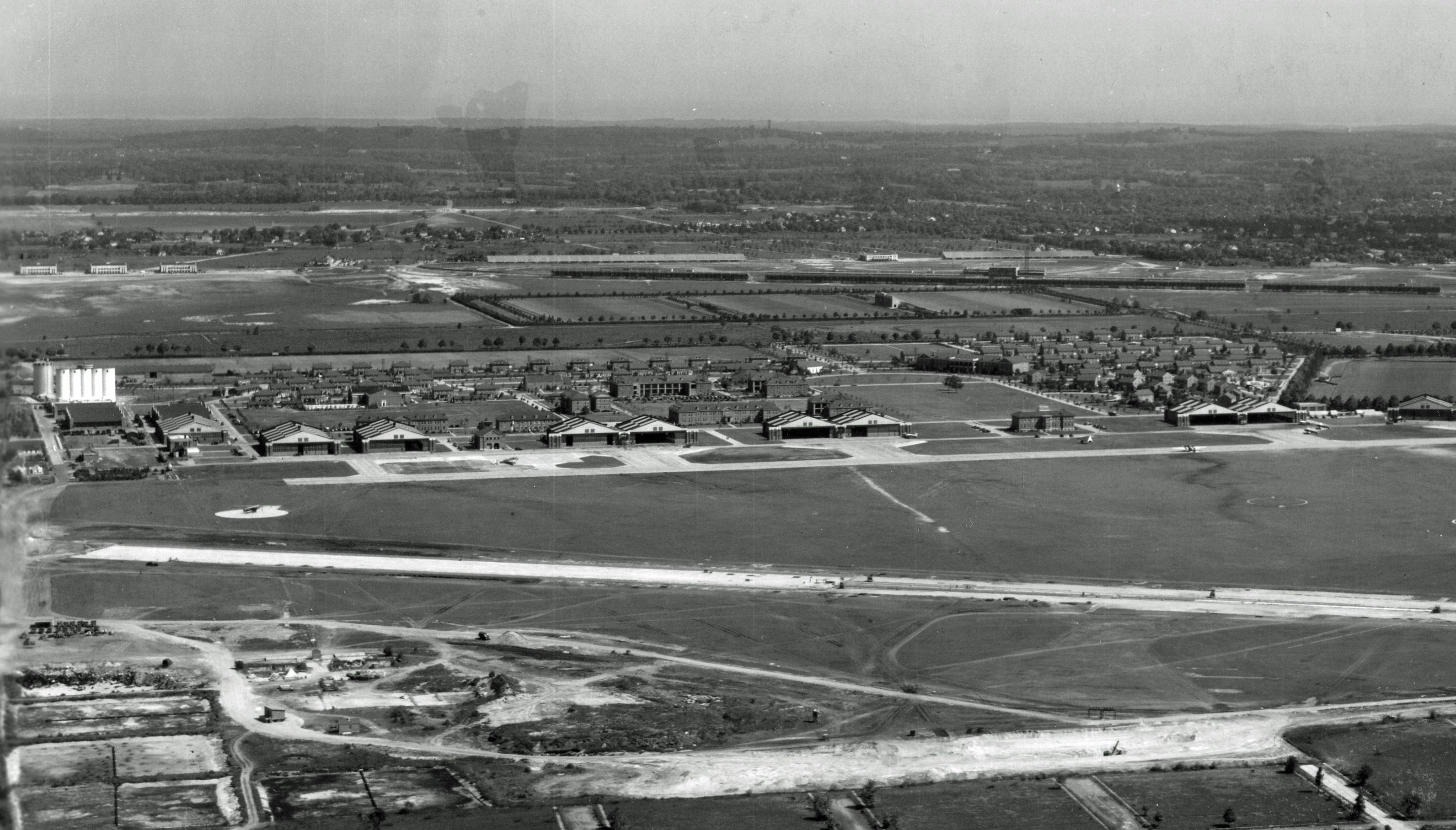
Mitchel Field looking Northeast towards the former location of Roosevelt Field #2. Joel Friedman, volunteer archivist at the Cradle of Aviation, believes this Mystery Foto was not an aerial but a Cirkut photo, taken from atop one of the Mitchel Field buildings. See below Kleiner's Korner submitted by Art Kleiner.
- Name the many significant events that occurred at this location
Mitchel Field
- In 1923, two airplane world speed records were established
- In October 1923, the site for the first airplane jumping contest in the USA
- Air mail service was begun in 1924
- World's first blind flight in 1929 by Lt. General James H. Doolittle
- In 1938, the starting point for the first nonstop transcontinental bomber flight.
Roosevelt Field #2
- Arrival of the British dirigible R34 on July 6, 1919; completing the first east/west non-stop transatlantic air crossing and carrying the first transatlantic air mail.
- Charles Lindbergh took off on his solo flight to Parison May 20, 1927.
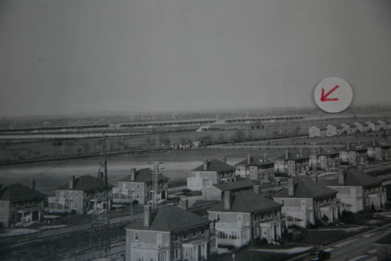
- Identify the structure that is being pointed at by the two red arrows
The grandstands of Roosevelt Raceway-the site for the 1936 and 1937 Vanderbilt Cup Races
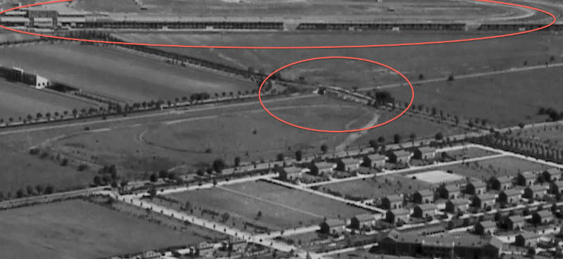
- Identify the train track in the aerial
Former Central Railroad of Long Island with a spur track for Mitchel Field
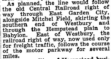
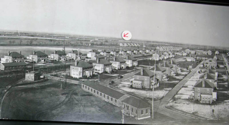
- What Long Island Motor Parkway structure was captured in the aerial?
Roosevelt Field Motor Parkway Bridge
- Can you find the airplane in the aerial?
Located in close-up G
- What is the year of the aerial? Provide a rationale.
1937. Rationale: Roosevelt Racway and construction of the Mitchel Field buildings. Evidence: Caption of the photo.
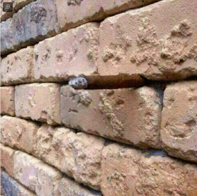
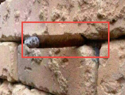
- Bonus: Identify the object sticking out of the below brick wall.
A cigar!
Congrats to A. Ward, Greg O., Jerry Giarratana, Art Kleiner, Sam Berliner III, Michael Appice, Gary Hammond (see Hammond's Historical Happenings), Steve Lucas, and Frank Femenias for identifying Mitchel Field.
Year Kudos (1937): Greg O., Art Kleiner, Gary Hammond, Steve Lucas
Arrow Structure Kudos (Roosevelt Raceway grandstands): A. Ward, Greg O., Jerry Giarratana, Art Kleiner, Michael Appice, Gary Hammond, Steve Lucas and Frank Femenias
Long Island Motor Parkway Structure Kudos (Roosevelt Field Bridge): Greg O., Jerry Giarratana, Art Kleiner, Gary Hammond and Steve Lucas
A cigar for the bonus: Greg O.
Enjoy,
Howard Kroplick
Bonus: Look carefully, a cigar is sticking out of the brick wall
Kleiner's Korner( Submitted by Art Kleiner)
September 9, 1939. The Mystery Cirkut Foto was likely taken from atop the silo.
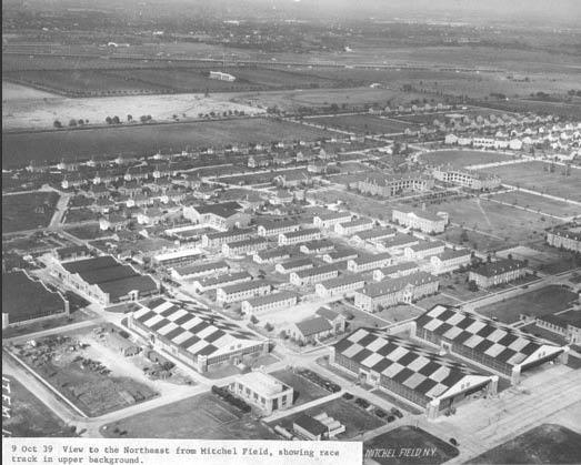
October 9, 1939
The New York Times, September 10, 1921
Close-Ups
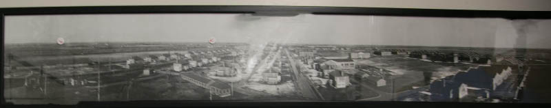
This Cirkut photo is hanging on a wall at the SLPIA archives. The photo is so large that it is presented here in sections.
Close-Ups
Close-Up A.
Arrows point to the Roosevelt Raceway.

Close-Up B.
The Roosevelt Field Motor Parkway Bridge is in the middle of the close-up.
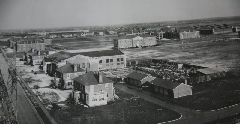
Close-Up C.
Close-Up D
Central Railroad and Mitchel Field spur can be seen on the left.
Close-Up E.
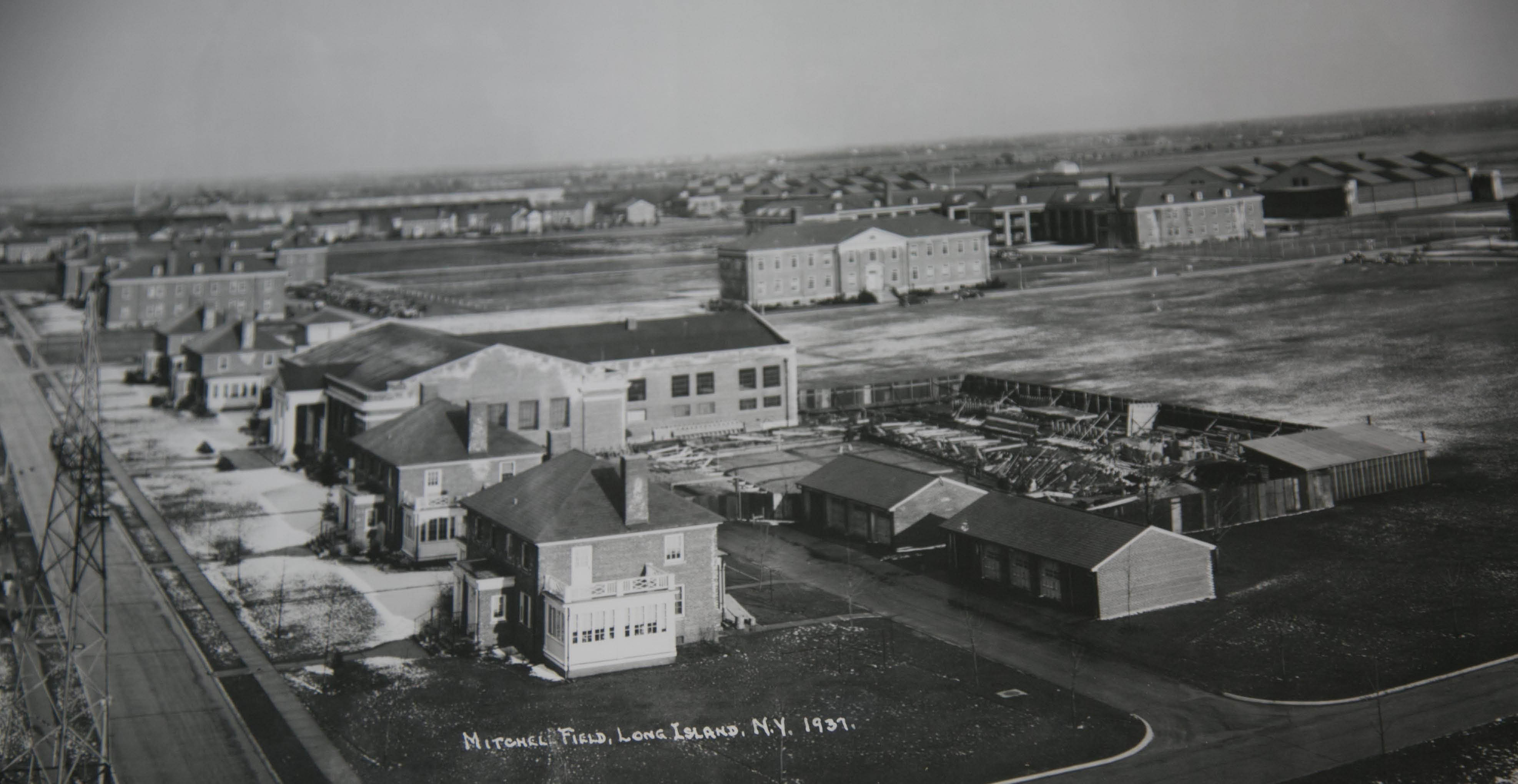
Caption: Mitchel Field, Long Island N.Y. 1937.
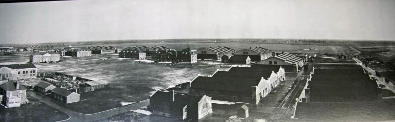
Close-Up F.
Hangars can be seen in the background.
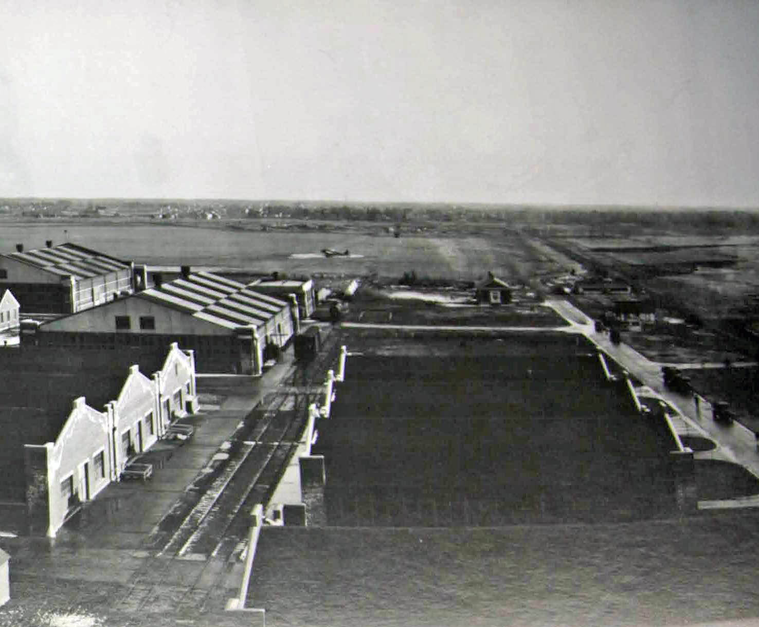
Close-Up G.
Note the airplane on the field.
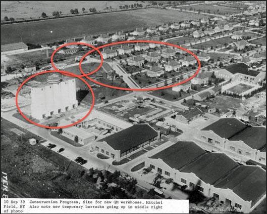
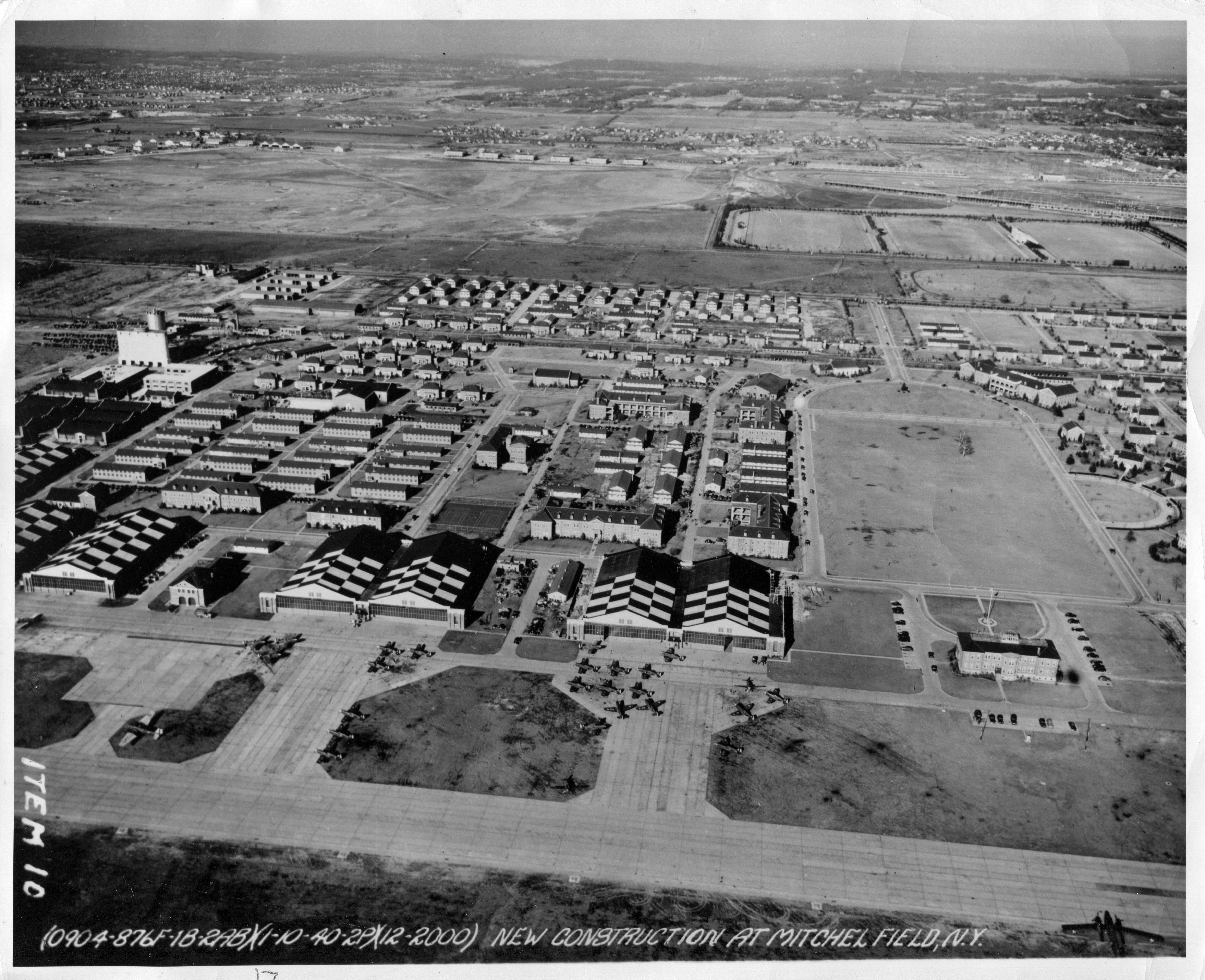
Hammond's Historical Happenings (Submitted by Gary Hammond)
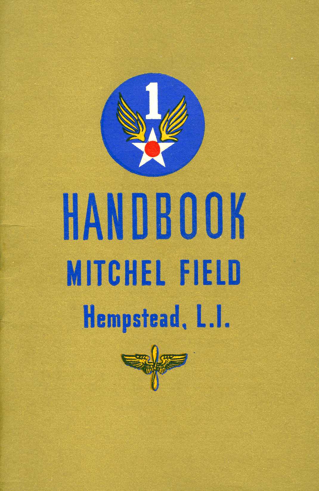
Mitchel Field Handbook- September 1945
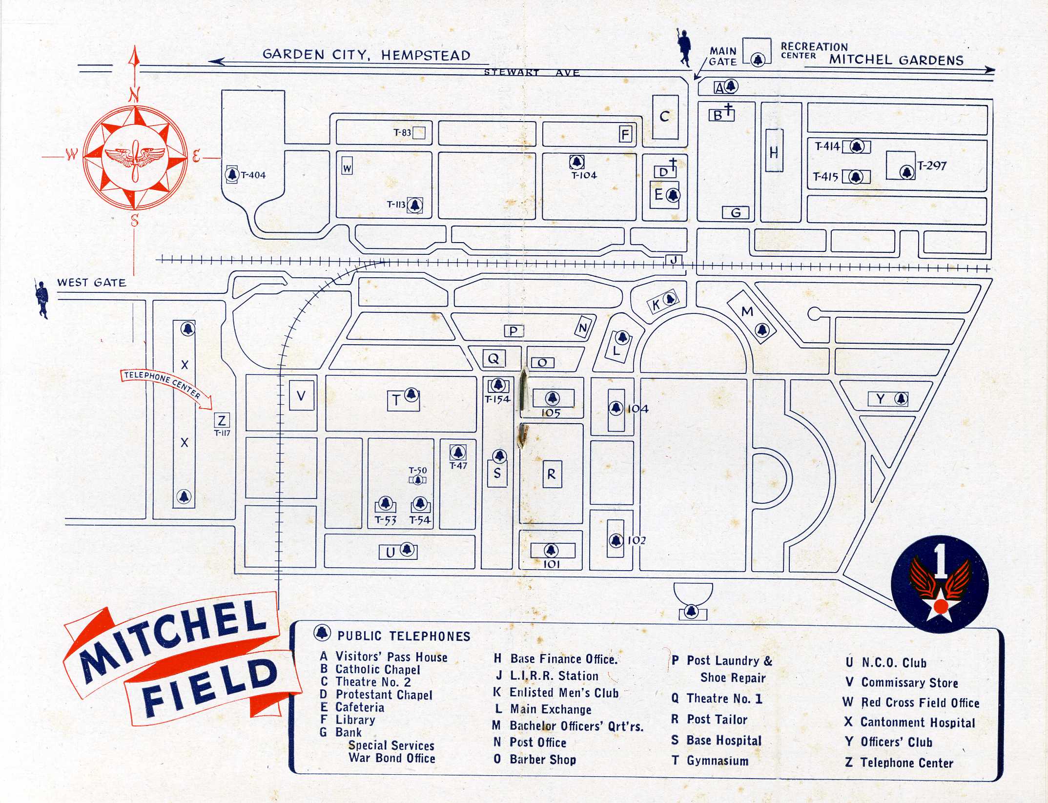
Mitchel Field buildings identified
Views of Mitchel Field (Courtesy of the Cradle of Aviation)- Submitted by Howard Kroplick
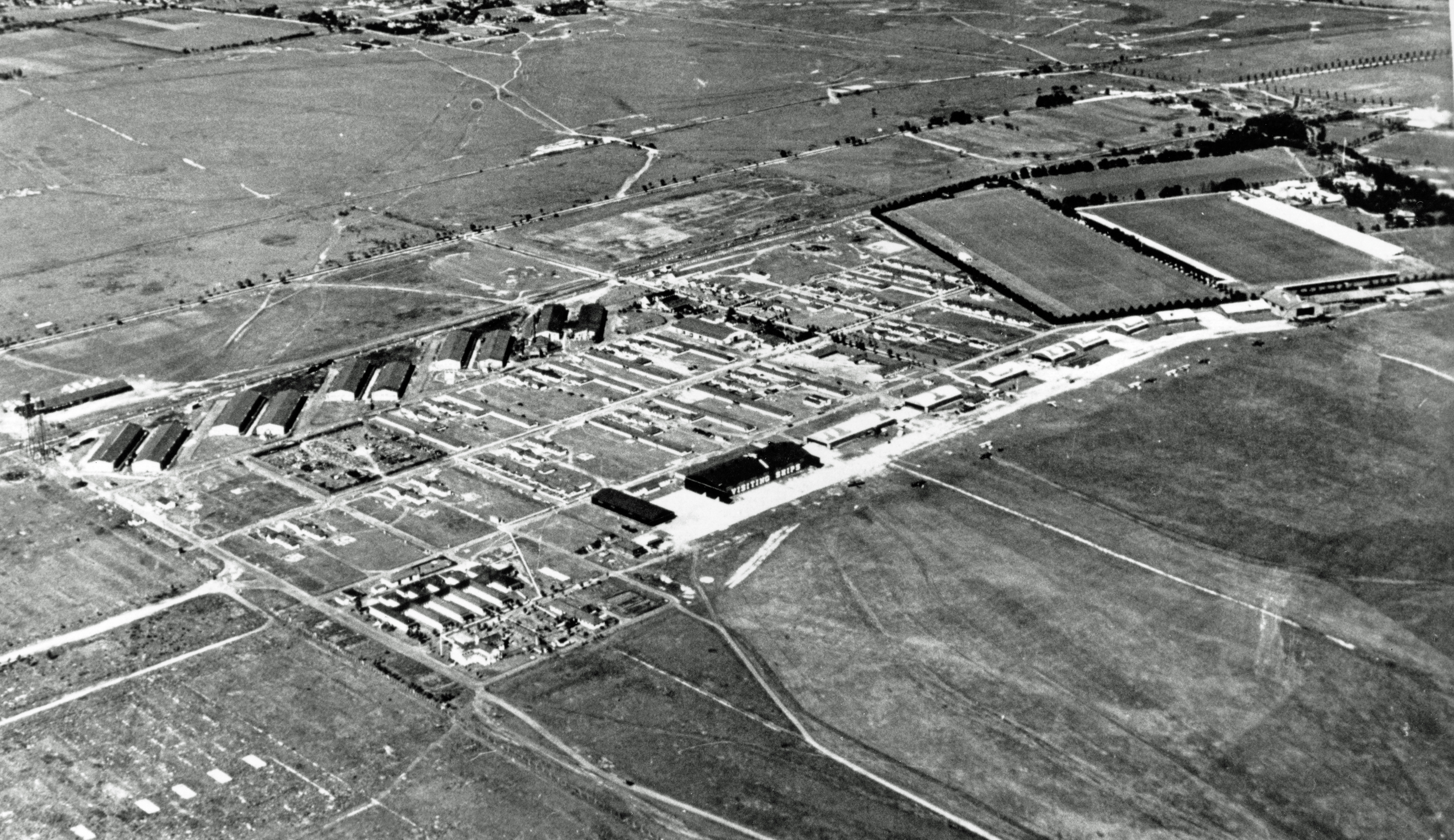
August 10, 1924
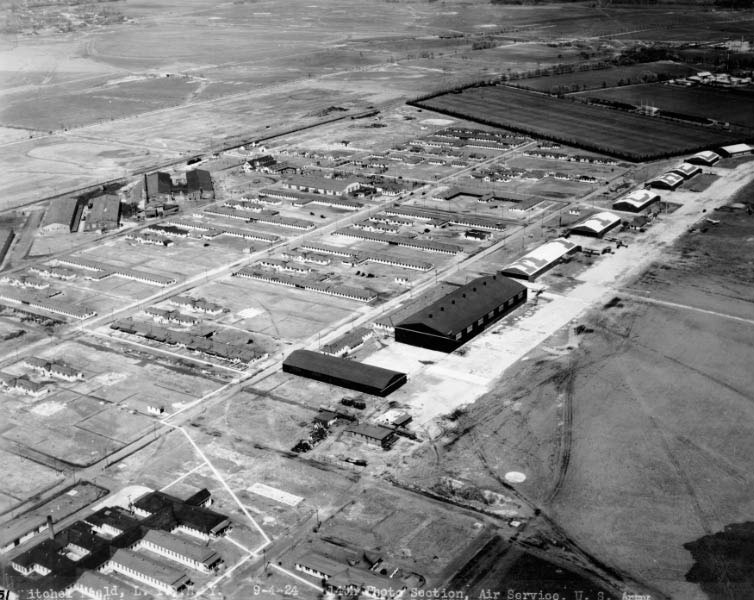
September 24, 1924
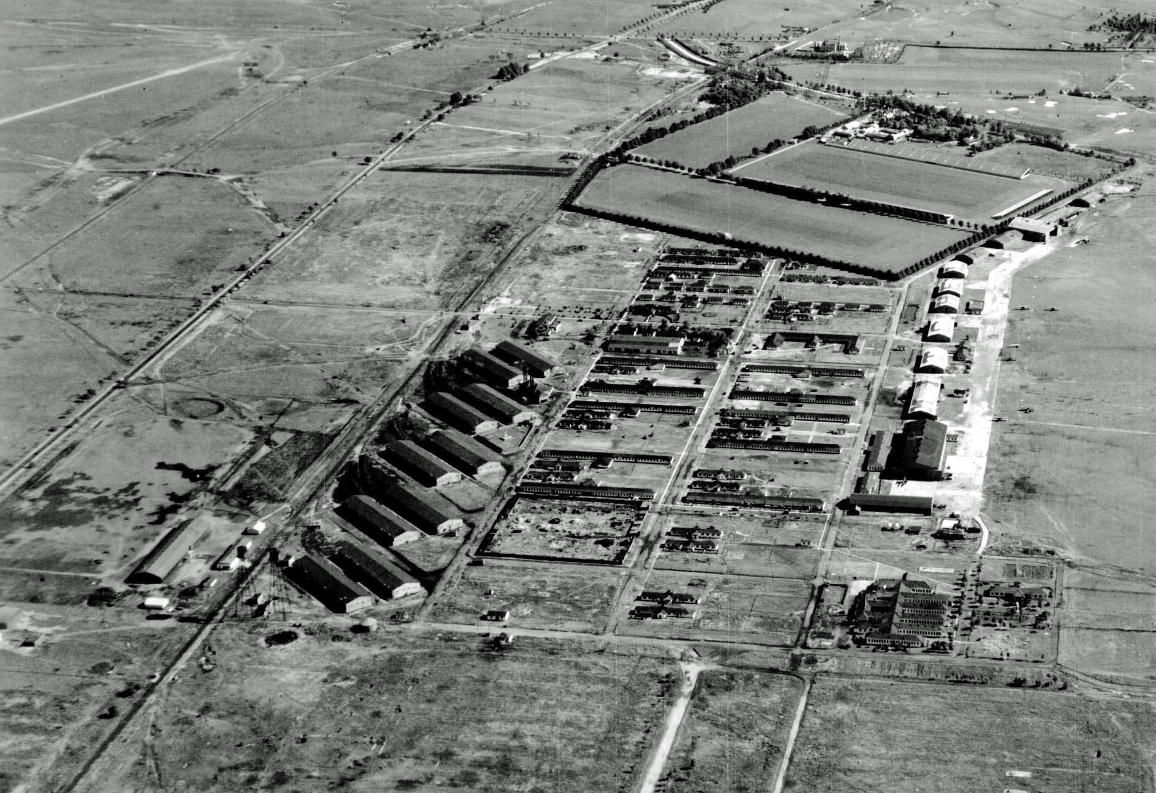
October 10, 1927
May 22, 1938
August 10, 1938
October 7, 1938
January 10, 1940


Comments
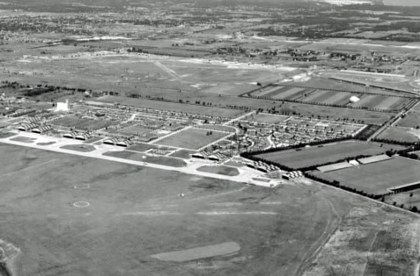
This is Michell Field Housing, LIRR Spurs and the Roosevelt Raceway in back. Circa 1950.
-Identify the location and orientation of the aerial
Mitchel Field. The wide angle, almost 170 degree of view is from about North North East on the left of the photo to South South East on the right side of the photo.
Name the many significant events that occurred at this location
1908,09,10 and 1936,37 Vanderbilt Cup Races
Identify the structure that is being pointed at by the two red arrows
Grandstands for Roosevelt Raceway.
-Identify the train track in the aerial
Tracks can be seen coming directly at the photographer in close up A, and then away from the photographer in close ups F & G. These tracks were a spur for Mitchel off of the Central line in between the first row of houses. 1966 Aerials show some sort of tall silos alongside the spur so one can assume the photographer was on top of them.
-What Long Island Motor Parkway structure was captured in the aerial?
Roosevelt Field highway bridge.
-Can you find the airplane in the aerial?
Parked on the airfield in the center of close up G
-What is the year of the aerial? Provide a rationale.
1937 judging by the Mitchel Field buildings, lack of trees and the grandstands.
-Bonus: Identify the object sticking out of the below brick wall.
I have no clue! A rock?
Mitchell field complex looking toward Roosevelt raceway(red arrows) picture has to be 1936-1937 years of vanderbuilt cup at the track. I assume this timeline because mitchell field housing was built around 1932
Mitchell field was a training base in WW I ,in the 1920’s Air racing was popular here.airmail service started in 1924
During WW ll Mitchell field was used as the “Air Defense Command"This was to defend home soil, bases and other Military facilities in the US.
The bridge is the Roosevelt field motor parkway bridge
The train line was an extension of the Hempstead line (no longer in use) stops at Clinton Ave. I believe it was called the Stewart line and ran to Bethpage junction.
Close up G shows an aircraft ,sitting on the grass runway or tarmac
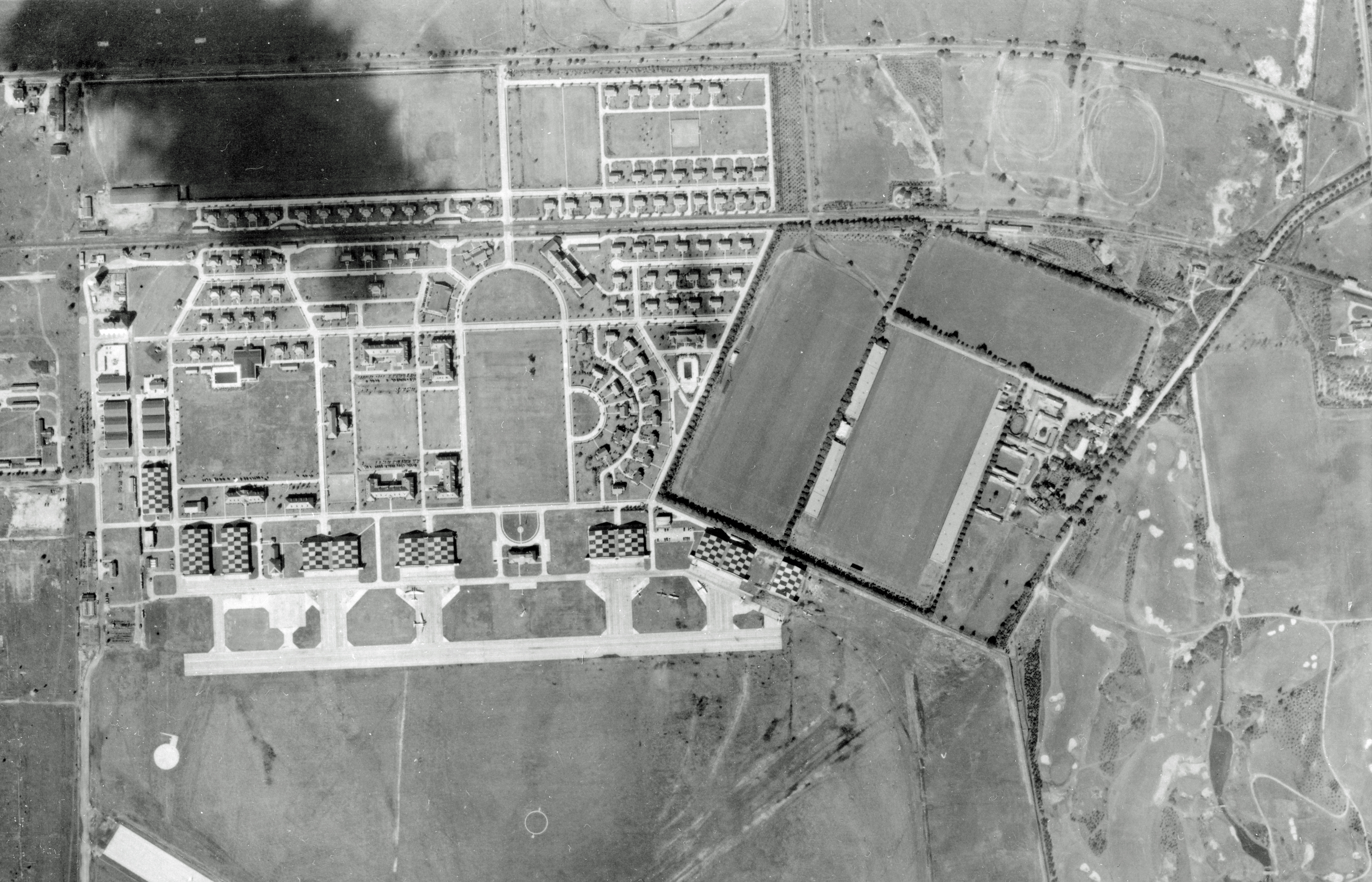
Identify the location and orientation of the aerial: Mitchel Field, Garden City looking northeast towards Roosevelt Field and Raceway. Mitchel Field closed in 1961 after several plane crashes (one into a Hofstra Univ. building).
Name the many significant events that occurred at this location:
1919 British Army R-34 dirigibile landed at Roosevelt Field (first airship crossing the Atlantic); 1920 Pulitzer Air Race speed record by Major C.S. Mosely, 1925 Air Race speed record by Lt. Cyrus Bettis in a Long Island built Curtis racer; 1927 return of Charles Lindbergh after his flight to Paris; 1938 starting point for the first transcontinental bomber flight made by Army B-18s; 1954 last air speed record recorded on LI.
Identify the structure that is being pointed at by the two red arrows: Roosevelt Raceway grandstand
Identify the train track in the aerial: Central RR
What Long Island Motor Parkway structure was captured in the aerial?
Roosevelt Field Motor Parkway Bridge connecting Stewart Avenue with Roosevelt Field.
Can you find the airplane in the aerial? Close up in G. East end of panaromic photo.
What is the year of the aerial? Provide a rationale. 1937 - Grandstand built, compared to a 1939 photo sent to Howard some buildings had not been built yet.
Bonus: Identify the object sticking out of the below brick wall. Snake peeking its head out of the wall.
Clearly Mitchel Field, looking NE with the LIRR Meadowbrook Secondary and LIMP beyond, with the parade ground in E, officers row in C and D/ LIMP bridge in B. Plane in the upper middle of G = this mod-‘30s. Bonus - memorial pebble in Jerusalem’s Wailing Wall! Sam, III
The aerial looks like Mitchell Field Air Base looking north northeast. Major events were the Vanderbilt Motor Parkway Cup Races and the only 2 major road races held at Roosevelt Raceway.The air base held the National Air Races from 1920 -1925 and was a major hub for air defense during WW ll .The structure indicated by the red arrow is Roosevelt Raceway site of the 1936-37 Vanderbilt Cup Race. The railroad is the Central Branch of the LIRR Mitchell Field Sta. The Motor Parkway Structure looks like the Merrick Ave Bridge of the LIMP. In closeup g you can see a plane on the field.I think the time of the foto is late 1930s about 1935-1940 .The object in the wall looks like a lead bullet.
From Gary Hammond
• Location & orientation - Mitchel Field, prior to becoming Mitchel Air Force Base, looking (l to r) from the north, then to the east, then to the south; taken from top of coal bunker
• Significant events – numerous events (see William K. Kaiser’s The Development of the Aerospace Industry on Long Island, Vol. III, A Chronology: 1833-1965, Hofstra Univ., 1968, for a comprehensive listing); including the Pulitzer Trophy Race which was held here in 1920 and 1925; the 1st “blind” flight by Jimmy Doolittle, Sept. 24, 1929; home to the Medical Research Laboratory and School for Flight Surgeons, 1919-26; (The school trained medical personnel in the specialized field of aviation medicine, and also conducted research to improve physical and technological problems experienced by fliers – today it’s known as the USAF School of Aerospace Medicine); numerous record setting flights took off or landed here; served as a major embarkation point for military flights overseas.
• Structure with 2 red arrows – Roosevelt Raceway grandstands
• Train track in aerial – former Central RR of LI, also spur going to coal bunker & alongside warehouses (later base PX)
• LIMP Structure – Roosevelt Field LIMP bridge
• Airplane – located in close-up G
• Year – winter of 1937/38?; after the George Vanderbilt Cup races; snow on ground; hangars have been doubled in size, but still retain checkerboard roof markings (so pre-WWII camo)
• Object in wall – Civil War lead bullet (Minie Ball)
• See attachments for cover & map from Sept. 1945 Mitchel Field Handbook with some of the buildings identified
I forgot to note that the Cradle of Aviation Museum has all sorts of great pix and maps, such as those at http://sbiii.com/limpmaps.html#mitchel and http://sbiii.com/limpmaps.html#WWILIMap , and SPLIA also has the Soils Map http://sbiii.com/limpmaps.html#soilsmap. It would be great if you could get better shots of those. Sam, III
The photographer appears to be over Garden City with his camera pointed northeast toward Westbury. The structure in the background is the grandstands built for the 1936 & 1937 Vanderbilt Cup Races. The train track is the LIRR Central Branch or A.T. Stewart’s old Central Railroad. In the center is the bridge over the LIMP connecting Stewart Ave. to Roosevelt Field (& raceway). The airplane is on the right side in Mitchel Field. The date is at least 1937 but might be a year or so later based on the finished condition of the buildings at Mitchel Field. Among the many events that took place hear are: Lindbergh’s 1927 solo flight; the previously mentioned Vanderbilt Cup Races; the R-34 Dirigible’s landing in July, 1919; Lindbergh’s homecoming celebration (6/16/27); Clarence Chamberlin’s first passenger flight to Eisleben, Germany; Chamberlin’s stunt flight taking off from Stewart Ave. in 1928; and the site of the first retail shopping mall in NY State (1956). The bonus photo could be a Civil War era “Minne” ball (bullet).
My revised answer for the bonus photo is it’s a cigar sticking out of the wall. Great optical illusion!
This could be a rear view of Roosevelt Raceway’s grandstand looking ENE in Westbury (E Garden City) showing Motor Parkway and its Roosevelt Field ‘highway’ bridge along the raceway’s southern perimeter. If correct, the roadway parallel to Motor Parkway should be Stewart Ave heading east, just before crossing over MSP (not yet built) and heading towards Salisbury Park’s entrance (Eisenhower Park). The houses in the foreground would be Mitchel Gardens (housing development for Mitchel Field’s personnel), still under construction in 1941. Great job at OCR’s bridge! A favorite LIMP spot, I’m feeling vibes this section could be the next major restoration project for the LIMP greenway thoroughfare. Staying tuned for PSE&G’s massive cleanup…..
Great Mitchel Field aerials from Cradle of Aviation.