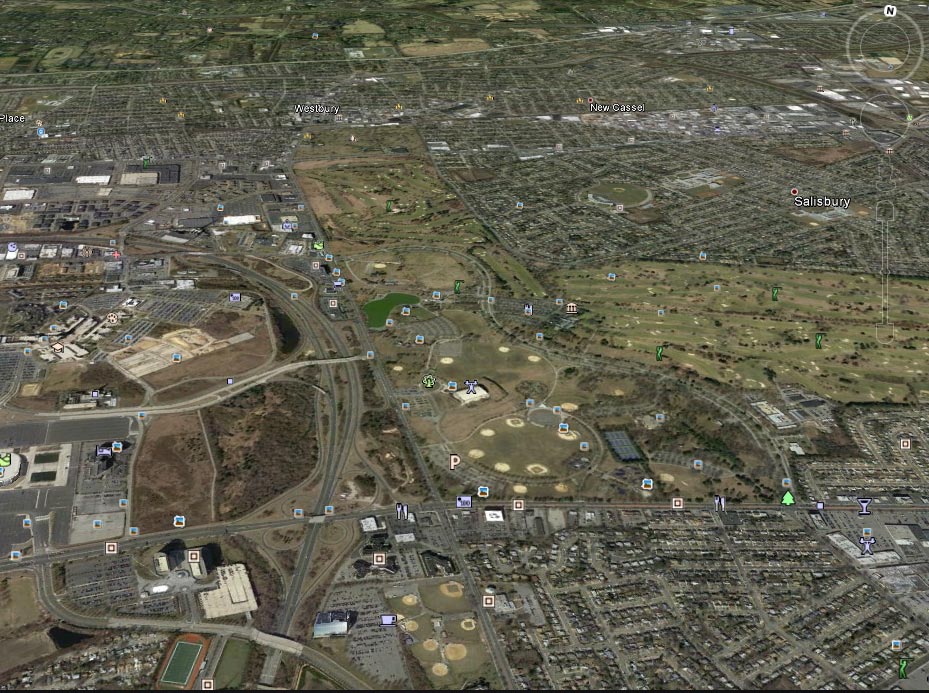
Mystery Foto #14 Solved: East Meadow/Westbury: Location for Six Vanderbilt Cup Race Courses
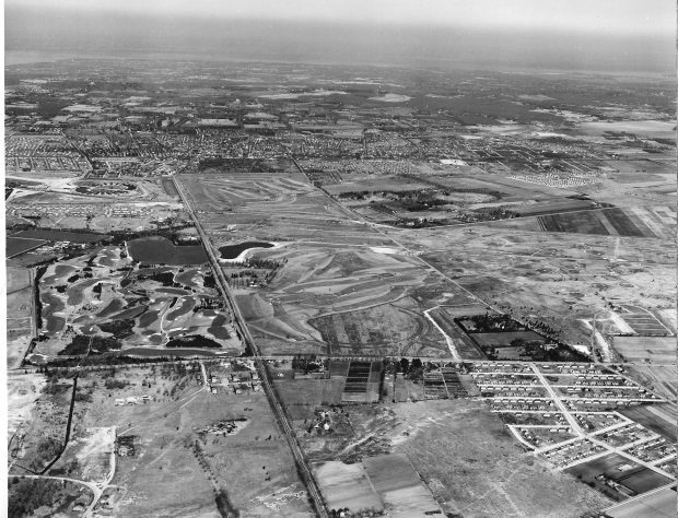
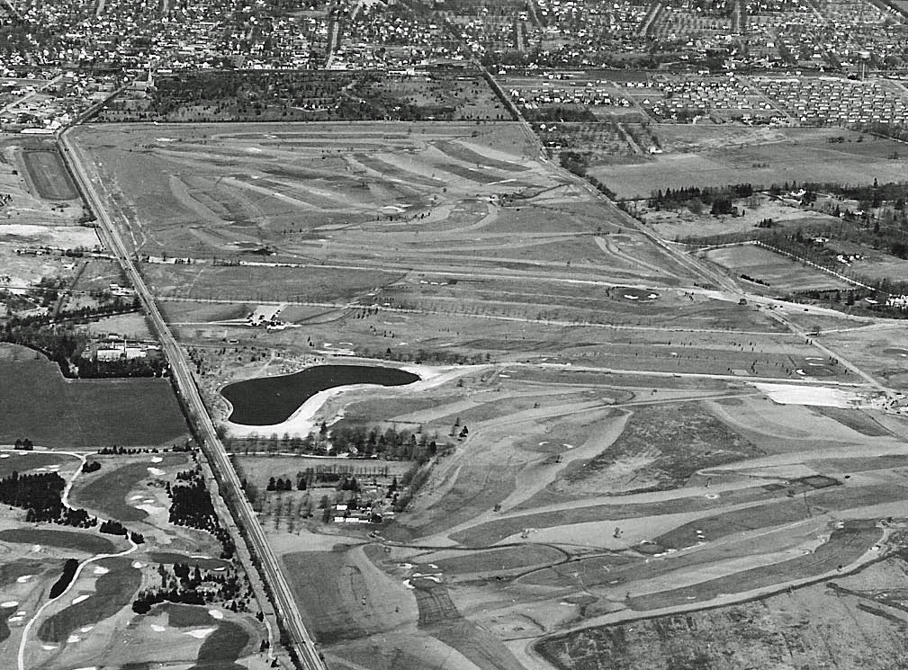
This 1949 aerial shows sections of the courses for six Vanderbilt Cup Races...Greg and Frank found two more races than I originally considered.
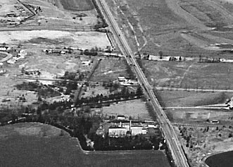
The aerial is looking north towards East Meadow (my childhood hometown) and Westbury. Merrick Avenue is the major north/south road, Hempstead Turnpike is the east/west road on the bottom and Old Country Road is the east/west road in the background. Remnants of the Long Island Motor Parkway can be seen heading east/west in the middle of the aerial.
Answers to the Mystery Foto questions:
-Which four...make that six... Vanderbilt Cup Races were held on roads shown in this aerial? Name the roads
1904 Vanderbilt Cup Race: Hempstead Turnpike
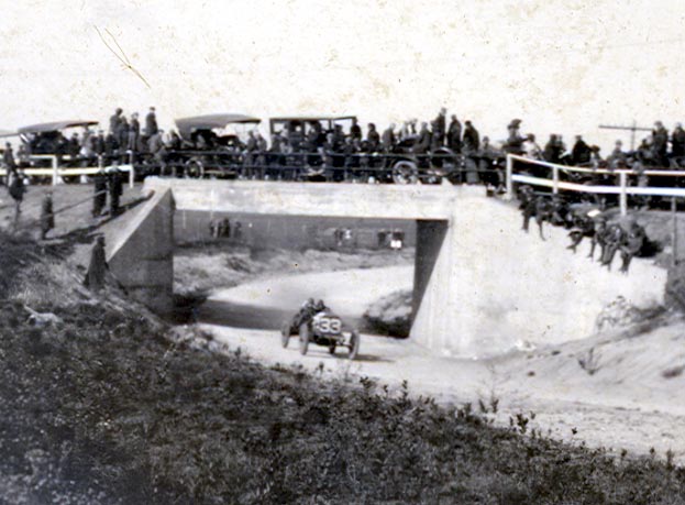
1908, 1909, 1910 Vanderbilt Cup Races: Long Island Motor Parkway and Old Country Road
1936 and 1937 Vanderbilt Cup Races: Remnants of Roosevelt Raceway (upper left corner)
-What other landmarks are in the aerial?
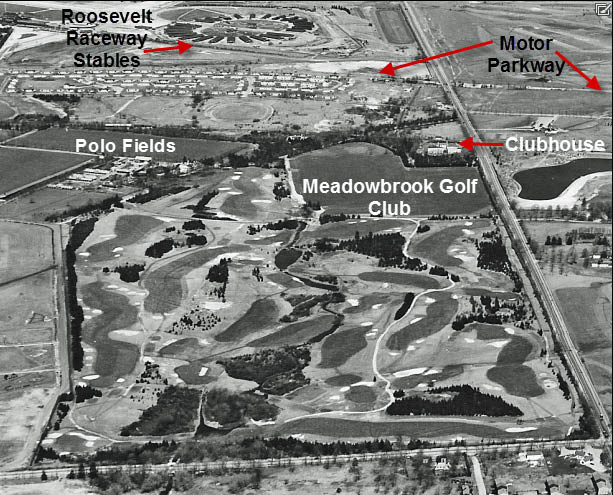
The orignal Meadowbrook Golf Club
Meadowbrook Golf Club Clubhouse
Meadowbrook Polo Fields
Salisbury Golf Club , now Eisenhower Park golf courses
The future home of Dave Shor at the corner of Hempstead Turnpike and Merrick Avenue
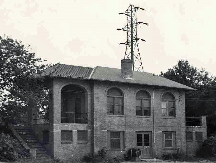
Site of the Meadow Brook Lodge
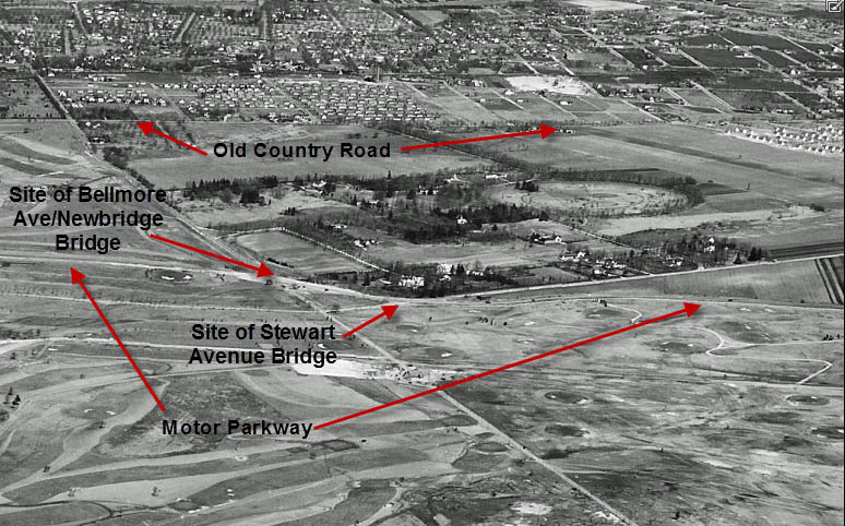
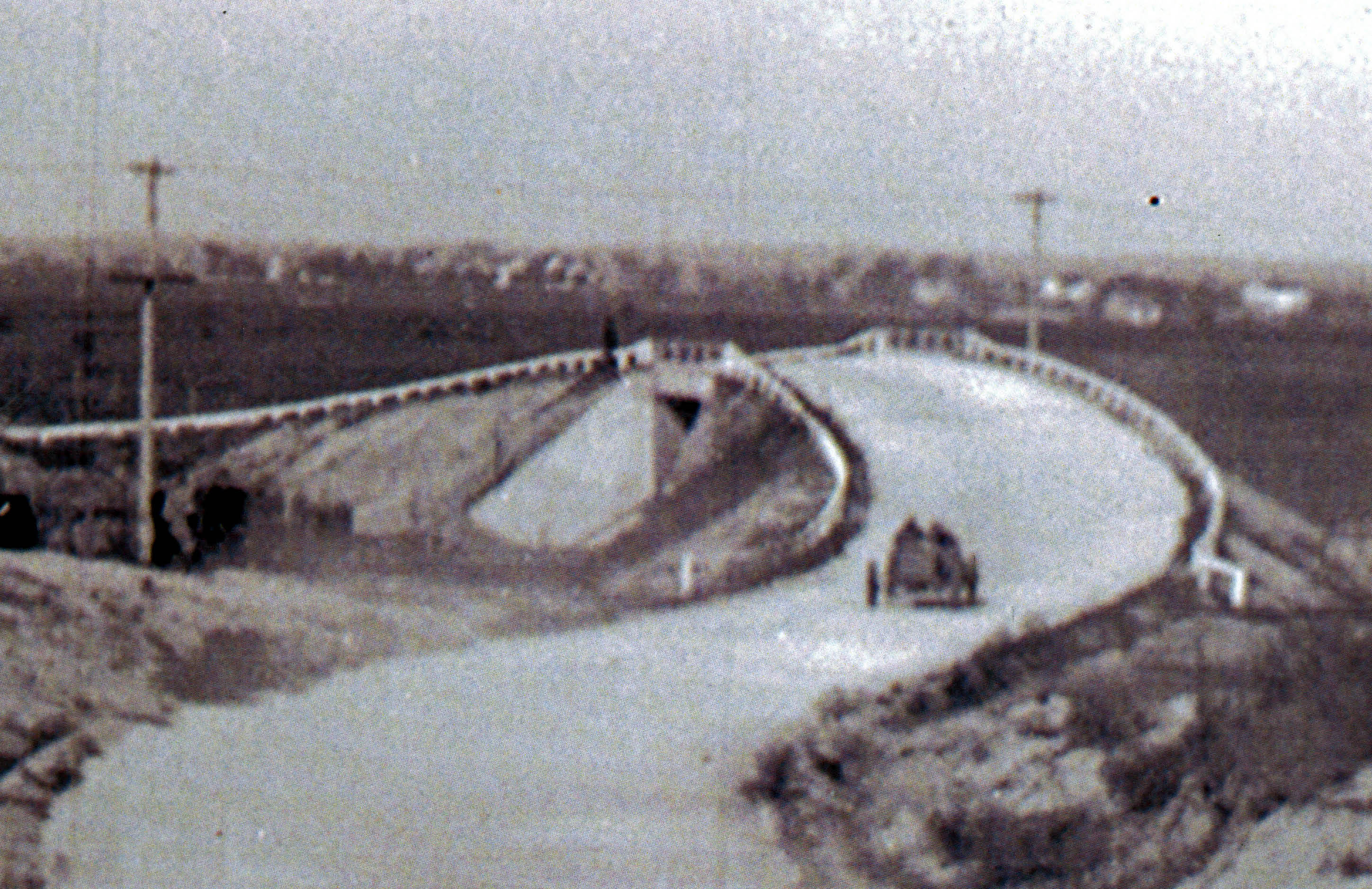
Sites of Motor Parkway bridges: Merrick Avenue, Bellmore Avenue (Newbridge Avenue) and Stewart Avenue
Stables of Roosevelt Raceway (harness racing) and site of Roosevelt Raceway (auto racing), now the Source shopping mall.
The site of the runway at Roosevelt Field used by Charles Lindbergh in 1927 on his historic flight. Lindbergh just missed hitting the telephone wires on Merrick Avenue.
Congratulations to Steve Haubell, Tim Ivers, Jim Waechtler, Greg and Frank Femenias for getting the location correct and many answers to the Mystery Foto questions.
If you have a suggested Mystery Foto, please send a jpeg to me at [email protected] .
Enjoy,
Howard Kroplick
Aerial Close-Ups
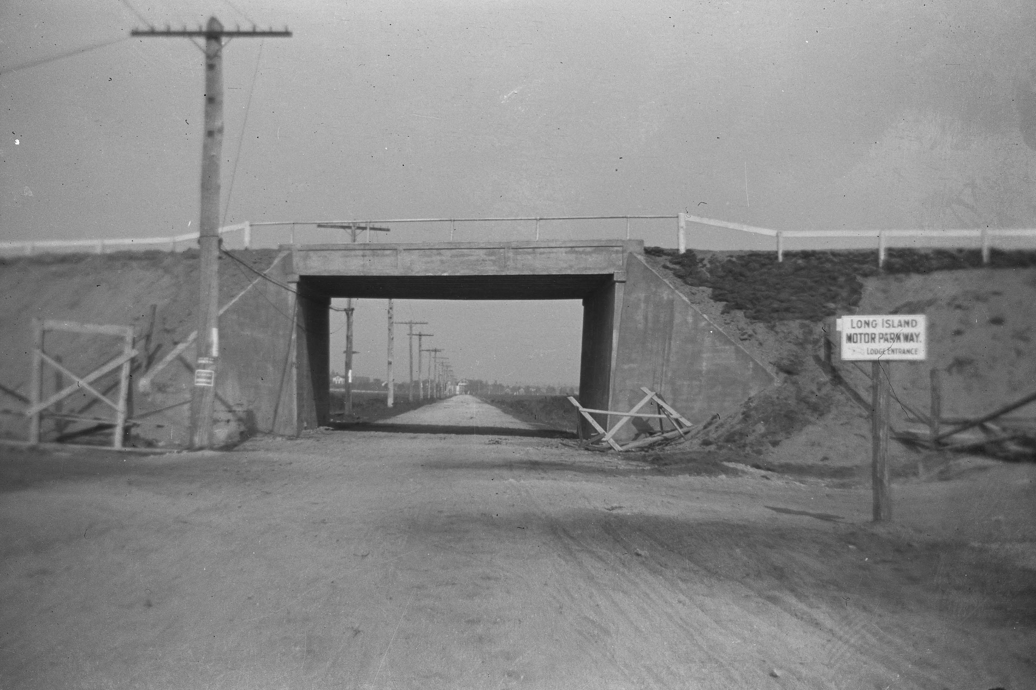
Merrick Avenue Motor Parkway Bridge looking north.
Newbridge Avenue Motor Parkway bridge
Stewart Avenue Motor Parkway Bridge
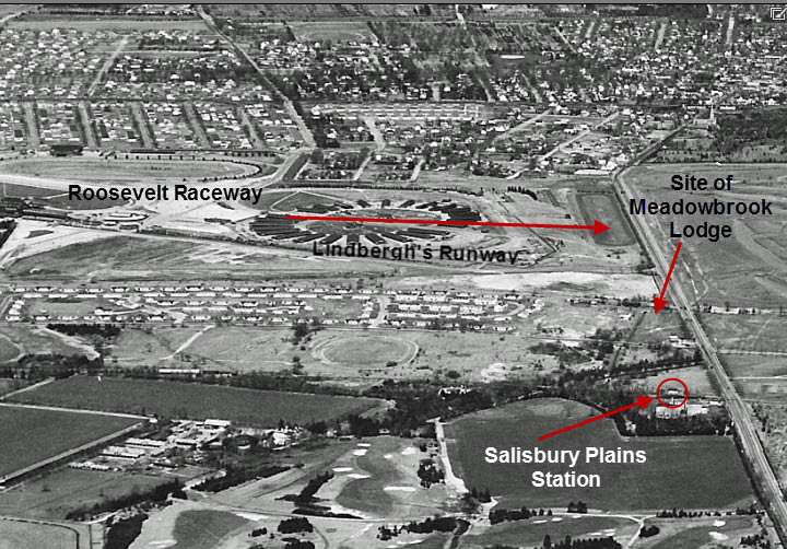
Salisbury Plains Station
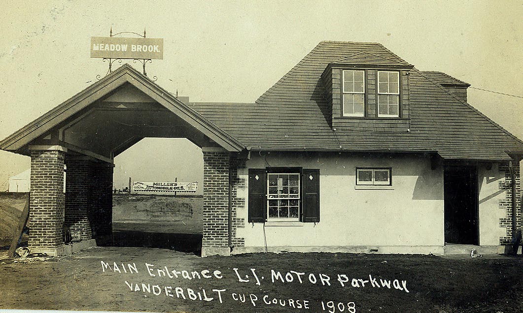
Meadow Brook Lodge looking north in 1908
Salisbury Golf Club- the ultimate links course
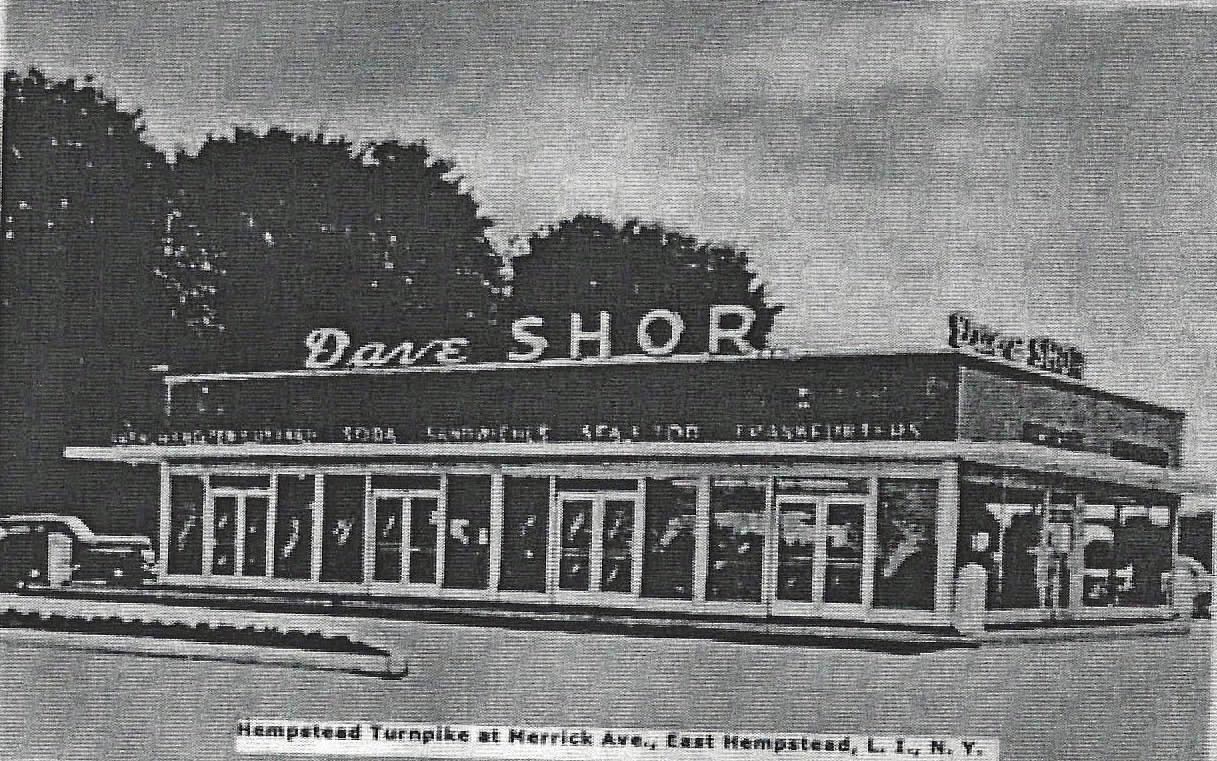
Dave Shor located at the south east corner of Hempstead Turnpike and Merrick Avenue.

Then: 1949
Now: 2013


Comments
The three lines cutting through Eisenhower Park are the LIMP, Stewart Ave and the LIRR right of way (from north to south). I believe the well-maintained golf course is the Meadowbrook Club. If so, the entrance to the club at the north end had a train trestle that went over the roadway. The trestle still remains next to the Meadowbrook Parkway, although overgrown. It is readily visible in the winter when the leaves are gone.
1906, 1907, 1908 and 1909 races.
Looking north; East Meadow and Westbury areas.
Hempstead Tpke running left to right across bottom.
Lake visible in center, fromer Salisbury Park.
LIMP right of way visible at Merrick Avenue in center
Old Country Rd. left to right across top
Holy Rood Cemetery at top center.
The old Meadow Brook Golf course at bottom left
Eisenhower Golf Course - South Westbury (Salisbury)
Hempstead-Bethpage Turnpike in foreground.
Merrick Road on left
Old Country Road & then LIRR Main Line north of golf course
Long Island Sound in distance
1st close-up has been replaced by Meadowbrook Pkwy & Nassau Coliseum
2nd close-up is where there are East Meadow schools now
3rd close-up is probably Roosevelt Raceway, now Roosevelt Field Mall
4th close-up is Eisenhower Golf Course (formerly Salisbury)
Another great shot, with TONS of landmarks! Especially the estates off to the North in Old Westbury. A lot of Phipps property in the photo! With ‘Westbury House’ and ‘Erchless’ front and center. To the right of that, the 1904 and 1906 grandstands and press boxes were on Jericho Turnpike, directly in front of Hitchcock’s Horse Track at Broadhollow Farm.-Jericho Tpke was also used in 1905.
In 1908 ,1909, and 1910 part of the course also used some small sections of Salisbury Park Drive, Ellison Ave and Old Country Road. So hasn’t just about every cup race used some of these roads, and not just 4?
Also, It’s a stretch, but to the left of the encircled Roosevelt Raceway horse paddocks where the tracks are, was the site of the 1936 Cup races, could that be included as ‘races in the area’? 😉
My old house in the Salisbury section will be built off to the right in four years, so it has yet to be ‘landmarked’. LOL!
Nice shot. It’s future Eisenhower Park in the center looking north, here it’s Salisbury golf course with Stewart Ave running undivided, east-west through the course. The LIMP is north of Stewart running parallel to it. Plenty of golfing here. Meadowbrook Club golf is west of Salisbury golf where the MSPkwy will run thru 7 years later. Mitchell Field is just west of that. The Meadowbrook Park racetrack is on the east side of Salisbury golf, remnants still exists today as part of the school’s backyard. Appears all 3 LIMP bridges are gone, also the Meadowbrook lodge. I see a corner of the Meadowbrook polo grounds along the left edge, Roosevelt horse raceway with its circular stables on left, Front Street is in the bottom right corner running diagonally east-west. Correct me but I think there were 7 Cup races that ran through here: ’04-Hmpstd Tpke, ’08/’09/’10-Limp/Old Country Rd, ’36/’37/’60-Roosevelt raceway, not sure. Is that an extended East Meadow Ave running north-south through the park?
Good job guys with the answers and adding a little more info and Frank,that question you’re not sure of,you’ll get from someone else,most likely Howard,knowing him.