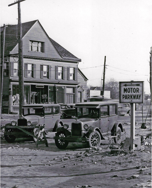
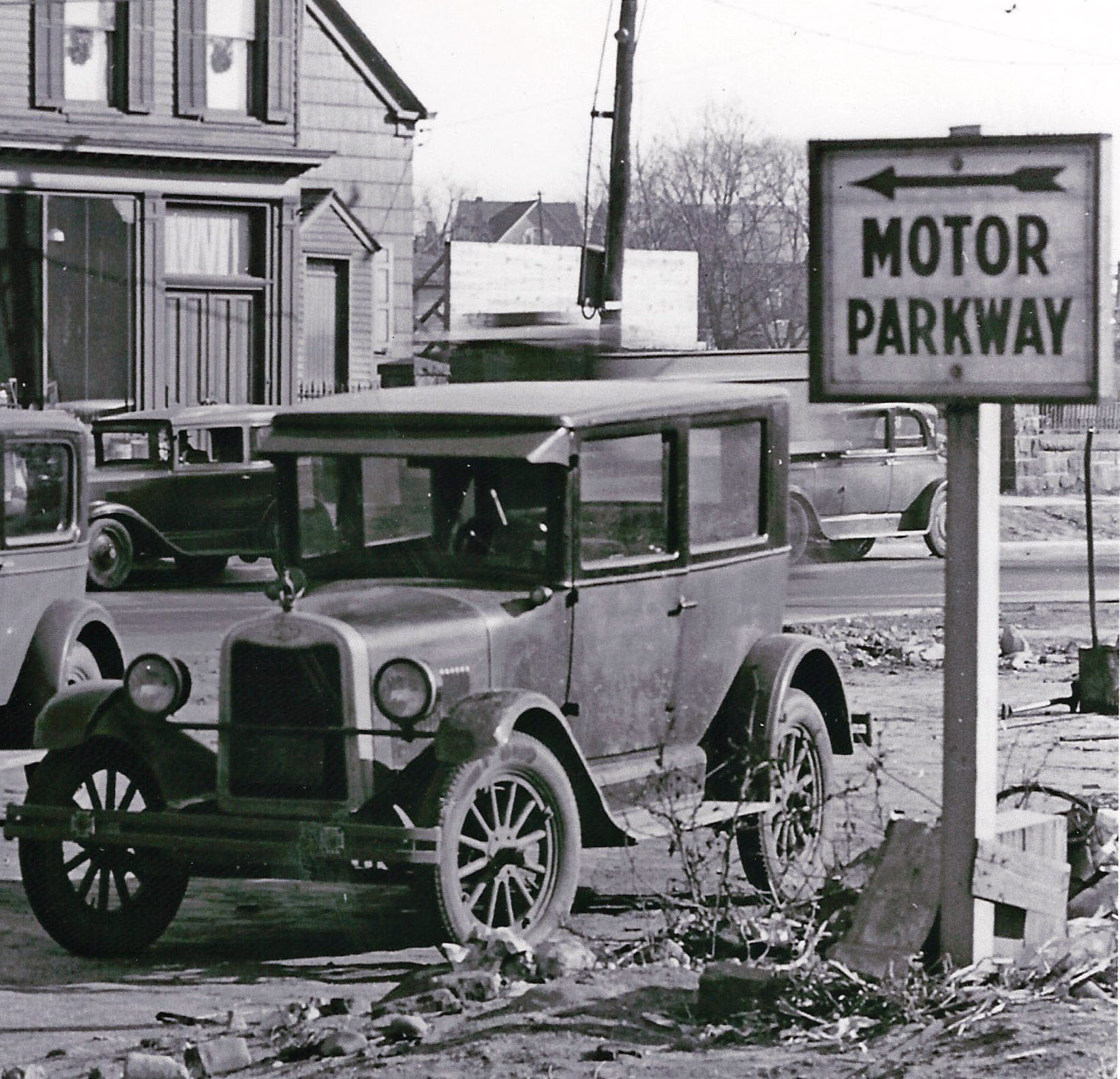
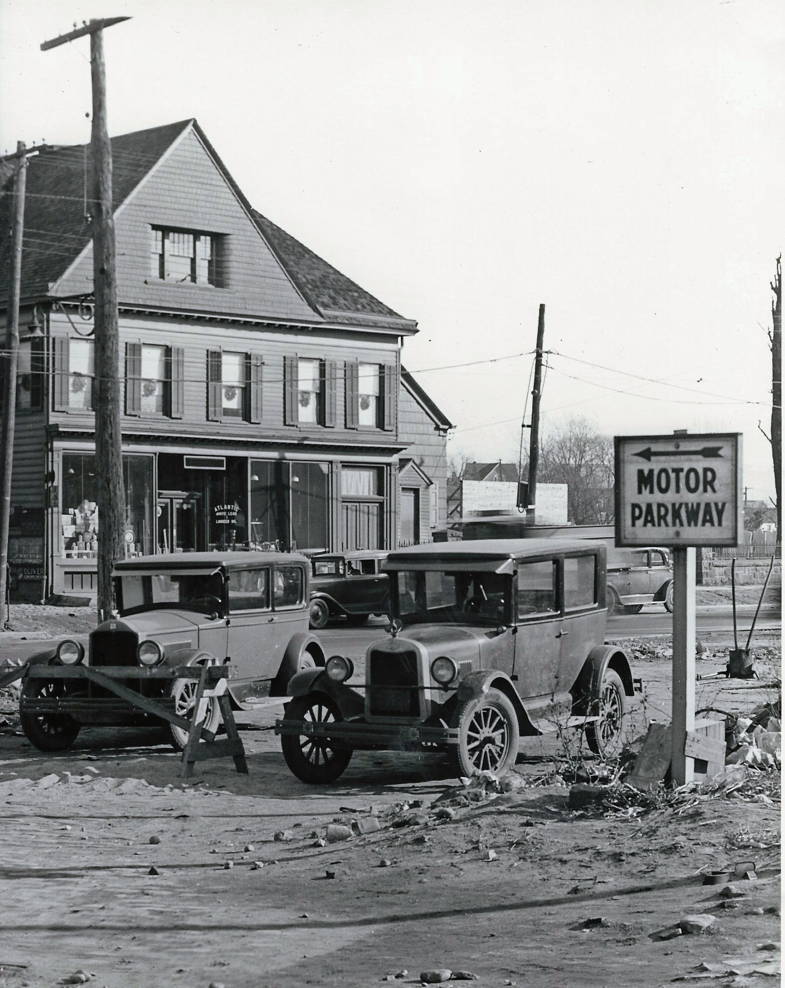
Mystery Foto #14 Solved: A Motor Parkway Sign at Queens Boulevard and Grand Avenue Circa 1928
Al Velocci challenged you this weekend to solve this Queens Mystery Foto.
Mystery Foto questions:
- Identify the exact location of the photo in Elmhurst, Queens. Provide a rationale.
The location of this Mystery Foto was one of the great challenges ever on this website. It took the combined resources of Al Velocci and I to figure it out. Here is how we did:
The key to solving the mystery was the gravestones seen to the right of the Motor Parkway sign. Historically, where there was an early Queens cemetery, a church would be nearby. Researching the Elmhurst churches in the 1920s, Al and I focused on the First Presbyterian Church of Newtown located on Queens Boulevard, just east of Grand Avenue. I found a vintage photo of the First Presbyterian Church, where the surrounding wall matched the wall below the Mystery Foto's gravestones. Then, Al note thed church's cemetery was located on the north side of a much smaller Queens Boulevard. We both agreed it was logical that the cemetery might have had the same type of wall as the church on the south side of Queens Boulevard.
Accordingly, we believe the location is looking northeast on Queens Boulevard at the intersection of Grand Avenue. The Motor Parkway sign was directing motorists to turn left at Grand Avenue to connect to Corona Avenue and then to Nassau Boulevard. The gravestones are in the cemetery of the First Presbyterian Church of Newtown across Queens Boulevard from the church. The hardware or paint store to the left was on property once owned by T. Anderian and was promoting "Atlantic White Lead and Linseed Oil" in its window.
- What entrance is the Motor Parkway sign pointing to?
The sign was pointing to the best route to the western terminus of the Long Island Motor Parkway at Nassu Boulevard in Fresh Meadows via Corona Avenue (Union Avenue).
Queens Boulevard was being widened in the 1920s, while the western section of Nassau Boulevard was primarily residential. Thus, the Motor Parkway needed to direct motorists driving east on Queens Boulevard to an alternate route by making a left turn at Grand Avenue, then a right turn on to Corona Avenue (a major road in the 1920s). Corona Boulevard eventually connected to Nassu Boulevard (later renamed Horace Harding Boulevard.)
- Identify the years and manufacturers of the automobiles
The consensus comments indiate the automobile on the left is a mid-1920s Chevrolet and the other a 1920s Dodge.
- What is the approximate date of the photo?
Based on the automobiles, the presence of a Motor Pakway sign directing motorists to the 1928 entrance at Nassau Boulevard and the imminent widening of Queens Boulevard, Al and I both believe the photo was taken around 1928.
Congrats to Fran Femenias, Steve Lucas, Greg O. Brian McCarthy, Art Kleiner and Tim Ivers for even attempting to solve this wonderful Mystery Foto. Kudos to Frank Femenias who figured out the route indicated by the Motor Parkway sign.
Enjoy,
Howard Kroplick
1873 Queens Map by Beers, Comstock & Cline
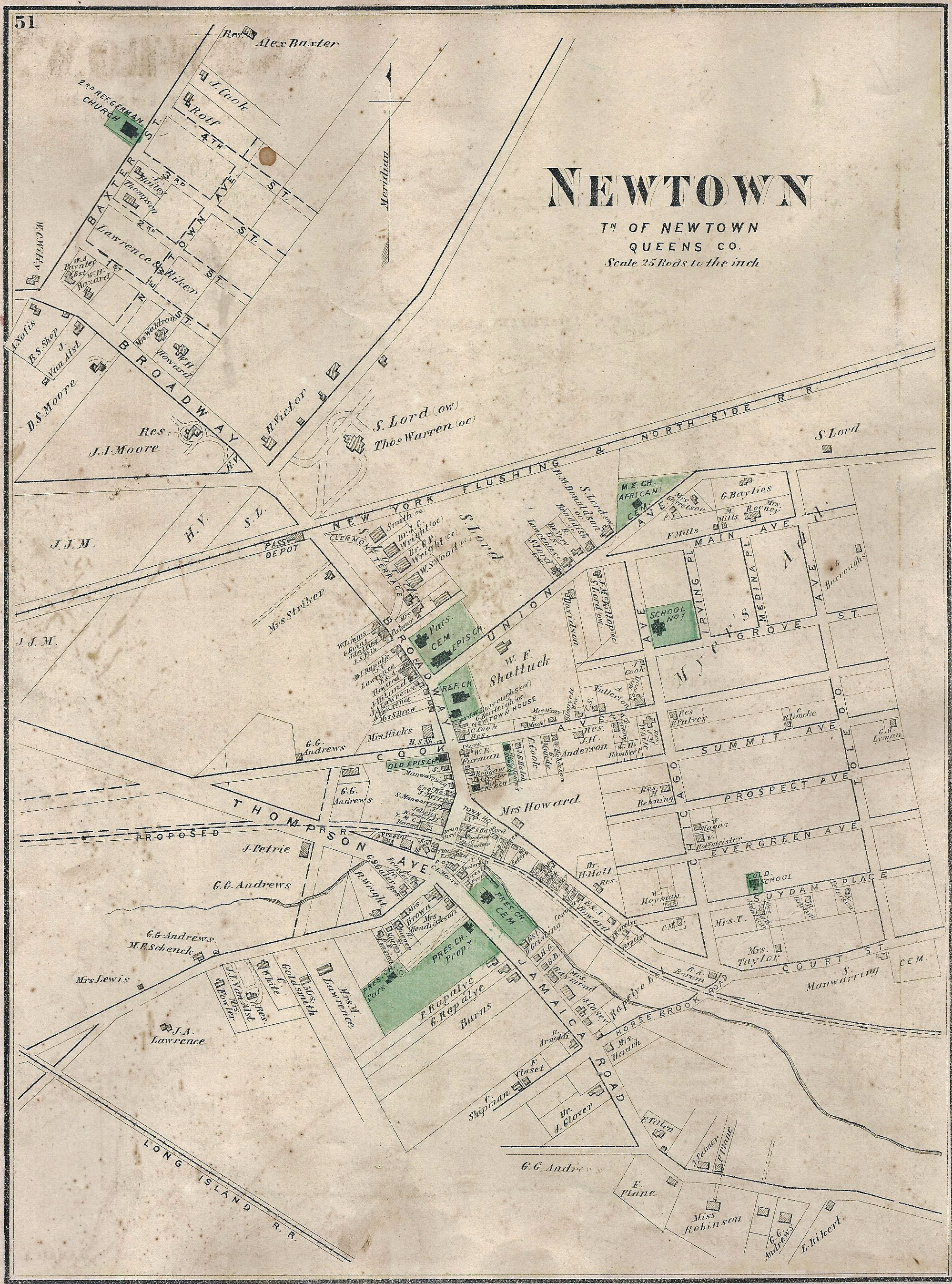
This Elmhurst section of Queens was originally called Newtown
In Newtown, Queens Boulevard was originally called Thompson Avenue and Jamaica Avenue. Corona Avenue was originally called Union Avenue
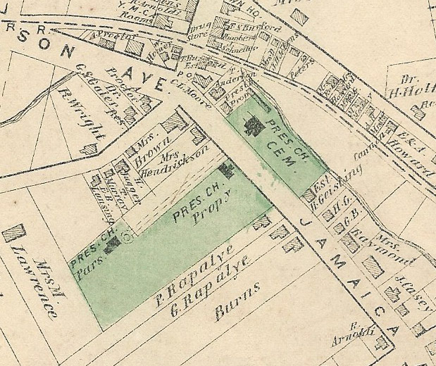
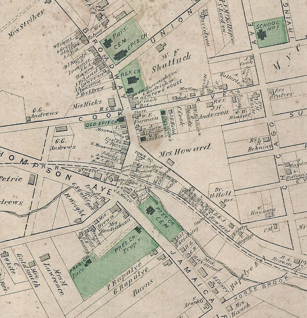
The key to solving the Mystery photo: the church's cemetery was across the road from the main building.
First Presbyterian Church of Newtown
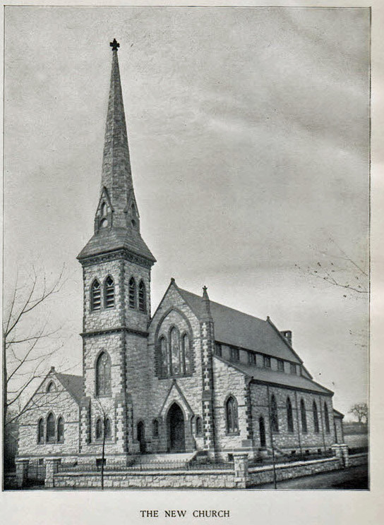
A vintage photo of the First Presbyterian Church of Newton. The church was dedicated in 1895and moved 125 feet in the 1920s to accommodate the widening of Queens Boulevard.
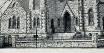
The wall around the church matches the wall surrounding the gravestones in the Mystery Foto.
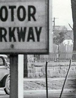
Close-Ups
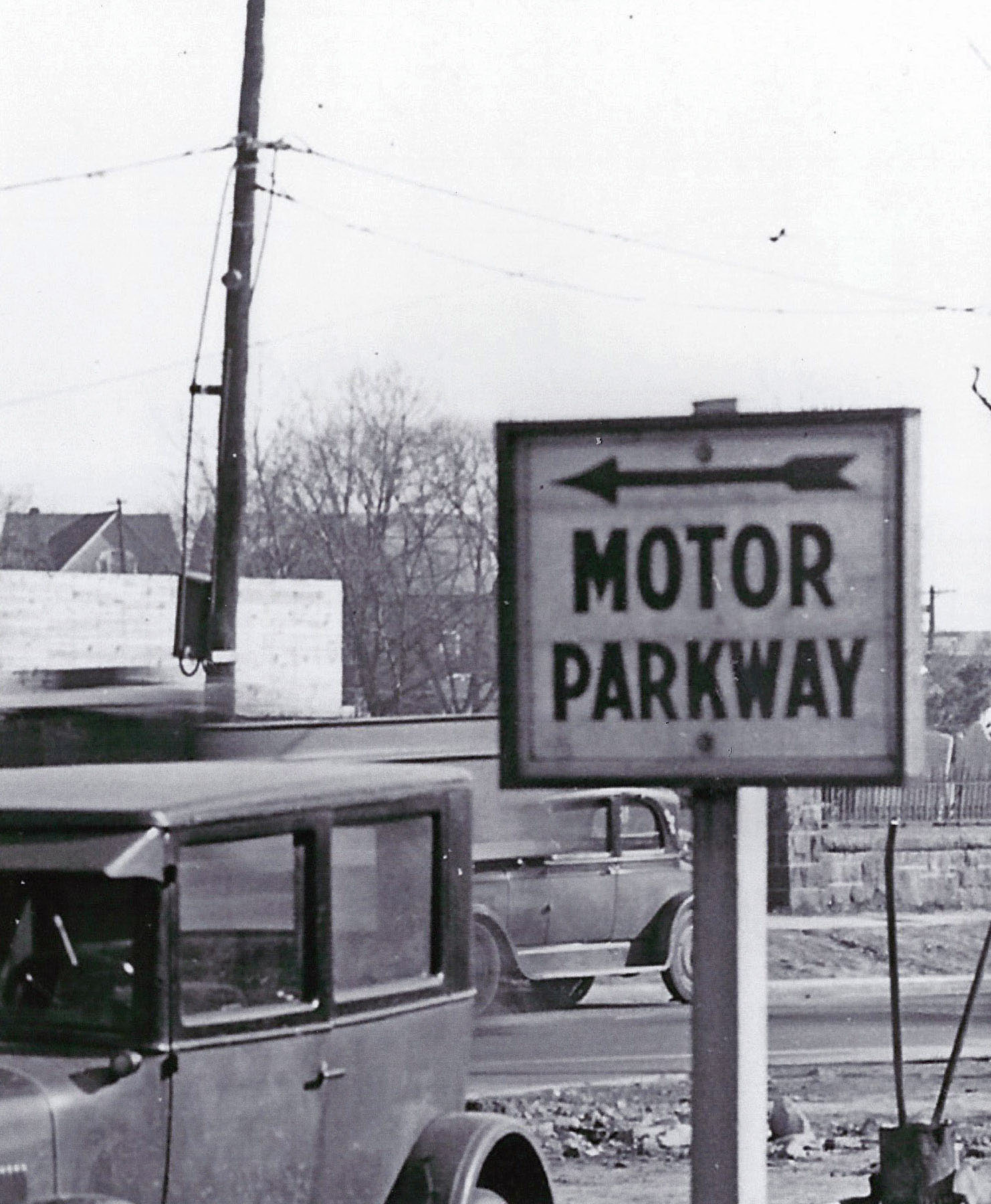
For motorists heading east on Queens Boulevard, the sign was directing a left turn at Grand Avenue on to Broadway.
The gravestones were in the cemetery of the First Presbyterian Church of Newtown.
The cemetery is no longer there! Hopefully, it was relocated with the widening of Queens Boulevard.
A 1920s Dodge?
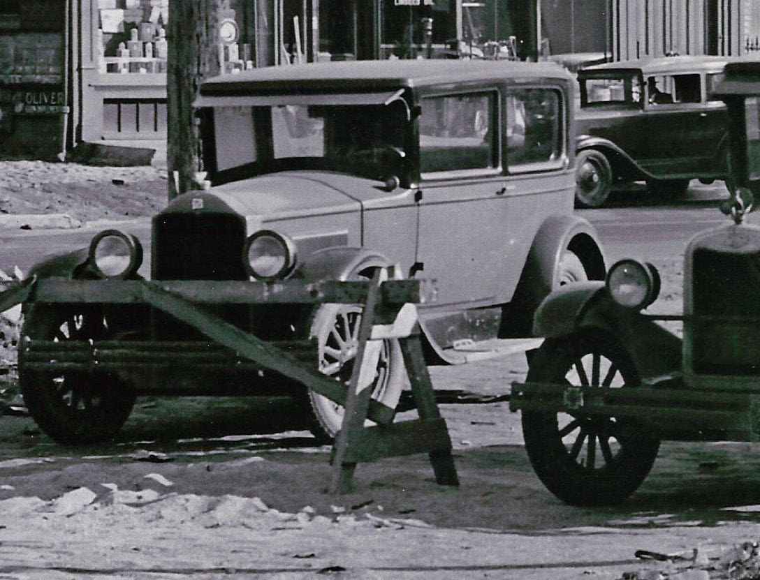
A mid-1920s Chevrolet
Hardware/Paint Store on Queens Boulevard
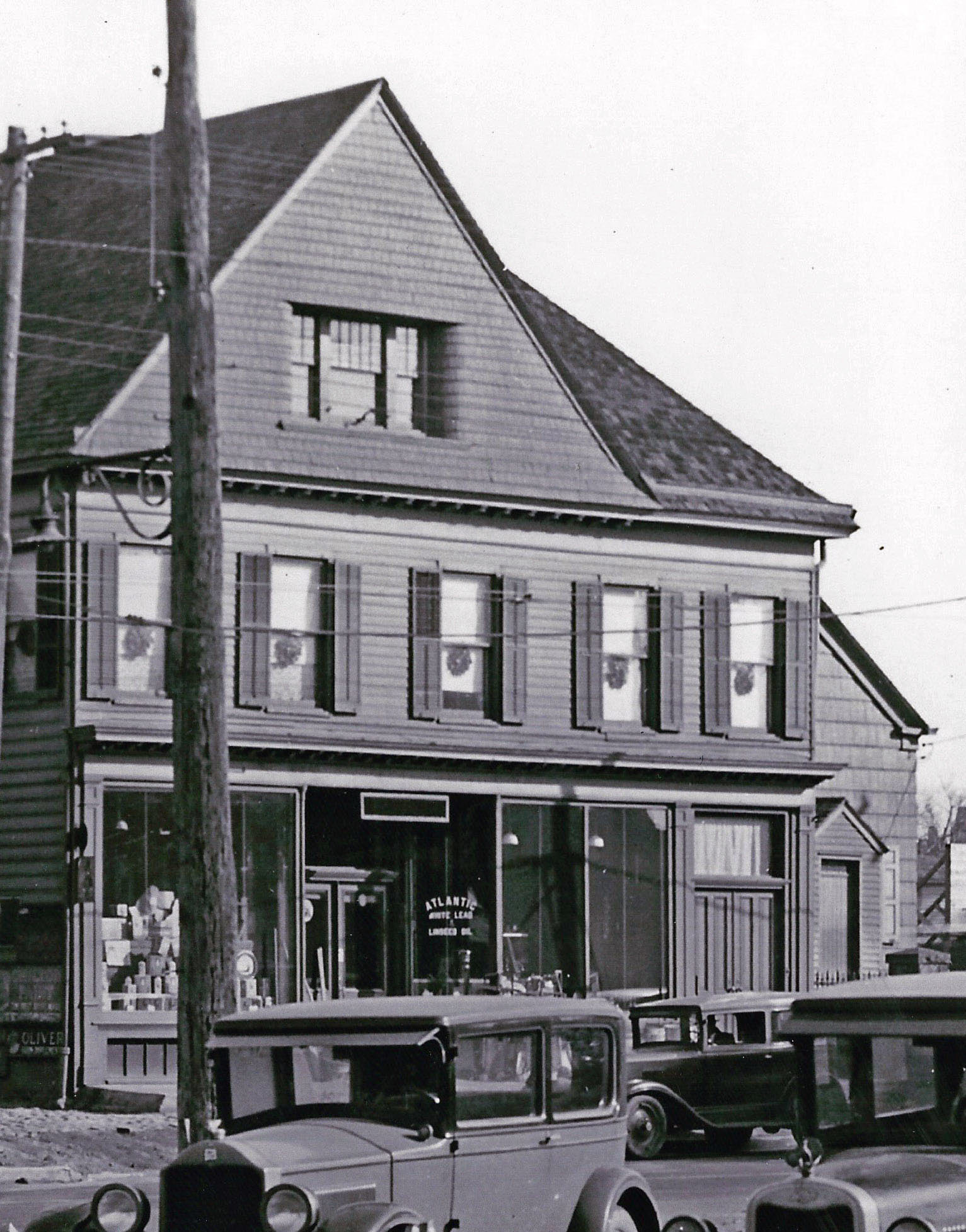
This building was located on property owned by T. Anderian in 1873.
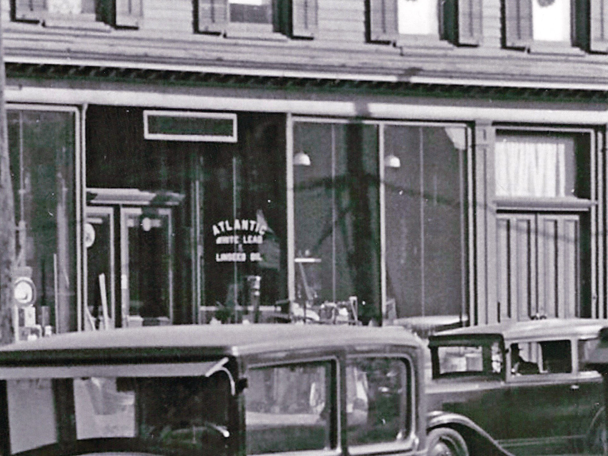
Copy on the window: ATLANTIC White Lead & Linseed Oil
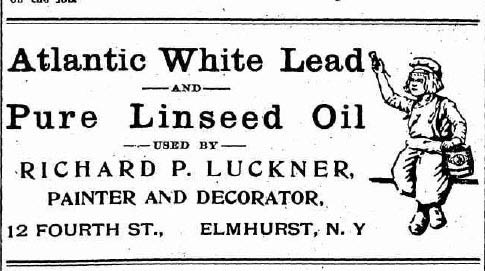
These products were widely advertised by Elmhurst painters and decorators.
The Likely Route to the Western Terminus of the Motor Parkway in Fresh Meadows
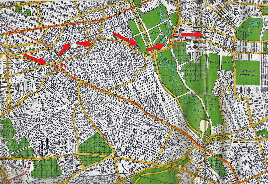
-Head east on Queens Boulevard
-Left at Grand Avenue, turning on to Broadway
-A right at Corona Avenue
-Continue on to Nassau Boulevard (later Horace Harding Boulevard)
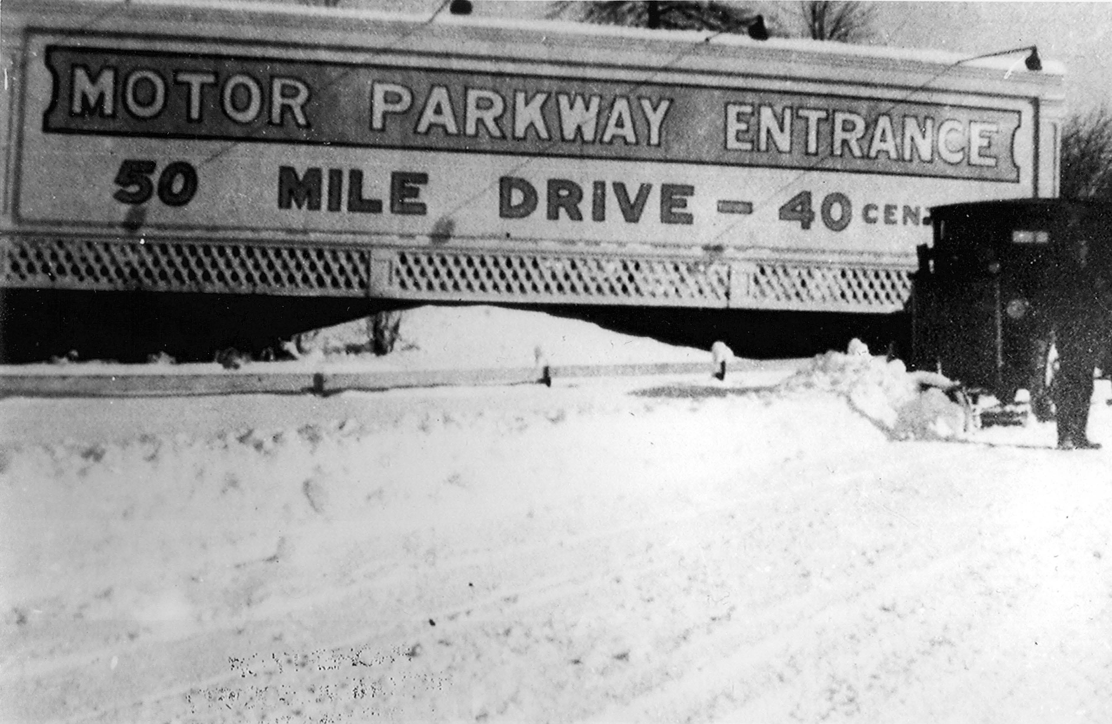
-Turn right at the large sign at the entrance to the Long Island Motor Parkway
Current View
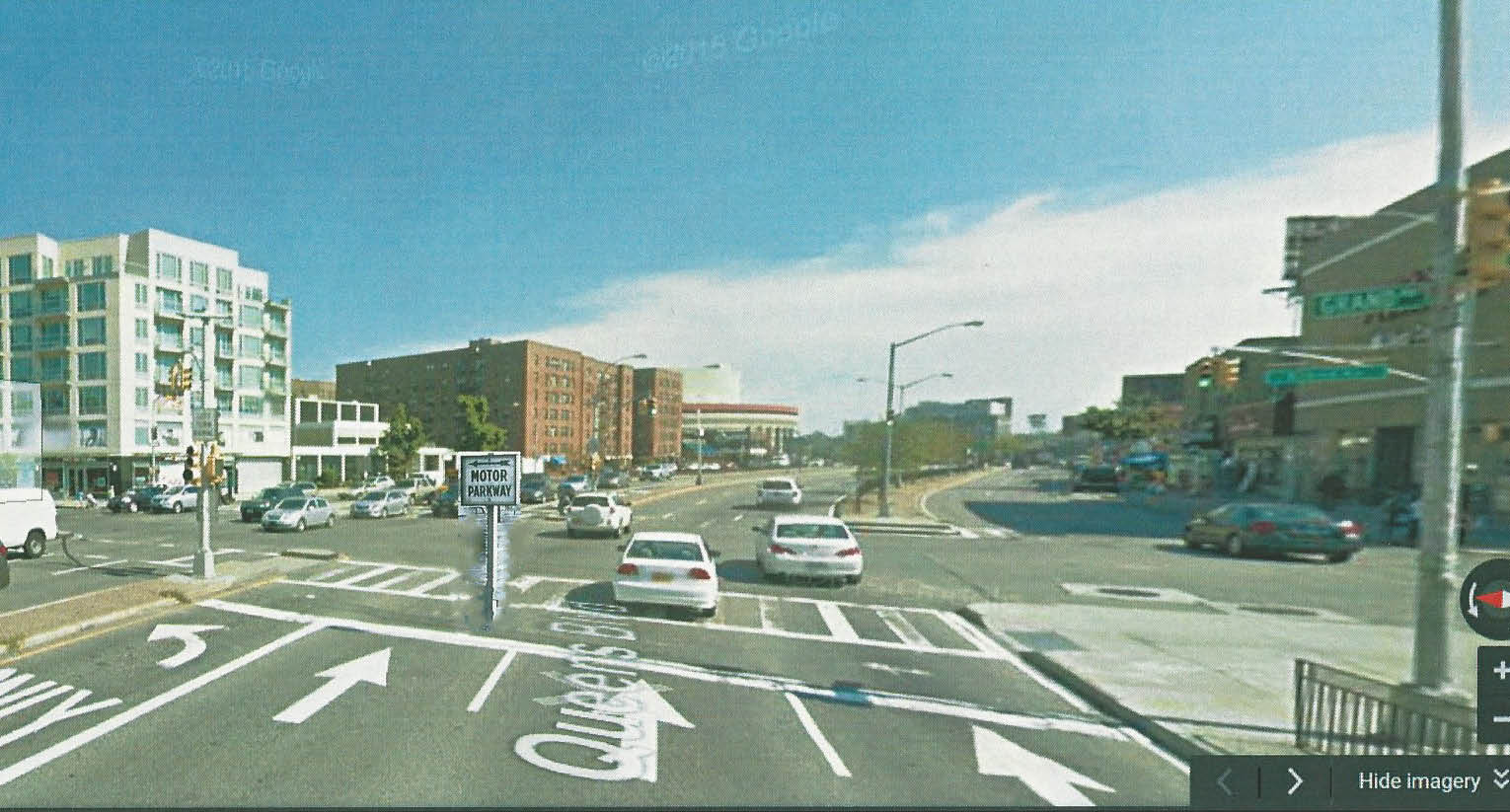
A current view of the location of the Mystery Foto. Amazingly, the Motor Parkway sign is still there!
Femenias' Finding (Submitted by Frank Femenias)
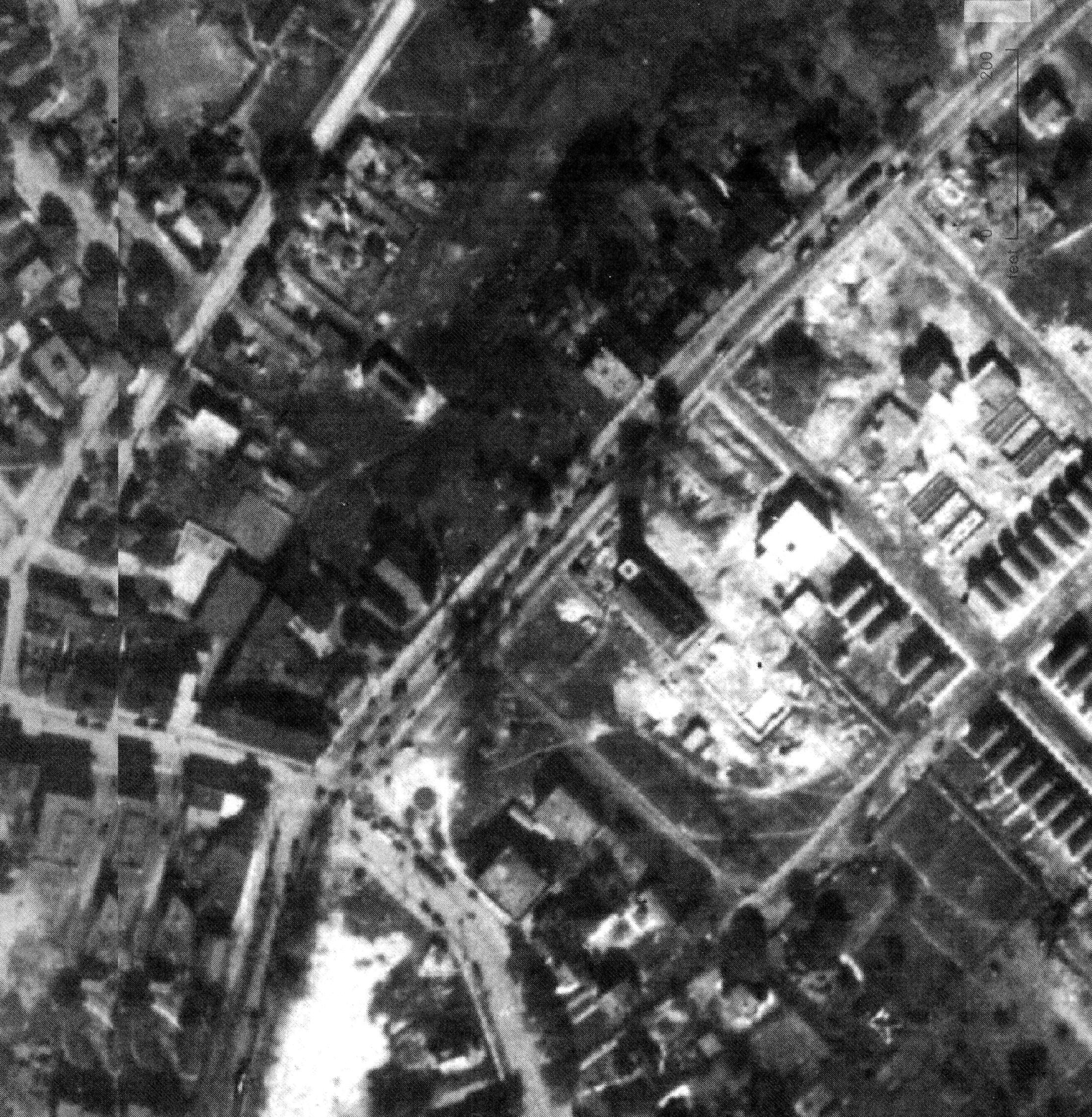
This 1924 aerial shows the church's new foundation in place just before the structure was moved back 125 feet. The church belfry's shadow indicates it was already damaged and removed before actual movement began. Also an attached conference room was damaged and lost when attempts were first made to separate from the main structure.
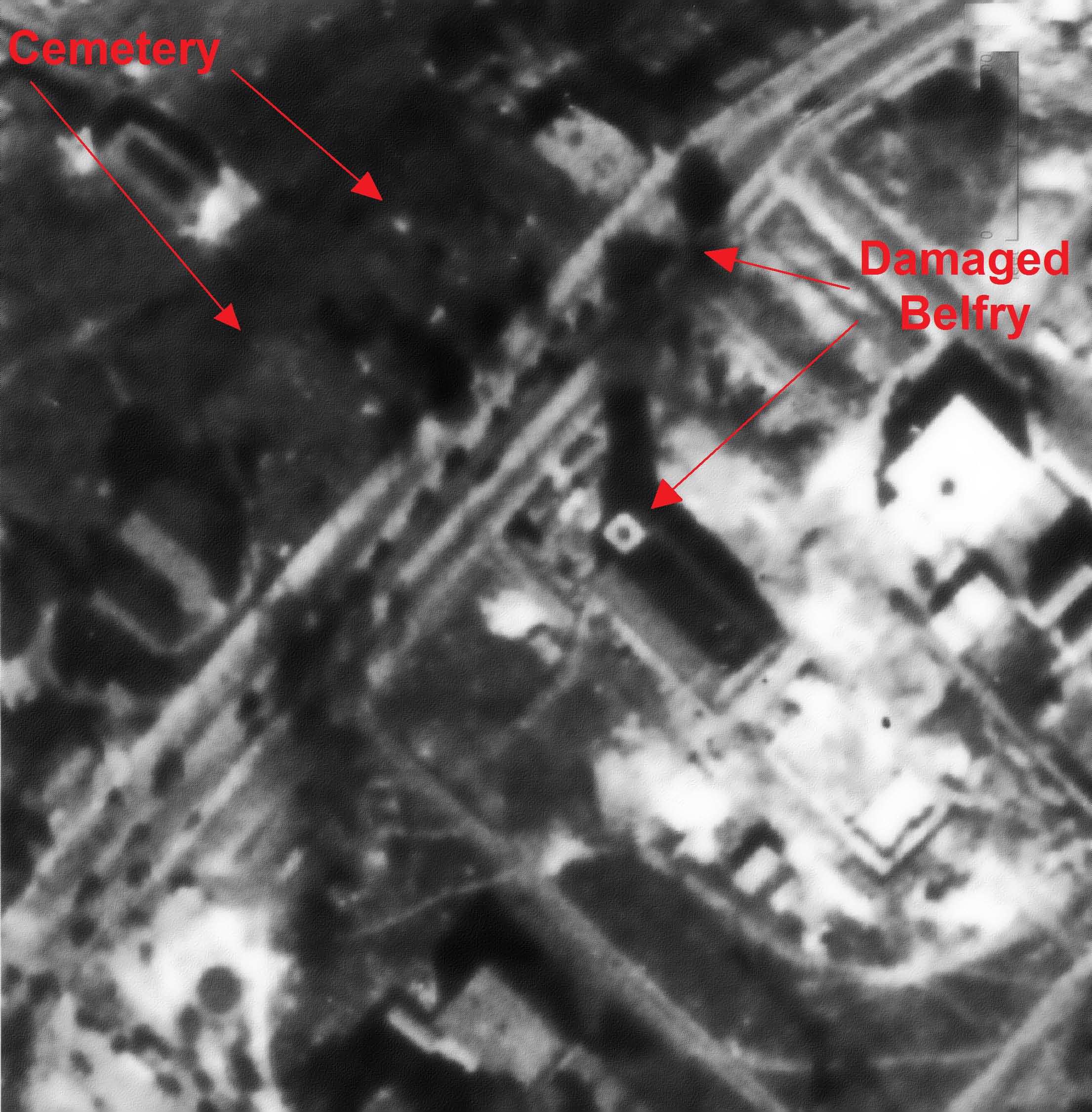
The company used to move was Kidde, today's makers of fire extinguishers. The cemetery can be seen across the street. Also, many nearby lots with property owner's names in your 1873 Newtown map were owned by pastors, elders, and contributors to the church.


Comments
Good one Al. Even though I was brought up near here, just about a mile west in Woodside, as a kid on a bike imprinting all the surrounding areas in memory, I haven’t a clue where the heck this place this. Amazing what time can do!. This will take some doing. Hagstrom Maps can’t help me now
After spending more hours than I care to admit researching this one, it’s time for some guesses (educated or otherwise): based on the shadow of the sun, I think we’re looking southeast late in the afternoon. So what road heads in that direction with a left turn to the LIMP (in Elmhurst) and would be under construction in the time period indicated by the visable cars? I think it might be the intersection of Queens Blvd. and Horace Harding Blvd. If so, the sign is pointing to the western terminus of the LIMP in Fresh Meadows. Since the westward extension of Horace Harding Blvd. from Flushing to Queens Blvd. was completed in 1935, I’ll guess the date around 1934. As to the two cars, I think the one on the right might be a 1926 Chevrolet; no clue on the other.
Mostly guesses this week since I can’t really make any confirmations. I’ll make revision posts if I discover anything new, but for now I’m somewhat stumped.
Identify the exact location of the photo in Elmhurst, Queens. Provide a rationale.
According to your site, “The Long Island Motor Parkway, Inc. placed directional signs along Nassau Boulevard (later renamed Horace Harding Parkway) to help motorists find the entrance to the Motor Parkway. [signs were} placed at the corner of Nassau Boulevard and Rodman Street (later renamed College Point Boulevard). The same sign was placed at the intersection of (Nassau) Boulevard and Kissena Boulevard”
So my guess would be that the sign might be at one of those locations. Although the two other photos I have seen of the sign are left facing and not right facing like the mystery photo sign.
What entrance is the Motor Parkway sign pointing to?
Nassau Boulevard toll booth
Identify the years and manufacturers of the automobiles
Quick guess on the car on he right would be a 1925 Chevrolet Model K. Unsure of the car on the left.
What is the approximate date of the photo?
The other Motor Parkway sign photos that I’ve seen are dated; Feb 17, 1931 I’ll guess this photo as around the same date or close.
OK, here goes:
Location of photo in Elmhurst, Queens. Explain my finding: This building ( perhaps a hardware/paint store ) was located on the S/S of todays Queens Blvd. ( Hoffman Blvd in past ). I came to this assumption by accessing an edition of “The evening world” newspaper dated 7/20/1911 pg 4 via the nyshistoricnewspapers.org website. The notation at the bottom of pg 4 states NEW STORE at 2 Broadway, corner of Hoffman Blvd. Elmhurst NY opening this morning. Presently, a Hoffman Dr extends just south of Queens Blvd. There was (and still may be ) St Johns Hospital at this location. The hospital’s address came up as 90-02 Queens Blvd, but it may have closed and became housing.
What entrance is the Motor Pkwy sign directing to? At the time, it would’ve been a short distance to Horace Harding Blvd. So, the sign was directing east to the LIMP entrance off Horace Harding Blvd.
Manufacturers, years of 2 automobiles? My best guess for the auto on the left is a 1920ish Chevy, and the auto on the right is a 1920ish Dodge.
Approx. photo date: The entrance to the LIMP via Horace Harding Blvd was established in 1928. So, with the Motor Parkway sign existing; I’ll say 1930.
I’m looking forward to everyone’s responses. Doesn’t matter if I’m right or wrong. Keeping my brain working is a good thing.
Love the ol’ historic photos and the challenging mysteries they can bring. This one is truly a toughy, as my answer still persists with just one annoying conflict left, so hoping for the best here. Another amazement with this photo is that I was brought up just 1.5 miles from here in Woodside, and this photo is totally unrecognizable to me.
With some searching, I have this house located as 12 Fourth Street (Ithaca Street), just southwest of the corner of Newtown Avenue (Pettit Avenue) in Elmhurst, as the ‘Atlantic White Lead & Linseed Oil’, belonging to painter and decorator, Richard P. Luckner.
Scroll down to check the ad on the right.
http://fultonhistory.com/Newspaper4/Newtown NY Register/Newtown NY Register 1915 Grayscale/Newtown NY Register 1915 Grayscale - 0402.pdf
If I’m correct so far, the year is 1915. This mystery LIMP sign will ultimately direct you to the preferred route (along with other LIMP signs) to the LIMP’s Rocky Hill Lodge western terminus and entrance at today’s Springfield Blvd (9.5 miles away). But a shorter, less desirable route was possible by taking Queens Blvd east (Hoffman Blvd), hanging a left at Plank Rd (63rd Rd), going through Strong Causeway (through the Valley of Ashes dump site (who’d want to travel that way)), and proceed through North Hemp Tpke (Booth Memorial Ave) to the Rocky Hill Lodge (9.1 miles). Times were tough back then. Looking forward to this week’s answers. Thanks Al
That sign could be pointing south on Newtown Av (Pettit Av), then heading east on Bway, then left on Justice Av, or Queens Bl, and heading east towards the Rocky Hill Rd Lodge. It’s complicated back then, not easy
Spent too much time on this one without a conclusion! Found one reference to a painter using Atlantic White Lead and Pure Linseed Oil in Elmhurst - Richard P. Luckner on Fourth Street (later changed to Ithaca Street). Hint of a cemetery - could it be Cedar Grove or a local church cemetery? In any case, sign might be pointing to Rocky Road entrance. 1928
Along Nassau Blvd.
Good one Al. 2nd attempt: OK, I grew old trying to figure this out and still not sure. The Newtown First Presbyterian church hint helps. I believe the mystery photo was always looking NW (NE for the church hint photo), so I’m assuming the church/cemetery once stood on Hoffman Blvd’s northside. That would also explain the signs direction. So going with that, we’re at the intersection of today’s Queens Blvd and Broadway/Grand Ave looking NW. The sign is directing to turn onto Broadway, then turn right onto Corona Ave, go over Strong’s Causeway bridge, follow to North Hemp Tpke to the Rocky Hill Lodge. Baffling is the fact that during the church’s relocation in 1924, it was moved only 125 ft south, to accommodate the mostly southward expansion of Hoffman Blvd (Queens Blvd). That’s not enough space to move it from the northside to the southside of the boulevard. Anticipating this week’s answers
BTW, this church was at the center of the Revolutionary War. Incredible story.
Queens Blvd. at 54th Avenue.
The historic First Presbyterian Church of Newtown.
Sign is pointing left (southeast) towards the western terminus of
the LIMP at Peck Avenue and Horace Harding Blvd. (today’s LIE).
Year about 1925 ?
Auto makes unknown.
Too much for me to comprehend! But thanks Howard and Al for your detailed analysis. Once I thought it was a church cemetery I went searching for churches and found one, but not the right one. And by that time I was exhausted with this photo.
Amazing the sign is still there. If you look closely, you’ll see a few parkway posts too. And then there’s a bridge I have for sale. So what if April Fools Day was just a few days ago. Thanks for the challenge guys.
We all knew this wasn’t going to be easy. I always figured whoever supply’s the mystery photo already knows the answer. But it sounds like Howard and Al were figuring this out along with us.
______________________________
From Howard Kroplick
Brian, we were!
Howard,
“In 1822 land was donated next to the church for a cemetery, which remained there until the 1950s, when the land was sold. Those buried there were reinterred in the Cemetery of the Evergreens on the Queens/Brooklyn border, where one stone marks the church’s dead.”
Scroll down about 40%
https://www.nps.gov/nr/feature/places/pdfs/13000696.pdf
Looking back now, this is a great shot of one of the boulevard’s busiest and most historic intersection. This intersection goes back a long time. Amazing what time can do. Thank you all.
The cars in the photos the one on the left is a 1928 Buick, the car on the right is a 1925 Chevrolet, Superior, Series K, coach. I have a photo of that exact car.
Sorry to chime in so late - missed this one. That’s no Dodge; Dodge radiator shells did not “dip” in the top middle, under the badge. Model A Fords did but that’s no A. The badge appears to be that of a Chevy; 1927 Chevys had that dip! Your so-called Chevy appears to have a Buick badge. The actual key to the ID is the distinctive small notch in the shell/hood edge, like Packard or Chrysler Imperial 80 or Star, but far smaller. I do believe we have a 1925 Buick there. Unrelated to the cars, my Dad watched a huge stone RC church being picked up bodily, swung around 180°, and moved northwest across Hoffman/Queens Blvd. in that general area ca. 1914. Sam, III
I didn’t see this until it ended, but as historian of The First Presbyterian Church of Newtown I can confirm that is the church’s former cemetery, begun 1822. Vandalized and full it closed in 1909, but the land was not sold until the late 1950s. The 1787 Old White Church across the street (which had been saved, forcing the move of the new church) actually burned down in 1927, torn down 1928. ...An old time resident (descendant of the 1652 Moore family founders of Newtown) tells me the store was later Weber’s Hardware. Queens Blvd. (Hoffman/Road to Jamaica as mentioned) was then only 2 lanes wide - on the north side. When it was enlarged to 12 in 1924, the church was given 3 choices - 1) Be an island in the middle of the road (That would have been fun getting to church!); 2) Tear down its still existing historic 1787 Old White Church Bldg. (across the street) AND its 1822 cemetery and graves, or 3) Move the new church back the equivalent of 10 lanes of traffic. Public outcry over the possible destruction of the historic 1787 church & burial ground forced the move of the new church, built 1895. It did have beautiful steeple once that DOUBLED the height of the present church. (We have a couple photos- beautiful!) The steeple did not fall in the move; the engineers were wise enough to know it wouldn’t withstand that. Instead, it was purposely taken down and all the stones numbered for reassembly later. Unfortunately that did not happen. Although the city paid some of the cost, the church still had to take out a $37,000 mortgage to cover the cost of the move. It took 30 or 40 years to repay. For a move they didn’t want!! Costs became so high they could not afford to reassemble the steeple. I often wonder if those stones are fill under Queens Blvd. No one knows where they went. The small room (not bldg.) removed at the side of the church I don’t think was damaged, but part of the plan. Too difficult to move, and the church later hoped to build an attached larger educational bldg.- which it did much later. The moving itself was considered a wonder of the world, reported even in Scotland. Before modern equipment, the church ( estimated 5 million lbs.) was hoisted onto greased huge logs, which were turned with hand winches,- so slowly and smoothly movement could not be seen. And the valuable 1895 stained glass by former Tiffany designers Sellers and Ashley did not break, except in a couple small areas. They still are there! The logs that moved the church along also still exist, under the church basement.
____________________________________________________
Howard Kroplick:
Marjorie, thanks so much for providing the historic information on the church. Much appreciated!
Another photo from inside the cemetery looking SE at the church on 17Jan1930
It appears the numbers painted on the tombstones in 1930 are for preparation to relocate to the Cemetery of the Evergreens, located on the Queens Brooklyn border.