Mystery Foto #11 Solved: Taking a Stroll on the Plainview Road Motor Parkway Bridge in Bethpage
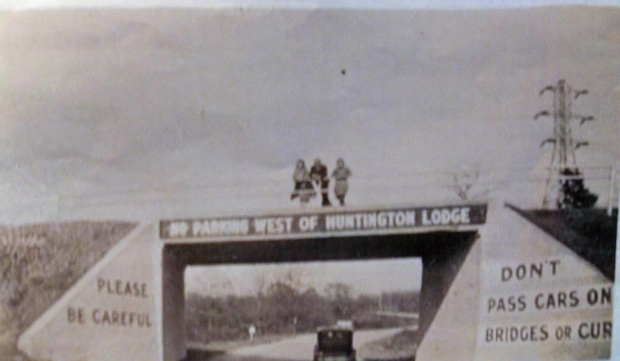
This weekend's Mystery Foto highlighted several people enjoying the view from the Plainview Road Motor Parkway Bridge in Bethpage State Park.
Photo courtesy of Aline Scherer.
Mystery Foto questions:
- Identify the location for the Motor Parkway bridge and its orientation. Provide a rationale based on features in the photo.
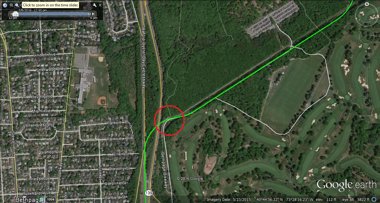
Plainview Road Motor Parkway Bridge over the Long Island Motor Parkway, looking east. Rationale includes: Signage on the bridge, the utility power lines and the right and left bend through trees on the Motor Parkway in the background.
- What is the estimated date of the photo?
Likely late 1930s to early 1940s.
Congrats to Greg O., Tim Ivers, Brian McCarthy, Frank Femenias (seeFemenias' Findings) and Steve Lucas for correctly identifying the Plainview Road Motor Parkway Bridge in Bethpage and the approximate date. Super kudos to Tim Ivers for discovering a previously unknown image of the bridge that appeared in a news article of a tragic 1939 airplane crash.
Enjoy,
Howard Kroplick
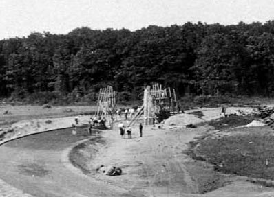
In this July 1908 photo, forms were being put in place for the pouring of concrete embankments of the Motor Parkway Bridge over the relocated Plainview Road.
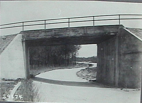
The completed bridge with the Motor Parkway looking east. Note: It is an exact match with the Mystery Foto.
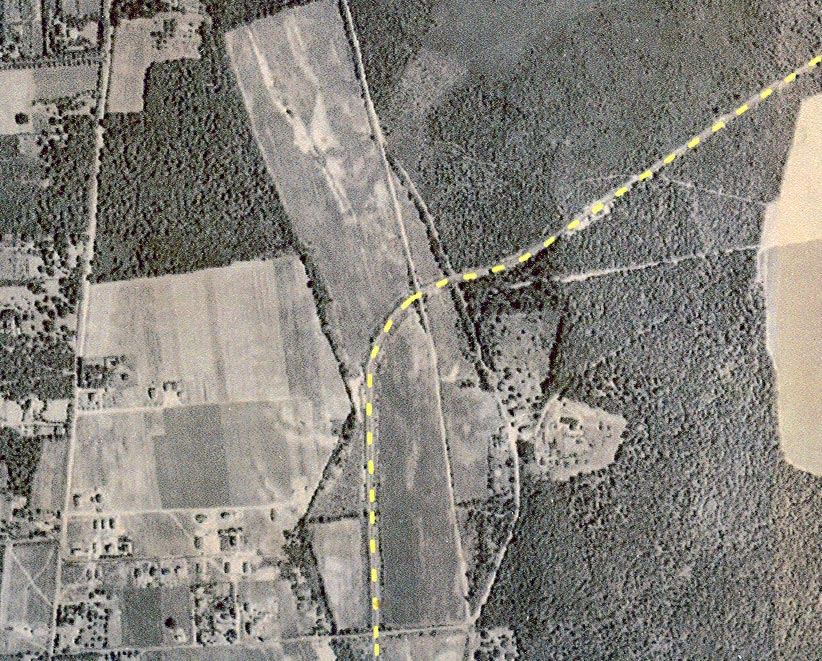
A 1928 aerial of the area around the bridge.
Femenias' Findings
Ivers' Investigations
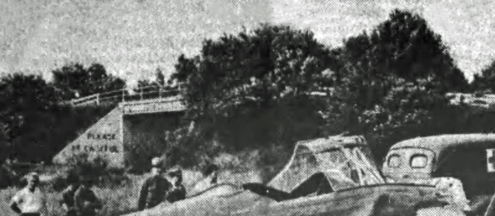
Tim Ivers: A July 15,1939 Nassau Daily Review front page shows a fatal army plane crash on the outskirts of Bethpage State Park. In the background there is noted a bridge with writing on the abutment which seems to be identical with that of the mystery photo as well as the LILCO power poles and lines. From the location image it appears to be Plainview Road.
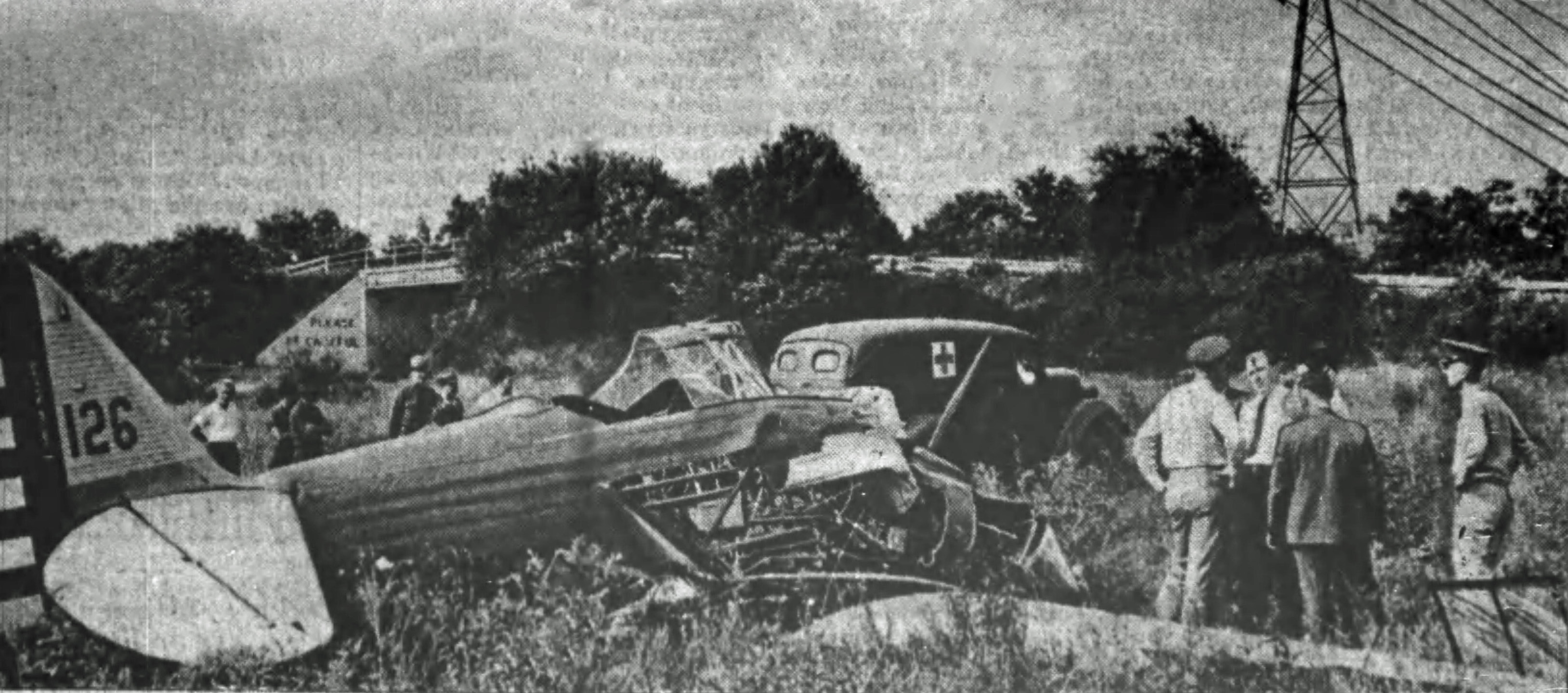
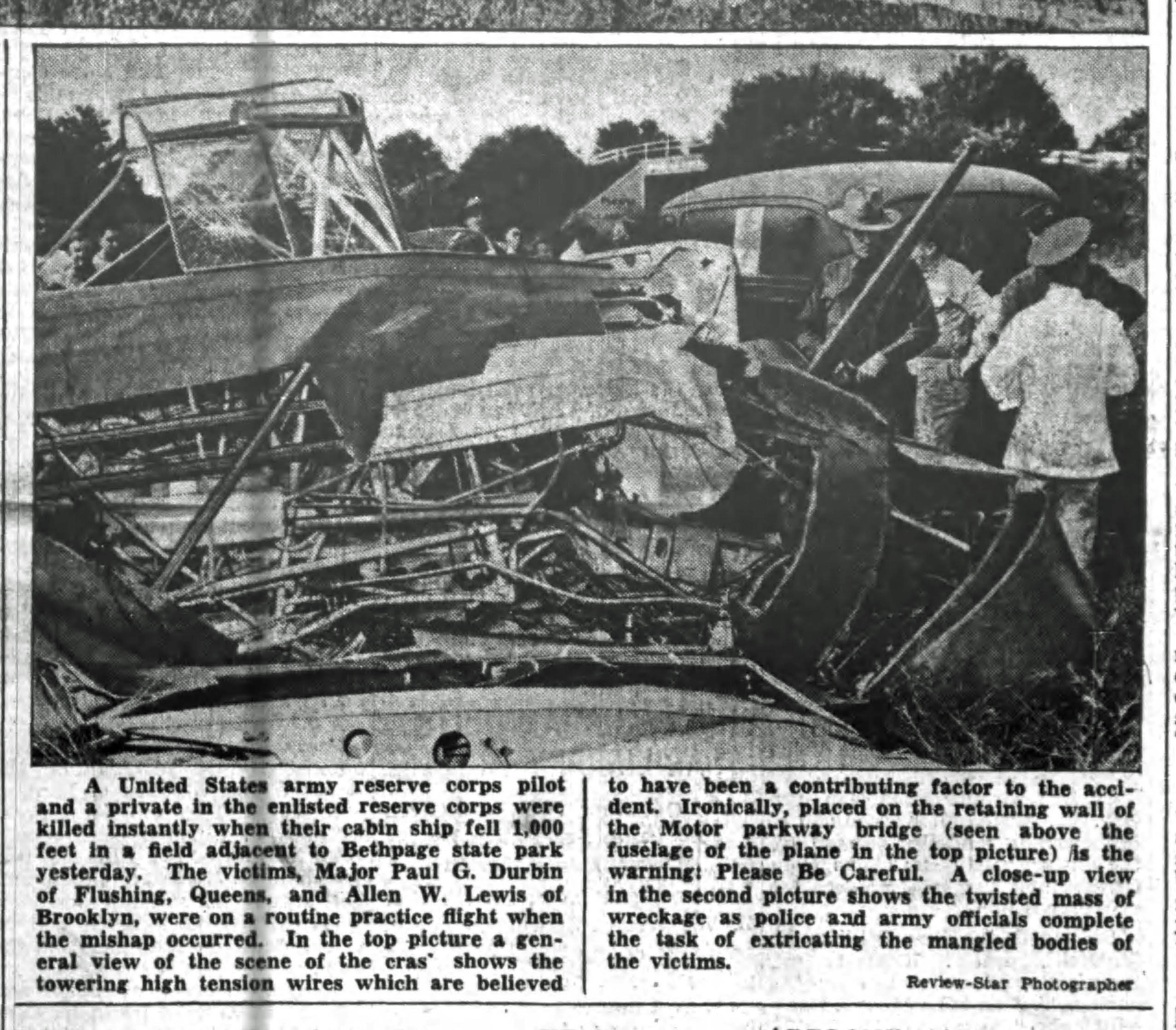
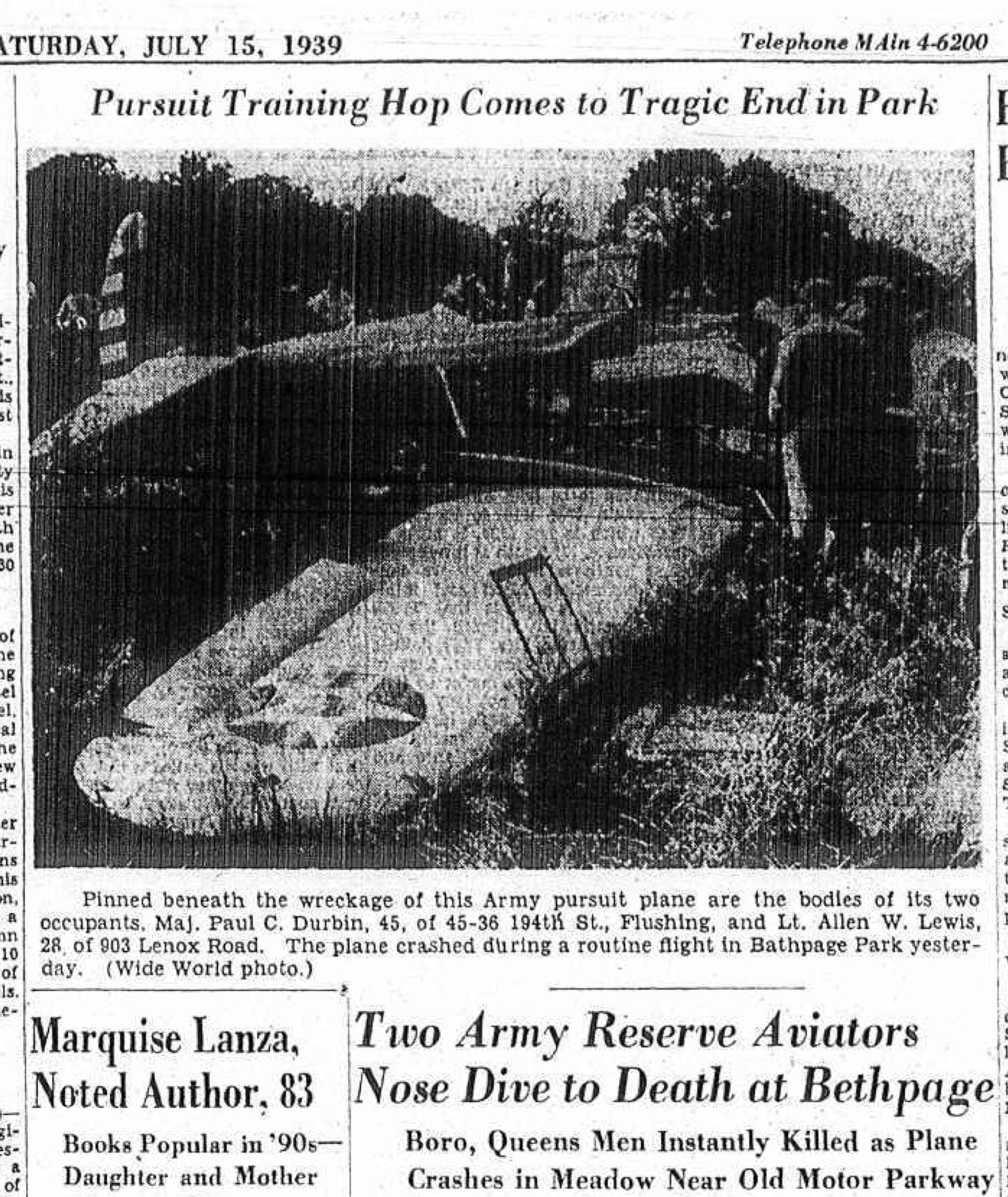
From the July 15, 1939 issue of the Brooklyn Daily Eagle, the crash occurred "about 100 feet west of Plainview Road near the old Motor Parkway in the western and undeveloped section of the park."


Comments
Because this is a parkway bridge and the bend in the road is to the right and then to the left, my guess is the Plainview Road bridge looking East.
The no parking bridge warnings were placed on the bridges in 1930, so for a guess on the photo I’ll go with the early 30’s (1930-35)
My guess would be the Plainview Road bridge looking east, about 1935. The LILCO power lines are noted on the right.
No clue but it sure looks like the same view as in the plane crash picture. Sam, III
St Patricks Day parade soon to commence here in Lake Ronkonkoma! As far as this photo, I’m looking east on the LIMP with the Plainview Rd bridging north and south. Not quite sure when these transmission towers were initially erected, but I’ve seen the tower line here in some of your 1930ish images; Howard. So I’m guessing this image is in the early 1930’s. The tower that is seen appears to be in the approximate location of the present tower located near the curved access road into BSP.
From John Wevers
Is that Little East Neck Road?
I believe this is the Plainview Road bridge with the camera facing east or northeast because the shadow of the sun under the bridge seems to indicate that. Also, the proximity of the Lilco tower along with the curve in the LIMP east of the bridge is another clue. As to the date, I’m going to guess around 1930-1931 since that’s when the phrase “No Parking West Of Huntington Lodge” first appeared on LIMP tickets.
How about the Powell Ave. highway bridge around 1930. Looking south?
From Frank Femenias:
This photo gives only 3 clues on location, the Huntington sign, the electric tower, and the winding Motor Parkway under the bridge. This is the Plainview Rd highway bridge once located in Bethpage Park (Central Park) looking east, just coming out of Deadman’s curve 3, then curves again after the bridge before heading northeast. The vehicle may be a ‘40’s model. The date could be after the LIMP’s closing in 1938, perhaps where the roadway remained open for park use only. I wonder what the larger white sign up ahead read. Could it be for the parking lot entrance coming up?
That location’s pretty obvious - once it’s shown! But forget the LIMP and the bridge - I want to know how Durbin and Lewis managed to end up “beneath” the wreckage when the fuselage is upright and the greenhouse is not mashed flat (which would indicate to me that the wreck had not flipped and been uprighted). Sam, III