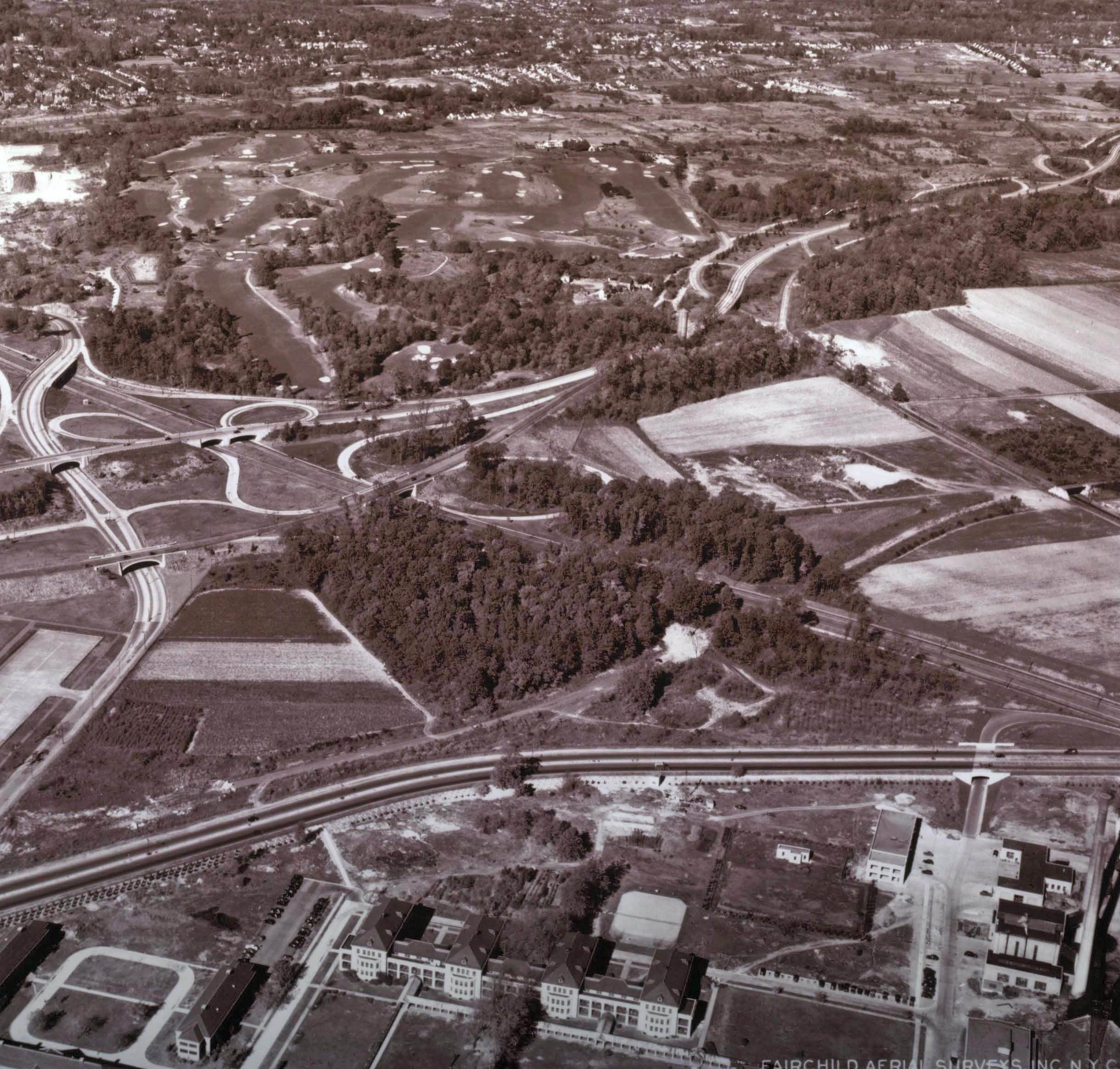
Mystery Foto 2013#5 Redux:Creedmore Hospital and Commonwealth Boulevard Motor Parkway Bridge in 1941
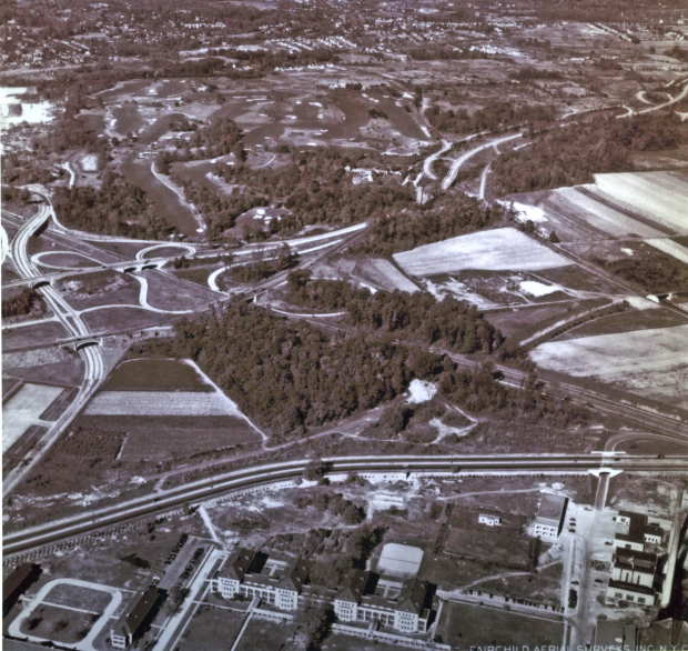
I do like my Fairchild aerials! This previous Mystery Foto was solved in 2013 as Creedmore Hospital and Commonwealth Boulevard Motor Parkway Bridge in 1941
Enjoy,
Howard Kroplick
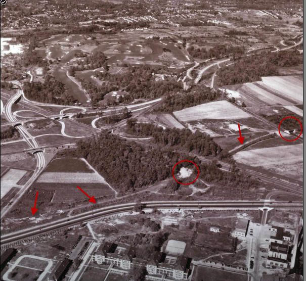
The Motor Parkway right-of-way is indicated with arrows. The white area in the middle was the remains of the Creedmoor Pedestrian Bridge over the Motor Parkway.

A closer look at the Commonwealth Boulevard Motor Parkway Bridge. Note the section west of the bridge had already been taken down to keep automobiles off the closed road.
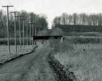
A ground-level view of the bridge looking north.
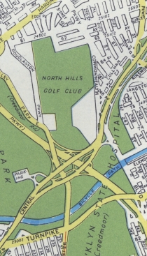
The golf course in the background was North Hills Golf Club, now the Douglaston Park Golf Club. It is located on one of the highest points in Queens.
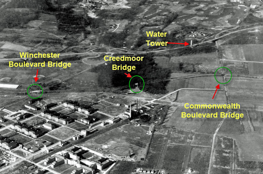
The Motor Parkway was still operating when this aerial was taken in 1937.


Comments
I hate to say it, but we have another duplication from mystery photo #5 from March 12 2013, but this is such a great aerial, it’s ok to challenge people who may have not seen it!
http://www.vanderbiltcupraces.com/blog/article/mystery_friday_foto_5_can_you_identify_the_motor_parkway_in_this_1941_aeria
-Identify the major roads
Union Turnpike, Commonwealth Boulevard
-What are the buildings in the lower section of the aerial?
Creedmoor Hospital
-Identify the golf course
North Hills Golf Club
-What is the approximate date of the aerial?
October 1941
Missed the first question;
-Identify this section of the Long Island Motor Parkway and its bridges
Queens near Creedmore, The Commonwealth Boulevard Motor Parkway Bridge was still standing in the middle far right.
Identify this section of the Long Island Motor Parkway and its bridges:
• The Queens section of the LIMP, in the Little Neck area.
• The photo shows the Commonwealth Boulevard and Creedmoor Motor Parkway Bridges.
• The Winchester Boulevard Bridge would have been at, or just outside, the left edge of the photo.
Identify the major roads:
• Union Turnpike runs west/east from the left to right across the lower portion of the photo frame.
• Cross Island Parkway runs north/south from the upper middle left to lower middle right.
• Grand Central Parkway runs west/east from middle left to upper right.
• Douglaston Parkway/Winchester Boulevard weaves north/south over the Cross Island Parkway and under the Grand Central Parkway, along the left side.
• Commonwealth Boulevard runs north/south from the upper right quarter of the photo to the middle-right side.
What are the buildings in the lower section of the aerial?
• The Creedmoor Hospital complex
Identify the golf course:
• The North Hills Golf Club, now the Douglaston Park Golf Club
What is the approximate date of the aerial?
• October 1941, after completion of the new bridges over Winchester Boulevard and the Cross Island Parkway, 3 years after the closing of the LIMP.