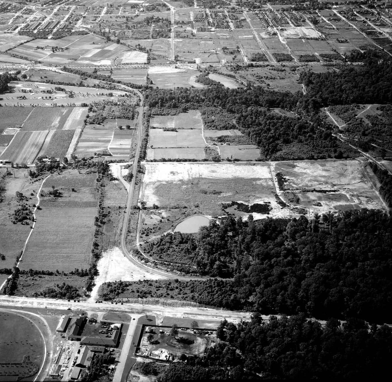
Mystery Foto #17 Solved: A 1924 Aerial of the Future Western Terminus in Fresh Meadows
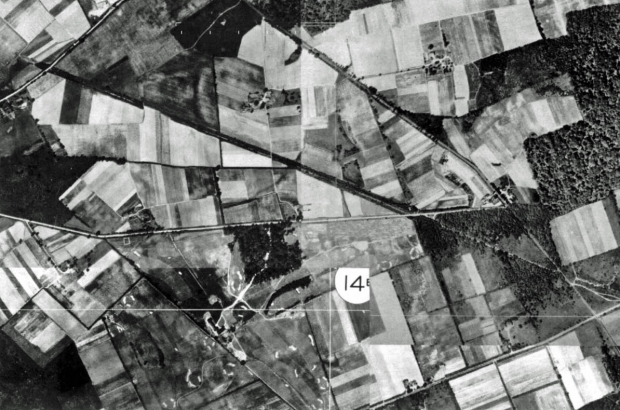
Frank Femenias submitted this 1924 aerial of a location "where the Long Island Motor Parkway will eventually pass through".
The Mystery Foto answers:
1. What is the location? Fresh Meadows where the Western Terminus will be located off Nassau Boulevard (Horace Harding Boulevard)
2. Identify the railroad in the aerial. Central Railroad of Long Island Runs diagonally from the top left to the bottom right.
3. Identify the golf course: Fresh Meadows Golf Course- Host of the 1932 US Open
4. Identify the roads: Top road: Queens Road (Later Hollis Court Boulevard); Road diagonally in the middle: North Hempstead Turnpike (later Booth Memorial Avenue); Bottom right: Black Stump Road (73rd Avenue).
Congrats to Greg, Howard, Roy Warner, Mitch Kaften and Brian McCarthy for solving the Fresh Meadows location and most of the Mystery Foto questions.
Frank, thanks for the excellent Mystery Foto and your follow-up jpeg below.
If you have a suggested Mystery Foto, please send a jpeg to [email protected].
Enjoy,
Howard Kroplick
From Frank Femenias
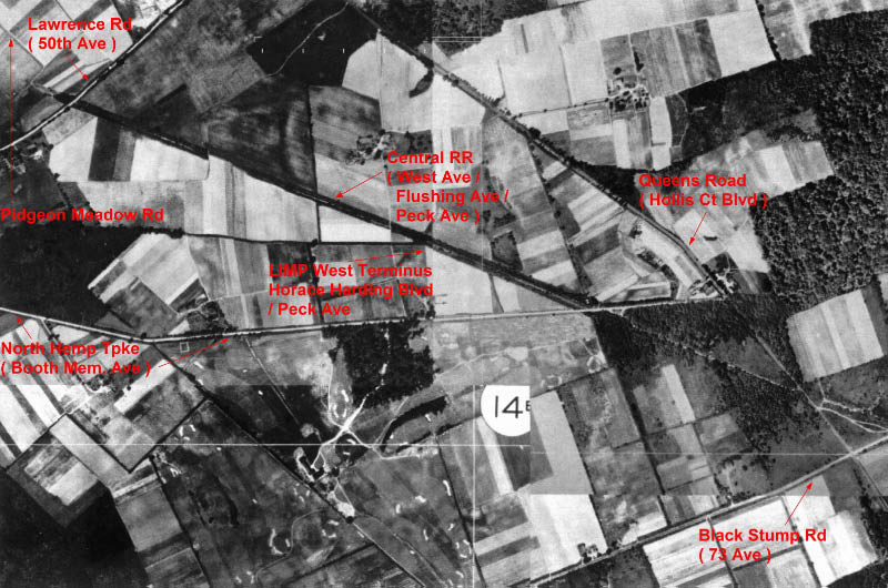
The 1924 aerial was found on the nyc map website http://maps.nyc.gov/doitt/nycitymap/ and shows the white North Hempstead Tpke across the center (east/west) with its bend on the left (west) which is today’s Booth Memorial Ave. On the right side (east), North Hempstead Turnpike terminates at white Hollis Court Blvd. Hollis Court is fragmented today and only the north part of the roadway shown in the aerial still exists. White 50th Ave is running diagonally in the top left corner, also fragmented today by the Peck Ave/Underhill park that replaced the black Central RR that is running diagonally in the center of the aerial. White 73rd Ave is running diagonally in the bottom right corner.
From NYCCityMap.com
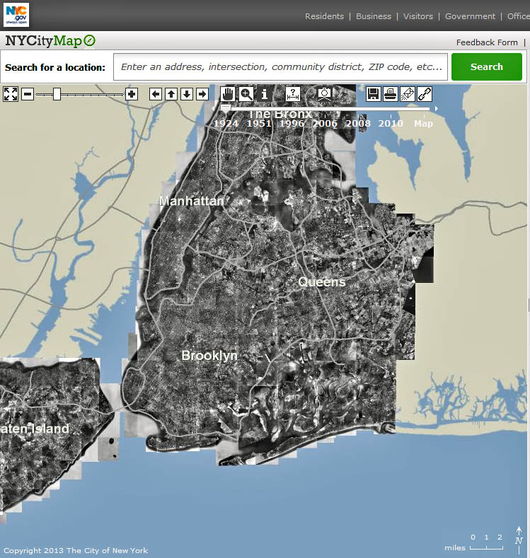
Frank has provided this spectacular research tool for this week's Mystery Foto- NYCity Map.
Click on the camera icon for a current map of NYC and a selection of interactive aerial maps for 1924,1951,1996, 2008, 2010.
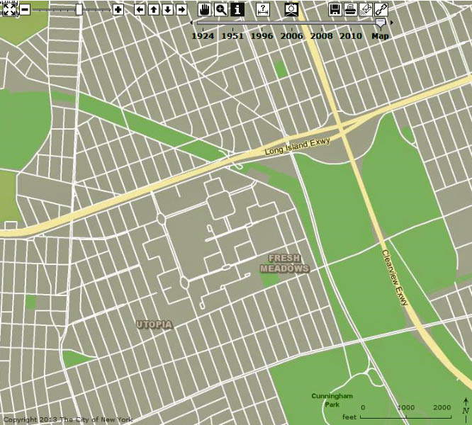
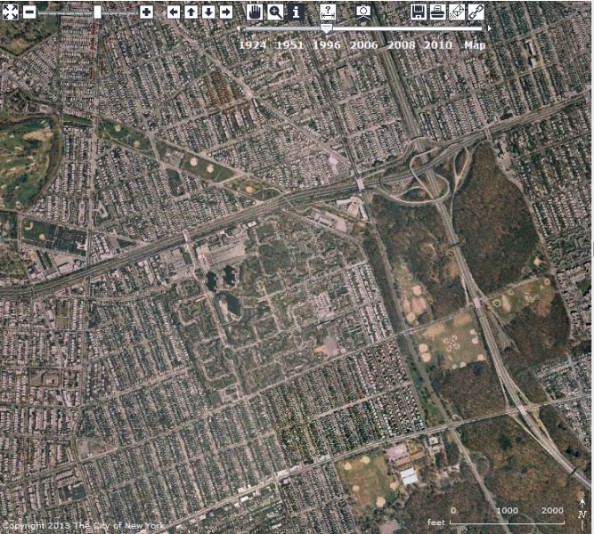
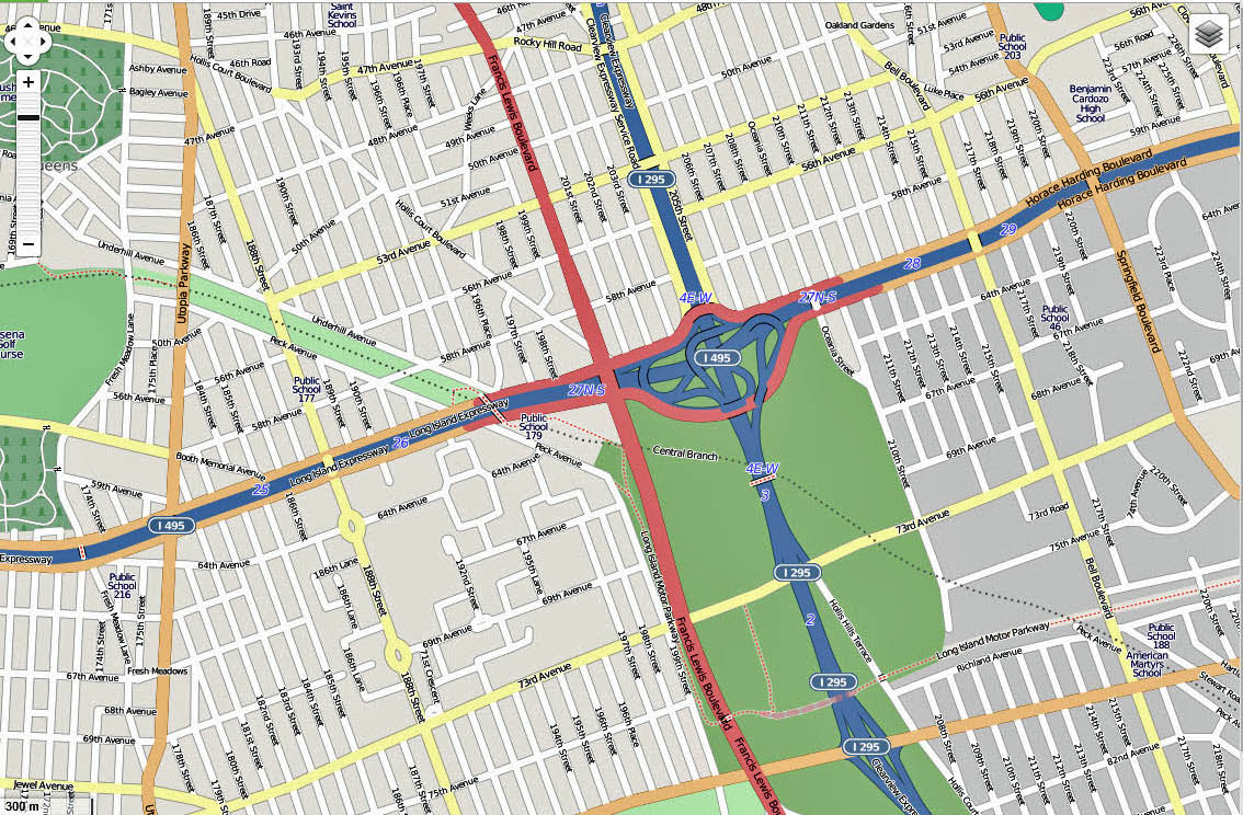
For example, this is Fresh Meadows and the Western Terminus of the Long Island Motor Parkway from 1924 to 2010.
Current map on NYCityMap
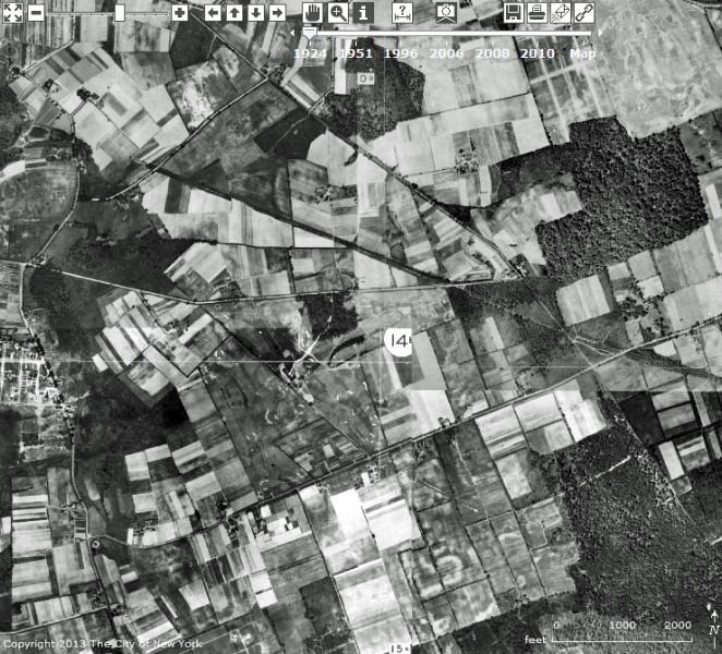
1924 aerial

1951 aerial
1996 aerial

2006 aerial
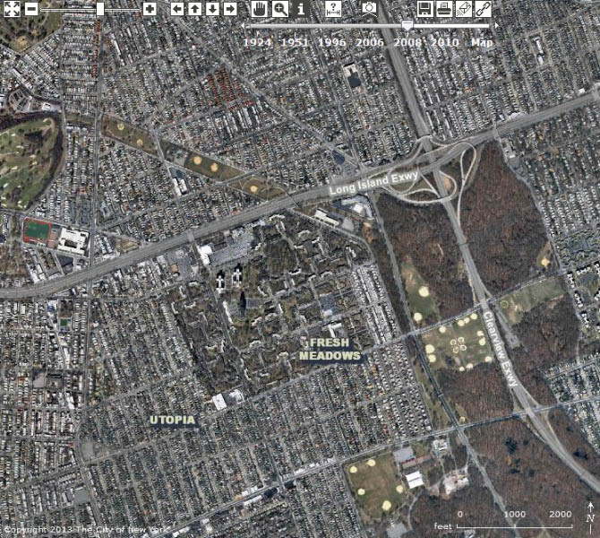
2008 aerial
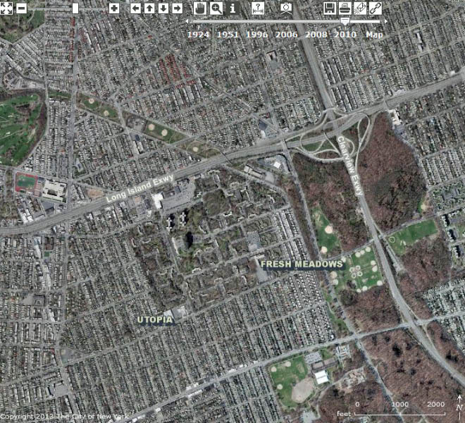
2010 aerial
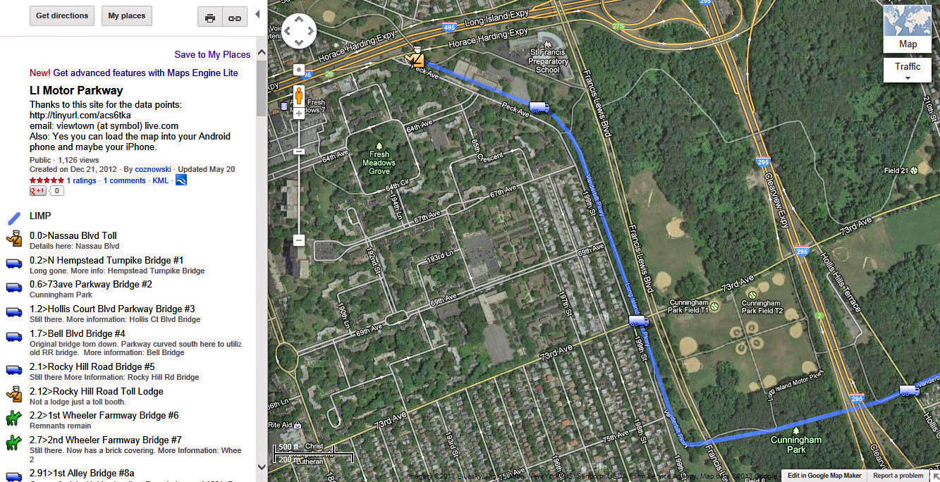
A Google View of Fresh Meadows using Wayne Consolla's online map of the Long Island Motor Parkway.
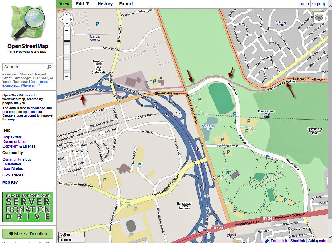
At the May 18, 2013 Long Island Motor Parkway Preservation Society Meeting, Steve Lucas provided another mapping research tool- OpenStreetMap . Someone has mapped out the entire 44-mile route of the Long Island Motor Parkway. Just click on any Motor Parkway location and give it a try.
OpenStreetMap of Fresh Meadows. Note paths of both of the Long Island Motor Parkway and the Central Branch.
June 24, 1938 aerial of Fresh Meadows looking north towards the Western Terminus.


Comments
Howard,
Too funny! I found that NYCity map site earlier this morning before you posted the link while researching this picture! It was tough without it, but it made it real easy to confirm that it is indeed what I suspected it was; the future Western terminus for the LIMP in Fresh Meadows. I don’t know the name of the golf course, but the long abandoned railroad would be the old Central RR. The roads in the area would also be the usual suspects; North Hempstead Turnpike, Horace Harding, 73rd etc.
OpenStreetMap does not show the entire 44 mile route of the LIMP. It assumes that the Suffolk portion follows CR 67. CR 67 was moved in the area of Sagtikos State Parkway and the LIE and some of the curves were changed. Look at the google map for the LIMP in the above mentioned area.:
Google Map of LIMP: http://goo.gl/maps/Ah1ne
For me - this is where I grew up. Freash Meadows. The long diagonal was, and still is, the abandoned Central Railroad of Long Island that went all the way out to Garden City, and a little beyond, which the magnate Stewart built. Some tracks are still extant in Garden City, where I had my law office for many years. My family was a member of the Fresh Meadows Synagogue, which was right at Peck Ave. next to the old railroad right of way, on the north side of what became Horace Harding. I would have to walk across the abandoned railroad right of way if I walked to shul.
The golf course is Fresh Meadows.
The top diagonal road is the old Queens Road, which was named Hollis Court Blvd. when I was a kid. After the LIE and Clearview Expressways were built, the portion south of of the LIE that remained was renamed Hollis Court Terrace. The portion of the diagonal road at the upper left was the old Lawrence Ave., which became 50th Ave., I grew up at the intersection of 51st Ave and 199th St.
As of 1924, Nassau Blvd (Horace Harding) hadn’t been built. Neither had Francis Lewis Blvd been built, albeit in stages, which was originally named Cross Island Blvd; the name was changed to Francis Lewis when the Cross Island Parkway opened in 1938. But that was a little before my time, as I was born in 1948.
I am happy to say that I spent a good part of my youth on the Vanderbilt Parkway, and sped along all the way out to Creedmor. What a ride!
The almost horizontal road that abuts the golf course and ends at a T-intersection with the old Queens Road was North Hempstead Turnpike. It was renamed Booth Memorial in the early 60s from what I remember. It went right by my high school - Francis Lewis.
Addendum,
The road running horizontally at the bottom of the photo was the old Black Stump Rd., which was renamed 73rd Ave. - the same 73rd Ave. over which the parkway goes.
This is the Fresh Meadow Country Club golf course and surrounding area, the western terminus of the LIMP. North Hempstead Turnpike running horizontally across the middle. Central RR of Long Island. Black Stump Road (73rd Avenue) in the lower right corner. Queens Road (Hollis Court Boulevard) in the upper right corner.
Howard that I think is Meadowbrook bridge & Stewart ave bridge. Salisbury park drive & Stewart ave Eisenhower Park correct me if Iam wrong Pete Tumminello.
I may have this. This is in Fresh Meadows, Queens. The remnants of the Central RR is evident in the center of the aerial , top left then to lower right . Horace HardingBlvd is eastand west through the middle. Fresh Meadows Golf Course is south of Horace Harding, and 73rd Ave is south of the course. Francis Lewis Blvd runs lower right , then northly to the center of the aerial; bisecting all the roads mentioned. The section of road seen in the upper left corner is Northern Blvd, I think. The CitiMap site isgreat. Just have to figure out howto add roads to the aerial maps.Oh, and the LIMP would be turning north towards Horace Harding; if it existed at this time.
THanks Wayne.I thought I was doing something wrong on open street map when I couldn’t find anymore of the limp
With the help from Wayne,I looked at the map and found some places to do some exploring this week. I’ll keep you informed of my findings. Wish me luck
Well,I mapped out my route to do some exploring that I thought I was going to do today,with the threat of rain,I didn’t. I’ll be doing it in the Melville area,Bagatelle Rd,Half Hollow Rd, three places,pretty near each other. That map from Wayne is great,so easy to use