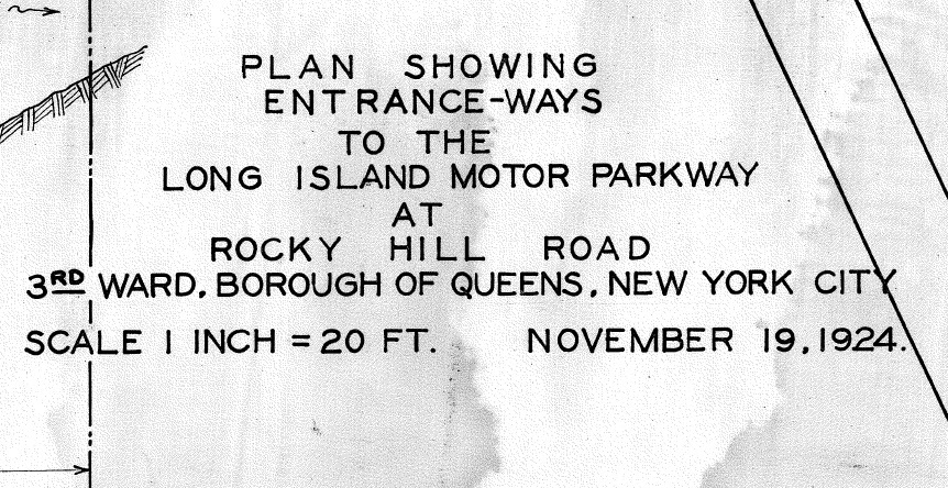
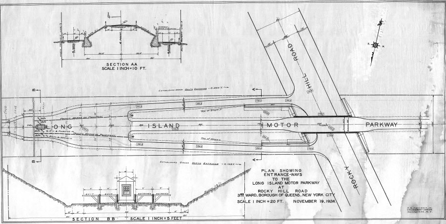
Malverne Treasure #3: Plan Showing the Entrances to the Motor Parkway at Rocky Hill Road

Over 200 Long Island Motor Parkway surveys, maps, blueprints, documents and drawings discovered by Roy Knoernschild in a Malverne basement in February 2017 are being categorized, repaired and scanned. This 1924 Motor Parkway survey documented the Rocky Hill Road Bridge, the two entrances and the Rocky Hill Lodge.
Enjoy,
Howard Kroplick
Close-Ups
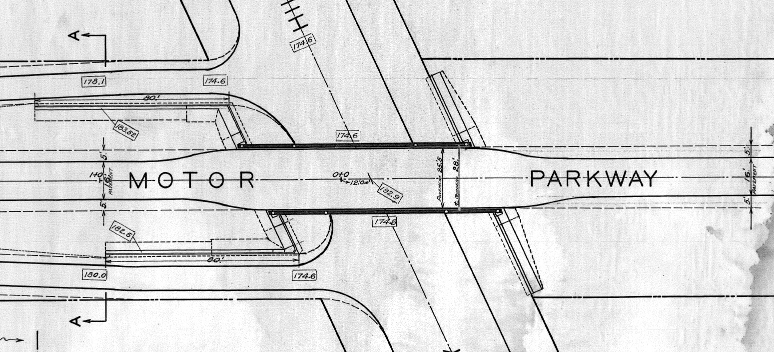
The Motor Parkway bridge over Rocky Hill Road (Springfield Boulevard)

Cross-section of the bridge and the north and south entrances. This was the only Motor Parkway lodge with two entrances.
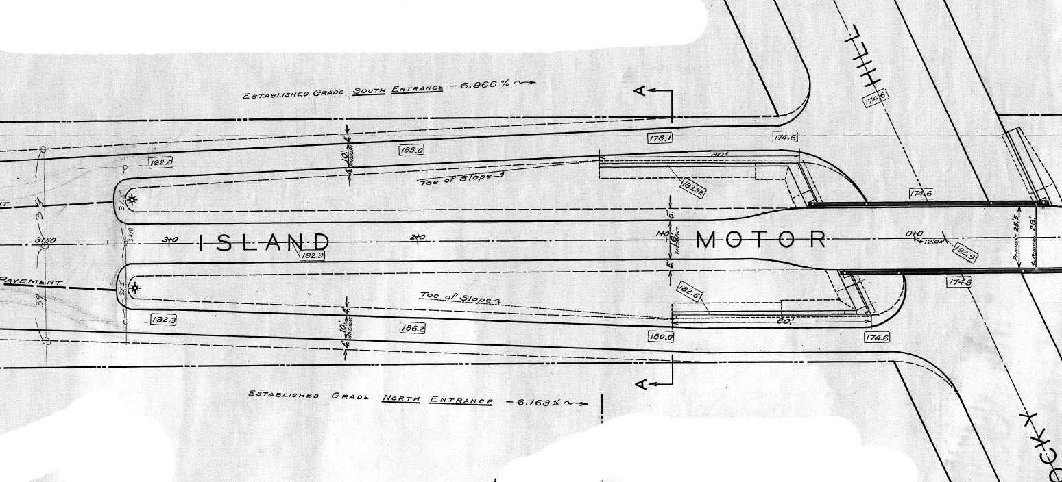
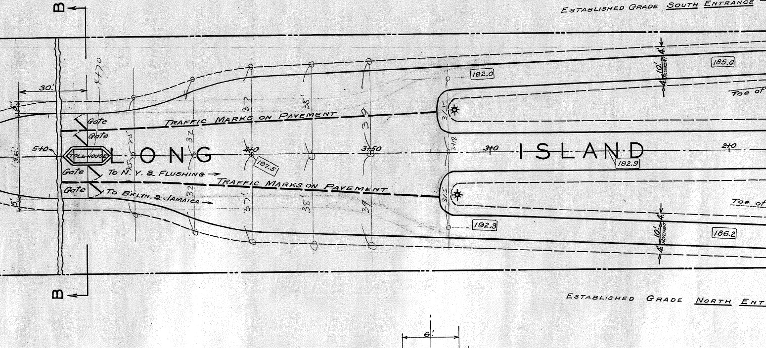
Automobiles on Rocky Hill Road would enter at the south entrance. Automobiles on the Motor Parkway heading west would exit on to Rocky Hill Road using the north entrance.
Question: Did an automobile entering at the south entrance and heading west to Horace Harding Boulevard make a U-Turn just prior to the toll lodge?
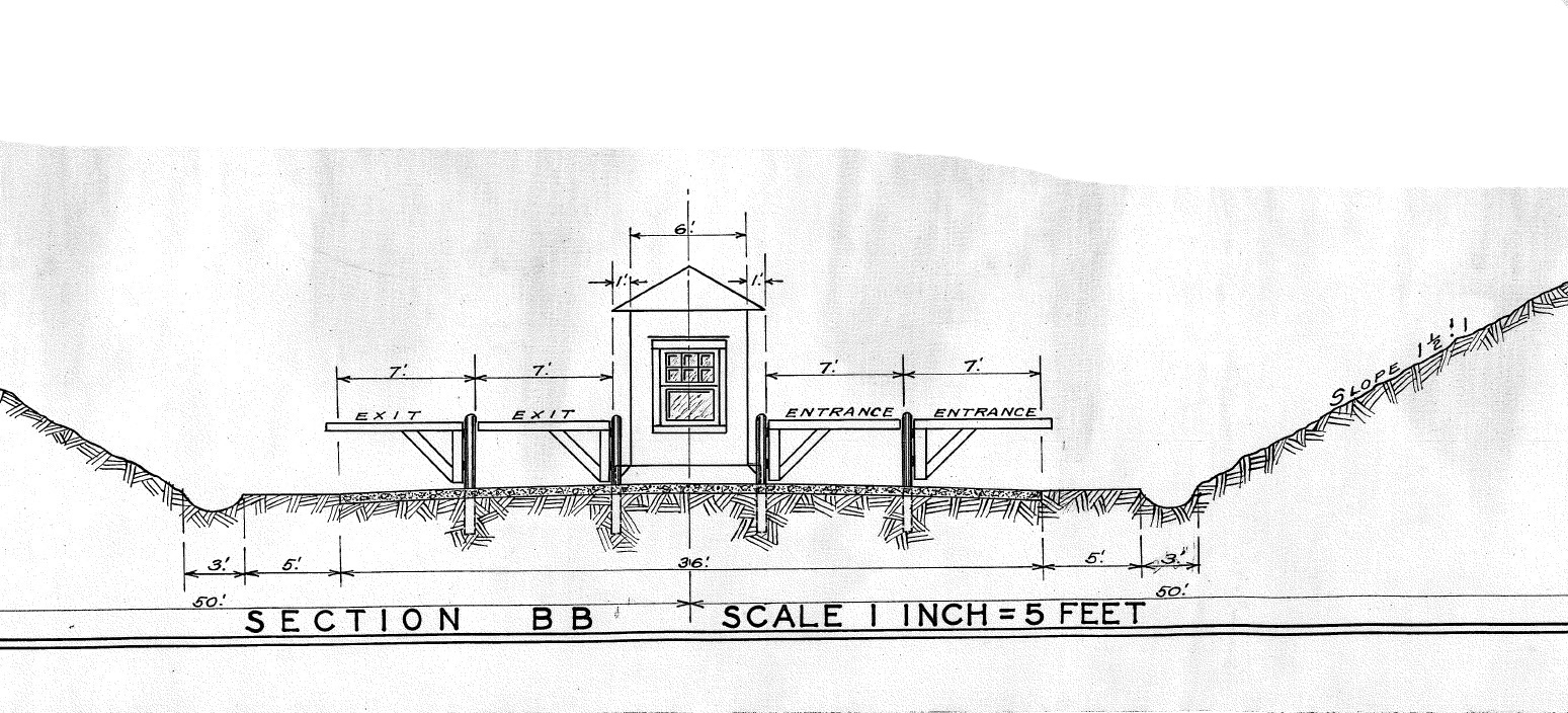
The 1924 survey did not show a roof which was added in the final construction.
Rocky Hill Lodge
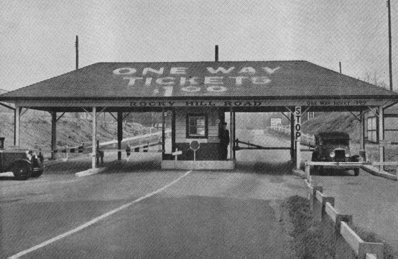
Rocky Hill Lodge with a roof.
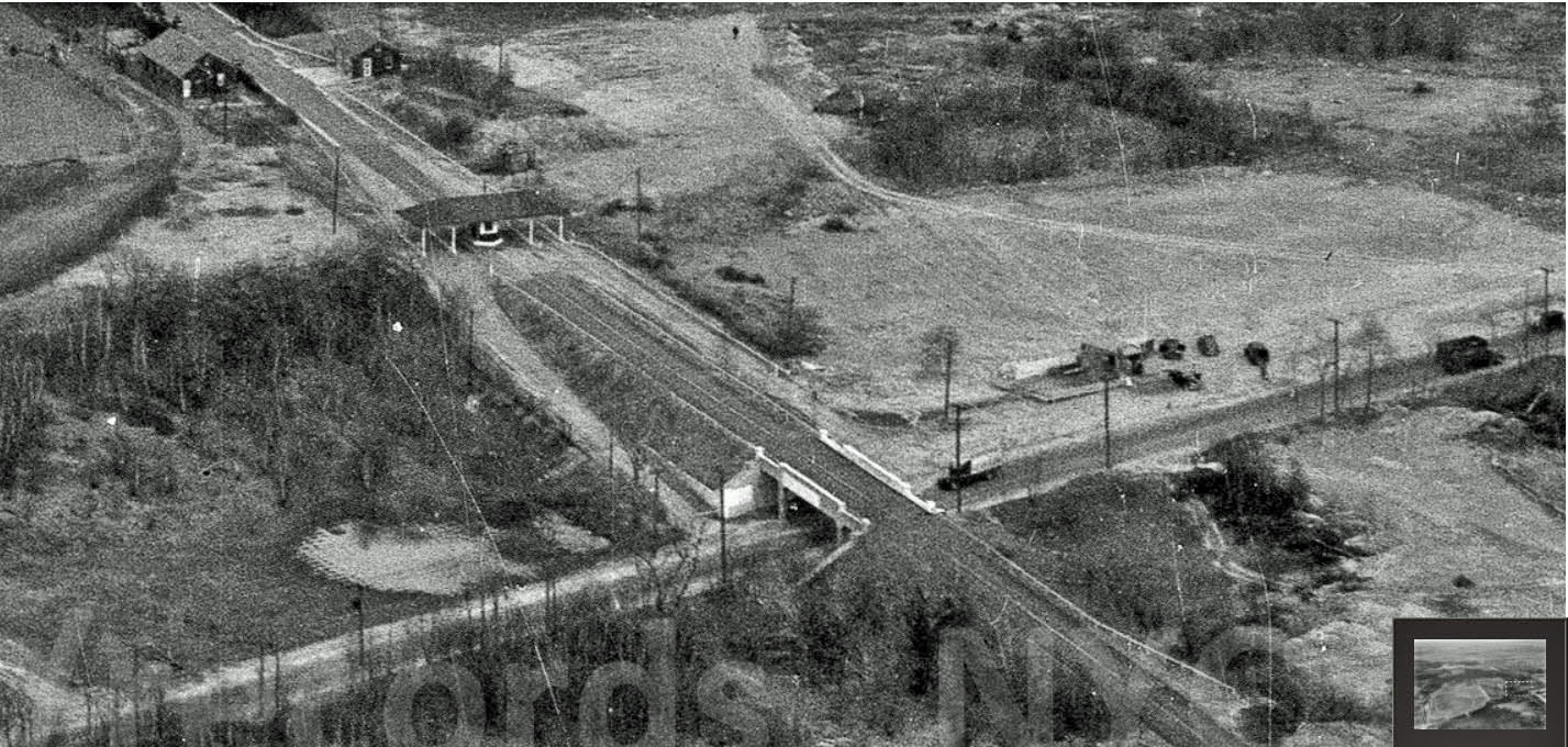
The 1940 Aerial showing the area in the survey.


Comments
The worlds first entrance and exit ramps?
______________________________________________
Howard Kroplick
Joe, likely the first in the US.
Good question Howard. There seems ample room for a U-turn (probably reversing once with the older car’s wider turning radius’). I believe it wasn’t practiced though, even by the locals living in the area looking for quick access to HHB when commuting to work. It would’ve been awkward to inconvenience the gate keeper to come out everytime expecting to collect a toll. Also, there was only eastbound access on HHB at the western terminus. Most commuters would’ve needed westbound access. Let’s take a vote!
This just doesn’t sit right! I always assumed westbound cars originating there used local toads to access the old Nassau Blvd./HHB and w/b cars on the LIMP exited on the south ramp and eastbound cars entered on the north ramp. U-turns just don’t seem likely. Also, that’s no “sideview” of the bridge; rather, it’s cross section A-A of the LIMP taken ~30’ east of RHR. Sam, III
I vote that the westbound motorist went thru the tollgate- paid the toll and then made a u-turn to go west. This was the era when the toll ticket had to be given up when exiting the Parkway. I’m assuming the motorist paid the fee, the ticket stamped and not issued to the motorist as there were no toll collectors west of Rocky Hill Rd. to collect the ticket. Starting in 1929 there was a one way ticket price of 50 cents if you went west from the Meadow Brook lodge. Al.
I loved the “U-turn question” but I suspect some may be overlooking just how rural this area was 1924, how much traffic patterns differed from today, and how the premise of the question is a bit suspect.
Plans to connect LIMP to No Hmpstd Tpke (or later Nassau Blvd) were meant to tap into many drivers coming from points many miles east going many miles west, a complaint Queens residents still have about the LIE…and that their predecessors had about Nassau Blvd in the 1920s!
Also, Nassau Blvd was not completed until 1928 and when Nassau Blvd was more concept than real in the 1920s, it was seen more as the link to a “true” Northern State Parkway. Again, the westbound drivers for the road were not envisioned as coming from (the undeveloped portions of) eastern Queens.
Finally, improvements to Qns Blvd & Hillside Ave would have been a better western route for drivers from points south of the temporary Rocky Hill terminus. (Recall LIMP was originally extended to Rocky Hill Rd in order to be close to Hillside Ave and to better connect with drivers from points miles east and those coming over the Queensborough Bridge.)